University of Minnesota
http://www.umn.edu/
612-625-5000
http://www.umn.edu/
612-625-5000
Minnesota Biodiversity Atlas
Bell Museum
Dataset: All Collections
Taxa: Brotherella recurvans (Brotherella delicatula, Pylaisiadelpha recurvans, Rhaphidostegium laxepatulum, Rhaphidostegium recurvans, Hypnum recurvans, Rhaphidostegium whitei), Brotherella recurvans subsp. delicatula
Search Criteria: Bell Museum bryophytes; Minnesota; excluding cultivated/captive occurrences
1
Page 1, records 1-27 of 27
Bell Museum bryophytes | |
 MIN:Bryophytes | 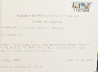 Brotherella recurvans (Michx.) M. Fleisch. 852726[1107384]Frank D. Bowers 241481995-09-21 United States, Minnesota, Cook, Judge Magney State Park; area above Brule River (west); T 61 N, R 4 E; ca 24 km NE of Grand Marais, North of Devil's Kettle |
MIN:Bryophytes | 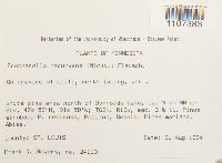 Brotherella recurvans (Michx.) M. Fleisch. 856545[1107383]Frank D. Bowers 241131994-08-31 United States, Minnesota, Saint Louis, White pine area north of Burnside Lake, ca. 9 km NW of Ely, Sec. 2 & 11., 47.966667 -91.966667 |
MIN:Bryophytes | 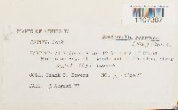 Brotherella recurvans (Michx.) M. Fleisch. 734142[1107367]Frank D. Bowers M-52551977-08-05 United States, Minnesota, Cook, At Kodonce River 17 km north of Grand. Marais on Hwy. 61 |
MIN:Bryophytes | 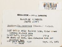 Brotherella recurvans (Michx.) M. Fleisch. 748715[1107369]Jan A. Janssens 71971981-09-16 United States, Minnesota, Isanti, EAST BETHLE AREA: Beckman Lake, Cedar Creek Natural History area, 44.423333 -93.186111, 279m |
MIN:Bryophytes | 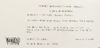 Brotherella recurvans (Michx.) M. Fleisch. 852082[1107378]Frank D. Bowers 240741994-08-31 United States, Minnesota, Saint Louis, White pine area North of Burntside Lake, ca. 9 km NW of Ely. Sec. 2 + sec. 11., 47.966667 -91.966667 |
MIN:Bryophytes | 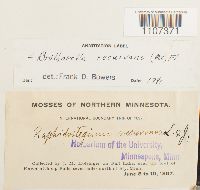 Brotherella recurvans (Michx.) M. Fleisch. 43216[1107371]J.M. Holzinger s.n.1897-06-08 United States, Minnesota, on Fall Lake, near the foot of Kawasatchong Falls, seven miles north of Ely |
MIN:Bryophytes |  Brotherella recurvans (Michx.) M. Fleisch. 851591[1107376]Frank D. Bowers 242831995-09-23 United States, Minnesota, Lake, Crosby-Manitow State Park, sec. 28, SW 1/4, & sec. 32, SE 1/4, ca 12 km North of Hwy 7. Yellow Birch Area. |
MIN:Bryophytes | 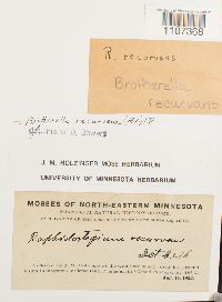 Brotherella recurvans (Michx.) M. Fleisch. 649195[1107368]J.M. Holzinger s.n.1902-08-14 United States, Minnesota, at the west base of Mt. Josephine, 2 miles east of Grand Portage |
MIN:Bryophytes | 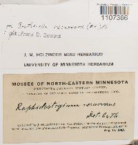 Brotherella recurvans (Michx.) M. Fleisch. 649194[1107366]J.M. Holzinger s.n.1902-08-15 United States, Minnesota, on Hat Point, a peninsula projecting south-ward from Mt. Josephine, into Lake Superior, near Grand Portage |
MIN:Bryophytes | 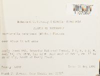 Brotherella recurvans (Michx.) M. Fleisch. 856586[1107382]Frank D. Bowers 223271994-08-29 United States, Minnesota, Lake, Keely Creek RNA, Superior National Forest. Just west of Hwy 1, ca. 17 km SE of Ely, South of Keely Creek, 47.633333 -91.7 |
MIN:Bryophytes | 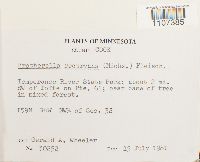 Brotherella recurvans (Michx.) M. Fleisch. 856742[1107385]Gerald A. Wheeler 302521981-07-15 United States, Minnesota, Cook, Temperance River State Park; about 2 mi. SW of Tofte on Rte. 61. T59N R4W NW1/4 of Sec. 32 |
MIN:Bryophytes | 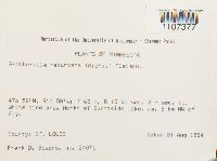 Brotherella recurvans (Michx.) M. Fleisch. 852088[1107377]Frank D. Bowers 240711994-08-31 United States, Minnesota, Saint Louis, sec. 2 + sec. 11. North of Burntside Lake, ca, 9 km NW of Ely |
MIN:Bryophytes | 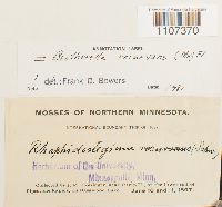 Brotherella recurvans (Michx.) M. Fleisch. 43215[1107370]J.M. Holzinger s.n.1897-06-10 United States, Minnesota, near Camp II at the lower end of Pipestone Rapids, on Basswood Lake. |
MIN:Bryophytes | 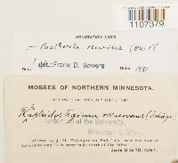 Brotherella recurvans (Michx.) M. Fleisch. 43214[1107379]J.M. Holzinger s.n.1897-06-08 United States, Minnesota, on Fall Lake, near the foot of Kawasatchongr Falls, seven miles north of Ely |
MIN:Bryophytes | 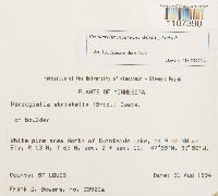 Brotherella recurvans (Michx.) M. Fleisch. 852793[1107390]Frank D. Bowers 23923a1994-08-31 United States, Minnesota, Saint Louis, ca. 9 km NW of Ely, R 13 W, T 63 N, sec. 2 + sec. 11, 47.96667 -91.96667 |
MIN:Bryophytes | 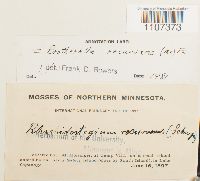 Brotherella recurvans (Michx.) M. Fleisch. 43219[1107373]J.M. Holzinger s.n.1897-06-16 United States, Minnesota, at Camp VIII, Safety Island (close by South Island), in Lake Saganaga |
MIN:Bryophytes | 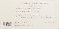 Brotherella recurvans (Michx.) M. Fleisch. 851837[1107374]Frank D. Bowers 239251994-08-31 United States, Minnesota, Saint Louis, north of Burntside Lake, ca 9 km NW of Ely, 47.966667 -91.966667 |
MIN:Bryophytes | 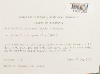 Brotherella recurvans (Michx.) M. Fleisch. 851864[1107365]Frank D. Bowers 234451995-09-08 United States, Minnesota, Cook, Superior National Forest, Just N of Loon Lake, ca 45 km NW of Grand Marais, north of Hwy 12, 48.05 -90.733333 |
MIN:Bryophytes | 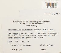 Brotherella recurvans (Michx.) M. Fleisch. 856762[1107386]Gerald A. Wheeler 301571981-07-12 United States, Minnesota, Cook, Hat Point; about 2 mi. E of Grand Portage on Rte. 17 |
MIN:Bryophytes | 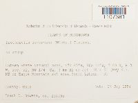 Brotherella recurvans (Michx.) M. Fleisch. 853119[1107381]Frank D. Bowers 23879a1994-09-17 United States, Minnesota, Cook, Lutsen State Natural Area. NW 1/4. Ca. 3 km NE of Jct. 36 & 61 (Hwy 61), NE of Eagle Mountain ski area.South Lutsen -SE, 47.75 -90.733333 |
MIN:Bryophytes | 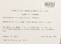 Brotherella recurvans (Michx.) M. Fleisch. 852055[1107364]Frank D. Bowers 241041994-08-31 United States, Minnesota, Saint Louis, eastside of Lake, North of Burntside Lake, ca. 9 km NW of Ely. sec. 2 + sec. 11, 47.966667 -91.966667 |
MIN:Bryophytes | 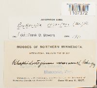 Brotherella recurvans (Michx.) M. Fleisch. 43218[1107372]J.M. Holzinger s.n.1897-06-10 United States, Minnesota, near Camp II, at the lower end of Pipestone Rapids, on Basswood Lake |
MIN:Bryophytes | 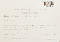 Brotherella recurvans (Michx.) M. Fleisch. 851604[1107375]Frank D. Bowers 229611994-09-17 United States, Minnesota, Lake, Heartbreak Creek cRNA, ca. 8 km NNE of Schroeder, west of Road 343, 47.583333 -90.916667 |
MIN:Bryophytes | 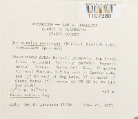 Brotherella recurvans (Michx.) M. Fleisch. 809496[1107380]Joannes A. Janssens 117051983-11-20 United States, Minnesota, Itasca, GRAND FORKS AREA: Marcell Intensive Bog Study Site, National Forestry Service Experimental Forest, Watershed S-2, Chippewa National Forest, 0.5 km west of Spring Lake and 1.5 km east of Bog Lake, 32 km north of Grand Forks (SE corner of NW NW NW NW S13 T58 R25W), 47.51667 -93.46667, 426m |
MIN:Bryophytes | 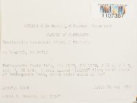 Brotherella recurvans (Michx.) M. Fleisch. 853250[1107387]Frank D. Bowers 240451994-09-02 United States, Minnesota, Lake, Tettegouche State Park; T56N R7W Sec. 7, SE 1/4; 7 acre upland "Island" along north shore of Tettegouche Lake, white cedar north of that |
MIN:Bryophytes | 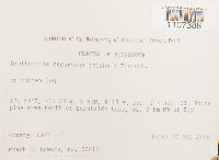 Brotherella recurvans (Michx.) M. Fleisch. 853088[1107388]Frank D. Bowers 238121994-09-02 United States, Minnesota, Lake, White pine area north of Burntside Lake; ca. 9km NW of Ely; T63N R13W sec 2 + sec 11, 47.966667 -91.966667 |
MIN:Bryophytes | 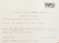 Brotherella recurvans (Michx.) M. Fleisch. 853028[1107389]Frank D. Bowers 223331994-08-29 United States, Minnesota, Lake, Keely Creek RNA, Superior National Forest. Just west of Hwy 1, ca 17 km SE of Ely, South of Keely Creek, 47.633333 -91.7 |
1
Page 1, records 1-27 of 27
Google Map
Google Maps is a web mapping service provided by Google that features a map that users can pan (by dragging the mouse) and zoom (by using the mouse wheel). Collection points are displayed as colored markers that when clicked on, displays the full information for that collection. When multiple species are queried (separated by semi-colons), different colored markers denote each individual species.