University of Minnesota
http://www.umn.edu/
612-625-5000
http://www.umn.edu/
612-625-5000
Minnesota Biodiversity Atlas
Bell Museum
Dataset: All Collections
Taxa: Fissidens dubius (Fissidens cristatus, Fissidens circinans, Fissidens decipiens, Fissidens floridanus, Fissidens rupestris, Fissidens savatieri, Fissidens velenovskyi, Fissidens adianthoides var. semicristatus, Fissidens cristatus var. winonensis, Fissidens cristatus var. cristatus, Fissidens cristatus var. mucronatus, Fissidens decipiens var. mucronatus)
Search Criteria: Bell Museum bryophytes; Minnesota; excluding cultivated/captive occurrences
1
Page 1, records 1-18 of 18
Bell Museum bryophytes | |
 MIN:Bryophytes | 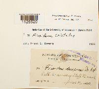 Fissidens dubius P. Beauv. 34723[1128520]J.M. H. s.n.1890-06-11 United States, Minnesota, Winona, Catholic Cemetery bluff |
MIN:Bryophytes | 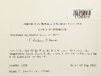 Fissidens dubius P. Beauv. 852928[1128512]Frank D. Bowers 23590b1995-09-09 United States, Minnesota, Cook, Temperence River State Park, along river and falls, 1.2 km N of Schroeder on Hwy 61. T59N, R4W, Sec. 30 + Sec. 31., 47.516667 -90.933333 |
MIN:Bryophytes | 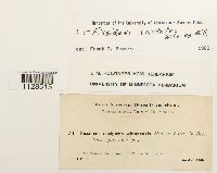 Fissidens dubius P. Beauv. 643463[1128515]J.M. H. 341900-04-28 United States, Minnesota, Winona, Bluffs near Winona |
MIN:Bryophytes | 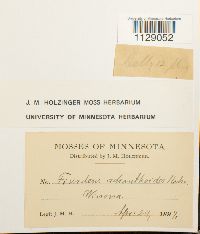 Fissidens dubius P. Beauv. 643395[1129052]J.M. H. s.n.1897-04-24 United States, Minnesota, Winona |
MIN:Bryophytes | 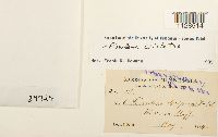 Fissidens dubius P. Beauv. 34724[1128514]J.M. H. 61894-05-00 United States, Minnesota, Winona, Winona bluffs |
MIN:Bryophytes | 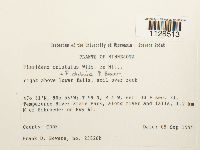 Fissidens dubius P. Beauv. 852934[1128513]Frank D. Bowers 23526b1995-09-09 United States, Minnesota, Cook, Temperance River State Park; 1.2 km N of Schroeder on Hwy 61. T59N, R4W, Sec. 30 + Sec. 31, 47.516667 -90.933333 |
MIN:Bryophytes | 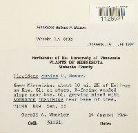 Fissidens dubius P. Beauv. 857071[1128521]Gerald A. Wheeler 310211984-08-14 United States, Minnesota, Wabasha, Near Minneiska; about 10 mi. SE of Kellogg on Rte. 61; on steep, E-facing wooded slope near Rte. 61 |
MIN:Bryophytes | 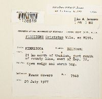 Fissidens dubius P. Beauv. 734122[1128519]Frank D. Bowers 79481977-07-29 United States, Minnesota, Beltrami, 21 km N of Waskish, just S of county line, east of Hwy. 72, 48.350135 -94.51222 |
MIN:Bryophytes | 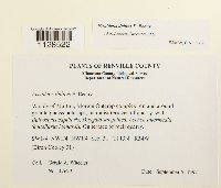 Fissidens dubius P. Beauv. 864956[1128522]Gerald A. Wheeler 176791997-09-05 United States, Minnesota, Renville, W side of Morton, Morton Outcrop complex. SW1/4 NW1/4 NW1/4 of Sec. 31 (Birch Cooley 31) |
MIN:Bryophytes | 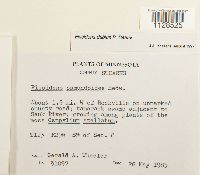 Fissidens dubius P. Beauv. 856846[1128525]Gerald A. Wheeler 310971985-05-26 United States, Minnesota, Stearns, About 1.5 mi. W of Rockville on unmarked county road; swamp adjacent to Sauk River. S1/2 of Sec. 8. |
MIN:Bryophytes |  Fissidens dubius P. Beauv. 34725[1128948]F.F. Wood s.n.1891-00-00 United States, Minnesota, N. Minn. |
MIN:Bryophytes | 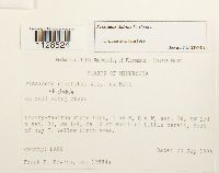 Fissidens dubius P. Beauv. 852727[1128524]Frank D. Bowers 23994a1995-09-23 United States, Minnesota, Lake, Crosby-Manitou State Park ca. 12 km north of Little Marais and east of Hwy 7. SW1/4 of Sec. 28, SE1/4 of Sec. 32. T58N, R6W. |
MIN:Bryophytes | 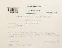 Fissidens dubius P. Beauv. 852875[1128523]Frank D. Bowers 236501995-09-21 United States, Minnesota, Cook, Judge Magney State Park, area above Brule River (west); ca 24 km NE of Grand Marais, North of Devil's Kettle. T61N, R4E, 47.766667 -90.033333 |
MIN:Bryophytes |  Fissidens dubius P. Beauv. 643464[1128516]J.M. H. 61894-05-00 United States, Minnesota, Winona |
MIN:Bryophytes | 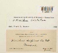 Fissidens dubius P. Beauv. 536827[1128511]J.M. Holzinger s.n.1890-06-00 United States, Minnesota, Winona |
MIN:Bryophytes | 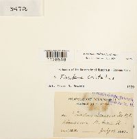 Fissidens dubius P. Beauv. 34726[1128518]J.M. H. s.n.1890-07-16 United States, Minnesota, Chisago, St. Croix River |
MIN:Bryophytes |  Fissidens dubius P. Beauv. [1298496]Pursell, R.A. s.n.1996-06-00 United States, Minnesota, Winona Bluffs |
MIN:Bryophytes |  Fissidens dubius P. Beauv. 957771[1298497] s.n.1996-06-00 United States, Minnesota, Redwing |
1
Page 1, records 1-18 of 18
Google Map
Google Maps is a web mapping service provided by Google that features a map that users can pan (by dragging the mouse) and zoom (by using the mouse wheel). Collection points are displayed as colored markers that when clicked on, displays the full information for that collection. When multiple species are queried (separated by semi-colons), different colored markers denote each individual species.