University of Minnesota
http://www.umn.edu/
612-625-5000
http://www.umn.edu/
612-625-5000
Minnesota Biodiversity Atlas
Bell Museum
Dataset: All Collections
Taxa: Fontinalis novae-angliae, Fontinalis novae-angliae var. groutii
Search Criteria: Bell Museum bryophytes; Minnesota; excluding cultivated/captive occurrences
1
Page 1, records 1-20 of 20
Bell Museum bryophytes | |
 MIN:Bryophytes |  Fontinalis novae-angliae Sull. 350559[1129472]L.W. Kretting s.n.1936-08-00 United States, Minnesota, Cook, Cascade Lake. T62N R2W |
MIN:Bryophytes | 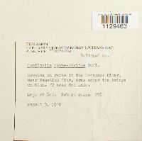 Fontinalis novae-angliae Sull. 734012[1129463]Quinn, Robert 7881980-08-03 United States, Minnesota, Beltrami, Near Waushiok, area under the bridge on Minn. 72 near Red Lake |
MIN:Bryophytes | 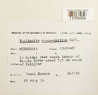 Fontinalis novae-angliae Sull. 734154[1129464]Frank D. Bowers M-11061975-07-29 United States, Minnesota, Beltrami, At bridge over south branch of Battle River about 3.5 km S of Kelliher |
MIN:Bryophytes | 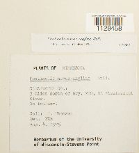 Fontinalis novae-angliae Sull. 677687[1129458]P. Thomson s.n.1975-08-04 United States, Minnesota, Clearwater, 3 mi. N of hwy. 200, in Mississippi River |
MIN:Bryophytes | 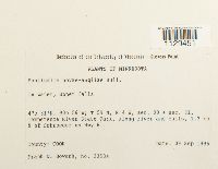 Fontinalis novae-angliae Sull. 853201[1129451]Frank D. Bowers 235341995-09-09 United States, Minnesota, Cook, Temperence River State Park, along river and falls, 1.2 km N of Schroeder on Hwy 61. T59N, R4W, Sec. 30 + Sec. 31., 47.516667 -90.933333 |
MIN:Bryophytes | 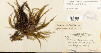 Fontinalis novae-angliae Sull. 362143[1129456]J.B. Moyle 36211940-06-24 United States, Minnesota, Lake, Lower Knife R. |
MIN:Bryophytes | 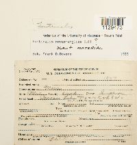 Fontinalis novae-angliae Sull. 386164[1129473]L.W.K. s.n.1937-00-00 United States, Minnesota, Cook, Superior Forest; Cascade Lake, T62N R2W and R3W |
MIN:Bryophytes | 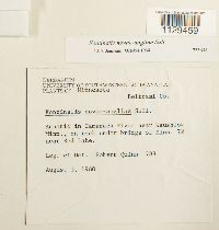 Fontinalis novae-angliae Sull. 733658[1129459]Quinn, Robert 7881980-08-03 United States, Minnesota, Beltrami, Aquatic in Tamarack River near Waushiok, Minn.; on rock under bridge of Minn. 72 near Red Lake. |
MIN:Bryophytes | 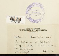 Fontinalis novae-angliae Sull. 337951[1129465]Moore, W.C. s.n.1936-07-23 United States, Minnesota, Saint Louis, Cloquet River |
MIN:Bryophytes | 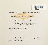 Fontinalis novae-angliae Sull. 733659[1129462]Quinn, Robert 3951979-07-27 United States, Minnesota, Clearwater, 3 mi. N of Hwy. 200 in Mississippi River |
MIN:Bryophytes | 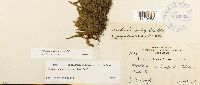 Fontinalis novae-angliae Sull. 362062[1129453]J.B. Moyle 36251940-06-25 United States, Minnesota, Lake |
MIN:Bryophytes |  Fontinalis novae-angliae Sull. 337967[1129468]C. Raif A151936-07-22 United States, Minnesota, Cook, Temperance River |
MIN:Bryophytes |  Fontinalis novae-angliae Sull. 337952[1129466]C. Reif s.n.1936-07-10 United States, Minnesota, Cook, Brule River |
MIN:Bryophytes |  Fontinalis novae-angliae Sull. 338204[1129470]Kretting, L.W. s.n.1936-00-00 United States, Minnesota, Cook, Cascade Lake, T62N R2+3W |
MIN:Bryophytes | 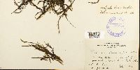 Fontinalis novae-angliae Sull. 337966[1129467]C. Reiy s.n.1936-07-10 United States, Minnesota, Cook, Brule River |
MIN:Bryophytes | 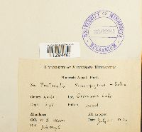 Fontinalis novae-angliae Sull. 336284[1129460]Moore, W.G. s.n.1936-07-21 United States, Minnesota, Lake, Greenwood Lake |
MIN:Bryophytes | 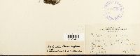 Fontinalis novae-angliae Sull. 337968[1129469]C. Reif s.n.1936-07-10 United States, Minnesota, Cook, Brule River |
MIN:Bryophytes | 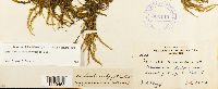 Fontinalis novae-angliae Sull. 362140[1129455]J.B. Moyle 36201940-07-26 United States, Minnesota, Lake, West branch of Knife R. |
MIN:Bryophytes | 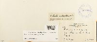 Fontinalis novae-angliae Sull. 362031[1129452]J.B. Moyle 36361940-07-12 United States, Minnesota, Lake, In Rock Creek, 45.757457 -92.962433 |
MIN:Bryophytes | 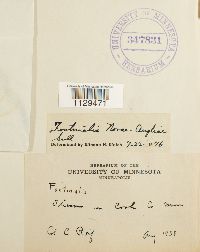 Fontinalis novae-angliae Sull. 347831[1129471] s.n.1938-08-00 United States, Minnesota, Cook |
1
Page 1, records 1-20 of 20
Google Map
Google Maps is a web mapping service provided by Google that features a map that users can pan (by dragging the mouse) and zoom (by using the mouse wheel). Collection points are displayed as colored markers that when clicked on, displays the full information for that collection. When multiple species are queried (separated by semi-colons), different colored markers denote each individual species.