University of Minnesota
http://www.umn.edu/
612-625-5000
http://www.umn.edu/
612-625-5000
Minnesota Biodiversity Atlas
Bell Museum
Dataset: All Collections
Taxa: Grimmia teretinervis (Schistidium teretinerve, Grimmia tenuis)
Search Criteria: Bell Museum bryophytes; Minnesota; excluding cultivated/captive occurrences
1
Page 1, records 1-16 of 16
Bell Museum bryophytes | |
 MIN:Bryophytes | 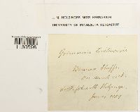 Grimmia teretinervis Limpr. 644349[1130596]J. M- Holzinger s.n.1907-06-00 United States, Minnesota, Winona bluffs |
MIN:Bryophytes |  Grimmia teretinervis Limpr. 639782[1130601]Holzinger, John M. 1655 United States, Minnesota |
MIN:Bryophytes | 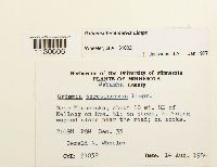 Grimmia teretinervis Limpr. 857062[1130606]Wheeler, Gerald A. 310321984-08-14 United States, Minnesota, Wabasha, near Minneiska; about 10 mi. SE of Kellog on Rte. 61; on steep, E-facing wooded slope near the road |
MIN:Bryophytes | 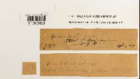 Grimmia teretinervis Limpr. 644344[1130589]Holzinger, J. M. 261919-09-12 United States, Minnesota |
MIN:Bryophytes | 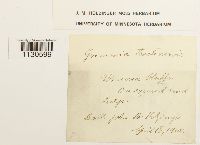 Grimmia teretinervis Limpr. 667627[1130599]Holzinger, John M. s.n.1900-04-18 United States, Minnesota, Winona |
MIN:Bryophytes | 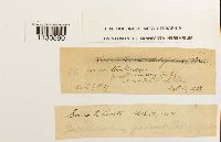 Grimmia teretinervis Limpr. 644351[1130590]Holzinger, J.M. 261924-09-11 United States, Minnesota, Jewell Nursery Bluff [?] |
MIN:Bryophytes | 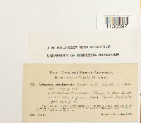 Grimmia teretinervis Limpr. 644354[1130597]Holzinger, John M. 261903-03-00 United States, Minnesota, near Winona |
MIN:Bryophytes | 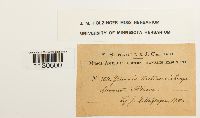 Grimmia teretinervis Limpr. 637123[1130600]Holzinger, J.M. 3641900-00-00 United States, Minnesota |
MIN:Bryophytes | 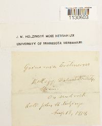 Grimmia teretinervis Limpr. 644345[1130603]Holzinger, John M. s.n.1914-08-18 United States, Minnesota, Wabasha |
MIN:Bryophytes | 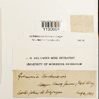 Grimmia teretinervis Limpr. 644352[1130604]Holzinger, John M. s.n.1919-08-06 United States, Minnesota, Meyer, Henry farm [?] |
MIN:Bryophytes | 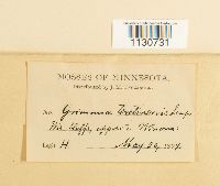 Grimmia teretinervis Limpr. 35853[1130731] s.n.1899-05-20 United States, Minnesota, Winona |
MIN:Bryophytes | 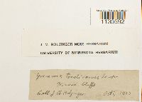 Grimmia teretinervis Limpr. 644350[1130592]Holzinger, J.M. s.n.1903-10-00 United States, Minnesota, Winona bluffs |
MIN:Bryophytes | 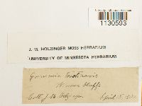 Grimmia teretinervis Limpr. 644348[1130593]Holzinger, J.M. s.n.1900-04-18 United States, Minnesota, Winona bluffs |
MIN:Bryophytes | 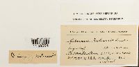 Grimmia teretinervis Limpr. 644347[1130594]Holzinger, J.M. s.n.1900-10-19 United States, Minnesota, Winona, Sugar Loaf Bluff, 300m |
MIN:Bryophytes | 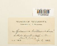 Grimmia teretinervis Limpr. 35852[1130602]Holzinger, J.M. s.n.1894-04-06 United States, Minnesota, Catholic Cemetery Bluff, near Winona |
MIN:Bryophytes | 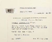 Grimmia teretinervis Limpr. 857081[1130605]Wheeler, Gerald A. 308671984-07-10 United States, Minnesota, Winona, John A. Latsch State Park; about 6.5 mi. NW of Minnesota City on Rte. 61, T108N R8W SW1/4 of Sec. 7 |
1
Page 1, records 1-16 of 16
Google Map
Google Maps is a web mapping service provided by Google that features a map that users can pan (by dragging the mouse) and zoom (by using the mouse wheel). Collection points are displayed as colored markers that when clicked on, displays the full information for that collection. When multiple species are queried (separated by semi-colons), different colored markers denote each individual species.