University of Minnesota
http://www.umn.edu/
612-625-5000
http://www.umn.edu/
612-625-5000
Minnesota Biodiversity Atlas
Bell Museum
Dataset: All Collections
Taxa: Grimmia unicolor
Search Criteria: Bell Museum bryophytes; Minnesota; excluding cultivated/captive occurrences
1
Page 1, records 1-9 of 9
Bell Museum bryophytes | |
 MIN:Bryophytes | 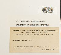 Grimmia unicolor Hook. 644647[1130610]Holzinger, John M. s.n.1902-07-16 United States, Minnesota, Cook, vicinity of Grand Marais, near lat 48° N |
MIN:Bryophytes | 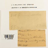 Grimmia unicolor Hook. 644649[1130608] 481891-06-24 United States, Minnesota |
MIN:Bryophytes |  Grimmia unicolor Hook. 644646[1130611]Herzinger, John M. 271902-07-00 United States, Minnesota, Cook, North Shore of Lake Superior |
MIN:Bryophytes |  Grimmia unicolor Hook. 35914[1130732]Wood, F. F. s.n.1891-00-00 United States, Minnesota, N. Minn. |
MIN:Bryophytes | 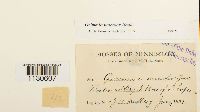 Grimmia unicolor Hook. 35915[1130607]Sanberg, J. H. s.n.1891-06-00 United States, Minnesota, Floodwood Bay, N. shore of Lake Superior |
MIN:Bryophytes | 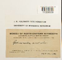 Grimmia unicolor Hook. 644648[1130609]Holzinger, John M. s.n.1902-07-06 United States, Minnesota, Cook |
MIN:Bryophytes | 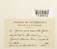 Grimmia unicolor Hook. 35916[1130612]MacMillan, C. s.n. United States, Minnesota |
MIN:Bryophytes | 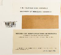 Grimmia unicolor Hook. 644650[1130613]Holzinger, John M. s.n.1902-07-16 United States, Minnesota, Cook, North Shore of Lake Superior, vicinity of Grand Marais |
MIN:Bryophytes | 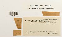 Grimmia unicolor Hook. 644651[1130614]Holzinger, John M. s.n.1902-07-16 United States, Minnesota, Cook |
1
Page 1, records 1-9 of 9
Google Map
Google Maps is a web mapping service provided by Google that features a map that users can pan (by dragging the mouse) and zoom (by using the mouse wheel). Collection points are displayed as colored markers that when clicked on, displays the full information for that collection. When multiple species are queried (separated by semi-colons), different colored markers denote each individual species.