University of Minnesota
http://www.umn.edu/
612-625-5000
http://www.umn.edu/
612-625-5000
Minnesota Biodiversity Atlas
Bell Museum
Dataset: All Collections
Taxa: Leskea obscura
Search Criteria: Bell Museum bryophytes; Minnesota; excluding cultivated/captive occurrences
1
Page 1, records 1-7 of 7
Bell Museum bryophytes | |
 MIN:Bryophytes | 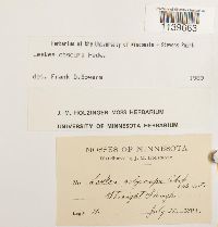 Leskea obscura Hedw. 646652[1139663]J.M. Holzinger s.n.1895-07-22 United States, Minnesota, Straight Slough |
MIN:Bryophytes | 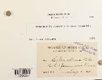 Leskea obscura Hedw. 39001[1139657]Holzinger, J.M. s.n.1890-08-06 United States, Minnesota, Beck's farm, near Winona |
MIN:Bryophytes | 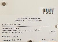 Leskea obscura Hedw. 812929[1139658]J.A. Janssens 87621982-06-11 United States, Minnesota, Washington, Stillwater Area: St. Croix River Island, 45.085833 -92.781944, 208m |
MIN:Bryophytes | 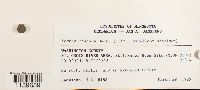 Leskea obscura Hedw. 812948[1139659]Janssens, J.A. 81581982-03-29 United States, Minnesota, Washington, St. Croix River Area: Stillwater Boom Site (T30N R19W), 45.084722 -92.784722 |
MIN:Bryophytes | 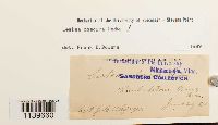 Leskea obscura Hedw. 39000[1139660]Holzinger, J.M. s.n.1890-06-26 United States, Minnesota, Winona |
MIN:Bryophytes | 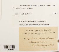 Leskea obscura Hedw. 646639[1139661]Holzinger, J.M. 1931890-00-00 United States, Minnesota, Winona |
MIN:Bryophytes | 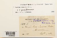 Leskea obscura Hedw. 38999[1139662]Holzinger, J.M. 361894-09-00 United States, Minnesota, Winona |
1
Page 1, records 1-7 of 7
Google Map
Google Maps is a web mapping service provided by Google that features a map that users can pan (by dragging the mouse) and zoom (by using the mouse wheel). Collection points are displayed as colored markers that when clicked on, displays the full information for that collection. When multiple species are queried (separated by semi-colons), different colored markers denote each individual species.