University of Minnesota
http://www.umn.edu/
612-625-5000
http://www.umn.edu/
612-625-5000
Minnesota Biodiversity Atlas
Bell Museum
Dataset: All Collections
Taxa: Mnium thomsonii (Mnium decurrens, Mnium orthorrhynchum)
Search Criteria: Bell Museum bryophytes; Minnesota; excluding cultivated/captive occurrences
1
Page 1, records 1-14 of 14
Bell Museum bryophytes | |
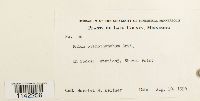
MIN:Bryophytes | Mnium thomsonii Schimp. 583533[1142256]Harriet M Kellner 361956-08-10 United States, Minnesota, Lake, station 3, Shovel Point |
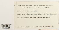
MIN:Bryophytes | Mnium thomsonii Schimp. 610548[1142257]Olson, W. A. 720c1960-08-17 United States, Minnesota, Cook, Bell Rose Island of Susie Islands in Lake Superior |
MIN:Bryophytes | Mnium thomsonii Schimp. 647183[1142258]Holzinger, J.M. s.n.1902-07-16 United States, Minnesota, Cook, in the vicinity of Grand Marais, near lat. 48°N |
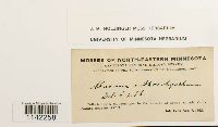
MIN:Bryophytes | Mnium thomsonii Schimp. 39568[1142259]Sandberg, J.H. s.n.1891-06-00 United States, Minnesota |
MIN:Bryophytes | Mnium thomsonii Schimp. 39569[1142260]Holzinger, John M. 3971918-09-08 United States, Minnesota, Lake, west side of Little Sugar Loaf |
MIN:Bryophytes | Mnium thomsonii Schimp. 583531[1142261]Kellner, Harriet M. 381956-08-10 United States, Minnesota, Lake, Station 3, Shovel Point |
MIN:Bryophytes | Mnium thomsonii Schimp. 852538[1142262]Bowers, Frank D. 228761994-09-17 United States, Minnesota, Cook, Lutsen State Natural Area, ca 3 km NE of Jct 36 & 61 (Hwy 61) NW 1/4. NE of Eagle Mountain ski area, T 60 N, R 3 W, sec. 21; 47.75 -90.733333, 47.75 -90.733333 |
MIN:Bryophytes | Mnium thomsonii Schimp. 856552[1142263]Bowers, Frank D. 240531994-08-31 United States, Minnesota, Saint louis, North of Burnside lake, ca. 9 km NW of Ely; T63N, R13W, sec. 2 & 11., 47.966667 -91.966667 |
MIN:Bryophytes | Mnium thomsonii Schimp. 856609[1142264]Bowers, Frank D. 224941994-08-30 United States, Minnesota, Lake, Kawishiwi Pines cRNA, Superior National Forest. R 11 W, T 62 N, sec. 21; ca 9 km SE of Ely, N of S Kawishiwi River |
MIN:Bryophytes | Mnium thomsonii Schimp. 853214[1142265]Bowers, Frank D. 235841995-09-09 United States, Minnesota, Cook, T 59 N, R 4 W, sec. 30 + sec. 31. Temperance River State Park, along river and falls, 1.2 km N of Schroeder on Hwy 61., 47.516667 -90.933333 |
MIN:Bryophytes | Mnium thomsonii Schimp. 852062[1142266]Bowers, Frank D. 22799a1994-09-02 United States, Minnesota, Lake, Tettegouche State Park, T 56 N, R 7 W, sec. 7, SE 1/4. 7 acre upland "Island" along north shore of Tettegouche Lake, white cedar north of that.; 47.316667 -91.266667, 47.316667 -91.266667 |
MIN:Bryophytes | Mnium thomsonii Schimp. 852065[1142267]Bowers, Frank D. 228181994-09-02 United States, Minnesota, Lake, Tettegouche State Park, T 56 N, R 7 W, SE 1/4. 91o 16'W, 47o19N. 7 acre upland "Island" along the north shore of Tettegouche Lake, white cedar north of that, rock outcrop present., 47.316667 -91.266667 |
MIN:Bryophytes | Mnium thomsonii Schimp. 851586[1142268]Bowers, Frank D. 225901994-08-31 United States, Minnesota, Saint louis, White pine area, North of Burntside Lake ca 9 km NW of Ely. R 13 W, T 63 N, sec. 2 + sec. 11, 47.966667 -91.966667 |
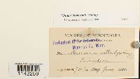
MIN:Bryophytes | Mnium thomsonii Schimp. 851615[1142269]Bowers, Frank D. 22550a1994-08-31 United States, Minnesota, Saint louis, White pine area N of Burntside Lake, HH ca 9 km NW of Ely; R 13 W, T 63 N, sec. 2 sec. 11., 47.966667 -91.966667 |
1
Page 1, records 1-14 of 14
Google Map
Google Maps is a web mapping service provided by Google that features a map that users can pan (by dragging the mouse) and zoom (by using the mouse wheel). Collection points are displayed as colored markers that when clicked on, displays the full information for that collection. When multiple species are queried (separated by semi-colons), different colored markers denote each individual species.
