University of Minnesota
http://www.umn.edu/
612-625-5000
http://www.umn.edu/
612-625-5000
Minnesota Biodiversity Atlas
Bell Museum
Dataset: All Collections
Taxa: Polytrichastrum alpinum (Polytrichum austroalpinum), Polytrichastrum alpinum var. septentrionale, Polytrichastrum alpinum var. sylvaticum, Polytrichastrum alpinum var. brevifolium
Search Criteria: Bell Museum bryophytes; Minnesota; excluding cultivated/captive occurrences
1
Page 1, records 1-33 of 33
Bell Museum bryophytes | |
 MIN:Bryophytes |  Polytrichastrum alpinum (Hedw.) G.L. Sm. 856796[1156428]Wheeler, Gerald A. 312021985-07-18 United States, Minnesota, Lake, Gooseberry Falls State Park; about 15 mi. NE of Two Harbors on Rte. 61. T54N R9W Sec. 28 |
MIN:Bryophytes |  Polytrichastrum alpinum (Hedw.) G.L. Sm. 853280[1156426]F. Bowers 228061994-09-02 United States, Minnesota, Lake, Tettegouche State Park. SE 1/4 of Sec. 7. 7 acre upland "island" along Northshore of Tettegouche Lake; 47.316667 -91.266667; 47.316667 -91.266667; 47.316667 -91.266667; 47.316667 -91.266667; 47.316667 -91.266667, 47.316667 -91.266667 |
MIN:Bryophytes |  Polytrichastrum alpinum (Hedw.) G.L. Sm. 731096[1156421]Trana, Thomas D. 6281975-08-14 United States, Minnesota, Cook, Woods, stream, and lakeside just N of Grand Marais, near Lake Superior |
MIN:Bryophytes |  Polytrichastrum alpinum (Hedw.) G.L. Sm. 852100[1156414]Bowers, Frank D. 227731994-09-02 United States, Minnesota, Lake, Tettegouche State Park, T 56 N, R 7 W, sec. 7, SE 1/4, 47.316667 -91.266667 |
MIN:Bryophytes | 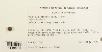 Polytrichastrum alpinum (Hedw.) G.L. Sm. 852851[1156413]F. Bowers 235651955-09-09 United States, Minnesota, Cook, Temperence River State Park, 1.2km N of Schroeder on Hwy 61, T59N, R4W, sec. 30 + sec. 31, 47.516667 -90.933333 |
MIN:Bryophytes | 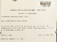 Polytrichastrum alpinum (Hedw.) G.L. Sm. 852036[1156405]F. Bowers 236131995-09-09 United States, Minnesota, Cook, Temperence River State Park, along river and falls, 1.2 km N of Schroeder on Hwy 61; 47.516667 -90.933333; 47.516667 -90.933333, 47.516667 -90.933333 |
MIN:Bryophytes | 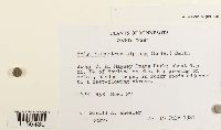 Polytrichastrum alpinum (Hedw.) G.L. Sm. 856740[1156430]Wheeler, Gerald A. 302771981-07-15 United States, Minnesota, Cook, Judge C. R. Magney State Park; about 4.5 mi. SW of Hovland on Rte. 61; T62N R3E Sec. 27. |
MIN:Bryophytes | 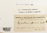 Polytrichastrum alpinum (Hedw.) G.L. Sm. 648483[1156439]Holzinger, J.M. s.n.1902-07-16 United States, Minnesota, Cook, in the vicinity of Grand Marais, near lat. 48° N. |
MIN:Bryophytes |  Polytrichastrum alpinum (Hedw.) G.L. Sm. 583537[1156412]Kellner, Harriet M. 321956-08-09 United States, Minnesota, Lake, Shovel Point, station 2 |
MIN:Bryophytes |  Polytrichastrum alpinum (Hedw.) G.L. Sm. 852469[1156415]Bowers, Frank D. 234131994-10-08 United States, Minnesota, Cook, Loon Lake white pine, Superior National Forest, just N of Loon Lake. T 65 N, R 3 W, sec. 25, North of Hwy 12, ca 45 km NW of Grand Marais |
MIN:Bryophytes |  Polytrichastrum alpinum (Hedw.) G.L. Sm. 668433[1156420]Holzinger, J.M. s.n.1902-07-16 United States, Minnesota, Cook, In the vicinity of Grand Marais, near lat. 48° N. |
MIN:Bryophytes |  Polytrichastrum alpinum (Hedw.) G.L. Sm. 856985[1156427]Wheeler, Gerald A. 301641981-07-12 United States, Minnesota, Cook, Hat Point. about 2 mi. E of Grand Portage on Rte. 17 |
MIN:Bryophytes |  Polytrichastrum alpinum (Hedw.) G.L. Sm. 856715[1156429]G.A. Wheeler 303061981-07-17 United States, Minnesota, Carlton, Jay Cooke State Park; about 15 mi. SW of Duluth; N of Rte. 210, T48N R16W N1/2 of Sec. 10 |
MIN:Bryophytes |  Polytrichastrum alpinum (Hedw.) G.L. Sm. 648482[1156438]J.M. Holzinger 731902-08-00 United States, Minnesota, Lake Superior, Grand Marais, lat 48N |
MIN:Bryophytes |  Polytrichastrum alpinum (Hedw.) G.L. Sm. 857212[1156431]G.A. Wheeler 305031982-06-04 United States, Minnesota, Pine, Banning State Park; 4.5 mi, NNW of Sandstone, and 1 mi. N of jct. of Rte. 23 and the Kettle River. W1/2 of Section 23. |
MIN:Bryophytes |  Polytrichastrum alpinum (Hedw.) G.L. Sm. 857409[1156432]Wheeler, Gerald A. 301431981-07-12 United States, Minnesota, Cook, Cascade River State Park; about 4.5 mi. SW of Grand Marais on Rte. 61. T61N R1W S1/2 of Sec. 27 |
MIN:Bryophytes | 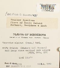 Polytrichastrum alpinum (Hedw.) G.L. Sm. 619793[1156435]R. Koch 66281969-10-18 United States, Minnesota, Lake, Knife Island; (Diabase Gull Rookery) |
MIN:Bryophytes |  Polytrichastrum alpinum (Hedw.) G.L. Sm. 41866[1156407]Wood, F.F. s.n.1891-00-00 United States, Minnesota, N. Minn. |
MIN:Bryophytes |  Polytrichastrum alpinum (Hedw.) G.L. Sm. 368884[1156409]M. Jackson 4341939-07-20 United States, Minnesota, at intersection of Boulevard and Hanen Road |
MIN:Bryophytes |  Polytrichastrum alpinum (Hedw.) G.L. Sm. 648486[1156418] 80 United States, Minnesota |
MIN:Bryophytes |  Polytrichastrum alpinum (Hedw.) G.L. Sm. 648484[1156416]Holzinger, J. M. s.n.1902-07-28 United States, Minnesota, Cook, At Rosebush falls and along Rosebush Creek, 3 mi W of Grand Marais |
MIN:Bryophytes |  Polytrichastrum alpinum (Hedw.) G.L. Sm. 583535[1156411]Kellner, Harriet M. 341956-08-08 United States, Minnesota, Lake, Near station 2, Shovel Point |
MIN:Bryophytes |  Polytrichastrum alpinum (Hedw.) G.L. Sm. 853184[1156424]Bowers, Frank D. 235391995-09-09 United States, Minnesota, Cook, T 59 N, R 4 W, sec. 30 + sec. 31. Temperance River State Park, along river and falls, 1.2 km N of Schroeder on Hwy 61., 47.516667 -90.933333 |
MIN:Bryophytes |  Polytrichastrum alpinum (Hedw.) G.L. Sm. 852146[1156423]Bowers, Frank D. 241101994-08-31 United States, Minnesota, St. Louis, North of Burntside Lake, ca 9 km NW of Ely, R 13 W, T 63 N, sec. 2 + sec. 11, 47.966667 -91.966667 |
MIN:Bryophytes | 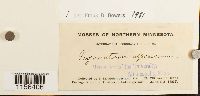 Polytrichastrum alpinum (Hedw.) G.L. Sm. 41705[1156406]Holzinger, J. M. s.n.1897-06-23 United States, Minnesota, Grand Portage Island, north shore of Lake Superior |
MIN:Bryophytes | 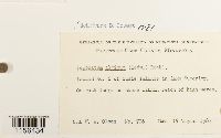 Polytrichastrum alpinum (Hedw.) G.L. Sm. 610567[1156434]Olson, W. A. 7061960-08-16 United States, Minnesota, Cook, Island No. 6 of Susie Islands in Lake Superior. |
MIN:Bryophytes | 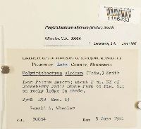 Polytrichastrum alpinum (Hedw.) G.L. Sm. 857446[1156433]G.A. Wheeler 300841981-06-05 United States, Minnesota, Lake, Twin Points Resort; about 2 mi. NE of Gooseberry Falls State Park on Rte. 61 |
MIN:Bryophytes |  Polytrichastrum alpinum (Hedw.) G.L. Sm. 744313[1156422]Vitt, Dale H. 268211981-07-28 United States, Minnesota, Cook, Northwest shore of Lake Superior; Temperance River crossing of Hwy 61, just west of bridge near Tofte, 47.516667 -90.783333 |
MIN:Bryophytes |  Polytrichastrum alpinum (Hedw.) G.L. Sm. 648514[1156488]Nelson, Elias 51701898-08-25 United States, Minnesota, La Plata Minnes |
MIN:Bryophytes |  Polytrichastrum alpinum (Hedw.) G.L. Sm. 853002[1156425]Bowers, Frank D. 224251994-08-30 United States, Minnesota, Lake, Kawishiwi Pines cRNA, Superior National Forest, T 62 N, R 11 W, sec. 11; ca 9 km SE of Ely, N of S Kawishiwi River, 47.816667 -91.75 |
MIN:Bryophytes |  Polytrichastrum alpinum (Hedw.) G.L. Sm. 415508[1156410]Lakela, Olga s.n.1944-09-17 United States, Minnesota, Lake, on high cliff of Lake Superior at East Beaver Bay |
MIN:Bryophytes |  Polytrichastrum alpinum (Hedw.) G.L. Sm. 648485[1156417]J.M. Holzinger s.n.1902-08-15 United States, Minnesota, Cook, On Hat Point, a peninsula projecting southward from Mt. Josephine, into Lake Superior, near Grand Portage. |
MIN:Bryophytes | 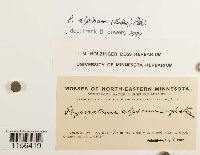 Polytrichastrum alpinum (Hedw.) G.L. Sm. 648487[1156419]Holzinger, J. M. s.n.1902-08-07 United States, Minnesota, Cook, In the vicinity of Grand Marais, near lat.48°N |
1
Page 1, records 1-33 of 33
Google Map
Google Maps is a web mapping service provided by Google that features a map that users can pan (by dragging the mouse) and zoom (by using the mouse wheel). Collection points are displayed as colored markers that when clicked on, displays the full information for that collection. When multiple species are queried (separated by semi-colons), different colored markers denote each individual species.