University of Minnesota
http://www.umn.edu/
612-625-5000
http://www.umn.edu/
612-625-5000
Minnesota Biodiversity Atlas
Bell Museum
Dataset: All Collections
Taxa: Thuidium delicatulum (Leskea assimilis, Thuidium delicatulum var. repens), Thuidium delicatulum var. delicatulum, Thuidium delicatulum var. peruvianum, Thuidium delicatulum var. parvulum, Thuidium delicatulum var. tamarisciforme
Search Criteria: Bell Museum bryophytes; Minnesota; excluding cultivated/captive occurrences
1
Page 1, records 1-52 of 52
Bell Museum bryophytes | |
 MIN:Bryophytes | 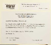 Thuidium delicatulum (Hedw.) Schimp. 864787[1170596]Gerald A Wheeler 168891997-07-26 United States, Minnesota, Stearns, Ca. 5 mi. N of St. Joseph, W of Rte. 4. NW1/4 SW1/4 SE1/4 of Sec. 16, 45.637364 -94.335962 |
MIN:Bryophytes | 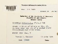 Thuidium delicatulum (Hedw.) Schimp. 857124[1170591]Gerald A. Wheeler 308201984-07-10 United States, Minnesota, Winona, About 13 km SE of Winona on Rte. 61; overlooking Big Trout Creek, 43.996103 -91.467064 |
MIN:Bryophytes | 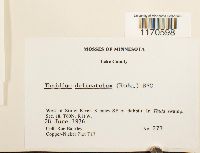 Thuidium delicatulum (Hedw.) Schimp. 753865[1170598]Barkley, Rae 2731976-06-28 USA, Minnesota, Lake, West of Stony River, 8 miles SE of Babbitt. Copper-Nickel Plot T17, 47.694438 -91.760755 |
MIN:Bryophytes |  Thuidium delicatulum (Hedw.) Schimp. 812850[1170575]J A Janssens 198791989-08-28 United States, Minnesota, Cass, Bena Area: Little Portage Lake Cedar Swamp, east of Little Portage lake, Bena Bog WMA, north of highway 2 from Cass lake to Bena, 9 km west of Bena, 47.363889 -94.327222, 400m |
MIN:Bryophytes | 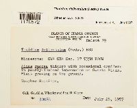 Thuidium delicatulum (Hedw.) Schimp. 857479[1170572]Gerald A Wheeler 300281977-07-28 United States, Minnesota, Itasca, Clay Boswell Steam Electric Station, Collection Site No. Releve 29; Swarta Plain; SE1/4 SE1/4 Section 8 |
MIN:Bryophytes |  Thuidium delicatulum (Hedw.) Schimp. 852019[1170608]Frank D Bowers 1979-10-01 United States, Minnesota, Beltrami, Hwy. 72, at Ludlow, ca. 10 miles north of Waskish |
MIN:Bryophytes |  Thuidium delicatulum (Hedw.) Schimp. 45059[1170563]J M Holzinger 1894-06-00 USA, Minnesota, Winona, Winona |
MIN:Bryophytes |  Thuidium delicatulum (Hedw.) Schimp. 400871[1170564]Eloise Newcomb 1941-07-29 United States, Minnesota, Clearwater, Itasca |
MIN:Bryophytes |  Thuidium delicatulum (Hedw.) Schimp. 753953[1170601]Barkley, Rae 3231976-08-04 United States, Minnesota, Lake, East of Beaver Hut Lake near state highway 1 (16 miles SE of Ely). Copper-Nickel T28., 47.726089 -91.651851 |
MIN:Bryophytes |  Thuidium delicatulum (Hedw.) Schimp. 45114[1170606]J M Holzinger 1897-06-08 United States, Minnesota, on Fall Lake, near the foot of Kawasatchong Galls, seven miles north of Ely, 47.969976 -91.722706 |
MIN:Bryophytes |  Thuidium delicatulum (Hedw.) Schimp. 857415[1170589]Gerald A Wheeler 301351981-07-12 United States, Minnesota, Cook, Cascade River State Park; about 4.5 mi. SW of Grand Marais on Rte. 61. S1/2 of Sec. 27 |
MIN:Bryophytes |  Thuidium delicatulum (Hedw.) Schimp. 809439[1170580]Lorenz, R. 1982-12-02 USA, Minnesota, Hennepin, Minnetonka area, 44.913345 -93.432089 |
MIN:Bryophytes | 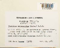 Thuidium delicatulum (Hedw.) Schimp. 748807[1170587]J A Janssens 110831982-08-21 United States, Minnesota, Beltrami, Waskish Area: 5.5 km upstream on Tamarac River, along left bank (NE NE SW or S15)., 48.15 -94.466667, 359m |
MIN:Bryophytes |  Thuidium delicatulum (Hedw.) Schimp. 853182[1170573]Frank D Bowers 235371995-09-09 United States, Minnesota, Cook, Temperence River State Park, along river and falls, 1.2 km N of Schroeder on Hwy 61. T59N, R4W, Sec. 30 + Sec. 31., 47.516667 -90.933333 |
MIN:Bryophytes |  Thuidium delicatulum (Hedw.) Schimp. 853339[1170574]Frank D Bowers 240151994-09-02 United States, Minnesota, Lake, Tettegouche State Park, SE 1/4. 7 acre upland "Island" along north shore of Tettegouche Lake, white cedar north of that, 47.316667 -91.266667 |
MIN:Bryophytes |  Thuidium delicatulum (Hedw.) Schimp. 45056[1171894]E Ross 1891-07-23 USA, Minnesota, Saint Croix Falls |
MIN:Bryophytes |  Thuidium delicatulum (Hedw.) Schimp. 753885[1170599]Barkley, Rae 4721976-08-05 United States, Minnesota, Saint louis, east end of Snort Lake, 7 mi SE of Babbitt, 47.680441 -91.806543 |
MIN:Bryophytes |  Thuidium delicatulum (Hedw.) Schimp. 857300[1170590]Gerald A Wheeler 300071977-07-18 United States, Minnesota, Itasca, NE 1/4 SE 1/4, on Aitkin Lacustrine Plain., 47.289362 -93.692348 |
MIN:Bryophytes |  Thuidium delicatulum (Hedw.) Schimp. 753853[1170597]Barkley, Rae 2161976-06-27 United States, Minnesota, Saint Louis, Near St. Louis River, 5 miles S of Hoyt Lakes, 47.467314 -92.123029 |
MIN:Bryophytes |  Thuidium delicatulum (Hedw.) Schimp. 748806[1170586]J A Janssens 82151982-04-11 United States, Minnesota, Chisago, Interstate Park, right bank of St. Croix River, bluffs north of Folsom Island, 45.397222 -92.658333, 240m |
MIN:Bryophytes |  Thuidium delicatulum (Hedw.) Schimp. 677707[1170581]Frank D Bowers 8511975-07-24 USA, Minnesota, Clearwater, Iron Bridge (Iron Springs) just N of Hwy 200, 1mi w of Lake Itasca, 47.254281 -95.243373 |
MIN:Bryophytes |  Thuidium delicatulum (Hedw.) Schimp. 748606[1170588]J A Janssens 59611981-08-29 United States, Minnesota, Anoka, EAST BETHEL AREA: Cedar Creek Bog at Cedar Creek Natural Histry Area, 45.409722 -93.202222, 277m |
MIN:Bryophytes |  Thuidium delicatulum (Hedw.) Schimp. 850632[1170607]Calvin R Sperling 89 USA, Minnesota, Saint louis, Kabetogama lake, 3.6 mi W of the Ash River Campground along the Ash River trail, 48.417103 -92.867545, 347m |
MIN:Bryophytes |  Thuidium delicatulum (Hedw.) Schimp. 753919[1170600]Barkley, Rae 4371976-08-05 United States, Minnesota, Lake, Near Tony Lake on state highway 1 (16 miles SE of Ely). Copper-Nickel Plot T14., 47.726089 -91.651851 |
MIN:Bryophytes |  Thuidium delicatulum (Hedw.) Schimp. 415536[1170565]Olga Lakela 1944-10-20 United States, Minnesota, Duluth, Hartley Road |
MIN:Bryophytes |  Thuidium delicatulum (Hedw.) Schimp. 851872[1170609]Frank D Bowers 243431994-09-17 United States, Minnesota, Cook, Lutsen State Natural Area ca 3 km NE of Jct 36 & 61 (Hwy 61) NE of Eagle Mt ski area. NW 1/4. (South Lutsen) -- SW corner, 47.75 -90.733333 |
MIN:Bryophytes |  Thuidium delicatulum (Hedw.) Schimp. 45058[1170562]Conway McMillan 1895-09-00 USA, Minnesota, International Boundary Line, Northern Minnesota, Saganaga Lake to South Lake |
MIN:Bryophytes |  Thuidium delicatulum (Hedw.) Schimp. 731115[1170582]Trana, Thomas D. 4561975-07-24 USA, Minnesota, Clearwater, 1st highway bridge over the Mississippi River, N of Lake Itasca outlet, 47.253413 -95.225281 |
MIN:Bryophytes |  Thuidium delicatulum (Hedw.) Schimp. 734006[1170585]Quinn, Robert 6841980-06-25 United States, Minnesota, Clearwater, Minn. 200 and the area ca. 2 mi. from the Mississippi River (west), 47.253342 -95.236393 |
MIN:Bryophytes | 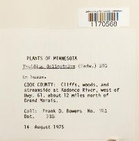 Thuidium delicatulum (Hedw.) Schimp. 677679[1170568]Frank D Bowers 7611975-08-14 United States, Minnesota, Cook, at Kodonce River, west of Hwy. 61, about 12 miles north of Grand Marals. |
MIN:Bryophytes |  Thuidium delicatulum (Hedw.) Schimp. 754037[1170603]Barkley, Rae 4321976-08-05 United States, Minnesota, Lake, Southeast of Birch Lake, 9 miles E of Babbitt. Copper-Nickel Plot T11., 47.712857 -91.750308 |
MIN:Bryophytes |  Thuidium delicatulum (Hedw.) Schimp. 754163[1170604]Barkley, Rae 7181976-08-06 United States, Minnesota, Saint Louis, South of Stubble Creek near USFS 113 (9 miles SSE of Babbitt), Copper-Nickel Plot T18, 47.593898 -91.912149 |
MIN:Bryophytes |  Thuidium delicatulum (Hedw.) Schimp. 45057[1171888]J M Holzinger 1889-10-12 United States, Minnesota, Winona, Bear Creek, 44.075241 -91.846821 |
MIN:Bryophytes |  Thuidium delicatulum (Hedw.) Schimp. 650287[1170561]J M Holzinger 1897-04-24 USA, Minnesota, Winona, Bear Creek |
MIN:Bryophytes |  Thuidium delicatulum (Hedw.) Schimp. 419945[1170566]Olga Lakela 118571950-08-27 United States, Minnesota, Saint Louis, Crooked Lake, Curtain Falls |
MIN:Bryophytes |  Thuidium delicatulum (Hedw.) Schimp. 812823[1170577]J A Janssens 201341990-04-22 United States, Minnesota, Washington, MARINE ON ST. CROIX AREA: William O'Brien State Park, along creek from source near escarpment up to St. Croix River, at the northern boundary of William 0'Brian State Park, north of Marine on St. Croix, 22 km north of Stillwater (SW of SE of S 30 ), 45.22694 -92.76, 230m |
MIN:Bryophytes | 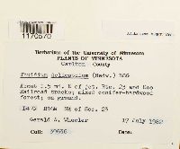 Thuidium delicatulum (Hedw.) Schimp. 856901[1170570]Gerald A Wheeler 306361982-07-17 United States, Minnesota, Carlton, About 1.5 mi. E of jct. 23 and Soo Railroad tracks. S1/2 of Sec. 23, 46.540282 -92.332494 |
MIN:Bryophytes |  Thuidium delicatulum (Hedw.) Schimp. 812924[1170579]J A Janssens 155161985-05-30 United States, Minnesota, Washington, Hardwood Creek Area: Hardwood Creek Peatland (T32N R21W), 45.210833 -92.941389, 280m |
MIN:Bryophytes |  Thuidium delicatulum (Hedw.) Schimp. 864901[1170594]Gerald A Wheeler 162641997-06-26 United States, Minnesota, Renville, Ca. 10 mi. S of Renville; SE1/4 NE1/4 NW1/4 of Sec. 30 (Flora 30) |
MIN:Bryophytes |  Thuidium delicatulum (Hedw.) Schimp. 856868[1170593]Gerald A Wheeler 310721985-05-26 United States, Minnesota, Stearns, Near St. John's University, about 2 mi. NW of St. Joseph. N1/2 of Sec. 6, 45.579929 -94.373314 |
MIN:Bryophytes |  Thuidium delicatulum (Hedw.) Schimp. 610609[1170567]Olson, W.A. 6111960-08-02 United States, Minnesota, Koochiching, Near Ericsburg. SE1/4 NE1/4 of Sec. 6, 48.49655 -93.341798 |
MIN:Bryophytes | 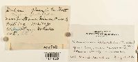 Thuidium delicatulum (Hedw.) Schimp. 382858[1171889]Mrs A Holmes 1930-07-12 United States, Minnesota, Itasca, near Northome, 47.872456 -94.280503 |
MIN:Bryophytes | 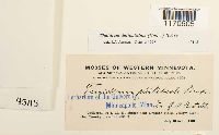 Thuidium delicatulum (Hedw.) Schimp. 45115[1170605]J M Holzinger 1901-07-10 United States, Minnesota, Yellow Medicine, Near Granite Falls |
MIN:Bryophytes | 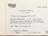 Thuidium delicatulum (Hedw.) Schimp. 857251[1170569]Gerald A Wheeler 304811982-06-04 United States, Minnesota, Pine, Banning State Park; 4.5 mi NNW of Sandstone, and 1 mi. N of jct. of Rte. 23 and the Kettle River. W1/2 of Sec. 23, 46.164123 -92.834446 |
MIN:Bryophytes |  Thuidium delicatulum (Hedw.) Schimp. 753958[1170602]Barkley, Rae 7041976-08-06 USA, Minnesota, Saint louis, Aurora 12mi SE, at Skibo Vista |
MIN:Bryophytes |  Thuidium delicatulum (Hedw.) Schimp. 734005[1170584]Quinn, Robert 7981980-08-07 USA, Minnesota, Clearwater, Itasca State Park, Garrison Pt, 47.20778 -95.219645 |
MIN:Bryophytes |  Thuidium delicatulum (Hedw.) Schimp. 733670[1170583]Quinn, Robert 3481979-07-17 United States, Minnesota, Clearwater, Itasca State Park |
MIN:Bryophytes | 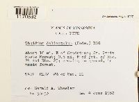 Thuidium delicatulum (Hedw.) Schimp. 857270[1170592]Gerald A Wheeler 304521982-06-04 United States, Minnesota, Pine, About 16 mi. E of Sandstone; St. Croix State Forest; 0.5 mi. N of jct. of Rte. 24 and Rte. 25. W1/2 of Sec. 21, 46.106076 -92.498158 |
MIN:Bryophytes | 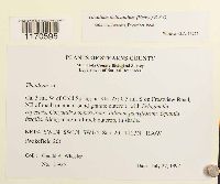 Thuidium delicatulum (Hedw.) Schimp. 864764[1170595]Gerald A Wheeler 169251997-07-27 United States, Minnesota, Stearns, 3 Mi W of Cold Spring, 45.449224 -94.47601 |
MIN:Bryophytes |  Thuidium delicatulum (Hedw.) Schimp. 812818[1170578]J A Janssens 201511990-05-27 USA, Minnesota, Washington, MARINE ON ST. CROIX AREA: St. Croix Field Research Station. west of conifer plantation and east of highway 95, 3.5 km south of Marine on St. Croix (NW of NE of S 19 T31N R19W), 45.159575 -92.765856 |
MIN:Bryophytes |  Thuidium delicatulum (Hedw.) Schimp. 857480[1170571]Gerald A Wheeler 300271977-07-22 United States, Minnesota, Itasca, Releve 28 NE1/4 NE1/4 of Sec. 9, 47.347538 -93.650458 |
MIN:Bryophytes |  Thuidium delicatulum (Hedw.) Schimp. 812871[1170576]J A Janssens 195121989-08-19 United States, Minnesota, Clearwater, LAKE ITASCA AREA: Iron Springs Bog Scientific and Natural Area , north of gravel road, 3 kin west of Lake Itasca (S_ of S 28), 47.255 -95.24528, 440m |
1
Page 1, records 1-52 of 52
Google Map
Google Maps is a web mapping service provided by Google that features a map that users can pan (by dragging the mouse) and zoom (by using the mouse wheel). Collection points are displayed as colored markers that when clicked on, displays the full information for that collection. When multiple species are queried (separated by semi-colons), different colored markers denote each individual species.