University of Minnesota
http://www.umn.edu/
612-625-5000
http://www.umn.edu/
612-625-5000
Minnesota Biodiversity Atlas
Bell Museum
Dataset: All Collections
Taxa: Brachythecium rivulare (Calliergon kawaguchii, Brachythecium rivulare var. cataractarum, Brachythecium rivulare var. lamoillense, Brachythecium rivulare var. laxum, Brachythecium rivulare var. noveboracense), Brachythecium rivulare var. rivulare, Brachythecium rivulare var. chrysophyllum, Brachythecium rivulare var. tenue, Brachythecium rivulare subsp. flavescens, Brachythecium rivulare var. longifolium, Brachythecium rivulare var. schmiedlianum
Search Criteria: Bell Museum bryophytes; Minnesota; excluding cultivated/captive occurrences
1
Page 1, records 1-17 of 17
Bell Museum bryophytes | |
 MIN:Bryophytes |  Brachythecium rivulare Schimp. 637081[1104090]J.M. Holzinger 2441894-00-00 United States, Minnesota, Lanesboro |
MIN:Bryophytes |  Brachythecium rivulare Schimp. 876454[1104099]Gerald A. Wheeler 198531999-06-04 United States, Minnesota, Jackson, Ca. 6.5 mi. NE of Lakefield. Kilen Woods State Park. N1/2 SE1/4 of Section 17 (Belmont 17). |
MIN:Bryophytes |  Brachythecium rivulare Schimp. 852731[1104101]Frank D. Bowers 239921995-09-23 United States, Minnesota, Lake, Crosby-Manitow State Park. ca 12 km North of Little Marais, East of Hwy 7. Yellow Birch Area. sec. 28, SW1/4 & sec. 32, SE1/4 |
MIN:Bryophytes |  Brachythecium rivulare Schimp. 29645[1104088]J.M.H. s.n.1895-10-12 United States, Minnesota, Lamiolle |
MIN:Bryophytes | 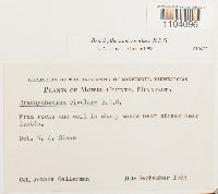 Brachythecium rivulare Schimp. 943279[1104096]Joanne Gellerman s.n.1963-09-00 United States, Minnesota, Mower, near Austin |
MIN:Bryophytes | 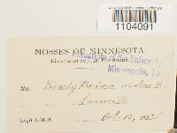 Brachythecium rivulare Schimp. 29644[1104091]J.M.H. s.n.1895-10-12 United States, Minnesota, Lamoille, 44.000269 -91.473139 |
MIN:Bryophytes | 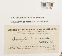 Brachythecium rivulare Schimp. 636884[1104087]J.M. Holzinger s.n.1902-07-28 United States, Minnesota, Cook, at Rosebush falls and along Rosebush creek 3 miles west of Grand Marais |
MIN:Bryophytes | 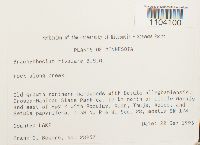 Brachythecium rivulare Schimp. 852685[1104100]Frank D. Bowers 239571995-09-22 United States, Minnesota, Lake, Crosby-Manitou State Park ca. 12 km north of Little Marais and east of Hwy 7, mostly SW 1/4 of section |
MIN:Bryophytes | 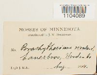 Brachythecium rivulare Schimp. 29643[1104089]J.M. Holzinger s.n.1894-08-00 United States, Minnesota, Houston |
MIN:Bryophytes | 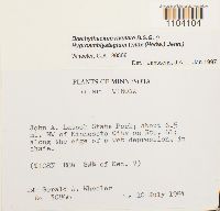 Brachythecium rivulare Schimp. 857082[1104104]Gerald A. Wheeler 308661984-07-10 United States, Minnesota, Winona, John A. Latsch State Park. about 6.5 mi. NW of Minnesota City on Rte. 61, SW 1/4 of Sec. 7 |
MIN:Bryophytes | 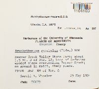 Brachythecium rivulare Schimp. 857332[1104103]Gerald A. Wheeler 306751984-05-23 United States, Minnesota, Houston, Beaver Creek Valley State Park; about 1.5 mi. N of Rte. 12; base of E-facing wooded slope overlooking Beaver Creek. W 1/2 of Sec. 8 |
MIN:Bryophytes | 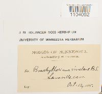 Brachythecium rivulare Schimp. 636879[1104092] s.n.1895-10-12 United States, Minnesota, Lamoille cave, 44.000269 -91.473139 |
MIN:Bryophytes | 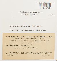 Brachythecium rivulare Schimp. 636882[1104095]J.M. Holzinger s.n.1902-08-05 United States, Minnesota, Cook, along the mail trail to Two Harbors, near Thompsonite beach, 7 miles west of Grand Marais |
MIN:Bryophytes | 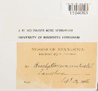 Brachythecium rivulare Schimp. 636880[1104093] s.n.1898-09-14 United States, Minnesota, Lanesboro |
MIN:Bryophytes | 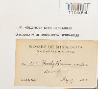 Brachythecium rivulare Schimp. 636883[1104094]J.M. Holzinger 1231895-05-09 United States, Minnesota, Bear Creek |
MIN:Bryophytes | 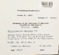 Brachythecium rivulare Schimp. 857334[1104102]Gerald A. Wheeler 306731984-05-23 United States, Minnesota, Houston, Beaver Creek Valley State Park; about 1.5 mi. N of Rte. 12; on E-facing, W 1/2 of Sec. 8 |
MIN:Bryophytes | 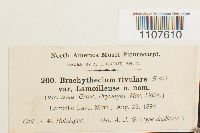 29665[1107610]Holzinger, J.M. 2001894-08-23 United States, Minnesota, Lamoille Cave, 44.000269 -91.473139 |
1
Page 1, records 1-17 of 17
Google Map
Google Maps is a web mapping service provided by Google that features a map that users can pan (by dragging the mouse) and zoom (by using the mouse wheel). Collection points are displayed as colored markers that when clicked on, displays the full information for that collection. When multiple species are queried (separated by semi-colons), different colored markers denote each individual species.