University of Minnesota
http://www.umn.edu/
612-625-5000
http://www.umn.edu/
612-625-5000
Minnesota Biodiversity Atlas
Bell Museum
Dataset: MIN-Plants
Taxa: Araceae
Search Criteria: excluding cultivated/captive occurrences
Bell Museum plants | |
 MIN:Plants |  Spirodela polyrrhiza (L.) Schleiden 542520[1337446]Moore, John W. 216261952-05-23 United States, Minnesota, Cass, East shore of Steamboat Lake [Leech Lake Indian Reservation / Welsh Lake State Forest; T1441;R31W], 47.277294 -94.584464 |
MIN:Plants |  Spirodela polyrrhiza (L.) Schleiden 549957[1337452]Moore, John W. 222761954-09-22 United States, Minnesota, Lincoln, on island at north east end of Lake Benton [T110N;R45W;s25], 44.306759 -96.210724 |
MIN:Plants |  Spirodela polyrrhiza (L.) Schleiden 550159[1337516]Moore, John; et al. 221761954-09-20 United States, Minnesota, Lyon, Lyon County...Prairie Lake, 1 mi. E of Balaton.;;109N;41W;, 44.239535 -95.775284 |
MIN:Plants |  Spirodela polyrrhiza (L.) Schleiden 551580[1337465]Cotter, Shirley 6321948-07-27 United States, Minnesota, Clearwater, Itasca State Park [T143N;R36W], 47.19557 -95.2332161 |
MIN:Plants | 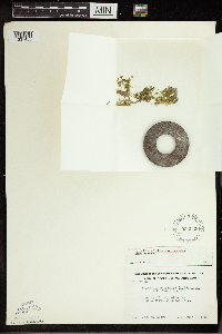 Spirodela polyrrhiza (L.) Schleiden 553938[1337455]Moore, John W. 225551955-06-03 United States, Minnesota, Sibley, 1/2 mile south of Green Isle. [T114N;R26W], 44.673646 -93.949624 |
MIN:Plants |  Spirodela polyrrhiza (L.) Schleiden 594147[1337450]Thorne, Robert F. 307701962-06-30 United States, Minnesota, Clearwater, Itasca State Park. Small pond near S end of Bear Paw Point, between N and E arms, Lake Itasca. NE 1/4 Sec. 11, T-143 N, R-36 W.. 143N 36W 11, 47.217521 -95.201495 |
MIN:Plants |  Spirodela polyrrhiza (L.) Schleiden 618982[1337515]Thieret, J. 336581970-08-24 United States, Minnesota, Clearwater, In the backwater of a small stream flowing into Lake Itasca at the boat landing of Douglas Lodge, Itasca State Park.;Itasca State Park;143N;36W;, 47.19557 -95.233216 |
MIN:Plants |  Spirodela polyrrhiza (L.) Schleiden 687496[1337479]Wheeler, Gerald A. 19381977-07-08 United States, Minnesota, Itasca, Coll Site No. 94; SAW1/4 SW1/4 Sec. 3 T150N R28W, approx. 51 miles NW of Grand Rapids; on the northeast shore of Island Lake. [Chippewa National Forest], 47.838884 -94.214331 |
MIN:Plants |  Spirodela polyrrhiza (L.) Schleiden 738161[1337478]Monson, Paul H. 43861960-08-31 United States, Minnesota, Saint Louis, Duluth-Superior Harbor. West of the Interlake Iron Plant, 59th Ave. W. [T49N;R14W], 46.745914 -92.128249 |
MIN:Plants |  Spirodela polyrrhiza (L.) Schleiden 758619[1337522]Smith, Welby 7016A1982-07-30 United States, Minnesota, Mower, Brandt-Larson State Wildlife Management Area. Ca. 4 mi. NE of Lyle. Along Otter Creek.;Brandt-Larson Wildlife Management Area;101N;17W;16, 43.550746 -92.878835 |
MIN:Plants |  Spirodela polyrrhiza (L.) Schleiden 774249[1337500]Monson, Paul 51911982-07-28 United States, Minnesota, Saint Louis, Voyageur's National Park...St. Louis Co. R-21W, T-69N, SE1/4, S-2. Kabetogama Lake, Cutover Island.;Voyageurs National Park;069N;21W;02, 48.492468 -92.993658 |
MIN:Plants |  Spirodela polyrrhiza (L.) Schleiden 789495[1337514]Smith, Welby 108371985-07-24 United States, Minnesota, Lyon, Prairie Marshes State Wildlife Managment Area, ca. 4 mi. N-NW of Russell. At the edge of Highpoint Lake.;Prairie Marshes Wildlife Management Area;111N;43W;36, 44.378119 -95.968102 |
MIN:Plants |  Spirodela polyrrhiza (L.) Schleiden 796487[1337477]Cholewa, A. F. 15131988-08-05 United States, Minnesota, Aitkin, Savanna Portage State Park, W Savanna River at Portage Trail. T50N R22W S7 sw1/4 of sw1/4, 46.831435 -93.177842 |
MIN:Plants |  Spirodela polyrrhiza (L.) Schleiden 832191[1337519]Benson, Robert 1111941-08-15 United States, Minnesota, Carver, Carver Co. Minn. R. bottoms - Shakopee. T115 R23 S1;;115N;23W;1, 44.797739 -93.53047 |
MIN:Plants |  Spirodela polyrrhiza (L.) Schleiden 832192[1337520]Benson, Robert 2011941-08-28 United States, Minnesota, Becker, Becker Co. Rice Lake. T140 R39 S22-23-26;Tamarac National Wildlife Refuge;140N;39W;, 46.933275 -95.603528 |
MIN:Plants |  Spirodela polyrrhiza (L.) Schleiden 833237[1337506]Myhre, K. 30941992-08-17 United States, Minnesota, Cass, Cass Co. Located 1 mi NW of Sylvan Lake; edge of the Crow Wing River; T133N R30W SW1/4 of NE1/4 of Sec 24;;133N;30W;24, 46.316245 -94.404584 |
MIN:Plants |  Spirodela polyrrhiza (L.) Schleiden 837345[1337505]Smith, Welby 174771990-07-27 United States, Minnesota, Morrison, Camp Ripley Military Reservation. Camp Ripley Military Reservation. Morrison Co.; picnic area #3; Mississippi River; UTM: 393800E 5108900N T131N R29W SE1/ Camp Ripley Military Reservation. Morrison Co.; picnic area #3; Mississippi River; UTM: 393800E 5108900N T131N R29W SE1/4 of SE1/4 of Sec 30. 131N 29W 30, 46.128878 -94.381984 |
MIN:Plants |  Spirodela polyrrhiza (L.) Schleiden 838404[1311638]Myhre, K. 43831993-08-07 United States, Minnesota, Pine, Pine Co. Located 2.5 mi NW of the town of Willow River; E shore of Fox Lake; T44N R20W SE1/4 of NE1/4 of Sec 8.;;044N;20W;8, 46.310244 -92.897415 |
MIN:Plants |  Spirodela polyrrhiza (L.) Schleiden 839283[1311637]Smith, Welby 183231990-09-05 United States, Minnesota, Faribault, Pihls County Park. Faribault Co. ... Pihls County Park. On the west side of Rice Lake, about 6 mi south of Wells. T102N R24W SW1/4 of NW1/4 of Sec 16. 102N 24W 16, 43.6402779 -93.7258301 |
MIN:Plants |  Spirodela polyrrhiza (L.) Schleiden 841185[1311636]Smith, Welby 137861987-08-08 United States, Minnesota, Wabasha, Upper Mississippi National Wildlife Refuge. Wabash County...Upper Mississippi River National Wildlife Refuge, about 1 mi NE of Weaver; backwater of the Mississippi River (Weaver Bottoms)...SE1/4 SW1/4 sec. 20, T109N R9W. 109N 09W 20, 44.2197222 -91.9175 |
MIN:Plants |  Spirodela polyrrhiza (L.) Schleiden 841230[1311641]Smith, Welby 145051988-07-07 United States, Minnesota, Washington, Washington County...Baldwin Lake in the Mississippi River bottoms, about 4 mi SW of Cottage Grove. SW1/4 SE1/4 sec. 26 T27N R22W. 027N 22W 26, 44.7866667 -93.0133333 |
MIN:Plants |  Spirodela polyrrhiza (L.) Schleiden 841261[1337521]Smith, Welby 144861988-07-05 United States, Minnesota, Washington, Warner Nature Center. Washington County...Lee and Rose Warner Nature Center, about 2.5 mi SW of Marine on St. Croix. Near the S end of Terrapin Lake. SW1/4 NE1/4 sec. 15, T31N R20W. 031N 20W 15, 45.1777778 -92.8241667 |
MIN:Plants |  Spirodela polyrrhiza (L.) Schleiden 842849[1311642]Myhre, K. 57441995-06-29 United States, Minnesota, Aitkin, Aitkin Co. Located 8 mi NW of the town of Aitkin; NE bay of Blind Lake; T48N R27W SW1/4 of SW1/4 of Sec 11.;;048N;27W;11, 46.660343 -93.729627 |
MIN:Plants |  Spirodela polyrrhiza (L.) Schleiden 84584[1337486]Moyer, Lycurgus R. s.n.1898-09-00 United States, Minnesota, Chippewa, Chippewa River. Montevideo [T117N;R40W], 44.934626 -95.675774 |
MIN:Plants |  Spirodela polyrrhiza (L.) Schleiden 84671[1337464]Sheldon, E. P. s.n.1895-06-00 United States, Minnesota, Dakota, Minnesota River bottoms, 44.789146 -93.003383 |
MIN:Plants |  Spirodela polyrrhiza (L.) Schleiden 84672[1337454]Sheldon, E. P. s.n.1895-06-00 United States, Minnesota, Hennepin, Ft. Snelling [T28N;R23W], 44.905162 -93.166462 |
MIN:Plants |  Spirodela polyrrhiza (L.) Schleiden 84673[1337467]Ballard, C.A. B4411891-07-00 United States, Minnesota, Scott, Prior Lake [T115N;R21W], 44.753605 -93.344349 |
MIN:Plants |  Spirodela polyrrhiza (L.) Schleiden 84674[1337476]Ballard, C.A. B 8821891-08-00 United States, Minnesota, Carver, Waconia [T116N;R25W], 44.8476 -93.827753 |
MIN:Plants |  Spirodela polyrrhiza (L.) Schleiden 84675[1337513]Wheeler, William 1131899-06-05 United States, Minnesota, Houston, Winnebago Valley, Houston Co.;Dorer Memorial Hardwood State Forest;N;;, 43.53984 -91.41209 |
MIN:Plants |  Spirodela polyrrhiza (L.) Schleiden 84676[1337448]Ballard, C. B601891-06-00 United States, Minnesota, Carver, Chaska [T116N;R23W], 44.848169 -93.581063 |
MIN:Plants |  Spirodela polyrrhiza (L.) Schleiden 84677[1337447]Sheldon, E. P. S7241891-07-00 United States, Minnesota, Brown, Sleepy Eye [T110N;R32W], 44.325885 -94.684758 |
MIN:Plants |  Spirodela polyrrhiza (L.) Schleiden 84679[1337468]Campbell, Jennie s.n.1897-08-00 United States, Minnesota, Otter Tail, Underwood [T132N;R41W], 46.238648 -95.832645 |
MIN:Plants |  Spirodela polyrrhiza (L.) Schleiden 84680[1337449]Ballard, C. s.n.1892-07-00 United States, Minnesota, Nicollet, Nicollet [T109N;R28W], 44.239687 -94.190492 |
MIN:Plants |  Spirodela polyrrhiza (L.) Schleiden 439748[1337487]Myhre, K.M. 3499A1993-04-30 United States, Minnesota, Pine, Located on the south outlet of the Hay Creek Flowage as it enters the Lower Tamarack River; along the west shore of the outlet. T42N R16W NE1/4 of SE1/4 of Sec 30, 46.0916 -92.415029 |
MIN:Plants |  Spirodela polyrrhiza (L.) Schleiden 515045[1337502]Lee, Michael MDL37722004-08-04 United States, Minnesota, Todd, TODD COUNTY ... Pendergast Lake, four miles west-northwest of Eagle Bend ... T131N R35W SE1/4 of NW1/4 of NW1/4 Sec.8;;131N;35W;08, 46.172117 -95.114831 |
MIN:Plants |  Spirodela polyrrhiza (L.) Schleiden 489833[1337556]Stevens, O. 2821937-08-17 United States, North Dakota, Cass, Fargo.;;;;, 46.877186 -96.789803 |
MIN:Plants |  Spirodela polyrrhiza (L.) Schleiden 631389[1337557]Dawson, V. 1411973-07-22 United States, Wisconsin, La Crosse, Upper Mississippi National Wildlife Refuge. Co.: La Crosse...near public boat landing, Louis B. Nelson Mem. Park at end of Lake Shore Drive, French Island. T 16 N R 7 W sec 6. 016N 07W 6, 43.890783 -91.260176 |
MIN:Plants |  Spirodela polyrrhiza (L.) Schleiden 907070[1337499]Lee, Michael MDL44392007-07-11 United States, Minnesota, Wadena, Wadena County ... Along the Crow Wing River ~1/2 mile downstream from the mouth of Beaver Creek, 3.5 miles southeast of Nimrod ... T136N R33W SE1/4 of SW1/4 Sec.10 ... UTM: 5162568N 359503E. 136N 33W 10, 46.608193 -94.832611 |
MIN:Plants |  Spirodela polyrrhiza (L.) Schleiden 922907[1337496]Rowe, Erika; et al. ERR4142008-07-15 United States, Minnesota, Hubbard, T139N R34W NESW 31...~40 meters from western shore of Upper Twin Lake; 400m east of 159th Ave.; 0.3 mile north of Hubbard Co. line. 139N 34W 31, 46.8108333 -95.0325 |
MIN:Plants |  Spirodela polyrrhiza (L.) Schleiden 929445[1337495]Gerdes, Lynden B.; Walewski, Joe W. 61682010-08-05 United States, Minnesota, Lake, Approximately 0.30 miles west of the far northwestern portion of Ester Lake at the north end of a small bog pond. NENWNESE of section;Superior National Forest;066N;06W;27, 48.1727778 -91.0788889 |
MIN:Plants |  Spirodela polyrrhiza (L.) Schleiden 937597[1337494]Gerdes, Lynden B.; Bach, Melissa J. 65462012-06-21 United States, Minnesota, Lake, North Kawishiwi River. Approximately 9.81 miles east of Ely, MN and 0.50 miles SW of Greenstone Lake; at western end of portage.;Boundary Waters Canoe Area Wilderness / Superior National Forest;063N;10W;29, 47.9175 -91.630833 |
MIN:Plants |  Spirodela polyrrhiza (L.) Schleiden 489365[1337493]Scott, P. A. 34492011-07-29 United States, Minnesota, Cook, Superior National Forest. Near Poplar Lake public boat landing. T64N R2W sec. 02 NWNESW., 48.046734 -90.508674 |
MIN:Plants |  Spirodela polyrrhiza (L.) Schleiden 958963[1305183]Lynden B. Gerdes 71652014-08-03 United States, Minnesota, Saint Louis, Superior National Forest, Ramshead Creek, BWCAW. Near eastern end of portage., 48.19611111 -92.08555556 |
MIN:Plants |  Spirodela polyrrhiza (L.) Schleiden 800569[1337531]Larson, Gary E. 72851982-06-13 United States, Nebraska, Cherry, T29N, R27W, Sec. 17, S1/2 ; Pony Lake; T29N R27W S17, 42.486029 -100.507057 |
MIN:Plants |  Spirodela polyrrhiza (L.) Schleiden 579308[1337532]Kaul, R. B. 15441960-07-20 United States, Montana, Flathead, McWenneger Slough, 48.225477 -114.199986 |
MIN:Plants |  Spirodela polyrrhiza (L.) Schleiden 302085[1337533]Deam, Chas. C. 512611931-09-28 United States, Indiana, White, about 5 mi. N of Reynolds, 40.821944 -86.871681 |
MIN:Plants |  Spirodela polyrrhiza (L.) Schleiden 300514[1337534]Hioeus, O. A. s.n.1919-08-30 United States, North Dakota, Cass |
MIN:Plants |  Spirodela polyrrhiza (L.) Schleiden 361533[1337535]Hayden, Ada 101351937-07-14 United States, Iowa, Clay, Lake Twp, Sec. 25, Mud Lake; clay co, 43.188429 -94.915696 |
MIN:Plants |  Spirodela polyrrhiza (L.) Schleiden 269325[1337536]Moore, John W. 17771922-09-00 United States, South Dakota, Brule, Red Lake, 43.726116 -99.22407 |
MIN:Plants |  Spirodela polyrrhiza (L.) Schleiden 575712[1337537]Garton, C. E. 86021961-07-05 Canada, Ontario, Rainy River District; , 4 mi. below Rainy River Town, Wildland Reserve., 48.698695 -94.487039 |
MIN:Plants |  Spirodela polyrrhiza (L.) Schleiden 575801[1337538]Porter, C. L. 88601962-08-19 United States, Wyoming, Teton, ponds 1 mile SW of Moose, 43.645523 -110.732421, 1951m |
MIN:Plants |  Spirodela polyrrhiza (L.) Schleiden 361538[1337539]Hayden, Ada 101361037-06-18 United States, Iowa, Palo alto, Walnut Township, Sec. 34; 1.5 miles W of Osgood along the W side of the Des Moines River below the bridge, 43.183654 -94.724693 |
MIN:Plants |  Spirodela polyrrhiza (L.) Schleiden 551999[1337540] 20191958-08-29 United States, North Dakota, Grand forks, Turtle River; Larimore, 47.937733 -97.583539 |
MIN:Plants |  Spirodela polyrrhiza (L.) Schleiden 378655[1337541]Chase, Virginius H. 34791920-09-17 United States, Illinois, Tazewell, Illinois River just below I.T.S.Ry. bridge |
MIN:Plants |  Spirodela polyrrhiza (L.) Schleiden 480385[1337542]Russell, N. H. 72752101952-07-27 United States, Iowa, Poweshiek, small pond just SW of Arbor Lake; Grinnell, 41.743049 -92.722412 |
MIN:Plants |  Spirodela polyrrhiza (L.) Schleiden 523056[1337543]Cooper, William S. s.n.1901-08-10 United States, Michigan, Saint clair |
MIN:Plants |  Spirodela polyrrhiza (L.) Schleiden 545938[1337544]Scoggan, H.J. 35741948-07-08 Canada, Manitoba, Cross Lake, 45 mi. north of Lake Winnipeg., 54.780013 -97.472867 |
MIN:Plants |  Spirodela polyrrhiza (L.) Schleiden 564269[1337545]Mason, Herbert L. 7481949-05-29 United States, California, Shasta, marsh beween Hat Creek and Pitt River bridge, highway 299, 40.978371 -121.552182 |
MIN:Plants |  Spirodela polyrrhiza (L.) Schleiden 84663[1337546]White, Jas. 107681893-06-17 Canada, Ontario |
MIN:Plants |  Spirodela polyrrhiza (L.) Schleiden 436536[1337547]Schumacher, George s.n.1952-04-29 United States, New York, Tompkins, Ringwood Lakes (Dryden quad.), 42.490905 -76.297155 |
MIN:Plants |  Spirodela polyrrhiza (L.) Schleiden 354694[1337548]Gilbert, F. A. 7721939-06-26 United States, West Virginia, Mason, McCullough's Pond, Ashton, 38.624251 -82.164589 |
MIN:Plants |  Spirodela polyrrhiza (L.) Schleiden 84667[1337549]Umbach, L.M. s.n.1899-08-04 Canada, Ontario, Pembroke; Ottowa River, 45.825041 -77.108427 |
MIN:Plants |  Spirodela polyrrhiza (L.) Schleiden 84668[1337550]Suksdorf, Wilhelm N. 28191903-06-25 United States, Washington, Klickitat |
MIN:Plants |  Spirodela polyrrhiza (L.) Schleiden 291377[1337551]Muensher, W. C. 21141931-07-03 United States, New York, Jefferson, near outlet end of Butterfield Lake, 44.316701 -75.775078 |
MIN:Plants |  Spirodela polyrrhiza (L.) Schleiden 398312[1337552]Shimek, B. s.n.1918-08-26 United States, Iowa, Dickinson, kettlehole E of Green Slough S of Emerson's Bay, West Okoboji Lake, 43.388682 -95.159513 |
MIN:Plants |  Spirodela polyrrhiza (L.) Schleiden 84654[1337553]Fink, B. s.n.1893-08-07 United States, Georgia, Fayette |
MIN:Plants |  Spirodela polyrrhiza (L.) Schleiden 84661[1337554] s.n. United States, New York |
MIN:Plants |  Spirodela polyrrhiza (L.) Schleiden 84665[1337558]Werner, W. M. C. s.n.1887-08-00 United States, Ohio, Lake, near Painesville, 41.72444 -81.24583 |
MIN:Plants |  Spirodela polyrrhiza (L.) Schleiden 463881[1337559]Abbot, Robinson S. s.n.1952-07-12 United States, Pennsylvania, Bucks, Penn's Manor |
MIN:Plants |  Spirodela polyrrhiza (L.) Schleiden 84658[1337560]Morris, E. L. s.n.1897-08-00 United States, Massachusetts, Hampden |
MIN:Plants |  Spirodela polyrrhiza (L.) Schleiden 84669[1337561]Stevens, G. W. 6801913-05-29 United States, Oklahoma, Woods |
MIN:Plants |  Spirodela polyrrhiza (L.) Schleiden 294355[1337562]Aiken, Walter H. s.n. United States, Ohio, Hamilton |
MIN:Plants |  Spirodela polyrrhiza (L.) Schleiden 84655[1337563]Steele, E. S. s.n.1896-00-00 United States, District of Columbia |
MIN:Plants | 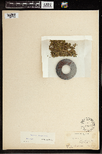 Spirodela polyrrhiza (L.) Schleiden 84653[1337564]Durand, E. J. s.n.1893-09-30 United States, New York, Tompkins, ditch by fairgrounds, 42.440628 -76.496607 |
MIN:Plants | 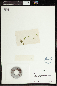 Spirodela polyrrhiza (L.) Schleiden 619026[1337565]Albright, Doris 1711961-07-27 United States, Ohio, Ottawa, West Bass Island, Haunck's Pond, 41.678726 -82.811893 |
MIN:Plants | 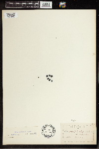 Spirodela polyrrhiza (L.) Schleiden 84652[1337566]Werner, Wm. C. s.n. United States, Ohio, Lake |
MIN:Plants | 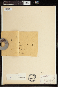 Spirodela polyrrhiza (L.) Schleiden 84651[1337567]Nelson, N. L. T. 22071898-09-00 United States, Illinois, Cook, 87th St. and Stony Island Ave, 41.736981 -87.585486 |
MIN:Plants |  Spirodela polyrrhiza (L.) Schleiden 349196[1337568]Smith, L. B. s.n.1938-07-10 United States, Massachusetts, Middlesex, Horn Pond; Woburn, 42.468995 -71.156559 |
MIN:Plants |  Spirodela polyrrhiza (L.) Schleiden 84660[1337569]Nash., Geo. V. 22821895-00-00 United States, Florida, Brevard |
MIN:Plants |  Spirodela polyrrhiza (L.) Schleiden 84666[1337570]Wright, John S. s.n.1893-06-00 United States, Indiana, Adams, Near Perrysville, 40.051427 -87.433348 |
MIN:Plants |  Spirodela polyrrhiza (L.) Schleiden 594809[1337571]Baldwin, W. K. W. 88361961-06-21 Canada, Ontario, Thunder Bay District; Upper English River Forest Section in part; Lac des Mille Lacs: northwest end, outlet dam to Seine R., 48.833333 -90.5 |
MIN:Plants |  Spirodela polyrrhiza (L.) Schleiden 353092[1337572]Meis s.n.1935-08-21 United States, Nebraska, Garden, Oshkosh; Blue Creek, 41.475008 -102.184135 |
MIN:Plants |  Spirodela polyrrhiza (L.) Schleiden 503787[1337573]Russell, Norman H. 8225381953-08-22 United States, New York, Albany, Edmund Niles Huyck Preserve, seepage water on steps of the Lincoln Pond Dam, 44.141533 -73.574613 |
MIN:Plants |  Spirodela polyrrhiza (L.) Schleiden 276686[1337574]Seymour, F. C. 4581925-07-11 United States, Massachusetts, Hampden, Muddy Brook; Chicopee, 42.208601 -72.520024 |
MIN:Plants |  Spirodela polyrrhiza (L.) Schleiden 389591[1337575]Mcfarland, Frank T. 471940-10-11 United States, Kentucky, Fayette, on pond on Exp. Station grounds; Lexington, 38.0333 -84.5 |
MIN:Plants |  Spirodela polyrrhiza (L.) Schleiden 368731[1337576]McFarland, Frank T. 471940-10-11 United States, Kentucky, Fayette, pond on Exp. Station grounds; Lexington, 38.0333 -84.5 |
MIN:Plants |  Spirodela polyrrhiza (L.) Schleiden 236056[1337577]Congdon, J. W. s.n.1903-08-20 United States, Washington, King, Green Lake; Seattle, 47.677743 -122.337262 |
MIN:Plants |  Spirodela polyrrhiza (L.) Schleiden 84659[1337578]Fernald, M. L. s.n.1892-07-20 United States, Maine, Penobscot, Lower Penobscot Valley, 45.25 -68.6667 |
MIN:Plants |  Spirodela polyrrhiza (L.) Schleiden 564851[1337579]H. G. J. s.n.1875-09-00 United States, Massachusetts, Hampshire, Lord's Pond; Granby, 42.256481 -72.516198 |
MIN:Plants |  Spirodela polyrrhiza (L.) Schleiden 84662[1337580]Nelson, N. L. T. s.n.1898-10-00 United States, Illinois, Cook, Stony Island Ave and 85th St, 41.740541 -87.585728 |
MIN:Plants |  Spirodela polyrrhiza (L.) Schleiden 84664[1337581]Smith, J. G. s.n.1890-07-21 United States, Nebraska, Lancaster |
MIN:Plants |  Spirodela polyrrhiza (L.) Schleiden 765809[1337582]Nelson, N. L. T. s.n.1899-06-00 United States, Illinois, Cook |
MIN:Plants |  Spirodela polyrrhiza (L.) Schleiden 765812[1337583]Nelson, N. L. T. s.n.1898-10-00 United States, Illinois, Cook, Stony Island Ave and 85th St, 41.740541 -87.585728 |
MIN:Plants |  Spirodela polyrrhiza (L.) Schleiden 800483[1337584]Van Sickle, Steve 6601983-06-12 United States, Nebraska, Holt, T25N R11W Sec. 26 NW1/4, 42.110568 -98.564099 |
MIN:Plants |  Spirodela polyrrhiza (L.) Schleiden 800480[1337585]Van Sickle, Steve 6391983-06-12 United States, South Dakota, Gregory, T95N R69W Sec. 4 SE1/4, 43.075097 -99.009336 |
MIN:Plants |  Spirodela polyrrhiza (L.) Schleiden 813622[1337586]Penland, William T. 17331941-08-20 United States, Wyoming, Carbon, slough S of Baggs, 41.035798 -107.657569, 1890m |
MIN:Plants |  Spirodela polyrrhiza (L.) Schleiden 84657[1337587]Umbach, L. M. s.n.1897-08-21 United States, Wisconsin, Walworth |
MIN:Plants |  Spirodela polyrrhiza (L.) Schleiden 389590[1337588]Wadmond, S. C. 27911898-07-16 United States, Wisconsin, Racine, Horlicksville |
MIN:Plants | 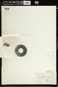 Spirodela polyrrhiza (L.) Schleiden 424202[1337589]Fassett, N. C. 51051927-08-28 United States, Wisconsin, Pepin, Smith Lake, Sec.31 T23N, R14W., 44.431485 -92.125401 |
MIN:Plants | 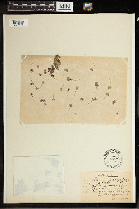 Spirodela polyrrhiza (L.) Schleiden 84682[1337591]Bagenholm, Gosta s.n.1995-06-00 Denmark |
Google Map
Google Maps is a web mapping service provided by Google that features a map that users can pan (by dragging the mouse) and zoom (by using the mouse wheel). Collection points are displayed as colored markers that when clicked on, displays the full information for that collection. When multiple species are queried (separated by semi-colons), different colored markers denote each individual species.