University of Minnesota
http://www.umn.edu/
612-625-5000
http://www.umn.edu/
612-625-5000
Minnesota Biodiversity Atlas
Bell Museum
Dataset: MIN-Plants
Taxa: Araceae
Search Criteria: excluding cultivated/captive occurrences
Bell Museum plants | |
 MIN:Plants | 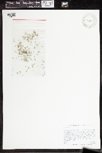 Lemna minor L. 947564[1296419]Lee, Jeffrey G. 1042015-06-23 United States, Minnesota, Saint Louis |
MIN:Plants |  Lemna minor L. 960895[1329755]Perry, Ethan F. 170232017-07-18 United States, Minnesota, Koochiching, 5.0 miles northeast of Wildwood., 47.94 -93.89 |
MIN:Plants | 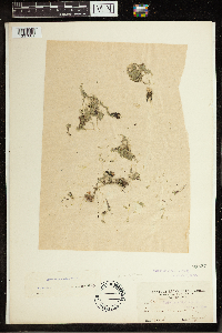 Lemna minor L. 84567[1337061]Hitchcock, A.S. 3731900-06-00 United States, Florida, Fort Myers, 26.640628 -81.872308 |
MIN:Plants | 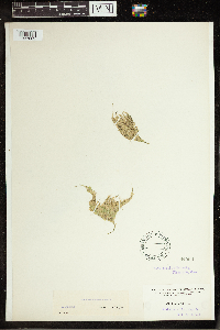 Lemna minor L. 84560[1337063]Nash, Geo. V. 15911894-08-01 United States, Pennsylvania, Lake, Vicinity of Eustis, 28.852768 -81.685353 |
MIN:Plants |  Lemna minor L. 534499[1337064]York, C.L. 543151954-05-08 United States, Texas, Bell, Near site of old Leon River bridge, W. of old Tennessee Valley site., 31.057885 -97.444513 |
MIN:Plants |  Lemna minor L. 503829[1337075]Russell, Norman H. N282653161953-08-26 United States, New York, Albany, Upper part of Lincoln Pond., 44.141533 -73.574613 |
MIN:Plants |  Lemna minor L. 380823[1337076]Fogg, John M. Jr. 3931922-09-22 United States, New Jersey, Camden, Oaklyn, 39.900946 -75.084618 |
MIN:Plants |  Lemna minor L. 84563[1337077]Durand, E. J. s.n.1893-05-00 United States, New York, Tompkins, Fall Creek, 42.440628 -76.496607 |
MIN:Plants | 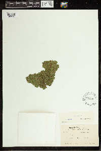 Lemna minor L. 576444[1337078]Fogg, John M. Jr. 3931922-09-22 United States, New Jersey, Camden, Oaklyn, 39.900946 -75.084618 |
MIN:Plants | 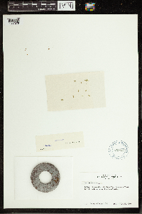 Lemna minor L. 619027[1337079]Albright, Doris 1721961-07-27 United States, Ohio, Ottawa, W. Bass Is, Haunck's Pond, 41.678726 -82.811893 |
MIN:Plants | 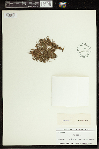 Lemna minor L. 581184[1337080]Dutton, D. L. s.n.1924-09-14 United States, Vermont, Rutland, marsh at Lake Bomoseen; Hubbardton, 43.650629 -73.195586 |
MIN:Plants | 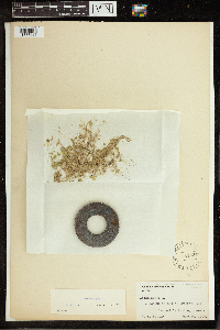 Lemna minor L. 84564[1337081]Palmer, E. L. 2631913-06-26 United States, New York, Tompkins, Dwyer's Pond, Cascadilla Ravine, 42.440628 -76.496607 |
MIN:Plants |  Lemna minor L. 415710[1337082]Berkheimer, David 57821945-05-05 United States, Pennsylvania, Montgomery, .5 mi. SE of Stowe, 40.201334 -75.610269, 46m |
MIN:Plants |  Lemna minor L. 353093[1337083]Neilson, E. L. s.n.1935-08-21 United States, Nebraska, Blue Creek, 41.633822 -102.11754 |
MIN:Plants |  Lemna minor L. 411654[1337084]Small, John K. s.n.1890-08-15 United States, Pennsylvania, Lancaster, on Delaware above Easton, PA, 41.1167 -79.5333 |
MIN:Plants |  Lemna minor L. 587833[1337266]Heikkinen, Lauri s.n.1963-07-28 Finland, Siikalahti, 63.516667 26.983333 |
MIN:Plants |  Lemna minor L. 84585[1337267][illegible] s.n. |
MIN:Plants |  Lemna minor L. 84586[1337268]Bågenholm, Gösta s.n.1895-07-00 Sweden |
MIN:Plants |  Lemna minor L. 84587[1337269]Ipse s.n.1901-07-00 Sweden |
MIN:Plants |  Lemna minor L. 84588[1337270] s.n.1867-06-07 Switzerland |
MIN:Plants |  Lemna minor L. 84589[1337271]Lomax, A.E. s.n. United Kingdom, Cheshire |
MIN:Plants |  Lemna minor L. 343334[1337272]Asplund, Erik s.n.1914-06-20 Sweden |
MIN:Plants |  Lemna minor L. 84590[1337273]Copineau, C. s.n.1889-05-05 France, Hauts-de-France, Somme |
MIN:Plants |  Lemna minor L. 84591[1337274][illegible] s.n.1884-04-00 Sweden |
MIN:Plants |  Lemna minor L. 84592[1337275][illegible] s.n. Sweden |
MIN:Plants |  Lemna minor L. 274972[1337276]Glück, H. s.n.1899-07-00 Germany |
MIN:Plants |  Lemna minor L. 384573[1337277] 509 Russian Federation |
MIN:Plants |  Lemna minor L. 571087[1337289]Willa, Eileen s.n. New Zealand, Stewart Island, Half Moon Bay, -46.89313 168.143238 |
MIN:Plants | 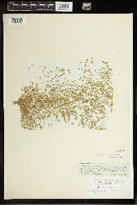 Lemna minor L. 84593[1337290]Heller, A. A. s.n.1895-04-12 United States, Hawaii, Honolulu, Kapi'olani Park at Diamond Head, 21.250992 -157.812021 |
MIN:Plants | 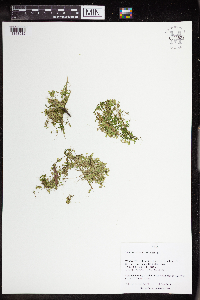 Lemna minor L. 963528[1348912]Nee, M. H. 642622018-06-17 United States, Wisconsin, Richland, 4 km NE of Gotham, Moss Hollow Lake, 43.2475 -90.255, 251m |
MIN:Plants | Lemna minor L. []Timothy J. S. Whitfeld 31842022-06-03 United States, Minnesota, Washington, Crystal Spring Scientific and Natural Area, 0.4 miles northeast of the intersection of Scandia Trail North and Hwy 95, 45.25999 -92.763754, 247m |
MIN:Plants |  Lemna minor L. 973596[1397150]Bezanson, Char A. 2641991-08-14 United States, Minnesota, Rice, in the main unit of Boyd Sartell Wildlife Management Area. Marsh at the west edge of Shields Lake, 44.377646 -93.453515 |
MIN:Plants | Lemna minor L. []Timothy J. S. Whitfeld 3588b2023-07-06 United States, Minnesota, Marshall, Agassiz National Wildlife Refuge, Agassiz Wilderness Area, 1 mile west of Webster Creek Pool, 4.7 miles north of main administration building, 48.3689 -95.96569, 346m |
MIN:Plants |  Spirodela polyrrhiza (L.) Schleiden 490729[1337508]Scott, P. 14002002-08-18 United States, Minnesota, Lake, Lake County ... Swamp Lake by boardwalk part of portage, BWCAW. T66N R6W sec.24 SWSENW.;Boundary Waters Canoe Area Wilderness / Superior National Forest;066N;06W;24, 48.184614 -91.042089 |
MIN:Plants |  Spirodela polyrrhiza (L.) Schleiden 426751[1337510]Juhnke, C. 256 CMJ FRO1999-05-19 United States, Minnesota, Goodhue, Frontenac State Park Goodhue County ... 0.5 miles south of interpretive area ... T112N R13W NE NE SE 3;Frontenac State Park;112N;13W;03, 44.535145 -92.35936 |
MIN:Plants |  Spirodela polyrrhiza (L.) Schleiden 493515[1337509]Leenhouts, R.; et al. 15422003-08-16 United States, Minnesota, Saint Louis, St. Louis County ... In cove of Pocket Lake, BWCAW. T67N R14W sec.3 NENESW.;Boundary Waters Canoe Area Wilderness / Superior National Forest;067N;14W;03, 48.318328 -92.116153 |
MIN:Plants |  Spirodela polyrrhiza (L.) Schleiden 386178[1337488]Moyle, J. B. 37981944-07-26 United States, Minnesota, Saint Louis, near Elmer (T53 R19), 47.103642 -92.777153 |
MIN:Plants |  Spirodela polyrrhiza (L.) Schleiden 429736[1337511]Smith, Michael 2691996-08-29 United States, Minnesota, Koochiching, Kabetogama State Forest. Voyageurs National Park. Koochiching Co.; Plot name: Voya 33 DNR # 5771; Rat Root River. 48 32'49' N 93 13'40' W [this locale is not in the Nat. Park but Kabetogama State Forest]. 070N 22W, 48.5469437 -93.2277756 |
MIN:Plants |  Spirodela polyrrhiza (L.) Schleiden 903624[1337501]Lee, Michael MDL41732005-09-15 United States, Minnesota, Becker, Becker County...In the Otter Tail River four miles north of Frazee...just downstream from the Wannigan Road bridge... T138N R40W NE1/4 of SW1/4 of NE1/4 of Sec. 11. 138N 40W 11, 46.781101 -95.700537 |
MIN:Plants |  Spirodela polyrrhiza (L.) Schleiden 910684[1337497]Smith, Welby 217561992-08-27 United States, Minnesota, Brown, Tauer Prairie Scientific Natural Area. Brown County...Tauer Prairie State Scientific and Natural Area, about 7 miles south-southwest of New Ulm...T 109N R 31W NW1/4 of SW1/4 of Sec 35. 109N 31W 35, 44.2013889 -94.5302778 |
MIN:Plants |  Spirodela polyrrhiza (L.) Schleiden 332360[1337484]Oestlund, O. s.n.1888-08-24 United States, Minnesota, Hennepin, [no further data], 45 -93.47 |
MIN:Plants |  Spirodela polyrrhiza (L.) Schleiden 84678[1337483]Ballard, C.A. B4411891-07-00 United States, Minnesota, Scott, Prior Lake [T115N;R21W], 44.753605 -93.344349 |
MIN:Plants |  Spirodela polyrrhiza (L.) Schleiden 837213[1337485]Smith, Welby R. 201271991-09-10 United States, Minnesota, Aitkin, In Elm Island Lake, about 6 miles southeast of Aitkin. T 46N R 26W NE1/4 of NE1/4 of Sec 21, 46.458889 -93.625 |
MIN:Plants | 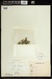 Spirodela polyrrhiza (L.) Schleiden 265428[1337466]Goldsmith, G. G.78 United States, Minnesota, Rice, Northfield [T111N;R20W;S1], 44.45833 -93.16139 |
MIN:Plants | 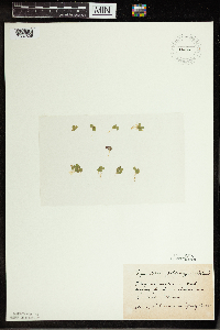 Spirodela polyrrhiza (L.) Schleiden 270250[1337529]Gunderson, Harvey s.n.1940-07-02 United States, Minnesota, Saint Louis, In a fish rearing pond in Lester Park, Duluth.;North Shore;050N;13W;05, 46.844016 -92.016103 |
MIN:Plants | 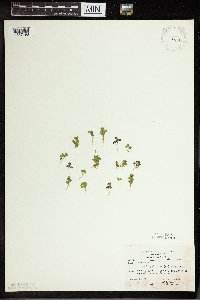 Spirodela polyrrhiza (L.) Schleiden 270808[1337498]Carter, J.; et al. s.n.1981-07-11 United States, Minnesota, Saint Louis, Bass Lake.;;064N;12W;, 48.020352 -91.863148 |
MIN:Plants | 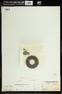 Spirodela polyrrhiza (L.) Schleiden 276685[1337528]Fassett, N.; Hotchkiss, N. 31931926-08-09 United States, Minnesota, Wabasha, Wabasha.;;N;;, 44.220979 -92.196055 |
MIN:Plants |  Spirodela polyrrhiza (L.) Schleiden 281298[1337512]Moyle, J. 5601931-07-12 United States, Minnesota, Clearwater, Itasca Park. Clearwater Co. Mississippi River. SW-SW-35 T. 144 R. 36;Itasca State Park;144N;36W;35, 47.246503 -95.201577 |
MIN:Plants |  Spirodela polyrrhiza (L.) Schleiden 347564[1337482]Moyle, J. B. 30991937-09-17 United States, Minnesota, Scott, Fisher Lake [Minnesota Valley National Wildlife Refuge; T27N;R21W], 44.7995 -93.40988 |
MIN:Plants |  Spirodela polyrrhiza (L.) Schleiden 347982[1337451]Buell, Murray F. 6551933-08-01 United States, Minnesota, Anoka, Decodon Pond [Cedar Creek National History Area; T34N; R23W; S27], 45.406779 -93.193727 |
MIN:Plants |  Spirodela polyrrhiza (L.) Schleiden 354020[1337530]Lakela, Olga 26621938-08-01 United States, Minnesota, Saint Louis, Superior Bay front. Oatka Beach addition.;;049N;13W;18, 46.74675 -92.066988 |
MIN:Plants |  Spirodela polyrrhiza (L.) Schleiden 360910[1337472]Moyle, J. B. 35591940-07-02 United States, Minnesota, Saint Louis, Hatchery pool, Duluth, 46.740336 -92.140616 |
MIN:Plants |  Spirodela polyrrhiza (L.) Schleiden 369896[1337443]Moore, John 130271940-06-19 United States, Minnesota, Blue Earth, West shore of Eagle Lake, S.E.1/4, Section 1, Mankato Township [T108N;R26W;S1], 44.188701 -93.898739 |
MIN:Plants |  Spirodela polyrrhiza (L.) Schleiden 370700[1337463]Moore, John W. 137131940-10-01 United States, Minnesota, Isanti, near the shore of Long Lake, N.E. 1/4, Section 4, Cambridge Township [T36N;R23W], 45.637428 -93.214098 |
MIN:Plants |  Spirodela polyrrhiza (L.) Schleiden 371111[1337444]Moore, John; Moore, Marjorie 136811940-09-28 United States, Minnesota, Anoka, east side of the lake, 1/2 mile west of Bethel [T34N;R24W], 45.427962 -93.326981 |
MIN:Plants |  Spirodela polyrrhiza (L.) Schleiden 372190[1337458]Moore, John W. 149681941-08-07 United States, Minnesota, Kanabec, North-east shore of Knife Lake. [T41N;R24W], 46.025971 -93.369213 |
MIN:Plants |  Spirodela polyrrhiza (L.) Schleiden 381696[1337461]Moore, John W. 155811942-06-28 United States, Minnesota, Polk, 5 miles east of Fertile [T147N;R45W], 47.543099 -96.259086 |
MIN:Plants |  Spirodela polyrrhiza (L.) Schleiden 383537[1344042]Moore, John 158681943-06-29 United States, Minnesota, Dakota, Chub Lake. [T113N;R20W], 44.587247 -93.217572 |
MIN:Plants |  Spirodela polyrrhiza (L.) Schleiden 385745[1337491]Moyle, J. B. 38971944-09-21 United States, Minnesota, Saint Louis, Wolf Lake flowage [Cloquet Valley State Forest; T55N;R13W], 47.241859 -91.983939 |
MIN:Plants | 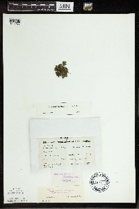 Spirodela polyrrhiza (L.) Schleiden 386180[1337492]Moyle, J. B. 38491944-08-29 United States, Minnesota, Saint Louis, in Swan River near Calyx, 47.067962 -92.898091 |
MIN:Plants | 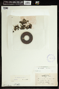 Spirodela polyrrhiza (L.) Schleiden 407743[1337525]Lakela, Olga 91911949-07-30 United States, Minnesota, Saint Louis, In Frying Pan Lake, Palo.;;057N;15W;, 47.415324 -92.239713 |
MIN:Plants | 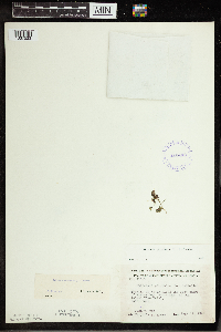 Spirodela polyrrhiza (L.) Schleiden 412449[1337523]Moore, John; Moore, Marjorie 117191939-08-14 United States, Minnesota, Koochiching, Koochiching Co.; Along the west shore of Krause Bay, south east of the Island View Hotel.;Voyageurs National Park;071N;22W;, 48.609164 -93.157413 |
MIN:Plants | 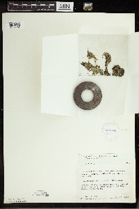 Spirodela polyrrhiza (L.) Schleiden 412784[1337457]Moore, John W. 109911939-07-20 United States, Minnesota, Lake of the Woods, West of the mouth of Pine Creek, Angle Inlet. [Northwest Angle, T168N;R34W], 49.344621 -95.028893 |
MIN:Plants |  Spirodela polyrrhiza (L.) Schleiden 412872[1337459]Moore, John W. 114341939-08-04 United States, Minnesota, Roseau, Marvin Lake along the southeast shore, 2 1/2 miles west of Longworth. [Lost River State Forest; T164N;R37W], 48.986092 -95.420148 |
MIN:Plants |  Spirodela polyrrhiza (L.) Schleiden 413673[1337518]Moore, John; et al. 107511939-05-29 United States, Minnesota, Clearwater, Near the Garrison Point dock, along the shore of Lake Itasca, Itasca State Park.;Itasca State Park;143N;36W;, 47.19557 -95.233216 |
MIN:Plants |  Spirodela polyrrhiza (L.) Schleiden 418971[1337442]Ahlgren, Clifford 2031949-07-09 United States, Minnesota, Lake, Sec. 20, T. 64.N, R. 10W. [Boundary Waters Canoe Area Wilderness / Superior National Forest], 48.002267 -91.639633 |
MIN:Plants |  Spirodela polyrrhiza (L.) Schleiden 422747[1337527]Lakela, Olga 77851948-09-04 United States, Minnesota, Saint Louis, Near New Duluth.;;048N;15W;, 46.657011 -92.257257 |
MIN:Plants |  Spirodela polyrrhiza (L.) Schleiden 425839[1337441]Emanuel, J. P. 5081951-06-28 United States, Minnesota, Winona, Crooked Sough-vic. of Winona [T107N;R7W], 44.052588 -91.672687 |
MIN:Plants |  Spirodela polyrrhiza (L.) Schleiden 437373[1337456]Moore, John W. 121371939-08-26 United States, Minnesota, Lake of the Woods, West side of Baudette Bay, at Baudette. [T161N;R31W], 48.736605 -94.658188 |
MIN:Plants |  Spirodela polyrrhiza (L.) Schleiden 440003[1311640]Myhre, K. 41221993-07-11 United States, Minnesota, Pine, Pine Co. Located on the N and NW shores of Little Pine Lake. T43N R21W SW1/4 of SE1/4 of Sec 10;;043N;22W;10, 46.223757 -92.980501 |
MIN:Plants |  Spirodela polyrrhiza (L.) Schleiden 442019[1337470]Moore, John W. 186631946-06-18 United States, Minnesota, Mower, Red Cedar River at Austin [T102N;R18W], 43.630435 -92.989503 |
MIN:Plants |  Spirodela polyrrhiza (L.) Schleiden 442155[1337460]Moore, John W. 190551946-08-16 United States, Minnesota, Stevens, along Highway No. 28, four miles north west of Morris. [T125N;R41W], 45.628995 -95.820171 |
MIN:Plants |  Spirodela polyrrhiza (L.) Schleiden 442408[1337526]Lakela, Olga 131771951-07-13 United States, Minnesota, Saint Louis, Bald Rock Creek, Rainy Lake.;;N;;, 48.623498 -93.206383 |
MIN:Plants |  Spirodela polyrrhiza (L.) Schleiden 444732[1337445]Moore, John W. 194681947-06-06 United States, Minnesota, Clay, Clay Co.; 4 miles South east of Hawley [T139N;R44W], 46.848411 -96.238952 |
MIN:Plants |  Spirodela polyrrhiza (L.) Schleiden 444756[1337481]Moore, John W. 191251946-08-29 United States, Minnesota, Koochiching, Bartlett Lake at Northome [T151N;R28W], 47.889524 -94.227769 |
MIN:Plants |  Spirodela polyrrhiza (L.) Schleiden 444937[1337469]Moore, John W. 185311946-06-07 United States, Minnesota, Le Sueur, north arm of Lake Elysian [T109N;R24W], 44.239498 -93.707142 |
MIN:Plants |  Spirodela polyrrhiza (L.) Schleiden 444938[1337524]Moore, John; Huff, N. 183661945-10-06 United States, Minnesota, Stearns, At old granite quarries, 2 mi. W of St. Cloud. Stearns Co.;;124N;29W;, 45.543642 -94.322053 |
MIN:Plants |  Spirodela polyrrhiza (L.) Schleiden 444998[1337480]Moore, John W. 191501946-08-30 United States, Minnesota, Beltrami, Growing at end of eastern peninsula, between upper and lower Red Lakes. [Red Lake Indian Reservation; T153N;R34W], 48.06332 -95.008892 |
MIN:Plants |  Spirodela polyrrhiza (L.) Schleiden 445801[1337473]Moore, John W. 183181945-10-05 United States, Minnesota, Pine, Lake Pokegama, 3 miles west of Pine City [T39N;R22W], 45.861072 -93.081791 |
MIN:Plants | 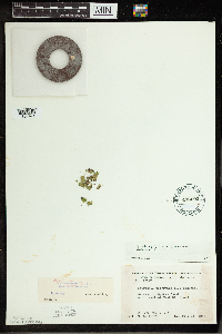 Spirodela polyrrhiza (L.) Schleiden 446292[1337474]Moore, John W. 188361946-07-31 United States, Minnesota, Benton, Mayhew Creek, north east of East St. Cloud [T36N;R30W], 45.603343 -94.07039 |
MIN:Plants | 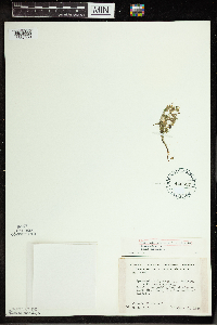 Spirodela polyrrhiza (L.) Schleiden 446537[1337453]Moore, John W. 185671946-06-11 United States, Minnesota, Itasca, edge of North Star Lake, 5 miles south of Marcell. [Chippewa National Forest; T59N;R26W], 47.587871 -93.641146 |
MIN:Plants | 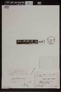 Spirodela polyrrhiza (L.) Schleiden 448423[1311612]Moore, John; Huff, N. 18959 a1946-08-03 United States, Minnesota, Benton, Benton County ... S. E. 1/4 Sec. 21, St. George Township;;036N;29W;21, 45.596785 -93.954974 |
MIN:Plants | 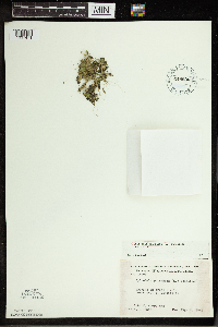 Spirodela polyrrhiza (L.) Schleiden 448636[1337471]Moore, John W. 189691946-08-03 United States, Minnesota, Wright, creek 1 mile north west of Monticello [T121N;R25W], 45.278428 -93.832121 |
MIN:Plants | 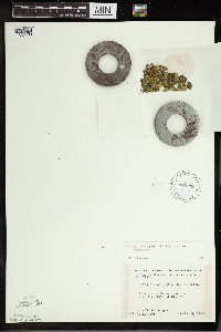 Spirodela polyrrhiza (L.) Schleiden 449296[1337489]Moore, John W. 179011945-07-24 United States, Minnesota, Morrison, west end of Fish Trap Lake at Lincoln [T32N;R31W], 46.238341 -94.581982 |
MIN:Plants |  Spirodela polyrrhiza (L.) Schleiden 476292[1337507]Myhre, K. 68271997-07-04 United States, Minnesota, Morrison, Morrison Co.; Sullivan Lake. Located 15 miles northeast of the town Pierz. Plants occur along the north bay of the lake; Morrison Co.; Sullivan Lake. Located 15 miles northeast of the town Pierz. Plants occur along the north bay of the lake; T 42N R 29W SW1/4 of NE1/4 of SEc 1. 042N 29W 1, 46.149496 -93.946975 |
MIN:Plants |  Spirodela polyrrhiza (L.) Schleiden 476468[1311643]Myhre, K. 68461997-07-07 United States, Minnesota, Mille Lacs, Mille Lacs Kathio State Park. Mille Lacs Co.; Shakopee Lake. Located 2 miles northwest of the town of Onamia. Plants occur along the northwest channel Mille Lacs Co.; Shakopee Lake. Located 2 miles northwest of the town of Onamia. Plants occur along the northwest channel and bay of the lake; T 42N R 27W SW1/4 of SE1/4 of sec 15. 042N 27W 15, 46.120557 -93.734999 |
MIN:Plants |  Spirodela polyrrhiza (L.) Schleiden 497528[1337462]Moore, John W. 202461949-06-22 United States, Minnesota, Beltrami, west shore of Lake Bemidji. [T146N;R33W], 47.453829 -94.863614 |
MIN:Plants |  Spirodela polyrrhiza (L.) Schleiden 507226[1337440]Moore, John W. 206621950-06-20 United States, Minnesota, Martin, North end of Budd Lake at Fairmont. [T102N;R30W], 43.630246 -94.430321 |
MIN:Plants |  Spirodela polyrrhiza (L.) Schleiden 507372[1337517]Moore, John 209491950-09-28 United States, Minnesota, Murray, Along the S shore of Lime Lake.;;106N;40W;, 43.978473 -95.642866 |
MIN:Plants |  Spirodela polyrrhiza (L.) Schleiden 514887[1311639]Cholewa, A. 25041997-06-26 United States, Minnesota, Anoka, Anoka Co. NE bay of Ham Lake (in the town of Ham Lake). T32N R23W sec.16.;;032N;23W;16, 45.262524 -93.214112 |
MIN:Plants |  Spirodela polyrrhiza (L.) Schleiden 519576[1337504]Winkelman, J.; et al. 1027UM1996-06-24 United States, Minnesota, Goodhue, Gores Pool Wildlife Management Area. Upper Mississippi River Corridor; Goodhue Co.; Pool 3, River Mile 804.5...UTM E522695 N4946612... North Lake. N from landing along shoreline.. 114N 16W 0, 44.6666667 -92.7166667 |
MIN:Plants | Spirodela polyrrhiza (L.) Schleiden 458905[]Smith, Welby 147771988-08-08 United States, Minnesota, Washington, Washington County ... on the Mississippi River, about one mile south of St. Paul Park. NW1/4 SW1/4 sec.13, T 27N R 22W. 027N 22W 13, 44.8252778 -93.0016667 |
MIN:Plants |  Spirodela polyrrhiza (L.) Schleiden 526194[1337490]Moore, John W. 211351951-06-27 United States, Minnesota, Todd, north end of Little Birch Lake at Ward Springs [T127N;R33W], 45.803167 -94.829109 |
MIN:Plants |  Spirodela polyrrhiza (L.) Schleiden 526296[1337475]Moore, John W. 210641951-06-26 United States, Minnesota, Todd, backwater of the Long Prairie River at Long Prairie [T129N;R33W], 45.976547 -94.83484 |
MIN:Plants |  Spirodela polyrrhiza (L.) Schleiden 538402[1337503]Hale, T. s.n.1861-00-00 United States, Minnesota, Ramsey, St. Paul;;029N;23W;00, 44.992077 -93.166387 |
MIN:Plants |  Spirodela polyrrhiza (L.) Schleiden 542520[1337446]Moore, John W. 216261952-05-23 United States, Minnesota, Cass, East shore of Steamboat Lake [Leech Lake Indian Reservation / Welsh Lake State Forest; T1441;R31W], 47.277294 -94.584464 |
MIN:Plants |  Spirodela polyrrhiza (L.) Schleiden 549957[1337452]Moore, John W. 222761954-09-22 United States, Minnesota, Lincoln, on island at north east end of Lake Benton [T110N;R45W;s25], 44.306759 -96.210724 |
MIN:Plants |  Spirodela polyrrhiza (L.) Schleiden 550159[1337516]Moore, John; et al. 221761954-09-20 United States, Minnesota, Lyon, Lyon County...Prairie Lake, 1 mi. E of Balaton.;;109N;41W;, 44.239535 -95.775284 |
MIN:Plants |  Spirodela polyrrhiza (L.) Schleiden 551580[1337465]Cotter, Shirley 6321948-07-27 United States, Minnesota, Clearwater, Itasca State Park [T143N;R36W], 47.19557 -95.2332161 |
MIN:Plants |  Spirodela polyrrhiza (L.) Schleiden 553938[1337455]Moore, John W. 225551955-06-03 United States, Minnesota, Sibley, 1/2 mile south of Green Isle. [T114N;R26W], 44.673646 -93.949624 |
Google Map
Google Maps is a web mapping service provided by Google that features a map that users can pan (by dragging the mouse) and zoom (by using the mouse wheel). Collection points are displayed as colored markers that when clicked on, displays the full information for that collection. When multiple species are queried (separated by semi-colons), different colored markers denote each individual species.