University of Minnesota
http://www.umn.edu/
612-625-5000
http://www.umn.edu/
612-625-5000
Minnesota Biodiversity Atlas
Bell Museum
Dataset: MIN-Plants
Taxa: Lycopodiaceae
Search Criteria: excluding cultivated/captive occurrences
Bell Museum plants | |
 MIN:Plants | 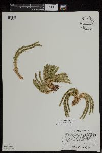 Huperzia appressa (Desv.) Á. Löve & D. Löve 509008[1294981]Lee, Michael D. MDL28292000-07-18 United States, Minnesota, Lake, cliffs overlooking the Beaver River 1-1/2 miles west of Beaver Bay. T55N R8W N1/2 of SW1/4 of SE1/4 Sec. 10, SE1/4 of NW1/4 of SE1/4 Sec. 10, 47.2577 -91.300444 |
MIN:Plants | 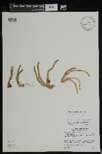 Huperzia appressa (Desv.) Á. Löve & D. Löve 493615[1295046]Gerdes, Lynden B. 44882001-09-06 United States, Minnesota, Lake, T56N R07W S09NENW. Tettegouche State Park. Silver Bay. Northwest-facing cliff approximately 0.44 mile east of Nipisquit Lake., 47.33958 -91.198054 |
MIN:Plants | 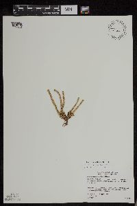 Huperzia appressa (Desv.) Á. Löve & D. Löve 480586[1295054]Gerdes, Lynden B. 41772000-07-31 United States, Minnesota, Lake, T57N R07W S13SENE. Little Marais. Section 13 Cliff feature approx 1 mile NNE of the Finland Cemetary, 47.410745 -91.110162 |
MIN:Plants | 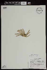 Huperzia appressa (Desv.) Á. Löve & D. Löve 478099[1294979]Gerdes, Lynden B. 40182000-07-06 United States, Minnesota, Lake, T57N R07W S24NESE. Little Marais; approx. 1/4 mile SE of the Superior Hiking Trail and County 6 junction. Approx. 1/2 mile SE of the Finland Cemetary., 47.410745 -91.110162 |
MIN:Plants | 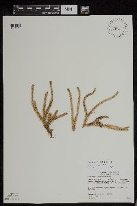 Huperzia appressa (Desv.) Á. Löve & D. Löve 480583[1295064]Gerdes, Lynden B. 40802000-07-17 United States, Minnesota, Lake, T56N R08W S24NENW. Tettegouche State Park, northwest of Silver Bay. Long, north-facing (east-west trending) cliff feature 0.25-0.50 mile north of Bear and Bean Lakes., 47.33958 -91.198054 |
MIN:Plants | 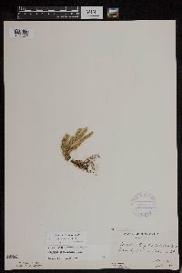 Huperzia appressa (Desv.) Á. Löve & D. Löve 357444[1295039]Butters, F.K. 591938-07-07 United States, Minnesota, Cook, At W end of Mountain Lake. Twp. 65N R 1E [Boundary Waters Canoe Area Wilderness / Superior National Forest], 48.10737 -90.224172 |
MIN:Plants | 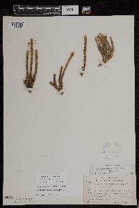 Huperzia appressa (Desv.) Á. Löve & D. Löve 387741[1295040]Lakela, Olga 60631943-07-21 United States, Minnesota, Lake, On Beaver Island in Lake Superior. East Beaver Bay, 47.2677 -91.282943 |
MIN:Plants | 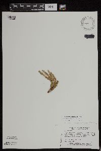 Huperzia appressa (Desv.) Á. Löve & D. Löve 439474[1294985]Myhre, K.M. 40201993-07-05 United States, Minnesota, Pine, Located 2 mi northeast of the town of Sandstone; escarpment of the Kettle River. T43N R20W NW1/4 of SE1/4 of Sec 35. [Banning State Park], 46.164078 -92.834671 |
MIN:Plants | 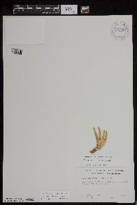 Huperzia appressa (Desv.) Á. Löve & D. Löve 691349[1295038]Clemants, Steven E. 7891977-07-30 United States, Minnesota, Cook, Pigeon Point; T64N, R7E, Sec.27 NE1/4 [Grand Portage Indian Reservation], 47.997942 -89.538143 |
MIN:Plants | 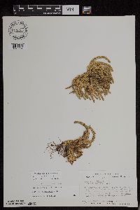 Huperzia appressa (Desv.) Á. Löve & D. Löve 728735[1295037]Coffin, B. 341980-08-21 United States, Minnesota, Cook, T65N, R1E, SW1/4, SW1/4, Sec.28. Clearwater Lake. Approx. 1 3/4 mi from W end of lake on S shore on first N-fac Cook Co. T65N, R1E, SW1/4, SW1/4, Sec.28. Clearwater Lake. Approx. 1 3/4 mi from W end of lake on S shore on first N-facing cliff. [Boundary Waters Canoe Area Wilderness / Superior National Forest], 48.08486 -90.335202 |
MIN:Plants | 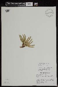 Huperzia appressa (Desv.) Á. Löve & D. Löve 493665[1295051]Gerdes, Lynden B. 44132001-07-26 United States, Minnesota, Cook, T59N R04W S01NWSW. Leveaux Mountain, Superior National Forest. Approximately 4.0 miles NE of Tofte, 47.623034 -90.777434 |
MIN:Plants | 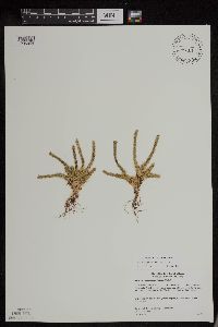 Huperzia appressa (Desv.) Á. Löve & D. Löve 440619[1295063]Gerdes, Lynden B. 40642000-07-17 United States, Minnesota, Lake, T56N R08W S24SESW. Tettegouche State Park, northwest of Silver Bay. Long, north-facing (east-west trending) cliff feature approx. 0.31 mile north of Bean Lake., 47.33958 -91.198054 |
MIN:Plants | 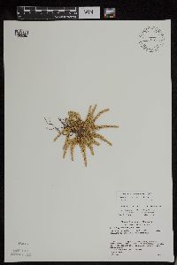 Huperzia appressa (Desv.) Á. Löve & D. Löve 488240[1295050]Gerdes, Lynden B. 43622001-06-14 United States, Minnesota, Lake, T56N R07W S22NWSW. Tettegouche State Park. Silver Bay. Palisade Head., 47.33958 -91.198054 |
MIN:Plants | 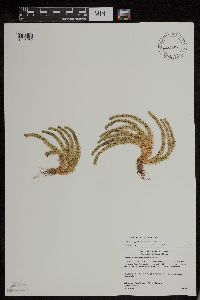 Huperzia appressa (Desv.) Á. Löve & D. Löve 477227[1295062]Gerdes, Lynden B. 40852000-07-17 United States, Minnesota, Lake, T56N R08W S24SESW. Tettegouche State Park, northwest of Silver Bay. Long, north-facing (east-west trending) cliff feature 0.25-0.50 mile north of Bear and Bean Lakes., 47.33958 -91.198054 |
MIN:Plants | 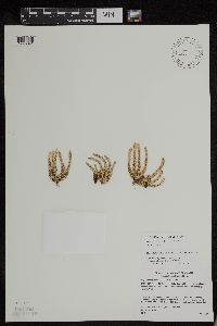 Huperzia appressa (Desv.) Á. Löve & D. Löve 489112[1295041]Gerdes, Lynden B. 43642001-06-14 United States, Minnesota, Lake, T56N R07W S22SENW. Tettegouche State Park. Silver Bay. Palisade Head. Cliff overlooking Pallisade Creek., 47.33958 -91.198054 |
MIN:Plants | 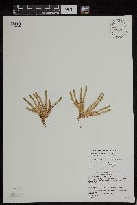 Huperzia appressa (Desv.) Á. Löve & D. Löve 493605[1295049]Gerdes, Lynden B. 44362001-08-02 United States, Minnesota, Lake, T56N R07W S17SWNE. Tettegouche State Park, Mount Trudee. Approximately 2.6 miles north of Silver Bay, 47.33958 -91.198054 |
MIN:Plants | 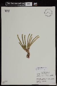 Huperzia appressa (Desv.) Á. Löve & D. Löve 477746[1295044]Gerdes, Lynden B. 41672000-07-31 United States, Minnesota, Lake, T57N R07W S13SENE. Little MaraisN. Section 13 Cliff feature approx 1 mile NNE of the Finland Cemetary., 47.410745 -91.110162 |
MIN:Plants | 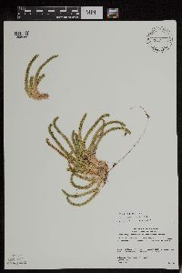 Huperzia appressa (Desv.) Á. Löve & D. Löve 302332[1295066]Gerdes, Lynden B. 42362000-08-18 United States, Minnesota, Lake, T57N R07W S35NWSW. Wolf Ridge Environmental Center, Finland, MN. Raven lake cliff., 47.379057 -91.182368 |
MIN:Plants | 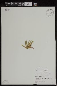 Huperzia appressa (Desv.) Á. Löve & D. Löve 477300[1295060]Gerdes, Lynden B. 42022000-08-02 United States, Minnesota, Lake, T56N R08W S24NENW. Tettegouche State Park. Cliff feature approx. 2.25 miles NNW of Silver Bay and 1 mile south of Lax Lake., 47.33958 -91.198054 |
MIN:Plants | 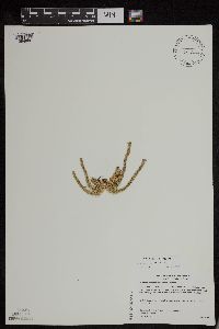 Huperzia appressa (Desv.) Á. Löve & D. Löve 477233[1294986]Gerdes, Lynden B. 40762000-07-17 United States, Minnesota, Lake, T56N R08W S24SESW. Tettegouche State Park, northwest of Silver Bay, MN. Long, north-facing (east-west trending) cliff feature 0.25-0.50 mile north of Bear and Bean Lakes., 47.33958 -91.198054 |
MIN:Plants | 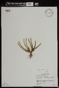 Huperzia appressa (Desv.) Á. Löve & D. Löve 480567[1295055]Gerdes, Lynden B. 41782000-07-31 United States, Minnesota, Lake, T57N R07W S13SENE. Little Marais. Section 13 Cliff feature approx 1 mile NNE of the Finland Cemetary, 47.410745 -91.110162 |
MIN:Plants | 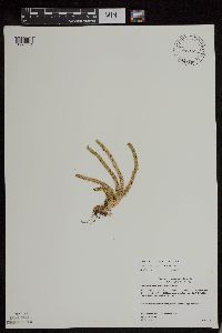 Huperzia appressa (Desv.) Á. Löve & D. Löve 480568[1295061]Gerdes, Lynden B. 41952000-08-02 United States, Minnesota, Lake, T56N R08W S24NENW. Tettegouche State Park. Cliff feature approx. 2.25 miles NNW of Silver Bay and 1 mile south of Lax Lake., 47.33958 -91.198054 |
MIN:Plants | 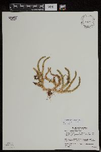 Huperzia appressa (Desv.) Á. Löve & D. Löve 302331[1295045]Gerdes, Lynden B. 39062000-05-23 United States, Minnesota, Lake, T56N R08W S27NESE. Silver Bay. North-facing rock cliff approx. 0.5 miles north of the Cty. 4 & Silver Bay Rd. junction., 47.307471 -91.336257 |
MIN:Plants | 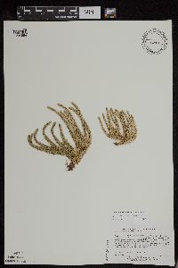 Huperzia appressa (Desv.) Á. Löve & D. Löve 508921[1294984]Lee, Michael D. MDL27262000-06-12 United States, Minnesota, Lake, 4-1/2 miles east-northeast of Finland. T57N R7W N1/2 of SE1/4 of NE1/4 Sec. 13, 47.422385 -91.161398 |
MIN:Plants | 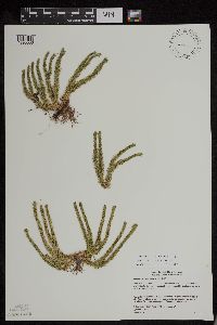 Huperzia appressa (Desv.) Á. Löve & D. Löve 477231[1295056]Gerdes, Lynden B. 41302000-07-25 United States, Minnesota, Lake, T57N R07W S34NESE. Wolf Ridge Environmental Learning Center, Finland, MN. Southwest portion of the Wolf Lake cliff feature., 47.378962 -91.203696 |
MIN:Plants | 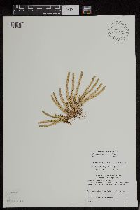 Huperzia appressa (Desv.) Á. Löve & D. Löve 488052[1295048]Gerdes, Lynden B. 44352001-08-02 United States, Minnesota, Lake, T56N R07W S17SWNE. Tettegouche State Park, Mount Trudee. Approximately 2.6 miles north of Silver Bay, 47.33958 -91.198054 |
MIN:Plants | 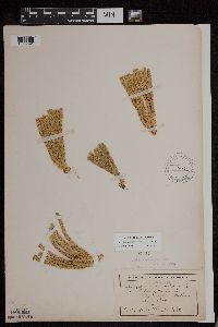 Huperzia appressa (Desv.) Á. Löve & D. Löve 55437[1295091]Wheeler, W.A. 6801900-08-00 United States, Michigan, Keweenaw, Tobin's Harbor, Isle Royal [Isle Royale National Park] |
MIN:Plants | 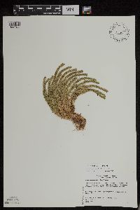 Huperzia appressa (Desv.) Á. Löve & D. Löve 480581[1294980]Gerdes, Lynden B. 4086A2000-07-17 United States, Minnesota, Lake, T56N R08W S24SESW. Tettegouche State Park, northwest of Silver Bay, MN. Long, north-facing (east-west trending) cliff feature 0.25-0.50 mile north of Bear and Bean Lakes., 47.33958 -91.198054 |
MIN:Plants | 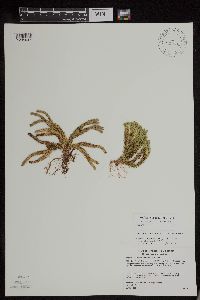 Huperzia appressa (Desv.) Á. Löve & D. Löve 493518[1295047]Gerdes, Lynden B. 43532001-06-11 United States, Minnesota, Lake, T56N R07W S07NENW. Tettegouche State Park. Silver Bay. Outcrop/cliff feature visible from MicMac camp road, approximately 0.25 mile east of Cty. 4., 47.33958 -91.198054 |
MIN:Plants | 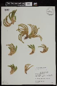 Huperzia appressa (Desv.) Á. Löve & D. Löve 480566[1295065]Gerdes, Lynden B. 41962000-08-02 United States, Minnesota, Lake, T56N R08W S24NENW. Tettegouche State Park. Cliff feature approx. 2.25 miles NNW of Silver Bay and 1 mile south of Lax Lake., 47.33958 -91.198054 |
MIN:Plants | 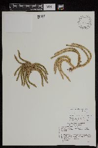 Huperzia appressa (Desv.) Á. Löve & D. Löve 489102[1294978]Gerdes, Lynden B. 44372001-08-02 United States, Minnesota, Lake, T56N R07W S17SENW. Tetttegouche State Park, Mount Trudee. Approximately 2.5 miles north of Silver Bay, 47.336138 -91.250865 |
MIN:Plants | 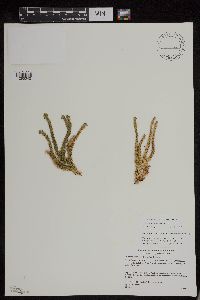 Huperzia appressa (Desv.) Á. Löve & D. Löve 489104[1295042]Gerdes, Lynden B. 43992001-07-13 United States, Minnesota, Lake, T56N R08W S25SENW. Tettegouche State Park, Silver Bay. Bean Lake Cliff. Apprioximately 1.70 miles NW of town., 47.33958 -91.198054 |
MIN:Plants | 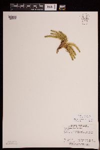 Huperzia appressa (Desv.) Á. Löve & D. Löve 950706[1290008]Perry, Ethan F. 110032011-08-10 United States, Minnesota, Lake, T65N R6W NE1/4 of SW1/4 of Sec 10 [Boundary Waters Canoe Area Wilderness / Superior National Forest], 48.125556 -91.090278 |
MIN:Plants | 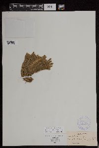 Huperzia appressa (Desv.) Á. Löve & D. Löve 388084[1295090]Grout, A.J. s.n. United States, Vermont, Lamoille |
MIN:Plants | 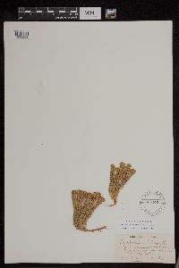 Huperzia appressa (Desv.) Á. Löve & D. Löve 565446[1295089]Williams, Newlin s.n. United States, New Hampshire, Grafton |
MIN:Plants | 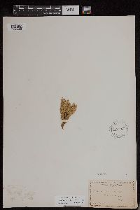 Huperzia appressa (Desv.) Á. Löve & D. Löve 55446[1295088]Manning, Sara s.n. United States, New Hampshire, Coos |
MIN:Plants |  Huperzia appressa (Desv.) Á. Löve & D. Löve 293283[1295087]Killip, Ellsworth P. 1221 United States, New York, Essex |
MIN:Plants |  Huperzia appressa (Desv.) Á. Löve & D. Löve 279116[1295086]Carpenter, Dana S. s.n. United States, New Hampshire, Coos |
MIN:Plants |  Huperzia appressa (Desv.) Á. Löve & D. Löve 528205[1295085]Garton, C.E. 1909 Canada, Ontario, Thunder Bay |
MIN:Plants |  Huperzia appressa (Desv.) Á. Löve & D. Löve 469774[1295084]Farlow, W.G. s.n. United States, New Hampshire, Lamoille |
MIN:Plants | 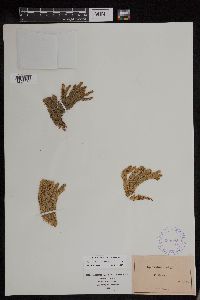 Huperzia appressa (Desv.) Á. Löve & D. Löve 388085[1295083]Pringle, C.G. s.n. United States, Vermont, Lamoille |
MIN:Plants | 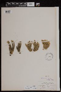 Huperzia appressa (Desv.) Á. Löve & D. Löve 55442[1295082]Eggleston, Willard W. s.n. United States, Vermont, Lamoille |
MIN:Plants | 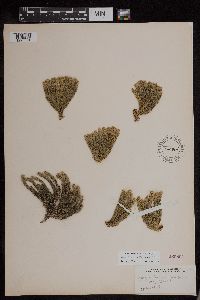 Huperzia appressa (Desv.) Á. Löve & D. Löve 260864[1295081]Eggleston, Willard W. s.n. United States, Vermont, Lamoille |
MIN:Plants | 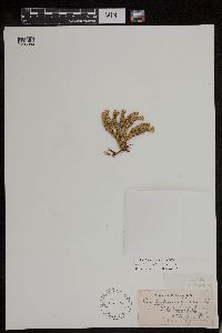 Huperzia appressa (Desv.) Á. Löve & D. Löve 55434[1295080]Hyanis, M.E. s.n. United States, North Carolina, Iredell |
MIN:Plants | 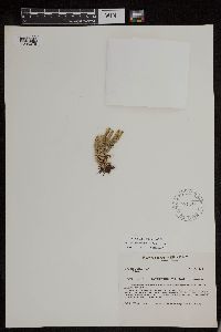 Huperzia appressa (Desv.) Á. Löve & D. Löve 581140[1295079]Charette, L.A. 2233 United States, Vermont, Orleans |
MIN:Plants | 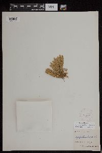 Huperzia appressa (Desv.) Á. Löve & D. Löve 274097[1295078]Durand, E.J. 28 United States, New York, Adirondack Mountains |
MIN:Plants | 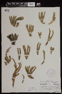 Huperzia appressa (Desv.) Á. Löve & D. Löve 356134[1295077]Clausen, Robert T. 3699 United States, North Carolina, Mitchell |
MIN:Plants | 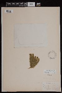 Huperzia appressa (Desv.) Á. Löve & D. Löve 55444[1295076]Forbes, F.F. 227 United States, New Hampshire, Coos |
MIN:Plants | 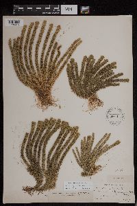 Huperzia appressa (Desv.) Á. Löve & D. Löve 55417[1295075]Williams, Emile F. 1 & 2 United States, New Hampshire, Coos |
MIN:Plants | 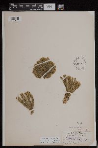 Huperzia appressa (Desv.) Á. Löve & D. Löve 55435[1295057]Eggleston, Willard W. s.n. United States, Vermont, Lamoille |
MIN:Plants | 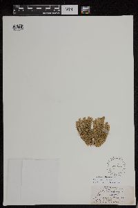 Huperzia appressa (Desv.) Á. Löve & D. Löve 55440[1295074]Eggleston, Willard W. s.n. United States, Vermont, Lamoille |
MIN:Plants | 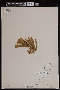 Huperzia appressa (Desv.) Á. Löve & D. Löve 525034[1295073]Stebbins, S. s.n. United States, Vermont, Lamoille |
MIN:Plants | 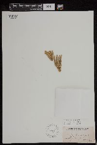 Huperzia appressa (Desv.) Á. Löve & D. Löve 55438[1295072]Heller, A.A. 213 United States, North Carolina, Mitchell |
MIN:Plants | 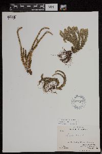 Huperzia appressa (Desv.) Á. Löve & D. Löve 618504[1295071]Abbe, E.C. 5204 Canada, Ontario, Thunder Bay, 48.133333 -89.2 |
MIN:Plants | 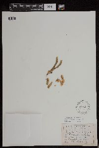 Huperzia appressa (Desv.) Á. Löve & D. Löve 55443[1295070]Heller, A.A. s.n.1890-08-00 United States, North Carolina, Mitchell |
MIN:Plants | 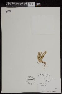 Huperzia appressa (Desv.) Á. Löve & D. Löve 597729[1295069]Radford, A.E. 44904 United States, North Carolina, Ashe |
MIN:Plants | 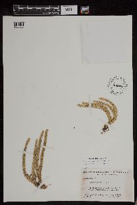 Huperzia appressa (Desv.) Á. Löve & D. Löve 450820[1295068]Godfrey, R.K. 51738 United States, North Carolina, Jackson |
MIN:Plants | 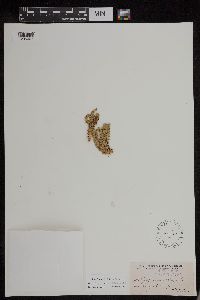 Huperzia appressa (Desv.) Á. Löve & D. Löve 55439[1295067]Heller, A.A. 213 United States, North Carolina, Mitchell |
MIN:Plants | 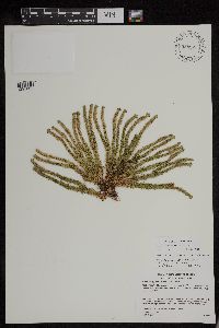 Huperzia appressa (Desv.) Á. Löve & D. Löve 955887[1295035]Gerdes, Lynden B. 43982001-07-13 United States, Minnesota, Lake, Tettegouche State Park, Silver Bay. Bean Lake Cliff. Approximately 1.6 miles NW of town., 47.33958 -91.198054 |
MIN:Plants | 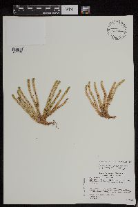 Huperzia appressa (Desv.) Á. Löve & D. Löve 489088[1294977]Gerdes, Lynden B. 44342001-08-02 United States, Minnesota, Lake, Tettegouche State Park. Mount Trudee. Approximately 2.6 miles north of Silver Bay, MN. T56N R07W S17SWNE, 47.33958 -91.198054 |
MIN:Plants | 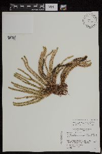 Huperzia appressa (Desv.) Á. Löve & D. Löve 489103[1294976]Gerdes, Lynden B. 44122001-07-26 United States, Michigan, Cook, Leveaux Mountain, Superior National Forest. Approximately 3.9 miles NE of Tofte. T59N R04W S02SENES |
MIN:Plants | 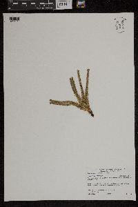 Huperzia appressa (Desv.) Á. Löve & D. Löve 959023[1305250]Gerdes, Lynden B. 43982001-07-13 United States, Minnesota, Lake, Tettegouche State Park, Silver Bay, MN. Bean Lake Cliff. Approximately 1.6 miles NW of town., 47.307532 -91.293145 |
MIN:Plants | 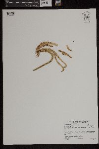 Huperzia appressa (Desv.) Á. Löve & D. Löve 959024[1305251]Gerdes, Lynden B. 44372001-08-02 United States, Minnesota, Lake, Tettegouche State Park, Mount Trudee. Approximately 2.5 miles north of Silver Bay, MN., 47.336138 -91.250865 |
MIN:Plants | 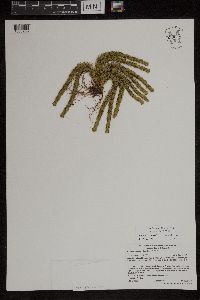 Huperzia appressa (Desv.) Á. Löve & D. Löve 959036[1305263]Gerdes, Lynden B. 53972007-06-11 United States, Minnesota, Lake, Superior National Forest. Approximately 9.23 miles NNW of Isabella, MN. Prominent rock outcrop ~ 0.21 miles east of the Northwest Road (FR373)., 47.74861111 -91.38527778 |
MIN:Plants | 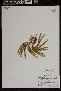 Huperzia appressa (Desv.) Á. Löve & D. Löve 959038[1305265]Gerdes, Lynden B. 54892007-08-14 United States, Minnesota, Lake, Superior National Forest. Approximately 9.22 miles WNW of Isabella, MN and 0.22 miles east of the Northwest Road (FR 373)., 47.74861111 -91.38611111 |
MIN:Plants | 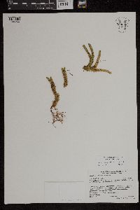 Huperzia appressa (Desv.) Á. Löve & D. Löve 959039[1305266]Gerdes, Lynden B. 55042007-08-14 United States, Minnesota, Lake, Superior National Forest. Approximately 9.22 miles WNW of Isabella, MN and 0.22 miles east of the Northwest Road (FR 373)., 47.74861111 -91.38611111 |
MIN:Plants | 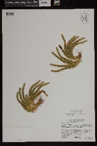 Huperzia appressa (Desv.) Á. Löve & D. Löve 959040[1305267]Gerdes, Lynden B. 55052007-08-14 United States, Minnesota, Lake, Superior National Forest. Approximately 9.22 miles WNW of Isabella, MN and 0.22 miles east of the Northwest Road (FR 373)., 47.74861111 -91.38611111 |
MIN:Plants | 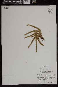 Huperzia appressa (Desv.) Á. Löve & D. Löve 959041[1305268]Gerdes, Lynden B. 55062007-08-14 United States, Minnesota, Lake, Superior National Forest. Approximately 9.22 miles WNW of Isabella, MN and 0.22 miles east of the Northwest Road (FR 373)., 47.74861111 -91.38611111 |
MIN:Plants | 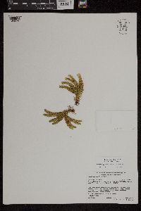 Huperzia appressa (Desv.) Á. Löve & D. Löve 959042[1305269]Gerdes, Lynden B. 55072007-08-14 United States, Minnesota, Lake, Superior National Forest. Approximately 9.22 miles WNW of Isabella, MN and 0.22 miles east of the Northwest Road (FR 373)., 47.74861111 -91.38611111 |
MIN:Plants | 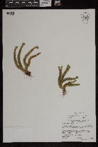 Huperzia appressa (Desv.) Á. Löve & D. Löve 959045[1305272]Gerdes, Lynden B. 55102007-08-14 United States, Minnesota, Lake, Superior National Forest. Approximately 9.22 miles WNW of Isabella, MN and 0.25 miles east of the Northwest Road (FR 373)., 47.74861111 -91.38555556 |
MIN:Plants | 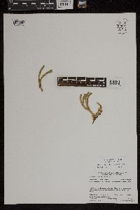 Huperzia appressa (Desv.) Á. Löve & D. Löve 959019[1305246]Gerdes, Lynden B. 61112010-07-17 United States, Minnesota, Cook, Superior National Forest. BWCAW. Southeast shore of Bingshick Lake., 48.08333333 -90.88972222 |
MIN:Plants | 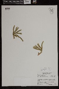 Huperzia appressa (Desv.) Á. Löve & D. Löve 959021[1305248]Gerdes, Lynden B. 61122010-07-17 United States, Minnesota, Cook, Superior National Forest. BWCAW. Southeast shore of Bingshick Lake., 48.08333333 -90.88972222 |
MIN:Plants | 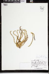 Huperzia appressa (Desv.) Á. Löve & D. Löve 960611[1329214]Lee, Michael MDL32782002-09-04 United States, Minnesota, Cook, On the north side of Moose Mountain in rugged bedrock terrain of the Lutsen Mountains Ski Area three miles west-northwest of Lutsen; above the Poplar River. N1/2 of SE1/4 of NE1/4 Sec. 29, Lutsen Mountains Ski Area, 47.650103 -90.719184 |
MIN:Plants | 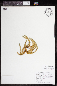 Huperzia appressa (Desv.) Á. Löve & D. Löve 965135[1375805]Lee, Michael MDL5076A2009-08-19 United States, Minnesota, Cook, Boundary Waters Canoe Area Wilderness, Rugged bedrock terrain northwest of Brule Lake, 24 miles northwest of Grand Marais. T63N R3W N1/2 of NW1/4 of NW1/4 Sec. 5, 47.97407942 -90.74086815 |
MIN:Plants | 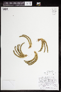 Huperzia appressa (Desv.) Á. Löve & D. Löve 964693[1375637]Lee, Michael MDL49182009-06-18 United States, Minnesota, Cook, Rugged bedrock bedrock terrain along the Border Route Hiking Trail, above the lower reaches of the Swamp River 11 miles north of Hovland. T64N R4E NW1/4 of NE1/4 of NE1/4 Sec. 28, N1/2 of NW1/4 of NE1/4 Sec. 28, 47.99959334 -89.93413815 |
MIN:Plants | 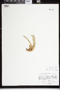 Huperzia appressa (Desv.) Á. Löve & D. Löve 960597[1329198]Lee, Michael MDL33032002-09-11 United States, Minnesota, Cook, Rugged bedrock terrain just northeast of the Lutsen Mountains Ski Area, 1.5 miles northwest of Lutsen. SW1/4 of SW1/4 of NW1/4 Sec. 22, SE1/4 of SE1/4 of NE1/4 Sec. 21, Lutsen State Scientific & Natural Area, 47.666178 -90.691973 |
MIN:Plants | 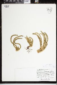 Huperzia appressa (Desv.) Á. Löve & D. Löve 960609[1329212]Lee, Michael MDL32872002-09-06 United States, Minnesota, Lake, Along the Superior Hiking Trail in rugged bedrock terrain on the southwest side of Silver Bay. S1/2 of SW1/4 of SW1/4 Sec. 36 (and into Sec. 1 - T55N), Superior Hiking Trail, 47.410348 -91.165782 |
MIN:Plants | 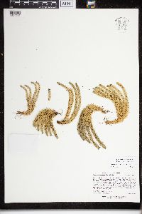 Huperzia appressa (Desv.) Á. Löve & D. Löve 960613[1329217]Lee, Michael MDL33002002-09-11 United States, Minnesota, Cook, Rugged bedrock terrain northeast of the Lutsen Mountains Ski Area, two miles north-northwest of Lutsen; just north of the Lutsen State Scientific & Natural Area. S1/2 of SW1/4 of SE1/4 Sec. 15, 47.680648 -90.691896 |
MIN:Plants | 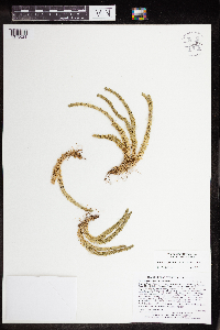 Huperzia appressa (Desv.) Á. Löve & D. Löve 964680[1375624]Lee, Michael MDL49052009-06-16 United States, Minnesota, Cook, Boundary Waters Canoe Area Wilderness, Rugged bedrock terrain along the Border Route Hiking Trail, 24 miles north of Grand Marais. T65N R1E SE1/4 of SW1/4 of NE1/4 Sec. 21, SW1/4 of SE1/4 of NE1/4 Sec. 21, 48.09953998 -90.33126083 |
MIN:Plants | 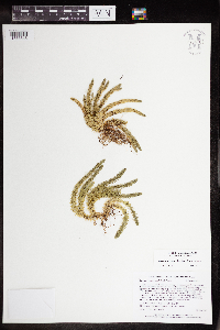 Huperzia appressa (Desv.) Á. Löve & D. Löve 964703[1375648]Lee, Michael MDL49282009-06-22 United States, Minnesota, Cook, Along the Border Route Hiking Trail in rugged bedrock terrain 11 miles north of Hovland. T64N R4E NW1/4 of NE1/4 of NE1/4 Sec. 29, 48.00198789 -89.95818439 |
MIN:Plants | 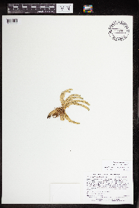 Huperzia appressa (Desv.) Á. Löve & D. Löve 965360[1356222]Lee, Michael MDL53002010-07-24 United States, Minnesota, Cook, Boundary Waters Canoe Area Wilderness, Rolling to fairly rugged bedrock terrain 23 miles north of Lutsen, 23 miles northwest of Grand Marais.T64N R3W N1/2 of NW1/4 of SE1/4 Sec. 33, 47.9814965 -90.70967972, 585m |
MIN:Plants | 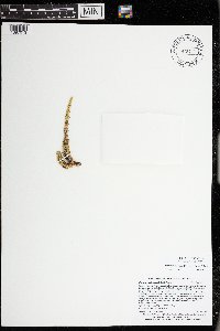 Huperzia appressa (Desv.) Á. Löve & D. Löve 973459[1397013]Lee, Michael MDL56112011-06-28 United States, Minnesota, Lake, Superior National Forest; Rugged bedrock terrain south of the Fernberg Road, along the upper reaches of Madden Creek, 12 miles east-northeast of Ely., 47.95184451 -91.59150033, 457m |
MIN:Plants | 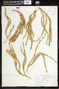 398148[1341305]Harper, Francis 1947-06-27 Canada, Nunavut, Keewatin, NW corner of Nueltin Lake, 1 mi above mouth of Windy River |
MIN:Plants | 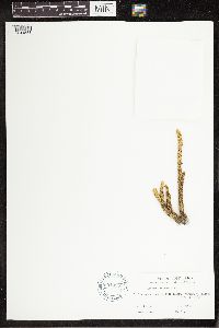 601935[1341588]Lent, Roy W. 1965-08-15 Costa Rica, Cartago, Turrialba Volcano, 9.906384 -83.680715, 3150m |
MIN:Plants | 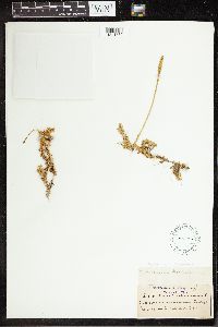 55120[1341789]Holland s.n.1890-00-00 South Africa, Lowry's Pass |
MIN:Plants | 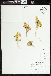 715823[1341847]Curran, M. 330371975-12-23 New Zealand, North Island, -46.816453 168.239369, 1109m |
MIN:Plants | 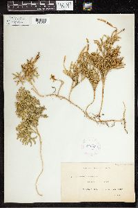 270781[1341848]Leland, B. 3151910-02-00 New Zealand, Stewart Island, -47 167.833333 |
MIN:Plants |  270780[1341849]Leland, B. 3151910-02-00 New Zealand, Stewart Island, -47 167.833333 |
MIN:Plants | 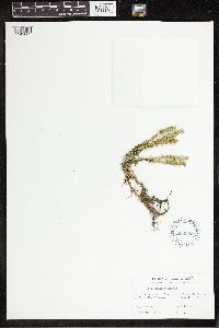 602023[1341609]Lent, Roy W. 7121965-08-15 Costa Rica, Cartago, 1.5 km above "Lecharia Central" on Turrialba Volcano, 9.906384 -83.680715, 2750m |
MIN:Plants | 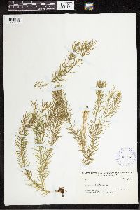 294639[1341612]Yuncker, T.G. 49501934-08-07 Honduras, Near Tela River, above Lancetilla, 15.77586 -87.47585, 30m |
MIN:Plants | 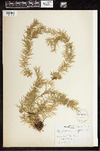 229262[1341613]Stevenson, J.A. 52311916-04-19 Puerto Rico, Puerto Rico, San Juan, Naguabo;; Mt Forest, 18.235418 -66.450317 |
MIN:Plants | 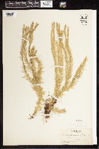 55252[1341614]Pollard, Charles L. 2241902-02-01 Cuba, Santiago, Vicinity of Baracoa, 23.033333 -82.583333 |
MIN:Plants | 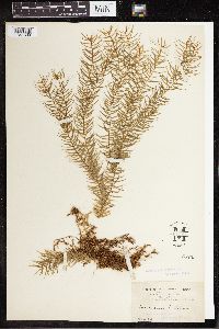 55253[1341639]Rusby, H.H. 4591895-00-00 Venezuela, Lower Orinoco, 10.206753 -63.892924 |
MIN:Plants | 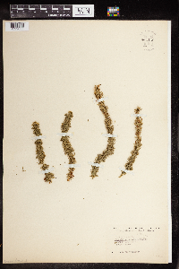 960466[1329006]KenKnight, Glenn United States, Minnesota, Clearwater |
MIN:Plants | 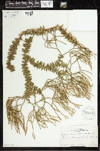 270979[1341857]Tilden, J.E. 4931912-08-00 French Polynesia, Tahiti, Tahiti, -17.633333 -149.45 |
MIN:Plants | 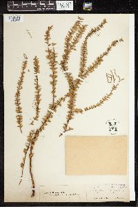 55385[1341858]Norris, W. s.n. Malaysia, 3.776559 102.158203 |
MIN:Plants | 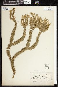 55386[1341859]Bailey, F.M. 1821904-00-00 Australia, Bellenden ker, -17.266667 145.916667 |
MIN:Plants | 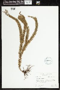 620575[1341860]Moore, John W. 4131926-12-11 French Polynesia, Raiatea, Opoa Valley, -16.82666 -151.439587 |
MIN:Plants | 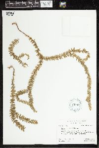 620051[1341861]Moore, John W. 931926-09-18 French Polynesia, Raiatea, Mt. Temehani, -16.82666 -151.439587 |
MIN:Plants | 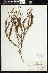 349124[1341862]Topping, D. L. 8451907-10-13 Philippines, Bataan, Luzon. Marivales Mts., 16.959638 121.693386 |
Google Map
Google Maps is a web mapping service provided by Google that features a map that users can pan (by dragging the mouse) and zoom (by using the mouse wheel). Collection points are displayed as colored markers that when clicked on, displays the full information for that collection. When multiple species are queried (separated by semi-colons), different colored markers denote each individual species.