University of Minnesota
http://www.umn.edu/
612-625-5000
http://www.umn.edu/
612-625-5000
Minnesota Biodiversity Atlas
Bell Museum
Dataset: MIN-Plants
Taxa: Ruscaceae
Search Criteria: excluding cultivated/captive occurrences
Bell Museum plants | |
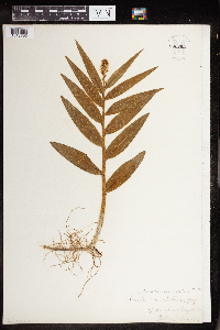
MIN:Plants | Maianthemum stellatum (L.) Link 757994[]Smith, Welby 59581982-05-18 United States, Minnesota, Dakota, Dakota Co. Fort Snelling State Park. In the Minnesota Valley 1/2 mi E of Gun Club Lake. SE1/4 NW1/4 sec.4, T27N R23W;Fort Snelling State Park;027N;23W;4, 44.857051 -93.180869 |
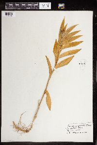
MIN:Plants | Maianthemum stellatum (L.) Link 758003[]Smith, Welby 59411982-05-18 United States, Minnesota, Dakota, Dakota County...In the Minnesota Valley, about 1/4 mi N of Nicols...NE1/4 SW1/4 sec.18, T27N R23W;Fort Snelling State Park;027N;23W;18, 44.825093 -93.219746 |
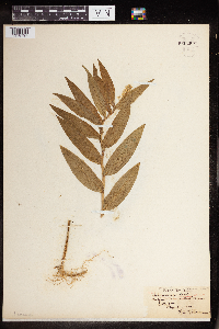
MIN:Plants | Maianthemum stellatum (L.) Link 758100[]Smith, Welby 60491982-05-23 United States, Minnesota, Cottonwood, Lake Augusta National Waterfowl Production Area. On the E side of Lake Augusta, ca. 4 mi. SW of Jeffers.;Lake Augusta Wildlife Management Area;106N;37W;11, 44.005427 -95.242934 |
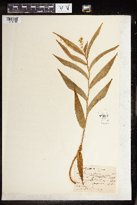
MIN:Plants | Maianthemum stellatum (L.) Link 758153[]Smith, Welby 62951982-06-11 United States, Minnesota, Clearwater, On the E side of hwy. 5, ca. 2 1/4 mi. N of its jct. with hwy. 92 in Clearbrook.;;149N;37W;17, 47.724444 -95.420116 |
MIN:Plants | Maianthemum stellatum (L.) Link 758221[]Smith, Welby 62011982-06-10 United States, Minnesota, Becker, Becker Co. Spring Creek State Wildlife Management Area. 1 1/4 mi. N-NW of Ogema.;Spring Creek Wildlife Management Area / White Earth Indian Reservation;142N;42W;13, 47.120565 -95.936471 |
MIN:Plants | Maianthemum stellatum (L.) Link 758452[]Smith, Welby 60741982-05-26 United States, Minnesota, Nicollet, Nicollet Co.; in the Minnesota Valley. On the E side of hwy. 169, about 2 1/2 mi. S-SW of LeSueur. NE1/4 NE1/4 of sec 1 Nicollet Co.; in the Minnesota Valley. On the E side of hwy. 169, about 2 1/2 mi. S-SW of LeSueur. NE1/4 NE1/4 of sec 16, T111N R26W. 111N 26W 16, 44.420539 -93.95977 |
MIN:Plants | Maianthemum stellatum (L.) Link 758811[]Smith, Welby 63631982-06-15 United States, Minnesota, Rice, Ca. 3 1/4 mi. due S of Dundas, in the Cannon River Valley.;Cannon River Wilderness Park;111N;20W;34, 44.377714 -93.211094 |
MIN:Plants | Maianthemum stellatum (L.) Link 762805[]Hart, H. s.n.1922-05-18 United States, Minnesota, Hennepin, Along E river bank near the Shine Hospital, Minneapolis.;;N;;, 44.959774 -93.210149 |
MIN:Plants | Maianthemum stellatum (L.) Link 763833[]Lugger, O. s.n.1892-05-30 United States, Minnesota, Hennepin, Lake Harriet.;;N;;, 44.921821 -93.304866 |
MIN:Plants | Maianthemum stellatum (L.) Link 770046[]Smith, Welby 77971983-06-04 United States, Minnesota, Wabasha, Kellogg-Weaver Dunes State Scientific and Natural Area. Ca. 4 mi. SE of Kellogg, on the E side of Co. Rd. 84.;Kellogg-Weaver Dunes Scientific Natural Area / Kellogg-Weaver Dunes, The Nature Conservancy;109N;09W;6, 44.272608 -91.938982 |
MIN:Plants | Maianthemum stellatum (L.) Link 770503[]Smith, Welby 77791983-06-02 United States, Minnesota, Swift, Swift Co. On the right-of-way of the Burlington Northern Railroad, about 1 mi. SE of Murdock. NW1/4 SE1/4 sec.12, T120N Swift Co. On the right-of-way of the Burlington Northern Railroad, about 1 mi. SE of Murdock. NW1/4 SE1/4 sec.12, T120N R38W. 120N 38W 12, 45.217888 -95.379082 |
MIN:Plants | Maianthemum stellatum (L.) Link 773738[]Boe, J. 51A1979-06-05 United States, Minnesota, Lake of the Woods, Zippel Bay State Park, near Lakeview Campground.;Zippel Bay State Park;162N;33W;12, 48.863874 -94.859386 |
MIN:Plants | Maianthemum stellatum (L.) Link 773739[]Boe, J. 1421979-06-13 United States, Minnesota, Lake of the Woods, 7 Mile Corner, W of Norris Camp.;;159N;36W;, 48.67041 -95.331666 |
MIN:Plants | Maianthemum stellatum (L.) Link 789522[]Smith, Welby 101161985-05-22 United States, Minnesota, Dodge, Iron Horse Prairie Scientific Natural Area. Dodge County...Iron Horse Prairie State Scientific and Natural Area, about 1-1/2 mi. S of Hayfield...NW1/4 SE1/4 of Sec.27, T105N R17W. 105N 17W 27, 43.8675003 -92.8486099 |
MIN:Plants | Maianthemum stellatum (L.) Link 792193[]Smith, Welby 102421985-05-29 United States, Minnesota, Lyon, Prairie Marshes State Wildlife Management Area, ca. 4 mi. N-NW of Russell.;Prairie Marshes Wildlife Management Area;111N;43W;36, 44.373819 -95.971176 |
MIN:Plants | Maianthemum stellatum (L.) Link 796502[]Kaul, R. 51871998-05-09 United States, Minnesota, Steele, On a slope above the Straight River, along Lemond Road.;;N;;, 43.991071 -93.244087 |
MIN:Plants | Maianthemum stellatum (L.) Link 802753[]Smith, Welby 114381986-05-16 United States, Minnesota, Sherburne, Sherburne National Wildlife Refuge, about 2.5 mi SE of Orrock.;Sherburne National Wildlife Refuge;034N;27W;10, 45.451167 -93.684223 |
MIN:Plants | Maianthemum stellatum (L.) Link 802761[]Smith, Welby 114131986-05-16 United States, Minnesota, Sherburne, Sherburne National Wildlife Refuge, about 2.5 mi SE of Santiago.;Sherburne National Wildlife Refuge;035N;28W;23, 45.508593 -93.789216 |
MIN:Plants | Maianthemum stellatum (L.) Link 802797[]Smith, Welby 115121986-05-25 United States, Minnesota, Ramsey, Maplewood Nature Center. Ramsey Co.; In the City of Maplewood, about 2? mi S of Larpenteur Avenue and 1/4 mi E of McKnight Road. Sec. 24, T 29N R Ramsey Co.; In the City of Maplewood, about 2? mi S of Larpenteur Avenue and 1/4 mi E of McKnight Road. Sec. 24, T 29N R 22W. 029N 22W 24, 44.986499 -92.9922 |
MIN:Plants | Maianthemum stellatum (L.) Link 804633[]Smith, Welby 122531986-07-24 United States, Minnesota, Polk, Belgium State Wildlife Management Area, ca. 4 mi. E-NE of Euclid.;Belgium Wildlife Management Area;152N;46W;16, 47.985145 -96.558273 |
MIN:Plants | Maianthemum stellatum (L.) Link 804670[]Smith, Welby 116811986-06-12 United States, Minnesota, Pipestone, Prairie Coteau Scientific Natural Area. Pipestone County...Prairie Coteau State Scientific and Natural Area (Aetna Prairie), on the northwest side of statae highway 23, about 2 1/2 miles northeast of Holland; NW1/4 SE1/4 section 32, T 108N R 44W. 108N 44W 32, 44.1152778 -96.1522222 |
MIN:Plants | Maianthemum stellatum (L.) Link 804804[]Gerbig, R. s.n.1973-06-04 United States, Minnesota, Pope, Strandness Prairie; NE of E pond.;Strandness Prairie, The Nature Conservancy;058N;05W;, 45.665152 -95.500112 |
MIN:Plants | Maianthemum stellatum (L.) Link 805859[]Cholewa, A.; et al. 18521989-09-07 United States, Minnesota, Dakota, Fort Snelling State Park. Dakota Co. 'Nicols Fen', ca 100 yds NE of jnc Cedar Ave. and Chicago Northwestern RR, T27N R23W S18 just SW of center. Along edge of depression at N end and along W border.. 027N 23W 18, 44.825884 -93.216999 |
MIN:Plants | Maianthemum stellatum (L.) Link 816247[]Wheeler, Gerald 104061988-05-23 United States, Minnesota, Norman, Ca. 8 mi. E-NE of Twin Valley; 0.5 mi. N of Faith on Rte. 40. S1/2 NE1/4 Sec. 14, T144N, R43W, Fossum Twp.;;144N;43W;14, 47.289431 -96.09907 |
MIN:Plants | Maianthemum stellatum (L.) Link 89397[]Moore, W. s.n.1907-05-30 United States, Minnesota, Hennepin, Spring Park;;;;, 44.93528 -93.63194 |
MIN:Plants | Maianthemum stellatum (L.) Link 89646[]Bergman, H. 28351913-06-29 United States, Minnesota, Meeker, Darwin;;119N;30W;, 45.096352 -94.410821 |
MIN:Plants | Maianthemum stellatum (L.) Link 89735[]Moyer, W. s.n.1898-05-20 United States, Minnesota, Chippewa, Montevideo;;117N;40W;, 44.93463 -95.67577 |
MIN:Plants | Maianthemum stellatum (L.) Link 89736[]Manning, Sara s.n.1883-06-00 United States, Minnesota, Wabasha, Lake City;;111N;12W;04, 44.44702 -92.25898 |
MIN:Plants | Maianthemum stellatum (L.) Link 89738[]Manning, Sara s.n.1883-06-14 United States, Minnesota, Wabasha, Lake City;;111N;12W;04, 44.44702 -92.25898 |
MIN:Plants | Maianthemum stellatum (L.) Link 89739[]Ainslie, G. 10321902-05-19 United States, Minnesota, Olmsted, Rochester;;106N;14W;, 43.97834 -92.49834 |
MIN:Plants | Maianthemum stellatum (L.) Link 89740[]Skinner, S. 1431902-06-17 United States, Minnesota, Jackson, Heron Lake region;;N;;, 43.794959 -95.320276 |
MIN:Plants | Maianthemum stellatum (L.) Link 89741[]Sheldon, Edmund s.n.1895-05-00 United States, Minnesota, Ramsey, Lake Vadnais. Ramsey Co.;;030N;22W;, 45.045133 -93.095004 |
MIN:Plants | Maianthemum stellatum (L.) Link 89742[]Hero, C. s.n.1871-05-00 United States, Minnesota, Hennepin, Minnepolis.;;N;;, 44.977089 -93.268631 |
MIN:Plants | Maianthemum stellatum (L.) Link 89743[]Wirkrrshrim, W. s.n.1891-05-00 United States, Minnesota, Lincoln, Idlewild [pioneer village in sec. 18 of Ash Lake Township]. Lincoln Co.;;111N;45W;18, 44.422973 -96.294773 |
MIN:Plants | Maianthemum stellatum (L.) Link 89744[]Sheldon, Edmund S28631892-07-00 United States, Minnesota, Kanabec, Mora. Kanabec Co.;;039N;24W;, 45.876903 -93.293835 |
MIN:Plants | Maianthemum stellatum (L.) Link 89745[]Hammond, George 441881-05-00 United States, Minnesota, Wabasha, Lake City.;;N;;, 44.449412 -92.266844 |
MIN:Plants | Maianthemum stellatum (L.) Link 89746[]Sheldon, Edmund s.n.1895-05-00 United States, Minnesota, Ramsey, Larsen Island. Ramsey Co.;;;;, 45.018032 -93.092742 |
MIN:Plants | Maianthemum stellatum (L.) Link 89747[]Sheldon, Edmund S.20631892-06-00 United States, Minnesota, Mille Lacs Lake [spans Aitkin and Mille Lacs cos.];;;;, 46.228105 -93.636954 |
MIN:Plants | Maianthemum stellatum (L.) Link 89748[]MacMillan, C.; et al. 218Sk1900-08-00 United States, Minnesota, Polk, Crookston;;150N;46W;30, 47.77414 -96.60812 |
MIN:Plants | Maianthemum stellatum (L.) Link 89749[]Kassube, J. s.n.1878-05-00 United States, Minnesota, Hennepin, Minneapolis;;N;;, 44.979965 -93.263836 |
MIN:Plants | Maianthemum stellatum (L.) Link 89750[]Sandberg, John s.n.1890-06-00 United States, Minnesota, Hennepin, [no further data];;;;, 45 -93.47 |
MIN:Plants | Maianthemum stellatum (L.) Link 89751[]Campbell, E. 381896-05-00 United States, Minnesota, Stearns, St. Cloud;;N;;, 45.557693 -94.1603 |
MIN:Plants | Maianthemum stellatum (L.) Link 89752[]MacMillan, C.; et al. MS11111894-07-00 United States, Minnesota, Lake of the Woods, Oak Point;Pine & Curry Islands Scientific Natural Area;162N;31W;06, 48.87976 -94.69025 |
MIN:Plants | Maianthemum stellatum (L.) Link 89753[]MacMillan, C.; et al. MS14721894-07-00 United States, Minnesota, Lake of the Woods, Sandy Beach [other collections by M&S indicate this is in Northwest Angle];Northwest Angle;;;, 49.16861 -95.07694 |
MIN:Plants | Maianthemum stellatum (L.) Link 89754[]MacMillan, C.; et al. 14551894-07-00 United States, Minnesota, Lake of the Woods, Sandy Beach [other collections by M&S indicate this is in Northwest Angle];Northwest Angle;;;, 49.16861 -95.07694 |
MIN:Plants | Maianthemum stellatum (L.) Link 89755[]Menzel, Max 104671895-03-00 United States, Minnesota, Pipestone, Pipestone [assuming the quarry area; town generally noted as Pipestone City by collector];Pipestone National Monument;106N;46W;01, 44.01585 -96.31767 |
MIN:Plants | Maianthemum stellatum (L.) Link 89756[]Anderson, A. a7131893-08-00 United States, Minnesota, Goodhue, Featherstone;;N;;, 44.501255 -92.611443 |
MIN:Plants | Maianthemum stellatum (L.) Link 89757[]Holzinger, John s.n.1886-06-00 United States, Minnesota, Winona, Winona Co.;;N;;, 43.98685 -91.779129 |
MIN:Plants | Maianthemum stellatum (L.) Link 89758[]Burglehaus, F. 1891-05-21 United States, Minnesota, Hennepin, [no further data];;;;, 45 -93.47 |
MIN:Plants | Maianthemum stellatum (L.) Link 89759[]Frost, W. F571892-06-00 United States, Minnesota, Meeker, Litchfield.;;119N;31W;, 45.127185 -94.528047 |
MIN:Plants | Maianthemum stellatum (L.) Link 89761[]Sheldon, Edmund S33541892-08-00 United States, Minnesota, Otter Tail, Battle Lake;;N;;, 46.280516 -95.713658 |
MIN:Plants | Maianthemum stellatum (L.) Link 89762[]Sheldon, Edmund s.n.1891-05-00 United States, Minnesota, Ramsey, Ramsey Co.;;;;, 45.03333 -93.08333 |
MIN:Plants | Maianthemum stellatum (L.) Link 89763[]Aiton, G. s.n.1878-06-00 United States, Minnesota, Rice, Rice Co.;;N;;, 44.354264 -93.296679 |
MIN:Plants | Maianthemum stellatum (L.) Link 89764[]Wheeler, William 971899-06-03 United States, Minnesota, Houston, Winnebago Valley, Houston Co.;Dorer Memorial Hardwood State Forest;N;;, 43.537379 -91.40119 |
MIN:Plants | Maianthemum stellatum (L.) Link 89765[]Sandberg, John s.n.1886-05-00 United States, Minnesota, Goodhue, Red Wing;;113N;14W;, 44.562468 -92.533801 |
MIN:Plants | Maianthemum stellatum (L.) Link 89766[]Menzel, Max s.n.1894-05-00 United States, Minnesota, Pipestone, Pipestone [assuming the quarry area; town generally noted as Pipestone City by collector];Pipestone National Monument;106N;46W;01, 44.01585 -96.31767 |
MIN:Plants | Maianthemum stellatum (L.) Link 89767[]Sheldon, Edmund S8821891-07-00 United States, Minnesota, Brown, Sleepy Eye.;;N;;, 44.297183 -94.72415 |
MIN:Plants | Maianthemum stellatum (L.) Link 89768[]Sheldon, Edmund S1351891-06-00 United States, Minnesota, Blue Earth, Madison Lake.;;N;;, 44.190628 -93.807612 |
MIN:Plants | Maianthemum stellatum (L.) Link 89769[]Sheldon, Edmund 12011891-06-00 United States, Minnesota, Le Sueur, Elysian.;;109N;24W;, 44.198577 -93.673838 |
MIN:Plants | Maianthemum stellatum (L.) Link 89770[]Ballard, C. B4171891-07-00 United States, Minnesota, Scott, New Prague.;;113N;23W;, 44.551346 -93.574768 |
MIN:Plants | Maianthemum stellatum (L.) Link 89771[]Taylor, B. T2121891-06-00 United States, Minnesota, Waseca, Janesville.;;N;;, 44.116078 -93.708004 |
MIN:Plants | Maianthemum stellatum (L.) Link 89772[]Taylor, B. T1661891-06-00 United States, Minnesota, Waseca, Janesville.;;N;;, 44.116078 -93.708004 |
MIN:Plants | Maianthemum stellatum (L.) Link 89773[]Sandberg, John s.n.1886-05-00 United States, Minnesota, Goodhue, [no further data];;;;, 44.40976099 -92.72282341 |
MIN:Plants | Maianthemum stellatum (L.) Link 89774[]Sheldon, Edmund S20151892-06-00 United States, Minnesota, Crow Wing, Brainerd.;;N;;, 46.358022 -94.200829 |
MIN:Plants | Maianthemum stellatum (L.) Link 89775[]Burglehaus, F. s.n.1892-05-00 United States, Minnesota, Hennepin, Near Minneapolis;;N;;, 44.98 -93.26361 |
MIN:Plants | Maianthemum stellatum (L.) Link 89776[]Sheldon, Edmund 2301891-06-00 United States, Minnesota, Blue Earth, Lake Washington;;109N;25W;, 44.23865 -93.867678 |
MIN:Plants | Maianthemum stellatum (L.) Link 89777[]Sheldon, Edmund s.n.1891-05-00 United States, Minnesota, Ramsey, Ramsey Co.;;;;, 45.03333 -93.08333 |
MIN:Plants | Maianthemum stellatum (L.) Link 89787[]G. & L. 116=131885-05-20 United States, Minnesota, Chippewa, Chippewa River;;;;, 44.93472 -95.73306 |
MIN:Plants | Maianthemum stellatum (L.) Link 490631[]McNaughton, Lynn 1242003-05-16 United States, Minnesota, Waseca, Waseca County ... NE1/4 of SW1/4 of Sect.9, T107N, R22W.;;107N;22W;09, 44.087663 -93.476763 |
MIN:Plants | Maianthemum stellatum (L.) Link 491051[]Wheeler, Gerald 155571997-05-20 United States, Minnesota, Renville, Birch Coulee State Memorial Park. Renville County ... Ca. 1.5 mi. NE of Morton; S of Rte. 2; Birch Coulee State Memeorial Park ... NW1/4 NW1/4 Sec. 28 T113N R34W. 113N 34W 28, 44.563404 -94.944224 |
MIN:Plants | Maianthemum stellatum (L.) Link 255484[]Mearns, E. 8761902-05-26 United States, Wyoming, Park, Yellowstone National Park ... Mammoth Hot Springs;Yellowstone National Park |
MIN:Plants | Maianthemum stellatum (L.) Link 508116[]Kaul, R. 29331984-05-19 United States, Minnesota, Steele, Steele County ... along Straight River, Owatonna ... near Lemond Road.;;107N;20W;, 44.084579 -93.230139 |
MIN:Plants | Maianthemum stellatum (L.) Link 540005[]Tester, John s.n.1957-00-00 United States, Minnesota, Mahnomen, Mahnomen County...Waubun Prairie, 3-4 miles w. and 1 mile s. of Waubun. Sect. 33, T. 143 N, R. 42 W.;Waubun Prairie Wildlife Management Area / White Earth Indian Reservation;143N;42W;33, 47.15922 -96.007291 |
MIN:Plants | Maianthemum stellatum (L.) Link 585824[]Porter, C.; et al. 92311963-06-03 United States, Wyoming, Crook, Crook County. Devils Tower campground.;Devils Tower National Monument, 1219m |
MIN:Plants | Maianthemum stellatum (L.) Link 910603[]Perry, Ethan 080562008-06-28 United States, Minnesota, Itasca, Itasca County...West shore of Lake Winnibigoshish just S of the mouth of Third River Flowage...T147N R28W SE1/4 of SW1/4;Chippewa National Forest / Leech Lake Indian Reservation;147N;28W;32, 47.5022222 -94.2566667 |
MIN:Plants | Maianthemum stellatum (L.) Link 511459[]Kaul, R.; et al. 50481985-05-26 United States, Minnesota, Steele, Steele County ... US Hwy 218 ca 2 miles southeast of Owatonna.;;107N;20W;, 44.084579 -93.230139 |
MIN:Plants | Maianthemum stellatum (L.) Link 912863[]Smith, Welby 242101994-05-31 United States, Minnesota, Koochiching, Franz Jevne State Park. Koochiching County...Franz Jevne State Park. In the Rainy River Valley, about 2 miles northeast of Birchdale... T160N R27W SW1/4 of SW1/4 of Sec 26. 160N 27W 26, 48.6427778 -94.0783333 |
MIN:Plants | Maianthemum stellatum (L.) Link 488959[]Gerdes, Lynden 39092000-05-23 United States, Minnesota, Lake, T57N R07W S33SESW. Lake County...Baptism River, Finland, MN. Northeast of the Ecbeck Campground.;North Shore;057N;07W;33, 47.374915 -91.222593 |
MIN:Plants | Maianthemum stellatum (L.) Link 488834[]Bosch, T. 42001-05-13 United States, Minnesota, Big Stone, Big Stone County ... T120N R45W sec. 1-2 ... along the Minnesota River. Approx. 0.5 mile east of Hwy. 75 and 2 miles south of Hwy. 7.. 120N 40W 0, 45.249301 -96.292454 |
MIN:Plants | Maianthemum stellatum (L.) Link 904364[]Gerdes, Lynden 53742007-06-05 United States, Minnesota, Itasca, Chippewa National Forest / Leech Lake Indian Reservation. T146N R29W S29 SESE Itasca County ... Leech Lake Reservation. Chippewa National Forest. Approximately 4.7 miles NNE of Schley, MN on the banks of the Mississippi River ... NAD 83 / 396407 / 5254037. 146N 29W 29, 47.4316667 -94.3736111 |
MIN:Plants | Maianthemum stellatum (L.) Link 913740[]Smith, Welby 227821993-07-09 United States, Minnesota, Rock, Blue Mounds State Park. Rock County ... Blue Mounds State Park, about 4 miles north-northeast of Luverne...Mound Creek. T 103N R 45W NW 1/4 of NW 1/4 of Sec 24. 103N 45W 24, 43.7163889 -96.1897222 |
MIN:Plants | Maianthemum stellatum (L.) Link 919149[]Anderson, Derek 8502008-05-20 United States, Minnesota, Freeborn, Freeborn County...White Woods County Park, ca. 2 km west of Twin Lakes...T101N, R22W, NESE10;White Woods County Park;101N;22W;10, 43.5616667 -93.45 |
MIN:Plants | Maianthemum stellatum (L.) Link 435894[]Wheeler, Gerald 157361997-05-24 United States, Minnesota, Nicollet, Nicollet Co.; Near Fort Ridgely State Park, just E of the jct. of Rte. 4 and Rte. 5; SW1/4 NE1/4 SW1/4 Sec. 5 T111N R32W (Ridgely 5). 111N 32W 5, 44.449167 -94.715207 |
MIN:Plants | Maianthemum stellatum (L.) Link 431784[]Carlson, Bruce 010722001-07-03 United States, Minnesota, Mille Lacs, Mille Lacs County ... 4.2 miles NNE of Bock in a hayfield along the east side of Cnty Rd. 24 ... T039N R26W NWSWNW25;;039N;26W;25, 45.841142 -93.523531 |
MIN:Plants | Maianthemum stellatum (L.) Link 924499[]Smith, Welby 202531992-05-20 United States, Minnesota, Marshall, About 11 miles east of Argyle...Along Middle River. NW1/4 of SE1/4 of section;Old Mill State Park;156N;46W;04, 48.3602778 -96.5702778 |
MIN:Plants | Maianthemum stellatum (L.) Link 931696[]Smith, Welby R. 202851992-06-02 United States, Minnesota, Redwood, On a gentle north-facing slope in the Minnesota River Valley, about 3 miles northeast of Belview NE of NW of section;;114N;37W;27, 44.6563889 -95.2977778 |
MIN:Plants | Maianthemum stellatum (L.) Link 207389[]Nash, A.; Nash, V. 35701960-07-06 United States, Wyoming, Park, Elk Park;Yellowstone National Park |
MIN:Plants | Maianthemum stellatum (L.) Link 960292[1318795]Marsh, Ellen F. 1886-05-12 United States, Illinois |
MIN:Plants | Maianthemum stellatum (L.) Link 960291[1318796]Oliver, Elizabeth 1930-08-00 United States, Michigan |
MIN:Plants | Maianthemum stellatum (L.) Link 960290[1318797] 1900-05-26 United States, Iowa |
MIN:Plants | Maianthemum stellatum (L.) Link 960289[1318798] 1891-05-00 United States, Nebraska |
MIN:Plants | Maianthemum stellatum (L.) Link 960288[1318799] 1902-05-19 |
MIN:Plants | Maianthemum stellatum (L.) Link 960287[1318800]Oliver, Elizabeth 1993-04-14 United States, California, canyon near Oakland |
MIN:Plants | Maianthemum stellatum (L.) Link 960492[1318980]KenKnight, Glenn 1932-00-00 United States, Minnesota, Clearwater |
MIN:Plants | Maianthemum stellatum (L.) Link 960491[1318981]Kaliher, Earl L. 1927-06-29 United States, Minnesota, Todd |
MIN:Plants | Maianthemum stellatum (L.) Link 960555[1329066]Stork, H.E. 1927-06-26 United States, Wyoming, Yellowstone National Park |
MIN:Plants | Maianthemum stellatum (L.) Link 960554[1329067]Stork, H.E. 32541927-08-06 United States, Wyoming, Yellowstone National Park, Mammoth Hot Springs |
MIN:Plants | Maianthemum stellatum (L.) Link 963072[1346786]Whitfeld, T.J.S. 22502019-06-23 United States, Minnesota, Itasca, Us Army Corps of Engineers Winnibigoshish Recreation Area, point, 47.43237 -94.052647 |
MIN:Plants | Maianthemum stellatum (L.) Link 0968686[1391287]T. Thorstenson 1938-00-00 United States, Montana, Rattlesnake Creek |
MIN:Plants | Maianthemum stellatum (L.) Link []Weiblen, G. D. GW19032003-07-28 United States, Colorado, Gunnison, Kebler Pass Road near Marcellina Mountain, Gunnison National Forest, 38.910056 -107.240528, 2590m |
Google Map
Google Maps is a web mapping service provided by Google that features a map that users can pan (by dragging the mouse) and zoom (by using the mouse wheel). Collection points are displayed as colored markers that when clicked on, displays the full information for that collection. When multiple species are queried (separated by semi-colons), different colored markers denote each individual species.
