University of Minnesota
http://www.umn.edu/
612-625-5000
http://www.umn.edu/
612-625-5000
Minnesota Biodiversity Atlas
Bell Museum
Dataset: MIN-Plants
Taxa: Amaranthaceae
Search Criteria: excluding cultivated/captive occurrences
Bell Museum plants | |
 MIN:Plants | 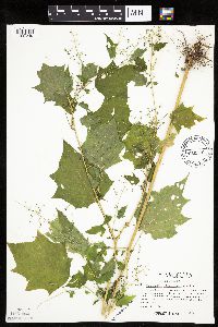 Chenopodium simplex (Torrey) Rafinesque 478324[1037249]Kaul, R. 59961987-08-21 United States, Minnesota, Steele, Steele County ... above Straight River at Lemond Road.;;107N;20W;, 44.066112 -93.226071 |
MIN:Plants | 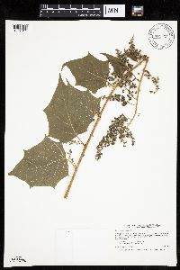 Chenopodium simplex (Torrey) Rafinesque 911625[1037311]Smith, Welby 218311992-09-03 United States, Minnesota, Watonwan, Watonwan County...At the public access on the north side of Fedji Lake, about 2 miles northeast of Madelia...T 107N R 30W SW1/4 of SW1/4 of Sec 12. 107N 30W 12, 44.0816667 -94.3880556 |
MIN:Plants |  Chenopodium simplex (Torrey) Rafinesque 906489[1037310]Smith, Welby 311462008-08-18 United States, Minnesota, Beltrami, Beltrami County...About 12 miles north-northeast of Bemidji...T 148 R 33 SW1/4 of NE1/4 of sec 12;Buena Vista State Forest;148N;33W;12, 47.6522222 -94.8072222 |
MIN:Plants |  Chenopodium simplex (Torrey) Rafinesque 918242[1037276]Smith, Welby 252381994-08-23 United States, Minnesota, Sibley, Vale Wildlife Management Area. Sibley County...Vale State Wildlife Management Area, about 3 miles northwest of Henderson...floodplain of High Island Creek...T 113N R 26W SE1/4 of NW1/4 of Sec 27. 113N 26W 27, 44.5680556 -93.9413889 |
MIN:Plants | 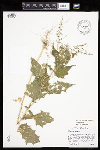 Chenopodium simplex (Torrey) Rafinesque 896834[1037347]Haferman, J. 2881996-08-25 United States, Minnesota, Scott, Approx. 0.1 miles NNE of intersection of State Highway 13 and County Road 44 on N side of highway. SW1/4 of SW1/4 of section.;;115N;22W;36, 44.72459 -93.40903 |
MIN:Plants | 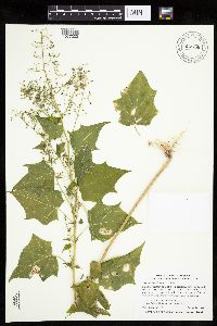 Chenopodium simplex (Torrey) Rafinesque 907756[1037333]Smith, Welby 311242008-08-14 United States, Minnesota, Le Sueur, Le Sueur County ... Lake Pepin, about 2 miles north-northwest of Montgomery ... T112N R23W NW1/4 of NW1/4 of Sec 33;;112N;23W;33, 44.4691667 -93.6019444 |
MIN:Plants | 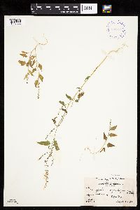 Chenopodium simplex (Torrey) Rafinesque 394014[1037386]Abbe, L.; et al. 6031937-08-21 Canada, Ontario, Thunder Bay, North side of Pigeon Bay |
MIN:Plants | 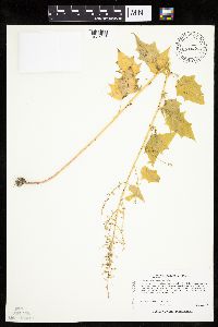 Chenopodium simplex (Torrey) Rafinesque 430200[1037248]Lee, Michael MDL19251997-08-21 United States, Minnesota, Stearns, Stearns Co.; On south side of Big Birch Lake 4-1/2 miles south of Grey Eagle; T127N R32W SE1/4 of SW1/4 Sec. 31;;127N;32W;31, 45.766774 -94.756997 |
MIN:Plants | 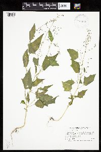 Chenopodium simplex (Torrey) Rafinesque 923849[1037258]Smith, Welby 216631992-08-26 United States, Minnesota, Nicollet, About 7 miles north of Mankato; bank of Seven Mile Creek. NW1/4 of NE1/4 of section.;Seven Mile Creek County Park;109N;27W;11, 44.2680556 -94.0344444 |
MIN:Plants | 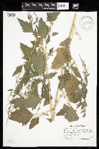 Chenopodium simplex (Torrey) Rafinesque 923857[1037257]Smith, Welby 217011992-08-26 United States, Minnesota, Nicollet, At the public access on the Minnesota River; about 7 miles north of Mankato. SE1/4 of NW1/4 of section;Seven Mile Creek County Park;109N;27W;12, 44.2611111 -94.0219444 |
MIN:Plants | 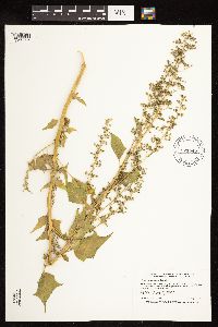 Chenopodium simplex (Torrey) Rafinesque 921845[1122505]Smith, Welby 231991993-06-29 United States, Minnesota, Grant, South side of Ask Lake, about 1.5 miles east-southeast of Ashby ... T130N R41W NW1/4 of SW1/4 of Sec 12;;130N;41W;12, 46.0847222 -95.7886111 |
MIN:Plants | 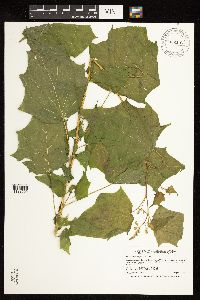 Chenopodium simplex (Torrey) Rafinesque 922152[1122509]Smith, Welby 232701993-08-03 United States, Minnesota, Renville, in the Minnesota Valley about 4 miles southwest of Sacred Heart. north bank of the Minnesota River. SW1/4 of SE1/4 of Sec.;Skalbakken County Park;115N;38W;27, 44.7338889 -95.4097222 |
MIN:Plants | 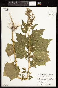 Chenopodium simplex (Torrey) Rafinesque 929695[1122508]Smith, Welby 161921989-08-23 United States, Minnesota, Nobles, West Grahm Lake, about one mile southwest of Kinbrae. NW of SW of section;;104N;39W;15, 43.8086111 -95.5105556 |
MIN:Plants | 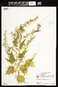 Chenopodium simplex (Torrey) Rafinesque 931499[1122506]Gerdes, Lynden B. 63852011-08-16 United States, Minnesota, Lake, Superior National Forest. Approximately 20.63 miles NW of Isabella, MN and 2.01 miles east of Birch Lake. Area of ongoing mining exploration and recent timber sale layout. SESENENW. 061N 11W 10, 47.7880556 -91.7158333 |
MIN:Plants | 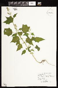 Chenopodium simplex (Torrey) Rafinesque 447842[1122504]Ruby, Janeen MN2012-322012-09-05 United States, Minnesota, Jackson, At SSE end of Loon Lake, between 715th St. (County Hwy. 4) and the lakeshore. NWSE of section;Robertson County Park;101N;36W;25, 43.522012 -95.10124 |
MIN:Plants | 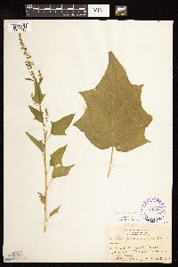 Chenopodium simplex (Torrey) Rafinesque 295396[1122515]Benner, F.; Benner, J. 1161928-08-03 United States, Wisconsin, Polk, 5 mi. N. St. Croix Falls on River Road;;;;, 45.470949 -92.681073 |
MIN:Plants | 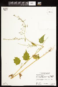 Chenopodium simplex (Torrey) Rafinesque 931493[1122507]Gerdes, Lynden 63972011-08-18 United States, Minnesota, Lake, About 18.24 mi NW of Isabella, MN and 1.10 mi S of Bogberry Lake. Near FR 1468 and FR 1468A junction. SWSESENW of sec.;;061N;10W;07, 47.7847222 -91.655 |
MIN:Plants | 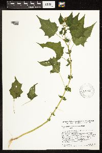 Chenopodium simplex (Torrey) Rafinesque 899241[1192532]Simmers, S. 70 United States, North Dakota, Slope |
MIN:Plants | 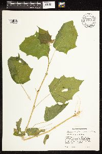 Chenopodium simplex (Torrey) Rafinesque 722770[1192533]Trana, T. D. 1991 United States, North Dakota, McHenry |
MIN:Plants | 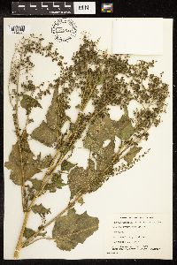 Chenopodium simplex (Torrey) Rafinesque 749641[1192534]Stevenson, G. A. 1587 Canada, Manitoba |
MIN:Plants | 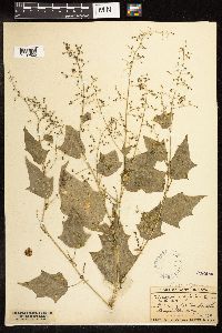 Chenopodium simplex (Torrey) Rafinesque 246458[1192535]Lunell, J. 598 United States, North Dakota, Benson |
MIN:Plants | 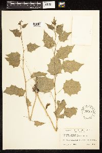 Chenopodium simplex (Torrey) Rafinesque 547000[1192536]Scoggan, H. J. 11212 Canada, Manitoba |
MIN:Plants | 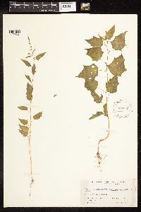 Chenopodium simplex (Torrey) Rafinesque 434157[1192537]Richards, C. D. 2297 United States, Michigan, Houghton |
MIN:Plants | 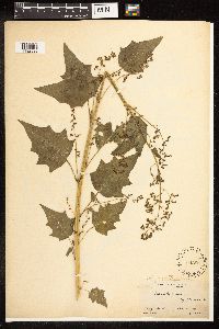 Chenopodium simplex (Torrey) Rafinesque 104596[1192538]Durand, E. J. s.n. United States, New York, Erie |
MIN:Plants | 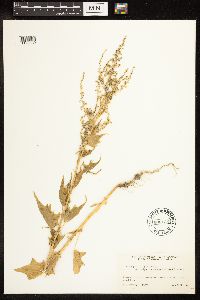 Chenopodium simplex (Torrey) Rafinesque 606135[1192539]Scoggan, H. J. 16031 Canada, British Columbia |
MIN:Plants | 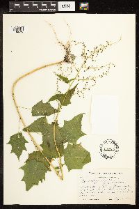 Chenopodium simplex (Torrey) Rafinesque 602262[1192540]Monserud, W. 1139 United States, South Dakota, Day |
MIN:Plants | 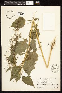 Chenopodium simplex (Torrey) Rafinesque 546867[1192541]Scoggan, H. J. 6553 Canada, Manitoba |
MIN:Plants | 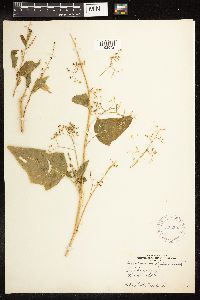 Chenopodium simplex (Torrey) Rafinesque 332206[1192542]Hovland, L. s.n. United States, North Dakota, Stark |
MIN:Plants | 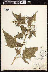 Chenopodium simplex (Torrey) Rafinesque 487658[1192543]Deane, W. s.n. United States, Massachusetts, Middlesex |
MIN:Plants | 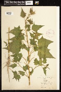 Chenopodium simplex (Torrey) Rafinesque 275490[1192544]Lakela, O. 406 United States, North Dakota, Ward |
MIN:Plants | 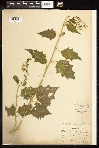 Chenopodium simplex (Torrey) Rafinesque 229687[1192545]Davis, J. 5566 United States, Missouri, Ralls |
MIN:Plants | 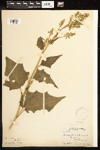 Chenopodium simplex (Torrey) Rafinesque 104597[1192546]Stevens, G. W. 1823 United States, Oklahoma, Hay |
MIN:Plants | 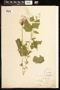 Chenopodium simplex (Torrey) Rafinesque 104601[1192547]Crandall, C. S. 2202 United States, Colorado, Larimer |
MIN:Plants | 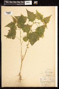 Chenopodium simplex (Torrey) Rafinesque 104605[1192548]Lunell, J. s.n. United States, North Dakota, Benson |
MIN:Plants | 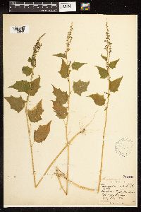 Chenopodium simplex (Torrey) Rafinesque 246424[1192549]Lunell, J. 372 United States, North Dakota, Bottineau |
MIN:Plants | 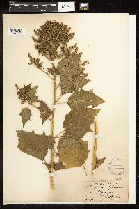 Chenopodium simplex (Torrey) Rafinesque 104604[1192550]Wright, J. S. s.n. United States, Indiana, Marion |
MIN:Plants | 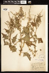 Chenopodium simplex (Torrey) Rafinesque 104608[1192551]Camp, S. H. s.n. United States, Michigan, Jackson |
MIN:Plants | 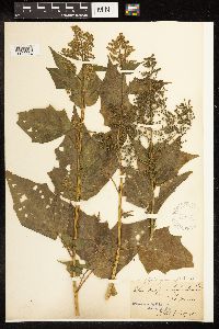 Chenopodium simplex (Torrey) Rafinesque 104610[1192552]Glatfelter, N. M. s.n. United States, Missouri |
MIN:Plants | 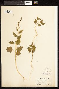 Chenopodium simplex (Torrey) Rafinesque 104612[1192553]Parlin, J. C. s.n. United States, Maine, York |
MIN:Plants | 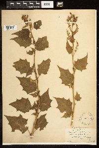 Chenopodium simplex (Torrey) Rafinesque 225233[1192554]Commons, A. s.n. United States, Delaware, New Castle |
MIN:Plants | 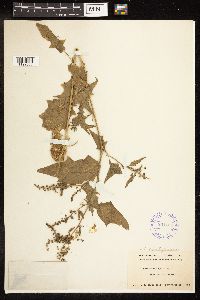 Chenopodium simplex (Torrey) Rafinesque 291765[1192555]Ricksecker, A. E. s.n. United States, Ohio, Lorain |
MIN:Plants | 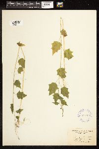 Chenopodium simplex (Torrey) Rafinesque 354699[1192556]Gilbert, F. A. 774 United States, West Virginia, Wayne |
MIN:Plants | 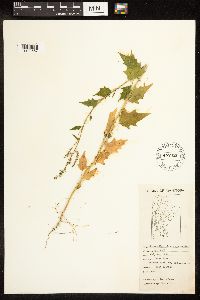 Chenopodium simplex (Torrey) Rafinesque 452421[1192557]Love, D. 4983 Canada, Manitoba |
MIN:Plants | 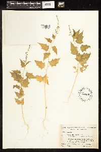 Chenopodium simplex (Torrey) Rafinesque 450856[1192558]Godfrey, R. K. 51493 United States, North Carolina, Jackson |
MIN:Plants | 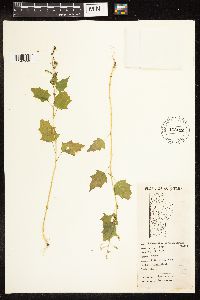 Chenopodium simplex (Torrey) Rafinesque 452412[1192559]Love, A. 5311 Canada, Manitoba |
MIN:Plants | 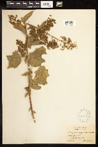 Chenopodium simplex (Torrey) Rafinesque 302324[1192560]Bush, B. F. 12385 United States, Missouri, Daviess |
MIN:Plants | 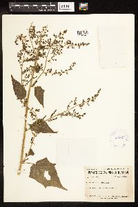 Chenopodium simplex (Torrey) Rafinesque 424918[1192561]Marie-Victorin, J. L. 49313 Canada, Quebec, Chambly |
MIN:Plants | 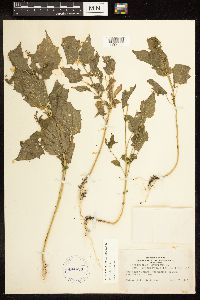 Chenopodium simplex (Torrey) Rafinesque 404453[1192562]Harden, P. H. s.n. United States, South Dakota, Jerauld |
MIN:Plants | 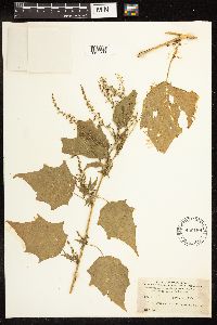 Chenopodium simplex (Torrey) Rafinesque 490186[1192563]Stevens, O. A. 73 United States, North Dakota, Cass |
MIN:Plants | 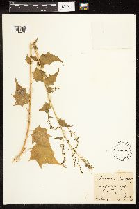 Chenopodium simplex (Torrey) Rafinesque 468922[1192564]Shimek, B. s.n. United States, Iowa, Clayton |
MIN:Plants | 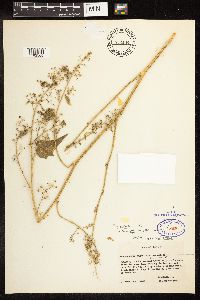 Chenopodium simplex (Torrey) Rafinesque 832144[1192565]Ewan, J. 14809 United States, Nebraska, Franklin |
MIN:Plants | 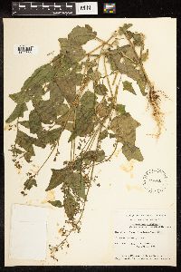 Chenopodium simplex (Torrey) Rafinesque 528661[1192566]Garton, C. E. 1663 Canada, Ontario, Thunder Bay |
MIN:Plants | 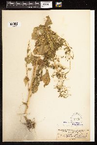 Chenopodium simplex (Torrey) Rafinesque 104600[1192567]Kreager, F. O. 567 United States, Washington, Spokane |
MIN:Plants | 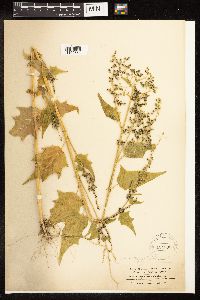 Chenopodium simplex (Torrey) Rafinesque 104606[1192568]Elmer, A. D. E. 590 United States, Washington, Okanogan |
MIN:Plants | 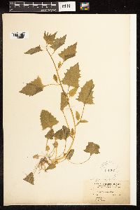 Chenopodium simplex (Torrey) Rafinesque 104607[1192569]Baker, C. F. 125 United States, Colorado, Montezuma |
MIN:Plants | 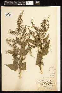 Chenopodium simplex (Torrey) Rafinesque 104609[1192570]Kelsey, F. D. s.n. United States, Montana, Lewis and Clark |
MIN:Plants | 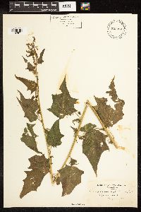 Chenopodium simplex (Torrey) Rafinesque 522398[1192571]Cooper, W. S. s.n. United States, Michigan, St. Clair |
MIN:Plants | 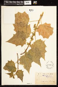 Chenopodium simplex (Torrey) Rafinesque 104611[1192572]Clements, F. 2745 United States, Nebraska, Holt |
MIN:Plants | 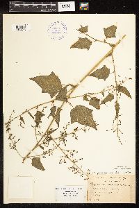 Chenopodium simplex (Torrey) Rafinesque 394786[1192573]Wadmond, S. C. 1804 United States, Wisconsin, Racine |
MIN:Plants | 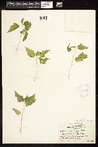 Chenopodium simplex (Torrey) Rafinesque 414367[1192574]Russell, N. H. s.n. United States, Wisconsin, St. Croix |
MIN:Plants | 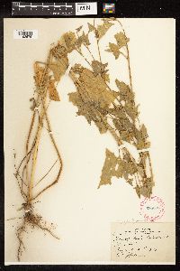 Chenopodium simplex (Torrey) Rafinesque 285898[1192575]Harris, J. A. C27631 United States, Utah, Utah |
MIN:Plants | 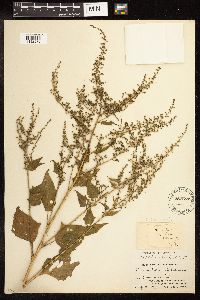 Chenopodium simplex (Torrey) Rafinesque 487657[1192576]Churchill, J. R. s.n. United States, Illinois, Cook |
MIN:Plants | 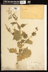 Chenopodium simplex (Torrey) Rafinesque 104599[1192577]Bates, J. M. s.n. United States, Nebraska, Cherry |
MIN:Plants | 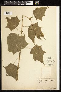 Chenopodium simplex (Torrey) Rafinesque 104595[1192578]Metcalf, F. P. 6380 United States, New York, Tompkins |
MIN:Plants | 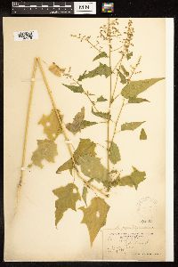 Chenopodium simplex (Torrey) Rafinesque 104603[1192579]Davis, C. A. s.n. United States, Michigan, Gratiot |
MIN:Plants | 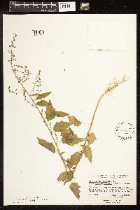 Chenopodium simplex (Torrey) Rafinesque 575507[1192580]Garton, C. E. 9222 Canada, Ontario, Rainy River |
MIN:Plants | 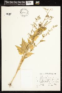 Chenopodium simplex (Torrey) Rafinesque 804946[1192581]Garton, C. E. 23984 Canada, Ontario, Thunder Bay |
MIN:Plants | 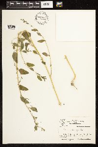 Chenopodium simplex (Torrey) Rafinesque 749813[1192582]Taylor, J. 29682 United States, Utah, San Juan |
MIN:Plants | 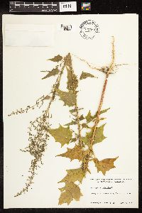 Chenopodium simplex (Torrey) Rafinesque 702584[1192583]Ahles, H. E. 85755 United States, Massachusetts, Hampshire |
MIN:Plants | 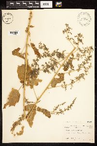 Chenopodium simplex (Torrey) Rafinesque 448019[1192584]Cruise, J. E. s.n. United States, New York, Tompkins |
MIN:Plants | 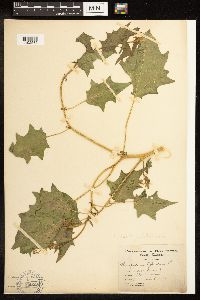 Chenopodium simplex (Torrey) Rafinesque 104598[1192585]Rydberg, P. A. 149 United States, South Dakota, Lawrence |
MIN:Plants | 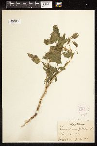 Chenopodium simplex (Torrey) Rafinesque 274034[1192586]Moore, John W. 4411924-07-00 United States, South Dakota, Lawrence, 44.490817 -103.85937 |
MIN:Plants |  Chenopodium simplex (Torrey) Rafinesque 276508[1192587]Moore, John W. 12021924-08-00 United States, South Dakota, Brookings, Lake Campbell, 44.202598 -96.851815 |
MIN:Plants |  Chenopodium simplex (Torrey) Rafinesque 269590[1192588]Moore, John W. 19781923-09-00 United States, South Dakota, Brookings, Warren Woods, Brookings; 44.45 -96.5333, 44.45 -96.5333 |
MIN:Plants |  Chenopodium simplex (Torrey) Rafinesque 269596[1192589]Moore, John W. 19801925-07-00 United States, South Dakota, Custer, Lime Stone District west of Custer; 43.777311 -103.78008, 43.777311 -103.78008 |
MIN:Plants |  Chenopodium simplex (Torrey) Rafinesque 274038[1192590]Moore, John W. 4451924-08-00 United States, South Dakota, Stanley, 44.353593 -100.373745 |
MIN:Plants | 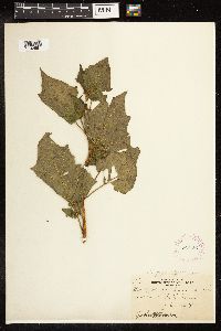 Chenopodium simplex (Torrey) Rafinesque 269597[1192591]Moore, John W. 19791925-07-00 United States, South Dakota, Charles Mix, Missouri River, Lake Andes, 43.100255 -98.551083 |
MIN:Plants | 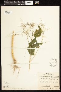 Chenopodium simplex (Torrey) Rafinesque 591451[1192592]Bailey, W. M. 551 United States, Illinois, Jackson |
MIN:Plants | 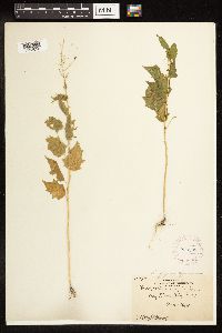 Chenopodium simplex (Torrey) Rafinesque 269508[1192593]Moore, John W. 10951924-08-00 United States, South Dakota, Grant, 45.291632 -96.462834 |
MIN:Plants | 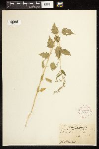 Chenopodium simplex (Torrey) Rafinesque 269738[1192594]Moore, John W. 19911925-07-00 United States, South Dakota, Lawrence, 44.461095 -103.638528 |
MIN:Plants | 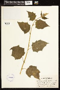 Chenopodium simplex (Torrey) Rafinesque 392103[1192595]Duncan, W. D. s.n. United States, South Dakota, Minnehaha |
MIN:Plants | 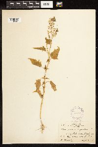 Chenopodium simplex (Torrey) Rafinesque 301374[1192596]Keinholz, R. 135 United States, South Dakota, Grant |
MIN:Plants | 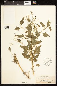 Chenopodium simplex (Torrey) Rafinesque 104613[1192597]Moffatt, W. S. s.n. United States, Illinois, Cook |
MIN:Plants | 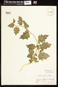 Chenopodium simplex (Torrey) Rafinesque 477929[1192598]Linnstrom, H. A. 84-84 United States, Idaho, Butte |
MIN:Plants | 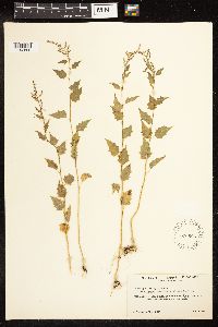 Chenopodium simplex (Torrey) Rafinesque 546666[1192599]Scoggan, H. J. 3619 Canada, Manitoba |
MIN:Plants | 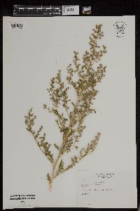 Chenopodium simplex (Torrey) Rafinesque 953721[1294570]Rogge, Janet 152 United States, South Dakota, Minnehaha |
MIN:Plants | 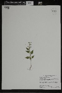 Chenopodium simplex (Torrey) Rafinesque 959691[1311995]Lynden B. Gerdes 73472015-08-04 United States, Minnesota, Koochiching, Approximately 7.55 miles northwest of Ray, MN. East of inlet into the Rat Root River 0.51 miles west of Rat Root Lake., 48.4925 -93.31333333 |
MIN:Plants | 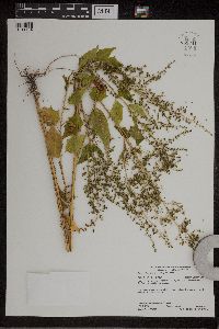 Chenopodium simplex (Torrey) Rafinesque 959341[1311184]Lynden B. Gerdes 73522015-08-04 United States, Minnesota, Koochiching, Approximately 6.04 miles northwest of Ray, MN and 0.14 miles NE of the Rat Root Lake public boat landing., 48.49 -93.26083333 |
MIN:Plants | 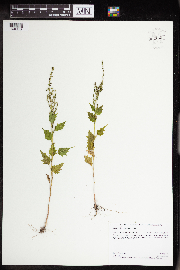 Chenopodium simplex (Torrey) Rafinesque 962650[1346356]Graham, Dustin R. DRJG242015-07-08 United States, Minnesota, Marshall, Growing short way(ca. 10 m) to the west of Hwy 118., 48.46 -96.27, 347m |
MIN:Plants | 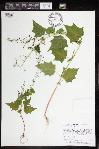 Chenopodium simplex (Torrey) Rafinesque 965366[1356229]Lee, Michael MDL53062010-07-25 United States, Minnesota, Cook, Boundary Waters Canoe Area Wilderness, Strongly rolling bedrock terrain north of Winchell Lake, 23 miles northwest of Grand Marais.T64N R3W NW1/4 of SE1/4 Sec. 24, 48.00866404 -90.64487749, 585m |
MIN:Plants | Chenopodium simplex (Torrey) Rafinesque []Timothy J. S. Whitfeld 35122022-08-26 United States, Minnesota, Washington, Crystal Spring Scientific and Natural Area, 0.4 miles northeast of the intersection of Scandia Trail North and Hwy 95, 45.2572195 -92.765073, 254m |
MIN:Plants | 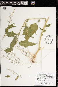 Chenopodium simplex (Torrey) Rafinesque 973348[1398901]Lee, Michael MDL57952011-10-05 United States, Minnesota, Becker, Rugged forested moraine north of Juggler Lake, 18 miles northwest of Osage, on north side of State Highway 113., 47.14567879 -95.45361439, 442m |
MIN:Plants | 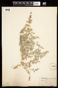 Atriplex powellii S. Watson 103955[1036804]Moyer, Lycurgus 7241915-08-20 United States, North Dakota, Slope, Bad Lands, Marmarth |
MIN:Plants | 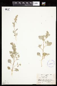 Atriplex powellii S. Watson 422775[1036803]Weber, W. 54221950-05-20 United States, Utah, Uintah, Uintah Co....along road from Dinosau Monument headquarters to Split Mountain Gorge;Dinosaur National Monument |
MIN:Plants | 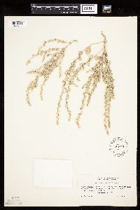 Atriplex powellii S. Watson 540143[1036805]Porter, C. 74451957-09-07 United States, South Dakota, Pennington, Pennington County. badlands National Monument 13 miles south of Wall;Badlands National Monument, 701m |
MIN:Plants | 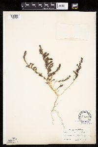 Suaeda linearis (Elliott) Moquin-Tandon 104910[1037727]Fernald, M. s.n.1892-09-18 United States, Maine, Hancock, Hancock Co....Norwoods Cove, Mt. Desert I.;Acadia National Park |
MIN:Plants |  Krascheninnikovia lanata (Pursh) A. Meeuse & A. Smit 448017[1037576]Abbott, Robinson s.n.1977-05-21 United States, North Dakota, Slope, Slope County...Brown farm, c. 11 mi. N. of Marmarth on the Little Missouri River. |
MIN:Plants | 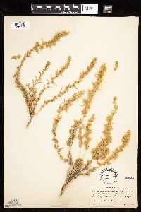 Krascheninnikovia lanata (Pursh) A. Meeuse & A. Smit 246440[1037574]Mearns, E. 34071902-08-17 United States, Wyoming, Park, Yellowstone National Park...Mammoth Hot Springs;Yellowstone National Park |
MIN:Plants | 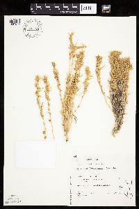 Krascheninnikovia lanata (Pursh) A. Meeuse & A. Smit 794725[1037571]Schaaf, J. 241982-07-27 United States, Nevada, Pershing, Pershing Co. ... SR 399 MP-14-15, 1250m |
MIN:Plants | 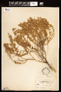 Krascheninnikovia lanata (Pursh) A. Meeuse & A. Smit 104972[1122523]Nelson, Aven; et al. 59831899-07-19 United States, Wyoming, Park, Gardiner River;Yellowstone National Park |
Google Map
Google Maps is a web mapping service provided by Google that features a map that users can pan (by dragging the mouse) and zoom (by using the mouse wheel). Collection points are displayed as colored markers that when clicked on, displays the full information for that collection. When multiple species are queried (separated by semi-colons), different colored markers denote each individual species.