University of Minnesota
http://www.umn.edu/
612-625-5000
http://www.umn.edu/
612-625-5000
Minnesota Biodiversity Atlas
Bell Museum
Dataset: MIN-Plants
Taxa: Asplenium
Search Criteria: excluding cultivated/captive occurrences
Bell Museum plants | |
 MIN:Plants | 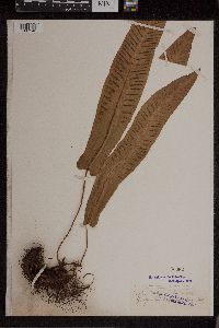 Asplenium scolopendrium var. americanum (Fernald) Reichst. & Rasbach & Viane 53382[1307142] 2461894-08-00 Korea, Democratic People's Republic of |
MIN:Plants | 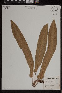 Asplenium scolopendrium var. americanum (Fernald) Reichst. & Rasbach & Viane 763897[1307143]Lugger, Otto s.n. United States, New York, Green Lake |
MIN:Plants | 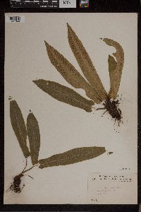 Asplenium scolopendrium var. americanum (Fernald) Reichst. & Rasbach & Viane 261093[1307144]Fisher, Geo. L. 21905-08-06 Canada, Ontario, Owen Sound |
MIN:Plants | 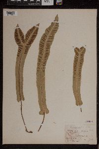 Asplenium scolopendrium var. americanum (Fernald) Reichst. & Rasbach & Viane 261094[1307145]Cleveland, G.F. s.n.1907-09-19 United States, New York, Jamesville |
MIN:Plants | 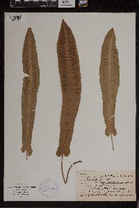 Asplenium scolopendrium var. americanum (Fernald) Reichst. & Rasbach & Viane 388105[1307147]Maxon, Will R. s.n.1895-09-15 United States, New York, Madison, Chittenango Falls State Park, 42.9834 -75.847135 |
MIN:Plants | 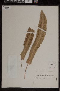 Asplenium scolopendrium var. americanum (Fernald) Reichst. & Rasbach & Viane 279061[1307148]McCall, W.R. s.n.1924-09-27 Canada, Ontario, Owen Sound, 44.666667 -80.916667 |
MIN:Plants | 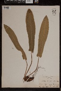 Asplenium scolopendrium var. americanum (Fernald) Reichst. & Rasbach & Viane 959103[1307146]Durand, Elias J. s.n.1891-06-27 United States, New York, shore of Green Lake East, Jamesville |
MIN:Plants | 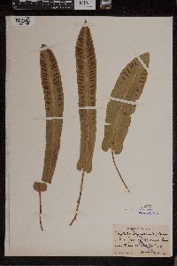 Asplenium scolopendrium var. americanum (Fernald) Reichst. & Rasbach & Viane 53373[1307149]Maxon, Will. R. s.n.1898-10-22 United States, New York, near Syracuse, 43.048122 -76.147424 |
MIN:Plants | 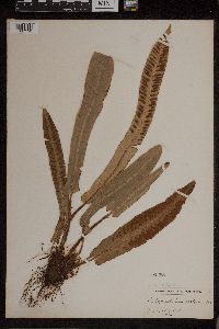 Asplenium scolopendrium var. americanum (Fernald) Reichst. & Rasbach & Viane 53363[1307150]Underwood, Lucien M. 441886-00-00 United States, New York, Jamesville |
MIN:Plants | 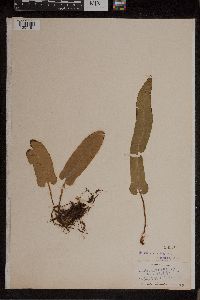 Asplenium scolopendrium var. americanum (Fernald) Reichst. & Rasbach & Viane 53370[1307151]MacDonald, Mrs. s.n.1891-07-11 Canada, Ontario, Owen Sound, 44.666667 -80.916667 |
MIN:Plants | 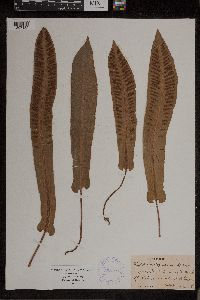 Asplenium scolopendrium var. americanum (Fernald) Reichst. & Rasbach & Viane 388104[1307152]Maxon, Will R. s.n.1898-10-22 United States, New York, Jamesville |
MIN:Plants | 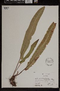 Asplenium scolopendrium var. americanum (Fernald) Reichst. & Rasbach & Viane 565323[1307153]Grevatt, J.G. 1621957-08-01 Canada, Ontario, Grey, Bowles Gully, lot 1, conc. VI, Euphrasia Tp. (Loc. 20), 51.604927 -86.242187 |
MIN:Plants | 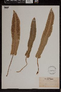 Asplenium scolopendrium var. americanum (Fernald) Reichst. & Rasbach & Viane 195741[1307154]Durand, Elias J. s.n.1878-10-00 United States, New York, Green Lake, Jamesville |
MIN:Plants | 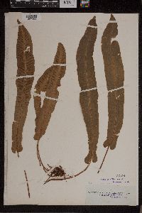 Asplenium scolopendrium var. americanum (Fernald) Reichst. & Rasbach & Viane 53371[1307155] 490 United States, New York, Hound's-tongue Fern., 43.409688 -75.393188 |
MIN:Plants | 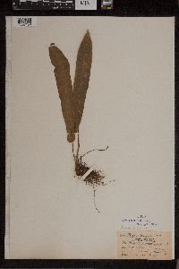 Asplenium scolopendrium var. americanum (Fernald) Reichst. & Rasbach & Viane 53369[1307156]Aiton, Geo. B. s.n.1878-00-00 United States, Tennessee, Marion, So Pittsburg |
MIN:Plants | 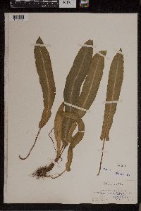 Asplenium scolopendrium var. americanum (Fernald) Reichst. & Rasbach & Viane 53368[1307157]Maxon, Will R. 4071900-08-03 United States, Tennessee, Marion, Growing in light clay on a moist limestone ledge in a sink hole., 36.2167 -82.6167 |
MIN:Plants | 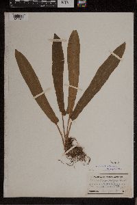 Asplenium scolopendrium var. americanum (Fernald) Reichst. & Rasbach & Viane 53367[1307158]Smith, Kirby s.n.1878-00-00 United States, Tennessee |
MIN:Plants | 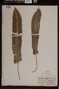 Asplenium scolopendrium var. americanum (Fernald) Reichst. & Rasbach & Viane 53364[1307159]Maxon, Will R. s.n.1898-10-22 United States, New York, near Syracuse, at Rock Cut s.e., 43.048122 -76.147424 |
MIN:Plants | 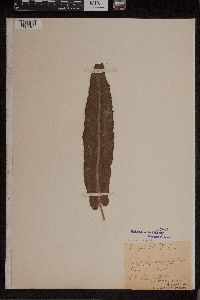 Asplenium scolopendrium var. americanum (Fernald) Reichst. & Rasbach & Viane 53366[1307160]Bell, Clara s.n. United States, New York, Onodaga, [No further info.] |
MIN:Plants | 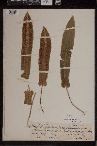 Asplenium scolopendrium var. americanum (Fernald) Reichst. & Rasbach & Viane 53365[1307161]Maxon, Will R. s.n.1898-10-22 United States, New York, near Syracuse, at Rock Cut s.e., 43.048122 -76.147424 |
MIN:Plants | 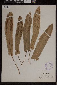 Asplenium scolopendrium var. americanum (Fernald) Reichst. & Rasbach & Viane 290968[1307162]McCall, W.R. s.n. Canada, Ontario, Grey, Cherry's Farm, 51.604927 -86.242187, 243m |
MIN:Plants | 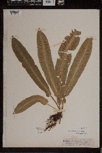 53372[1307163]Ten-Eyck Burr, J.H. s.n.1890-09-00 United States, New York, Madison |
MIN:Plants |  260960[1307166]Carter, J.J. s.n.1903-11-09 United States, Florida, In hammocks near the homestead road, Between Cutler and Longview Camp, 25.767041 -80.07753 |
MIN:Plants |  411668[1307167]Carter, J.J. s.n.1906-11-12 United States, Florida, Ross' Hammock near Silver Palm School, 25.565663 -80.385888 |
MIN:Plants | 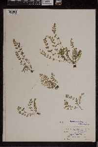 50893[1307168]Curtiss, A.H. 54611895-07-08 United States, Florida, Shaded banks of Arch Creek, 25.889817 -80.150324 |
MIN:Plants | 51057[1307164] United States |
MIN:Plants | 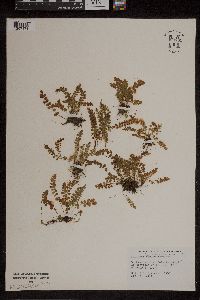 950781[1307171]Eyerdam, W. J. 74381949-10-02 United States, Washington, Washington Bay, Kuiu Island, 47 -120 |
MIN:Plants | 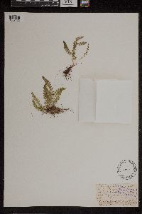 51187[1307172]Jones, L.R. s.n.1891-07-16 United States, Vermont, Smuggler's Notch; Mansfield, 44.543663 -72.81429 |
MIN:Plants | 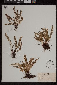 485627[1307173]Forbes, F.F. s.n.1905-06-22 Canada, Quebec, Rimouski, Bic |
MIN:Plants | 565402[1307174]Grevatt, J.G. Canada, Ontario, Grey, Detailed locality information protected. This is typically done to protect rare or threatened species localities. |
MIN:Plants | 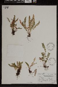 346070[1307175]Clausen, R.T. 28321937-08-22 Canada, Quebec, Between Cap a' l'Original and Cap Enrage, 45.616667 -74.683333 |
MIN:Plants | 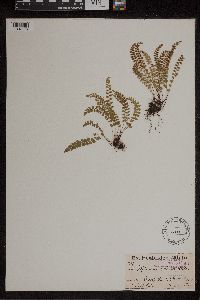 51186[1307176]White, Jas. 126071892-08-03 Canada, Ontario, Credit Forks Ont., 43.8 -80 |
MIN:Plants | 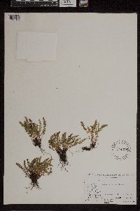 544379[1307177]Abbe, Lucy B. 38241939-08-12 Canada, Quebec, East Coast of Hudson Bay ... south side of Gulf Hazard, 59.400064 -84.771781 |
MIN:Plants | 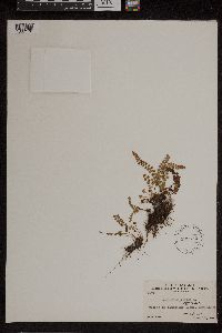 538612[1307178]Abbe, Ernst C. 10011929-06-15 Canada, Quebec, 63° 11', 52.656937 -71.681641 |
MIN:Plants | 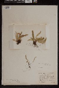 51176[1307179]Collins, J.F. 1021905-07-15 Canada, Quebec, Grand Cascapedia River, Quebec, 48.2 -65.9 |
MIN:Plants | 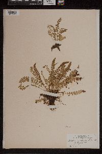 51177[1307180]Eggleston, Willard W. 511897-07-05 United States, Vermont, Rutland, Mt. Mansfield; Smuggler's Notch, 43.961835 -72.681397 |
MIN:Plants | 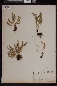 51178[1307181]White, Jas. s.n.1893-08-07 Canada, Ontario, Edmonton, Ontario, 53.55 -113.5 |
MIN:Plants | 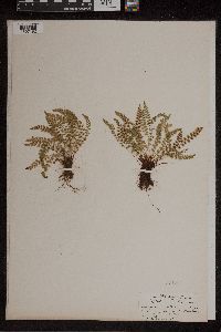 51179[1307182]Eggleston, Willard W. s.n.1893-06-14 United States, Vermont, Smuggler's Notch. Mt. Mansfield, 44.543663 -72.81429 |
MIN:Plants | 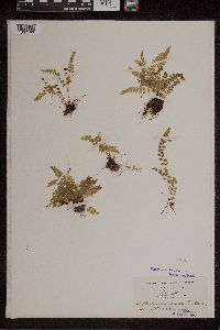 51180[1307183]Eggleston, Willard W. 17731897-07-05 United States, Vermont, Mt. Mansfield; Pringle's Ravine, Smuggler's Notch, 44.543663 -72.81429 |
MIN:Plants | 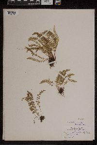 51181[1307184]Eggleston, Willard W. s.n.1897-07-05 United States, Vermont, Mt. Mansfield; Smuggler's Notch, 44.543663 -72.81429 |
MIN:Plants | 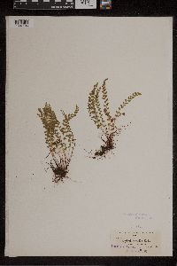 51183[1307185]Howell, Thos. 17271895-07-02 United States, Alaska, Yes Bay, 55.913333 -131.793611 |
MIN:Plants | 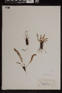 51184[1307186]Waghorne, Rev. A.C. 301896-08-22 Canada, Newfoundland and Labrador, Soore Arm [?], 53.775217 -61.552246 |
MIN:Plants | 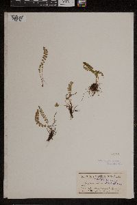 51185[1307187]Macoun, Jas. M. s.n.1890-08-13 Canada, British Columbia, Kicking Horse River; Rocky Mts, 51.306944 -116.987778 |
MIN:Plants | 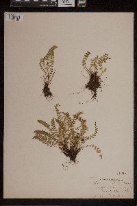 261108[1307188]Eggleston, W.W. s.n.1897-07-05 United States, Vermont, Smuggler's Notch, Mt. Mansfield, 44.543663 -72.81429 |
MIN:Plants | 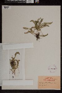 279075[1307189]Carpenter, Dana S. s.n.1920-07-02 United States, Vermont, Windsor, Plymouth Notch, 43.961835 -72.681397 |
MIN:Plants | 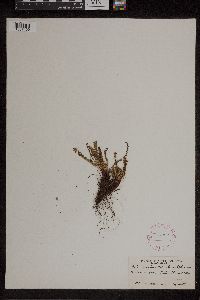 267862[1307190]Ulke, Titus F81927-08-13 Canada, British Columbia, Yoho Park; Mt Stephen, 51.45 -116.3, 1615m |
MIN:Plants | 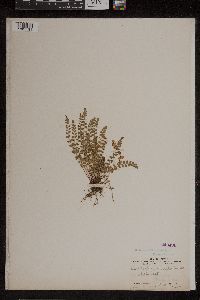 240496[1307191]Shaw, Charles H. 2691904-07-13 Canada, British Columbia, Selkirk and Rocky Mountains; near 51° 30' N lat., 54.5 -122.5, 1829m |
MIN:Plants | 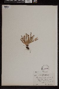 240497[1307192]Butters, F.K. 9201915-09-10 Canada, British Columbia, East end of Cougar Mt. Glacier, B.C., 51.266667 -117.516667, 1829m |
MIN:Plants | 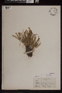 240490[1307193]Butters, F.K. 7071911-08-13 Canada, British Columbia, Selkirk Mountains;Head of Downie Creek, 54.5 -122.5, 1768m |
MIN:Plants | 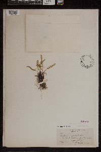 240489[1307194]Butters, F.K. 5371910-07-16 Canada, British Columbia, Selkirk Mountains; Sandford Moraine, 54.5 -122.5, 1676m |
MIN:Plants | 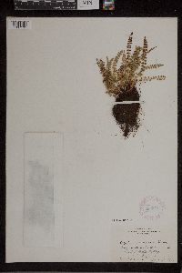 282374[1307195]Butters, F.K. s.n.1931-08-15 Canada, British Columbia, end of Whaleback [mountain]; Head of Yoho Valley, B.C., 51.539444 -116.560556 |
MIN:Plants | 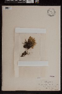 240495[1307196]Butters, F.K. s.n.1904-08-29 Canada, British Columbia, Yoho Valley BC, 51.45 -116.3, 1829m |
MIN:Plants | 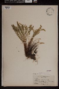 240498[1307197]Butters, F.K. 6281911-07-27 Canada, British Columbia, South Moraine Siu[?] Sandford Glacier, 51.266667 -117.516667, 1676m |
MIN:Plants | 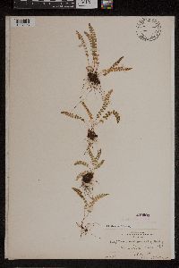 240500[1307198]Butters s.n.1905-08-28 Canada, British Columbia, Vermilion Pass B.C., 51.233333 -116.05, 1829m |
MIN:Plants |  Asplenium viride Hudson 240488[1307199]Butters, F.K. 5891910-08-01 Canada, British Columbia, Selkirk Mountains; Cougar Mt., 54.5 -122.5, 1981m |
MIN:Plants |  240499[1307200]Butters, F.K. s.n.1924-08-30 Canada, British Columbia, Glacier Circle, Selkirk Mts. B.C., 51.166667 -117.4, 1829m |
MIN:Plants |  387983[1307201]White, Jas. G 35461893-05-06 Canada, Ontario, Edmonton, Ontario, 53.55 -113.5 |
MIN:Plants |  387982[1307202]Fassett, N.C. 147421932-09-11 United States, Michigan, Chippewa |
MIN:Plants |  450645[1307203]Fernald, M.L. 11521929-08-12 Canada, Newfoundland and Labrador, Main Arm (East Arm of charts), Bonne Bay; Lord and Lady Cove, 47.458116 -55.814664 |
MIN:Plants |  346069[1307204]Clausen, Robert T. 29511937-09-04 Canada, Quebec, Gaspe, southwest of Cap des Rosiers, 48.85 -64.2 |
MIN:Plants |  418316[1307205]Collins, J.F. 1021905-07-15 Canada, Quebec, Grand Cascapedia River, Quebec, 48.2 -65.9 |
MIN:Plants |  51188[1307206]Eggleston, Willard W. s.n.1893-06-14 United States, Vermont, Smuggler's Notch, Mt. Mansfield, 44.543663 -72.81429 |
MIN:Plants |  51189[1307207]White, Jas. s.n.1893-08-07 Canada, Ontario, Edmonton, 53.55 -113.5 |
MIN:Plants |  530421[1307208]Eyerdam, W.J. 75621951-06-25 United States, Alaska, Washington Bay, Krein[?] Id., 56.721111 -134.365833 |
MIN:Plants | 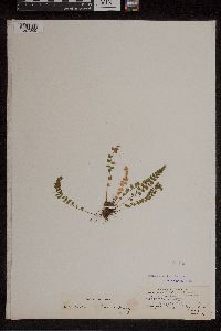 51190[1307209]Waghorne, Rev. A.C. 71895-08-20 Canada, Newfoundland and Labrador, Summerside; Bay or Islands, 53.775217 -61.552246 |
MIN:Plants | 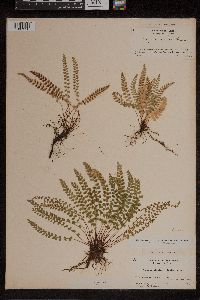 51182[1307210]Collins, J.F. 21905-07-15 Canada, Quebec, Bonaventure, Eastern Quebec; Grand Cascapedia River, 48.2 -65.9 |
MIN:Plants | 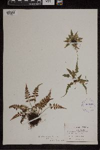 Asplenium x trudellii Wherry 404179[1307211]Sargent, F.H. s.n.1949-08-27 United States, West Virginia, Baker, W. Va., 39.041775 -78.74474 |
MIN:Plants | 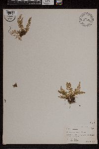 Asplenium verecundum Chapm.; Fourn. 445559[1307212]Ford, E.S. 6561954-02-11 United States, Florida, Alachua, 7 mi. W. of Gainesville on the Newberry road, 29.651583 -82.44177 |
MIN:Plants | 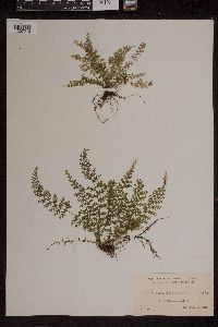 Asplenium verecundum Chapm.; Fourn. 300038[1307213]Small, J.K. s.n.1906-10-24 United States, Florida, Brickell Hammock, near Miami, 25.767041 -80.07753 |
MIN:Plants | 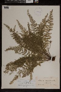 Asplenium verecundum Chapm.; Fourn. 411665[1307214]Small, J.K. s.n.1906-10-24 United States, Florida, Brickell Hammock, near Miami, 25.767041 -80.07753 |
MIN:Plants | 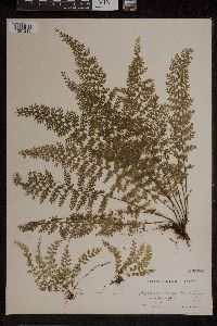 Asplenium verecundum Chapm.; Fourn. 260982[1307215]Small, J.K. s.n.1903-11-09 United States, Florida, near the homestead road, Between Cutler and Longview Camp, 25.767041 -80.07753 |
MIN:Plants | 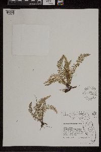 Asplenium verecundum Chapm.; Fourn. 589563[1307216]Lakela, O. 257861963-04-13 United States, Florida, Citrus, Withlacoochee State Forest south of Lecanto, 28.680553 -81.509516 |
MIN:Plants | 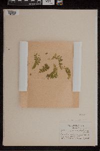 Asplenium verecundum Chapm.; Fourn. 50976[1307217]Gilbert, B.D. s.n.1903-03-06 United States, Florida, near Ocala, 29.187199 -82.140092 |
MIN:Plants | 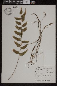 Asplenium L. 701924[1307219]Taylor, John 178171974-12-29 Costa Rica, Alajuela, along the Rio La balsa about 23 Km. northeast of San Ramon., 11.137867 -84.940249, 850m |
MIN:Plants | 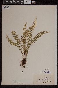 Asplenium L. 50946[1307220]Clute, Willard N. 1351900-02-12 Jamaica, Clyde River, 18.078199 -76.684394, 914m |
MIN:Plants | 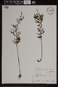 Asplenium L. 701943[1307221]Taylor, John 178191974-12-29 Costa Rica, Alajuela, along the Rio La Balsa about 23 Km. northeast of San Ramon., 11.137867 -84.940249, 850m |
MIN:Plants |  Asplenium L. 50846[1307222]Murray, Alex s.n. Mexico, [no further info], 21.515239 -101.476563 |
MIN:Plants |  Asplenium abscissum Willd. 220354[1307223]Fuertes, Padre Miguel 10351912-09-00 Dominican Republic, Barahona, El. Hoyo in feuchten Waltern, 18.45 -71.766667, 700m |
MIN:Plants |  Asplenium alatum Humb. & Bonpl. ex Willd. 50863[1307224]Clute, Willard N. 941900-02-09 Jamaica, Morce's Gap, 18.20933 -77.252625, 1524m |
MIN:Plants |  Asplenium alatum Humb. & Bonpl. ex Willd. 521848[1307225]Moore, A. s.n.1906-01-00 Jamaica, B.W.I.; St. Catharine's Pk., 18.077673 -76.425771 |
MIN:Plants |  558857[1307226]Pringle, C.G. 157121909-10-03 Mexico, mountain canyon above Cuernavaca, 18.282246 -101.327922, 1981m |
MIN:Plants |  50869[1307227]Pringle, C.G. 89551904-07-21 Mexico, Morelos, mountain canyon above Cuernavaca, 18.933725 -99.228488, 1981m |
MIN:Plants |  701930[1307228]Taylor, John 177011974-12-29 Costa Rica, Alajuela, the Stapp farm near the school house in the area of Balsa da San Ramon., 11.137867 -84.940249, 900m |
MIN:Plants |  610720[1307229]Corman, Alice 8331918-02-06 Panama, Chiriqui, in and around El Boquete, Province of Chiriqui, Republic of Panama., 9 -80 |
MIN:Plants | 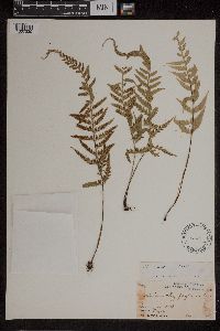 51051[1307230]Smith, Jared G. 741892-01-00 Mexico, Orizaba, 17.679814 -92.484738 |
MIN:Plants | 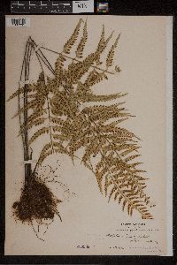 220369[1307231]Bang, A. Miguel 2251 Bolivia, [no further data], -17.286855 -64.181641 |
MIN:Plants | 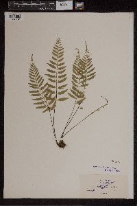 50868[1307232]Clute, Willard N. 1521900-02-13 Jamaica, Saint Thomas Parish, Cedar Valley, 18.151922 -77.370728, 610m |
MIN:Plants | 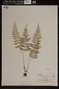 50867[1307233]Pringle, C.G. 89561904-07-21 Mexico, Morelos, mountain canyon above Cuernavaca, 18.933725 -99.228488, 1981m |
MIN:Plants |  425407[1307234]Smith, Jared G. 751892-02-16 Mexico, Orizaba, 17.679814 -92.484738 |
MIN:Plants |  521862[1307235]Moore, A. s.n.1906-01-13 Jamaica, Jamaica, B.W.I.; St. Catharine's Peak, 18.25 -77.5 |
MIN:Plants |  Asplenium castaneum Schltdl. & Cham. 507014[1307236]Ownbey, Gerald B. 19471953-09-28 Mexico, Durango: Road between Durango, Dgo, and Villa Union, Sin.; 60 miles southwest of El Salto, Dgo. (2.8 miles n.e. of El Paraiso, Sin.), 21.171348 -104.779442, 2073m |
MIN:Plants | Asplenium castaneum Schltdl. & Cham. 51001[1307237] Mexico |
MIN:Plants |  Asplenium crenulatum C.Presl 521619[1307238]Moore, A. s.n.1906-01-00 Jamaica, Man Mountain; Jamaica, B.W.I., 18.25 -77.5 |
MIN:Plants | 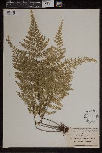 50878[1307239]Pringle, C.G. 40721891-12-04 Mexico, San Luis Potosi, Tamasopo Canyon, 21.943433 -99.510285 |
MIN:Plants | 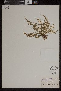 497058[1307240]Pringle, C.G. 60941895-01-21 Mexico, Vera Cruz, barranca near Orizaba, 17.679814 -92.484738, 1219m |
MIN:Plants | 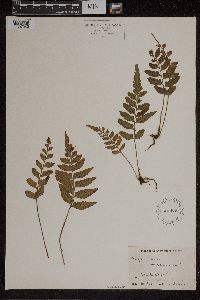 521478[1307242]Moore, A. s.n.1906-04-00 Jamaica, Chepstow, Jamaica, B.W.I., 18.178102 -76.635981 |
MIN:Plants | 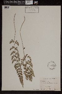 Asplenium cuneatum Lam. 521618[1307243]Moore, A. s.n.1906-04-00 Jamaica, Chepstow; Jamaica, B.W.I., 18.178102 -76.635981 |
MIN:Plants | 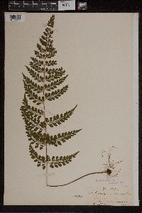 Asplenium cuneatum Lam. 50888[1307244]Pollard, Charles L. 1441902-01-30 Cuba, Santiago, Summit of El Yunque, near Baracoa, 23.033333 -82.583333, 305 - 610m |
MIN:Plants | Asplenium cuneatum Lam. 220386[1307245] United States Minor Outlying Islands |
MIN:Plants | 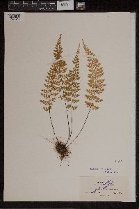 Asplenium cuneatum Lam. 50889[1307246]Clute, Willard N. 2781900-02-28 Jamaica, Above Moore Town, 18.077673 -76.425771, 457m |
Google Map
Google Maps is a web mapping service provided by Google that features a map that users can pan (by dragging the mouse) and zoom (by using the mouse wheel). Collection points are displayed as colored markers that when clicked on, displays the full information for that collection. When multiple species are queried (separated by semi-colons), different colored markers denote each individual species.