University of Minnesota
http://www.umn.edu/
612-625-5000
http://www.umn.edu/
612-625-5000
Minnesota Biodiversity Atlas
Bell Museum
Dataset: MIN-Plants
Taxa: Asplenium
Search Criteria: excluding cultivated/captive occurrences
Bell Museum plants | |
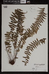
MIN:Plants | 346886[1307247]Senn, H.A. 2811938-03-21 Cuba, Santa Clara, Mina Carlota, south-east of Cumanayagua, Sierra de San Juan, 20.998611 -75.860833, 300 - 400m |
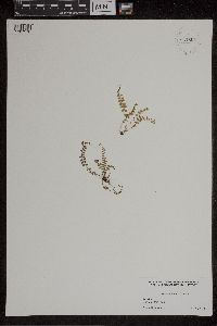
MIN:Plants | 261100[1307248]Heller, A.A. 62971902-12-17 Puerto Rico, On the Adjuntas road eight miles from Ponce, 18.007339 -66.588676 |
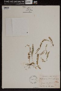
MIN:Plants | 50894[1307249] Jamaica |
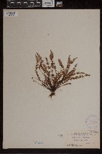
MIN:Plants | 220370[1307250]Stevenson, J.A. 13881914-02-18 Puerto Rico, Carolina, Puerto Rico, 18.449195 -65.950439 |
MIN:Plants | 51171[1307251]Pollard, C.L. s.n.1902-02-21 Cuba, Santiago, near El Cobre, 20.048498 -75.945786 |
MIN:Plants | 51172[1307252]Pollard, Charles L. 271902-01-24 Cuba, Santiago, Vicinity of Baracoa, 23.033333 -82.583333 |
MIN:Plants | Asplenium eatonii Davenp. 50898[1307253]Pringle, C.G. 103001906-09-08 Mexico, Puebla, 1981m |
MIN:Plants | 50882[1307254]Pringle, C.G. 60721894-12-03 Mexico, Oaxaca, Sierra de San Felipe in Benito Juarez National Park, 31.017029 -114.833695, 2591m |
MIN:Plants | 50906[1307255]Butler, Eloise s.n.1894-07-00 Jamaica, Blue Mountains, 18.04468 -76.577034 |
MIN:Plants | 357697[1307256]Brues, B.B. s.n.1925-01-25 Cuba, Santa Clara, Trinidad Mountains, 21.933333 -80 |
MIN:Plants | Asplenium falcatum Lam. 50907[1307257]Clute, W.N. 1501900-02-13 Jamaica, Saint Thomas, Cedar Valley, 18.151922 -77.370728, 610m |
MIN:Plants | Asplenium glenniei Baker 50929[1307258]Pringle, C.G. 8331886-11-04 Mexico, Chihuahua, Mapula Mountains, 28.50847 -105.9409 |
MIN:Plants | Asplenium glenniei Baker 50928[1307259]Pringle, C.G. s.n.1905-10-12 Mexico, Durango, south of Sandias, 25.25 -105.6, 1981m |
MIN:Plants | Asplenium falcatum Lam. 521716[1307260]Moore, A. s.n. Jamaica, Middlesex, St. Catherine's Peak, 18.151922 -77.370728 |
MIN:Plants | Asplenium fibrillosum Pringle & Davenp. 50909[1307261]Pringle, C.G. 87911903-09-06 Mexico, Federal District, Mexico City, near Eslaba, 22.777006 -102.150391 |
MIN:Plants | Asplenium flabellatum Kunze 610667[1307262]Cornman, M. Alice 10101918-02-20 Panama, Chiriqui, Boquete, Dexter Trail, 9 -80 |
MIN:Plants | Asplenium formosum Willd. 50915[1307263]Butler, Eloise s.n.1894-07-00 Jamaica, W of Water, 18.151922 -77.370728 |
MIN:Plants | Asplenium formosum Willd. 295832[1307265]Yuncker, T.G. 49121934-07-31 Honduras, Cortes, Lake Yojoa, 14.866487 -87.982178, 640m |
MIN:Plants | 50917[1307266]Pringle, C.G. 33641890-11-25 Mexico, San Luis Potosi, Tamasopo Canyon, 21.943433 -99.510285 |
MIN:Plants | 597660[1307267]Heckenlaible, J. 53-91-P1953-06-13 Mexico, Tamaulipas, Sierra Madre Oriental, 4 miles northwest of Gomez Farias, 23.077701 -99.194684, 1067m |
MIN:Plants | 50916[1307268]Clute, W.N. 561900-02-06 Jamaica, Morge's Gap, 18.20933 -77.252625, 1524m |
MIN:Plants | Asplenium harpeodes Kunze 931807[1307269]Lawrence, D.B. s.n.1932-07-13 Jamaica, Blue Mountain Peak, 18.04468 -76.577034 |
MIN:Plants | Asplenium harrisii Jenman 931806[1307270]Lawrence, D.B. s.n.1932-07-13 Jamaica, Blue Mountain Peak, 18.04468 -76.577034 |
MIN:Plants | Asplenium harrisii Jenman 522133[1307271]Shreve, F. s.n.1906-10-14 Jamaica, Blue Mountain Peak, 18.04468 -76.577034 |
MIN:Plants | Asplenium heterochroum Kunze 368551[1307272]Degener, O. 12,5041921-08-08 Bermuda, Bermuda, Paget Marsh, 32.285 -64.776944 |
MIN:Plants | 52010[1307273]Fendler, A. 611877-00-00 Trinidad and Tobago |
MIN:Plants | 518260[1307274]Barkelew, F.E. 2151903-05-27 Mexico, Colima, Revillagigedo, Revillagigedo Islands, Socorro Island, 18.758452 -110.999291 |
MIN:Plants | Asplenium monanthemum Murray 50955[1307275]Smith, J.G. 941892-09-00 Mexico, Veracruz, Orizaba, maybe Orizaba mountain?, 17.679814 -92.484738 |
MIN:Plants | Asplenium monanthemum Murray 281158[1307276]Durand, E.J. 117751903-11-13 Mexico, Federal District, Mexico City |
MIN:Plants | Asplenium monanthemum Murray 50954[1307277]Smith, J.G. 601892-02-27 Mexico, Puebla, Aljojuca, Foot of Mount Orizaba, 17.679814 -92.484738, 3170m |
MIN:Plants | 50845[1307278]Pringle, C.G. 87541903-11-15 Mexico, Federal District, Mexico City, 2377m |
MIN:Plants | 507008[1307279]Ownby, G.B. 19431953-09-28 Mexico, Durango, Road between Durango, Dgo, and Villa Union, Sinaloa ; 60 miles southwest of El Salto, Durango (2.8 miles northeast of El Paraiso, Sinaloa, 21.171348 -104.779442, 2073m |
MIN:Plants | 507010[1307280]Ownbey, G.B. 19441953-09-28 Mexico, Durango, Durango, Road between Durango, Dgo, and Villa Union, Sin.; 60 miles southwest of El Salto, Dgo. (2.8 miles n.e. of El Paraiso, Sin.), 21.171348 -104.779442, 2073m |
MIN:Plants | 507041[1307281]Ownbey, G.B. 19731953-09-29 Mexico, Durango, Road between Durango, Durango and Villa Union, Sinaloa; 51.6 miles southwest of El Salto, Durango (11.2 miles norhteast of El Paraiso, Sinaloa); on overhanging cliffs by steam, 21.171348 -104.779442, 2377m |
MIN:Plants | 507020[1307282]Ownbey, G.B. 19411953-09-28 Mexico, Durango, Road between Durango, Durango and Villa Union, Sinaloa ; 60 miles southwest of El Salto, Durango ; (2.8 miles norhteast of El Paraiso, Sinaloa), 21.171348 -104.779442, 2073m |
MIN:Plants | 521712[1307283]Shreve, F. s.n.1906-10-13 Jamaica, St. Thomas, Yallahs Valley, 18.151922 -77.370728 |
MIN:Plants | 507007[1307284]Ownbey, G.B. 19421953-09-28 Mexico, Durango, Road between Durango, Dgo and Villa Union, Sinaloa ;;; 60 miles southwest of El Salto, Dgo. (2.8 miles northeast of El Paraiso, Sinaloa), 21.171348 -104.779442, 2073m |
MIN:Plants | 366036[1307285]Hinton, G.B. 111111937-12-24 Mexico, Guerrero, Galeana, 2500m |
MIN:Plants | 298120[1307286] 16051927-01-31 Mexico, Jalisco, Real Alto, Arroyo de las Cruzes ; Sierra Madre Occidental, 25 -105, 2500m |
MIN:Plants | Asplenium monteverdense Hook. 50975[1307287]Pollard, C.L. s.n.1902-01-30 Cuba, Santiago, summit of El Yunque, near Baracoa, 23.033333 -82.583333, 305 - 610m |
MIN:Plants | Asplenium myriophyllum (Sw.) C.Presl 50979[1307288]Clute, W.N. 1301900-02-12 Jamaica, Clyde River, 18.078199 -76.684394, 914m |
MIN:Plants | Asplenium L. 521834[1307289]Shreve, Forrest s.n.1906-04-04 Jamaica, B.W.I.; Clyde Valley, 18.077673 -76.425771 |
MIN:Plants | Asplenium L. 304142[1307290]Mexia, Y. 15571927-01-24 Mexico, Jalisco, San Sebastian, Sierra Madre Occidental, 25 -105 |
MIN:Plants | Asplenium L. 50919[1307291]Pringle, C.G. 33631890-11-00 Mexico, Michoacan, hills of Patzcuaro, 19.515938 -101.608867 |
MIN:Plants | 589503[1307292]Spross, Barbara 1051964-08-04 Guatemala, Quiche, one mile NW of Nebaj, Dept. of Quiche, Guatemala, 15.4 -91.1333, 1829m |
MIN:Plants | Asplenium L. 220347[1307293]Deam, C.C. 62361909-06-07 Guatemala, 1128m |
MIN:Plants | Asplenium L. 51043[1307294]Pollard, Charles L. 1451902-01-30 Cuba, Santiago, Summit of El Yunque, near Baracoa, 23.033333 -82.583333, 305 - 610m |
MIN:Plants | Asplenium L. 297996[1307295]Mexia, Y. 11821926-11-29 Mexico, Jalisco, Quimixto, 70m |
MIN:Plants | Asplenium L. 524203[1307296]Shreve, Forrest s.n.1905-11-13 Jamaica, B.W.I., 18.077673 -76.425771 |
MIN:Plants | Asplenium L. 51047[1307297]Clute, W.N. 3301900-02-22 Jamaica, St. Andrew, above Gordon Town, 18.151922 -77.370728 |
MIN:Plants | Asplenium L. 51050[1307298]Clute, W.N. 1371900-02-12 Jamaica, Clyde River, 18.078199 -76.684394, 914m |
MIN:Plants | Asplenium L. 524202[1307299]Moore, A. s.n.1906-01-00 Jamaica, Woodcutter's Gap, 18.151922 -77.370728 |
MIN:Plants | Asplenium L. 220355[1307300]Fuertes, M. s.n.1911-07-00 Dominican Republic, Barahona, Waldern, 18.45 -71.766667 |
MIN:Plants | Asplenium L. 51042[1307301]Smith, J.G. 921892-01-14 Mexico, Veracruz, Orizaba |
MIN:Plants | Asplenium L. 51053[1307302]Pringle, C.G. 61501895-10-07 Mexico, Mexico, Sierra de las Cruces, 20.001818 -101.388465, 3658m |
MIN:Plants | Asplenium L. 524246[1307303]Shreve, F. s.n.1905-11-13 Jamaica |
MIN:Plants | Asplenium L. 279627[1307304]Jack, J.G. 69701929-03-04 Cuba, Santa Clara, San Blas, 183 - 244m |
MIN:Plants | Asplenium L. 51104[1307305]Pollard, C.L. 691902-01-24 Cuba, Santiago |
MIN:Plants | 51105[1307306]Clute, Willard N. 1481900-02-26 Jamaica, above Moore Town, 18.077673 -76.425771, 457m |
MIN:Plants | Asplenium sessilifolium Desv. 558824[1307307]Pringle, C.G. 156131908-06-17 Mexico, Hidalgo, Barranca below Honey Station, 20.238845 -98.212529 |
MIN:Plants | Asplenium sessilifolium Desv. 507013[1307308]Ownby, Gerald B. 19481953-09-28 Mexico, Durango, On road between Durango, Dgo, and Villa Union, Sin.; 60 miles southwest of El Salto, Dgo. (2.8 miles n.e. of El Paraiso, Sin.), 21.171348 -104.779442, 2073m |
MIN:Plants | Asplenium sessilifolium Desv. 51108[1307309]Pringle, C.G. 89751904-05-10 Mexico, Hidalgo, Barranca below Trinidad Iron Works, 20.238845 -98.212529, 1524m |
MIN:Plants | Asplenium sessilifolium Desv. 507006[1307310]Ownby, Gerald B. 19401950-09-28 Mexico, Durango, On road between Durange, Dgo, and Villa Union, Sin; 60 miles southwest of El Salto, Dgo. (2.8 miles n.e. of El Paraiso, Sin.), 21.171348 -104.779442, 2073m |
MIN:Plants | Asplenium theciferum (Kunth) Mett. 959106[1307311]Seibert, R.J. 2801935-06-27 Panama, Chiriquí, Valley of the upper Rio Chiriquí Viejo, vicinity of Monte Lirio, 9 -80, 1300 - 1900m |
MIN:Plants | Asplenium theciferum (Kunth) Mett. 51111[1307312]von Turckheim, H. 29781910-02-00 Dominican Republic, Santo Domingo; Prope Constanza, 18.459828 -69.900343, 1250m |
MIN:Plants | Asplenium tuerckheimii Maxon 52011[1307313]Finck, Hugo 1571890-01-00 Mexico, Cordovenses, 22.045742 -101.930664 |
MIN:Plants | Asplenium aethiopicum (Burm.f.) Becherer 940651[1307314]Fay, Alice 34411992-06-27 Ecuador, Tungurahua, Baños Canton, East of Baños, 78.416667 -1.383333, 1770m |
MIN:Plants | Asplenium alatum Humb. & Bonpl. ex Willd. 949166[1307315]Croat, Thomas B. 581661984-04-12 Peru, San Martin, Along road between Moyobamba and Chachapoyas, in vicinity of Km marker 415, 13.5 km W of Naranjos, -5.633333 -77.416667, 700m |
MIN:Plants | 461382[1307316]Timana, Martin 27051991-10-19 Peru, Tambopata, Las Piedras, Madre de Dios: Tambopata Province Las Piedras. Cusco Amazónico. Inventrio Permanente., -12.483333 -69.05, 200m |
MIN:Plants | 427613[1307317]Timana, M. 22981991-09-21 Peru, Tambopata, Las Piedras, Madre de Dios: Tambopata Province Las Piedras. Cusco Amazonico. Inventario Permanente. Plantas colectadas en la zona 2., -12.483333 -69.05, 200m |
MIN:Plants | Asplenium cirrhatum Rich. 937399[1307318]Vasquez, R. 170611991-07-06 Peru, Maynas, Loreto, Iquitos, Allpahuayo-IIAP. Bosque primario, inundable solo hay grandes lluvias (Quebrada Shimbaico), muestreo de 1000 m cuadrada en subparcelas de 50 x 2 m, -4.166667 -73.5, 150 - 180m |
MIN:Plants | Asplenium cirrhatum Rich. 485123[1307319]Vasquez, R. 165211991-05-25 Peru, Maynas, Loreto, Iquitos. Allpahuayo. Estación Experimental del Instituto de Investigaciones de la Amazonia Peruana (IIAP); (Quebrada Brashico), -4.166667 -73.5, 150 - 180m |
MIN:Plants | Asplenium L. 401881[1307320]Zardini, E. 283831991-08-20 Paraguay, National Park Ybycu'. 6km S of northwestern corner of park along tributary of Arroyo Mina. Gallery forest, -26.066667 -56.766667 |
MIN:Plants | Asplenium cristatum Lam. 50890[1307321] 363 Venezuela, Orinoco; Eleanor Creek, 10.206753 -63.892924 |
MIN:Plants | Asplenium cristatum Lam. 50879[1307322]Miller, O.O. 1621901-08-02 Venezuela, Island of Margarita; El Valle, 10.983196 -63.882916 |
MIN:Plants | Asplenium cristatum Lam. 50880[1307323] 118 Venezuela, Orinoco; Eleanor Creek, 10.206753 -63.892924 |
MIN:Plants | 928765[1307324]Lewis, Marko 383211991-03-10 Bolivia, Inquisivi, La Paz, "Aquas Clientes de Calachaca"- -In the area of the thermal springs of Rio Calachaca Jahuira, 9 km NW of Choquetanga, -16.8 -67.316667, 3450 - 3500m |
MIN:Plants | Asplenium harpeodes Kunze 50931[1307325]Bang, A. Miguel 2233 Bolivia, [no further info], -17.286855 -64.181641 |
MIN:Plants | Asplenium bilobulatum Gand. 220539[1307326]Bang, A. Miguel 2285 Bolivia |
MIN:Plants | Asplenium bilobulatum Gand. 50947[1307327]Bang, A. Miguel 2419 Bolivia |
MIN:Plants | Asplenium pearcei Baker 427609[1307328]Vasquez, R. 173751991-07-11 Peru, Maynas, Loreto, Iquitos, Allpahuayo-IIAP., -4.166667 -73.5, 150 - 180m |
MIN:Plants | Asplenium pearcei Baker 478608[1307329]Timana, M. 21001991-08-28 Peru, Tambopata, Madre de Dios, Las Piedras. Cusco Amazónico, Inventario Permanente., -12.483333 -69.05, 200m |
MIN:Plants | Asplenium furcatum Thunb. 50920[1307330]Bang, A. Miguel 2138 Bolivia |
MIN:Plants | 928766[1307331]Killeen, T. 37831992-04-00 Bolivia, Franz Tamayo, La Paz, Serranía de Chepite, Campamento Scismico de Texaco, 15 km O del Río Tuichi., -14.333333 -68.066667, 700m |
MIN:Plants | 485095[1307332]Vasquez, R. 163161991-05-22 Peru, Maynas, Loreto, Iquitos, Allpahuayo. Estación Experimental del Instituto de Investigaciones de la Amazonía Peruana (IIAP), -4.166667 -73.5, 150 - 180m |
MIN:Plants | 485089[1307333]Vasquez, R. 162301991-05-21 Peru, Maynas, Loreto, Iquitos, Allpahuayo. Estación Experimental del Instituto de Investigaciones de la Amazonía Peruana (IIAP)., -4.166667 -73.5, 150 - 180m |
MIN:Plants | 51106[1307334] 272 Venezuela, Orinoco; Eleanor Creek, 10.206753 -63.892924 |
MIN:Plants | 51107[1307335]Riarl 1241885-12-00 Brazil |
MIN:Plants | Asplenium stubelianum Hieron. 427554[1307336]Vasquez, R. 166361991-05-27 Peru, Maynas, Loreto, Iquitos, Allpahuayo. Estación Experimental del Instituto de Investigaciones de la Amazonia Peruana (IIAP)., -4.166667 -73.5, 150 - 180m |
MIN:Plants | Asplenium stubelianum Hieron. 427555[1307337]Vasquez, R. 166961991-05-30 Peru, Maynas, Loreto, Iquitos, Allpahuayo. Estacion Experimental del Instituto de Investigaciones de la Amazonia Peruana (IIAP)., -4.166667 -73.5, 150 - 180m |
MIN:Plants | Asplenium uniseriale Raddi 447820[1307338]Fay, Alice 38121992-08-02 Ecuador, Napo, Quijos Canton; between Baeza and Quijos, 77.941667 -0.458333, 1920m |
MIN:Plants | Asplenium zamiifolium Willd. 925564[1307339]Smith, D.N. 63561984-03-00 Peru, Oxapampa, Pasco, Trail between Yanahuanca and Chumalli along Rio Pozuzo, -11.77974 -75.05808, 820 - 1100m |
MIN:Plants | Asplenium L. 825168[1307340]Doebley, John F. 2551979-06-30 Switzerland, 13 km S of Zurich on highway 4 to Lucern, 46.887089 8.275024 |
MIN:Plants | 50855[1307341]Lomax, A.E. s.n.1888-03-00 United Kingdom, N r Prestatyn. N. Wales, 52.937 -3.659 |
MIN:Plants | 497056[1307342]Murray, Alex s.n. United Kingdom, British, 54.65 -6.216667 |
MIN:Plants | 339991[1307343]Jahn, J. s.n.1907-09-29 Czech Republic, Serpentinfelsen bei Ginsieol - Petschan [?], 48.969987 17.726929 |
MIN:Plants | 275106[1307344]Genck, A. s.n.1889-01-09 Germany, Im Osennad[?], 50.177471 10.020019 |
MIN:Plants | 261056[1307345]Sintenis, P. 14101901-07-01 Iran, Islamic Republic of, Persia borealis; prov. Asterabad [Esterabad, now Gorgan]; Bender Ges, 36.774809 54.580566 |
MIN:Plants | 343509[1307346]Lillefosse, T. s.n.1923-01-05 Norway, S.B. Auch: Hardanger: Strandebarum: Jandal: Torinkebyyd: Eide, Hiebengst, i veigrotten, i veistjarig. Farstegaug salugt inid i Harduyeh [?], 60.333333 6.5 |
MIN:Plants | 343508[1307347]Mulhardt, N. s.n.1915-08-00 Sweden, Runaberg, 62.785297 16.0625 |
Google Map
Google Maps is a web mapping service provided by Google that features a map that users can pan (by dragging the mouse) and zoom (by using the mouse wheel). Collection points are displayed as colored markers that when clicked on, displays the full information for that collection. When multiple species are queried (separated by semi-colons), different colored markers denote each individual species.
