University of Minnesota
http://www.umn.edu/
612-625-5000
http://www.umn.edu/
612-625-5000
Minnesota Biodiversity Atlas
Bell Museum
Dataset: MIN-Plants
Taxa: Dryopteris
Search Criteria: excluding cultivated/captive occurrences
Bell Museum plants | |
 MIN:Plants |  Dryopteris cristata (L.) A. Gray 794168[1324239]Johnson, Gary s.n.1987-07-30 United States, Minnesota, Isanti, Isanti Co. 5.6 mi E of Zimmerman on Co.8;;N;;, 45.443331 -93.407949 |
MIN:Plants |  Dryopteris cristata (L.) A. Gray 795657[1324108]Wheeler, Gerald 64141982-08-11 United States, Minnesota, Polk, Polk County...Approx. 0.9 mi N of Rt.1 on an unmarked co.rd...on the Nels Vedbraaten farm. T147N R39W Sec. 4;;147N;39W;04, 47.57911 -95.628954 |
MIN:Plants |  Dryopteris cristata (L.) A. Gray 795669[1324090]Wheeler, Gerald 63591982-08-11 United States, Minnesota, Mahnomen, Mahnomen Co. Approx. 1.5 mi N of the jnc. of Rt.113 and Rt.4 ( W side of road on Rt.4). T143N R39W Sec.19;White Earth Indian Reservation;143N;39W;19, 47.186982 -95.66814 |
MIN:Plants |  Dryopteris cristata (L.) A. Gray 795671[1324091]Wheeler, Gerald 62801982-08-10 United States, Minnesota, Mahnomen, Mahnomen Co. Approx.2.5 mi NE of Island Lake; at the jnc. of Rt.15 and Rt.24. T146N R39W Sec.(s) 3-4;White Earth Indian Reservation;146N;39W;, 47.475347 -95.615077 |
MIN:Plants | 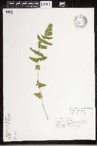 Dryopteris cristata (L.) A. Gray 800102[1324066]Johnson, Gary s.n.1988-08-03 United States, Minnesota, Crow Wing, SW1/4 of NE1/4 S.6 T44N R28W, Crow Wing Co.;;044N;28W;6, 46.323121 -93.925049 |
MIN:Plants | 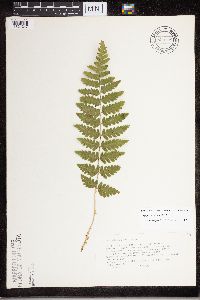 Dryopteris cristata (L.) A. Gray 800108[1324247]Johnson, Gary s.n.1988-08-03 United States, Minnesota, Crow Wing, NE1/4 S.15 and NW1/4 S.14, T44N R29W, Crow Wing Co.;;044N;29W;, 46.297123 -93.979401 |
MIN:Plants | 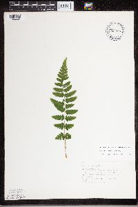 Dryopteris cristata (L.) A. Gray 804385[1324248]Johnson, Gary s.n.1989-08-09 United States, Minnesota, Isanti, NE1/4 of NW1/4 S.14 T37N R23W, Isanti Co.;;037N;23W;14, 45.69353 -93.175519 |
MIN:Plants | 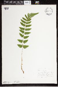 Dryopteris cristata (L.) A. Gray 804389[1327990]Johnson, Gary s.n.1989-08-09 United States, Minnesota, Isanti, NE1/4 of S.12 T36N R24W, Isanti Co.;;036N;24W;12, 45.626343 -93.271049 |
MIN:Plants |  Dryopteris cristata (L.) A. Gray 804394[1324252]Johnson, Gary s.n.1989-08-09 United States, Minnesota, Isanti, NE1/4 of S.4 T36N R24W, Isanti Co.;;036N;24W;4, 45.635905 -93.332529 |
MIN:Plants |  Dryopteris cristata (L.) A. Gray 804399[1324251]Johnson, Gary s.n.1988-08-05 United States, Minnesota, Pine, NE1/4 S.7 T38N R22W. Pine Co.;;038N;22W;7, 46.122319 -92.719238 |
MIN:Plants |  Dryopteris cristata (L.) A. Gray 804401[1324249]Johnson, Gary s.n.1988-08-02 United States, Minnesota, Mille Lacs, SE1/4 of S.20 T41N R26W, Mille Lacs Co.;Mille Lacs Wildlife Management Area;041N;26W;20, 45.938041 -93.630083 |
MIN:Plants |  Dryopteris cristata (L.) A. Gray 804405[1324250]Johnson, Gary s.n.1989-08-09 United States, Minnesota, Isanti, NW1/4 of NW1/4 S.16 T36N R24W, Isanti Co.;;036N;24W;16, 45.613713 -93.343493 |
MIN:Plants |  Dryopteris cristata (L.) A. Gray 804408[1327991]Johnson, Gary s.n.1989-08-05 United States, Minnesota, Kanabec, NW1/4 S.18 T41N R24W, Kanabec Co.;;041N;24W;18, 45.95 -93.3 |
MIN:Plants | 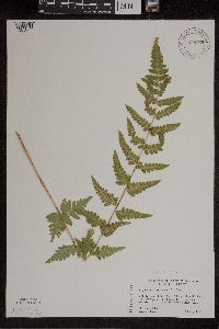 Dryopteris cristata (L.) A. Gray 818169[1305865]Engels, A. s.n.1991-08-18 United States, Minnesota, Aitkin, Aitkin Co, T49N R25W S33 nw1/4. Engels Farm, ca. 2 1/2 mi SW of Palisade. Ditch near Mississippi River;;049N;25W;33, 46.692025 -93.521788 |
MIN:Plants | 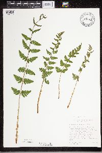 Dryopteris cristata (L.) A. Gray 825667[1324115]Cholewa, A. 19731991-06-01 United States, Minnesota, Aitkin, Savanna State Forest. Aitkin Co, Savanna State Forest, end of logging road ca. 3 mi W of Co. hwy 10 (Great River Road), Ca. 8 mi N of co. hwy Aitkin Co, Savanna State Forest, end of logging road ca. 3 mi W of Co. hwy 10 (Great River Road), Ca. 8 mi N of co. hwy 18; T51N R24W S16.. 512 24W 16, 46.90533 -93.389223 |
MIN:Plants | 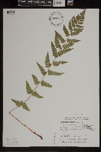 Dryopteris cristata (L.) A. Gray 828259[1305866]Dana, R. 910251991-07-22 United States, Minnesota, Kittson, Kittson Co.; S1/2 NE1/4 NW1/4 Sec.3 T159N R45W;Twin Lakes Wildlife Management Area;159N;45W;3, 48.6269989 -96.4469986 |
MIN:Plants | 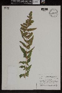 Dryopteris cristata (L.) A. Gray 836039[1305869]Smith, Welby 173061990-07-17 United States, Minnesota, Morrison, Camp Ripley Military Reservation. Camp Ripley Military Reservation. Morrison Co.; on the S side of Argonne Road, about 0.5 km S of Ferrell Lake; UTM: 3907 Camp Ripley Military Reservation. Morrison Co.; on the S side of Argonne Road, about 0.5 km S of Ferrell Lake; UTM: 390700E 5106500N T130N R30W NE1/4 of NE1/4 of Sec 2. 130N 30W 2, 46.007122 -94.278687 |
MIN:Plants | 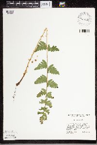 Dryopteris cristata (L.) A. Gray 836182[1324116]Cholewa, A. 22541995-06-23 United States, Minnesota, Aitkin, Savanna Portage State Park. Aitkin Co. Savanna Portage State Park, about 17 mi NE of McGregor, N of old homestead site on W end of Wolf Lake, T50N R Aitkin Co. Savanna Portage State Park, about 17 mi NE of McGregor, N of old homestead site on W end of Wolf Lake, T50N R22W S6 NE1/4. 050N 22W 6, 46.850494 -93.192696 |
MIN:Plants | 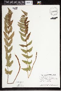 Dryopteris cristata (L.) A. Gray 840618[1327995]Smith, Welby 135491987-07-22 United States, Minnesota, Washington, Washington Co. About 5 mi NE of Hugo; SE1/4 NE1/4 sec.12, T31N R21W;;031N;21W;12, 45.1880569 -92.9024963 |
MIN:Plants | 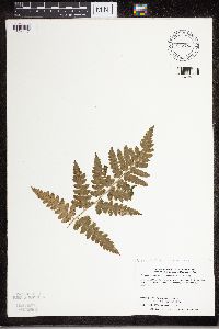 Dryopteris cristata (L.) A. Gray 842782[1324117]Dahle, R. 930461993-10-24 United States, Minnesota, Chisago, Wild River State Park. Chisago County... Along the St. Croix River in Wild River Park north of the Spring Creek boat launch...T35N R19W NW1/4 of NW1/4 of Sec 16. 035N 19W 16, 45.5261116 -92.7311096 |
MIN:Plants | 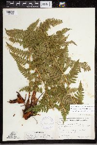 Dryopteris carthusiana (Villars) H.P. Fuchs 387512[1327835]Moore, John 175001945-06-29 United States, Minnesota, Kanabec, Kanabec Co.; 7 mi south-east of Mora;;038N;23W;, 45.805189 -93.190895 |
MIN:Plants |  387513[1327902]Moore, John 174941945-06-29 United States, Minnesota, Kanabec, Kanabec Co.; 7 mi south-east of Mora;;038N;23W;, 45.805189 -93.190895 |
MIN:Plants |  Dryopteris cristata (L.) A. Gray 455292[1327921]Myhre, K. 22431992-06-15 United States, Minnesota, Cass, Cass Co.; located 2 miles southeast of Birch Lake; T 141N R 25W NE1/4 of NE1/4 of Sec 21;Chippewa National Forest;141N;25W;21, 47.018032 -93.841291 |
MIN:Plants |  529009[1327899]Lakela, Olga 191611955-08-09 United States, Minnesota, Saint Louis, St. Louis Co. Small lake, Jack Lakela farm, Palo;;057N;15W;, 47.415205 -92.259625 |
MIN:Plants |  536083[1327897]Wherry, E. 32231935-06-28 United States, Minnesota, Carlton, University of Minn. Forestry Station near Cloquet;;;;, 46.670402 -92.384695 |
MIN:Plants |  568979[1327901]Moore, John 253211960-10-06 United States, Minnesota, Rice, 1/2 mi S of Shields Lake;;110N;22W;, 44.362804 -93.441437 |
MIN:Plants |  692592[1327896]Wagner, W. 754591975-08-00 United States, Minnesota, Roseau, Roseau Co.: 1.5 mi W of Roseau Wildlife Area Headquarters at "T" jnc. of road;Roseau River Wildlife Management Area;;;, 48.858805 -95.764348 |
MIN:Plants |  692609[1327895]Wagner, W. s.n.1975-08-15 United States, Minnesota, Lake, Lake Co.: on hwy.1, N of Finland;Finland State Forest;057N;07W;18, 47.669689 -91.416748 |
MIN:Plants |  692612[1327892]Wagner, W. 733051973-08-22 United States, Minnesota, Hubbard, Hubbard Co.: Itasca State Park; just S of the smaller of the Twin Lakes, W of Lake Drive, T143N, R35W, sec.31;Itasca State Park;143N;35W;31, 46.902804 -94.905571 |
MIN:Plants |  692614[1327900]Waterway, Marcia 1441973-08-17 United States, Minnesota, Mahnomen, Mahnomen Co.: Co.rd.24, 1.5 mi W of Co.rd.4, T146N, R39W, sec.7;White Earth Indian Reservation;146N;39W;7, 47.476081 -95.668303 |
MIN:Plants |  692615[1327888]Wagner, W. 732901973-08-17 United States, Minnesota, Clearwater, Clearwater Co.: Garrison Pt. & swamp just to N & by eagle`s nest, R36W, T143N, sec.15;Itasca State Park;143N;36W;15, 47.202782 -95.222917 |
MIN:Plants |  692646[1327894]Wagner, W. 732031973-08-11 United States, Minnesota, Becker, Becker Co.: Rt.44, Savannah Twp, 3 mi W of Rt.71, T142N, R36W, sec.27;;142N;36W;27, 47.087082 -95.223499 |
MIN:Plants |  692647[1327891]Wagner, W. 731421973-08-03 United States, Minnesota, Beltrami, Beltrami Co.: Red Lakes Area, Indian Service Rd.18, 0.4 mi N of Minn. Rt.1, R33W, T151N, sec.25;Red Lake Indian Reservation;151N;33W;25, 47.868166 -94.818547 |
MIN:Plants |  692648[1327893]Wagner, W. 731631973-08-08 United States, Minnesota, Hubbard, Hubbard Co.: N side of 71, 1.5 mi W of Paul Bunyan Forest, 2.3 mi from Rt.4, across from M.E. Smith property, T143N R33W, sec.7. 143N 33W 7, 47.217622 -94.908556 |
MIN:Plants |  692649[1327887]Wagner, W. 75360A1975-08-05 United States, Minnesota, Becker, Becker Co.: Savannah Twp, 0.9 mi W of 127 on RT.44, R36W, T142N, Sec.21/28;;142N;36W;, 47.094126 -95.245228 |
MIN:Plants |  692650[1327889]Wagner, W. 753501975-07-26 United States, Minnesota, Beltrami, Beltrami Co.: St.rd.72, ca. 2 mi S of Waskish, 1.2 mi N of jnc. co.rds.110 & 111, T154N, R30W, sec.29; W side of rd.;Red Lake Indian Reservation;154N;30W;29, 48.12753 -94.520799 |
MIN:Plants |  692652[1327898]Wagner, W. 753821975-08-15 United States, Minnesota, Lake, Lake Co. Rt.1, 6 mi S of Murphy City;Superior National Forest;058N;08W;00, 47.669689 -91.416748 |
MIN:Plants |  692681[1327890]Wagner, W. 753171975-07-24 United States, Minnesota, Beltrami, Beltrami Co.: Along Sand Rd, 4.1-4.3 mi N of Becida, R35W, T146N, sec.36;;146N;35W;36, 48.373818 -94.678884 |
MIN:Plants | 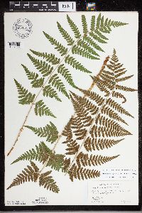 692683[1327883]Wagner, W. 756201975-08-09 United States, Minnesota, Cass, Cass Co. Ottertail Peninsula, 0.6 mi N of turnoff to Springborn's;Chippewa National Forest / Leech Lake Indian Reservation;114N;29W;, 47.218468 -94.417527 |
MIN:Plants | 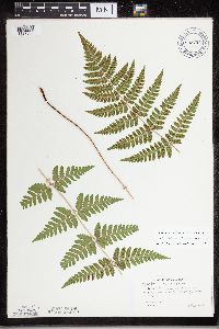 692704[1327885]Wagner, W. 75403A1975-08-18 United States, Minnesota, Hubbard, Hubbard Co.: E side of Rt.3, opposite Parthun's Property, 2.6 mi N of Co.26;;;;, 47.10863 -94.916621 |
MIN:Plants | 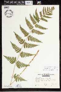 717225[1327886]Peck, J. 80-6301980-08-01 United States, Minnesota, Winona, Winona Co.: La Moille, 1 mi S of town along Trout Creek;Dorer Memorial Hardwood State Forest;106N;05W;, 44.197 -91.941562 |
MIN:Plants | 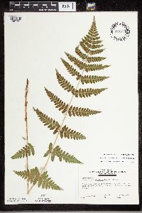 717235[1327884]Peck, J. 80-6311980-08-01 United States, Minnesota, Houston, Houston Co.: Brownsville, S of town; 400 yds from road along river;Upper Mississippi National Wildlife Refuge;103N;04W;, 43.694413 -91.27319 |
MIN:Plants | 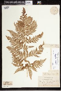 Dryopteris expansa (C. Presl) Fraser-Jenkins & Jermy 52491[1324158]Holzinger, John s.n.1905-00-00 United States, Minnesota, Winona, La Moille Cave, in Winona Co.;;N;;, 44.049963 -91.639315 |
MIN:Plants | 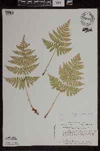 Dryopteris expansa (C. Presl) Fraser-Jenkins & Jermy 727442[1305880]Smith, Welby 26001980-06-21 United States, Minnesota, Cook, At the western-most tip of Magnet Island, in the Susie Island system, Lake Superior.;North Shore / Susie Islands, The Nature Conservancy;063N;07E;04, 47.9708333 -89.5616667 |
MIN:Plants | 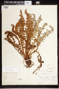 Dryopteris fragrans (L.) Schott 220452[1324304]Rosendahl, C.O. 45421924-07-01 United States, Minnesota, Cook, Along Brule River, Cook Co.;Judge Magney State Park / North Shore;062N;03E;, 48.001162 -90.464967 |
MIN:Plants | 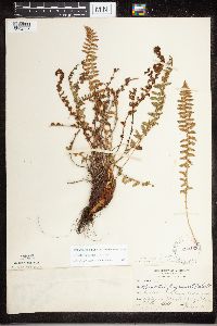 Dryopteris fragrans (L.) Schott 220453[1324306]Rosendahl, C.O. 46221924-07-03 United States, Minnesota, Cook, Below bridge of Pigeon River, Cook Co.;Grand Portage Indian Reservation / North Shore;064N;07E;, 47.9667 -89.7667 |
MIN:Plants | 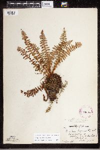 Dryopteris fragrans (L.) Schott 262184[1324173]Rosendahl, C. 5-4341927-09-07 United States, Minnesota, Cook, Poplar Lake, northern Cook Co.;Superior National Forest;N;;, 48.046734 -90.508674 |
MIN:Plants | 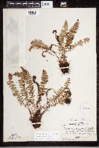 Dryopteris fragrans (L.) Schott 273309[1324217]Rosendahl, C. 60671929-08-14 United States, Minnesota, Cook, Grand Portage;Grand Portage Indian Reservation / North Shore;063N;06E;, 47.959234 -89.821113 |
MIN:Plants | 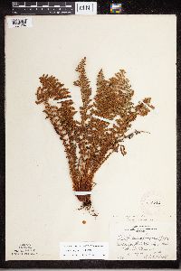 Dryopteris fragrans (L.) Schott 276716[1324294]Huff, N. 1351914-07-14 United States, Minnesota, Lake, South Kawishiwi River. Lake Co.;Superior National Forest;N;;, 47.583104 -91.421915 |
MIN:Plants | 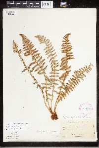 Dryopteris fragrans (L.) Schott 278246[1324311]Roberts, Thomas s.n.1884-08-01 United States, Minnesota, Chisago, Taylor's Falls;;N;;, 45.401187 -92.651766 |
MIN:Plants |  Dryopteris fragrans (L.) Schott 282062[1324211]Butters, F.K. 62401930-08-19 United States, Minnesota, Cook, Magnet Island, Cook Co.;North Shore / Susie Islands, The Nature Conservancy;063N;07E;, 47.973776 -89.578978 |
MIN:Plants |  Dryopteris fragrans (L.) Schott 282774[1324203]Butters, F.K. 3781932-07-10 United States, Minnesota, Cook, ledges south of Gunflint Lake; Cook Co.;Superior National Forest;065N;03W;00, 48.098395 -90.695108 |
MIN:Plants |  Dryopteris fragrans (L.) Schott 282828[1324204]Butters, F.K. 3781932-07-10 United States, Minnesota, Cook, ledges S. of Gunflint Lake, Cook [Co.];Superior National Forest;065N;03W;00, 48.098395 -90.695108 |
MIN:Plants |  Dryopteris fragrans (L.) Schott 283963[1324202]Butters, F.K. 3311932-07-07 United States, Minnesota, Cook, McFarland Lake, Cook Co.;Superior National Forest;064N;03E;00, 48.05 -90.0667 |
MIN:Plants | 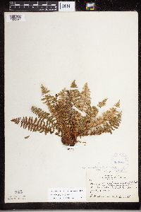 Dryopteris fragrans (L.) Schott 284016[1324187]Butters, F.K. 3711932-07-08 United States, Minnesota, Cook, Susie Island, Cook Co.;North Shore / Susie Islands, The Nature Conservancy;063N;07E;, 47.973776 -89.578978 |
MIN:Plants | 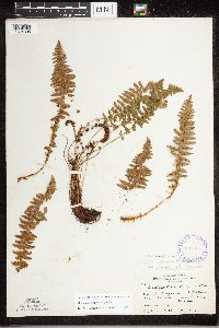 Dryopteris fragrans (L.) Schott 289031[1324305]Rosendahl, C.O. 62081930-08-19 United States, Minnesota, Cook, Back of the old stockade, Grand Portage;Grand Portage National Monument / North Shore;063N;06E;, 47.964751 -89.685844 |
MIN:Plants | 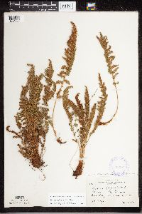 Dryopteris fragrans (L.) Schott 338207[1324288]Moyle, J. 23971936-08-29 United States, Minnesota, Saint Louis, Near Bass Laek, St. Louis Co.;Superior National Forest;063N;12W;, 47.898118 -91.900966 |
MIN:Plants | 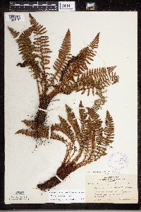 Dryopteris fragrans (L.) Schott 353879[1324176]Lakela, Olga 28081938-09-18 United States, Minnesota, Saint Louis, Above Haines road at Skyline Parkway, 40th Ave. N, Duluth;;N;;, 46.759628 -92.164757 |
MIN:Plants |  Dryopteris fragrans (L.) Schott 354139[1324191]Lakela, Olga 27851938-09-02 United States, Minnesota, Lake, The Palisades, N side, near the trail.;North Shore / Palisade Head;056N;07W;22, 47.583104 -91.421915 |
MIN:Plants |  Dryopteris fragrans (L.) Schott 355802[1324188]Cathcart, E. 1021875-08-00 United States, Minnesota, Chisago, Taylor's Falls;;N;;, 45.401187 -92.651766 |
MIN:Plants |  Dryopteris fragrans (L.) Schott 356607[1324287]Lakela, Olga 30991939-07-02 United States, Minnesota, Lake, The Great Palisades, N shore of Lake Superior, 65 mi N of Duluth.;North Shore / Palisade Head;056N;07W;22, 47.583104 -91.421915 |
MIN:Plants |  Dryopteris fragrans (L.) Schott 356711[1324295]Lakela, Olga 30771939-07-01 United States, Minnesota, Lake, On Moose Lake. Canadian Border Lodge. Lake Co.;Boundary Waters Canoe Area Wilderness / Superior National Forest;064N;09W;32, 47.583104 -91.421915 |
MIN:Plants |  Dryopteris fragrans (L.) Schott 358162[1324310]Rosendahl, C.O. 67181936-09-01 United States, Minnesota, Carlton, About 1/4 mi E of Thompson [sic], Carlton Co.;;048N;16W;00, 46.663832 -92.41964 |
MIN:Plants |  Dryopteris fragrans (L.) Schott 358775[1324192]Butters, F. 68841937-08-27 United States, Minnesota, Lake, About 20 mi SE of Ely, Lake Co.;;N;;, 47.694906 -91.561384 |
MIN:Plants |  Dryopteris fragrans (L.) Schott 362088[1324180]Lakela, Olga 39271940-08-04 United States, Minnesota, Saint Louis, At Burntside Lake, Burntside Lodge, St. Louis Co.;Superior National Forest;063N;13W;23, 47.9357 -91.982299 |
MIN:Plants |  Dryopteris fragrans (L.) Schott 362888[1324174]Lakela, Olga 36971948-07-05 United States, Minnesota, Cook, Windigo Point, Sea Gull Lake, Cook Co.;Boundary Waters Canoe Area Wilderness / Superior National Forest;065N;05W;, 48.149256 -90.887916 |
MIN:Plants |  Dryopteris fragrans (L.) Schott 362902[1324199]Lakela, Olga 35731940-06-16 United States, Minnesota, Saint Louis, Above Beck's road near Fond du Lac jnc, Duluth;;N;;, 46.7833 -92.1 |
MIN:Plants |  Dryopteris fragrans (L.) Schott 367063[1324172]Moore, John 103421938-08-27 United States, Minnesota, Saint Louis, W facing slope of the Great Laurentian Highland Divide, 1/2 mi E fo Hwy.53, St. Louis Co.;;N;;, 47.205 -91.894948 |
MIN:Plants |  Dryopteris fragrans (L.) Schott 368759[1324200]Lakela, Olga 45411941-06-23 United States, Minnesota, Saint Louis, At Vermilion River Gorge, Crane Lake;Kabetogama State Forest;N;;, 48.2833 -92.4667 |
MIN:Plants |  Dryopteris fragrans (L.) Schott 368761[1324209]Lakela, Olga 45421941-07-23 United States, Minnesota, Saint Louis, At Vermilion River Gorge, St. Louis Co.;Kabetogama State Forest;N;;, 48.275739 -92.506548 |
MIN:Plants |  Dryopteris fragrans (L.) Schott 371638[1324193]Lakela, Olga 48521941-08-23 United States, Minnesota, Lake, At Gooseberry River, upper falls, Lake Co.;Gooseberry Falls State Park / North Shore;054N;09W;22, 47.176567 -91.607707 |
MIN:Plants |  Dryopteris fragrans (L.) Schott 387595[1324215]Schuster, R. 60591947-07-06 United States, Minnesota, Cook, Cook Co. Below Grand Portage;Grand Portage Indian Reservation / North Shore;063N;06E;, 47.959234 -89.821113 |
MIN:Plants |  Dryopteris fragrans (L.) Schott 387596[1324178]Moore, John 181881945-08-20 United States, Minnesota, Carlton, Carlton Co. Jay Cooke Park.;Jay Cooke State Park;048N;16W;, 46.649665 -92.330748 |
MIN:Plants |  Dryopteris fragrans (L.) Schott 387597[1324213]Huff, N. s.n.1941-08-23 United States, Minnesota, Cook, Lake Saganaga, Cook Co.;Boundary Waters Canoe Area Wilderness / Superior National Forest;N;;, 48.206824 -90.925662 |
MIN:Plants |  Dryopteris fragrans (L.) Schott 387598[1324307]Schuster, R. 60731947-07-05 United States, Minnesota, Cook, Cook Co. Flute Reed R, Hoveland [sic];Grand Portage State Forest / North Shore;062N;03E;, 47.959234 -89.821113 |
MIN:Plants | 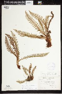 Dryopteris fragrans (L.) Schott 387599[1324303]Schuster, R. 60731947-07-05 United States, Minnesota, Cook, Cook Co. Flute Reed R, near Hoveland [sic];Grand Portage State Forest / North Shore;062N;03E;, 47.959234 -89.821113 |
MIN:Plants | 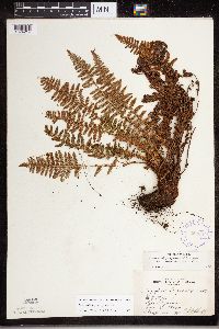 Dryopteris fragrans (L.) Schott 387600[1324214]Huff, N. s.n.1941-08-23 United States, Minnesota, Cook, Lake Saganaga, Cook Co.;Boundary Waters Canoe Area Wilderness / Superior National Forest;N;;, 48.206824 -90.925662 |
MIN:Plants | 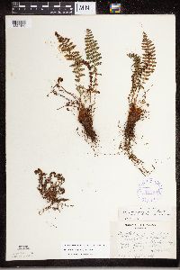 Dryopteris fragrans (L.) Schott 387601[1324186]Dahl, A. 891945-06-18 United States, Minnesota, Cook, Cook Co. Island - #1; Poplar Lake (N of North Isle);Superior National Forest;064N;02W;1, 48.046734 -90.508674 |
MIN:Plants | 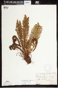 Dryopteris fragrans (L.) Schott 387602[1324301]Burns, G. 4301938-08-07 United States, Minnesota, Cook, Cook Co. E side of Little Caribou Lake, T65N R1E;Boundary Waters Canoe Area Wilderness / Superior National Forest;065N;01E;, 47.726653 -90.386005 |
MIN:Plants | 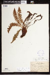 Dryopteris fragrans (L.) Schott 387603[1324184]Nielsen, E. 16581932-09-10 United States, Minnesota, Cook, Lucille Island, near Grand Portage, Cook Co.;North Shore / Susie Islands, The Nature Conservancy;063N;07E;, 47.959234 -89.821113 |
MIN:Plants | 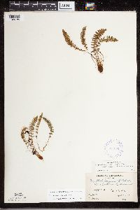 Dryopteris fragrans (L.) Schott 387604[1324185]Butters, F.K. s.n.1935-00-00 United States, Minnesota, Cook, Cook Co. Cliff 2A, Clearwater Lake; T65N R1E;Boundary Waters Canoe Area Wilderness / Superior National Forest;065N;01E;, 48.087449 -90.322587 |
MIN:Plants | 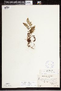 Dryopteris fragrans (L.) Schott 387605[1324170]Butters, F.K. 2751937-07-04 United States, Minnesota, Cook, Cook Co. E of portage on S side of Mountain Lake, T65N R1E;Boundary Waters Canoe Area Wilderness / Superior National Forest;065N;01E;, 48.10737 -90.224172 |
MIN:Plants | 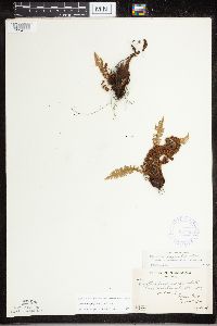 Dryopteris fragrans (L.) Schott 387606[1324308]Butters, F.K. 4321937-07-13 United States, Minnesota, Cook, Cook Co. S side of Pigeon Point, T64N R7E;Grand Portage Indian Reservation / North Shore;064N;07E;, 47.959234 -89.821113 |
MIN:Plants |  Dryopteris fragrans (L.) Schott 387607[1324300]Butters, F.K. 571936-06-20 United States, Minnesota, Cook, Cook Co. Clearwater Lake, T65N R1E;Boundary Waters Canoe Area Wilderness / Superior National Forest;065N;01E;, 48.087449 -90.322587 |
MIN:Plants |  Dryopteris fragrans (L.) Schott 387608[1324302]Butters, F.K. 2451937-07-02 United States, Minnesota, Cook, Cook Co. Watab Lake, T65N R1E;Boundary Waters Canoe Area Wilderness / Superior National Forest;065N;01E;, 48.0833 -90.35 |
MIN:Plants |  Dryopteris fragrans (L.) Schott 387600[1324177]Butters, F.K. 2141936-06-28 United States, Minnesota, Cook, Cook Co. Clearwater Lake, T65N R1E;Boundary Waters Canoe Area Wilderness / Superior National Forest;065N;01E;, 48.087449 -90.322587 |
MIN:Plants |  Dryopteris fragrans (L.) Schott 387610[1324309]Butters, F.K. 3791937-07-11 United States, Minnesota, Cook, Cook Co. Lucille Island, T63N R7E;North Shore / Susie Islands, The Nature Conservancy;063N;07E;, 47.726653 -90.386005 |
MIN:Plants |  Dryopteris fragrans (L.) Schott 387611[1324216]Dahl, A. 971945-06-18 United States, Minnesota, Cook, Cook Co. Island #1, Poplar Lake; T64N R2W1;Boundary Waters Canoe Area Wilderness / Superior National Forest;064N;02W;1, 48.046734 -90.508674 |
MIN:Plants |  Dryopteris fragrans (L.) Schott 393215[1324299]Ownbey, Gerald B. 10591948-08-14 United States, Minnesota, Cook, Cook County...NE end of Belle Rose Island, Susie Islands near Grand Portage;North Shore / Susie Islands, The Nature Conservancy;063N;07E;, 47.959234 -89.821113 |
MIN:Plants |  Dryopteris fragrans (L.) Schott 405087[1324207]Rosendahl, C. 78661947-09-21 United States, Minnesota, Cook, W of stockade, Grand Portage.;Grand Portage National Monument / North Shore;063N;06E;, 47.959234 -89.821113 |
MIN:Plants |  Dryopteris fragrans (L.) Schott 412745[1324293]Moore, John 116861939-08-12 United States, Minnesota, Koochiching, Growing in the vicinity of the Island View Hotel, T 71, R 22W, Sec.25. Along the S shore of Rainy Lake.;Voyageurs National Park;071N;22W;25, 48.599102 -93.377757 |
MIN:Plants |  Dryopteris fragrans (L.) Schott 427663[1324169]Myhre, K. 35701993-05-12 United States, Minnesota, Pine, Banning State Park. Pine Co. Located along the northern section of Hell's Gate Rapids of the Kettle River; T43N R20W NE1/4 of SW1/4 of sEc 3 Pine Co. Located along the northern section of Hell's Gate Rapids of the Kettle River; T43N R20W NE1/4 of SW1/4 of sEc 35. 043N 20W 35, 46.164078 -92.834671 |
MIN:Plants |  Dryopteris fragrans (L.) Schott 427943[1305890]Myhre, K. 37761993-06-02 United States, Minnesota, Pine, Banning State Park. Pine Co. Located 1/4 mi NE of Wolf Creek Falls. Plants growing along the SE-facing, sandstone escarpment of Kettle River Pine Co. Located 1/4 mi NE of Wolf Creek Falls. Plants growing along the SE-facing, sandstone escarpment of Kettle River; T42N R20W NE1/4 of SW1/4 of Sec 3. 042N 20W 3, 46.148738 -92.856824 |
MIN:Plants |  Dryopteris fragrans (L.) Schott 439572[1305892]Myhre, K. 35431993-05-06 United States, Minnesota, Pine, Banning State Park. Pine Co. Located less than 1 mi N of the town of Sandstone, in the vicinity of the bat hibernacleum;; escarpments of the Pine Co. Located less than 1 mi N of the town of Sandstone, in the vicinity of the bat hibernacleum;; escarpments of the Kettle River; T42N R20W NW1/4 of NW1/4 of Sec 10. 042N 20W 10, 46.145255 -92.860815 |
MIN:Plants | 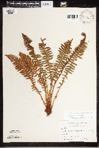 Dryopteris fragrans (L.) Schott 440066[1324297]Kukachka, B. 7911937-09-17 United States, Minnesota, Saint Louis, Half way station, Ely;;N;;, 47.583299 -92.48927 |
MIN:Plants |  Dryopteris fragrans (L.) Schott 442389[1324189]Lakela, Olga 129271951-07-10 United States, Minnesota, Saint Louis, Just above Kettle Falls Dam, Rainy Lake, St. Louis Co.;Voyageurs National Park;070N;18W;, 48.49944 -92.63889 |
MIN:Plants | 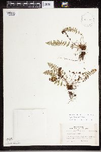 Dryopteris fragrans (L.) Schott 442543[1324194]Lakela, Olga 135721951-08-12 United States, Minnesota, Lake, At East Beaver Bay bluff, Lake Superior, Lake Co.;;N;;, 47.2677 -91.282943 |
MIN:Plants | 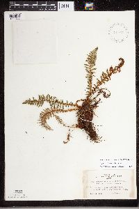 Dryopteris fragrans (L.) Schott 442743[1324208]Lakela, Olga 130971951-07-11 United States, Minnesota, Saint Louis, Rainy Lake below Kettle Falls, St. Louis Co.;Voyageurs National Park;070N;18W;, 48.49944 -92.63889 |
MIN:Plants | 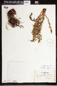 Dryopteris fragrans (L.) Schott 442744[1324210]Lakela, Olga 130961951-07-11 United States, Minnesota, Saint Louis, Kettle Falls, Rainy Lake side, St. Louis Co.;Voyageurs National Park;070N;18W;, 48.49944 -92.63889 |
MIN:Plants |  Dryopteris fragrans (L.) Schott 458954[1305895]Myhre, K. 52831994-08-29 United States, Minnesota, Lake, Lake Co.; located 1 mile NW of Illgen City, along the Superior Hiking Trail; T 56N R 7W NW1/4 of NW1/4 of Sec 2;North Shore;056N;07W;02, 47.669689 -91.416748 |
Google Map
Google Maps is a web mapping service provided by Google that features a map that users can pan (by dragging the mouse) and zoom (by using the mouse wheel). Collection points are displayed as colored markers that when clicked on, displays the full information for that collection. When multiple species are queried (separated by semi-colons), different colored markers denote each individual species.