University of Minnesota
http://www.umn.edu/
612-625-5000
http://www.umn.edu/
612-625-5000
Minnesota Biodiversity Atlas
Bell Museum
Dataset: MIN-Plants
Taxa: Equisetaceae
Search Criteria: excluding cultivated/captive occurrences
Bell Museum plants | |
 MIN:Plants |  Equisetum laevigatum A. Braun 261226[1336388]Harris, J. Arthur C223841922-07-26 United States, Utah, Andrews Canyon; Mt. Nebs. |
MIN:Plants |  Equisetum laevigatum A. Braun 376971[1336389]Melbus, J.E. s.n.1932-07-02 United States, Iowa, Conesville |
MIN:Plants |  Equisetum laevigatum A. Braun 375523[1336390]Gates, Frank C. 152991928-07-20 United States, Michigan, Leelanau, Sleeping Bear Point |
MIN:Plants |  Equisetum laevigatum A. Braun 534596[1336330]Dunn, David B. 1954-08-12 United States, Montana, Flathead, 3 miles SSE of Cloumbia Falls. T30N R20W S28, 48.334399 -114.164852, 914m |
MIN:Plants |  Equisetum laevigatum A. Braun 372233[1336391]Rogers, H.T. 4811940-05-21 United States, Washington, Stevens, along Spokane River 10 miles above its mouth., 393m |
MIN:Plants |  Equisetum laevigatum A. Braun 715958[1336392]Nelson, Aven 76931900-07-26 United States, Wyoming, North Fork, Centennial |
MIN:Plants |  Equisetum laevigatum A. Braun 529336[1336331]Ahles, H.E. 1953-06-16 United States, Illinois, Champaign, railroad S of Champaign |
MIN:Plants |  Equisetum laevigatum A. Braun 402840[1336393]Shinners, L.H. 20911940-06-30 United States, Wisconsin, Milwaukee, C&NW.RR. Greenfield Park; Milwaukee |
MIN:Plants |  Equisetum laevigatum A. Braun 480376[1336394]Russell, N.H. NR 622525b1952-06-22 United States, Iowa, Poweshiek, between 10th Ave. & stables, Grinnell. |
MIN:Plants |  Equisetum laevigatum A. Braun 388170[1336395]Wadmond, S.C. 1171898-05-29 United States, Wisconsin, Dane, Madison |
MIN:Plants |  Equisetum laevigatum A. Braun 749912[1336396]Taylor, John 304531981-06-16 United States, Montana, Flathead, about 2 miles South of Olney. This is near US Hy #95 |
MIN:Plants |  Equisetum laevigatum A. Braun 332013[1336397]Moyle, J.B. 26761932-09-14 United States, Wisconsin, Racine, near Dale's Crossing |
MIN:Plants |  Equisetum laevigatum A. Braun 54682[1336332]Morris, C.M. 1896-06-19 United States, Oklahoma, Stillwater |
MIN:Plants |  Equisetum laevigatum A. Braun 636386[1336398]Disrud, D.T. s.n.1969-06-06 United States, North Dakota, McHenry, [no further info] |
MIN:Plants |  Equisetum laevigatum A. Braun 756072[1336399]Davis, Owen ID78-141978-07-17 United States, Idaho, Cassia, Albion Mtns.; NE 1/4, sec. 21, T 13 S, R 24 E, 1951m |
MIN:Plants |  Equisetum laevigatum A. Braun 54681[1336333]Morris, C.M. 1896-06-19 United States, Oklahoma, Stillwater |
MIN:Plants |  Equisetum laevigatum A. Braun 737677[1336400]Hartman, Ronald L. 65281978-06-10 United States, Wyoming, Campbell, ca. 15 (air) miles SSE of Reno Junction (T 42N; R 71 W, sect 25 and 36); Porcupine Creek, 1433m |
MIN:Plants |  Equisetum laevigatum A. Braun 369609[1336334]Demaree, Delzie 1939-05-29 United States, Arkansas, Phillips, Helena, foot of Crowley's Ridge, 61m |
MIN:Plants |  Equisetum laevigatum A. Braun 452334[1336335]Love, Askell 52661951-08-29 Canada, Manitoba, Vivian, T10 R8E S36 |
MIN:Plants |  Equisetum laevigatum A. Braun 54844[1336336]Wooton, E.O. 1897-06-19 United States, New Mexico, Dona ana, Mesilla, 1188m |
MIN:Plants |  Equisetum laevigatum A. Braun 495797[1336337]Jones, George Neville 174821946-06-06 United States, Illinois, Champaign, near Urbana along railroad |
MIN:Plants | 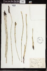 Equisetum laevigatum A. Braun 427746[1336338] United States |
MIN:Plants | 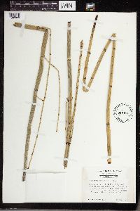 Equisetum laevigatum A. Braun 449416[1336339]Duncan, Wilbur H. 1950-06-29 United States, Georgia, Habersham, below Wells Shoals (Flat Shoals) along Middle Broad River in extreme SE corner of county, 243m |
MIN:Plants | 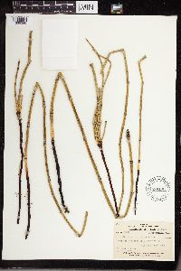 Equisetum laevigatum A. Braun 598132[1336340]Gates, Frank C. 1928-07-20 United States, Michigan, Leelanau, Sleeping Bear Point |
MIN:Plants | 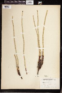 Equisetum laevigatum A. Braun 54662[1336341]Moyer, Lycurgus R. 1914-06-06 United States, Missouri, near Little Missouri |
MIN:Plants |  Equisetum laevigatum A. Braun 269541[1336342]Moore, John W. 8391925-05-00 United States, South Dakota, Brookings, 44.311357 -96.798388 |
MIN:Plants |  Equisetum laevigatum A. Braun 269539[1336343]Moore, John W. 8371925-06-00 United States, South Dakota, Grant, 45.052187 -96.55339 |
MIN:Plants |  Equisetum laevigatum A. Braun 274056[1336344]Moore, John W. 6071924-08-00 United States, South Dakota, Walworth, 45.537216 -100.427913 |
MIN:Plants |  Equisetum laevigatum A. Braun 269534[1336345]Moore, John W. 8401925-07-00 United States, South Dakota, Lawrence, 44.352206 -103.765198 |
MIN:Plants |  Equisetum laevigatum A. Braun 274224[1336346]Moore, John W. 2271924-07-00 United States, South Dakota, Fall river, 43.429417 -103.475761 |
MIN:Plants |  Equisetum laevigatum A. Braun 427691[1336347]Jones, G.N. 1946-06-07 United States, Illinois, Douglas, near Tuscola |
MIN:Plants |  Equisetum laevigatum A. Braun 766762[1336348]Fitzpatrick, T.J. s.n.1898-06-28 United States, Iowa, Pottawattamie, [no further info] |
MIN:Plants |  Equisetum laevigatum A. Braun 54675[1336349]Heller, A.A. 31181896-05-23 United States, Idaho, Nez Perce, near Lewiston, 457 - 610m |
MIN:Plants | 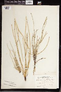 Equisetum laevigatum A. Braun 54641[1336212]Parish, S.B. 1903-11-01 United States, California, San bernardino, Santa Ana River |
MIN:Plants | 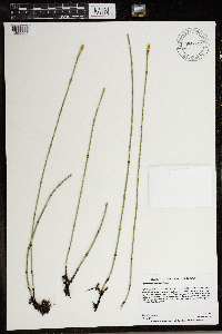 Equisetum laevigatum A. Braun 966812[1359505]Anderson, Derek S. 27772018-07-03 United States, Minnesota, Kittson, Lake Bronson State Park. About 7.5 km east-southeast of Lake Bronson, about 500 meters north of County Rd. 10, 48.72 -96.57 |
MIN:Plants | 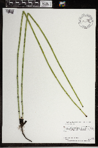 Equisetum laevigatum A. Braun 968455[1391028]Dahlberg, Nathan B. NBD2302020-07-14 United States, Minnesota, Lac Qui Parle, Lac qui Parle 36-1 NPB. 710m North of 220th St; 1.5miles Southwest of Laq Qui Parle., 44.99 -95.88 |
MIN:Plants | Equisetum laevigatum A. Braun []Timothy J. S. Whitfeld 33692022-07-07 United States, Minnesota, Yellow medicine, Mounds Spring Prairie Scientific and Natural Area, 8.75 miles northwest of Canby, 44.76874 -96.444074, 515m |
MIN:Plants | 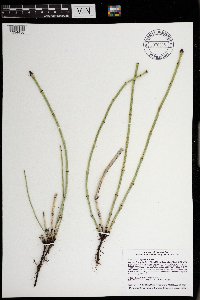 Equisetum laevigatum A. Braun 970988[1394456]Smith, Welby R WRS359492018-06-18 United States, Minnesota, Morrison, On the airfield at the Camp Ripley Military Reservation. About 12.5 km (7.8 miles) due north of the approximate center of Little Falls., 46.0928333 -94.3640167 |
MIN:Plants |  Equisetum laevigatum A. Braun 973691[1397246]Bezanson, Char A. 1711991-07-15 United States, Minnesota, Rice, One mile east of city of Morristown., 44.23 -93.42 |
MIN:Plants | Equisetum laevigatum A. Braun []McElderry, M. GW25172004-08-07 United States, Colorado, Gunnison, Paradise Basin, 39.013139 -107.051275, 3246m |
MIN:Plants |  Equisetum laevigatum A. Braun 974305[1396669]Smith, Welby R WRS361622019-05-29 United States, Minnesota, Washington, Afton State Park, about 4 km (2.5 miles) S-SE of the town of Afton. On a moderate SE-facing slope about 10 meters from the St. Croix River., 44.86722 -92.7714 |
MIN:Plants |  Equisetum variegatum Schleicher ex F. Weber & D. Mohr 401698[1336780]Spetzman, L. 6941948-07-14 United States, Alaska, Arctic North Slope ... Lake Peters.;Arctic National Wildlife Refuge;;;, 69.3333333 -145, 1067m |
MIN:Plants |  Equisetum variegatum Schleicher ex F. Weber & D. Mohr 408318[1336820]Spetzman, L. s.n.1949-07-10 United States, Alaska, Arctic North Slope ... Tuliguk Springs, Anaktuvuk Pass;Gates of the Arctic National Park;;;, 68.2833333 -151.4166667, 610m |
MIN:Plants | 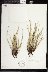 Equisetum variegatum Schleicher ex F. Weber & D. Mohr 565206[1336785]Cotter, Shirley 31261951-08-09 United States, Montana, Glacier, Lake Josephine, Glacier Park;Glacier National Park |
MIN:Plants |  Equisetum variegatum Schleicher ex F. Weber & D. Mohr 408394[1336819]Spetzman, L. 19451949-07-17 United States, Alaska, Arctic North Slope ... Kanayut Lake.;Gates of the Arctic National Park;;;, 68.3333359 -151, 914m |
MIN:Plants |  Equisetum variegatum Schleicher ex F. Weber & D. Mohr 401726[1336784]Spetzman, L. 9931948-08-03 United States, Alaska, Arctic North Sloope ... Ignek Valley.;Arctic National Wildlife Refuge;;;, 69.4166641 -145, 610m |
MIN:Plants |  Equisetum variegatum Schleicher ex F. Weber & D. Mohr 355297[1336779]Sandberg, John 4811889-08-00 United States, Michigan, Keweenaw, Isle Royale;Isle Royale National Park |
MIN:Plants |  Equisetum variegatum subsp. variegatum Schleicher ex F. Weber & D. Mohr 514652[1311033]Dana, R. 920691992-07-19 United States, Minnesota, Kittson, Kittson Co.; T 163N R 45W SE1/4 of NE1/4 of Sec 3;;163N;45W;3, 48.971937 -96.460363 |
MIN:Plants |  Equisetum variegatum Schleicher ex F. Weber & D. Mohr 401699[1336782]Spetzman, L. 8411948-07-26 United States, Alaska, Arctic North Slope ... Sadlerochit R.;Arctic National Wildlife Refuge;;;, 69.4166641 -145.1666718, 762m |
MIN:Plants |  Equisetum variegatum subsp. variegatum Schleicher ex F. Weber & D. Mohr 906968[1333606]Smith, Welby R. 308782008-06-09 United States, Minnesota, Itasca, Itasca County...About 5 miles northeast of Grand Rapids...T56N R25W SE1/4 of SE1/4 of Sec 33;;056N;25W;33, 47.285 -93.5161111 |
MIN:Plants |  Equisetum variegatum subsp. variegatum Schleicher ex F. Weber & D. Mohr 461979[1311031]Lee, Michael MDL26051999-07-21 United States, Minnesota, Lake, Crosby Manitou State Park / North Shore. Lake County ... Along Hwy 61 three miles northeast of Little Marais, 1/8 mile southwest of Manitou River bridge ... T57N R6W NW1/4 of NE1/4 Sec. 10. 057N 06W 10, 47.444015 -91.068992 |
MIN:Plants |  Equisetum variegatum Schleicher ex F. Weber & D. Mohr 548540[1336783]Spetzman, L. 38511951-07-15 United States, Alaska, Arctic North Slope ... Canning R. & Ignek Cr.;Arctic National Wildlife Refuge;;;, 69.5833359 -145.25 |
MIN:Plants |  Equisetum variegatum Schleicher ex F. Weber & D. Mohr 408391[1336818]Spetzman, L. 17641949-07-08 United States, Alaska, Arctic North Slope ... Anaktuvuk Pass.;Gates of the Arctic National Park;;;, 68.2833333 -151.4166667, 610m |
MIN:Plants |  Equisetum variegatum Schleicher ex F. Weber & D. Mohr 401741[1336781]Spetzman, L. 5421948-07-08 United States, Alaska, Arctic North Slope ... Lake Schrader;Arctic National Wildlife Refuge;;;, 69.4166667 -145, 914m |
MIN:Plants |  Equisetum variegatum Schleicher ex F. Weber & D. Mohr 408390[1336817]Spetzman, L. 16781949-07-05 United States, Alaska, Arctic North Slope ... Anaktuvuk Pass.;Gates of the Arctic National Park;;;, 68.2833333 -151.4166667, 610m |
MIN:Plants |  Equisetum variegatum Schleicher ex F. Weber & D. Mohr 600041[1336816]Cooper, William 2481929-07-21 United States, Alaska, Glacier Bay, Station 19.;Glacier Bay National Park;;;, 58.797845 -136.458473 |
MIN:Plants |  Equisetum variegatum subsp. variegatum Schleicher ex F. Weber & D. Mohr 930285[1333593]Leoschke, M. 18011997-10-11 United States, Minnesota, Clay, Approximately 5 miles east-southeast of Glyndon. Riverton Township. SE4 NE4 SE4 of section;Bluestem Prairie Scientific Natural Area;139N;46W;22, 46.8355667 -96.4642333 |
MIN:Plants |  Equisetum variegatum subsp. variegatum Schleicher ex F. Weber & D. Mohr 936141[1333603]Smith, Welby R. 325722011-06-14 United States, Minnesota, Koochiching, About 21 miles east of Big Falls, on the Nett Lake Indian Reservation. NW of NE of section;;065N;23W;19, 48.1091333 -93.3407 |
MIN:Plants |  Equisetum variegatum subsp. variegatum Schleicher ex F. Weber & D. Mohr 228593[1333592]Gockman, Otto 001912012-08-26 United States, Minnesota, Polk, 1.8 miles northwest of Benoit. UTM: 242955E 5290513N. NW1/4 NE1/4 of section.;Kertsonville Wildlife Management Area;149N;45W;21, 47.7163889 -96.4272222 |
MIN:Plants |  Equisetum variegatum subsp. variegatum Schleicher ex F. Weber & D. Mohr 61275[1333600]Smith, Welby R. 306582007-08-22 United States, Minnesota, Koochiching, About 5.5 miles west of Big Falls. SW of NE of section;Pine Island State Forest;155N;26W;36, 48.2042626 -93.9142111 |
MIN:Plants |  Equisetum variegatum subsp. variegatum Schleicher ex F. Weber & D. Mohr 939530[1333613]Smith, Welby R. 316552010-06-15 United States, Minnesota, Beltrami, Along County Road 37, about 7 miles north-northwest of Blackduck. NE of SE of section;;150N;31W;10, 47.8204386 -94.59604 |
MIN:Plants |  Equisetum variegatum subsp. variegatum Schleicher ex F. Weber & D. Mohr 939572[1333610]Smith, Welby R. 316972010-06-16 United States, Minnesota, Koochiching, In a wet, clay-bottom ditch along Hwy 30, about 4 miles west of Big Falls. SW of SW of section;;155N;25W;31, 48.1971365 -93.9031603 |
MIN:Plants |  Equisetum variegatum subsp. variegatum Schleicher ex F. Weber & D. Mohr 753248[1333611]Smith, Welby R. 317352010-06-17 United States, Minnesota, Koochiching, About 22 miles S-SW of Big Falls. NW of NE of section;;151N;26W;25, 47.8736411 -93.9137336 |
MIN:Plants | 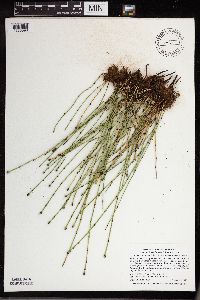 Equisetum variegatum subsp. variegatum Schleicher ex F. Weber & D. Mohr 475187[1333598]Smith, Welby R. 320742010-08-27 United States, Minnesota, Lake, Forest Hwy 11, about 5 miles northwest of Silver Bay. SE of NE of section;;056N;08W;21, 47.3236809 -91.3485343 |
MIN:Plants | 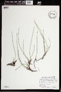 Equisetum variegatum subsp. variegatum Schleicher ex F. Weber & D. Mohr 941705[1333599]Smith, Welby R. 303822007-07-25 United States, Minnesota, Marshall, about 8 miles north of Newfolden. SE of SE of section;East Park Wildlife Management Area;158N;44W;28, 48.4738889 -96.3261111 |
MIN:Plants | 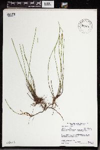 Equisetum variegatum subsp. variegatum Schleicher ex F. Weber & D. Mohr 942326[1333608]Gerdes, Lynden B. 69102013-08-06 United States, Minnesota, Lake, Silver Bay Approximately 4.72 miles NW of town and 0.06 miles east of the East Branch Beaver River on north side of Cty. Road 15. SENE of section;;56N;08W;21, 47.27222 -91.31695 |
MIN:Plants | 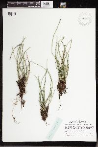 Equisetum variegatum Schleich. ex F. Weber & D. Mohr 946028[1296719]Smith, Welby R. 34643 United States, Minnesota, Marshall |
MIN:Plants |  Equisetum variegatum Schleich. ex F. Weber & D. Mohr 952209[1297386]Smith, Welby R. 35173 United States, Minnesota, Marshall |
MIN:Plants |  Equisetum variegatum Schleich. ex F. Weber & D. Mohr 478075[1336786]Stuart, Alice M. 1401941-08-10 United States, Alaska, vicinity of Wiseman |
MIN:Plants |  Equisetum variegatum Schleich. ex F. Weber & D. Mohr 670922[1336787]Oldenburg, Margaret E. 1947-08-12 Canada, Northwest Territories, Mackenzie District, Burnside Harbor |
MIN:Plants |  Equisetum variegatum Schleich. ex F. Weber & D. Mohr 671505[1336788]Oldenburg, Margaret E. 1954-08-14 United States, Northwest Territories, Franklin District, Bands Island. [illegible] Lake |
MIN:Plants | 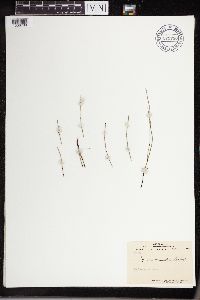 Equisetum variegatum Schleich. ex F. Weber & D. Mohr 671730[1336789]Oldenburg, Margaret E. 1947-09-06 Canada, Quebec, James Bay; Wood Island near Old Factory |
MIN:Plants |  Equisetum variegatum Schleich. ex F. Weber & D. Mohr 671819[1336790]Oldenburg, Margaret E. 1947-08-12 Canada, Northwest Territories, Mackenzie District, Burnside Harbor. Island in river mouth |
MIN:Plants |  Equisetum variegatum Schleich. ex F. Weber & D. Mohr 672120[1336791]Oldenburg, Margaret E. 1954-08-08 Canada, Northwest Territories, Franklin District. Victoria Island, Yellow Lake |
MIN:Plants | 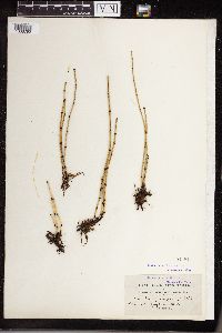 Equisetum variegatum Schleich. ex F. Weber & D. Mohr 54981[1336792]Macoun, John 1887-07-23 Canada, British Columbia, Vancouver Island. Home Lake |
MIN:Plants | 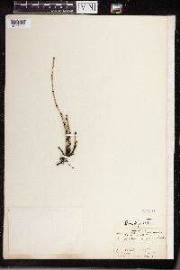 Equisetum variegatum Schleich. ex F. Weber & D. Mohr 354964[1336793]Peterson, N. 1904-09-03 Canada, British Columbia, Selkirk and Rocky Mountains. Emerald Lake margin, 1311m |
MIN:Plants | 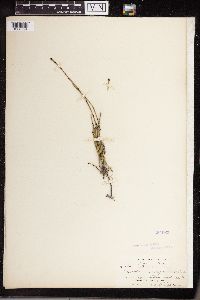 Equisetum variegatum Schleich. ex F. Weber & D. Mohr 354963[1336794]Rosendahl, C.O. 1902-08-23 Canada, Alberta, Laggan, 914m |
MIN:Plants | 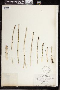 Equisetum variegatum Schleich. ex F. Weber & D. Mohr 354962[1336795]Butters, F.K. 1920-08-28 Canada, British Columbia, Glacier, 1219m |
MIN:Plants | 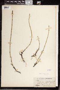 Equisetum variegatum Schleich. ex F. Weber & D. Mohr 354967[1336796]Butters, F.K. 1906-06-14 Canada, British Columbia, Yaho Valley, 1524m |
MIN:Plants |  Equisetum variegatum Schleich. ex F. Weber & D. Mohr 580966[1336797]Dutton, D. Lewis 1924-09-27 United States, Vermont, Goshen |
MIN:Plants |  Equisetum variegatum Schleich. ex F. Weber & D. Mohr 282379[1336798]Butters, F.K. 1931-08-00 Canada, British Columbia, Lake MacArthur. Yoho Park |
MIN:Plants |  Equisetum variegatum Schleich. ex F. Weber & D. Mohr 304530[1336799]Weatherby, C.A. 1932-06-04 United States, Connecticut, Salisbury |
MIN:Plants |  Equisetum variegatum Schleich. ex F. Weber & D. Mohr 385304[1336800]Tryon, Jr., R.M. 1941-07-16 United States, Michigan, Marquette, Huron Mountains, 35 miles NW of Marquette, Ives Lake |
MIN:Plants |  Equisetum variegatum Schleich. ex F. Weber & D. Mohr 505222[1336801]Beckett, Eva 1954-07-07 Canada, Manitoba, Churchill |
MIN:Plants |  Equisetum variegatum Schleich. ex F. Weber & D. Mohr 595766[1336802]Cody, W.J. 1955-07-29 Canada, Northwest Territories, Mackenzie District. S of Fort Simpson Island |
MIN:Plants |  Equisetum variegatum Schleich. ex F. Weber & D. Mohr 401697[1336803]Spetzman, L.A. 1948-06-27 United States, Alaska, Umiat, 183m |
MIN:Plants |  Equisetum variegatum Schleich. ex F. Weber & D. Mohr 416044[1336804]Spetzman, L.A. 1950-06-13 United States, Alaska, Nuka River, 610m |
MIN:Plants |  Equisetum variegatum Schleich. ex F. Weber & D. Mohr 618584[1336805]Abbe, E.C. 1951-06-30 Canada, Ontario, Thunder District, 0.5 miles E of Jackfish |
MIN:Plants |  Equisetum variegatum Schleich. ex F. Weber & D. Mohr 618590[1336806]Abbe, E.C. 1951-06-30 Canada, Ontario, roadside between Jackfish and Terrace Bay |
MIN:Plants |  Equisetum variegatum Schleich. ex F. Weber & D. Mohr 416162[1336807]Spetzman, L.A. 1950-07-12 United States, Alaska, N of Lake Noluk, 731m |
MIN:Plants |  Equisetum variegatum Schleich. ex F. Weber & D. Mohr 408392[1336808]Spetzman, L.A. 1949-08-01 United States, Alaska, Alaktak Half-Moon 3, edge of river, 70.766111 -155.038889, 15m |
MIN:Plants |  Equisetum variegatum Schleich. ex F. Weber & D. Mohr 541166[1336809]Raup, H.M. 1932-07-16 Canada, British Columbia and Alberta, Peace River near Wicked Rises |
MIN:Plants |  Equisetum variegatum Schleich. ex F. Weber & D. Mohr 522848[1336810]Cooper, W.S. 1902-07-18 United States, Michigan, Elk Rapids |
MIN:Plants |  Equisetum variegatum Schleich. ex F. Weber & D. Mohr 532048[1336811]Oldenburg, Margaret E. 1947-09-06 Canada, Northwest Territories, Franklin District. James Bay; Wood Island near Old Factory |
MIN:Plants |  Equisetum variegatum Schleich. ex F. Weber & D. Mohr 800891[1336812]Garton, C.E. 1983-08-11 Canada, Ontario, Thunder Bay District, Nordic Lake. 4 km N of Highway 11, Irwin Twp. |
MIN:Plants | 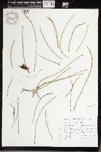 Equisetum variegatum Schleich. ex F. Weber & D. Mohr 805579[1336813]Garton, C.E. 1987-07-07 Canada, Ontario, Thunder Bay District. Thunder Bay City on Current River |
MIN:Plants |  Equisetum variegatum Schleich. ex F. Weber & D. Mohr 54986[1336821]Eggleston, Willard W. 1893-07-03 United States, Vermont, banks of White River, Royalton |
MIN:Plants |  Equisetum variegatum Schleich. ex F. Weber & D. Mohr 566144[1336822]Tryon, Jr., R.M. 1945-09-04 Canada, Manitoba, Junction of Limestone River and Nelson River |
MIN:Plants |  Equisetum variegatum Schleich. ex F. Weber & D. Mohr 566120[1336823]Tryon, Jr., R.M. 1945-09-04 Canada, Manitoba, Junction of the Limestone River and Nelson River |
MIN:Plants |  Equisetum variegatum Schleich. ex F. Weber & D. Mohr 81460[1336824]Schofield, W.B. 1950-06-01 Canada, Manitoba, Churchill District, 0.5 miles E of Kettle Rapids |
Google Map
Google Maps is a web mapping service provided by Google that features a map that users can pan (by dragging the mouse) and zoom (by using the mouse wheel). Collection points are displayed as colored markers that when clicked on, displays the full information for that collection. When multiple species are queried (separated by semi-colons), different colored markers denote each individual species.