University of Minnesota
http://www.umn.edu/
612-625-5000
http://www.umn.edu/
612-625-5000
Minnesota Biodiversity Atlas
Bell Museum
Dataset: MIN-Plants
Taxa: Rhynchospora
Search Criteria: excluding cultivated/captive occurrences
Bell Museum plants | |
 MIN:Plants |  Rhynchospora alba (L.) Vahl 687614[1021593]Wheeler, Gerald; Glaser, Paul 20591977-07-13 United States, Minnesota, Itasca, Ca. 11 mi. N-NE of Grand Rapids.;;057N;25W;22, 47.406623 -93.504033 |
MIN:Plants |  Rhynchospora alba (L.) Vahl 687622[1021590]Wheeler, Gerald; Glaser, Paul 20671977-07-13 United States, Minnesota, Itasca, Ca. 12.5 mi. N-NW of Grand Rapids.;Chippewa National Forest;057N;25W;18, 47.421972 -93.567645 |
MIN:Plants |  Rhynchospora alba (L.) Vahl 687715[1105085]Wheeler, Gerald; Glaser, Paul 21611977-07-20 United States, Minnesota, Itasca, Ca. 8.5 mi. N-NW of Grand Rapids.;;056N;26W;1, 47.362785 -93.587218 |
MIN:Plants |  Rhynchospora alba (L.) Vahl 691446[1105112]Ringle, J. s.n.1978-08-15 United States, Minnesota, Cass, 5 mi. E of Walker on Hwy. 200, the 2 1/2 mi. N on Co. Rd. 13 (Onigum Road).;Chippewa National Forest / Leech Lake Indian Reservation;142N;30W;, 47.109066 -94.468512 |
MIN:Plants |  Rhynchospora alba (L.) Vahl 691630[1021632]Morley, T. 14131978-08-16 United States, Minnesota, Cass, Cass Co. Near the SW side of a a pond in Onigum Bog. T142N R30W Sec.29 NE1/4;Chippewa National Forest / Leech Lake Indian Reservation;142N;30W;29, 47.088469 -94.502629 |
MIN:Plants |  Rhynchospora alba (L.) Vahl 698292[1105083]Wheeler, Gerald; Glaser, Paul 30921978-06-30 United States, Minnesota, Beltrami, Red Lake Peatland; ca. 13 mi. N of the Waskish Airport on Rte. 72, ca. 0.25 mi. E of the road.;Red Lake Peatland Scientific Natural Area;156N;30W;7, 48.345038 -94.543629 |
MIN:Plants |  Rhynchospora alba (L.) Vahl 698353[1105080]Wheeler, Gerald 31531978-07-05 United States, Minnesota, Beltrami, Red Lake Peatland; Ca. 12 mi. N of the Waskish Airport on Rte. 72, ca. 0.5 mi. E of the road.;Red Lake Peatland Scientific Natural Area;156N;30W;18, 48.330491 -94.543471 |
MIN:Plants |  Rhynchospora alba (L.) Vahl 698381[1105079]Wheeler, Gerald; Glaser, Paul 31821978-07-13 United States, Minnesota, Beltrami, Ca. 18 mi. NW of the Waskish Airport. Western Water Track Area.;Red Lake Wildlife Management Area;155N;33W;10, 48.259416 -94.871126 |
MIN:Plants |  Rhynchospora alba (L.) Vahl 698450[1105084]Wheeler, Gerald; Glaser, Paul 32511978-07-15 United States, Minnesota, Beltrami, Red Lake Peatland Scientific Natural Area. Red Lake Peatland; ca. 16 mi. NW of the Waskish Airport. Western edge of Ovoid Islands Area; ca. 0.25 mi. SW of Camp No Red Lake Peatland; ca. 16 mi. NW of the Waskish Airport. Western edge of Ovoid Islands Area; ca. 0.25 mi. SW of Camp No. II.. 156N 32W 15, 48.332043 -94.742064 |
MIN:Plants |  Rhynchospora alba (L.) Vahl 698502[1105082]Wheeler, Gerald; Glaser, Paul 33061978-08-30 United States, Minnesota, Beltrami, Red Lake Peatland; ca. 15 mi. NW of the Waskish Airport. Ovoid Islands Area; ca. 1.75 mi. NW of Camp. No. I.;Red Lake Peatland Scientific Natural Area;156N;32W;24, 48.317655 -94.695853 |
MIN:Plants |  Rhynchospora alba (L.) Vahl 698614[1105087]Wheeler, Gerald; Glaser, Paul 33451978-08-31 United States, Minnesota, Koochiching, Red Lake Peatland Scientific Natural Area. Koochiching Co. Red Lake Peatland. Ca. 8.5 mi. E of Rte. 72 and 10.5 mi. N-NE of the Waskish Airport. Koochiching T156N R29W sec. 16. 156N 29W 16, 48.33103 -94.370741 |
MIN:Plants |  Rhynchospora alba (L.) Vahl 698663[1105097]Wheeler, Gerald; Glaser, Paul 33941978-10-22 United States, Minnesota, Koochiching, Koochiching Co.; Ca. 16 mi. N-NE of Waskish. T156N R 29W sec. 3;Red Lake Peatland Scientific Natural Area;156N;29W;3, 48.360329 -94.349072 |
MIN:Plants |  Rhynchospora alba (L.) Vahl 701995[1105092]Glaser, Paul 10621979-08-14 United States, Minnesota, Saint Louis, Ca. 2 1/2 mi. N of Alborn on Hwy. 7.;;052N;18W;12, 47.004984 -92.565638 |
MIN:Plants |  Rhynchospora alba (L.) Vahl 709835[1105089]Wheeler, Gerald 48531979-09-07 United States, Minnesota, Itasca, Ca. 8.5 mi. N-NW of Grand Rapids.;;056N;26W;1, 47.362785 -93.587218 |
MIN:Plants |  Rhynchospora alba (L.) Vahl 724922[1105096]Smith, Welby 35541980-08-28 United States, Minnesota, Saint Louis, Arlberg Bog. Just S of Co. Rd. 8.;;051N;19W;12, 46.920171 -92.690321 |
MIN:Plants |  Rhynchospora alba (L.) Vahl 724927[1105093]Smith, Welby 35631980-08-28 United States, Minnesota, Saint Louis, Arlberg Bog. Ca. 1/25 mi. N of Co. Rd. 8.;;052N;18W;31, 46.949313 -92.669859 |
MIN:Plants |  Rhynchospora alba (L.) Vahl 726403[1105098]Smith, Welby 27381980-07-10 United States, Minnesota, Saint Louis, Arlberg Bog. On the N side of Co. Rd. 8, ca. 10.5 mi. due E of Floodwood.;;051N;19W;1, 46.934554 -92.690305 |
MIN:Plants |  Rhynchospora alba (L.) Vahl 745962[1021630]Smith, Welby 53781981-08-11 United States, Minnesota, Carlton, Ca. 2 1/2 mi. S of Wright.;;048N;21W;22, 46.629293 -92.989598 |
MIN:Plants |  Rhynchospora alba (L.) Vahl 758136[1105108]Smith, Welby 71081982-08-06 United States, Minnesota, Clearwater, On the E side of Hwy. 5, ca. 2 1/4 mi. N of its jct wih Hwy. 92 in Clearbrook.;;149N;37W;17, 47.724444 -95.420116 |
MIN:Plants |  Rhynchospora alba (L.) Vahl 770690[1105106]Smith, Welby 83001983-07-17 United States, Minnesota, Koochiching, Koochiching Co.; About 23 mi. N of Northome; Sec. 35, T155N R29W;Lost River Peatland Scientific Natural Area;155N;29W;35, 48.201754 -94.328316 |
MIN:Plants |  Rhynchospora alba (L.) Vahl 770718[1105107]Smith, Welby 83431983-07-17 United States, Minnesota, Koochiching, Koochiching Co.; About 9 mi. N of Northome; Sec. 3, T 152N R 29W;Lost River Peatland Scientific Natural Area;152N;29W;3, 48.013141 -94.343678 |
MIN:Plants |  Rhynchospora alba (L.) Vahl 780368[1105094]Ownbey, Gerald 70541985-07-18 United States, Minnesota, Aitkin, Aitkin Co. Just NE of Dam Lake, Kimberly Twp. In an un-named lake. Elev. 1225 ft.;;047N;25W;36, 46.512415 -93.442626 |
MIN:Plants |  Rhynchospora alba (L.) Vahl 781070[1021623]Smith, Welby 98331984-07-29 United States, Minnesota, Roseau, Luxemburg Peatland, ca. 18 mi. S-SW of Warroad.;Luxemburg Peatland Scientific Natural Area;160N;37W;21, 48.663272 -95.418898 |
MIN:Plants |  Rhynchospora alba (L.) Vahl 781111[1021625]Smith, Welby 96671984-07-26 United States, Minnesota, Koochiching, Koochiching Co.; Sturgeon River Bog Complex, about 19 mi. N of Northome; sec. 16, T 154N R 28W;Lost River Peatland Scientific Natural Area;154N;28W;16, 48.157985 -94.242044 |
MIN:Plants |  Rhynchospora alba (L.) Vahl 781119[1105110]Smith, Welby 96651984-07-26 United States, Minnesota, Koochiching, Koochiching Co.; Myrtle Lake Peatland, about 23 mi. south of Little Fork; sec. 10, T 64N R 25W;Myrtle Lake Peatland Scientific Natural Area;064N;25W;10, 48.051032 -93.52254 |
MIN:Plants |  Rhynchospora alba (L.) Vahl 781225[1105100]Smith, Welby 96731984-07-26 United States, Minnesota, Koochiching, Koochiching Co.; Sturgeon River Bog Complex, about 19 mi. north of Northome; sec. 16, T 154N R 28W;Lost River Peatland Scientific Natural Area;154N;28W;16, 48.157985 -94.242044 |
MIN:Plants |  Rhynchospora alba (L.) Vahl 781459[1105091]Smith, Welby 97771984-00-00 United States, Minnesota, Roseau, Pinecreek Peatland, ca. 12 mi. NW of Roseau.;Pine Creek Peatland Scientific Natural Area;164N;41W;25, 48.985821 -95.912445 |
MIN:Plants |  Rhynchospora alba (L.) Vahl 781466[1021624]Smith, Welby 97371984-07-28 United States, Minnesota, Roseau, Sprague Creek Peatland, ca. 12 mi. N-NW of Roseau.;Lost River State Forest / Sprague Creek Peatland Scientific Natural Area;164N;40W;34, 48.985399 -95.80143 |
MIN:Plants |  Rhynchospora alba (L.) Vahl 781470[1105099]Smith, Welby 97081984-07-26 United States, Minnesota, Koochiching, Koochiching Co.; Lost River Peatland, about 14 mi. west-southwest of Big Falls; sec. 27, T154N R27W;Lost River Peatland Scientific Natural Area;154N;27W;27, 48.128753 -94.092419 |
MIN:Plants |  Rhynchospora alba (L.) Vahl 781529[1105113]Smith, Welby 96231984-07-26 United States, Minnesota, Koochiching, Koochiching Co.; Myrtle Lake Peatland, about 26 mi. north of Little Fork; sec. 24, T 64N R 25W;Myrtle Lake Peatland Scientific Natural Area;064N;25W;24, 48.022554 -93.47838 |
MIN:Plants |  Rhynchospora alba (L.) Vahl 781591[1105101]Smith, Welby 96431984-07-26 United States, Minnesota, Koochiching, Koochiching Co.; Myrtle Lake Peatland, about 21 mi. south of Little Fork; sec. 36, T 65N R 25w;Myrtle Lake Peatland Scientific Natural Area;065N;25W;36, 48.076585 -93.496516 |
MIN:Plants |  Rhynchospora alba (L.) Vahl 781651[1021626]Smith, Welby 95701984-07-11 United States, Minnesota, Clearwater, Ca. 9 mi. NE of Clearbrook.;;150N;36W;19, 47.796844 -95.311915 |
MIN:Plants | 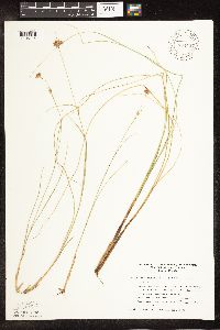 Rhynchospora alba (L.) Vahl 794437[1105114]Glaser, Paul 12091980-07-19 United States, Minnesota, Roseau, Releve' 36. Ca. 2 mi. W of Pine Creek and 11 mi. NW of Roseau.;Pine Creek Peatland Scientific Natural Area;164N;41W;25, 48.985821 -95.912445 |
MIN:Plants | 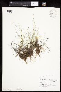 Rhynchospora alba (L.) Vahl 796578[1021631]Sather, Nancy 87-0361987-07-29 United States, Minnesota, Itasca, Clustered Bur Reed Bog. NE of Pughole Lake and W of USFS 2144.14 mi. N of Grand Rapids.;Chippewa National Forest;057N;25W;18, 47.421972 -93.567645 |
MIN:Plants | 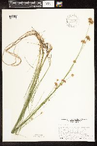 Rhynchospora alba (L.) Vahl 797556[1105088]Cholewa, A.; Engels, A. 15101988-08-05 United States, Minnesota, Aitkin, Aitkin Co. Savanna Portage State Park; W of Loon Lake.;Savanna Portage State Park;050N;23W;13, 46.817098 -93.200656 |
MIN:Plants | 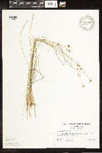 Rhynchospora alba (L.) Vahl 817727[1105061]McNeilus, V. 90-8691990-08-22 United States, Minnesota, Beltrami, Along Rte. 72. Ca. 5.0 mi. S of Lake of the Woods Co. line. [T156N, R30/31W];;;;, 48.266741 -94.55417 |
MIN:Plants |  Rhynchospora alba (L.) Vahl 82676[1105065]Aiton, G. 6511891-08-00 United States, Minnesota, Rice, Rice Co.;;N;;, 44.36 -93.3 |
MIN:Plants |  Rhynchospora alba (L.) Vahl 82677[1105070]Butters, F.; et al. s.n.1918-07-00 United States, Minnesota, Anoka, Southern Anoka County.;;;;, 45.275799 -93.238627 |
MIN:Plants |  Rhynchospora alba (L.) Vahl 82678[1105066]Aiton, G. s.n.1891-08-00 United States, Minnesota, Rice, Rice Co.;;N;;, 44.36 -93.3 |
MIN:Plants |  Rhynchospora alba (L.) Vahl 82679[1105095]Rosendahl, C.; Butters, F. 33751916-08-11 United States, Minnesota, Anoka, Near Ham Lake.;;032N;23W;, 45.254503 -93.203833 |
MIN:Plants | 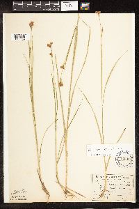 Rhynchospora alba (L.) Vahl 82680[1105069]Sandberg, John s.n.1891-08-00 United States, Minnesota, Chisago, [no further data];;;;, 45.522134 -92.91 |
MIN:Plants | 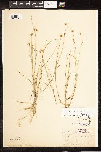 Rhynchospora alba (L.) Vahl 82681[1105067]Arthur, J.; et al. B3191886-07-23 United States, Minnesota, Saint Louis, St. Louis River [other collections indicated St. Louis Co.];;;;, 47.589862 -92.461466 |
MIN:Plants | 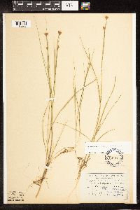 Rhynchospora alba (L.) Vahl 82682[1105068]Sandberg, John s.n.1891-07-00 United States, Minnesota, Chisago, [no further data];;;;, 45.522134 -92.91 |
MIN:Plants | 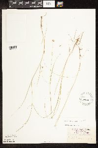 Rhynchospora alba (L.) Vahl 82683[1105071]Aiton, G. s.n.1891-08-00 United States, Minnesota, Rice, Rice Co.;;N;;, 44.36 -93.3 |
MIN:Plants | 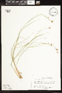 Rhynchospora alba (L.) Vahl 830368[1105063]Delaney, B. 912291991-07-09 United States, Minnesota, Morrison, Morrison Co.; about a mi NE of Cushing. NW1/4 NE1/4 sec.22, T131N R31W.;;131N;31W;22, 46.143634 -94.567225 |
MIN:Plants | 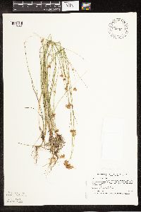 Rhynchospora alba (L.) Vahl 834404[1105064]Smith, Welby 200001991-08-13 United States, Minnesota, Cook, Boundary Waters Canoe Area Wilderness / Superior National Forest. Cook CO. Boundary Waters Canoe Area Wildernes, in the Superior National Forest; T63N R5W NE1/4 of NW1/4 of Sec 25 Cook CO. Boundary Waters Canoe Area Wildernes, in the Superior National Forest; T63N R5W NE1/4 of NW1/4 of Sec 25.. 063N 05W 25, 47.9158325 -90.9055557 |
MIN:Plants | 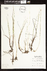 Rhynchospora alba (L.) Vahl 836292[1105090]Karns, K. 11021982-08-12 United States, Minnesota, Saint Louis, S of FR 424; Lake Co. 13 SENE T60 R12W [this is in St. Louis Co.];Superior National Forest;060N;12W;13, 47.68044 -91.806543 |
MIN:Plants | 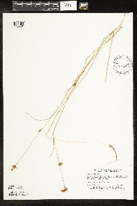 Rhynchospora alba (L.) Vahl 838426[1105081]Myhre, K. 46581993-09-18 United States, Minnesota, Pine, Pine Co. Located 1 mi E of Lena Lake; N shore of Sutton Lake; T41N R17W NE1/4 of NE1/4 of Sec 14.;Saint Croix State Forest;041N;17W;14, 46.034229 -92.457065 |
MIN:Plants | 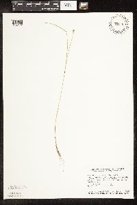 Rhynchospora alba (L.) Vahl 841157[1105102]Smith, Welby 134371987-07-08 United States, Minnesota, Washington, Washington Co. About 2 mi N of Scandia; NW1/4 NW1/4 sec.12, T32N R20W;;032N;20W;12, 45.2813873 -92.792778 |
MIN:Plants | 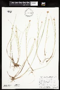 Rhynchospora alba (L.) Vahl 841294[1021627]Smith, Welby 144851988-07-05 United States, Minnesota, Washington, Washington Co. Lee and Rose Warner Nature Center, about 3 mi SW of Marine on St. Croix; NW1/4 SW1/4 sec.15, T31N R20W;Warner Nature Center;031N;20W;15, 45.174187 -92.825005 |
MIN:Plants | 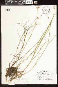 Rhynchospora alba (L.) Vahl 842738[1105062]Myhre, K. 43391993-08-06 United States, Minnesota, Pine, Pine Co. Located 1/2 mi E of Razor Lake; Stevens Lake; T41N R17W NW1/4 of SW1/4 of Sec.2;Saint Croix State Forest;041N;17W;2, 46.062886 -92.45679 |
MIN:Plants | Rhynchospora capillacea Torrey 264484[1105158]Holzinger, John United States, Minnesota, Winona, Detailed locality information protected. This is typically done to protect rare or threatened species localities. |
MIN:Plants | Rhynchospora capillacea Torrey 273154[1105134]Rosendahl, C. United States, Minnesota, Scott, Detailed locality information protected. This is typically done to protect rare or threatened species localities. |
MIN:Plants | Rhynchospora capillacea Torrey 373846[1021653]Moore, John United States, Minnesota, Dakota, Detailed locality information protected. This is typically done to protect rare or threatened species localities. |
MIN:Plants | Rhynchospora capillacea Torrey 440113[1105121]Harris, Fred United States, Minnesota, Polk, Detailed locality information protected. This is typically done to protect rare or threatened species localities. |
MIN:Plants | Rhynchospora capillacea Torrey 444037[1105162]Myhre, K. United States, Minnesota, Mahnomen, Detailed locality information protected. This is typically done to protect rare or threatened species localities. |
MIN:Plants | Rhynchospora capillacea Torrey 445572[1105156]Biederman, L. United States, Minnesota, Jackson, Detailed locality information protected. This is typically done to protect rare or threatened species localities. |
MIN:Plants | Rhynchospora capillacea Torrey 457871[1105144]Sandberg, John United States, Minnesota, Hennepin, Detailed locality information protected. This is typically done to protect rare or threatened species localities. |
MIN:Plants | Rhynchospora capillacea Torrey 458563[1105120]Sather, Nancy United States, Minnesota, Becker, Detailed locality information protected. This is typically done to protect rare or threatened species localities. |
MIN:Plants | Rhynchospora capillacea Torrey 458576[1105128]Puchalski, L. United States, Minnesota, Polk, Detailed locality information protected. This is typically done to protect rare or threatened species localities. |
MIN:Plants | Rhynchospora capillacea Torrey 458664[1105159]Dana, R. United States, Minnesota, Clay, Detailed locality information protected. This is typically done to protect rare or threatened species localities. |
MIN:Plants | Rhynchospora capillacea Torrey 458665[1105117]Dana, R. United States, Minnesota, Clay, Detailed locality information protected. This is typically done to protect rare or threatened species localities. |
MIN:Plants | Rhynchospora capillacea Torrey 458975[1105124]Sather, Nancy United States, Minnesota, Becker, Detailed locality information protected. This is typically done to protect rare or threatened species localities. |
MIN:Plants | Rhynchospora capillacea Torrey 458976[1105123]Sather, Nancy; et al. United States, Minnesota, Becker, Detailed locality information protected. This is typically done to protect rare or threatened species localities. |
MIN:Plants | Rhynchospora capillacea Torrey 459040[1105127]Ostlie, Wayne United States, Minnesota, Chippewa, Detailed locality information protected. This is typically done to protect rare or threatened species localities. |
MIN:Plants | Rhynchospora capillacea Torrey 460858[1105172]Smith, Welby United States, Minnesota, Pipestone, Detailed locality information protected. This is typically done to protect rare or threatened species localities. |
MIN:Plants | Rhynchospora capillacea Torrey 476420[1021645]Smith, Welby United States, Minnesota, Pipestone, Detailed locality information protected. This is typically done to protect rare or threatened species localities. |
MIN:Plants | Rhynchospora capillacea Torrey 505837[1105171]Smith, Welby United States, Minnesota, Roseau, Detailed locality information protected. This is typically done to protect rare or threatened species localities. |
MIN:Plants | Rhynchospora capillacea Torrey 506871[1021649]Smith, Welby United States, Minnesota, Carver, Detailed locality information protected. This is typically done to protect rare or threatened species localities. |
MIN:Plants | Rhynchospora capillacea Torrey 518803[1105125]Sather, Nancy United States, Minnesota, Mahnomen, Detailed locality information protected. This is typically done to protect rare or threatened species localities. |
MIN:Plants | Rhynchospora capillacea Torrey 518804[1021651]Sather, Nancy; et al. United States, Minnesota, Mahnomen, Detailed locality information protected. This is typically done to protect rare or threatened species localities. |
MIN:Plants | Rhynchospora capillacea Torrey 519061[1105118]Sather, Nancy United States, Minnesota, Mahnomen, Detailed locality information protected. This is typically done to protect rare or threatened species localities. |
MIN:Plants | Rhynchospora capillacea Torrey 744702[1105148]Converse, C. United States, Minnesota, Pope, Detailed locality information protected. This is typically done to protect rare or threatened species localities. |
MIN:Plants | Rhynchospora capillacea Torrey 745967[1021652]Smith, Welby United States, Minnesota, Clearwater, Detailed locality information protected. This is typically done to protect rare or threatened species localities. |
MIN:Plants | Rhynchospora capillacea Torrey 746071[1105143]Smith, Welby United States, Minnesota, Dakota, Detailed locality information protected. This is typically done to protect rare or threatened species localities. |
MIN:Plants | Rhynchospora capillacea Torrey 746173[1105163]Smith, Welby United States, Minnesota, Becker, Detailed locality information protected. This is typically done to protect rare or threatened species localities. |
MIN:Plants | Rhynchospora capillacea Torrey 746174[1105149]Smith, Welby United States, Minnesota, Norman, Detailed locality information protected. This is typically done to protect rare or threatened species localities. |
MIN:Plants | Rhynchospora capillacea Torrey 746238[1105136]Smith, Welby United States, Minnesota, Clay, Detailed locality information protected. This is typically done to protect rare or threatened species localities. |
MIN:Plants | Rhynchospora capillacea Torrey 746241[1105138]Smith, Welby United States, Minnesota, Jackson, Detailed locality information protected. This is typically done to protect rare or threatened species localities. |
MIN:Plants | Rhynchospora capillacea Torrey 746296[1105150]Smith, Welby United States, Minnesota, Polk, Detailed locality information protected. This is typically done to protect rare or threatened species localities. |
MIN:Plants | Rhynchospora capillacea Torrey 746302[1021642]Smith, Welby United States, Minnesota, Yellow Medicine, Detailed locality information protected. This is typically done to protect rare or threatened species localities. |
MIN:Plants | Rhynchospora capillacea Torrey 757822[1105137]Smith, Welby United States, Minnesota, Norman, Detailed locality information protected. This is typically done to protect rare or threatened species localities. |
MIN:Plants | Rhynchospora capillacea Torrey 758512[1105145]Smith, Welby United States, Minnesota, Mahnomen, Detailed locality information protected. This is typically done to protect rare or threatened species localities. |
MIN:Plants | Rhynchospora capillacea Torrey 758555[1105132]Smith, Welby United States, Minnesota, Mahnomen, Detailed locality information protected. This is typically done to protect rare or threatened species localities. |
MIN:Plants | Rhynchospora capillacea Torrey 758579[1105141]Smith, Welby United States, Minnesota, Polk, Detailed locality information protected. This is typically done to protect rare or threatened species localities. |
MIN:Plants | Rhynchospora capillacea Torrey 758598[1105140]Smith, Welby United States, Minnesota, Pope, Detailed locality information protected. This is typically done to protect rare or threatened species localities. |
MIN:Plants | Rhynchospora capillacea Torrey 770695[1105131]Smith, Welby United States, Minnesota, Koochiching, Detailed locality information protected. This is typically done to protect rare or threatened species localities. |
MIN:Plants | Rhynchospora capillacea Torrey 770712[1021641]Smith, Welby United States, Minnesota, Koochiching, Detailed locality information protected. This is typically done to protect rare or threatened species localities. |
MIN:Plants | Rhynchospora capillacea Torrey 777660[1105133]Coffin, Barbara; Aaseng, N. United States, Minnesota, Koochiching, Detailed locality information protected. This is typically done to protect rare or threatened species localities. |
MIN:Plants | Rhynchospora capillacea Torrey 777666[1105129]Aaseng, N. United States, Minnesota, Koochiching, Detailed locality information protected. This is typically done to protect rare or threatened species localities. |
MIN:Plants | Rhynchospora capillacea Torrey 781164[1105142]Smith, Welby United States, Minnesota, Clearwater, Detailed locality information protected. This is typically done to protect rare or threatened species localities. |
MIN:Plants | Rhynchospora capillacea Torrey 781412[1105139]Smith, Welby United States, Minnesota, Roseau, Detailed locality information protected. This is typically done to protect rare or threatened species localities. |
MIN:Plants | Rhynchospora capillacea Torrey 782170[1105147]Dana, R. United States, Minnesota, Clay, Detailed locality information protected. This is typically done to protect rare or threatened species localities. |
MIN:Plants | Rhynchospora capillacea Torrey 782198[1105157]Dana, R. United States, Minnesota, Clay, Detailed locality information protected. This is typically done to protect rare or threatened species localities. |
MIN:Plants | Rhynchospora capillacea Torrey 792943[1105170]Dana, R. United States, Minnesota, Polk, Detailed locality information protected. This is typically done to protect rare or threatened species localities. |
MIN:Plants | Rhynchospora capillacea Torrey 792944[1105169]Dana, R. United States, Minnesota, Polk, Detailed locality information protected. This is typically done to protect rare or threatened species localities. |
MIN:Plants | Rhynchospora capillacea Torrey 795412[1021648]Dana, R. United States, Minnesota, Wilkin, Detailed locality information protected. This is typically done to protect rare or threatened species localities. |
MIN:Plants | Rhynchospora capillacea Torrey 800432[1021643]Smith, Welby United States, Minnesota, Olmsted, Detailed locality information protected. This is typically done to protect rare or threatened species localities. |
MIN:Plants | Rhynchospora capillacea Torrey 801099[1021646]Smith, Welby United States, Minnesota, Scott, Detailed locality information protected. This is typically done to protect rare or threatened species localities. |
MIN:Plants | Rhynchospora capillacea Torrey 813652[1105135]Burglehaus, F. United States, Minnesota, Hennepin, Detailed locality information protected. This is typically done to protect rare or threatened species localities. |
Google Map
Google Maps is a web mapping service provided by Google that features a map that users can pan (by dragging the mouse) and zoom (by using the mouse wheel). Collection points are displayed as colored markers that when clicked on, displays the full information for that collection. When multiple species are queried (separated by semi-colons), different colored markers denote each individual species.