University of Minnesota
http://www.umn.edu/
612-625-5000
http://www.umn.edu/
612-625-5000
Minnesota Biodiversity Atlas
Bell Museum
Dataset: MIN-Plants
Taxa: Salicaceae
Search Criteria: excluding cultivated/captive occurrences
Bell Museum plants | |
 MIN:Plants | 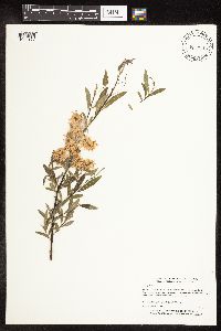 Salix petiolaris Smith 447027[1092172]Myhre, K. 55991995-06-15 United States, Minnesota, Aitkin, Hill River State Forest. Aitkin Co.; Located 4 miles east of the town of Hill City. Plants occur along the shores of Taylor Lake; T 52N R 25W SW1 Aitkin Co.; Located 4 miles east of the town of Hill City. Plants occur along the shores of Taylor Lake; T 52N R 25W SW1/4 of NE1/4 of Sec 16. 052N 25W 16, 46.993924 -93.512408 |
MIN:Plants | 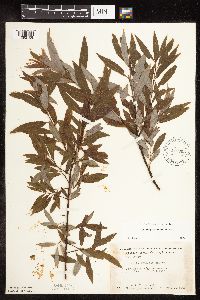 Salix petiolaris Smith 448905[1092159]Moore, John; Hall, Robert 167251944-08-01 United States, Minnesota, Aitkin, 10 mi. NE of Aitkin.;;N;;, 46.664275 -93.531915 |
MIN:Plants | 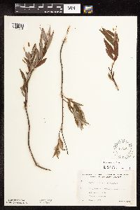 Salix petiolaris Smith 463267[1092212]Lakela, Olga 156041952-08-23 United States, Minnesota, Saint Louis, St. Louis County...Iron Lake about 3 mi from Curtain Falls, Canadian boundary.;Boundary Waters Canoe Area Wilderness / Superior National Forest;066N;13W;00, 48.219513 -91.957793 |
MIN:Plants | 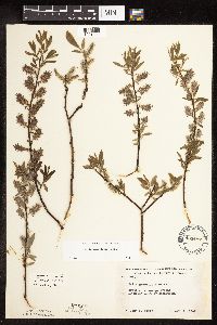 Salix petiolaris Smith 488497[1091923]Moore, John 199121949-05-10 United States, Minnesota, Kittson, 10 mi. E of Donaldson;;;;, 48.566493 -96.664603 |
MIN:Plants |  Salix petiolaris Smith 491754[1092008]Lakela, Olga 168141953-08-12 United States, Minnesota, Saint Louis, St. Louis Co.; Boulder Bay east end of Lac La Croix.;Boundary Waters Canoe Area Wilderness / Superior National Forest;067N;13W;, 48.3333 -92.1167 |
MIN:Plants |  Salix petiolaris Smith 500650[1092001]Harris, S. 323b1953-06-22 United States, Minnesota, Marshall, Marshall Co.; in Mud River Pool, Mud Lake National Wildlife Refuge.;Agassiz National Wildlife Refuge;;;, 48.313302 -96.01363 |
MIN:Plants |  Salix petiolaris Smith 514693[1092124]Mensing, D. 96-3541996-06-01 United States, Minnesota, Carlton, Carlton Co, T48N R18W SE1/4 of The SE1/4 of S16...floodplain of Moose Horn River;Sawyer Wildlife Management Area;048N;18W;16, 46.468837 -92.752022 |
MIN:Plants |  Salix petiolaris Smith 514695[1092034]Mensing, D. 96-701996-06-17 United States, Minnesota, Pine, Pine Co, T45N R16W SW1/4 of the SW1/4 of S17; floodplain of Net River; road crossing/bridge downstream from site;Nemadji State Forest;045N;16W;17, 46.352241 -92.352043 |
MIN:Plants | 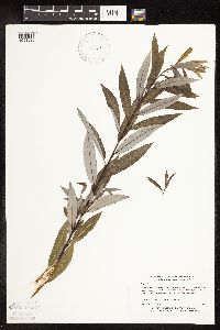 Salix petiolaris Smith 518829[1091925]Myhre, K. 58321995-07-05 United States, Minnesota, Crow Wing, Crow Wing Co.; located 11 miles W of the town of Garrison. Plants occur along the SE shore of South Long Lake; T44N R30W Crow Wing Co.; located 11 miles W of the town of Garrison. Plants occur along the SE shore of South Long Lake; T44N R30W NW1/4 of SE1/4 of Sec 23. 044N 30W 23, 46.277434 -94.090136 |
MIN:Plants | 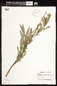 Salix petiolaris Smith 519914[1092074]Myhre, K. 20101992-06-01 United States, Minnesota, Cass, Cass Co.; located 2 miles NE of the town of Pillager; roadside; T133N R30W SW1/4 of NW1/4 of sec 10;;133N;30W;10, 46.349553 -94.450295 |
MIN:Plants | 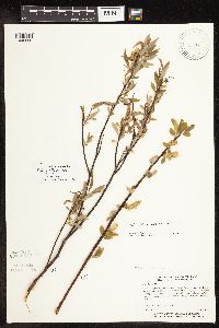 Salix petiolaris Smith 520200[1096598]Myhre, K. 37721993-06-01 United States, Minnesota, Pine, Located along the southwest shore of Mud Lake. SW1/4 of SE1/4 of Sec;;041N;17W;10, 46.30239 -92.884398 |
MIN:Plants | 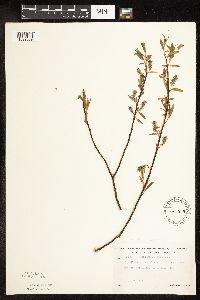 Salix petiolaris Smith 525839[1092009]Lakela, Olga 185491955-05-07 United States, Minnesota, Saint Louis, St. Louis Co.; east of Meadowlands on Highway 133;;053N;19W;, 47.068923 -92.805938 |
MIN:Plants |  Salix petiolaris Smith 529101[1092026]Lakela, Olga 196291956-05-30 United States, Minnesota, Saint Louis, St. Louis Co.; Bank of West Swan River, Highway No. 5, North of Toivola.;;054N;19W;, 47.251047 -92.818249 |
MIN:Plants |  Salix petiolaris Smith 532433[1092216]Lakela, Olga 198391956-06-16 United States, Minnesota, Saint Louis, Seven Beaver Bay, N end of the narrows;;N;;, 47.499159 -91.811429 |
MIN:Plants |  Salix petiolaris Smith 532551[1092219]Lakela, Olga 198391956-06-16 United States, Minnesota, Saint Louis, St. Louis Co.; Seven Beaver Bay north end of the narrows;;;;, 47.499159 -91.811429 |
MIN:Plants |  Salix petiolaris Smith 542415[1091996]Moore, John 215341952-05-20 United States, Minnesota, Koochiching, Koochiching Co.; 1 mile north of Big Falls.;Pine Island State Forest;155N;25W;, 48.191111 -93.802222 |
MIN:Plants | 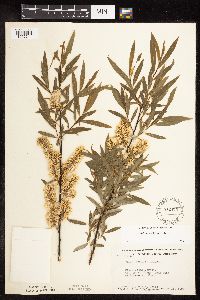 Salix petiolaris Smith 542473[1092211]Moore, John; et al. 215051952-05-18 United States, Minnesota, Anoka, Cedar Creek Forest, 48C, along Cedar Creek W of Lawrence's Woods.;Cedar Creek Ecosystem Preserve;034N;23W;, 45.405014 -93.206388 |
MIN:Plants | 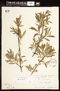 Salix petiolaris Smith 542580[1092044]Moore, John 215901952-05-22 United States, Minnesota, Beltrami, 1 mi. W of Bemidji.;;N;;, 47.468054 -94.902802 |
MIN:Plants | 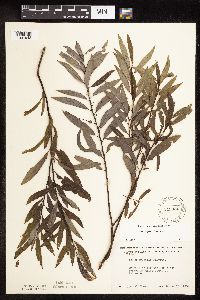 Salix petiolaris Smith 549934[1091948]Moore, John 219841954-09-13 United States, Minnesota, Sherburne, 3.5 mi S of Princeton;;N;;, 45.516159 -93.568582 |
MIN:Plants | 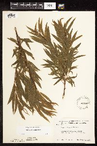 Salix petiolaris Smith 549944[1091950]Moore, John 218991954-07-21 United States, Minnesota, Wilkin, 1 mi S of Lawndale;;N;;, 46.541912 -96.36 |
MIN:Plants | 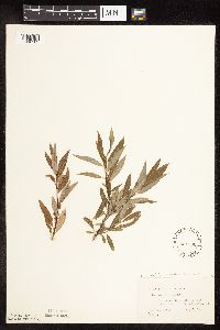 Salix petiolaris Smith 551560[1092102]Cotter, Shirley 7601948-08-14 United States, Minnesota, Clearwater, Hill Point, Lake Itasca, Itasca Park;Itasca State Park;143N;36W;, 47.197458 -95.201964 |
MIN:Plants | 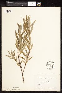 Salix petiolaris Smith 552309[1092103]Cooper, William s.n.1929-09-15 United States, Minnesota, Crow Wing, Crow Wing Co.; Brainerd;;;;, 46.35722 -94.19444 |
MIN:Plants | 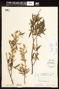 Salix petiolaris Smith 553916[1091981]Moore, John; et al. 227791956-06-08 United States, Minnesota, Clay, 10 mi E of Downer;;;;, 46.753933 -96.275715 |
MIN:Plants | 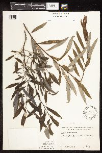 Salix petiolaris Smith 576817[1092058]Isaak, Daniel 511960-08-06 United States, Minnesota, Isanti, Horseshoe Lake; Sec. 2 and 11 T34N R22W;;034N;22W;, 45.455909 -93.051823 |
MIN:Plants | 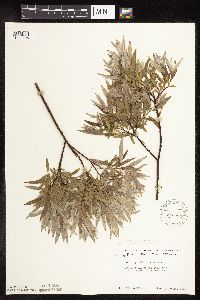 Salix petiolaris Smith 585634[1092106]Moore, John 260521962-06-26 United States, Minnesota, Kittson, Kittson Co.; Growing along the rail road 1 mile north of Northcote;;162N;49W;, 48.847772 -97 |
MIN:Plants | 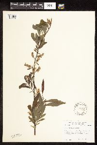 Salix petiolaris Smith 594249[1091992]Thorne, Robert 304121962-06-16 United States, Minnesota, Clearwater, Itasca State Park. Clearwater Co.; near boat house, bank of Lake Itasca, Campus of Univ. of Minnesota Biological Station, Itasca State Park Clearwater Co.; near boat house, bank of Lake Itasca, Campus of Univ. of Minnesota Biological Station, Itasca State Park.. 143N 36W , 47.197458 -95.201964 |
MIN:Plants | 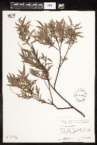 Salix petiolaris Smith 602842[1092000]Ownbey, Gerald 40941967-06-29 United States, Minnesota, Mahnomen, Mahnomen Co.; Rte. 59, 1.3 miles north of junction of Rte's 31 and 59; along east side of highway.;White Earth Indian Reservation;145N;42W;, 47.367983 -96.000088 |
MIN:Plants | 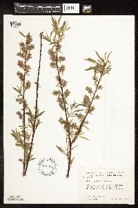 Salix petiolaris Smith 603624[1092094]Moore, John; Hsi, Yu-tseng [Eugene] 268081966-05-24 United States, Minnesota, Anoka, Anoka Co.; Growing at north edge of cattail swamp, Sect. 26 Bethel Twp, Cedar Creek Natural History Area;Cedar Creek National History Area;034N;23W;26, 45.319849 -93.296468 |
MIN:Plants | 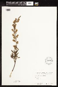 Salix petiolaris Smith 614609[1092010]Westkaemper, Remberta s.n.1969-05-00 United States, Minnesota, Stearns, Game preserve, St. Joseph;<No data>;;;, 45.564772 -94.317966 |
MIN:Plants | 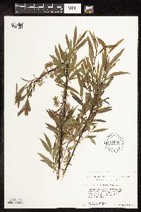 Salix petiolaris Smith 616469[1091993]Moore, John; Moore, Marjorie 601969-05-23 United States, Minnesota, Crow Wing, Crow Wing Natural Area. Crow Wing Natural History Area. Crow Wing Co.; along the east side of Chandler Lake; S.W. 1/4 S.W. 1/2 Sect. 22 Garrison Crow Wing Natural History Area. Crow Wing Co.; along the east side of Chandler Lake; S.W. 1/4 S.W. 1/2 Sect. 22 Garrison Twp.. 044N 28W 22, 46.278961 -93.86289 |
MIN:Plants | 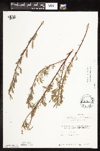 Salix petiolaris Smith 645912[1091971]Westkaemper, Remberta s.n.1971-05-00 United States, Minnesota, Stearns, Game preserve, St. Joseph;<No data>;;;, 45.564772 -94.317966 |
MIN:Plants | 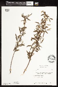 Salix petiolaris Smith 645962[1092136]Westkaemper, Remberta s.n.1969-00-00 United States, Minnesota, Stearns, Game refuge, St. Joseph;<No data>;;;, 45.564772 -94.317966 |
MIN:Plants | 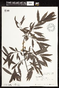 Salix petiolaris Smith 669915[1092016]Grimm, Eric 61974-06-19 United States, Minnesota, Hennepin, Hennepin County...YMCA Camp Ihduhapi, Loretto...Hidden Lake;;118N;24W;12, 45.053772 -93.636014 |
MIN:Plants | 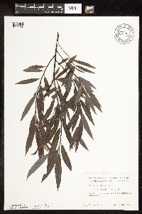 Salix petiolaris Smith 669964[1091994]Grimm, Eric 51974-06-18 United States, Minnesota, Hennepin, Hennepin County...YMCA Camp Ihduhapi, Loretto...Hidden Lake.;;118N;24W;12, 45.053772 -93.636014 |
MIN:Plants | 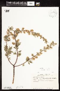 Salix petiolaris Smith 670768[1092045]Heitlinger, M. 5491972-05-30 United States, Minnesota, McLeod, SE1/4 of Sec. 34, T115N, R29W. Towards the N end of meadow, W of prominent N-S ridge.;Schaefer Prairie, The Nature Conservancy;115N;29W;34, 44.724106 -94.305158 |
MIN:Plants | 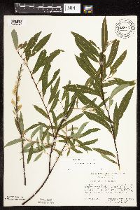 Salix petiolaris Smith 683077[1092057]Morley, T. 13501977-04-17 United States, Minnesota, Ramsey, Ramsey Co.; E of Dale St. between Transit Ave. and co. rd C; T29N R23W SW1/4 Sec. 12;;029N;23W;12, 45.017187 -93.120226 |
MIN:Plants | 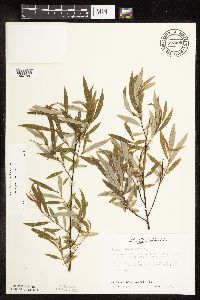 Salix petiolaris Smith 687009[1092156]Wheeler, Gerald; Glaser, Paul 14351977-05-28 United States, Minnesota, Itasca, NW1/4 SW1/4 Sec. 24, T55N, R27W; ca. 7.5 mi. W of Grand Rapids.;;055N;27W;24, 47.231048 -93.721427 |
MIN:Plants | 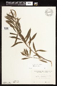 Salix petiolaris Smith 696523[1091949]Smith, Welby 8821978-07-19 United States, Minnesota, Wright, Just E of st. hwy 24; T122N R27W NE1/4 Sec. 22;;122N;27W;22, 45.362209 -94.066108 |
MIN:Plants | 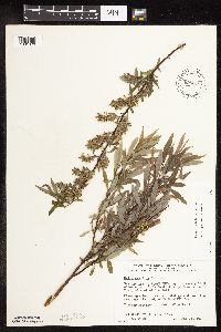 Salix petiolaris Smith 698018[1091978]Wheeler, Gerald; Glaser, Paul 28181978-05-23 United States, Minnesota, Beltrami, Red Lake Peatland Scientific Natural Area. Red Lake Peatland. NW1/4 NE1/4 Sec. 1, T156N, R31W; ca. 14.5 mi. N of the Waskish Airport on Rte. 72, just W of the roa Red Lake Peatland. NW1/4 NE1/4 Sec. 1, T156N, R31W; ca. 14.5 mi. N of the Waskish Airport on Rte. 72, just W of the road. Near the drainage ditch adjacent to Rte. 72. Site 2.. 156N 31W 1, 48.287244 -94.82516 |
MIN:Plants | 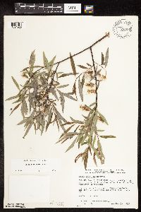 Salix petiolaris Smith 698097[1091980]Wheeler, Gerald; Glaser, Paul 28971978-05-31 United States, Minnesota, Beltrami, Red Lake Peatland Scientific Natural Area. Red Lake Peatland. NW1/4 NE1/4 Sec. 1, T156N, R31W; ca. 14.5 mi. N of the Waskish Airport on Rte. 72, just W of the roa Red Lake Peatland. NW1/4 NE1/4 Sec. 1, T156N, R31W; ca. 14.5 mi. N of the Waskish Airport on Rte. 72, just W of the road. Bordering the drainage ditch running parallel to Rte. 72.. 156N 31W 1, 48.287244 -94.82516 |
MIN:Plants |  Salix petiolaris Smith 699026[1092067]Sather, Nancy; et al. 1751976-06-24 United States, Minnesota, Lake, Plot #17B = plot #25; N1/2 SE1/4 NW1/4 Sec. 18 T60N R11W. Lake Co.;Superior National Forest;060N;11W;18, 47.684739 -91.778622 |
MIN:Plants |  Salix petiolaris Smith 699029[1092158]Sather, Nancy; et al. 3201976-07-15 United States, Minnesota, Saint Louis, Norway Point picnic area. SW1/4 NW1/4 NE1/4 Sec. 8, T57N, R14W.;Superior National Forest;057N;14W;08, 47.43677 -92.144224 |
MIN:Plants |  Salix petiolaris Smith 699034[1092056]Sather, Nancy; Shubat, D. 2791976-07-19 United States, Minnesota, Saint Louis, Plot 22. SE1/4 SW1/4 SW1/4 of Sec;Superior National Forest;T057N R13W S05, 47.451822 -92.015855 |
MIN:Plants |  Salix petiolaris Smith 704574[1092059]Smith, Welby 16261979-08-16 United States, Minnesota, Wabasha, 100 meters due W of co. rd 84; T109N R9W SE1/4 NW1/4 Sec. 18;;109N;09W;18, 44.243599 -91.939111 |
MIN:Plants | 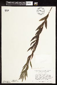 Salix petiolaris Smith 708170[1092100]Smith, Welby 15191979-08-22 United States, Minnesota, Clay, Clay Co.; T 139N R 45W, SW1/4 section 32. "Audubon Prairie". 5.5 mi SW of Hawley.;Audubon Prairie, The Nature Conservancy;139N;45W;32, 46.80768 -96.403202 |
MIN:Plants | 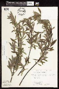 Salix petiolaris Smith 715126[1092113]Keller, C. 61979-06-05 United States, Minnesota, Polk, 4.5 mi S of Fischer; W1/2 NW1/4 Sec;Malmberg Prairie Scientific Natural Area;149N;48W;16, 47.72417 -96.813966 |
MIN:Plants | 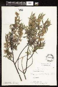 Salix petiolaris Smith 715128[1091954]Keller, C. 31979-06-06 United States, Minnesota, Polk, 4.5 mi S of Fischer; W1/2 NW1/4 Sec.;Malmberg Prairie Scientific Natural Area;149N;48W;16, 47.72417 -96.813966 |
MIN:Plants | 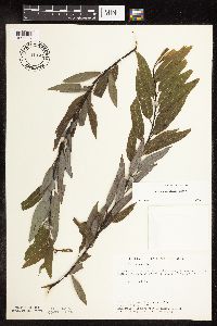 Salix petiolaris Smith 715144[1092037]Severson, M. 1061979-08-13 United States, Minnesota, Polk, 4.5 mi. S of Fischer, W1/2 of NW1/4 of Sec;Malmberg Prairie Scientific Natural Area;149N;48W;16, 47.72417 -96.813966 |
MIN:Plants | 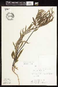 Salix petiolaris Smith 715202[1092062]Severson, M. 1471979-08-27 United States, Minnesota, Polk, 4.5 mi S of Fischer; W1/2 of NW1/4 of Sec;Malmberg Prairie Scientific Natural Area;149N;48W;16, 47.72417 -96.813966 |
MIN:Plants | 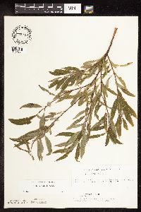 Salix petiolaris Smith 715413[1091934]Ottoson, S. 1291979-08-29 United States, Minnesota, Clay, Blazing Star Prairie, 4 mi SE of Felton; NE1/4 Sec. 5 T141N R45W;Felton Prairie-Blazing Star Prairie Scientific Natural Area;141N;45W;5, 47.056714 -96.417356 |
MIN:Plants | 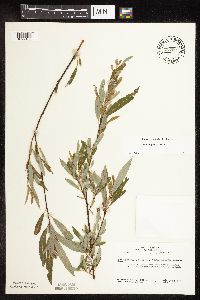 Salix petiolaris Smith 717061[1092133]Heitlinger, M. 7951975-07-23 United States, Minnesota, Anoka, Helen Allison Savanna Scientific Natural Area. Anoka Co. Allison Savanna, on N edge of aspen swale in N central part of old field that lies on the W side of the tract; Anoka Co. Allison Savanna, on N edge of aspen swale in N central part of old field that lies on the W side of the tract; N1/2 of NE1/4 Sec. 2 T33N R23W. 033N 23W 2, 45.380475 -93.168729 |
MIN:Plants | 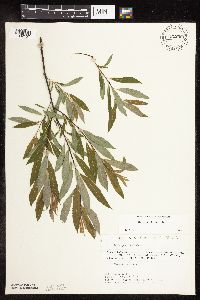 Salix petiolaris Smith 721259[1092157]Lustig, K. 5281979-06-25 United States, Minnesota, Sherburne, Clear Lake - Mississippi Scenic and Recreational River, SNA: 12 mi. SE of St. Cloud, Sec. 14, 22, 23, T34N, R30W.;Clear Lake Scientific Natural Area;034N;30W;, 45.428747 -94.042818 |
MIN:Plants | 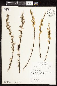 Salix petiolaris Smith 721301[1092170]Lustig, K. 2561979-05-16 United States, Minnesota, Sherburne, Clear Lake - Mississippi Scenic and Recreational River, SNA: 12 mi. SE of St. Cloud, Sec. 14, 22, 23, T34N, R30W.;Clear Lake Scientific Natural Area;034N;30W;, 45.428747 -94.042818 |
MIN:Plants | 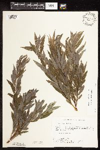 Salix petiolaris Smith 721437[1091930]Farrell, P. 1781979-08-08 United States, Minnesota, Polk, 7 mi. SE of Crookston. S1/2 of section;Pankratz Memorial Prairie, The Nature Conservancy;149N;45W;08, 47.73852 -96.44879 |
MIN:Plants | 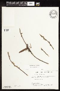 Salix petiolaris Smith 722572[1091979]Lustig, K. 2391979-05-04 United States, Minnesota, Anoka, 18 mi. SE of Cambridge.;Boot Lake Scientific Natural Area;033N;22W;, 45.34066 -93.08146 |
MIN:Plants | 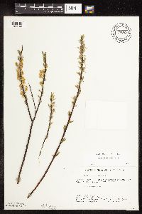 Salix petiolaris Smith 722869[1092163]Lustig, K. 2401979-05-10 United States, Minnesota, Anoka, 18 mi. SE of Cambridge.;Boot Lake Scientific Natural Area;033N;22W;, 45.34066 -93.08146 |
MIN:Plants |  Salix petiolaris Smith 727165[1092003]Herman, J. 661979-07-05 United States, Minnesota, Norman, Norman Co.; Twin Valley Prairie; 5 miles west of Syre, NW-1/4 and E-1/2 of SW-1/4 of sec. 23, T 143N, R 45W.;Twin Valley Prairie Scientific Natural Area;143N;45W;23, 47.166651 -96.35646 |
MIN:Plants |  Salix petiolaris Smith 727772[1092147]Keller, C. 41979-05-23 United States, Minnesota, Polk, Pankratz Prairie South, 7 mi SE of Crookston, SE1/4 of sec.17, NE1/4 of sec.20, T149N R45W;Pankratz Memorial Prairie, The Nature Conservancy;149N;45W;, 47.723975 -96.4489 |
MIN:Plants |  Salix petiolaris Smith 727962[1092110]Severson, M.; Farrell, P. 2351979-08-07 United States, Minnesota, Polk, Pembina Trail Preserve Scientific Natural Area. Polk County...Pembina Trail Preserve..6 1/2 mi E of Harold, all sec. 36, frac. sec. 25, 30, 31, T 149N, R 45W, frac. sec. 1, 2, T 148N, R 45W. , 47.666007 -96.334334 |
MIN:Plants |  Salix petiolaris Smith 728065[1092111]Severson, M.; Farrell, P. 3201979-08-07 United States, Minnesota, Polk, Pembina Trail Preserve Scientific Natural Area. Polk County...Pembina Trail Preserve..6 1/2 mi E of Harold, all sec. 36, frac. sec. 25, 30, 31, T 149N, R 45W, frac. sec. 1, 2, T 148N, R 45W. , 47.666007 -96.334334 |
MIN:Plants | 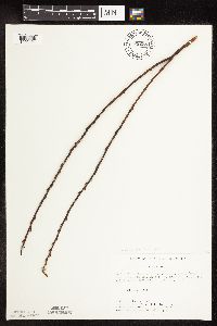 Salix petiolaris Smith 728238[1092121]Keller, C. 61979-05-18 United States, Minnesota, Polk, Pembina Trail Preserve Scientific Natural Area. Polk Co.; Pembina Trail Preserve; 6 1/2 miles east of Harold, all sec. 36, frac. sec. 25, 30, 31, T 149N, R 45W, frac. s Polk Co.; Pembina Trail Preserve; 6 1/2 miles east of Harold, all sec. 36, frac. sec. 25, 30, 31, T 149N, R 45W, frac. sec. 1, 2, T 149N, R 45W. , 47.666007 -96.334334 |
MIN:Plants |  Salix petiolaris Smith 728273[1092112]Keller, C. 11979-05-07 United States, Minnesota, Polk, Pembina Trail Preserve Scientific Natural Area. Polk Co.; Pembina Trail Preserve; 6 1/2 miles eaast of Harold, all sec. 36, frac. sec. 25, 30, 31, T 149N, R 45W, frac. Polk Co.; Pembina Trail Preserve; 6 1/2 miles eaast of Harold, all sec. 36, frac. sec. 25, 30, 31, T 149N, R 45W, frac. sec. 1, 2, T 148N, R 45W. , 47.666007 -96.334334 |
MIN:Plants | 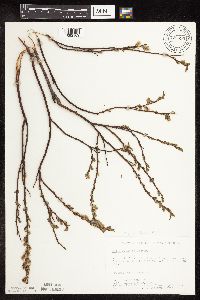 Salix petiolaris Smith 728395[1092109]Herman, J. 21979-00-00 United States, Minnesota, Mahnomen, Mahnomen Co.; Santee Prairie; 3 miles southeast of Bejou, Sec. 6,7, T145N, R41W;Santee Prairie Scientific Natural Area / White Earth Indian Reservation;145N;41W;, 47.405144 -95.922514 |
MIN:Plants | 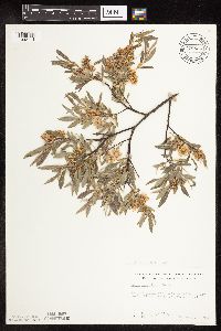 Salix petiolaris Smith 728534[1092114]Sperling, C. 47921979-06-17 United States, Minnesota, Polk, Polk Co.; Pembina Trail, far north end along county road.;Pembina Trail Preserve Scientific Natural Area;149N;44W;, 47.78 -95.692778 |
MIN:Plants | 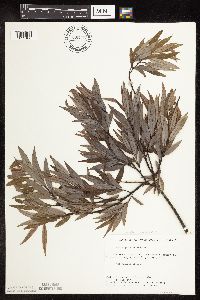 Salix petiolaris Smith 728775[1092108]Herman, J.; et al. 741979-07-11 United States, Minnesota, Mahnomen, Mahnomen Co.; Santee Prairie; 3 miles Southeast of Bejou, Sec. 6,7, T 145N, R 41W;Santee Prairie Scientific Natural Area / White Earth Indian Reservation;145N;41W;, 47.405144 -95.922514 |
MIN:Plants |  Salix petiolaris Smith 729356[1092004]Converse, C. 6921980-08-05 United States, Minnesota, Pine, Pine Co.; St. Croix Natural Area: 21 miles east of Hinckley. NW1/4 NE1/4 NE1/4 Sec. 32, T41N, R17W.;Saint Croix State Park;041N;17W;32, 45.990677 -92.51917 |
MIN:Plants |  Salix petiolaris Smith 729372[1092052]Severson, M. 131980-05-13 United States, Minnesota, Pine, St. Croix Natural Area: 21 mi. E of Hinckley.;Saint Croix State Park;041N;17W;33, 45.990519 -92.4984 |
MIN:Plants |  Salix petiolaris Smith 730067[1092051]Severson, M. 431980-05-14 United States, Minnesota, Pine, Pine co. Kettle River Natural Area: 5.5 mi. E of Hinckley. SW1/4 Sec. 23, T41N, R20W.;Kettle River Scientific Natural Area / Sandstone National Wildlife Refuge;041N;20W;23, 46.013408 -92.841832 |
MIN:Plants |  Salix petiolaris Smith 730233[1091933]Phelps, V. 1681980-08-25 United States, Minnesota, Chisago, Goose Creek Natural Area: 5 mi. SE of Rush City. NE1/4 NW1/4 Sec. 18, T36W, R20W.;Wild River State Park;036N;20W;18, 45.611804 -92.891582 |
MIN:Plants |  Salix petiolaris Smith 730573[1092050]Severson, M. 1991980-05-22 United States, Minnesota, Wilkin, Western Prairie North: 8 mi. N of Rothsay. SW1/4 NE1/4 Sec. 17, T136N, R45W.;Western Prairie North, The Nature Conservancy;136N;45W;17, 46.59078 -96.280619 |
MIN:Plants |  Salix petiolaris Smith 730663[1091937]Petron, T. 151980-06-06 United States, Minnesota, Wilkin, Western Prairie South: 6.5 mi. NW of Rothsay. NE1/4 NW1/4 Sec. 12, T135N, R46W.;Western Prairie South Scientific Natural Area;135N;46W;12, 46.536348 -96.369809 |
MIN:Plants |  Salix petiolaris Smith 732542[1092097]Severson, M. 1831980-05-21 United States, Minnesota, Becker, Bekcer Co.; Zimmerman Prairie: 10 miles west of Ogema. E1/2 SW1/4 Section 16 T142N R43W;Zimmerman Prairie [TNC];142N;43W;16, 47.111989 -96.14657 |
MIN:Plants |  Salix petiolaris Smith 732550[1091924]Severson, M. 5801980-07-28 United States, Minnesota, Becker, Becker County...Zimmerman Prairie: 10 miles west of Ogema. NE1/4 SW1/4 Sec. 16, T142N, R43W.;Zimmerman Prairie [TNC];142N;43W;16, 47.111989 -96.14657 |
MIN:Plants | 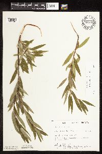 Salix petiolaris Smith 734733[1092142]Petron, T. 3181980-08-12 United States, Minnesota, Clay, Bluestem Prairie, 13 mi E of Moorhead; SE1/4 SE1/4 Sec. 15 T139N R46W;Bluestem Prairie Scientific Natural Area;139N;46W;15, 46.855337 -96.473419 |
MIN:Plants | 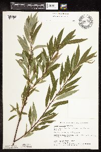 Salix petiolaris Smith 734773[1092134]Severson, M. 6291980-07-30 United States, Minnesota, Becker, Green Water Lake Natural Area, 5 mi W of Ponsford; NW1/4 SE1/4 Sec. 33 T141N R38W;Greenwater Lake Scientific Natural Area / White Earth Indian Reservation;141N;38W;33, 46.982254 -95.495125 |
MIN:Plants | 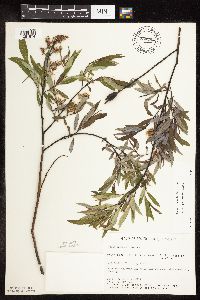 Salix petiolaris Smith 734792[1091974]Severson, M. 1551980-05-21 United States, Minnesota, Becker, Green Water Lake Natural Area: 5 mi. W of Ponsford. SE1/4 Sec. 33, T141N, R38W.;Greenwater Lake Scientific Natural Area / White Earth Indian Reservation;141N;38W;33, 46.98243 -95.488945 |
MIN:Plants | 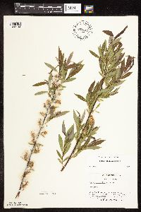 Salix petiolaris Smith 741617[1092144]Converse, C. 7061982-05-28 United States, Minnesota, Otter Tail, Otter Tail Preserve: T131N, R44W, E1/2 of Sec. 17.;Ottertail Prairie Scientific Natural Area;131N;44W;17, 46.159245 -96.235364 |
MIN:Plants | 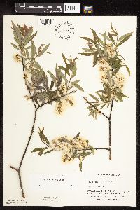 Salix petiolaris Smith 741619[1092149]Converse, C. 8511982-05-24 United States, Minnesota, Pope, Ordway Prairie: T123N, R36W, N1/2 and N1/2 SE1/4 of Sec. 30; SW1/4 and S1/2 SE1/4 of Sec. 19.;Ordway Prairie, The Nature Conservancy;123N;36W;, 45.434262 -95.245019 |
MIN:Plants | 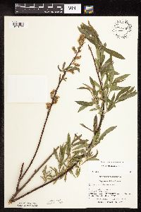 Salix petiolaris Smith 741636[1091953]Converse, C. 9101982-05-31 United States, Minnesota, Chippewa, Chippewa and Swift Cos. SW1/4 NE1/4 Sec.13. Chippewa Prairie: T119N, R43W;Chippewa Prairie, The Nature Conservancy;119N;43W;13, 45.116402 -95.989982 |
MIN:Plants | 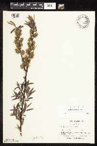 Salix petiolaris Smith 741647[1092066]Converse, C. 7981982-05-19 United States, Minnesota, Douglas, Staffanson Prairie: T127N, R40W, NW1/4 NE1/4 and NE1/4 NW1/4 of Sec. 18.;Staffanson Prairie, The Nature Conservancy;127N;40W;18, 45.810665 -95.748006 |
MIN:Plants | 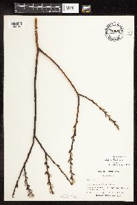 Salix petiolaris Smith 744585[1092152]Converse, C. 7041982-04-18 United States, Minnesota, Douglas, Douglas Co.; Staffanson Prairie: T127N, R40W, NW1/4 NE1/4 and NE1/4 NW1/4 of Sec. 18.;Staffanson Prairie, The Nature Conservancy;127N;40W;18, 45.810665 -95.748006 |
MIN:Plants | 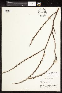 Salix petiolaris Smith 744844[1092151]Converse, C. 7071982-04-22 United States, Minnesota, Pope, Pope Co.; Ordway Prairie: T123N, R36W, SW1/4 SW1/4 Sec. 19.;Ordway Prairie, The Nature Conservancy;123N;36W;19, 45.434262 -95.245019 |
MIN:Plants | 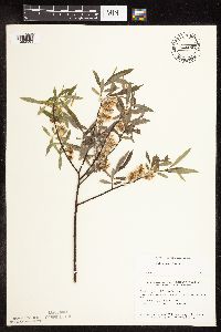 Salix petiolaris Smith 745007[1092063]Smith, Welby 38711981-05-22 United States, Minnesota, Wright, Lake Marie State Park, ca. 1.5 mi E of Silver Creek; SW1/4 SW1/4 Sec. 3 T121N R26W;Lake Maria State Park;121N;26W;3, 45.313541 -93.950377 |
MIN:Plants | 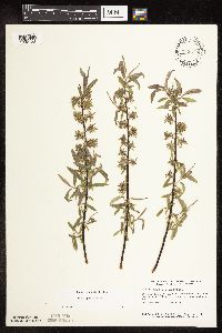 Salix petiolaris Smith 745218[1092132]Smith, Welby 37531981-05-04 United States, Minnesota, Wright, Dickinson Springs Scenic Wayside Park. Wright Co. Dickinson Springs Wayside Park, about 5 mi SE of Buffalo on st. hwy 55, at roadside; NW1/4 NE1/4 Sec. 15 T119 Wright Co. Dickinson Springs Wayside Park, about 5 mi SE of Buffalo on st. hwy 55, at roadside; NW1/4 NE1/4 Sec. 15 T119N R25W. 119N 25W 15, 45.120315 -93.814353 |
MIN:Plants | 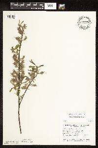 Salix petiolaris Smith 745275[1091938]Smith, Welby 37571981-05-04 United States, Minnesota, Wright, At the NE end of a small unnamed lake in Hanover; NW1/4 SE1/4 Sec. 35 T120N R24W;;120N;24W;35, 45.157431 -93.674163 |
MIN:Plants |  Salix petiolaris Smith 745277[1092210]Smith, Welby 37711981-05-10 United States, Minnesota, Wright, Ca. 1 3/4 mi SE of Silver Creek, and S of co. hwy 39; NW1/4 NW1/4 Sec. 15 T121N R26W;;121N;26W;15, 45.115773 -93.817185 |
MIN:Plants |  Salix petiolaris Smith 745310[1092046]Smith, Welby 39411981-05-26 United States, Minnesota, Steele, Ca. 1.5 mi ESE of Havana, between U.S. hwy 14 and the Chicago and Northwestern rr tracks; NE1/4 SW1/4 Sec. 21 T107N R19W;;107N;19W;21, 44.05785 -93.118899 |
MIN:Plants |  Salix petiolaris Smith 745367[1092060]Smith, Welby 38621981-05-19 United States, Minnesota, Mower, Wild Indigo Scientific Natural Area. Wild Indigo Scientific and Natural Area, ca. 4 mi SW of the jnc of st. hwy 56 and co. hwy 2 in Brownsdale; NE1/4 NW1/4 S Wild Indigo Scientific and Natural Area, ca. 4 mi SW of the jnc of st. hwy 56 and co. hwy 2 in Brownsdale; NE1/4 NW1/4 Sec. 24 T103N R18W. 103N 18W 24, 43.710438 -92.939849 |
MIN:Plants |  Salix petiolaris Smith 745373[1092061]Smith, Welby 38171981-05-18 United States, Minnesota, Mower, Wild Indigo Scientific Natural Area. Wild Indigo Scientific and Natural Area, ca. 2 1/4 mi E of the jnc of st. hwy 56 and co. hwy 2 in Brownsdale; SE1/4 SW1/ Wild Indigo Scientific and Natural Area, ca. 2 1/4 mi E of the jnc of st. hwy 56 and co. hwy 2 in Brownsdale; SE1/4 SW1/4 Sec. 12 T103N R17W. 103N 17W 12, 43.7396 -92.819237 |
MIN:Plants |  Salix petiolaris Smith 745375[1092146]Smith, Welby 38331981-05-19 United States, Minnesota, Mower, Wild Indigo Scientific Natural Area. Wild Indigo Scientific and Natural Area, ca. 1/2 mi SW of the jnc of st. hwy 56 and co. hwy 2 in Brownsdale; SE1/4 SW1/4 Wild Indigo Scientific and Natural Area, ca. 1/2 mi SW of the jnc of st. hwy 56 and co. hwy 2 in Brownsdale; SE1/4 SW1/4 Sec. 9 T103N R17W. 103N 17W 9, 43.7396 -92.819237 |
MIN:Plants |  Salix petiolaris Smith 751037[1092135]Galatowitsch, S. 8831983-08-13 United States, Minnesota, Wabasha, Wabasha County...NE1/4 NW1/4 Sec. 6 T109N R9W;Kellogg-Weaver Dunes Scientific Natural Area / Kellogg-Weaver Dunes, The Nature Conservancy;109N;09W;06, 44.272608 -91.938982 |
MIN:Plants |  Salix petiolaris Smith 753176[1092138]Boe, J. 18841983-06-06 United States, Minnesota, Kittson, Norway Dunes; SE1/4 SE1/4 Sec. 10 T160N R46W;Norway Dunes, The Nature Conservancy;160N;46W;10, 48.695736 -96.572771 |
MIN:Plants |  Salix petiolaris Smith 753177[1092065]Boe, J. 18821983-06-06 United States, Minnesota, Kittson, Norway Dunes; SE1/4 SE1/4 Sec. 10 T160N R46W;Norway Dunes, The Nature Conservancy;160N;46W;10, 48.695736 -96.572771 |
MIN:Plants | 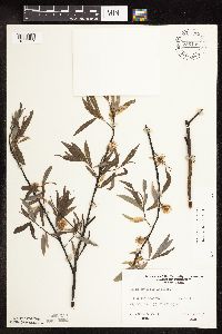 Salix petiolaris Smith 756138[1092064]Converse, C. 23831983-06-15 United States, Minnesota, Hubbard, NW1/4 SE1/4 Sec. 33 T143N R35W;;143N;35W;33, 47.157603 -95.117293 |
MIN:Plants | 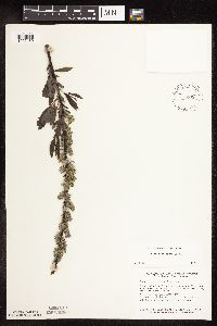 Salix petiolaris Smith 757865[1092139]Smith, Welby 5989B1982-05-18 United States, Minnesota, Mower, Racine Prairie Scientific Natural Area. Racine Prairie State Scientific and Natural Area, adjacent to the E side of U.S. Trunk hwy 63, ca. 2 mi N of Racine; NE1 Racine Prairie State Scientific and Natural Area, adjacent to the E side of U.S. Trunk hwy 63, ca. 2 mi N of Racine; NE1/4 NE1/4 Sec. 22 T104N R14W. 104N 14W 22, 43.797643 -92.499266 |
MIN:Plants | 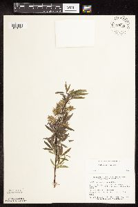 Salix petiolaris Smith 758055[1091975]Smith, Welby 59241982-05-14 United States, Minnesota, Wright, Between Albion Lake and Hwy. 6, ca. 2 mi. S of its jct. with Hwy. 55. NE1/4 SW1/4 Sec. 10, T120N, R27W.;;120N;27W;10, 45.215268 -94.067135 |
MIN:Plants | 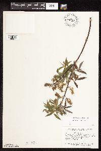 Salix petiolaris Smith 758057[1092217]Smith, Welby 59671982-05-18 United States, Minnesota, Scott, Scott Co. On the W side of Savage, 1/2 mi. S of Hwy. 13, in the Minnesota Valley. SE1/4 NE1/4 Sec. 17.;Savage Fen Scientific Natural Area;115N;21W;17, 44.769771 -93.369347 |
MIN:Plants | 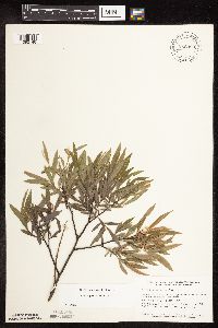 Salix petiolaris Smith 758393[1092140]Smith, Welby 72521982-06-10 United States, Minnesota, Norman, On the E side of co. hwy 40, ca. 2.5 mi S of Faith; SW1/4 NW1/4 Sec. 25 T144N R43W;;144N;43W;25, 47.259981 -96.077052 |
MIN:Plants | 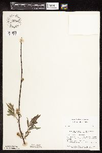 Salix petiolaris Smith 758450[1092137]Smith, Welby 60691982-05-26 United States, Minnesota, Nicollet, Nicollet Co.; in the Minnesota Valley, on the E side of U.S. hwy 169, ca. 2.5 mi SSW of Le Sueur; NE1/4 NE1/4 Sec. 16 T1 Nicollet Co.; in the Minnesota Valley, on the E side of U.S. hwy 169, ca. 2.5 mi SSW of Le Sueur; NE1/4 NE1/4 Sec. 16 T111N R26W. 111N 26W 16, 44.420539 -93.95977 |
MIN:Plants | 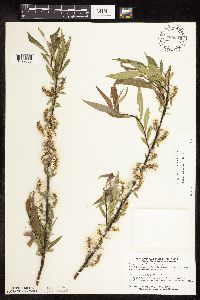 Salix petiolaris Smith 769994[1092036]Smith, Welby 77411983-05-28 United States, Minnesota, Watonwan, Watonwan Co.; right-of-way of the Chicago and Northwestern R.R, ca. 4 mi. SW of Madelia. SW1/4 NE1/4 Sec. 36, T107N, R Watonwan Co.; right-of-way of the Chicago and Northwestern R.R, ca. 4 mi. SW of Madelia. SW1/4 NE1/4 Sec. 36, T107N, R31W.. 107N 31W 36, 44.029211 -94.498907 |
Google Map
Google Maps is a web mapping service provided by Google that features a map that users can pan (by dragging the mouse) and zoom (by using the mouse wheel). Collection points are displayed as colored markers that when clicked on, displays the full information for that collection. When multiple species are queried (separated by semi-colons), different colored markers denote each individual species.