University of Minnesota
http://www.umn.edu/
612-625-5000
http://www.umn.edu/
612-625-5000
Minnesota Biodiversity Atlas
Bell Museum
Dataset: MIN-Plants
Taxa: Salicaceae
Search Criteria: excluding cultivated/captive occurrences
Bell Museum plants | |
 MIN:Plants |  Salix interior Rowlee 834915[1091254]Cholewa, A. 22161995-06-14 United States, Minnesota, Stearns, Stearns Co. Paynesville, Highgrove BioReserve, just S of Koronis Hills Golf Course, T122N R32W S20. Artificial dam;;122N;32W;20, 45.362225 -94.732288 |
MIN:Plants |  Salix interior Rowlee 837445[1091377]Smith, Welby 175461990-07-31 United States, Minnesota, Morrison, Camp Ripley Military Reservation. Camp Ripley Military Reservation. Morrison Co. At Sylvan Dam on the Crow Wing River; UTM: 393900E 512500N T133N R29W SW1 Camp Ripley Military Reservation. Morrison Co. At Sylvan Dam on the Crow Wing River; UTM: 393900E 512500N T133N R29W SW1/4 of NE1/4 of Sec 30. 133N 29W 30, 46.298839 -94.38527 |
MIN:Plants |  Salix interior Rowlee 839214[1091250]Myhre, K. 39111993-06-23 United States, Minnesota, Pine, Chengwatana State Forest. Pine County...Located 1/2 mi W of the Soderbeck Landing on the St. Croix River; escarpment of the river...T39N R20W SE1/4 of NE1/4 of Sec 36.. 039N 20W 36, 45.823967 -92.784805 |
MIN:Plants |  Salix interior Rowlee 840658[1091378]Boe, J. 930515041993-05-25 United States, Minnesota, Cass, Cass Co. Ottertail Peninsula. Shore of Leech Lake; T143N R20W NW1/4 of SW1/4 of Sec 12;Chippewa National Forest / Leech Lake Indian Reservation;143N;30W;12, 47.213086 -94.422387 |
MIN:Plants | 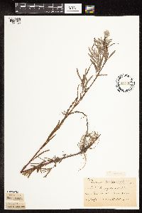 Salix interior Rowlee 95335[1091455]Taylor, B. T6411891-07-00 United States, Minnesota, Faribault, Minnesota Lake;;N;;, 43.837621 -93.860827 |
MIN:Plants | 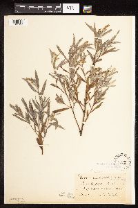 Salix interior Rowlee 95336[1091357]Taylor, B. T4281891-06-00 United States, Minnesota, Waseca, Buffalo Lake;;N;;, 44.057215 -93.721838 |
MIN:Plants | 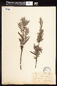 Salix interior Rowlee 95337[1091301]Sheldon, Edmund S13501891-08-00 United States, Minnesota, Lincoln, Verdi;;N;;, 44.20858 -96.352262 |
MIN:Plants | 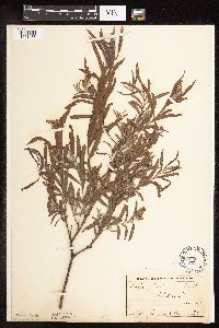 Salix interior Rowlee 95338[1091483]Campbell, Jennie s.n.1897-07-00 United States, Minnesota, Otter Tail, Clitherall.;;N;;, 46.250427 -95.666589 |
MIN:Plants |  Salix interior Rowlee 95339[1091358]Sheldon, Edmund S4381891-06-00 United States, Minnesota, Waseca, Buffalo Lake;;N;;, 44.057215 -93.721838 |
MIN:Plants |  Salix interior Rowlee 95399[1091350]Sandberg, John s.n.1887-04-00 United States, Minnesota, Goodhue, Red Wing;;113N;14W;, 44.562468 -92.533801 |
MIN:Plants |  Salix interior Rowlee 96001[1091422]Menzel, Max 98421895-05-00 United States, Minnesota, Pipestone, Pipestone [assuming the quarry area; town generally noted as "Pipestone City" by collector];Pipestone National Monument;106N;46W;01, 44.01585 -96.31767 |
MIN:Plants |  Salix interior Rowlee 96002[1091434]Moyer, Lycurgus s.n.1892-07-02 United States, Minnesota, Chippewa, Montevideo;;117N;40W;, 44.941389 -95.722222 |
MIN:Plants | 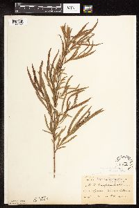 Salix interior Rowlee 96003[1091462]Taylor, B. T051891-06-00 United States, Minnesota, Le Sueur, Elysian.;;109N;24W;, 44.198577 -93.673838 |
MIN:Plants | 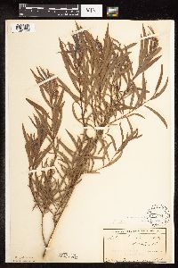 Salix interior Rowlee 96004[1091459]Campbell, Jennie s.n.1897-07-00 United States, Minnesota, Otter Tail, Clitherall.;;N;;, 46.250427 -95.666589 |
MIN:Plants | 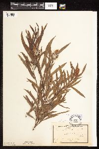 Salix interior Rowlee 96005[1091395]MacMillan, C.; et al. MS11251894-07-00 United States, Minnesota, Lake of the Woods, Oak Point.;Pine & Curry Islands Scientific Natural Area;162N;31W;06, 48.876094 -94.686323 |
MIN:Plants | 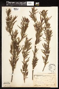 Salix interior Rowlee 96006[1091463]Anderson, A. s.n.1894-05-00 United States, Minnesota, Hennepin, Minneapolis;;N;;, 44.979965 -93.263836 |
MIN:Plants | 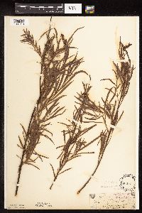 Salix interior Rowlee 96007[1091374]Sandberg, John s.n.1885-06-00 United States, Minnesota, Chisago, Wyoming;;;;, 45.336355 -92.997163 |
MIN:Plants | 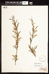 Salix interior Rowlee 96008[1091424]Holzinger, John s.n.1900-04-24 United States, Minnesota, [no further data];;;;, 46 -94 |
MIN:Plants | 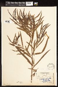 Salix interior Rowlee 96009[1096584]Aiton, G. s.n.1889-07-00 United States, Minnesota, Hennepin, [no further data];;;;, 45 -93.47 |
MIN:Plants | 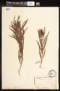 Salix interior Rowlee 96010[1091492]Ballard, C. B17381893-07-00 United States, Minnesota, Cass, Lake Kilpatrick.;;135N;29W;, 46.495108 -94.365032 |
MIN:Plants | 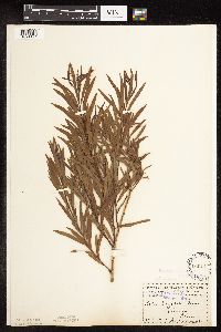 Salix interior Rowlee 96011[1091421]Menzel, Max s.n.1895-06-00 United States, Minnesota, Pipestone, Pipestone [assuming the quarry area; town generally noted as Pipestone City by collector];Pipestone National Monument;106N;46W;01, 44.01585 -96.31767 |
MIN:Plants | 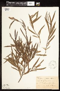 Salix interior Rowlee 96012[1091414]Sheldon, Edmund S2881891-06-00 United States, Minnesota, Blue Earth, Lake Washington.;;109N;25W;, 44.23865 -93.867678 |
MIN:Plants | 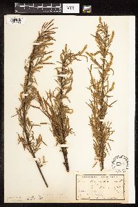 Salix interior Rowlee 96013[1091480]Anderson, A. s.n.1894-05-00 United States, Minnesota, Hennepin, NE Minneapolis.;;N;;, 44.985793 -93.263836 |
MIN:Plants | 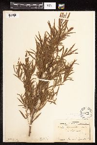 Salix interior Rowlee 96014[1091481]Campbell, Jennie s.n.1897-08-00 United States, Minnesota, Otter Tail, Clitherall.;;N;;, 46.250427 -95.666589 |
MIN:Plants | 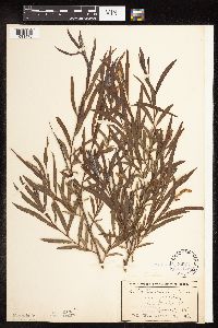 Salix interior Rowlee 96015[1091478]Wheeler, William 1361899-06-07 United States, Minnesota, Houston, Winnebago Valley, Houston Co.;Dorer Memorial Hardwood State Forest;N;;, 43.537379 -91.40119 |
MIN:Plants | 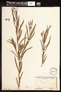 Salix interior Rowlee 96016[1091359]Wheeler, William 3331899-07-12 United States, Minnesota, Houston, Crooked Creek, Houston Co.;Dorer Memorial Hardwood State Forest;N;;, 43.592621 -91.284352 |
MIN:Plants | 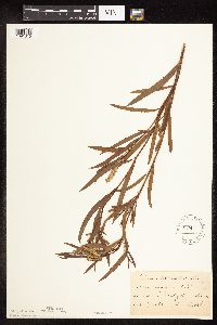 Salix interior Rowlee 96017[1091315]Frost, W. F2601892-07-00 United States, Minnesota, Kandiyohi, Willmar.;;119N;35W;, 45.121908 -95.043342 |
MIN:Plants | 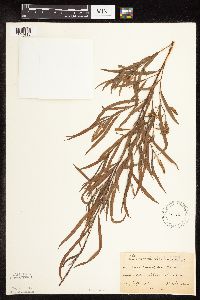 Salix interior Rowlee 96018[1091415]Sheldon, Edmund S11651891-07-00 United States, Minnesota, Brown, New Ulm.;;110N;30W;, 44.315266 -94.452293 |
MIN:Plants | 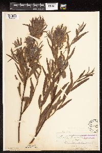 Salix interior Rowlee 96019[1096580]Leiberg, John s.n. United States, Minnesota, Blue Earth, [no further data];;;;, 44.132599 -94.002655 |
MIN:Plants | 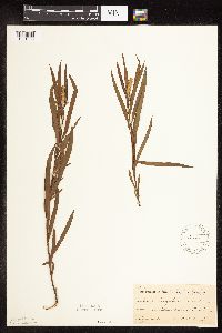 Salix interior Rowlee 96020[1091333]Ballard, C. B9611892-06-00 United States, Minnesota, Brown, New Ulm.;;110N;30W;, 44.315266 -94.452293 |
MIN:Plants | 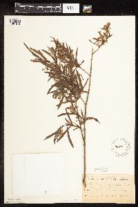 Salix interior Rowlee 96021[1091316]Sheldon, Edmund S1681891-06-00 United States, Minnesota, Blue Earth, Madison Lake.;;N;;, 44.190628 -93.807612 |
MIN:Plants | 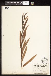 Salix interior Rowlee 96022[1091420]Menzel, Max s.n.1895-05-00 United States, Minnesota, Pipestone, Pipestone [assuming the quarry area; town generally noted as Pipestone City by collector];Pipestone National Monument;106N;46W;01, 44.01585 -96.31767 |
MIN:Plants | 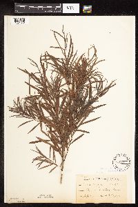 Salix interior Rowlee 96024[1091372]Taylor, B. T6171891-07-00 United States, Minnesota, Faribault, Minnesota Lake.;;104N;25W;, 43.837621 -93.860827 |
MIN:Plants | 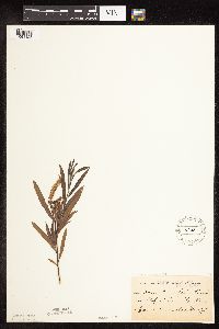 Salix interior Rowlee 96025[1091423]Menzel, Max s.n.1892-06-00 United States, Minnesota, Pipestone, Pipestone City;;106N;46W;12, 44.000526 -96.317534 |
MIN:Plants | 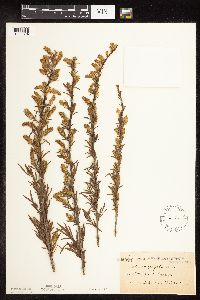 Salix interior Rowlee 96026[1091394]Frost, W. F221892-06-00 United States, Minnesota, Meeker, Litchfield.;;119N;31W;, 45.127185 -94.528047 |
MIN:Plants | 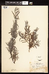 Salix interior Rowlee 96027[1091311]Rosendahl, C. 48841925-08-04 United States, Minnesota, Anoka, W side of Moore Lake.;;030N;24W;, 45.077013 -93.252399 |
MIN:Plants |  Salix interior Rowlee 96028[1091494]Rosendahl, C. 47851925-04-26 United States, Minnesota, Washington, Below Otisville.;;;;, 45.241593 -92.764245 |
MIN:Plants |  Salix interior Rowlee 96029[1091363]Rosendahl, C. 48131925-06-13 United States, Minnesota, Ramsey, E side of Lake Vadnais. Ramsey Co.;;030N;22W;, 45.053137 -93.08625 |
MIN:Plants |  Salix interior Rowlee 96030[1091436]Frost, W. s.n.1892-06-00 United States, Minnesota, Meeker, Litchfield.;;119N;31W;, 45.127185 -94.528047 |
MIN:Plants |  Salix interior Rowlee 96031[1091419]Menzel, Max s.n.1895-05-00 United States, Minnesota, Pipestone, Pipestone [assuming the quarry area; town generally noted as Pipestone City by collector];Pipestone National Monument;106N;46W;01, 44.01585 -96.31767 |
MIN:Plants | 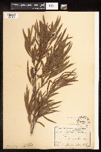 Salix interior Rowlee 96032[1091451]Campbell, Jennie C541896-07-00 United States, Minnesota, Stearns, Grand Lake. Stearns Co.;;123N;29W;, 45.436726 -94.337004 |
MIN:Plants | 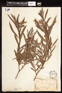 Salix interior Rowlee 96033[1091364]MacMillan, C.; et al. MS11241894-07-00 United States, Minnesota, Lake of the Woods, Oak Point.;Pine & Curry Islands Scientific Natural Area;162N;31W;06, 48.876094 -94.686323 |
MIN:Plants | 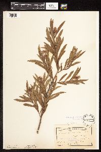 Salix interior Rowlee 96034[1091370]MacMillan, C.; et al. MS11321894-07-00 United States, Minnesota, Lake of the Woods, Oak Point.;Pine & Curry Islands Scientific Natural Area;162N;31W;06, 48.876094 -94.686323 |
MIN:Plants | 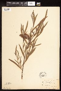 Salix interior Rowlee 96035[1091433]Moyer, Lycurgus s.n.1893-05-21 United States, Minnesota, Chippewa, Montevideo;;117N;40W;, 44.941389 -95.722222 |
MIN:Plants |  Salix interior Rowlee 96036[1091416]Sheldon, Edmund S12111891-07-00 United States, Minnesota, Brown, New Ulm.;;110N;30W;, 44.315266 -94.452293 |
MIN:Plants |  Salix interior Rowlee 96037[1091418]Menzel, Max s.n.1895-07-00 United States, Minnesota, Pipestone, Pipestone [assuming the quarry area; town generally noted as Pipestone City by collector];Pipestone National Monument;106N;46W;01, 44.01585 -96.31767 |
MIN:Plants |  Salix interior Rowlee 96038[1091362]Ballard, C. B2851891-06-00 United States, Minnesota, Scott, Jordan. Scott Co.;;114N;23W;, 44.66532 -93.627759 |
MIN:Plants |  Salix interior Rowlee 96039[1091386]Taylor, B. T9721891-07-00 United States, Minnesota, Pope, Glenwood.;;N;;, 45.648982 -95.401248 |
MIN:Plants | 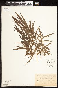 Salix interior Rowlee 96040[1091334]Sheldon, Edmund S6391891-06-00 United States, Minnesota, Waseca, Wilton;;N;;, 44.013852 -93.534387 |
MIN:Plants | 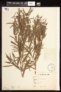 Salix interior Rowlee 96042[1091344]Goldsmith, G. G1811912-00-00 United States, Minnesota, Rice, Northfield;;N;;, 44.458298 -93.161604 |
MIN:Plants | 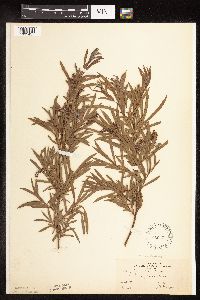 Salix interior Rowlee 96043[1091457]Bergman, H. 28571913-07-10 United States, Minnesota, Otter Tail, Dent.;;136N;40W;, 46.55357 -95.716435 |
MIN:Plants | 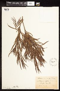 Salix interior Rowlee 96044[1091361]Sheldon, Edmund S7251891-07-00 United States, Minnesota, Brown, Sleepy Eye.;;110N;32W;, 44.297183 -94.72415 |
MIN:Plants | 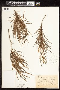 Salix interior Rowlee 96045[1091417]Frost, W. F1021892-06-00 United States, Minnesota, Meeker, Litchfield.;;119N;31W;, 45.127185 -94.528047 |
MIN:Plants | 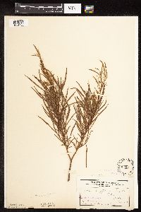 Salix interior Rowlee 96046[1091406]Frost, W. s.n.1892-06-00 United States, Minnesota, Meeker, Acton [pioneer village];;119N;32W;26, 45.08778 -94.66538 |
MIN:Plants | 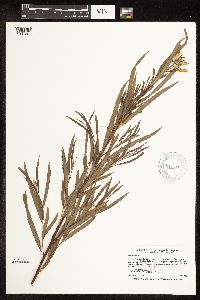 Salix interior Rowlee 912410[1091261]Smith, Welby 231171993-07-28 United States, Minnesota, Grant, National Waterfowl Production Area. At the northwest end of Lee Lake, about six miles east of Elbow Lake (town);Redhead Slough Wildlife Management Area;129N;41W;08, 45.9938889 -95.8583333 |
MIN:Plants | 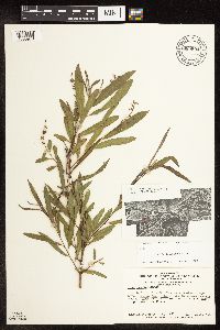 Salix interior Rowlee 680904[1096978]Swanson, Steven 4301975-06-12 United States, Wisconsin, La Crosse, La Crosse Co, Site 7, area on S edge of I-90 levee;Upper Mississippi National Wildlife Refuge |
MIN:Plants | 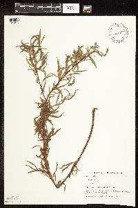 Salix interior Rowlee 499317[1091293]Capistrant, A. AMC12131998-05-11 United States, Minnesota, Ramsey, Ramsey Co, T29N R22W S21;;029N;22W;21, 44.984742 -93.055943 |
MIN:Plants | 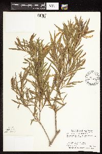 Salix interior Rowlee 475184[1091288]Smith, Welby 285852000-06-17 United States, Minnesota, Becker, Becker County ... About 0.5 mile west of Ogema ... T 142N R 41W NE1/4 of NE1/4 of Sec 24;White Earth Indian Reservation;142N;41W;24, 47.106945 -95.9349976 |
MIN:Plants | 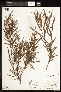 Salix interior Rowlee 474224[1091276]Moore, John 1981971-07-01 United States, Minnesota, Sherburne, NW1/4 S.27 - Blue Hill Twnshp. [Sherburne Natinal Wildlife Refuge];Sherburne National Wildlife Refuge;T035N R27W S27, 45.494037 -93.685105 |
MIN:Plants | 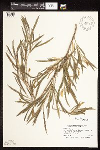 Salix interior Rowlee 475196[1091287]Smith, Welby 261671996-06-16 United States, Minnesota, Hennepin, Lake Rebecca County Park. Hennepin County ... In Lake Rebecca Regional Park, about 1/2 mile southeast of Rockford ... T 119N R 24W NW1/4 of NW1/4 of Sec 33. 119N 24W 33, 45.0777779 -93.7249985 |
MIN:Plants | 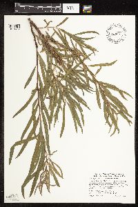 Salix interior Rowlee 461903[1091427]Smith, Welby 275111998-08-11 United States, Minnesota, Koochiching, Pine Island State Forest. Koochiching County ... Big Fork River, on the south side of Bigfork (town) [should be Big Falls] ... T 155N R 25W SE1/4 of SE1/4 of Sec 35. 155N 26W 7, 48.1972237 -93.8030548 |
MIN:Plants | 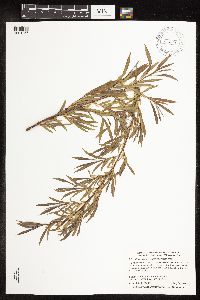 Salix interior Rowlee 438683[1091257]Smith, Welby 278091999-05-28 United States, Minnesota, Marshall, Marshall County ... Old Mill State Park, about 11 miles west of Newfolden ... T156N R46W NW1/4 of SW1/4 of Sec 4;Old Mill State Park;156N;46W;04, 48.3611111 -96.5730556 |
MIN:Plants | 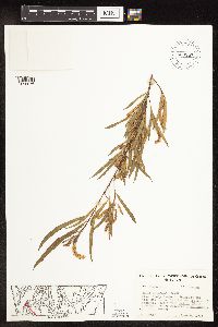 Salix interior Rowlee 653857[1096976]Sohmer, S. 75651973-06-06 United States, Wisconsin, Vernon, Co.: Vernon...Transect 8B, T14N R4W Sec. 6, 1st Isl. on trnsct E of Channel;Upper Mississippi National Wildlife Refuge |
MIN:Plants | 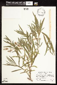 Salix interior Rowlee 476740[1091337]Smith, Welby 266631997-06-27 United States, Minnesota, Washington, William O'Brien State Park. Washington County ... William O'Brien State Park. In the St. Croix Valley, about 1.5 miles north of Marine ... T32N R19W SW1/4 of SW1/4 of Sec 30. 032N 19W 30, 45.225 -92.76 |
MIN:Plants | 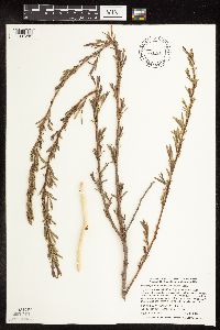 Salix interior Rowlee 462073[1091286]Smith, Welby 269671998-04-30 United States, Minnesota, Big Stone, Big Stone National Wildlife Refuge. Big Stone County ... Big Stone National Wildlife Refuge, about 3 miles south-southeast of Ortonville ... T 121N R 46W SW1/4 of NW1/4 of Sec 26. 121N 46W 26, 45.2627792 -96.4113922 |
MIN:Plants | 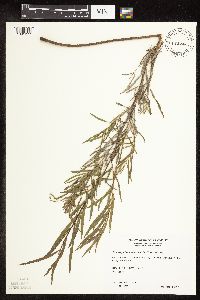 Salix interior Rowlee 482428[1091277]Wheeler, Gerald 161711997-06-14 United States, Minnesota, Nicollet, Nicollet Co.; Ca. 2.3 mi. W of Nicollet on Rte. 14, N of road, Swan Lake WMA; N1/2 Sec. 6 T109N R28W (Nicollet 6);Swan Lake Wildlife Management Area;109N;28W;6, 44.275753 -94.240943 |
MIN:Plants | 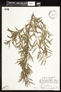 Salix interior Rowlee 472002[1091428]Smith, Welby 281241999-08-06 United States, Minnesota, Aitkin, Aitkin County ... On the W side of Ball Club [sic] Lake about 15 mi E of Hill City ... T51N R23W NE1/4 of SW1/4 of Sec 5;Savanna State Forest;051N;23W;05, 46.9336128 -93.2852783 |
MIN:Plants | 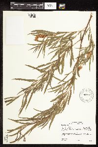 Salix interior Rowlee 907802[1091260]Gerdes, Lynden 52052006-07-13 United States, Minnesota, Itasca, Chippewa National Forest. T58N R27W S35NENWNE. Itasca County, MN. Chippewa National Forest. Bowstring State Forest. Approximately 5.79 miles SE of Bowstring, MN and 0.30 mile SE of McDonald Lake. Gravel pit area east of Cty. Rd. 48.. 058N 27W 35, 47.643577 -93.606187 |
MIN:Plants |  Salix interior Rowlee 499014[1091255]Juhnke, C. 421 CMJ FRO1999-07-03 United States, Minnesota, Goodhue, Frontenac State Park Goodhue County ... South of interpretive area ... T112N R13W NE SE NE 3;Frontenac State Park;112N;13W;03, 44.534992 -92.358902 |
MIN:Plants |  Salix interior Rowlee 294998[1096979]Benner, F.; et al. 261928-08-03 United States, Wisconsin, Polk, 8 mi N. St. Croix Falls...W. of River Road;Saint Croix National Riverway;;;, 45.481172 -92.687024 |
MIN:Plants |  Salix interior Rowlee 653860[1096974]Sohmer, S. 75181973-06-06 United States, Wisconsin, Vernon, Co.: Vernon...Transect 8B, T14N R4W Sec. 6, 1st Isl. on trnsct E of Channel;Upper Mississippi National Wildlife Refuge |
MIN:Plants |  Salix interior Rowlee 398703[1096968]Shimek, B. s.n.1912-07-01 United States, Iowa, Dickinson, N. end of W. Okoboji Lake. Dickinson County |
MIN:Plants | 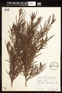 Salix interior Rowlee 553002[1091259]Tester, John s.n.1958-08-20 United States, Minnesota, Mahnomen, 3-4 miles W and 1 mile S of Waubun;Waubun Prairie Wildlife Management Area / White Earth Indian Reservation;143N;42W;33, 47.1589 -96.00743 |
MIN:Plants | 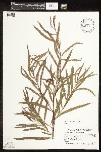 Salix interior Rowlee 478108[1091398]Smith, Welby 267531997-08-06 United States, Minnesota, Kanabec, Kanabec County ... Fish Lake, about 4 miles south-southwest of Mora ... T39N R24W SW1/4 of SW1/4 of Sec 34;;039N;24W;34, 45.8205566 -93.3255539 |
MIN:Plants | 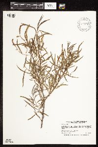 Salix interior Rowlee 914363[1091262]Smith, Welby 225481993-06-22 United States, Minnesota, Stevens, Stevens County...Between TH 9 and the BN railroad tracks, about 4 miles south-southeast of Donnelly...T 125N R 42W NW1/4 of NE1/4 of Sec 17. 125N 42W 17, 45.6427778 -95.9752778 |
MIN:Plants | 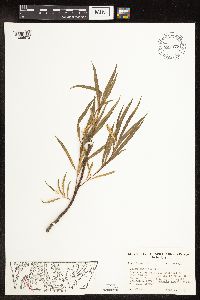 Salix interior Rowlee 653877[1096972]Sohmer, S. 75671973-06-06 United States, Wisconsin, Vernon, Co.: Vernon...Transect 8B, T14N R4W Sec. 6, 1st Isl. on trans E. of Channel;Upper Mississippi National Wildlife Refuge |
MIN:Plants | 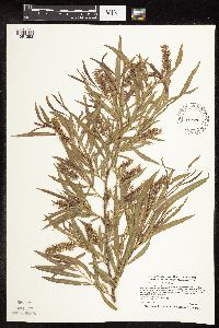 Salix interior Rowlee 490648[1091292]Smith, Welby 272161998-06-06 United States, Minnesota, Anoka, Lamprey Pass Wildlife Management Area. Anoka County ... Lamprey Pass State Wildlife Management Area, about 2 miles southwest of Forest Lake (town) ... T32N R22W SW1/4 of NE1/4 of Sec 13. 032N 22W 13, 45.2619444 -93.0294444 |
MIN:Plants | 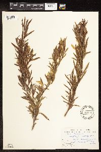 Salix interior Rowlee 551954[1096980]Stevens, O.; et al. 17421958-06-13 United States, North Dakota, Pembina, Mountain (Pembina Co.) |
MIN:Plants | 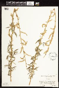 Salix interior Rowlee 499089[1091295]Cholewa, A. 26372003-04-29 United States, Minnesota, Sherburne, Sherburne County. Sherburne National Wildlife Refuge, Wildlife Drive, north leg near School House Pool; T34N R27W Sec 5;Sherburne National Wildlife Refuge;034N;27W;05, 45.465549 -93.725958 |
MIN:Plants | 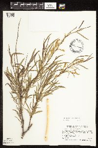 Salix interior Rowlee 462040[1091289]Smith, Welby 265471997-05-29 United States, Minnesota, Meeker, Meeker County ... between Hwy 7 and the old Chicago and Northwestern Railroad tracks (now abandoned), about 1.5 miles east of Corvuso ... T117N R31W NE1/4 of SW1/4 of Sec 16. 117N 31W 16, 44.9411125 -94.5744476 |
MIN:Plants | 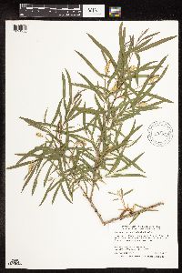 Salix interior Rowlee 896652[1091258]Smith, Welby 292942002-06-11 United States, Minnesota, Wright, Wright County...Harry Larson County Forest, about 7 miles W-NW of Monticello...T 122N R 26W SW1/4 of SW1/4 of Sec 35;Harry Larson County Forest;122N;26W;35, 45.33323 -93.92151 |
MIN:Plants | 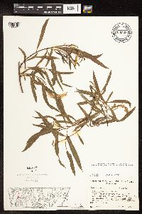 Salix interior Rowlee 739505[1096971]Sohmer, S. 74741973-06-06 United States, Wisconsin, Vernon, Co.: Vernon...Transect 8B, T14N R4W Sec. 6, 1st Isl. on trnsct E. of Channel;Upper Mississippi National Wildlife Refuge |
MIN:Plants | 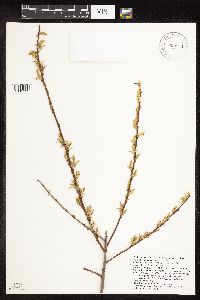 Salix interior Rowlee 923554[1091399]Savage, Jessica CC-76-20052005-05-02 United States, Minnesota, Anoka, Crane Farmhouse on East Bethel Blvd, south of Fawn Lake Drive.;Cedar Creek National History Area;;;, 45.4063361 -93.1837389 |
MIN:Plants | 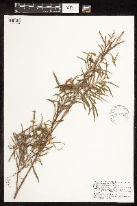 Salix interior Rowlee 923546[1091400]Savage, Jessica MN-19-20072007-06-23 United States, Minnesota, Lake of the Woods, East of Dicks Parkway north of Hiwood FR;Beltrami Island State Forest;;;, 48.6465708 -95.3091369, 378m |
MIN:Plants | 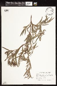 Salix interior Rowlee 921219[1096583]Smith, Welby 249811994-07-27 United States, Minnesota, Crow Wing, Crow Wing State Park. Crow Wing State Park, about 4 miles southwest of Barrows...along the Crow Wing R. ...T 44N R 32W NW1/4 of SE1/4 of Sec 23. 044N 32W 23, 46.2772222 -94.3391667 |
MIN:Plants | 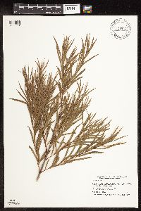 Salix interior Rowlee 921924[1096582]Smith, Welby 233401993-08-03 United States, Minnesota, Renville, About 4 miles east of Sacred Heart. SE1/4 of SE1/4 of Sec.;;115N;37W;02, 44.7913889 -95.2602778 |
MIN:Plants | 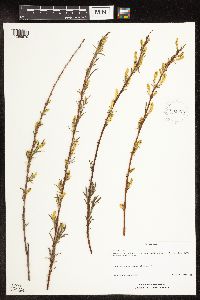 Salix interior Rowlee 931828[1096579]Schimpf, D. DJS6712012-05-13 United States, Minnesota, Saint Louis, NW1/4 of section;;049N;15W;34, 46.6852778 -92.2290278 |
MIN:Plants | 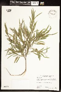 Salix interior Rowlee 942362[1226045]Gerdes, Lynden B. 68532013-07-17 United States, Minnesota, Saint Louis, Approximately 4.39 miles NNE of Ely, MN. West shore of Low Lake. NWSW of section;Bass Lake Trail / Superior National Forest;63N;12W;02, 47.966791 -91.838327 |
MIN:Plants | 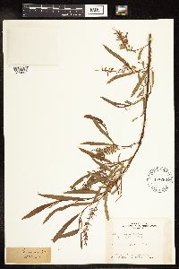 Salix interior Rowlee 457288[1214696] United States, Missouri |
MIN:Plants | 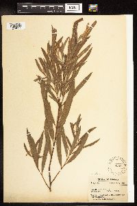 Salix interior Rowlee 95981[1214697] United States, Indiana, Posey |
MIN:Plants | 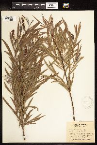 Salix interior Rowlee 303577[1214698] United States, Indiana, Knox |
MIN:Plants | 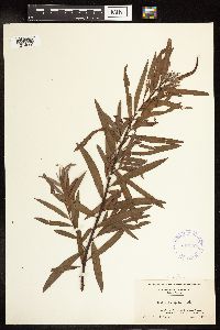 Salix interior Rowlee 337178[1214699] United States, New Jersey, Salem |
MIN:Plants | 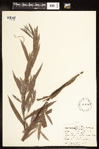 Salix interior Rowlee 530908[1214700] United States, Ohio, Trumbull |
MIN:Plants | 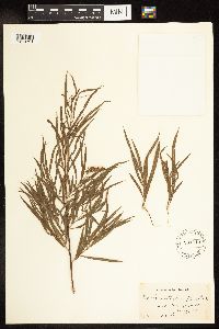 Salix interior Rowlee 531415[1214701] United States, Iowa, Lee |
MIN:Plants | 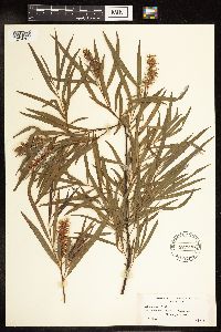 Salix interior Rowlee 529292[1214702] United States, Illinois, Champaign |
MIN:Plants | 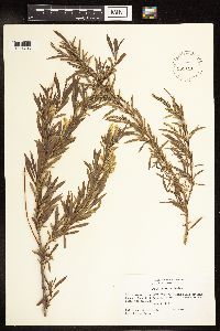 Salix interior Rowlee 531191[1214703] United States, South Dakota, Lawrence |
MIN:Plants |  Salix interior Rowlee 588743[1214704] United States, North Dakota, Ward |
MIN:Plants |  Salix interior Rowlee 588744[1214705] United States, North Dakota, Ward |
MIN:Plants |  Salix interior Rowlee 531386[1214706] United States, Iowa, Lee |
MIN:Plants |  Salix interior Rowlee 373014[1214707] United States, Arkansas, Phillips |
Google Map
Google Maps is a web mapping service provided by Google that features a map that users can pan (by dragging the mouse) and zoom (by using the mouse wheel). Collection points are displayed as colored markers that when clicked on, displays the full information for that collection. When multiple species are queried (separated by semi-colons), different colored markers denote each individual species.