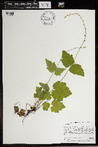
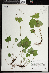
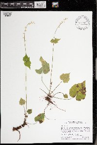
University of Minnesota
http://www.umn.edu/
612-625-5000
http://www.umn.edu/
612-625-5000
Minnesota Biodiversity Atlas
Bell Museum
Dataset: MIN-Plants
Taxa: Saxifragaceae
Search Criteria: excluding cultivated/captive occurrences
Bell Museum plants | |
MIN:Plants | 680800[]Wheeler, Gerald 10141977-04-25 United States, Minnesota, Goodhue, Kenyon: just S of the jnc of the Zumbro River and Hwy 60; N facing slope bordering the Zumbro River; T109N, R18W, S5;;109N;18W;5, 44.276498 -93.010399 |
MIN:Plants | 680814[]Wheeler, Gerald 10341977-05-01 United States, Minnesota, Wabasha, ca 2 mi NE of Theilman, T110N, R11W, S20;;110N;11W;20, 44.316222 -92.15924 |
MIN:Plants | 680833[]Wheeler, Gerald 10501977-05-01 United States, Minnesota, Olmsted, Olmsted Co. About 2 mi S of Simpson on Hwy 1, near the bluffs on the N bank of the Root River, T105N, R13W, S20;Dorer Memorial Hardwood State Forest;105N;13W;20, 43.884292 -92.408371 |
MIN:Plants | 691474[]Clemants, Steven 10061978-04-28 United States, Minnesota, Olmsted, Olmsted Co. Simpson's Bluff, ca 3 mi S of Simpson on co rd 1. North Branch Root River. T105N, R13W, E center S20;Dorer Memorial Hardwood State Forest;105N;13W;20, 43.88118 -92.404217 |
MIN:Plants | 695853[]Clemants, Steven 11511978-06-09 United States, Minnesota, Chisago, Goose Creek, ca 3 mi NE of Harris, T36N, R21W, intersection of sec. 13, 14, 23, 24;;036N;21W;, 45.600839 -92.919398 |
MIN:Plants | 697959[]Ownbey, Gerald 51511976-05-23 United States, Minnesota, Washington, Afton State Park. T28N, R20W, SW1/4 S34. N face of bluff above stream;Afton State Park;028N;20W;34, 44.865753 -92.796669 |
MIN:Plants | 708283[]Ownbey, Gerald 63301979-08-10 United States, Minnesota, Wabasha, T111N, R12W, S13, SW1/4, U.S. Rte 61, 1.8 mi W of Maple Springs, ca 2 mi SE of jnc Co. #44 with U.S. 61 at Lake City, ra T111N, R12W, S13, SW1/4, U.S. Rte 61, 1.8 mi W of Maple Springs, ca 2 mi SE of jnc Co. #44 with U.S. 61 at Lake City, ravine extending up river from hwy. 111N 12W 13, 44.417673 -92.199332 |
MIN:Plants | 708525[]Wheeler, Gerald 35111979-05-29 United States, Minnesota, Fillmore, Fillmore Co.; bordering Spring Valley Creek where Rt. 8 crosses the creek, ca 2 mi NW of Wykoff. T103N, R12W, S8.;Dorer Memorial Hardwood State Forest;103N;12W;8, 43.739543 -92.299184 |
MIN:Plants | 708704[]Wheeler, Gerald 36911979-06-05 United States, Minnesota, Sibley, Sibley Co. Approx. 0.5 mi W of Henderson on Hwy 19. Bordering a creek just S of the road. T112N, R26W, S11;;112N;26W;11, 44.52186 -93.918873 |
MIN:Plants | 708849[]Wheeler, Gerald 38371979-06-13 United States, Minnesota, Carlton, ca 6 mi SSE of Wrenshall. 1 mi E of Hwy 23. S facing hillside overlooking the North Fork Nemadji River. T47N, R16W, S27;;047N;16W;27, 46.525991 -92.35362 |
MIN:Plants | 708967[]Wheeler, Gerald 39551979-06-18 United States, Minnesota, Pine, Pine Co. Approx. 13.5 mi E of Cloverdale on Hwy 48, just S of the road, T41N, R17W, S23;;041N;17W;23, 46.019808 -92.45705 |
MIN:Plants | 709020[]Wheeler, Gerald 40081979-06-22 United States, Minnesota, Washington, Saint Croix National Riverway. Washington County ... Approx. 3 mi S of Marine on St. Croix ... 1 mi N of the St. Croix Islands Scenic Overlook on Rte 95 ... bluffs overlooking the St. Croix River. 031N 19W , 45.100814 -92.771062 |
MIN:Plants | 709216[]Wheeler, Gerald 42081979-07-05 United States, Minnesota, Houston, Houston Co. Approx. 9 mi SW of Reno, N facing bluff overlooking Winnebago Creek, ca 0.25 mi from Rte 5, T101N, R5W, S15;Dorer Memorial Hardwood State Forest;101N;05W;15, 43.551197 -91.422268 |
MIN:Plants | 709787[]Wheeler, Gerald 47991979-08-10 United States, Minnesota, Houston, Houston Co. Approx. 3 mi SE of Caledonia, N facing slope overlooking the South Fork Crooked Creek. T102N, R5W, S29;Dorer Memorial Hardwood State Forest;102N;05W;29, 43.609068 -91.461219 |
MIN:Plants | 712015[]Smith, Welby 9611979-07-04 United States, Minnesota, Wright, Wright Co.; T119N, R24W; SE1/4 NE1/4 S20. W side of Co Rd 19, 0.8 mi N of its jnc with State Hwy 55 in Rockford;;119N;24W;20, 45.102488 -93.730366 |
MIN:Plants | 723995[]Smith, Welby 22381980-05-27 United States, Minnesota, Winona, Winona Co. T107N, R9W; SW1/4 S16. Valley of Bear Creek, ca 1 mi E of Altura;Dorer Memorial Hardwood State Forest;107N;09W;16, 44.06641 -91.909908 |
MIN:Plants | 724155[]Smith, Welby 20471980-05-10 United States, Minnesota, Winona, Winona Co. T108N, R10W, NE1/4 S18. On S side of Co Rd 30. Terrace of Beaver Creek.;Whitewater Wildlife Management Area;T108N R10W S18, 44.155885 -92.008379 |
MIN:Plants | 728830[]Eikum, B. 411979-05-24 United States, Minnesota, Dakota, Hastings;Hastings Scientific Natural Area;115N;17W;, 44.73907 -92.86266 |
MIN:Plants | 728887[]Eikum, B. 381979-05-18 United States, Minnesota, Dakota, Hastings;Hastings Scientific Natural Area;115N;17W;, 44.73907 -92.86266 |
MIN:Plants | 729081[]Severson, M. 821980-05-15 United States, Minnesota, Chisago, Goose Creek Natural Area: 5 mi SE of Rush City, SE1/4 S12, T36N, R21W;Wild River State Park;036N;21W;12, 45.619039 -92.903169 |
MIN:Plants | 729088[]Severson, M. 711980-05-15 United States, Minnesota, Chisago, Goose Creek Natural Area: 5 mi SE of Rush City, NE1/4 S13, T36N, R21W;Wild River State Park;036N;21W;13, 45.611024 -92.912439 |
MIN:Plants | 729143[]Converse, C. 271980-06-02 United States, Minnesota, Chisago, Goose Creek Natural Area: 5 mi SE of Rush City, SW1/4 SE1/4 S12, T36N, R21W;Wild River State Park;036N;21W;12, 45.617688 -92.90171 |
MIN:Plants | 729164[]Berlin, N. 141979-05-06 United States, Minnesota, Goodhue, Wacouta Pond Natural Area: 5 mi SE of Red Wing. Portions of: S6, T112N, R13W and S31, 32, T113N, R13W;Wacouta Pond Natural Area, The Nature Conservancy;N;;, 44.539796 -92.413089 |
MIN:Plants | 729370[]Severson, M. 171980-05-13 United States, Minnesota, Pine, Pine Co. St. Croix Natural Area: 21 mi E of Hinckley, NW1/4 S33, T41N, R17W;Saint Croix State Park;041N;17W;33, 46.02924 -92.49425 |
MIN:Plants | 729725[]Converse, C. 1621980-06-05 United States, Minnesota, Pine, Pine Co. Kettle River Natural Area: 5.5 mi E of Hinckley. SW1/4 NW1/4 S23, T41N, R20W;Kettle River Scientific Natural Area / Sandstone National Wildlife Refuge;041N;20W;23, 46.013408 -92.841832 |
MIN:Plants | 729945[]Phelps, V. 391980-06-24 United States, Minnesota, Pine, Pine Co. Kettle River Natural Area: 5.5 mi E of Hinckley. SE1/4 SW1/4 S10, T41N, R20W;Kettle River Scientific Natural Area / Sandstone National Wildlife Refuge;041N;20W;10, 46.047453 -92.856673 |
MIN:Plants | 738451[]Galatowitsch, S. 821982-05-13 United States, Minnesota, Goodhue, Grace Nature Preserve: T109N, R18W parts of NW1/4 SW1/4 and SW1/4 SW1/4 S8;Grace Nature Preserve, The Nature Conservancy;109N;18W;8, 44.262012 -93.010543 |
MIN:Plants | 738472[]Galatowitsch, S. 371982-05-10 United States, Minnesota, Houston, Caledonia Oaks: T102N, R5W E1/2 SW1/4 S24;Caledonia Oaks, The Nature Conservancy;102N;05W;24, 43.623103 -91.382423 |
MIN:Plants | 743779[]Ownbey, Gerald 67691982-06-19 United States, Minnesota, Kanabec, Kanabec Co. 0.2 mi N of Woodland, E side of Rt 65, T42N, R23W S17 SW1/4;;042N;23W;17, 46.122851 -93.273403 |
MIN:Plants | 745058[]Smith, Welby 37851981-05-14 United States, Minnesota, Olmsted, Olmsted Co. About 1/2 mi W of King's Park, on the S side of the Middle Fork Zumbro River, SE1/4 SE1/4 S15, T108N, R14W;;108N;14W;15, 44.154477 -92.481283 |
MIN:Plants | 765014[]Lugger, O. 55141900-07-00 United States, Minnesota, Chisago, Center City;;034N;20W;34, 45.389814 -92.821151 |
MIN:Plants | 774780[]Wheeler, Gerald 83371984-06-19 United States, Minnesota, Wabasha, Carley State Park, N facing slope overlooking the Whitewater River (North Fork), T108N, R11W, S32;Carley State Park;108N;11W;32, 44.193107 -91.961615 |
MIN:Plants | 774834[]Wheeler, Gerald 82791984-06-14 United States, Minnesota, Fillmore, Forestville State Park. Fillmore Co. Forestville State Park; ca 0.25 mi S of Horse Trail Road, between the South Branch Root River and a major t Fillmore Co. Forestville State Park; ca 0.25 mi S of Horse Trail Road, between the South Branch Root River and a major trail; T102N, R12W, S13. 102N 12W 13, 43.806236 -92.170231 |
MIN:Plants | 774836[]Wheeler, Gerald 82071984-05-10 United States, Minnesota, Houston, Beaver Creek Valley State Park; E facing slope overlooking Beaver Creek, T102N, R6W, S8;Beaver Creek Valley State Park;102N;06W;8, 43.652158 -91.580811 |
MIN:Plants | 782410[]Tenney, M. 1391982-06-01 United States, Minnesota, Fillmore, Forestville State Park. Fillmore Co. T102N, R12W, S13, SW1/4 NE1/4 NW1/4;Forestville State Park;102N;12W;13, 43.637724 -92.219269 |
MIN:Plants | 782456[]Bolin, Kathy KEB161982-05-18 United States, Minnesota, Fillmore, Forestville State Park. Fillmore Co. T102N, R12W, S13, NW1/4 NW1/4 NW1/4;Forestville State Park;102N;12W;13, 43.637724 -92.219269 |
MIN:Plants | 787191[]Smith, Welby 100561985-05-01 United States, Minnesota, Olmsted, Olmsted Co. About 3 mi S of Simpson, along North Branch Root River; NW1/4 SE1/4 S20, T105N, R13W;Dorer Memorial Hardwood State Forest;105N;13W;20, 43.8813896 -92.4041672 |
MIN:Plants | 803067[]Smith, Welby 117771986-06-14 United States, Minnesota, Olmsted, Oxbow County Park. Olmsted County...Oxbow County Park, about 3 mi N of Byron...slope overlooking the Zumbro River. NW1/4 NW1/4 Sec 17, T107N, R15W. 107N 15W 17, 44.0769444 -92.6538889 |
MIN:Plants | 817523[]Delaney, B. 890141989-06-15 United States, Minnesota, Isanti, 1.5 mi E of Lory Lake, N border of Isanti Co. NE1/4 NE1.4 S4, T37N, R24W;;037N;24W;4, 45.728504 -93.330962 |
MIN:Plants | 829224[]Myhre, K. 19871992-05-29 United States, Minnesota, Cass, Cass Co. Located 2 mi SW of Thunder Lake; T140N R26W SW1/4 of NE1/4 of Sec 20;Land O Lakes State Forest;140N;26W;20, 46.928437 -93.994888 |
MIN:Plants | 832203[]Moyle, J.; et al. 37091941-06-29 United States, Minnesota, Fillmore, Fillmore Co. Near Wykoff.;Dorer Memorial Hardwood State Forest / Wykoff Balsam Fir Scientific Natural Area;103N;12W;, 43.722548 -92.289474 |
MIN:Plants | 833930[]Smith, Welby 140501988-05-20 United States, Minnesota, Kanabec, Kanabec County...On the W side of the Snake River, just S of the Highway 3 crossing...NE1/4 NW1/4 sec 22, T41N R23W;;041N;23W;22, 46.0238889 -93.2333333 |
MIN:Plants | 836305[]Cholewa, A. 24041995-08-10 United States, Minnesota, Aitkin, Savanna Portage State Park. Aitkin Co. Savanna Portage State Park, about 17 mi NE of McGregor, downslope from snowmobile trail along ridge N of Sava Aitkin Co. Savanna Portage State Park, about 17 mi NE of McGregor, downslope from snowmobile trail along ridge N of Savanna Lake, T51N R22W S31 SW1/4 of SW1/4.. 051N 22W 31, 46.850494 -93.192696 |
MIN:Plants | 840687[]Smith, Welby 126311987-05-02 United States, Minnesota, Mille Lacs, Mille Lacs Co. Mille Lacs State Wildlife Management Area, about 11 mi N of Bock; SE1/4 NE1/4 sec.24, T40N R26W;Mille Lacs Wildlife Management Area;040N;26W;24, 45.9472237 -93.5199966 |
MIN:Plants | 456206[]Rowe, Erika ERR1332005-09-08 United States, Minnesota, Becker, Becker County ... East of Little Rice Lake in Tamarac NWR; 3/4 mile west of Cnty Hwy 35 ...1/4NW 1/4NW S35 T142N R39W;Tamarac National Wildlife Refuge;142N;39W;35, 47.076643 -95.591183 |
MIN:Plants | 560996[]Gerdes, Lynden 52292006-07-19 United States, Minnesota, Itasca, T54N R23W S14SWNESW Itasca County ... Approximately 2.67 miles NE of Warba, MN and 0.37 miles SE of the Feeley Unit Forest Road.. 054N 23W 14, 47.1598 -93.225765 |
MIN:Plants | 295401[]Benner, F.; et al. 2491928-05-12 United States, Wisconsin, Polk, 2.9 mi. N. St. Croix Falls, Wis. near Whiskey Creek;Saint Croix National Riverway;;;, 45.452726 -92.649593 |
MIN:Plants | 826200[]Vixie, D. 8471982-05-16 United States, Wisconsin, Polk, Polk County...Somer's Lake (south end), 6 miles east of Frederic, Clam Falls twp.; T37N R16W S34 NW1/4.;;037N;16W;34, 366m |
MIN:Plants | 899971[]Lee, Michael MDL39822005-06-22 United States, Minnesota, Becker, Becker County...moraine southeast of Collet Lake, 6 mi SE of the town of Wolf Lake...T138N R38W NW1/4 of SE1/4 Sec. 36;;138N;38W;36, 46.721429 -95.432473 |
MIN:Plants | 510262[]Myhre, K. 63311996-06-13 United States, Minnesota, Aitkin, Aitkin County ... Located 2.5 miles east of the town of Hill City ... T 52N R 25W SW1/4 of NE1/4 of Sec 17;Hill River State Forest;052N;25W;17, 46.996324 -93.662869 |
MIN:Plants | 482217[]Lee, Michael MDL23631998-08-11 United States, Minnesota, Stearns, Stearns Co.; Two miles northeast of Holdingford; along the Two River; T127N R30W NW1/4 of NE1/4 Sec 33 ;;125N;30W;33, 45.768098 -94.460795 |
MIN:Plants | 493930[]Whitfeld, T.J.S. 5142004-06-02 United States, Minnesota, Otter Tail, Otter Tail County ... 2 miles north of Hillview; 1/4 mile south of 520th St ... T137N R36W NESW 4;;137N;36W;04, 46.709573 -95.237395 |
MIN:Plants | 551044[]Cotter, Shirley s.n.1951-05-30 United States, Wisconsin, Polk, Polk County...100 ft. from St. Croix River, 3 mi north of Sunrise, Minn.;Saint Croix National Riverway;;;, 45.592581 -92.852594 |
MIN:Plants | 507968[]Lee, Michael; et al. MDL22921998-07-28 United States, Minnesota, Crow Wing, Crow Wing Co. ... along the Little Pine River 5-1/2 miles south of Emily ... T137N R26W NE1/4 of SW1/4 Sec. 28;;137N;26W;28, 46.64936 -93.970243 |
MIN:Plants | 896542[]Rowe, Erika ERR20060628022006-06-28 United States, Minnesota, Becker, Becker County...West side of Toad River south of Little Toad Lake...SENW S25 T139N R39W;;139N;39W;25, 46.8252778 -95.5561111 |
MIN:Plants | 492214[]Smith, Welby 167371990-05-29 United States, Minnesota, Dodge, Dodge County ... About 1/2 mile east of Mantorville ... South Branch Middle Fork Zumbro River ... T 107N R 16W NE1/4 of NE1/4 of Sec 21. 107N 16W 21, 44.0630569 -92.7416687 |
MIN:Plants | 923376[]Smith, Welby 201581992-05-14 United States, Minnesota, Rice, About 6.5 miles N-NE of Faribault; along Cannon River. NE1/4 of NE1/4 of section.;Cannon River Wilderness Park;110N;20W;04, 44.3708333 -93.2230556 |
MIN:Plants | 934840[]Whitfeld, T. J. S.; et al. 8592012-05-04 United States, Minnesota, Mille Lacs, Mille Lacs County;Rum River State Forest;;;, 45.93 -93.63 |
MIN:Plants | 950370[]Rummels, Amy s.n.1896-05-03 United States, Minnesota, Goodhue, Zumbrota, 44.294132 -92.669081 |
MIN:Plants | 960815[1329749]Perry, Ethan F. 180062018-07-16 United States, Minnesota, Koochiching, 6.2 miles northwest of Rauch., 48.02 -93.24 |
MIN:Plants | 962247[1340884] United States, Wisconsin |
MIN:Plants | 962248[1340885]Stork, H. E. 1927-05-14 United States, Minnesota, Goodhue |
MIN:Plants | 962249[1340886] United States, Illinois |
MIN:Plants | 924768[]Lee, Michael MDL33632003-06-03 United States, Minnesota, Todd, Upper reaches of Swan River, 7 miles SW of Cushing, 10 miles E-SE of Browerville. UTM: 5102021n 371325E. SE1/4 of NW1/4 of NW1/4 of section.;;130N;32W;24, 46.0596492 -94.6635708 |
MIN:Plants | 932245[]Lee, Michael MDL45982008-06-12 United States, Minnesota, Cass, North side of Lova Lake, six miles northeast of Leader, 11 miles west of Pequot Lakes. NW1/4 of SW1/4 of NW1/4 of section;;136N;31W;23, 46.5825414 -94.5599127 |
MIN:Plants | 932246[]Lee, Michael MDL46532008-07-02 United States, Minnesota, Wadena, Three miles southwest of Menahga. NE1/4 of SW1/4 of section;;138N;35W;31, 46.7250018 -95.1552415 |
MIN:Plants | 966916[1359607]Dahlberg, Nathan B. NBD1442019-05-22 United States, Minnesota, Olmsted, Whitewater WMA 652m SW of 72nd St NE, 1309m NW of 175th Ave NE, 4.87 miles from Plainview;, 44.1 -92.14 |
MIN:Plants | 967209[1359868]Rowe, Erika R. ERR6802010-08-31 United States, Minnesota, Beltrami, Approx. 750 meters east of Clearwater River; 1 mile south of Beltrami County Rd 500; 1.5 miles west of the town of Debs., 47.72 -95.16 |
MIN:Plants | []Timothy J. S. Whitfeld 31712022-06-03 United States, Minnesota, Washington, Crystal Spring Scientific and Natural Area, 0.4 miles northeast of the intersection of Scandia Trail North and Hwy 95, 45.26226 -92.765461, 270m |
MIN:Plants | 975957[1373510]Smith, Welby R WRS366782020-05-19 United States, Minnesota, Mille Lacs, Mille Lacs State Wildlife Management Area, about 14.3 km (8.9 miles) S-SE of Onamia., 45.95631 -93.58247 |
MIN:Plants | Micranthes aprica (Greene) Small 376125[]McCalla, W. 63371940-07-01 United States, California, Shasta, Kings Creek, Lassen Nat. Park;Lassen Volcanic National Park, 2195m |
MIN:Plants | Micranthes aprica (Greene) Small 239184[]Congdon, J. s.n.1888-05-24 United States, California, Mariposa, Yosemite Cliffs, Mariposa County;Yosemite National Park |
MIN:Plants | Boykinia major A. Gray 238914[]Congdon, J. s.n.1889-08-21 United States, California, Mariposa, Big Tree Grove, Mariposa County;Yosemite National Park;;;, 37.51 -119.60111 |
MIN:Plants | Boykinia major A. Gray 238994[]Congdon, J. s.n.1883-09-20 United States, California, Mariposa, Wawona;Yosemite National Park;;;, 37.53694 -119.65528 |
MIN:Plants | Boykinia major A. Gray 238913[]Congdon, J. s.n.1883-09-20 United States, California, Mariposa, Wawona;Yosemite National Park;;;, 37.53694 -119.65528 |
MIN:Plants | Boykinia richardsonii (Hooker) Rothrock 403553[]Spetzman, L. 8671948-07-26 United States, Alaska, Arctic North Slope...Sadlerochit River;Arctic National Wildlife Refuge;;;, 69.4166667 -145.1666667, 762m |
MIN:Plants | Boykinia richardsonii (Hooker) Rothrock 399517[]Spetzman, L. 3071947-07-13 United States, Alaska, Canning River; forks within the mountains.;Arctic National Wildlife Refuge;;;, 69.2166667 -145.9 |
MIN:Plants | Boykinia richardsonii (Hooker) Rothrock 416956[]Lachenbruch, A.; et al. 991950-07-11 United States, Alaska, Arctic North Slope...So. bank of Noatak R. 5 mi. SW of camp.;Noatak National Preserve;;;, 67.9333333 -161.0833333, 411m |
MIN:Plants | Boykinia richardsonii (Hooker) Rothrock 298314[]Mexia, Ynes 21191928-07-19 United States, Alaska, McKinley National Park...Trail, Copper Mt. Camp to Grant's Cabin.;Denali National Park;;;, 60.868333 -146.585556, 1100m |
MIN:Plants | Boykinia richardsonii (Hooker) Rothrock 700188[]Glaser, Paul 49b1972-07-01 United States, Alaska, Mt. McKinley National Park...NW1/4NE1/4Sec.1 T17S R13W, Highway Pass;Denali National Park;017S;13W;01, 1219m |
MIN:Plants | Boykinia richardsonii (Hooker) Rothrock 403551[]Spetzman, L. 14401948-07-08 United States, Alaska, Arctic North Slope ... Lake Schrader;Arctic National Wildlife Refuge;;;, 69.4166667 -145, 914m |
MIN:Plants | Boykinia richardsonii (Hooker) Rothrock 403552[]Spetzman, L. 11281948-08-12 United States, Alaska, Arctic North Slope...Sadlerochit River;Arctic National Wildlife Refuge;;;, 69.5833333 -144.75, 457m |
MIN:Plants | Boykinia richardsonii (Hooker) Rothrock 700186[]Glaser, Paul 49a1972-07-01 United States, Alaska, Mt. McKinley National Park...NW1/4NE1/4Sec.1 T17S R13W, Highway Pass;Denali National Park;017S;13W;01, 1219m |
MIN:Plants | Boykinia richardsonii (Hooker) Rothrock 408418[]Spetzman, L. 20261949-07-17 United States, Alaska, Arctic North Slope...Kanayut Lake;Gates of the Arctic National Park;;;, 68.3333333 -151, 914m |
MIN:Plants | Boykinia richardsonii (Hooker) Rothrock 700190[]Glaser, Paul 9681975-09-20 United States, Alaska, Mt. McKinley National Park...NW1/4NW1/4Sec.2 T16S R11W, Igloo Canyon;Denali National Park;016S;11W;02, 1067m |
MIN:Plants | Boykinia richardsonii (Hooker) Rothrock 408419[]Spetzman, L. 27391949-07-14 United States, Alaska, Arctic North Slope ... Anaktuvuk Pass;Gates of the Arctic National Park;;;, 68.2833333 -151.4166667, 914m |
MIN:Plants | Boykinia richardsonii (Hooker) Rothrock 408420[]Spetzman, L. 15811949-07-02 United States, Alaska, Arctic North Slope ... Anaktuvuk Pass;Gates of the Arctic National Park;;;, 68.2833333 -151.4166667, 610m |
MIN:Plants | Boykinia richardsonii (Hooker) Rothrock 700189[]Glaser, Paul 415b1972-08-04 United States, Alaska, Mt. McKinley National Park...NW1/4NW1/4Sec.2 T16S R11W, Igloo Canyon;Denali National Park;016S;11W;02, 1067m |
MIN:Plants | Boykinia richardsonii (Hooker) Rothrock 408421[]Lachenbruch, A. 361949-08-15 United States, Alaska, Arctic North Slope...Killik R.;Gates of the Arctic National Park;;;, 68.2 -154.2, 716m |
MIN:Plants | Boykinia richardsonii (Hooker) Rothrock 700191[]Glaser, Paul 415a1972-08-04 United States, Alaska, Mt. McKinley National Park...NW1/4NW1/4Sec.2 T16S R11W, Igloo Canyon;Denali National Park;016S;11W;02, 1067m |
MIN:Plants | Boykinia richardsonii (Hooker) Rothrock 700187[]Glaser, Paul 968b1975-09-20 United States, Alaska, Mt. McKinley National Park...NW1/4NW1/4Sec.2 T16S R111W, Highway Pass;Denali National Park;016S;11W;02, 1067m |
MIN:Plants | Boykinia richardsonii (Hooker) Rothrock 700212[]Glaser, Paul 415c1972-08-04 United States, Alaska, Mt. McKinley National Park...NW1/4NW1/4Sec.2 T16S R111W, Highway Pass;Denali National Park;016S;11W;02, 1067m |
MIN:Plants | Boykinia richardsonii (Hooker) Rothrock 408417[]Spetzman, L. 17311949-07-07 United States, Alaska, Arctic North Slope ... Anaktuvuk Pass;Gates of the Arctic National Park;;;, 68.2833333 -151.4166667, 914m |
MIN:Plants | Boykinia richardsonii (Hooker) Rothrock 548496[]Spetzman, L. 38941951-07-15 United States, Alaska, Arctic North Slope...Canning R. & Ignek Cr.;Arctic National Wildlife Refuge;;;, 69.5833333 -146.1666667, 305m |
MIN:Plants | Boykinia richardsonii (Hooker) Rothrock 403558[]Spetzman, L. 6891948-07-14 United States, Alaska, Arctic North Slope ... Lake Peters;Arctic National Wildlife Refuge;;;, 69.3333333 -145, 914m |
MIN:Plants | Boykinia richardsonii (Hooker) Rothrock 548328[]Spetzman, L. 37401951-07-20 United States, Alaska, Arctic North Slope...Katakturuk River, Ignek Valley;Arctic National Wildlife Refuge;;;, 69.5833333 -145.5833333, 610m |
MIN:Plants | Micranthes ferruginea (Graham) Brouillet & Gornall 584630[]Morean, Edith 1701962-08-15 United States, Washington, Lewis, Mt. Rainier National Park, Paradise Valley.;Mount Rainier National Park, 1829m |
MIN:Plants | Micranthes ferruginea (Graham) Brouillet & Gornall 828035[]Lawrence, Donald s.n.1968-08-11 United States, Alaska, Sebree "mountain" above Sebree Cove; "Station B";Glacier Bay National Park;036S;55E;02, 58.776199 -136.19704, 671m |
MIN:Plants | Micranthes ferruginea (Graham) Brouillet & Gornall 124777[]Elmer, A.D.E. 26441900-08-00 United States, Washington, Pierce, Olympic Mts. [Olympic National Park] |
MIN:Plants | Micranthes ferruginea (Graham) Brouillet & Gornall 377266[]McCalla, W. 50991938-08-03 United States, Washington, Pierce, below Klapatche Park, Mt. Rainier Nat. Park;Mount Rainier National Park |
Google Map
Google Maps is a web mapping service provided by Google that features a map that users can pan (by dragging the mouse) and zoom (by using the mouse wheel). Collection points are displayed as colored markers that when clicked on, displays the full information for that collection. When multiple species are queried (separated by semi-colons), different colored markers denote each individual species.
