University of Minnesota
http://www.umn.edu/
612-625-5000
http://www.umn.edu/
612-625-5000
Minnesota Biodiversity Atlas
Bell Museum
Dataset: MIN-Plants
Taxa: Saxifragaceae
Search Criteria: excluding cultivated/captive occurrences
Bell Museum plants | |
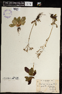
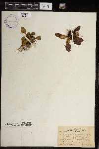
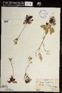
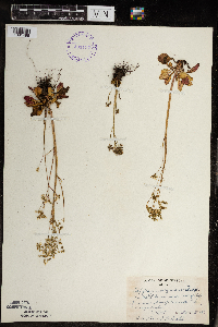
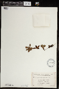
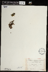
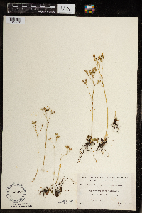
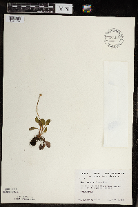
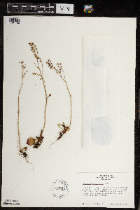
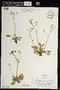
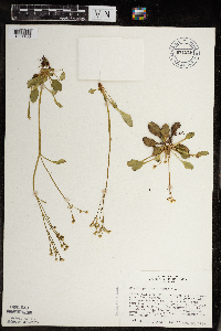
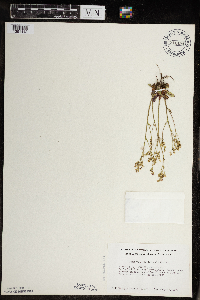
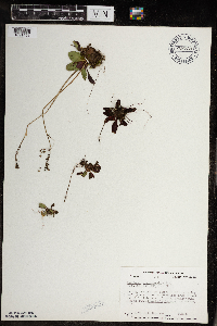
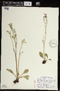
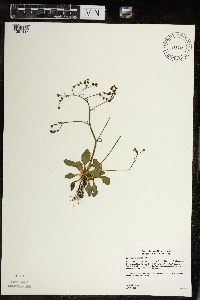
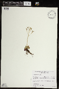
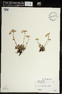
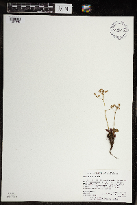
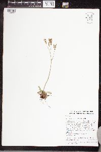
MIN:Plants | Micranthes virginiensis (Michaux) Small 391822[1391484]Lakela, Olga 59291945-05-26 United States, Minnesota, Lake, SE slope of Pancake Island in Lake Superior. Lake Co.;North Shore;055N;07W;00, 47.2667 -91.25 |
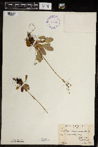
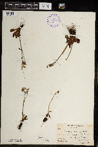
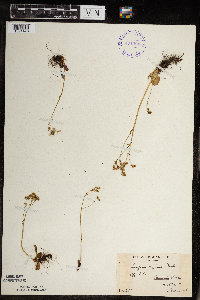
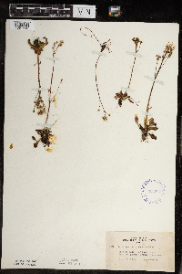
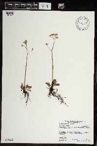
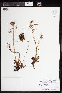
MIN:Plants | Micranthes virginiensis (Michaux) Small 401048[1391494]Burns, G.; Hendrickson, M. 2771938-07-27 United States, Minnesota, Cook, On slope of cliff at S end of South Fowl Lake; T64N R3E. Cook Co.;Pigeon River Cliffs, The Nature Conservancy / Superior National Forest;064N;03E;12, 47.999167 -89.569444 |
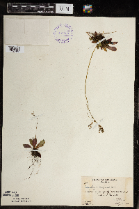
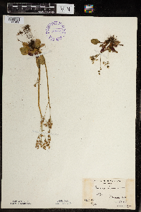
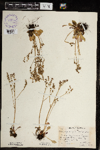
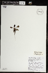
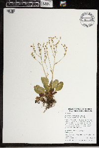
MIN:Plants | Micranthes virginiensis (Michaux) Small 401049[1391490]Burns, G.; Hendrickson, M. 1791938-07-20 United States, Minnesota, Cook, Cliff 3/4 mi N of middle of West Pike Lake; T65N R2E;Boundary Waters Canoe Area Wilderness / Superior National Forest;065N;02E;, 48.094155 -90.2 |
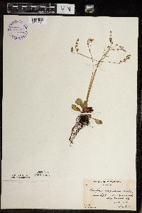
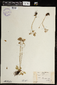
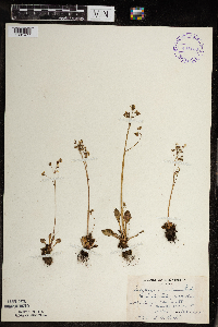
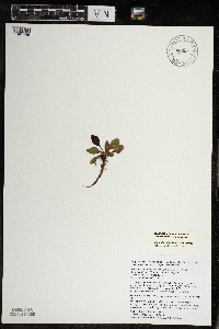
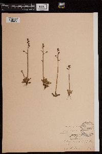
MIN:Plants | Micranthes virginiensis (Michaux) Small 401050[1391491]Burns, G.; Hendrickson, M. 1971938-07-19 United States, Minnesota, Cook, Cliff 1/2 mi SW of W end of West Pike Lake; T65N R2E;Boundary Waters Canoe Area Wilderness / Superior National Forest;065N;02E;, 48.078183 -90.20766 |
MIN:Plants | Micranthes virginiensis (Michaux) Small 401051[1391489]Burns, G.; Hendrickson, M. 2191938-07-22 United States, Minnesota, Cook, Cliff N of center of East Pike Lake; T65N R3E;Boundary Waters Canoe Area Wilderness / Superior National Forest;065N;03E;, 48.0667 -90.1 |
MIN:Plants | Micranthes virginiensis (Michaux) Small 401052[1391472]Burns, G.; Hendrickson, M. 2541938-07-25 United States, Minnesota, Cook, On a cliff directly S of Royal Lake. T64N, R03E. Cook Co.;Superior National Forest;064N;03E;11, 48.05 -90.0167 |
MIN:Plants | Micranthes virginiensis (Michaux) Small 401053[1391482]Butters, F.; et al. 1351938-07-13 United States, Minnesota, Cook, Cliff between Mountain Lake and Pike Lake.;Boundary Waters Canoe Area Wilderness / Superior National Forest;065N;02E;, 48.10737 -90.224172 |
MIN:Plants | Micranthes virginiensis (Michaux) Small 401054[1391481]Butters, F.; et al. 91938-07-03 United States, Minnesota, Cook, Second cliff from W end of and on S side of Clearwater Lake.;Boundary Waters Canoe Area Wilderness / Superior National Forest;065N;01E;, 48.087449 -90.322587 |
MIN:Plants | Micranthes virginiensis (Michaux) Small 401055[1391469]Burns, G.; Hendrickson, M. 3421938-07-29 United States, Minnesota, Cook, Cook County...3/8 mi. E of the source of the Royal River. T64N, R3E.;Superior National Forest;064N;03E;00, 48.052279 -90.025972 |
MIN:Plants | Micranthes virginiensis (Michaux) Small 401056[1391467]Burns, G.; Hendrickson, M. 3611938-07-29 United States, Minnesota, Cook, N side of cliff, 3/8 mi. E of the source of the Royal River. T64N, R3E.;Boundary Waters Canoe Area Wilderness / Superior National Forest;064N;03E;, 48.057803 -90.019427 |
MIN:Plants | Micranthes virginiensis (Michaux) Small 401057[1391470]Butters, F.; Abbe, E.; Burns, G. 6761940-07-01 United States, Minnesota, Cook, W side of North Fowl Lake. T65N, R03E.;Boundary Waters Canoe Area Wilderness / Superior National Forest;065N;03E;, 48.075089 -90.022876 |
MIN:Plants | Micranthes virginiensis (Michaux) Small 401058[1391473]Butters, F.; Abbe, E. 6131940-06-27 United States, Minnesota, Cook, About 1 mi. W of the outlet of South Fowl Lake. Cook Co.;Superior National Forest;065N;03E;, 48.053864 -90.028401 |
MIN:Plants | Micranthes virginiensis (Michaux) Small 401059[1391480]Nielsen, E. 17071932-09-13 United States, Minnesota, Cook, First cliff, on S side of Clearwater Lake;Boundary Waters Canoe Area Wilderness / Superior National Forest;065N;01E;, 48.087449 -90.322587 |
MIN:Plants | Micranthes virginiensis (Michaux) Small 401060[1391466]Butters, F.; et al. 63211930-08-26 United States, Minnesota, Cook, Summit of Mt. Josephine. T63N, R6E. Cook Co. [actually T64];Grand Portage Indian Reservation / North Shore;064N;06E;34, 47.9833 -89.65 |
MIN:Plants | Micranthes virginiensis (Michaux) Small 401061[1391468]Butters, F.; et al. s.n.1935-06-29 United States, Minnesota, Cook, Cook Co.; Clearwater Lake. T65N, R01E.;Boundary Waters Canoe Area Wilderness / Superior National Forest;065N;01E;00, 48.087449 -90.322587 |
MIN:Plants | Micranthes virginiensis (Michaux) Small 401062[1391471]Butters, F.; Abbe, E. 611936-06-20 United States, Minnesota, Cook, Cook Co.; Clearwater Lake. T65N, R01E.;Boundary Waters Canoe Area Wilderness / Superior National Forest;065N;01E;, 48.087449 -90.322587 |
MIN:Plants | Micranthes virginiensis (Michaux) Small 401063[1391479]Butters, F.; Abbe, E. 1291936-06-25 United States, Minnesota, Cook, Third cliff, S side of Clearwater Lake; T65N R1E;Boundary Waters Canoe Area Wilderness / Superior National Forest;065N;01E;, 48.087449 -90.322587 |
MIN:Plants | Micranthes virginiensis (Michaux) Small 401064[1391478]Butters, F.; Abbe, E. s.n.1936-06-21 United States, Minnesota, Cook, Cliff 2 A, Clearwater Lake; T65N R1E;Boundary Waters Canoe Area Wilderness / Superior National Forest;065N;01E;, 48.087449 -90.322587 |
MIN:Plants | Micranthes virginiensis (Michaux) Small 401106[1391465]Butters, F.; Moore, John 108271939-07-02 United States, Minnesota, Cook, Cleft in cliff just below the outlet of South Fowl Lake. Cook Co. T 64N R 3E.;Pigeon River Cliffs, The Nature Conservancy / Superior National Forest;064N;03E;12, 48.075089 -90.022876 |
MIN:Plants | Micranthes virginiensis (Michaux) Small 401136[1391477]Dahl, A. 1131945-06-19 United States, Minnesota, Cook, Clearwater Lake, N shore, near water; T65N R1E Sec. 31;Boundary Waters Canoe Area Wilderness / Superior National Forest;065N;01E;31, 48.087449 -90.322587 |
MIN:Plants | Micranthes virginiensis (Michaux) Small 401137[1391495]Dahl, A. 125B1945-06-19 United States, Minnesota, Cook, Cliff 2B on S shore of Clearwater Lake; T65N R1E Sec. 28;Boundary Waters Canoe Area Wilderness / Superior National Forest;065N;01E;28, 48.087449 -90.322587 |
MIN:Plants | Micranthes virginiensis (Michaux) Small 407593[1391456]Lakela, Olga 82331949-06-07 United States, Minnesota, Saint Louis, 40th Ave. W Skyline Parkway, Duluth.;;N;;, 46.7833 -92.1 |
MIN:Plants | Micranthes virginiensis (Michaux) Small 419091[1391485]Ahlgren, Clifford 3261949-07-11 United States, Minnesota, Lake, Basswood River Portage; T65N R10W Lake Co.;Boundary Waters Canoe Area Wilderness / Superior National Forest;065N;10W;00, 48.113783 -91.711237 |
MIN:Plants | Micranthes virginiensis (Michaux) Small 419504[1391486]Lakela, Olga 116931950-08-23 United States, Minnesota, Saint Louis, Crooked Lake, Curtain Falls.;Boundary Waters Canoe Area Wilderness / Superior National Forest;066N;12W;, 48.203274 -91.857461 |
MIN:Plants | Micranthes virginiensis (Michaux) Small 422646[1391499]Lakela, Olga 74901948-06-11 United States, Minnesota, Lake, On the Chapin's Estate, on Lake Superior, E of Split Rock Lighthouse.;North Shore;055N;08W;00, 47.200202 -91.367114 |
MIN:Plants | Micranthes virginiensis (Michaux) Small 437295[1391461]Moore, John; Moore, Marjorie 121211939-08-24 United States, Minnesota, Lake of the Woods, Clementson;;160N;30W;, 48.690302 -94.439218 |
MIN:Plants | Micranthes virginiensis (Michaux) Small 456545[1391453]Monson, Paul 59381984-06-05 United States, Minnesota, Cook, Grand Portage National Monument; Cook Co.; R-6E, T-63N, S-4, Intersect of trail and U.S. Hwy 61;Grand Portage National Monument / North Shore;063N;06E;4, 47.999682 -89.760688 |
MIN:Plants | Micranthes virginiensis (Michaux) Small 457214[1391476]Smith, Welby 154181989-06-19 United States, Minnesota, Lake, Boundary Waters Canoe Area Wilderness / Superior National Forest. Lake County...Boundary Waters Canoe Area Wilderness, Superior National Forest; cliff on north side of Kekekabic Lake. NW1/4 NE1/4 sec.31, T 65N R 6W. 065N 06W 31, 48.070836 -91.150335 |
MIN:Plants | Micranthes virginiensis (Michaux) Small 463330[1391506]Lakela, Olga 147091952-07-08 United States, Minnesota, Saint Louis, Dryweed Island, Rainy Lake, NW corner of the county.;Voyageurs National Park;N;;, 48.623498 -93.206383 |
MIN:Plants | Micranthes virginiensis (Michaux) Small 491865[1391487]Lakela, Olga 170241953-09-04 United States, Minnesota, Saint Louis, St. Louis County...Trout Lake portage from Vermilion Lake.;Boundary Waters Canoe Area Wilderness / Superior National Forest;063N;16W;24, 48.4833 -92.8 |
MIN:Plants | Micranthes virginiensis (Michaux) Small 526994[1391455]Lakela, Olga 175671954-06-23 United States, Minnesota, Saint Louis, Above Fenske Lake on Echo Trail, NE of Ely.;Superior National Forest;N;;, 47.9 -91.8667 |
MIN:Plants | Micranthes virginiensis (Michaux) Small 583443[1391496]Kellner, H. 3621956-06-13 United States, Minnesota, Cook, Cook Co.; Near the shore of Lake Superior, Hat Point, Grand Portage;Grand Portage Indian Reservation / North Shore;063N;06E;, 47.726653 -90.386005 |
MIN:Plants | Micranthes virginiensis (Michaux) Small 611432[1391452]Ownbey, Doris 1821969-06-16 United States, Minnesota, Cook, On W end of Clearwater Lake (N side), Clearwater Lake is ca. 35.2 mi from Grand Marais on the Gun Flint Trail;Boundary Waters Canoe Area Wilderness / Superior National Forest;065N;01E;, 48.087449 -90.322587 |
MIN:Plants | Micranthes virginiensis (Michaux) Small 671218[1391444]Ownbey, Doris 1811969-06-15 United States, Minnesota, Saint Louis, 0.3 mi. W of the jct. of Skyline Parkway and Rte. 91, (40th Ave. W) Duluth.;;N;;, 46.735497 -92.192639 |
MIN:Plants | Micranthes virginiensis (Michaux) Small 671219[1391436]Ownbey, Doris 1821969-06-16 United States, Minnesota, Cook, On W end of Clearwater Lake (N side), Clearwater Lake is ca. 35.2 mi from Grand Marais on the Gunflint Trail;Boundary Waters Canoe Area Wilderness / Superior National Forest;065N;01E;, 48.087449 -90.322587 |
MIN:Plants | Micranthes virginiensis (Michaux) Small 711494[1391442]Smith, Welby 11271979-07-18 United States, Minnesota, Lake, Lake County...T54N, R8W, SW1/4 SW1/4 Sec. 5. Split Rock Lighthouse State Park. On a cliff facing Lake Superior.;North Shore / Split Rock Lighthouse State Park;054N;08W;05, 47.194484 -91.384097 |
MIN:Plants | Micranthes virginiensis (Michaux) Small 728730[1391451]Coffin, Barbara; Engstrom, D. 181980-08-23 United States, Minnesota, Cook, T65N, R2E, SW1/4 NE1/4 Sec. 22. Overlooking a small pond S of Pemmican Lake S of E end of Mountain Lake.;Boundary Waters Canoe Area Wilderness / Superior National Forest;065N;02E;22, 48.10737 -90.224172 |
MIN:Plants | Micranthes virginiensis (Michaux) Small 765047[1391454]Lugger, O. s.n.1900-06-00 United States, Minnesota, Lake, Two Harbors;North Shore;052N;11W;01, 47.022711 -91.670732 |
MIN:Plants | Micranthes virginiensis (Michaux) Small 787127[1391441]Maxson, George-Ann s.n.1981-06-26 United States, Minnesota, Lake of the Woods, Long Point. NW1/4 Sec. 36, T164N, R34W. W side of granitic islands.;;164N;34W;36, 48.977214 -94.959949 |
MIN:Plants | Micranthes virginiensis (Michaux) Small 454150[1391443]Lee, Michael MDL28302000-07-18 United States, Minnesota, Lake, North Shore. Lake County ... crest of 450-foot ridge above Beaver River 1 1/2 miles west of Beaver Bay ... T55N R8W N1/2 of SW1/4 of SE1/4 Sec. 10, SE1/4 of NW1/4 of SE1/4 Sec. 10. 055N 08W 10, 47.2577 -91.300444 |
MIN:Plants | Micranthes virginiensis (Michaux) Small 178414[]Wheeler, William 716, 7221900-08-00 United States, Michigan, Keweenaw, Tobin's Harbor, Isle royale;Isle Royale National Park |
MIN:Plants | Micranthes virginiensis (Michaux) Small 906510[1391439]Smith, Welby; et al. 309362008-06-18 United States, Minnesota, Cook, Cook County...Eagle Mountain in the Boundary Waters Canoe Area Wilderness, Superior National Forest...T 63N R 2W etc.;Boundary Waters Canoe Area Wilderness / Superior National Forest;063N;02W;34, 47.895 -90.56 |
MIN:Plants | Micranthes virginiensis (Michaux) Small 488945[1391447]Gerdes, Lynden 40982000-07-19 United States, Minnesota, Lake, North Shore / Tettegouche State Park. T56N R08W S25NWNW Lake County ...Tettegouche State Park, northwest of Silver Bay, MN. WSW-facing cliff feature 0.15 mile north of Bean Lake. (Isolated feature south of the prominent east-west trending cliff feature to the north).. 056N 08W 25, 47.33958 -91.198054 |
MIN:Plants | Micranthes virginiensis (Michaux) Small 461258[1391437]Gerdes, Lynden 25251998-05-25 United States, Minnesota, Cook, Pigeon River Cliffs, The Nature Conservancy / Superior National Forest. T64N R03E S12NWNW. Cook County...Superior National Forest, South Fowl Lake Cliff. Topside of cliff feature near the cliff's edge.. 064N 03E 12, 48.010163 -89.708422 |
MIN:Plants | Micranthes virginiensis (Michaux) Small 575552[]Garton, C. 92001961-08-03 Canada, Ontario, Rainy River, Rainy River District...Burton I, S. end of Lake of the Woods |
MIN:Plants | Micranthes virginiensis (Michaux) Small 493485[1391440]Gerdes, Lynden 38972000-05-22 United States, Minnesota, Lake, T56N R07W S17NESW Lake County ... Tettegouche State Park, Mt. Trudee.;North Shore / Tettegouche State Park;056N;07W;17, 47.33958 -91.198054 |
MIN:Plants | Micranthes virginiensis (Michaux) Small 928696[1391449]Holmstrom, R. 01452010-06-10 United States, Minnesota, Saint Louis, Approx. 6 km SE of the Hwy 1 and Cty Rd 128 junction; about 0.5 km N of Norbert Lake. NENW of section.;Bear Head Lake State Park;061N;14W;01, 47.8002778 -92.0622222 |
MIN:Plants | Micranthes virginiensis (Michaux) Small 942429[1391450]Gerdes, Lynden B. 67742013-06-04 United States, Minnesota, Lake, Approximately 9.41 miles ENE of Babbitt, MN and 0.45 miles NW of Sue Lake. NENE of section;Superior National Forest;61N;11W;33, 47.834682 -91.531519 |
MIN:Plants | Micranthes virginiensis (Michaux) Small 948992[1391445]Kirschbaum, Jessica 2016-08-29 United States, Minnesota, Koochiching, Voyageurs National Park, On Dryweed Island, Rainy Lake. Approximately 500 meters east of the western edge of Harrison Bay, above the north shore of the bay atop the steepest part of the bluff. 489924E, 5384518N (UTM zone 15 north), 48.613654 -93.13670425712 |
MIN:Plants | Micranthes virginiensis (Michaux) Small 948991[1391446]Kirschbaum, Jessica 2016-08-29 United States, Minnesota, Koochiching, Voyageurs National Park, On Dryweed Island, Rainy Lake. Approximately 500 meters east of the western edge of Harrison Bay, above the north shore of the bay atop the steepest part of the bluff. 489924E, 5384518N (UTM zone 15 north), 48.613654 -93.13670425712 |
MIN:Plants | Micranthes virginiensis (Michaux) Small 961128[1334357]Timothy J. S. Whitfeld 16662018-06-06 United States, Rhode Island, Providence, Diamond Hill Reservation, Catamint Hill, 0.4 miles west south west of the intersection between Diamond Hill Road and Pine Swamp Road., 42.0036111 -71.4260278 |
MIN:Plants | Micranthes virginiensis (Michaux) Small 964730[1375676]Lee, Michael MDL49542009-06-25 United States, Minnesota, Cook, On the eastern slope of Oberg Mountain, in rugged bedrock terrain five miles northeast of Tofte. T59N R4W W1/2 of NE1/4 of NE1/4 Sec. 1, 47.62824348 -90.7702891 |
MIN:Plants | Micranthes virginiensis (Michaux) Small 968099[1368654]Timothy J. S. Whitfeld 12222016-05-12 United States, Rhode Island, Providence, Sherman Road, 0.45 miles northeast of intersection with Great Road., 41.91861 -71.44625 |
MIN:Plants | Mitella ovalis Greene 123355[]Elmer, A.D.E. 27771900-06-00 United States, Washington, Clallam, Olympic Mts. [Olympic National Park], 47.83 -123.83 |
MIN:Plants | Mitella ovalis Greene 499351[]Went, F. s.n. United States, California, Prairie Creek |
MIN:Plants | Heuchera villosa Michaux 123035[]Beardslee, H.; et al. s.n.1891-08-08 United States, North Carolina, Swain, Great Smoky Mountains...Swain County;Great Smoky Mountains National Park, 1676m |
MIN:Plants | Heuchera villosa Michaux 287995[]Steyermark, Julian 77141933-08-00 United States, Missouri, Iron, [cultivated from seeds] bluffs between Annapolis and Sabula, Iron co. |
MIN:Plants | Micranthes foliolosa (R. Brown) Gornall 403689[]Spetzman, L. 5581948-07-08 United States, Alaska, Arctic North Slope ... Lake Schrader;Arctic National Wildlife Refuge;;;, 69.4166667 -145, 914m |
MIN:Plants | Micranthes foliolosa (R. Brown) Gornall 403657[]Spetzman, L. 14471948-07-17 United States, Alaska, Arctic North Slope ... Lake Peters;Arctic National Wildlife Refuge;;;, 69.3333333 -145, 914m |
MIN:Plants | Micranthes foliolosa (R. Brown) Gornall 124794[1299676]Cornell Party 1896-08-12 Greenland, Nugsuak Penins. [Peninsula] |
MIN:Plants | Mitella trifida Graham 376119[]McCalla, W. 49831938-07-16 United States, Oregon, Klamath, inside of crater wall, Crater Lake National Park |
MIN:Plants | Mitella trifida Graham 551046[]Cotter, Shirley 30881951-08-07 United States, Montana, Garden Wall trail...Glacier Park;Glacier National Park, 2438m |
MIN:Plants | Saxifraga serpyllifolia Pursh 403503[]Spetzman, L. 8881948-07-29 United States, Alaska, Arctic North Slope...Sadlerochit River;Arctic National Wildlife Refuge;;;, 69.4166667 -149.1666667, 762m |
MIN:Plants | Saxifraga serpyllifolia Pursh 700151[]Glaser, Paul 4821972-08-15 United States, Alaska, Mt. McKinley National Park...NW1/4SE1/4Sec.18 T17S R14W, Thorofare Bluffs;Denali National Park;017S;14W;18, 1463m |
MIN:Plants | Saxifraga serpyllifolia Pursh 700149[]Glaser, Paul 5731974-06-22 United States, Alaska, Mt. McKinley National Park...SW1/4SW1/4Sec.22 T17S R14W, vicinity of Gravel Mtn.;Denali National Park;017S;14W;22, 1463m |
MIN:Plants | Saxifraga serpyllifolia Pursh 403502[]Spetzman, L. 6721948-07-10 United States, Alaska, Arctic North Slope ... Lake Schrader;Arctic National Wildlife Refuge;;;, 69.4166667 -145, 1524m |
MIN:Plants | Saxifraga serpyllifolia Pursh 399474[]Spetzman, L. 3511947-07-18 United States, Alaska, Canning River...where river leaves mountains...On mountain top 3 miles S.E. of big bluff.;Arctic National Wildlife Refuge;;;, 69.2833333 -146, 1524m |
MIN:Plants | Saxifraga serpyllifolia Pursh 408578[]Lachenbruch, A. 431949-08-15 United States, Alaska, Arctic North Slope...Killik R.;Gates of the Arctic National Park;;;, 68.25 -154, 1859m |
MIN:Plants | Saxifraga serpyllifolia Pursh 417272[]Emerson, P. 211950-07-23 United States, Alaska, Arctic North Slope...Kugururok R.;Noatak National Preserve;;;, 68.4333333 -161.1833333, 914m |
MIN:Plants | Saxifraga serpyllifolia Pursh 408577[]Lachenbruch, A. 431949-08-15 United States, Alaska, Arctic North Slope...Killik R.;Gates of the Arctic National Park;;;, 68.25 -154, 1524m |
MIN:Plants | Saxifraga serpyllifolia Pursh 298317[]Mexia, Ynes 21421928-07-25 United States, Alaska, McKinley National Park...Upper slopes of Copper Mt.;Denali National Park;;;, 60.868333 -146.585556, 1300m |
MIN:Plants | Micranthes rhomboidea (Greene) Small 124998[]Burglehaus, F. s.n.1893-06-00 United States, Wyoming, Park, Yellowstone National Park...near Mammoth Hot Springs;Yellowstone National Park, 2134m |
MIN:Plants | Micranthes rhomboidea (Greene) Small 607902[]Seim, A. s.n.1946-07-13 United States, Wyoming, Park, Mt. Washburn, Yellowstone National Park;Yellowstone National Park |
MIN:Plants | Micranthes rhomboidea (Greene) Small 521986[]Cooper, William s.n.1904-08-03 United States, Colorado, Larimer, Long's Peak;Rocky Mountain National Park |
MIN:Plants | Micranthes rhomboidea (Greene) Small 124999[]Burglehaus, F. s.n.1893-06-00 United States, Wyoming, Park, Yellowstone National Park...near Mammoth Hot Springs;Yellowstone National Park, 2134m |
MIN:Plants | Micranthes rhomboidea (Greene) Small 125001[]Nelson, Aven; et al. 55591899-06-29 United States, Wyoming, Park, Yellowstone National Park...Glen Creek;Yellowstone National Park |
MIN:Plants | Micranthes rhomboidea (Greene) Small 580593[]Hunnewell, F. 20261913-07-11 United States, Colorado, Larimer, Estes Park, Larimer Co. ...Long's Peak...Wind River Creek;Rocky Mountain National Park, 2438m |
MIN:Plants | Micranthes rhomboidea (Greene) Small 961495[1340036] United States, Colorado |
MIN:Plants | Chrysosplenium wrightii Franchet & Savatier 700224[]Glaser, Paul 8981975-07-25 United States, Alaska, McKinley National Park...NW1/4SW1/4Sec.18 T17S R14W, Thorofare Bluffs;Denali National Park;017S;14W;18, 1433m |
MIN:Plants | Chrysosplenium wrightii Franchet & Savatier 355330[]West, Phebe 1061932-09-03 United States, Alaska, Atka, Aleutian Islands;Aleutian Islands Wilderness;;;, 52.196111 -174.20056 |
MIN:Plants | Chrysosplenium wrightii Franchet & Savatier 700214[]Glaser, Paul 5471974-06-10 United States, Alaska, McKinley National Park...NW1/4SW1/4Sec.18 T17S R14W, Thorofare Bluffs;Denali National Park;017S;14W;18, 1433m |
MIN:Plants | Chrysosplenium wrightii Franchet & Savatier 700215[]Glaser, Paul 4791972-08-15 United States, Alaska, McKinley National Park...SW1/4SW1/4Sec.8 T17S R14W, near Thorofare Bluffs;Denali National Park;017S;14W;08, 1676m |
MIN:Plants | Chrysosplenium wrightii Franchet & Savatier 355364[]West, Phebe s.n.1932-09-03 United States, Alaska, Atka, Aleutian Islands;Aleutian Islands Wilderness;;;, 52.196111 -174.20056 |
MIN:Plants | Chrysosplenium wrightii Franchet & Savatier 417565[]Lachenbruch, A. 371949-08-15 United States, Alaska, Arctic North Slope...Killik R.;Gates of the Arctic National Park;;;, 68.25 -154, 1524m |
MIN:Plants | Chrysosplenium wrightii Franchet & Savatier 700222[]Glaser, Paul 5341974-06-09 United States, Alaska, McKinley National Park...NW1/4SW1/4Sec.18 T17S R14W, Thorofare Bluffs;Denali National Park;017S;14W;18, 1433m |
MIN:Plants | Chrysosplenium wrightii Franchet & Savatier 298318[]Mexia, Ynes 21431928-07-25 United States, Alaska, McKinley National Park...Upper slopes Copper Mt.;Denali National Park;;;, 60.868333 -146.585556, 1300m |
MIN:Plants | Chrysosplenium wrightii Franchet & Savatier 403420[]Spetzman, L. 7461948-07-17 United States, Alaska, Arctic North Slope ... Lake Schrader;Arctic National Wildlife Refuge;;;, 69.4166667 -145, 914m |
MIN:Plants | Lithophragma heterophyllum (Hooker & Arnott) Hooker & Arnott 239109[]Congdon, J. s.n.1885-06-00 United States, California, Mariposa, Footman Mt.;Yosemite National Park;;;, 37.54549 -119.82489 |
MIN:Plants | Heuchera rubescens Torrey 238849[]Congdon, J. s.n.1885-07-01 United States, California, Mariposa, Above Glacier Point, Mariposa County;Yosemite National Park;;;, 37.73083 -119.57278 |
MIN:Plants | Heuchera rubescens Torrey 238842[]Congdon, J. s.n.1888-05-24 United States, California, Mariposa, Yosemite Cliffs, Mariposa County;Yosemite National Park |
MIN:Plants | Heuchera rubescens Torrey 288024[]Moore, J.; et al. 31851931-06-21 United States, Texas, Brewster, Chisos Mountains. Brewster County...2 miles SW of Boot Spring;Big Bend National Park, 2150m |
MIN:Plants | Heuchera rubescens Torrey 288025[]Moore, J.; et al. 35841931-07-22 United States, Texas, Brewster, Guadalupe Mountains. Culberson County...McKittrick Canyon;Guadalupe Mountains National Park, 2000m |
MIN:Plants | Heuchera rubescens Torrey 288020[]Smith, R. s.n.1908-06-27 United States, California, Mariposa, Yosemite Falls;Yosemite National Park |
MIN:Plants | Heuchera rubescens Torrey 238843[]Congdon, J. s.n.1885-07-01 United States, California, Mariposa, Glacier Point, Mariposa County;Yosemite National Park;;;, 37.73083 -119.57278 |
MIN:Plants | Heuchera rubescens Torr. 288028[1127654]Parry, C.C. 2311878-00-00 Mexico, San Luis Potosi, In the region of San Luis Potosi, 2438m |
MIN:Plants | Tellima grandiflora (Pursh) Douglas ex Lindley 657557[]Anderson, H.; et al. 2561966-07-27 United States, Washington, Clallam, Olympic National Park: Hwy 9G. Along road 12 miles above Port Angeles.;Olympic National Park |
MIN:Plants | Tellima grandiflora (Pursh) Douglas ex Lindley 657586[]Anderson, H.; et al. 1281963-07-17 United States, Montana, Glacier National Park: Logan Pass;Glacier National Park |
MIN:Plants | Tellima grandiflora (Pursh) Douglas ex Lindley 125175[]Howell, Thomas 2051902-06-28 United States, Washington, Grays Harbor, waterfall...3 mi. above lake, Quiniault [sic] Valley;Olympic National Park;;;, 47.468093 -123.84669 |
MIN:Plants | Tellima grandiflora (Pursh) Douglas ex Lindley 657568[]Anderson, H.; et al. 3401968-06-29 United States, Washington, Pierce, Mt. Rainier National Park: Tahoma Creek road on west side of Mt. Rainier...Fish Creek;Mount Rainier National Park |
MIN:Plants | Tellima grandiflora (Pursh) Douglas ex Lindley 125181[]Elmer, A.D.E. 2051900-07-00 United States, Washington, Clallam, Olympic Mts. [Olympic National Park], 47.83 -123.83 |
Google Map
Google Maps is a web mapping service provided by Google that features a map that users can pan (by dragging the mouse) and zoom (by using the mouse wheel). Collection points are displayed as colored markers that when clicked on, displays the full information for that collection. When multiple species are queried (separated by semi-colons), different colored markers denote each individual species.
