University of Minnesota
http://www.umn.edu/
612-625-5000
http://www.umn.edu/
612-625-5000
Minnesota Biodiversity Atlas
Bell Museum
Dataset: MIN-Plants
Taxa: Schoenoplectus acutus
Search Criteria: excluding cultivated/captive occurrences
Bell Museum plants | |
 MIN:Plants | 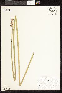 Schoenoplectus acutus var. acutus (Muhlenberg ex Bigelow) ́. L̦ve & D. L̦ve 746260[1105432]Smith, Welby 53311981-08-06 United States, Minnesota, Martin, On the N side of hwy. 50, ca. 2 1/4 mi. W of its jct. with hwy. 15 in Truman.;;104N;30W;7, 43.825466 -94.48011 |
MIN:Plants | 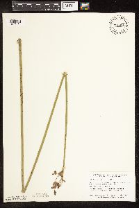 Schoenoplectus acutus var. acutus (Muhlenberg ex Bigelow) ́. L̦ve & D. L̦ve 746306[1105431]Smith, Welby 57721981-09-16 United States, Minnesota, Becker, Becker Co. Spring Creek State Wildlife Management Area. 1 1/4 mi. N-NW of Ogema.;Spring Creek Wildlife Management Area / White Earth Indian Reservation;142N;42W;, 47.115314 -95.944434 |
MIN:Plants | 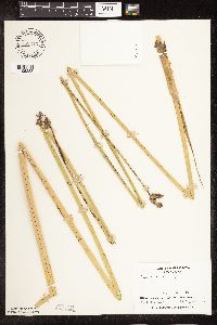 Schoenoplectus acutus var. acutus (Muhlenberg ex Bigelow) ́. L̦ve & D. L̦ve 753316[1105388]Boe, J. 20371983-08-27 United States, Minnesota, Kittson, Norway Dunes.;Norway Dunes, The Nature Conservancy;160N;46W;10, 48.695736 -96.57277 |
MIN:Plants | 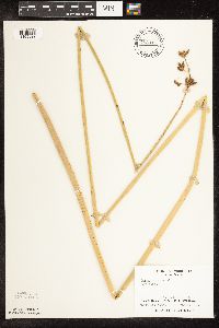 Schoenoplectus acutus var. acutus (Muhlenberg ex Bigelow) ́. L̦ve & D. L̦ve 753317[1105322]Boe, J. 20421983-08-27 United States, Minnesota, Kittson, Norway Dunes.;Norway Dunes, The Nature Conservancy;160N;46W;10, 48.695736 -96.57277 |
MIN:Plants | 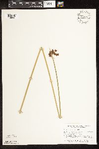 Schoenoplectus acutus var. acutus (Muhlenberg ex Bigelow) ́. L̦ve & D. L̦ve 757848[1105390]Smith, Welby 66801982-07-10 United States, Minnesota, Norman, On the E side of hwy. 40, ca. 2 1/2 mi. S of Faith.;;144N;43W;25, 47.260368 -96.077573 |
MIN:Plants | 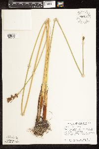 Schoenoplectus acutus var. acutus (Muhlenberg ex Bigelow) ́. L̦ve & D. L̦ve 758048[1105407]Smith, Welby 66301982-07-04 United States, Minnesota, Wright, Between Albion Lake and hwy. 6, ca. 4 mi. SW of Maple Lake.;;120N;27W;10, 45.217384 -94.064131 |
MIN:Plants | 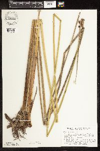 Schoenoplectus acutus var. acutus (Muhlenberg ex Bigelow) ́. L̦ve & D. L̦ve 758142[1105349]Smith, Welby 70921982-08-06 United States, Minnesota, Clearwater, On the E side of hwy. 5, ca. 2 1/4 mi. N of its jct with hwy. 92 in Clearbrook.;;149N;37W;17, 47.724444 -95.420116 |
MIN:Plants | 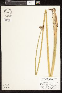 Schoenoplectus acutus var. acutus (Muhlenberg ex Bigelow) ́. L̦ve & D. L̦ve 758186[1105406]Smith, Welby 72731982-08-12 United States, Minnesota, Clay, Ca. 3 mi. E-SE of the jct. of hwy. 9 and 34 in Felton.;;142N;46W;36, 47.071261 -96.447104 |
MIN:Plants |  Schoenoplectus acutus var. acutus (Muhlenberg ex Bigelow) ́. L̦ve & D. L̦ve 758200[1105392]Smith, Welby 67121982-07-14 United States, Minnesota, Becker, Becker Co. Spring Creek State Wildlife Management Area. 1 1/4 mi. N-NW of Ogema.;Spring Creek Wildlife Management Area / White Earth Indian Reservation;142N;42W;13, 47.115314 -95.944434 |
MIN:Plants |  Schoenoplectus acutus var. acutus (Muhlenberg ex Bigelow) ́. L̦ve & D. L̦ve 758539[1105391]Smith, Welby 67161982-07-14 United States, Minnesota, Mahnomen, Mahnomen Co. Waubun State Wildlife Management Area. About 1 mi S of Waubun. NW1/4 of SW1/4 of sec.25, T143N R42W.;Waubun Prairie Wildlife Management Area / White Earth Indian Reservation;143N;42W;25, 47.173142 -95.943662 |
MIN:Plants |  Schoenoplectus acutus var. acutus (Muhlenberg ex Bigelow) ́. L̦ve & D. L̦ve 758838[1105353]Smith, Welby 65191982-06-29 United States, Minnesota, Le Sueur, Le Sueur Co. On the W side of County Hwy 23, about 2 mi NE of St. Peter, in the Minnesota Valley. Sec.11 NE1/4 NW1/4, T1 Le Sueur Co. On the W side of County Hwy 23, about 2 mi NE of St. Peter, in the Minnesota Valley. Sec.11 NE1/4 NW1/4, T110N R26W. 110N 26W 11, 44.348192 -93.919173 |
MIN:Plants |  Schoenoplectus acutus var. acutus (Muhlenberg ex Bigelow) ́. L̦ve & D. L̦ve 781100[1105410]Smith, Welby 98311984-07-29 United States, Minnesota, Lake of the Woods, At the edge of Winter Road Lake, ca. 13 mi. SW of Williams.;Beltrami Island State Forest;160N;34W;17, 48.677645 -95.050704 |
MIN:Plants | 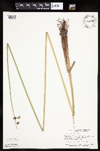 Schoenoplectus acutus var. acutus (Muhlenberg ex Bigelow) ́. L̦ve & D. L̦ve 781102[1021719]Smith, Welby 93311984-06-27 United States, Minnesota, Jackson, Kilen Woods State Park. Ca. 1/4 mi. W of the Des Moines River.;Kilen Woods State Park;103N;35W;17, 43.724814 -95.064648 |
MIN:Plants | 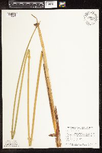 Schoenoplectus acutus var. acutus (Muhlenberg ex Bigelow) ́. L̦ve & D. L̦ve 781143[1105409]Smith, Welby 96951984-07-26 United States, Minnesota, Koochiching, Koochiching Co.; Lost River Peatland, about 14 mi. west-southwest of Big Falls; sec. 27, T154N R27W;Lost River Peatland Scientific Natural Area;154N;27W;27, 48.128753 -94.092419 |
MIN:Plants | 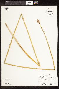 Schoenoplectus acutus var. acutus (Muhlenberg ex Bigelow) ́. L̦ve & D. L̦ve 781633[1105408]Smith, Welby 98661984-07-30 United States, Minnesota, Clearwater, Ca. 9 mi. NE of Clearbrook.;;150N;36W;19, 47.796844 -95.311915 |
MIN:Plants | 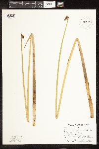 Schoenoplectus acutus var. acutus (Muhlenberg ex Bigelow) ́. L̦ve & D. L̦ve 787671[1105320]Smith, Welby 105041985-06-27 United States, Minnesota, Clay, Barnesville State Wildlife Management Area, ca. 6 mi. NE of Barnesville.;Barnesville Wildlife Management Area;137N;45W;1, 46.710524 -96.310792 |
MIN:Plants | 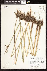 Schoenoplectus acutus var. acutus (Muhlenberg ex Bigelow) ́. L̦ve & D. L̦ve 789491[1105418]Smith, Welby 112581985-08-29 United States, Minnesota, Murray, In the valley of Chanarambie Creek, ca. 1 mi. W-SW of Chandler.;;105N;43W;2, 43.928399 -95.973652 |
MIN:Plants | 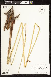 Schoenoplectus acutus var. acutus (Muhlenberg ex Bigelow) ́. L̦ve & D. L̦ve 789699[1105318]Smith, Welby 103411985-05-31 United States, Minnesota, Jackson, Ca. 1 mi. SE of Petersburg. On a W-facing bluff in the Des Moines River Valley.;;101N;34W;27, 43.522882 -94.90439 |
MIN:Plants | 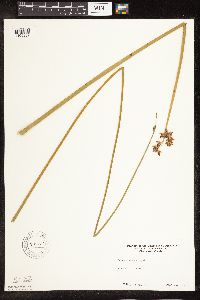 Schoenoplectus acutus var. acutus (Muhlenberg ex Bigelow) ́. L̦ve & D. L̦ve 795734[1105387]Sanford, J. s.n.1947-08-00 United States, Minnesota, Clearwater, Itasca State Park.;Itasca State Park;143N;36W;, 47.19557 -95.233216 |
MIN:Plants | 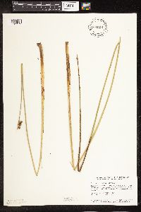 Schoenoplectus acutus var. acutus (Muhlenberg ex Bigelow) ́. L̦ve & D. L̦ve 801191[1105373]Smith, Welby 118311986-06-17 United States, Minnesota, Goodhue, Perched Valley State Wildlife Management Area, about 4 mi W of Frontenac.;Perched Valley Wildlife Management Area;112N;13W;8, 44.520103 -92.399937 |
MIN:Plants | 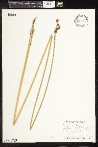 Schoenoplectus acutus var. acutus (Muhlenberg ex Bigelow) ́. L̦ve & D. L̦ve 804579[1105374]Smith, Welby 122891986-07-30 United States, Minnesota, Olmsted, Olmsted Co. About 2 mi S-SE of Rock Dell (town) and ? mi N of State Hwy 30; T105N R15W,NW1/4 of SW1/4 of SE1/4 of Sec 16 Olmsted Co. About 2 mi S-SE of Rock Dell (town) and ? mi N of State Hwy 30; T105N R15W, NW1/4 of SW1/4 of SE1/4 of Sec 16.. 105N 15W 16, 43.894722 -92.6255569 |
MIN:Plants | 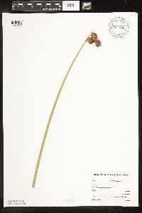 Schoenoplectus acutus var. acutus (Muhlenberg ex Bigelow) ́. L̦ve & D. L̦ve 807732[1105338]Dorio, J. 1771977-06-09 United States, Minnesota, Morrison, Lake Alexander;;N;;, 46.207554 -94.541473 |
MIN:Plants | 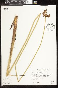 Schoenoplectus acutus var. acutus (Muhlenberg ex Bigelow) ́. L̦ve & D. L̦ve 814664[1105319]Wheeler, Gerald 112861988-07-22 United States, Minnesota, Lac Qui Parle, Ca. 5.5 mi. W-SW of Madison; wildlife area E of Rte. 13.;;118N;45W;33, 44.98695 -96.299017 |
MIN:Plants | 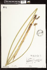 Schoenoplectus acutus var. acutus (Muhlenberg ex Bigelow) ́. L̦ve & D. L̦ve 815777[1105400]Wheeler, Gerald 110551988-07-14 United States, Minnesota, Traverse, Ca. 10 mi. SW of Wheaton; 1 mi. W of Rte. 27. Along the shore of Lake Traverse. NW1/4 Sec. 14 T126N R48W (Windsor Twp. Ca. 10 mi. SW of Wheaton; 1 mi. W of Rte. 27. Along the shore of Lake Traverse. NW1/4 Sec. 14 T126N R48W (Windsor Twp.).. 126N 48W 14, 45.723689 -96.666909 |
MIN:Plants | 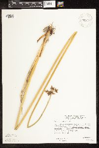 Schoenoplectus acutus var. acutus (Muhlenberg ex Bigelow) ́. L̦ve & D. L̦ve 816301[1105394]Wheeler, Gerald 121411988-09-10 United States, Minnesota, Traverse, Foley Wildlife Management Area. Traverse Co.; Ca. 11 mi E of Browns Valley, wildlife area N of rte 2, adjacent to small lake; W1/2 SE1/4 Sec. 29 T125N R47W (Parnell Township). 125N 47W 29, 45.607514 -96.60438 |
MIN:Plants | 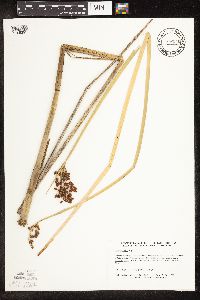 Schoenoplectus acutus var. acutus (Muhlenberg ex Bigelow) ́. L̦ve & D. L̦ve 817546[1105295]Delaney, B. 890511989-06-29 United States, Minnesota, Isanti, Isanti County ... 2 miles south-southwest of Isanti, on east side of Rum River. NE 1/4 NW 1/4 Sec. 12 T 34 N R 24 W;;034N;24W;12, 45.449615 -93.27591 |
MIN:Plants | 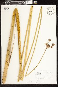 Schoenoplectus acutus var. acutus (Muhlenberg ex Bigelow) ́. L̦ve & D. L̦ve 821086[1105412]Vixie, D. 5751980-07-20 United States, Minnesota, Clearwater, Lake Itasca at U of MN Forestry & Biological Station near the boat docks;Itasca State Park;143N;36W;, 47.19557 -95.233216 |
MIN:Plants | 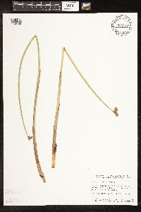 Schoenoplectus acutus var. acutus (Muhlenberg ex Bigelow) ́. L̦ve & D. L̦ve 833845[1105402]Smith, Welby 141791988-06-01 United States, Minnesota, Lac Qui Parle, Lac Qui Parle Co. In the Minnesota Valley, about 4 mi SW of Correll; SW1/4 NW1/4 sec 19, T120N R44W.;;120N;44W;19, 45.189266 -96.216659 |
MIN:Plants | 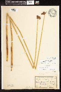 Schoenoplectus acutus var. acutus (Muhlenberg ex Bigelow) ́. L̦ve & D. L̦ve 83507[1105331]Sheldon, Edmund S23771892-06-00 United States, Minnesota, Aitkin, Farm Island Lake;;N;;, 46.374307 -93.748617 |
MIN:Plants | 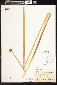 Schoenoplectus acutus var. acutus (Muhlenberg ex Bigelow) ́. L̦ve & D. L̦ve 83508[1105351]Frost, W. F144a1892-06-00 United States, Minnesota, Meeker, Acton [pioneer village], Meeker Co.;;119N;32W;26, 45.08778 -94.66538 |
MIN:Plants | 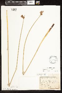 Schoenoplectus acutus var. acutus (Muhlenberg ex Bigelow) ́. L̦ve & D. L̦ve 83509[1105312]Sandberg, John s.n.1890-06-00 United States, Minnesota, Chisago, [no further data];;;;, 45.522134 -92.91 |
MIN:Plants | 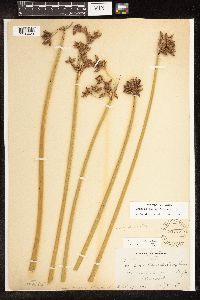 Schoenoplectus acutus var. acutus (Muhlenberg ex Bigelow) ́. L̦ve & D. L̦ve 83723[1105429]Bergman, H. 4691911-07-06 United States, North Dakota, Spiritwood;;;;, 46.936099 -98.495648 |
MIN:Plants | 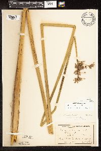 Schoenoplectus acutus var. acutus (Muhlenberg ex Bigelow) ́. L̦ve & D. L̦ve 83725[1105335]Ballard, C. 26371900-08-00 United States, Minnesota, Kittson, St. Vincent.;;163N;51W;, 48.945898 -97.210703 |
MIN:Plants | 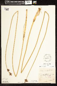 Schoenoplectus acutus var. acutus (Muhlenberg ex Bigelow) ́. L̦ve & D. L̦ve 83726[1105296]Burglehaus, F. s.n.1891-07-00 United States, Minnesota, Hennepin, [no further data];;;;, 45 -93.47 |
MIN:Plants | 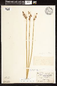 Schoenoplectus acutus var. acutus (Muhlenberg ex Bigelow) ́. L̦ve & D. L̦ve 83727[1105348]Menzel, Max s.n.1895-06-00 United States, Minnesota, Pipestone, Pipestone [assuming the quarry area; town generally noted as Pipestone City by collector];Pipestone National Monument;106N;46W;01, 44.01585 -96.31767 |
MIN:Plants | 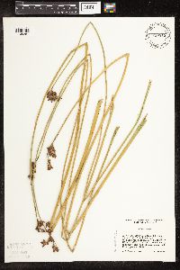 Schoenoplectus acutus var. acutus (Muhlenberg ex Bigelow) ́. L̦ve & D. L̦ve 839315[1105281]Cholewa, A. 23781995-07-28 United States, Minnesota, Aitkin, Savanna Portage State Park. Aitkin Co. Savanna Portage State Park, about 17 mi NE of McGregor, NW end of Wolf Lake near boat access, T50N R22W S6 NE Aitkin Co. Savanna Portage State Park, about 17 mi NE of McGregor, NW end of Wolf Lake near boat access, T50N R22W S6 NE1/4 of NE1/4.. 050N 22W 6, 46.845996 -93.17745 |
MIN:Plants | 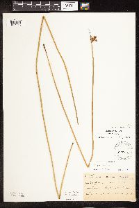 Schoenoplectus acutus var. acutus (Muhlenberg ex Bigelow) ́. L̦ve & D. L̦ve 83964[1105346]Ballard, C. B9481892-06-00 United States, Minnesota, Nicollet, Swan Lake, Nicollet Co.;;N;;, 44.30887 -94.262002 |
MIN:Plants | 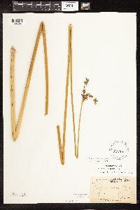 Schoenoplectus acutus var. acutus (Muhlenberg ex Bigelow) ́. L̦ve & D. L̦ve 83966[1105308]Arthur, J.; et al. B2191886-07-23 United States, Minnesota, Saint Louis, Vermilion Lake;Superior National Forest;;;, 47.879148 -92.351718 |
MIN:Plants | 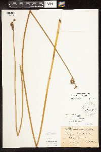 Schoenoplectus acutus var. acutus (Muhlenberg ex Bigelow) ́. L̦ve & D. L̦ve 83967[1105415]Sheldon, Edmund S8761891-07-00 United States, Minnesota, Brown, Sleepy Eye;;N;;, 44.325885 -94.684758 |
MIN:Plants | 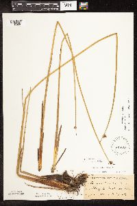 Schoenoplectus acutus var. acutus (Muhlenberg ex Bigelow) ́. L̦ve & D. L̦ve 83974[1105350]Frost, W. F701892-06-00 United States, Minnesota, Meeker, Litchfield.;;N;;, 45.127185 -94.528047 |
MIN:Plants |  Schoenoplectus acutus var. acutus (Muhlenberg ex Bigelow) ́. L̦ve & D. L̦ve 453828[1105393]Smith, Welby 157951989-07-18 United States, Minnesota, Freeborn, Freeborn County...At the south end of Geneva Lake, about 3 miles northeast of Clarks Grove; NE1/4 NE1/4 Sec. 30 T 104N R 20W. 104N 20W 30, 43.7852778 -93.2697222 |
MIN:Plants |  Schoenoplectus acutus (Muhlenberg ex Bigelow) ́. L̦ve & D. L̦ve 444334[1105860]Bright, R. 73-2531973-00-00 United States, Idaho, Franklin, [no further data] |
MIN:Plants |  Schoenoplectus acutus var. acutus (Muhlenberg ex Bigelow) ́. L̦ve & D. L̦ve 476044[1105404]Mensing, D. 95-24001995-08-10 United States, Minnesota, Carlton, Carlton Co, T48N R18W SE1/4 of the SW1/4 of S20; Park Lake;Fond du Lac Indian Reservation;048N;18W;20, 46.628015 -92.649915 |
MIN:Plants |  Schoenoplectus acutus var. acutus (Muhlenberg ex Bigelow) ́. L̦ve & D. L̦ve 912687[1105290]Smith, Welby 229061993-07-14 United States, Minnesota, Sibley, Sibley County...On the north side of Indian lake, about 4 miles west of Gaylord...T 113N R 29W NW1/4 of SW1/4 of Sec 21;;113N;29W;21, 44.5791667 -94.3341667 |
MIN:Plants | 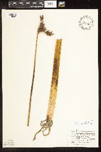 Schoenoplectus acutus var. acutus (Muhlenberg ex Bigelow) ́. L̦ve & D. L̦ve 474265[1105337]Haasch, S. s.n.1980-07-19 United States, Minnesota, Sherburne, Bergerson Slough;;;;, 45.445781 -93.797466 |
MIN:Plants | 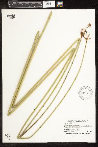 Schoenoplectus acutus var. acutus (Muhlenberg ex Bigelow) ́. L̦ve & D. L̦ve 912120[1105289]Smith, Welby 230731993-07-21 United States, Minnesota, McLeod, McLeod County... On the east side of Hook Lake, about 3 miles north of Hutchinson... T117N R29W SW1/4 of SW1/4 of Sec 9;;117N;29W;09, 44.9519444 -94.335 |
MIN:Plants | 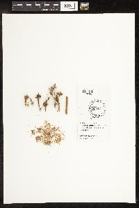 Schoenoplectus acutus (Muhlenberg ex Bigelow) ́. L̦ve & D. L̦ve 444335[1105861]Bright, R. 71-331971-00-00 United States, Idaho, Bannock, [no further data] |
MIN:Plants | 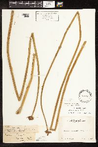 Schoenoplectus acutus (Muhlenberg ex Bigelow) ́. L̦ve & D. L̦ve 234255[1105433]Congdon, J. s.n.1890-08-18 United States, California, Tuolumne, Soda Springs, Tuolumne County;Yosemite National Park |
MIN:Plants | 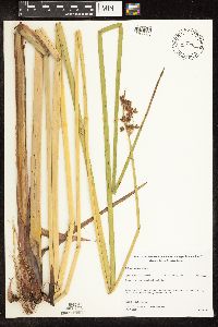 Schoenoplectus acutus var. acutus (Muhlenberg ex Bigelow) ́. L̦ve & D. L̦ve 480790[1105380]Gerdes, Lynden; et al. 28991998-07-09 United States, Minnesota, Cook, T64N R03E S03SWNW. Cook County ... Superior National Forest, Little John Lake.;Superior National Forest;064N;03E;3, 48.057476 -90.04601 |
MIN:Plants | 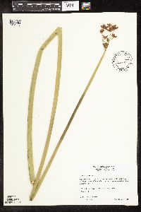 Schoenoplectus acutus var. acutus (Muhlenberg ex Bigelow) ́. L̦ve & D. L̦ve 511483[1105303]Wheeler, Gerald 170131997-08-08 United States, Minnesota, Swift, Swift County ... Ca. 5 mi. NNE of Benson; on NW margin of Frovold Lake ... NW1/4 SE1/4 NE1/4 Sec. 16 T122N R39W;;122N;39W;16, 45.376026 -95.571928 |
MIN:Plants | 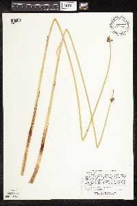 Schoenoplectus acutus var. acutus (Muhlenberg ex Bigelow) ́. L̦ve & D. L̦ve 453995[1105278]Lee, Michael MDL20721998-05-28 United States, Minnesota, Stearns, Stearns Co.; St. Wendel Swamp 2-1/2 miles south of St. Wendel; T125N R29W SW1/4 of SW1/4 of SE1/4 Sec. 17;;125N;29W;17, 45.637338 -94.356597 |
MIN:Plants | 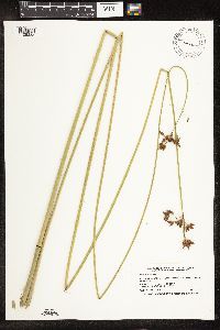 Schoenoplectus acutus var. acutus (Muhlenberg ex Bigelow) ́. L̦ve & D. L̦ve 124669[1105332]Smith, Welby 230361993-07-21 United States, Minnesota, Meeker, Meeker County...At the south end of Long Lake, about 1 mile north of Dassel...T 119N R 29W SW1/4 of SE1/4 of Sec 22;;119N;29W;22, 45.0977778 -94.3030556 |
MIN:Plants |  Schoenoplectus acutus var. acutus (Muhlenberg ex Bigelow) ́. L̦ve & D. L̦ve 426799[1105405]Wheeler, Gerald 163391997-06-28 United States, Minnesota, Swift, Monson Lake State Park. Swift County ... Ca. 10 mi NNE of Kerkhoven; Monson Lake State Memorial Park ... along shore of Monson Lake ... W1/2 NE1/4 NW1/4 Sec. 1 T121N R37W (Hayes 1). 121N 37W 1, 45.318174 -95.265442 |
MIN:Plants |  Schoenoplectus acutus var. acutus (Muhlenberg ex Bigelow) ́. L̦ve & D. L̦ve 461790[1105291]Lehtinen, R. 95-9071995-08-15 United States, Minnesota, Pope, Pope Co, T124N R38W NE1/4 of the NW1/4 of S28; Nelson Lake.;;124N;38W;28, 45.520673 -95.449408 |
MIN:Plants |  Schoenoplectus acutus var. acutus (Muhlenberg ex Bigelow) ́. L̦ve & D. L̦ve 510906[1105403]Gerdes, Lynden; et al. 28991998-07-09 United States, Minnesota, Cook, T64N R03E S03SWNW. Cook County ... Superior National Forest, Little John Lake.;Superior National Forest;064N;03E;3, 48.057476 -90.04601 |
MIN:Plants |  Schoenoplectus acutus var. acutus (Muhlenberg ex Bigelow) ́. L̦ve & D. L̦ve 924507[1021715]Smith, Welby 214941992-08-12 United States, Minnesota, Pennington, About 16 miles SW of Thief River Falls. NW1/4 of SE1/4 of section.;Pembina Wildlife Management Area;152N;45W;18, 47.9838889 -96.4658333 |
MIN:Plants | 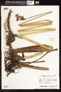 Schoenoplectus acutus var. acutus (Muhlenberg ex Bigelow) ́. L̦ve & D. L̦ve 930974[1105411]Smith, Welby R. 159261989-07-26 United States, Minnesota, Nobles, About 4.5 miles north of Wilmont. SW1/4 of NW1/4 of section;County Line Wildlife Management Area;104N;41W;06, 43.8438889 -95.8094444 |
MIN:Plants | 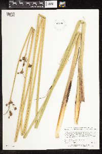 Schoenoplectus acutus var. acutus (Muhlenberg ex Bigelow) ́. L̦ve & D. L̦ve 932688[1105284]Lee, Michael MDL47382008-07-30 United States, Minnesota, Hubbard, Lake Plantagenet Public Water Access, seven miles south-southwest of Bemidji. On the southeastern shore of Lake Plantagenet. NW1/4 of NE1/4 of NE1/4 of section;;145N;33W;19, 47.3670803 -94.9097728 |
MIN:Plants | 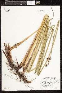 Schoenoplectus acutus var. acutus (Muhlenberg ex Bigelow) ́. L̦ve & D. L̦ve 935380[1105285]Smith, Welby R. 332862011-08-05 United States, Minnesota, Polk, About 2 miles north of the town of Gully. SE1/4 of SE1/4 of section;Larix State Wildlife Management Area;150N;39W;22, 47.7925 -95.6252778 |
MIN:Plants | 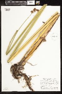 Schoenoplectus acutus var. acutus (Muhlenberg ex Bigelow) ́. L̦ve & D. L̦ve 935361[1105292]Smith, Welby R; Gerdes, Lynden B 333062011-08-10 United States, Minnesota, Lake, Boga Lake, off the west end of Lake Isabella. SW of NE of section;Boundary Waters Canoe Area Wilderness / Superior National Forest;062N;07W;31, 47.8106167 -91.2635167 |
MIN:Plants | 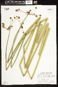 Schoenoplectus acutus var. acutus (Muhlenberg ex Bigelow) ́. L̦ve & D. L̦ve 935348[1105286]Smith, Welby R; Gerdes, Lynden B 333322011-08-11 United States, Minnesota, Lake, Superior National Forest, Boundary Waters Canoe Area Wilderness. A small protected bay of the large island at the north end of Lake Isabella. NW of SE of section;Boundary Waters Canoe Area Wilderness / Superior National Forest;062N;08W;25, 47.8196333 -91.2845 |
MIN:Plants | 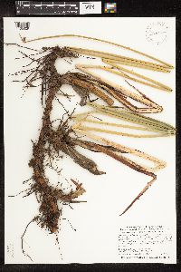 Schoenoplectus acutus var. acutus (Muhlenberg ex Bigelow) ́. L̦ve & D. L̦ve 936321[1105329]Smith, Welby R; Milburn, Scott 329032011-06-26 United States, Minnesota, Lake of the Woods, about 16 miles S-SE of Faunce. SE of NW of section;Red Lake State Wildlife Management Area;157N;33W;25, 48.3890333 -94.832 |
MIN:Plants | 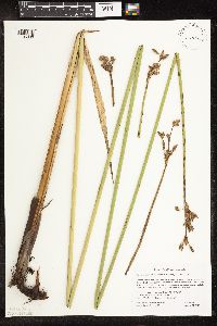 Schoenoplectus acutus var. acutus (Muhlenberg ex Bigelow) ́. L̦ve & D. L̦ve 132037[1105330]Gockman, Otto; Milburn, Scott 001932012-08-24 United States, Minnesota, Polk, 5 miles northeast of Melvin. UTM: 252003E 5286159N. SW1/4 NW1/4 of section.;Glacial Ridge National Wildlife Refuge;149N;44W;33, 47.6808333 -96.3041667 |
MIN:Plants | 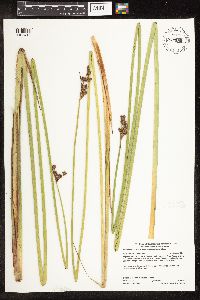 Schoenoplectus acutus var. acutus (Muhlenberg ex Bigelow) ́. L̦ve & D. L̦ve 937595[1105413]Gerdes, Lynden B.; Bach, Melissa J. 65432012-06-20 United States, Minnesota, Lake, North Kawishiwi River. Approximately 13.35 miles east of Ely, MN and ~ 0.55 miles SW of the portage/landing between Triangle Lake and the river. West shore of larger island.;Boundary Waters Canoe Area Wilderness / Superior National Forest;063N;10W;25, 47.916111 -91.554444 |
MIN:Plants | 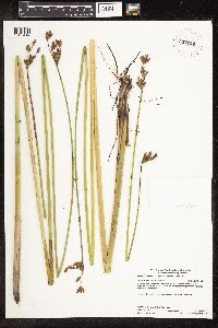 Schoenoplectus acutus var. acutus (Muhlenberg ex Bigelow) ́. L̦ve & D. L̦ve 937769[1105414]Gerdes, Lynden B.; Gockman, Otto 67502012-08-21 United States, Minnesota, Lake, Adventure Lake. Near shore approximately 0.11 miles south of the portage/landing between Adventure Lake and Ahsub Lake.;Boundary Waters Canoe Area Wilderness / Superior National Forest;064N;08W;23, 48.009444 -91.3175 |
MIN:Plants | 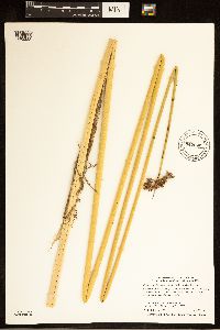 Schoenoplectus acutus var. acutus (Muhlenberg ex Bigelow) ́. L̦ve & D. L̦ve 942098[1285283]Smith, Welby R. 319262010-07-28 United States, Minnesota, Beltrami, On the west side of hwy 72, about 4 miles south of Waskish. NE of NW of section;;153N;30W;05, 48.1032599 -94.5241317 |
MIN:Plants | 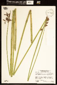 Schoenoplectus acutus var. acutus (Muhlenberg ex Bigelow) ́. L̦ve & D. L̦ve 942307[1285286]Gerdes, Lynden B. 69412013-08-19 United States, Minnesota, Saint Louis, South Lake approximately 11.91 miles ESE of Crane Lake, MN and 0.07 miles NW of portage to Steep Lake. NWSE of section;Boundary Waters Canoe Area Wilderness / Superior National Forest;67N;15W;03, 48.317079 -92.242321 |
MIN:Plants | 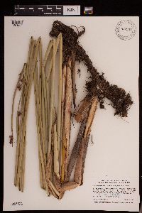 Schoenoplectus acutus var. acutus (Muhlenberg ex Bigelow) Á. Løve & D. Løve 942991[1291169]Smith, Welby R. 347322013-08-01 United States, Minnesota, Crow Wing, At the west end of Duck Lake about 5.5 km (3.5 miles) E-NE of the town of Emily. NW of SE of section; T138N R25W sec19, 46.7504 -93.8898 |
MIN:Plants | 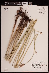 Schoenoplectus acutus var. acutus (Muhlenberg ex Bigelow) Á. Løve & D. Løve 942971[1291140]Smith, Welby R. 347112013-07-24 United States, Minnesota, Polk, between State Hwy 9 and the adjacent railroad tracks, about 6.5 km (4 miles) north of Beltrami (town). SW of SE of section; T148N R46W sec29, 47.60115 -96.5467667 |
MIN:Plants | 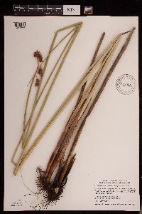 Schoenoplectus acutus var. acutus (Muhlenberg ex Bigelow) Á. Løve & D. Løve 942939[1291164]Smith, Welby R. 345762013-07-07 United States, Minnesota, Red Lake, Polk State Wildlife Management Area, about 6 km (3.7 miles) N-NE of Erskine. NE of SE of section; T150N R42W sec23, 47.7966667 -95.9887833 |
MIN:Plants | 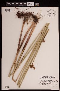 Schoenoplectus acutus var. acutus (Muhlenberg ex Bigelow) Á. Løve & D. Løve 942924[1291180]Smith, Welby R. 345612013-07-07 United States, Minnesota, Pennington, Jacksnipe State Wildlife Management Area, along U.S. Hwy 59, about 12 km (7.5 miles) southeast of Thief River Falls. SW of NW of section; T153N R42W sec28, 48.0441833 -96.0666 |
MIN:Plants | 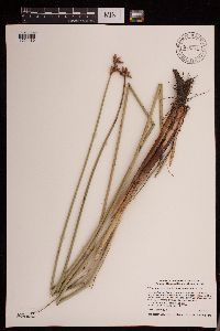 Schoenoplectus acutus var. acutus (Muhlenberg ex Bigelow) Á. Løve & D. Løve 942915[1291189]Smith, Welby R. 345512013-07-02 United States, Minnesota, Redwood, Luescher-Barnum State Wildlife Management Area, about 11.5 km (7 miles) S-SW of Redwood Falls. SE of NW of section; T111N R36W sec04, 44.4499833 -95.18315 |
MIN:Plants | 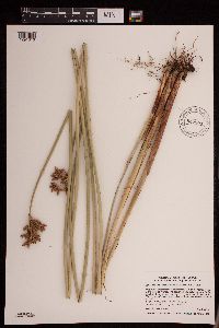 Schoenoplectus acutus var. acutus (Muhlenberg ex Bigelow) Á. Løve & D. Løve 942907[1291010]Smith, Welby R. 345432013-07-02 United States, Minnesota, Redwood, Willow Lake State Wldlife Management Area, on the norheast side of the town of Wanda. SW of NW of section; T110N R36W sec20, 44.3212 -95.2067833 |
MIN:Plants | 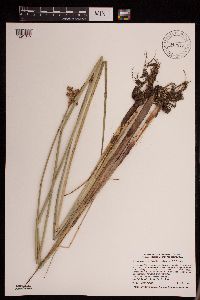 Schoenoplectus acutus var. acutus (Muhlenberg ex Bigelow) Á. Løve & D. Løve 942872[1291045]Smith, Welby R. 345062013-06-21 United States, Minnesota, Nobles, Groth State Wildlife Management Area, about 8 km (5 miles) east of Wilmont. NE of NW of section; T103N R41W sec02, 43.7591333 -95.7278833 |
MIN:Plants | 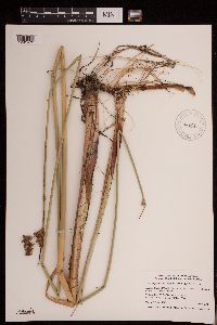 Schoenoplectus acutus var. acutus (Muhlenberg ex Bigelow) Á. Løve & D. Løve 946017[1291472]Smith, Welby R. WRS346332013-07-09 United States, Minnesota, Marshall, Agassiz National Wildlife Refuge, about 10.3 km (6.4 miles) east or Holt. SW of NE of section; T156N R42W sec33, 48.29665 -96.0543667 |
MIN:Plants | 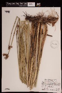 Schoenoplectus acutus var. acutus (Muhlenberg ex Bigelow) Á. Løve & D. Løve 946073[1291453]Smith, Welby R. WRS346972013-07-22 United States, Minnesota, Clay, In a strip of native marshy/sedgy habitat between U.S. Hwy 75 and the adjacent railroad tracks, about 5.5 km (3.4 miles) N-NW of Kragnes. NW of NW of section; T141N R48W sec16, 47.0338333 -96.7743834 |
MIN:Plants |  Schoenoplectus acutus var. acutus (Muhlenberg ex Bigelow) Á. Løve & D. Løve 948313[1292458]Smith, Welby R. WRS338882012-06-28 United States, Minnesota, Otter Tail, In a federal waterfowl production area, about 9.25 miles (15 km) N-NW of the center of Fergus Falls.; T134N R43W sec19, 46.4069 -96.1546167 |
MIN:Plants |  Schoenoplectus acutus var. acutus (Muhlenberg ex Bigelow) Á. Løve & D. Løve 948238[1292440]Smith, Welby R. WRS338112012-06-22 United States, Minnesota, Otter Tail, About 7.25 miles (11.65 km) west of Dalton.; T131N R43W sec03, 46.1821167 -96.0659333 |
MIN:Plants |  Schoenoplectus acutus var. acutus (Muhlenberg ex Bigelow) Á. Løve & D. Løve 948152[1292376]Smith, Welby R. WRS298352006-08-18 United States, Minnesota, Watonwan, About 3 miles southeast of St. James.; T106N R31W sec29, 43.9616407 -94.5856683 |
MIN:Plants |  Schoenoplectus acutus var. acutus (Muhlenberg ex Bigelow) Á. Løve & D. Løve 948150[1292378]Smith, Welby R. WRS298232006-08-17 United States, Minnesota, Cottonwood, Exposed mud flats at the edge of a Typha marsh, about 8 miles north of Windom.; T106N R35W sec13, 43.9896498 -94.9857403 |
MIN:Plants |  Schoenoplectus acutus var. acutus (Muhlenberg ex Bigelow) Á. Løve & D. Løve 947702[1291775]Smith, Welby R. WRS296022006-06-16 United States, Minnesota, Polk, Tilberg County Park, about 6 miles northeast of Fosston. NW of NW of section; T148N R39W sec21, 47.627498 -95.6348191 |
MIN:Plants |  Schoenoplectus acutus var. acutus (Muhlenberg ex Bigelow) Á. Løve & D. Løve 947738[1291809]Smith, Welby R. 296962006-07-18 United States, Minnesota, Faribault, Smith (no relation) State Wildlife Management Area, about 7 miles southwest of Winnebago. NE of SW of section; T104N R27W sec03, 43.8377426 -94.0609694 |
MIN:Plants |  Schoenoplectus acutus var. acutus (Muhlenberg ex Bigelow) Á. Løve & D. Løve 947745[1291816]Smith, Welby R. 297072006-07-19 United States, Minnesota, Jackson, Sangl State Wildlife Management Area, about 2.5 miles north of the Iowa state line. NW of SW of section; T101N R36W sec21, 43.5345395 -95.1707687 |
MIN:Plants |  Schoenoplectus acutus var. acutus (Muhlenberg ex Bigelow) Á. Løve & D. Løve 947756[1291827]Smith, Welby R. 297332006-07-27 United States, Minnesota, Lyon, Prairie Marshes State Wildlife Management Area, about 11 miles southwest of Marshall. NW of NW of section; T110N R43W sec01, 44.3684975 -95.9743067 |
MIN:Plants |  Schoenoplectus acutus var. acutus (Muhlenberg ex Bigelow) Á. Løve & D. Løve 947763[1291834]Smith, Welby R. 297572006-08-03 United States, Minnesota, Chippewa, Along the southwest shore of Watson Sag in Lac Qui Parle State Wildlife Management Area. NW of NW of section; T118N R41W sec08, 45.0487251 -95.8345794 |
MIN:Plants |  Schoenoplectus acutus var. acutus (Muhlenberg ex Bigelow) Á. Løve & D. Løve 948385[1292653]Smith, Welby R. 341632012-08-10 United States, Minnesota, Beltrami, At the east end of Upper Red Lake in Waskish. T154N R30W SW1/4 of NE1/4 of Sec 17, 48.158889 -94.518333 |
MIN:Plants |  Schoenoplectus acutus (Muhlenberg ex Bigelow) Á. Løve & D. Løve 954065[1293560]Perleberg, Donna J. 2329 United States, Minnesota, Cook, Trout Lake, 47.870279 -90.172666 |
MIN:Plants |  Schoenoplectus acutus (Muhlenberg ex Bigelow) Á. Løve & D. Løve 954066[1293559]Simon, Stephanie A. 2330 United States, Minnesota, Itasca, Turtle Lake, 47.6167 -93.7 |
MIN:Plants | 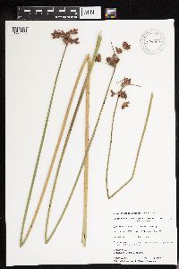 Schoenoplectus acutus (Muhlenberg ex Bigelow) Á. Løve & D. Løve 954062[1293563]Perleberg, Donna J. 2326 United States, Minnesota, Crow Wing, Borden Lake, 46.304945 -93.854533 |
MIN:Plants | 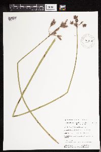 Schoenoplectus acutus (Muhlenberg ex Bigelow) Á. Løve & D. Løve 954064[1293561]Simon, Stephanie A. 2328 United States, Minnesota, Aitkin, Big Pine Lake, 46.355773 -93.771481 |
MIN:Plants | 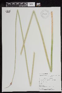 Schoenoplectus acutus (Muhlenberg ex Bigelow) Á. Løve & D. Løve 953999[1293625]Brown, Nicole 130 United States, Minnesota, Meeker, Long Lake, 45.103018 -94.66583 |
MIN:Plants | 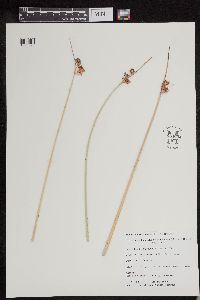 Schoenoplectus acutus (Muhlenberg ex Bigelow) Á. Løve & D. Løve 954004[1293620]Perleberg, Donna J. 327 United States, Minnesota, Crow Wing, Edward Lake, 46.508449 -94.159299 |
MIN:Plants |  Schoenoplectus acutus (Muhlenberg ex Bigelow) Á. Løve & D. Løve 954008[1293616]Perleberg, Donna J. 373 United States, Minnesota, Todd, Big Swan Lake, 45.884393 -94.751543 |
MIN:Plants |  Schoenoplectus acutus (Muhlenberg ex Bigelow) Á. Løve & D. Løve 954010[1293614]Perleberg, Donna J. 419 United States, Minnesota, Hubbard, Portage Lake, 46.965716 -95.120164 |
MIN:Plants |  Schoenoplectus acutus (Muhlenberg ex Bigelow) Á. Løve & D. Løve 954013[1293611]Perleberg, Donna J. 590 United States, Minnesota, Itasca, Trout Lake, 47.259755 -93.404884 |
MIN:Plants |  Schoenoplectus acutus (Muhlenberg ex Bigelow) Á. Løve & D. Løve 954014[1293610]Perleberg, Donna J. 611 United States, Minnesota, Carlton, Eagle Lake, 46.644264 -92.917206 |
MIN:Plants | 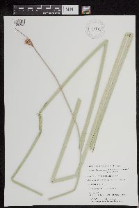 Schoenoplectus acutus (Muhlenberg ex Bigelow) Á. Løve & D. Løve 954022[1293602]Knopik, Joshua M. 1017 United States, Minnesota, Todd, Osakis Lake, 45.866908 -95.152252 |
MIN:Plants | 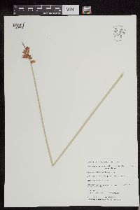 Schoenoplectus acutus (Muhlenberg ex Bigelow) Á. Løve & D. Løve 954023[1293601]Vacinek, Brent 1087 United States, Minnesota, Cass, Ada Lake, 46.830662 -94.349807 |
MIN:Plants | 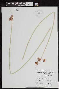 Schoenoplectus acutus (Muhlenberg ex Bigelow) Á. Løve & D. Løve 954025[1293599]Simon, Stephanie A. 1199 United States, Minnesota, Cass, Pine Mountain Lake, 46.833701 -94.518096 |
MIN:Plants | 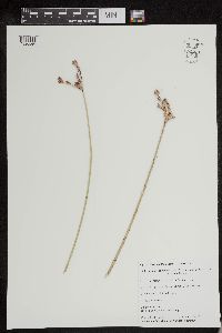 Schoenoplectus acutus (Muhlenberg ex Bigelow) Á. Løve & D. Løve 954031[1293594]Perleberg, Donna J. 1447 United States, Minnesota, Cass, Big Portage Lake, 46.853041 -94.427628 |
Google Map
Google Maps is a web mapping service provided by Google that features a map that users can pan (by dragging the mouse) and zoom (by using the mouse wheel). Collection points are displayed as colored markers that when clicked on, displays the full information for that collection. When multiple species are queried (separated by semi-colons), different colored markers denote each individual species.