University of Minnesota
http://www.umn.edu/
612-625-5000
http://www.umn.edu/
612-625-5000
Minnesota Biodiversity Atlas
Bell Museum
Dataset: MIN-Plants
Taxa: Schoenoplectus acutus
Search Criteria: excluding cultivated/captive occurrences
Bell Museum plants | |
 MIN:Plants | 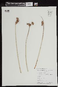 Schoenoplectus acutus (Muhlenberg ex Bigelow) Á. Løve & D. Løve 954032[1293593]Simon, Stephanie A. 1518 United States, Minnesota, Cass, Lawrence Lake, 46.495108 -94.365032 |
MIN:Plants | 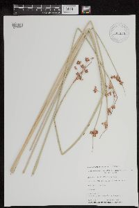 Schoenoplectus acutus (Muhlenberg ex Bigelow) Á. Løve & D. Løve 954043[1293582]Simon, Stephanie A. 1813 United States, Minnesota, Cass, Leech Lake, 46.495108 -94.365032 |
MIN:Plants | 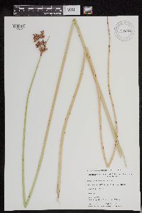 Schoenoplectus acutus (Muhlenberg ex Bigelow) Á. Løve & D. Løve 953997[1293627]Brown, Nicole 2324 United States, Minnesota, Cook, Lax Lake, 47.345921 -91.297479 |
MIN:Plants | 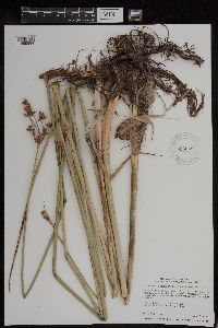 Schoenoplectus acutus (Muhlenberg ex Bigelow) Á. Løve & D. Løve 956068[1295894]Smith, Welby R. 35221 United States, Minnesota, Swift |
MIN:Plants |  Schoenoplectus acutus (Muhlenberg ex Bigelow) Á. Løve & D. Løve 956054[1295908]Smith, Welby R. 35205 United States, Minnesota, Swift |
MIN:Plants | 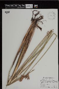 Schoenoplectus acutus (Muhlenberg ex Bigelow) Á. Løve & D. Løve 946036[1296751]Smith, Welby R. 34652 United States, Minnesota, Renville |
MIN:Plants | 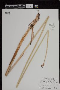 Schoenoplectus acutus (Muhlenberg ex Bigelow) Á. Løve & D. Løve 950313[1296878]Smith, Welby R. 337942012-06-21 United States, Minnesota, Otter Tail |
MIN:Plants | 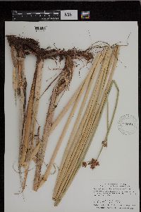 Schoenoplectus acutus (Muhlenberg ex Bigelow) Á. Løve & D. Løve 943501[1296969]Smith, Welby R. 342002012-08-17 United States, Minnesota, Jackson |
MIN:Plants | 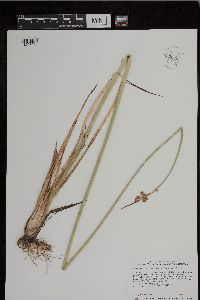 Schoenoplectus acutus (Muhlenberg ex Bigelow) Á. Løve & D. Løve 952046[1297038]Smith, Welby R. 349112014-06-17 United States, Minnesota, Yellow Medicine |
MIN:Plants | 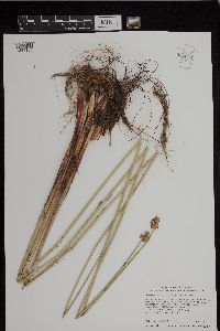 Schoenoplectus acutus (Muhlenberg ex Bigelow) Á. Løve & D. Løve 952064[1297106]Smith, Welby R. 34929 United States, Minnesota, Lac Qui Parle |
MIN:Plants | 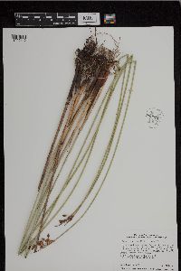 Schoenoplectus acutus (Muhlenberg ex Bigelow) Á. Løve & D. Løve 952074[1297116]Smith, Welby R. 34939 United States, Minnesota, Kandiyohi |
MIN:Plants | 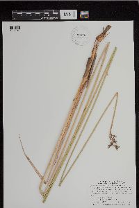 Schoenoplectus acutus (Muhlenberg ex Bigelow) Á. Løve & D. Løve 943583[1297141]Smith, Welby R. 342892012-09-11 United States, Minnesota, Sibley |
MIN:Plants | 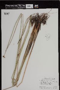 Schoenoplectus acutus (Muhlenberg ex Bigelow) Á. Løve & D. Løve 952146[1297274]Smith, Welby R. 350632014-07-02 United States, Minnesota, Kandiyohi |
MIN:Plants | 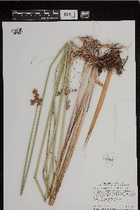 Schoenoplectus acutus (Muhlenberg ex Bigelow) Á. Løve & D. Løve 952161[1297288]Smith, Welby R. 350752014-07-02 United States, Minnesota, Kandiyohi |
MIN:Plants | 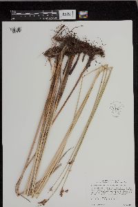 Schoenoplectus acutus (Muhlenberg ex Bigelow) Á. Løve & D. Løve 952199[1297376]Smith, Welby R. 35163 United States, Minnesota, Marshall |
MIN:Plants | 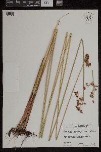 Schoenoplectus acutus (Muhlenberg ex Bigelow) Á. Löve & D. Löve 958920[1305157]Lynden B. Gerdes 71372014-07-24 United States, Minnesota, Lake, Superior National Forest. Approximately 6.88 miles east of McNair, MN and 0.15 miles northwest of Water Tank Lake., 47.32666667 -91.52611111 |
MIN:Plants | 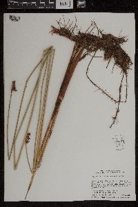 Schoenoplectus acutus (Muhlenberg ex Bigelow) Á. Löve & D. Löve 959173[1305381]Smith, Welby R. WRS353362015-06-28 United States, Minnesota, Hennepin, Crow-Hassan Regional Park, about 3 km (1.9 miles) southeast of St. Michael., 45.19035 -93.6417333 |
MIN:Plants | 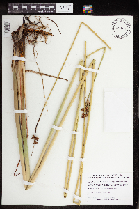 Schoenoplectus acutus (Muhlenberg ex Bigelow) Á. Löve & D. Löve 965446[1356309]Lee, Michael MDL53882010-08-10 United States, Minnesota, Cook, Boundary Waters Canoe Area Wilderness, Fairly rugged bedrock terrain east of Brule Lake, 17 miles northwest of Grand Marais.T63N R2W SW1/4 of SE1/4 of SE1/4 Sec. 10, 47.9480687 -90.55987977, 533m |
MIN:Plants | 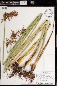 Schoenoplectus acutus (Muhlenberg ex Bigelow) Á. Löve & D. Löve 976132[1373685]Smith, Welby R WRS368302020-08-15 United States, Minnesota, Wright, On the northeast side of Pelican Lake, about 7 km (4.35 miles) southeast of the approximate center of Monticello., 45.252978 -93.748712 |
Google Map
Google Maps is a web mapping service provided by Google that features a map that users can pan (by dragging the mouse) and zoom (by using the mouse wheel). Collection points are displayed as colored markers that when clicked on, displays the full information for that collection. When multiple species are queried (separated by semi-colons), different colored markers denote each individual species.