University of Minnesota
http://www.umn.edu/
612-625-5000
http://www.umn.edu/
612-625-5000
Minnesota Biodiversity Atlas
Bell Museum
Dataset: MIN-Plants
Taxa: Verbenaceae
Search Criteria: excluding cultivated/captive occurrences
Bell Museum plants | |
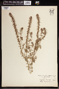
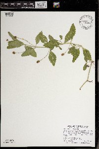
MIN:Plants | Verbena bracteata Lagasca y Segura & Rodr 912106[]Smith, Welby 219721992-09-07 United States, Minnesota, Watonwan, Watline Wildlife Management Area. Watonwan County...Watline State Wildlife Management Area, about 2 miles southwest of St. James...T 106N R 32W NW1/4 of NE1/4 of Sec 34. 106N 32W 34, 43.9463889 -94.6686111 |
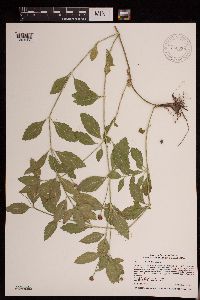
MIN:Plants | Verbena bracteata Lagasca y Segura & Rodr 919356[]Cholewa, A. 27712010-07-15 United States, Minnesota, Anoka, South end of Cenaiko Lake.;Coon Rapids Dam County Park;031N;24W;35, 45.1375 -93.3002778 |
MIN:Plants | Verbena bracteata Lagasca y Segura & Rodr 924490[]Smith, Welby 236021993-08-13 United States, Minnesota, Kandiyohi, About 8 miles west of New London. SE1/4 of NE1/4 of section.;Sibley State Park;121N;35W;04, 45.32 -95.0722222 |
MIN:Plants | Verbena bracteata Lagasca y Segura & Rodr 921303[]Smith, Welby 249701994-07-27 United States, Minnesota, Crow Wing, Crow Wing State Park, about 4 miles southwest of Barrows...T 44N R 32W NW1/4 of SE1/4 of Sec 23;Crow Wing State Park;044N;32W;23, 46.2772222 -94.3391667 |
MIN:Plants | Verbena bracteata Lag. & Rodr. 961402[1334865]stork, H. E. 1925-06-00 United States, Minnesota, Itasca, Bowstring, 47.543003 -93.796597 |
MIN:Plants | Verbena bracteata Lagasca y Segura & Rodr 961423[1334894] United States, Utah |
MIN:Plants | Verbena bracteata Lagasca y Segura & Rodr 961421[1334896] United States, Indiana |
MIN:Plants | Verbena bracteata Lagasca y Segura & Rodr 961420[1334897] United States, Nebraska |
MIN:Plants | Verbena bracteata Lag. & Rodr. []Weatherby, B. GW13592002-07-29 United States, Colorado, Gunnison, Kebler Pass Road near Marcellina Mountain, Gunnison National Forest, 38.933333 -107.05, 2590m |
MIN:Plants | Verbena bracteata Lag. & Rodr. []Schweitzer, T. GW22402003-07-24 United States, Colorado, Montrose, Black Canyon North Rim Campground, Black Canyon National Park, 38.9 -107.23333, 2286m |
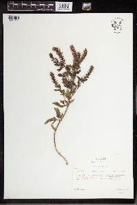
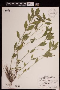
MIN:Plants | Phyla lanceolata (Michaux) Greene 479521[]Kaul, R.; et al. 61971988-08-05 United States, Minnesota, Steele, Steele County...along the Straight River just upstream from Morehouse Park.;;107N;20W;, 44.088034 -93.229717 |
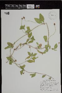
MIN:Plants | Phyla lanceolata (Michaux) Greene 509222[]Wheeler, Gerald 203131999-08-17 United States, Minnesota, Carver, Carver County ... Ca. 1.3 mi SSW of Watertown; where Rte. 25 crosses the South Fork Crow River ... S1/2 SW1/4 NE1/4 Sec. 17 T117N R25W (Watertown 17). 117N 25W 17, 44.941647 -93.859375 |
MIN:Plants | Phyla lanceolata (Michaux) Greene 482552[]Smith, Welby 258621995-08-17 United States, Minnesota, Hennepin, Hennepin County...Abut 1/4 mile downstream (south) of the Lake Street Bridge in Minneapolis...floodplain of the Mississippi River...T 28N R 23W SE1/4 of NW1/4 of Sec 5. 028N 23W 5, 44.9438889 -93.2022222 |
MIN:Plants | Phyla lanceolata (Michaux) Greene 180675[]Lyon, H. 2791899-07-26 United States, Minnesota, Houston, Jefferson;Dorer Memorial Hardwood State Forest;101N;04W;35, 43.50806 -91.28287 |
MIN:Plants | Phyla lanceolata (Michaux) Greene 180676[]Wheeler, William 6221899-08-25 United States, Minnesota, Houston, Brownsville;;103N;04W;, 43.694136 -91.279857 |
MIN:Plants | Phyla lanceolata (Michaux) Greene 359037[]Moyle, J. 33481939-08-03 United States, Minnesota, Carver, Along Crow River near St. Bonifacius, Carver Co.;;117N;25W;, 44.763574 -93.625791 |
MIN:Plants | Phyla lanceolata (Michaux) Greene 364258[]Moyle, J. 29101937-08-20 United States, Minnesota, Martin, School Section Lake;;N;;, 43.6822 -94.547284 |
MIN:Plants | Phyla lanceolata (Michaux) Greene 364260[]Moyle, J. 28901937-08-26 United States, Minnesota, Murray, near Lake Shetek;Lake Shetek State Park;N;;, 44.124433 -95.693123 |
MIN:Plants | Phyla lanceolata (Michaux) Greene 364295[]Butters, F.; et al. 66931936-08-20 United States, Minnesota, Goodhue, Lake Pepin, about 1 mi N of Lake City.;;;;, 44.474675 -92.27577 |
MIN:Plants | Phyla lanceolata (Michaux) Greene 386075[]Moyle, J. 41041945-08-10 United States, Minnesota, Waseca, Lake Elysian;;N;;, 44.1333 -93.7 |
MIN:Plants | Phyla lanceolata (Michaux) Greene 421393[]Jacobs, D. 5151948-08-06 United States, Minnesota, Blue Earth, Minnesota River, Mankato.;;N;;, 44.163578 -93.9994 |
MIN:Plants | Phyla lanceolata (Michaux) Greene 448695[]Moore, John; Huff, N. 193451946-10-05 United States, Minnesota, Olmsted, Olmsted Co, at Oronoco Wayside State Park.;;N;;, 44.167708 -92.539841 |
MIN:Plants | Phyla lanceolata (Michaux) Greene 456026[]Smith, Welby 147701988-08-08 United States, Minnesota, Washington, Washington County...On the Mississippi River, about one mile south of St. Paul Park. NW1/4 SW1/4 section 13, T 27N R 22W. 027N 22W 13, 44.8252778 -93.0016667 |
MIN:Plants | Phyla lanceolata (Michaux) Greene 488519[]Moore, John; Huff, N. 197521947-08-26 United States, Minnesota, Sibley, Sibley Co. Minnesota River opposite Le Sueur.;;112N;26W;, 44.579478 -94.232142 |
MIN:Plants | Phyla lanceolata (Michaux) Greene 488558[]Moore, John; Huff, N. 197961947-09-18 United States, Minnesota, Murray, at Lake Shetek, Lake Shetek State Park.;Lake Shetek State Park;N;;, 44.124433 -95.693123 |
MIN:Plants | Phyla lanceolata (Michaux) Greene 515997[]Smith, Welby 181391990-08-29 United States, Minnesota, Steele, Beaver Lake County Park. Steele Co.; at the E end of Beaver Lake, about 2 mi W-SW of Ellendale; T105N R21W NW1/4 of NW1/4 of Sec 22 Steele Co.; at the E end of Beaver Lake, about 2 mi W-SW of Ellendale; T105N R21W NW1/4 of NW1/4 of Sec 22. 105N 21W 22, 43.8911095 -93.3441696 |
MIN:Plants | Phyla lanceolata (Michaux) Greene 574839[]Moore, John 243861958-10-08 United States, Minnesota, Blue Earth, Maple River 3/4 mi SE of Good Thunder.;;N;;, 43.995129 -94.058932 |
MIN:Plants | Phyla lanceolata (Michaux) Greene 608470[]Abbott, Robinson s.n.1975-07-20 United States, Minnesota, Hennepin, Hennepin Co.; Mississippi River spoils beach below Lake Street bridge;;028N;23W;, 44.962286 -93.263057 |
MIN:Plants | Phyla lanceolata (Michaux) Greene 672685[]Wheeler, Gerald 8901976-08-12 United States, Minnesota, Goodhue, Red Wing City Park. W bank of the Mississippi River near the Red Wing Park Marina.;;N;;, 44.562468 -92.533801 |
MIN:Plants | Phyla lanceolata (Michaux) Greene 697803[]Ownbey, Gerald; et al. 53401976-08-26 United States, Minnesota, Houston, Houston Co. Rt 26, 1.3 mi N of Iowa border at New Albin.;Dorer Memorial Hardwood State Forest;101N;04W;, 43.544706 -91.432807 |
MIN:Plants | Phyla lanceolata (Michaux) Greene 697876[]Ownbey, Gerald 55031976-09-03 United States, Minnesota, Washington, 0.5 mi N of Afton village near mouth of Valley Branch (creek), NE side. T28N R20W SW1/4 SW1/4 Sec.14.;;028N;20W;14, 44.907911 -92.776143 |
MIN:Plants | Phyla lanceolata (Michaux) Greene 724993[]Smith, Welby 32631980-08-10 United States, Minnesota, Wright, Wright Co.; T120N R23W NW1/4 NW1/4 sec.18. About 2 mi E of St. Michael. W bank of the Crow River.;;120N;23W;18, 45.207802 -93.643188 |
MIN:Plants | Phyla lanceolata (Michaux) Greene 747337[]Galatowitsch, S. 7041982-08-20 United States, Minnesota, Wabasha, Wabasha County...Weaver Dunes: T109N R9W SE1/4 and E1/2 NE1/4 of Sec.7; NW1/4 and W1/2 NE1/4 of Sec.8.;Kellogg-Weaver Dunes Scientific Natural Area / Kellogg-Weaver Dunes, The Nature Conservancy;109N;09W;00, 44.258107 -91.938909 |
MIN:Plants | Phyla lanceolata (Michaux) Greene 789506[]Smith, Welby 108251985-07-21 United States, Minnesota, Ramsey, Ramsey Co.; Mississippi River at the N end of the St. Paul Downtown Airport (Holman Field). SW1/4 NW1/4 sec.4 T28N R22W.;;028N;22W;4, 44.942907 -93.064302 |
MIN:Plants | Phyla lanceolata (Michaux) Greene 824513[]Cholewa, A.; et al. 20231991-07-18 United States, Minnesota, Dakota, Dakota Co, Fort Snelling State Park, small boat ramp across from Pike Island, T28N R23W S28.;Fort Snelling State Park;028N;23W;28, 44.882343 -93.174156 |
MIN:Plants | Phyla lanceolata (Michaux) Greene 841699[]Smith, Welby 136571987-07-31 United States, Minnesota, Washington, Washington County...On Upper Grey Cloud Island in the Mississippi River, about 3 mi S of St. Paul Park. NE1/4 NW1/4 sec.35, T27N R22W. 027N 22W 35, 44.7886111 -93.0194444 |
MIN:Plants | Phyla lanceolata (Michaux) Greene 919354[]Cholewa, A. 27692010-07-15 United States, Minnesota, Anoka, Along rock outcropping/dam support just below dam. ;Coon Rapids Dam County Park;031N;24W;35, 45.1461111 -93.3094444 |
MIN:Plants | Phyla lanceolata (Michaux) Greene 436875[]Juhnke, C. 472 CMJ FRO1999-07-23 United States, Minnesota, Goodhue, Frontenac State Park. Frontenac State Park Goodhue County ... Behind rest building near beach along trail to Sand Point ... T112N R13W NE NW NE 13. 112N 13W 13, 44.50502 -92.31891 |
MIN:Plants | Phyla lanceolata (Michaux) Greene 923523[]Smith, Welby 220341992-09-17 United States, Minnesota, Nicollet, Along the Minnesota River (north bank); about 1/4 mile north of Judson. NW1/4 of SW1/4 of section.;;109N;28W;33, 44.2011111 -94.1952778 |
MIN:Plants | Phyla lanceolata (Michaux) Greene 750114[1404968]Smith, Welby R. 298672006-08-29 United States, Minnesota, Scott, Louisville Swamp, about 7 miles southwest of Shakopee. NE of SE of section;;115N;23W;31, 44.726293 -93.627916 |
MIN:Plants | Phyla lanceolata (Michaux) Greene 715327[]Smith, Welby R. 298612006-08-28 United States, Minnesota, Dakota, Black Dog Lake in the Minnesota River bottoms, just N of Burnsville. SE1/4 NW1/4 of section;;027N;24W;27, 44.8002778 -93.2825 |
MIN:Plants | Phyla lanceolata (Michaux) Greene 361939[]Dziuk, P. 13-0112013-09-18 United States, Minnesota, Scott, Louisville Swamp Unit. Within 100 yards of Rock Island lake impoundment barrier, on east side of trail, north side of flowage. W1/2 of SW1/4 of sec;Minnesota Valley National Wildlife Refuge;115N;23W;20, 44.7368806 -93.6187 |
MIN:Plants | Phyla lanceolata (Michaux) Greene 945928[1291536]Smith, Welby R. WRS348502013-09-24 United States, Minnesota, Nicollet, On the south bank of the Minnesota River about 1.3 km (0.8 mile) south of Courtland. SW of SE of section; T109N R29W sec08, 44.2568833 -94.3406 |
MIN:Plants | Phyla lanceolata (Michaux) Greene 945969[1291515]Smith, Welby R. WRS352812014-09-06 United States, Minnesota, Renville, Along the Minnesota River, about 9.5 km (6 miles) southwest of Fairfax. SW of SE of section; T112N R33W sec34, 44.4585833 -94.7931167 |
MIN:Plants | Phyla lanceolata (Michaux) Greene 943555[1297082]Smith, Welby R. 34258 United States, Minnesota, Nicollet |
MIN:Plants | Phyla lanceolata (Michaux) Greene 943586[1297144]Smith, Welby R. 342922012-09-26 United States, Minnesota, Scott |
MIN:Plants | Phyla lanceolata (Michaux) Greene 961491[1334898] United States, Iowa |
MIN:Plants | Phyla lanceolata (Michaux) Greene []Timothy J. S. Whitfeld 37552023-08-12 United States, Minnesota, Washington, Southern tip of Upper Grey Cloud Island on north side of channel from main channel of the Mississippi River and Baldwin Lake, 44.78453 -93.016184, 213m |
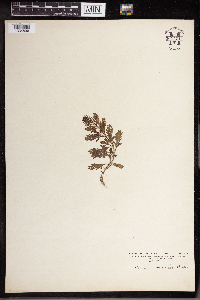
MIN:Plants | Avicennia nitida Jacquin 595249[]Stimson, William 6491964-06-28 United States, Florida, Monroe, Monroe County: Windleys Key ... north coast of island.;Everglades National Park |
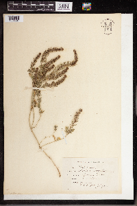
MIN:Plants | 911201[]Smith, Welby 218981992-09-03 United States, Minnesota, Watonwan, Watonwan County...About 5 miles east of St. James...along the South Fork Watonwan River...T 106N R 31W SW1/4 of SE1/4 of Sec 14. 106N 31W 14, 43.9786111 -94.5255556 |
MIN:Plants | 477222[]Smith, Welby 174111990-07-23 United States, Minnesota, Steele, Steele County ... Kaplan Woods City Park, on the south side of Owatonna ... T 107N R 20W NE1/4 of NW1/4 of Sec 21;;107N;20W;21, 44.0644455 -93.2350006 |
MIN:Plants | 479344[]Juhnke, C. 481 CMJ FRO1999-07-27 United States, Minnesota, Goodhue, Frontenac State Park Goodhue County ... Along Cty. Rd. 2 SSW of contact station ... T112N R13W SW SE NW 11;Frontenac State Park;112N;13W;11, 44.520016 -92.33874 |
MIN:Plants | 913985[]Smith, Welby 255201994-09-13 United States, Minnesota, Yellow Medicine, about 7 miles southwest of Sacred Heart; In the Minnesota Valley. on the south bank of the Minnesota River. SE1/4 of SE1/4 of Section;Upper Sioux Agency State Park;115N;38W;29, 44.735 -95.4425 |
MIN:Plants | 181122[]G. & L. 81-11885-07-26 United States, Minnesota, Chippewa, Montevideo;;117N;40W;, 44.941389 -95.722222 |
MIN:Plants | 181124[]Ballard, C. B6671891-07-00 United States, Minnesota, Carver, Waconia;;116N;25W;, 44.850796 -93.786909 |
MIN:Plants | 181126[]Sheldon, Edmund S10911891-07-00 United States, Minnesota, Brown, Springfield;;N;;, 44.238848 -94.975823 |
MIN:Plants | 181128[]Sheldon, Edmund S8401891-07-00 United States, Minnesota, Brown, Sleepy Eye;;N;;, 44.297183 -94.72415 |
MIN:Plants | 181141[]Ballard, C. 31701901-08-16 United States, Minnesota, Clay, Moorhead;;N;;, 46.873852 -96.767581 |
MIN:Plants | 439601[]Smith, Welby 162421989-08-29 United States, Minnesota, Chisago, Chisago Co. About 3 mi N of Almelund; SW1/4 NE1/4 sec.12, T35N R20W;;035N;20W;12, 45.5347214 -92.7791672 |
MIN:Plants | 440465[]Smith, Welby 149151988-08-17 United States, Minnesota, Meeker, Meeker County...About 3.5 mi W of Kingston; along the North Fork Crow River, near the Hwy. 27 crossing...SW1/4 NE1/4 sec.13, T120N R30W. 120N 30W 13, 45.2036111 -94.3880556 |
MIN:Plants | 440993[]Smith, Welby 122781986-07-30 United States, Minnesota, Goodhue, Goodhue Co. About 5 mi W of Cannon Falls; S bank of the Cannon River. SE1/4 SE1/4 sec.7, T112N R18W;;112N;18W;7, 44.261981 -93.030794 |
MIN:Plants | 441341[]Smith, Welby 163631989-09-05 United States, Minnesota, Mille Lacs, Mille Lacs Co. About 11 mi N of Milaca; SW1/4 SE1/4 sec.26, T40N R27W;;040N;27W;26, 45.9249992 -93.6680527 |
MIN:Plants | 443844[]Boe, J. 960821011996-08-21 United States, Minnesota, Aitkin, Aitkin Co.; Southeast of Washburn Lake. Stand #2. Near releve 96-38; T 051N R 024W NE1/4 of SE1/4 of Sec 7;Savanna State Forest;051N;24W;7, 46.917695 -93.424363 |
MIN:Plants | 448416[]Moore, John; Huff, N. 189661946-08-03 United States, Minnesota, Benton, Along the S bank of Mayhew Creek, 5 mi E of East St. Cloud;;N;;, 45.608364 -93.93811 |
MIN:Plants | 460450[]Husveth, J. 95-44191995-09-01 United States, Minnesota, Wabasha, Wabasha Co. T110N R11W SW1/4 of the SE1/4 of S12; Bank of the Zumbro River;Dorer Memorial Hardwood State Forest;110N;11W;12, 44.249964 -91.954363 |
MIN:Plants | 460473[]Husveth, J. 95-42141995-09-13 United States, Minnesota, Winona, Winona Co. T108N R10W SW1/4 of the SW1/4 of S11; Whitewater River.;Whitewater Wildlife Management Area;108N;10W;11, 44.174814 -91.995703 |
MIN:Plants | 460566[]Smith, Welby 145821988-07-22 United States, Minnesota, Washington, Washington County ... St. Croix River in the town of Afton. NW1/4 SW1/4 section 23, T 28N R 20W;Saint Croix National Riverway;028N;20W;23, 44.898056 -92.7788925 |
MIN:Plants | 464640[]Lee, Michael MDL2731993-07-29 United States, Minnesota, Dakota, Dakota Co.; Fort Snelling State Park, Gun Club Lake South; T 27N R 20W SE1/4 of NW1/4 of Sec 4;Fort Snelling State Park;027N;20W;4, 44.856868 -93.180525 |
MIN:Plants | 472032[]Nation, R. 94-2201994-07-05 United States, Minnesota, Mower, Lake Louise State Park. Mower Co.; Tract 6. T101N R14W SW1/4 of NE1/4 of sec. 29;Lake Louise State Park;101N;14W;29, 43.522073 -92.538882 |
MIN:Plants | 475624[]Husveth, J. 95-37231995-09-12 United States, Minnesota, Winona, Winona Co. T107N R10W SW1/4 of the SE1/4 of S6; North Fork of the Whitewater River.;Whitewater Wildlife Management Area;107N;10W;6, 44.084603 -92.021648 |
MIN:Plants | 491995[]Stevens, O. s.n.1953-08-26 United States, Minnesota, Cass, Woman Lake;;N;;, 46.951408 -94.280385 |
MIN:Plants | 514781[]Smith, Welby 162151989-08-25 United States, Minnesota, Freeborn, Myre Big Island State Park. Freeborn County...Helmer Myre State Park, about 2 mi SE of Albert Lea. On 'Big Island' in Albert Lea Lake; SW1/4 NW1/4 sec.19, T102N R20W. 102N 20W 19, 43.625 -93.2875 |
MIN:Plants | 554217[]Moore, John 230501956-09-15 United States, Minnesota, Clay, Clay Co.; along the river at Ulen;;142N;44W;, 47.07885 -96.258949 |
MIN:Plants | 554698[]Moore, John; Hsi, Yu-tseng [Eugene] 233201957-08-05 United States, Minnesota, Blue Earth, Blue Earth Co.; on the S shore of Lake George;;109N;25W;, 44.2338 -93.868684 |
MIN:Plants | 657150[]Scanlan, M. 771973-07-11 United States, Minnesota, Big Stone, Collected in BI-223; Sec. 12 T122N R45W;;122N;45W;12, 45.391148 -96.25154 |
MIN:Plants | 734831[]Petron, T. 2481980-07-14 United States, Minnesota, Clay, Clay Co.; Bluestem Prairie: 13 mi. E of Moorhead. NW1/4 NE1/4 Sec. 15, T139N, R46W. On E bank of the Buffalo River.;Bluestem Prairie Scientific Natural Area;139N;46W;15, 46.811205 -96.398224 |
MIN:Plants | 758282[]Delaney, B. s.n.1982-07-04 United States, Minnesota, Anoka, Anoka Co. Cedar Creek Natural History Area, at the old Heckenlaible House site; N of center Sec. 33 Bethel Twp.;Cedar Creek National History Area;034N;23W;33, 45.305423 -93.336637 |
MIN:Plants | 763381[]Lugger, O. s.n. United States, Minnesota, Blue Earth, Mankato;;N;;, 44.163578 -93.9994 |
MIN:Plants | 812702[]Wheeler, Gerald 115441988-07-28 United States, Minnesota, Big Stone, Big Stone Co.; Approx. 2.5 mi. SSE of Ortonville; Big Stone National Wildlife Refuge, SW of Rte. 75. NE1/4 Sec. 27, T12 Big Stone Co.; Approx. 2.5 mi. SSE of Ortonville; Big Stone National Wildlife Refuge, SW of Rte. 75. NE1/4 Sec. 27, T121N, R46W (Ortonville Twp.). 121N 46W 27, 45.266209 -96.416054 |
MIN:Plants | 830027[]Myhre, K. 3110A1992-08-17 United States, Minnesota, Cass, Cass Co. Located NE of the Crow Wing River and Crow Wing State Park; on the hillsides in the Crow Wing River floodplain; Cass Co. Located NE of the Crow Wing River and Crow Wing State Park; on the hillsides in the Crow Wing River floodplain; T133N R29W NW1/4 of NW1/4 of Sec.33. 133N 29W 33, 46.294672 -94.345859 |
MIN:Plants | 830129[]Myhre, K. 31101992-08-17 United States, Minnesota, Cass, Cass Co. Located NE of the Crow Wing River and Crow Wing State Park; Crow Wing River floodplain; T133N R29W NW1/4 of NW1 Cass Co. Located NE of the Crow Wing River and Crow Wing State Park; Crow Wing River floodplain; T133N R29W NW1/4 of NW1/4 of Sec.33. 133N 29W 33, 46.294672 -94.345859 |
MIN:Plants | 834162[]Smith, Welby 198151991-07-31 United States, Minnesota, Todd, Grey Eagle Wildlife Management Area. Todd Co. Grey Eagle State Wildlife Management Area, about 4 mi W of Grey Eagle; Todd Co. Grey Eagle State Wildlife Management Area, about 4 mi W of Grey Eagle; T127N R33W SW1/4 of SE1/4 of Sec 9. 127N 33W 9, 45.8202782 -94.8366699 |
MIN:Plants | 836165[]Smith, Welby 182001990-08-30 United States, Minnesota, Morrison, Camp Ripley Military Reservation. Camp Ripley Military Reservation Morrison Co. About 1 km E of the junction of Chorwan Road and East Boundary Road. UTM: Camp Ripley Military Reservation Morrison Co. About 1 km E of the junction of Chorwan Road and East Boundary Road. UTM: 396600E 5124800N T132N R29W SE1/4 of SW1/4 of Sec 4. 132N 29W 4, 46.272931 -94.344197 |
MIN:Plants | 838393[]Smith, Welby 178451990-08-08 United States, Minnesota, Red Lake, Red Lake County ... At 'Old Crossing Treaty State Wayside Park'. On the N bank of the Red Lake River, about 6 miles W of the town of Red Lake Falls ... T151N R45W SE1/4 of SW1/4 of Sec. 27. 151N 45W 27, 47.8666649 -96.4113922 |
MIN:Plants | 839136[]Smith, Welby 176351990-08-02 United States, Minnesota, Dodge, Dodge Co. About 3 mi NW of Byron. On a S-facing slope overlooking the South Branch Middle Fork Zumbro River; Dodge Co. About 3 mi NW of Byron. On a S-facing slope overlooking the South Branch Middle Fork Zumbro River; T107N R16W NE1/4 of SW1/4 of Sec 13. 107N 16W 13, 44.0708351 -92.6858368 |
MIN:Plants | 839240[]Smith, Welby 184401990-09-14 United States, Minnesota, Martin, Martin Co. Bright Lake County Park, about 2.5 mi NE of Ceylon; T101N R31W SW1/4 of NE1/4 of Sec 17 Martin Co. Bright Lake County Park, about 2.5 mi NE of Ceylon; T101N R31W SW1/4 of NE1/4 of Sec 17.. 101N 31W 17, 43.5533333 -94.7047195 |
MIN:Plants | 839281[]Smith, Welby 183351990-09-05 United States, Minnesota, Faribault, Pihls County Park. Faribault County ... Pihls County Park. On the west side of Rice Lake, about 6 mi south of Wells... T102N R24W SW1/4 of NW1/4 of Sec 16. 102N 24W 16, 43.6402779 -93.7258301 |
MIN:Plants | 840388[]Smith, Welby 135001987-07-13 United States, Minnesota, Scott, Murphy-Hanrahan County Park Reserve. Scott County...Murphy-Hanrahan Regional Park, on the S side of Hanrahan Lake, about 2 mi W of Burnsville SW1/4 NW1/4 sec. 34, T115N R21W. 115N 21W 34, 44.7277778 -93.3363889 |
MIN:Plants | 181121[]MacMillan, C.; et al. 2401900-08-00 United States, Minnesota, Polk, Crookston;;150N;46W;30, 47.77414 -96.60812 |
MIN:Plants | 181123[]Manning, Sara s.n.1883-07-23 United States, Minnesota, Wabasha, Wabasha Co.; Reads Landing;Dorer Memorial Hardwood State Forest;111N;11W;, 44.401088 -92.07924 |
MIN:Plants | 181125[]Skinner, S. 2691902-07-01 United States, Minnesota, Nobles, Heron Lake Region, S end of West Graham Lake;;104N;39W;, 43.802757 -95.513097 |
MIN:Plants | 181127[]Sheldon, Edmund S15751891-08-00 United States, Minnesota, Lincoln, Lake Benton, Lincoln Co.;;109N;45W;00, 44.261079 -96.287539 |
MIN:Plants | 181129[]Ballard, C. B5301891-07-00 United States, Minnesota, Scott, Cleary's Lake, Scott Co.;Cleary Lake County Park;114N;22W;, 44.691967 -93.400179 |
MIN:Plants | 181130[]Oestlund, O. s.n.1886-00-00 United States, Minnesota, Hennepin, Minneapolis;;;;, 44.979965 -93.263836 |
MIN:Plants | 181131[]Sandberg, John s.n.1886-07-00 United States, Minnesota, Goodhue, Goodhue Co.;;;;, 44.409846 -92.722591 |
MIN:Plants | 181132[]Kassube, J. s.n.1878-07-00 United States, Minnesota, Hennepin, Minneapolis;;;;, 44.979965 -93.263836 |
MIN:Plants | 181133[]Campbell, Jennie C971896-07-00 United States, Minnesota, Stearns, Rockville. Stearns Co.;;123N;29W;, 45.471909 -94.340827 |
MIN:Plants | 181134[]Sandberg, John s.n.1889-08-00 United States, Minnesota, Hennepin, Hennepin Co.;;;;, 45.004576 -93.476884 |
MIN:Plants | 181135[]Herrick, C. s.n.1877-07-07 United States, Minnesota, Hennepin, Minneapolis;;;;, 44.979965 -93.263836 |
MIN:Plants | 181136[]Aiton, G. s.n.1889-07-00 United States, Minnesota, Hennepin, Hennepin Co.;;;;, 45.004576 -93.476884 |
Google Map
Google Maps is a web mapping service provided by Google that features a map that users can pan (by dragging the mouse) and zoom (by using the mouse wheel). Collection points are displayed as colored markers that when clicked on, displays the full information for that collection. When multiple species are queried (separated by semi-colons), different colored markers denote each individual species.
