University of Minnesota
http://www.umn.edu/
612-625-5000
http://www.umn.edu/
612-625-5000
Minnesota Biodiversity Atlas
Bell Museum
Dataset: MIN-Plants
Taxa: Bolboschoenus
Search Criteria: excluding cultivated/captive occurrences
Bell Museum plants | |
 MIN:Plants |  Bolboschoenus fluviatilis (Torrey) Soj 907765[1006398]Smith, Welby; et al. 310892008-08-06 United States, Minnesota, Saint Louis, Boundary Waters Canoe Area Wilderness / Superior National Forest. St. Louis County...Meat Lake in the Boundary Waters Canoe Area Wilderness, Superior National Forest...T63N R 14W SE1/4 of SE1/4 of Sec 22. 063N 14W 22, 47.9197222 -92.0980556 |
MIN:Plants |  Bolboschoenus fluviatilis (Torrey) Soj 477043[1006363]Wheeler, Gerald 161591997-06-14 United States, Minnesota, Nicollet, Nicollet County ... Ca. 2.3 mi. W of Nicollet of Rte. 14, N of road; Swan Lake WMA ... N1/2 Sec. 6 T109N R28W;Swan Lake Wildlife Management Area;109N;28W;6, 44.275753 -94.240942 |
MIN:Plants |  Bolboschoenus fluviatilis (Torrey) Soj 907591[1006411]Gerdes, Lynden 54292007-06-22 United States, Minnesota, Lake, Superior National Forest. T60N R09W S26NWSESW Lake County ... Superior National Forest. Fish Fry Lake approximately 4.68 miles NW of Isabella ... NE of boat landing.. 060N 09W 26, 47.653543 -91.438022 |
MIN:Plants |  Bolboschoenus maritimus var. paludosus (A. Nelson) T. Koyama 483526[1006488]Cappel, E. 2991952-07-20 United States, Maine, Hancock, County: Hancock ... north of McKinley ... Mt. Desert Island.;Acadia National Park |
MIN:Plants |  Bolboschoenus fluviatilis (Torrey) Soj 561021[1006378]Scott, P. 13122001-08-10 United States, Minnesota, Cook, COOK CO ... Blueberry Island, Saganaga Lake, BWCAW. T66N R5W sec.1 SENENE.;Boundary Waters Canoe Area Wilderness / Superior National Forest;066N;05W;01, 48.22865 -90.910713 |
MIN:Plants |  Bolboschoenus fluviatilis (Torrey) Soj 914966[1006368]Smith, Welby; et al. 314782009-09-12 United States, Minnesota, Cook, Boundary Waters Canoe Area Wilderness / Superior National Forest. Cook County...Boundary Waters Canoe Area Wilderness Superior National Forest...north side of John Lake...T 65N R 3E SW1/4 of NE1/4 of Sec 33. 065N 03E 33, 48.0744444 -90.0633333 |
MIN:Plants |  Bolboschoenus fluviatilis (Torrey) Soj 916988[1006420]Gerdes, Lynden; et al. 58852009-08-21 United States, Minnesota, Cook, Boundary Waters Canoe Area Wilderness / Superior National Forest. T66N R05W S28 NWNWNESE Cook County ... Superior National Forest. Boundary Waters Canoe Area Wilderness. Northern end of drainage between Red Rock Lake and Red Rock Bay ... NAD 83 / 650761 / 5337240. 066N 05W 28, 48.1705556 -90.9722222 |
MIN:Plants |  Bolboschoenus fluviatilis (Torrey) Soj 453943[1006381]Lee, Michael MDL13291996-07-01 United States, Minnesota, Wabasha, Upper Mississippi National Wildlife Refuge. Wabasha County ... Mississippi River Floodplain just upstream from the mouth of the Zumbro River; 3 miles of Kellogg. Upper Mississsippi National Wildlife & Fish Refuge ... T110N R9W NE1/4 SE1/4 NE1/4 Sec. 30. 110N 09W 30, 44.249964 -91.954363 |
MIN:Plants | 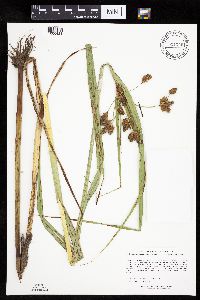 Bolboschoenus fluviatilis (Torrey) Soj 921246[1006421]Lee, Michael MDL35232003-08-04 United States, Minnesota, Todd, Todd County...two miles south of Burtrum, 3.5 miles east-northeast of Grey Eagle...north shore of Mound Lake... T127N R32W S1/2 of NW1/4 of SW1/4 of NE1/4 Sec. 2. 127N 32W 2, 45.838715 -94.674655 |
MIN:Plants | 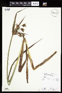 Bolboschoenus fluviatilis (Torrey) Soj 910521[1006414]Perleberg, D.; et al. 11802007-08-01 United States, Minnesota, Cass, County: Cass, Lake ID: 11005900, Lake: Washburn...T139, R26W, Sec16, South shore of east basin...DNR Site # N.S. 5;;139N;26W;16, 46.854245 -93.976762 |
MIN:Plants | 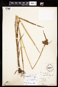 Bolboschoenus maritimus var. paludosus (A. Nelson) T. Koyama 83365[1006491]Elmer, A.D.E. 27251900-06-00 United States, Washington, Clallam, Olympic Mts. [Olympic National Park] |
MIN:Plants | 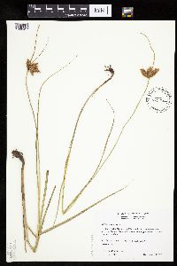 Bolboschoenus maritimus var. paludosus (A. Nelson) T. Koyama 482157[1006457]Wheeler, Gerald 170121997-08-08 United States, Minnesota, Swift, Swift Co.; Ca. 5 mi. NNE of Benson, on NW margin of Frovold Lake; NW1/4 SE1/4 NE1/4 Sec. 16 T122N R39W (Benson 16);;122N;39W;16, 45.376026 -95.571928 |
MIN:Plants |  Bolboschoenus maritimus var. paludosus (A. Nelson) T. Koyama 443464[1006487]Bright, R. s.n.1972-00-00 United States, Idaho, Franklin, Franklin Co. Coulam ditch |
MIN:Plants |  Bolboschoenus fluviatilis (Torrey) Soj 435578[1006408]Wheeler, Gerald 163351997-06-28 United States, Minnesota, Swift, Ca. 10 mi. NNE of Kerkhoven, along shore of Monson Lake. W1/2 NE1/4 NW1/4 of section;Monson Lake State Park;121N;37W;01, 45.318174 -95.265442 |
MIN:Plants |  Bolboschoenus fluviatilis (Torrey) Soj 426115[1006361]Homoya, M.; et al. 16312003-08-21 United States, Minnesota, Saint Louis, ST. LOUIS CO ... Upper Pauness Lake, BWCAW. T66N R15W sec. 15 SWSWSW.;Boundary Waters Canoe Area Wilderness / Superior National Forest;066N;15W;15, 48.199898 -92.244751 |
MIN:Plants |  Bolboschoenus fluviatilis (Torrey) Soj 914346[1006367]Smith, Welby 225261993-06-22 United States, Minnesota, Stevens, National waterfowl production area, about 4.5 miles south-southwest of Donnelly. SE1/4 of SW1/4 of section;Pepperton Wildlife Management Area;125N;43W;15, 45.636277 -96.05714 |
MIN:Plants | 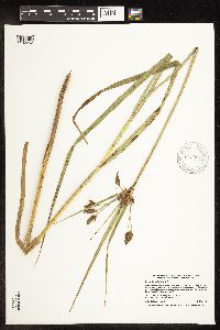 Bolboschoenus fluviatilis (Torrey) Soj 912354[1102262]Smith, Welby 229851993-07-20 United States, Minnesota, Sibley, Sibley County ... At the southeast end of Silver Lake, about 5 miles east of Arlington ...T113N R26W NW1/4 of NW1/4 of Sec 9. 113N 26W 9, 44.6130556 -93.9686111 |
MIN:Plants | 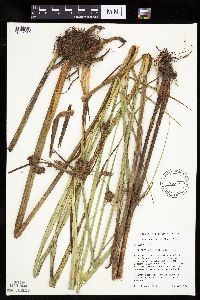 Bolboschoenus fluviatilis (Torrey) Soj 435697[1006380]Mensing, D. 95-21011995-08-31 United States, Minnesota, Chisago, Chisago Co, T37N R22W E1/4 of the SW1/4 of S21; Bird Island located in west arm of Rush Lake;Rush Lake Island Scientific Natural Area;037N;22W;21, 45.680502 -93.09363 |
MIN:Plants | 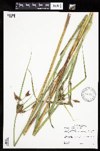 Bolboschoenus fluviatilis (Torrey) Soj 916032[1006419]Gerdes, Lynden 53162006-08-22 United States, Minnesota, Lake, T60N R09W S26SWSESW. Lake County, MN. Superior National Forest. Fish Fry Lake. Approximately 4.65 miles NW of Isabella;Superior National Forest;060N;09W;26, 47.653542 -91.438022 |
MIN:Plants | 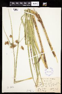 Bolboschoenus fluviatilis (Torrey) Soj 338085[1006388]Smith, L. 431936-07-29 United States, Minnesota, Itasca, Bowstring Lake;Chippewa National Forest;;;, 47.542434 -93.968693 |
MIN:Plants | 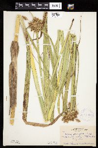 Bolboschoenus fluviatilis (Torrey) Soj 350846[1006434]Hedman, H. 481938-07-00 United States, Minnesota, Hennepin, N shore of Browns Bay, Lake Minnetonka.;;117N;23W;, 44.934923 -93.584208 |
MIN:Plants | 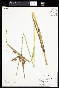 Bolboschoenus fluviatilis (Torrey) Soj 781127[1006410]Smith, Welby 95031984-06-28 United States, Minnesota, Lyon, About 4 mi. N-NW of Russell. SE1/4 SW1/4 of section;Prairie Marshes Wildlife Management Area;111N;43W;36, 44.378119 -95.968102 |
MIN:Plants | 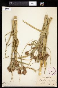 Bolboschoenus fluviatilis (Torrey) Soj 264513[1006384]Holzinger, John s.n.1897-07-00 United States, Minnesota, Winona, [prob. Lake Winona and Mississippi River area];;;;, 44.044407 -91.640148 |
MIN:Plants | 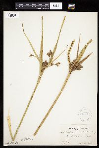 Bolboschoenus fluviatilis (Torrey) Soj 268466[1006392]Kreuholz, R. 1811929-09-03 United States, Minnesota, Big Stone, Big Stone Lake.;;N;;, 45.409244 -96.610864 |
MIN:Plants | 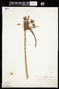 Bolboschoenus fluviatilis (Torrey) Soj 268470[1006447]Kreuholz, R. 41929-08-14 United States, Minnesota, Yellow Medicine, 4 mi. N of Lake Hendricks (W of Canby).;;N;;, 44.7038 -96.35628 |
MIN:Plants | 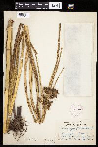 Bolboschoenus fluviatilis (Torrey) Soj 275978[1006370]Grant, Martin 33641929-09-18 United States, Minnesota, Clearwater, Itasca State Park. Mississippi River.;Itasca State Park;144N;36W;34, 47.246264 -95.222996 |
MIN:Plants | 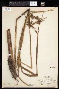 Bolboschoenus fluviatilis (Torrey) Soj 276770[1006427]Huff, N. 2371914-08-26 United States, Minnesota, Lake, Lake Isabella.;Boundary Waters Canoe Area Wilderness / Superior National Forest;N;;, 47.844631 -91.340688 |
MIN:Plants | 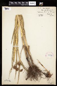 Bolboschoenus fluviatilis (Torrey) Soj 277634[1006433]Hotchkiss, N.; et al. 2781930-07-07 United States, Minnesota, Hennepin, Halsted Bay, Lake Minnetonka.;;117N;24W;, 44.934498 -93.706443 |
MIN:Plants |  Bolboschoenus fluviatilis (Torrey) Soj 306688[1006423]Oosting, H. 291021929-08-27 United States, Minnesota, Anoka, Ham Lake.;;032N;23W;, 45.254503 -93.203833 |
MIN:Plants |  Bolboschoenus fluviatilis (Torrey) Soj 336588[1006386]Smith, L.; Moyle, J. 421936-07-29 United States, Minnesota, Itasca, Itasca Co. Bowstring Lake, T147 R26;Chippewa National Forest / Leech Lake Indian Reservation;147N;26W;, 47.542434 -93.968693 |
MIN:Plants |  Bolboschoenus fluviatilis (Torrey) Soj 336596[1006387]Smith, L.; Moyle, J. 51936-07-27 United States, Minnesota, Itasca, Cut Foot Sioux Lake;Chippewa National Forest / Leech Lake Indian Reservation;147N;27W;, 47.542194 -94.09753 |
MIN:Plants |  Bolboschoenus fluviatilis (Torrey) Soj 338082[1006385]Moyle, J. 32421936-08-09 United States, Minnesota, Lac Qui Parle, Island in Lac Qui Parle.;;N;;, 45.09194 -95.97656 |
MIN:Plants | 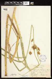 Bolboschoenus fluviatilis (Torrey) Soj 338083[1102265]Smith, L.; Moyle, J. 61936-07-27 United States, Minnesota, Itasca, Cut Foot Sioux Lake;Chippewa National Forest / Leech Lake Indian Reservation;147N;27W;, 47.542194 -94.09753 |
MIN:Plants | 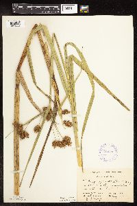 Bolboschoenus fluviatilis (Torrey) Soj 338084[1102267]Smith, L.; Moyle, J. 411936-07-29 United States, Minnesota, Itasca, Itasca Co. Bowstring Lake;Chippewa National Forest / Leech Lake Indian Reservation;147N;26W;, 47.542434 -93.968693 |
MIN:Plants | 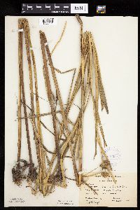 Bolboschoenus fluviatilis (Torrey) Soj 346222[1006451]Moyle, J. 29981937-08-27 United States, Minnesota, Traverse, Lake Traverse.;;N;;, 45.69025 -96.745148 |
MIN:Plants | 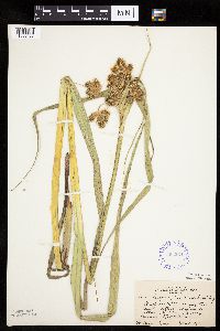 Bolboschoenus fluviatilis (Torrey) Soj 353264[1006436]Seim, A. 191937-07-03 United States, Minnesota, Ramsey, E of University [of Minn.] Farm School, between railraod tracks, St. Paul.;;029N;23W;, 44.992077 -93.166387 |
MIN:Plants |  Bolboschoenus fluviatilis (Torrey) Soj 354940[1006404]Barrows, Vera 1051939-07-16 United States, Minnesota, Saint Louis, Outlet, Lake Embarrass. Biwabik.;;N;;, 47.523489 -92.337086 |
MIN:Plants |  Bolboschoenus fluviatilis (Torrey) Soj 362749[1006389]Lakela, Olga 39641940-08-05 United States, Minnesota, Saint Louis, Shore of Vermillion Lake at Glenwood Lodge.;;N;;, 47.89977 -92.2419 |
MIN:Plants |  Bolboschoenus fluviatilis (Torrey) Soj 363790[1006444]Longley, W. s.n. United States, Minnesota, Kittson, Hallock.;;161N;49W;, 48.760418 -96.996127 |
MIN:Plants |  Bolboschoenus fluviatilis (Torrey) Soj 416698[1006430]Lakela, Olga 89291949-07-14 United States, Minnesota, Saint Louis, Shagawa River at Winton.;;063N;12W;, 47.933092 -91.861065 |
MIN:Plants | 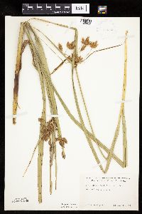 Bolboschoenus fluviatilis (Torrey) Soj 419159[1006377]Ahlgren, Clifford 4371949-07-13 United States, Minnesota, Lake, Lake Co, Sec 20 T64N R10W;Boundary Waters Canoe Area Wilderness / Superior National Forest;064N;10W;20, 48.002267 -91.639633 |
MIN:Plants | 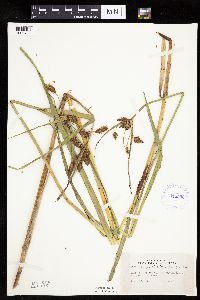 Bolboschoenus fluviatilis (Torrey) Soj 419506[1006438]Lakela, Olga 117021950-08-23 United States, Minnesota, Saint Louis, Crooked Lake at Curtain Falls.;Boundary Waters Canoe Area Wilderness / Superior National Forest;066N;12W;, 48.186787 -91.869968 |
MIN:Plants | 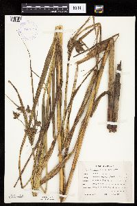 Bolboschoenus fluviatilis (Torrey) Soj 423975[1006443]Emanuel, J. 3361946-09-11 United States, Minnesota, Itasca, County: Itasca. Locality: Nashwauk Township - Crooked Lake;;057N;24W;01, 47.450034 -93.333592 |
MIN:Plants | 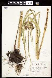 Bolboschoenus fluviatilis (Torrey) Soj 425853[1006426]Emanuel, J. 5311951-07-06 United States, Minnesota, Winona, Vic. of Bass Camp, 2 mi. S of Whitman Dam (Winona Pool).;;108N;08W;, 44.131005 -91.791254 |
MIN:Plants |  Bolboschoenus fluviatilis (Torrey) Soj 426912[1006364]Smith, Welby 211921992-07-31 United States, Minnesota, Rice, Rice Co.; on the E side of Caron lake, about 8 mi W of Faribault; T110N R22W SE1/4 of SE1/4 of Sec 28;;110N;22W;28, 44.3011093 -93.4661102 |
MIN:Plants |  Bolboschoenus fluviatilis (Torrey) Soj 433229[1006371]Myhre, K. 57451995-06-29 United States, Minnesota, Aitkin, Aitkin Co.; Located 8 miles northwest of the town of Aitkin; northeast bay of Blind Lake; T 48N R 27W SW1/4 of SW1/4 of Aitkin Co.; Located 8 miles northwest of the town of Aitkin; northeast bay of Blind Lake; T 48N R 27W SW1/4 of SW1/4 of sec 11. 048N 27W 11, 46.660343 -93.729627 |
MIN:Plants |  Bolboschoenus fluviatilis (Torrey) Soj 437173[1006405]Moore, John; Hall, Robert 164511944-06-11 United States, Minnesota, Lyon, Marsh beside hwy. 14, 3/4 mi. W of Florence.;;109N;43W;, 44.239934 -96.018264 |
MIN:Plants |  Bolboschoenus fluviatilis (Torrey) Soj 440176[1006365]Myhre, K. 39771993-06-28 United States, Minnesota, Pine, Pine Co. Located on the island in Pokegema Lake. T39N R22W NE1/4 of SE1/4 of Sec 24;;039N;22W;24, 45.853563 -93.031512 |
MIN:Plants | 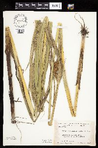 Bolboschoenus fluviatilis (Torrey) Soj 448405[1006400]Moore, John; et al. 176811945-07-10 United States, Minnesota, Martin, 5 mi. S-SE of Fairmont.;;;;, 43.618136 -94.422288 |
MIN:Plants | 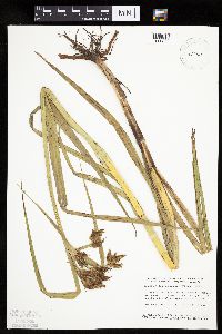 Bolboschoenus fluviatilis (Torrey) Soj 458868[1006372]Smith, Welby 154651989-06-25 United States, Minnesota, Freeborn, Freeborn Co.; Helmer Myre State Park, about 2 miles southwest of Albert Lea; NW1/4 NE1/4 sec.23, T 102N R 21W;Myre Big Island State Park;102N;21W;23, 43.622385 -93.318703 |
MIN:Plants | 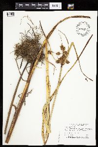 Bolboschoenus fluviatilis (Torrey) Soj 478377[1006366]Dana, R. 921561992-09-14 United States, Minnesota, Kittson, Beaches Lake Wildlife Management Area. Kittson Co.; Beaches Lake Wildlife Mgmt. Area, in the extensive 'Juneberry Ridge' fen complex; T 162N R 45W SE1/4 of NW1 Kittson Co.; Beaches Lake Wildlife Mgmt. Area, in the extensive 'Juneberry Ridge' fen complex; T 162N R 45W SE1/4 of NW1/4 of Sec 17. 162N 45W 17, 48.848025 -96.470432 |
MIN:Plants | 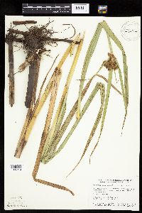 Bolboschoenus fluviatilis (Torrey) Soj 484914[1006374]Smith, Welby 155931989-07-04 United States, Minnesota, Nobles, Wachter Wildlife Management Area. Nobles County...Wachter State Wildlife Management Area, about 6 miles south of Worthington...NE1/4 NE1/4 section 26 T 101N R 40W. 101N 40W 26, 43.5280556 -95.6 |
MIN:Plants |  Bolboschoenus fluviatilis (Torrey) Soj 501562[1006452]Stevens, O. s.n.1954-09-14 United States, Minnesota, Pipestone, Pipestone National Monument.;Pipestone National Monument;106N;46W;, 43.979723 -96.367859 |
MIN:Plants |  Bolboschoenus fluviatilis (Torrey) Soj 507294[1006390]Moore, John 207501950-06-23 United States, Minnesota, Faribault, SE of Walnut Lake.;Walnut Lake Wildlife Management Area;N;;, 43.65893 -93.78376 |
MIN:Plants |  Bolboschoenus fluviatilis (Torrey) Soj 508420[1006362]Lee, Michael MDL9821995-06-08 United States, Minnesota, Wabasha, McCarthy Lake Wildlife Management Area. Wabasha Co.; along old channels of the Zumbro River in the Mississippi River floodplain 4 mi SSE of Kellogg; McCarthy La Wabasha Co.; along old channels of the Zumbro River in the Mississippi River floodplain 4 mi SSE of Kellogg; McCarthy Lake WMA. T109N R10W NWSE 12. 109N 10W 12, 44.256849 -91.968096 |
MIN:Plants |  Bolboschoenus fluviatilis (Torrey) Soj 514466[1006396]Smith, Welby 186801991-06-05 United States, Minnesota, Redwood, Redwood Co.; at the University of Minnesota Southwest Experiment Station, in the Minnesota Valley, about 1.5 NW of Lambe Redwood Co.; at the University of Minnesota Southwest Experiment Station, in the Minnesota Valley, about 1.5 NW of Lamberton; T109N R37W NE1/4 of SE1/4 of Sec 16. 109N 37W 16, 44.2444458 -95.2925034 |
MIN:Plants |  Bolboschoenus fluviatilis (Torrey) Soj 514850[1006360]Boe, J.; Almendinger, J. 930709051993-07-09 United States, Minnesota, Cass, Cass Co.; in Leech River channel through Mud Lake. T144N R26W NW1/4 of NE1/4 of Sec 27;Chippewa National Forest / Leech Lake Indian Reservation;144N;26W;27, 47.261716 -93.955861 |
MIN:Plants | 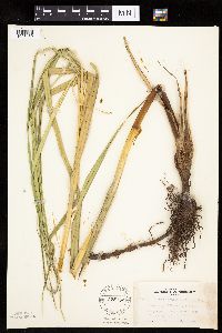 Bolboschoenus fluviatilis (Torrey) Soj 525752[1006439]Lakela, Olga 192771955-08-16 United States, Minnesota, Koochiching, Koochiching Co.; Black Bay, S side of Rainy Lake.;;070N;22W;, 48.545336 -93.155756 |
MIN:Plants | 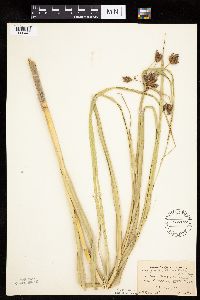 Bolboschoenus fluviatilis (Torrey) Soj 536187[1006448]Bennett, H. s.n.1947-08-00 United States, Minnesota, Clearwater, N Twin Lake - Pinehurst Resort. Itasca State Park.;Itasca State Park;143N;36W;, 47.19557 -95.233216 |
MIN:Plants | 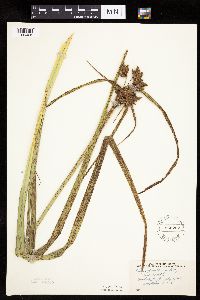 Bolboschoenus fluviatilis (Torrey) Soj 552207[1006428]Stevens, O. 19651958-07-28 United States, Minnesota, Clay, Moorhead.;;139N;48W;, 46.845648 -96.728846 |
MIN:Plants | 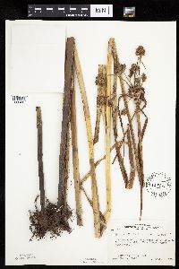 Bolboschoenus fluviatilis (Torrey) Soj 553613[1006417]Bernardini, J.; Moore, John 1251958-09-18 United States, Minnesota, Blue Earth, SW corner of section 26 of Medo Township.;;106N;25W;26, 43.956867 -93.798108 |
MIN:Plants |  Bolboschoenus fluviatilis (Torrey) Soj 554139[1006403]Moore, John 225331955-06-02 United States, Minnesota, Renville, Renville Co. Along the NE bay of Boon Lake.;;116N;31N;, 44.848495 -94.564273 |
MIN:Plants |  Bolboschoenus fluviatilis (Torrey) Soj 566406[1006418]Moore, John; Bernardini, J. 243051958-09-18 United States, Minnesota, Blue Earth, [no further data];;;;, 44.05764 -94.101199 |
MIN:Plants |  Bolboschoenus fluviatilis (Torrey) Soj 568965[1006446]Moore, John; Archer, A.; Bray, J. 251541960-07-14 United States, Minnesota, Anoka, Anoka County...Along the N shore of Fish Lake.;Cedar Creek National History Area;034N;23W;26, 45.406901 -93.173147 |
MIN:Plants |  Bolboschoenus fluviatilis (Torrey) Soj 574407[1006424]Moore, John 245771959-06-04 United States, Minnesota, Blue Earth, Along the N shore of Coon Lake.;;107N;28W;, 44.065133 -94.188647 |
MIN:Plants | 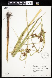 Bolboschoenus fluviatilis (Torrey) Soj 574643[1006429]Moore, John 246871959-06-28 United States, Minnesota, Kittson, Along the Joe River, 3 1/2 mi. E of Noyes.;;163N;50W;, 48.93381 -97.128306 |
MIN:Plants | 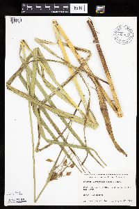 Bolboschoenus fluviatilis (Torrey) Soj 669832[1006431]Wheeler, Gerald s.n.1974-08-12 United States, Minnesota, Sherburne, Sherburne Co. 4 mi. E of St. Cloud; close to the Elk River.;;N;;, 45.55391 -94.03473 |
MIN:Plants | 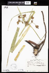 Bolboschoenus fluviatilis (Torrey) Soj 670562[1006453]Heitlinger, M. 2731971-07-11 United States, Minnesota, McLeod, Schaefer Prairie. On the E edge of a prairie pond in the SE corner of the tract.;Schaefer Prairie, The Nature Conservancy;115N;29W;34, 44.72505 -94.30491 |
MIN:Plants | 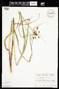 Bolboschoenus fluviatilis (Torrey) Soj 672633[1006401]Wheeler, Gerald s.n.1973-08-02 United States, Minnesota, Sherburne, Ca. 1 mi. SE of Santiago.;;035N;28W;, 45.516 -93.820644 |
MIN:Plants |  Bolboschoenus fluviatilis (Torrey) Soj 681588[1006441]Swanson, Steven 15961975-07-18 United States, Minnesota, Houston, Mississippi River (Navigation Pool #8). Houston Co. Site 35, extension of land on the SE side of Target Lake.;Upper Mississippi National Wildlife Refuge;N;;, 43.771295 -91.250286 |
MIN:Plants |  Bolboschoenus fluviatilis (Torrey) Soj 681596[1006440]Swanson, Steven 15781975-07-18 United States, Minnesota, Houston, Mississippi River (Navigation Pool #8). Houston Co. Site 33.;Upper Mississippi National Wildlife Refuge;N;;, 43.771295 -91.250286 |
MIN:Plants |  Bolboschoenus fluviatilis (Torrey) Soj 687778[1006397]Wheeler, Gerald; Glaser, Paul 22241977-07-23 United States, Minnesota, Itasca, Itasca Co. Coll. Site #133. NE1/4 SW1/4 Sec.10 T55N R26W, approx. 4.5 mi. W-NW of Grand Rapids; NE shore of Blackwater L Itasca Co. Coll. Site #133. NE1/4 SW1/4 Sec.10 T55N R26W, approx. 4.5 mi. W-NW of Grand Rapids; NE shore of Blackwater Lake.. 055N 26W 10, 47.260439 -93.629498 |
MIN:Plants |  Bolboschoenus fluviatilis (Torrey) Soj 689829[1006442]Ownbey, Gerald 57911977-08-10 United States, Minnesota, Mahnomen, Mahnomen Co.Rt. 113, 5.2 mi W of its jct. with Rt. 59 in Waubun. S side of roadway.;White Earth Indian Reservation;143N;42W;30, 47.173374 -96.053176 |
MIN:Plants | 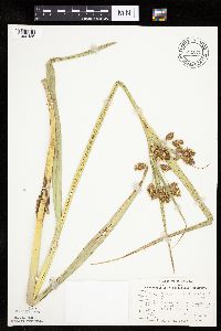 Bolboschoenus fluviatilis (Torrey) Soj 691070[1006435]Sperling, C. 3721976-06-18 United States, Minnesota, Douglas, 2 mi. W of Alexandria. S end of Lake Cowdry.;;128N;38W;, 45.889822 -95.448171 |
MIN:Plants | 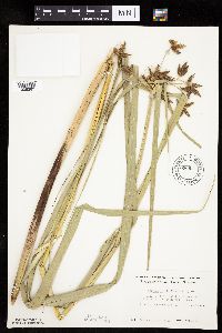 Bolboschoenus fluviatilis (Torrey) Soj 696631[1006383]Smith, Welby 8601978-07-19 United States, Minnesota, Wright, 1/2 mi. W of state aid road 6.;;121N;27W;28, 45.266091 -94.08483 |
MIN:Plants | 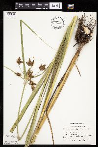 Bolboschoenus fluviatilis (Torrey) Soj 744526[1006373]Converse, C. 13891982-06-30 United States, Minnesota, Pope, Moe Woods.;Moe Woods, The Nature Conservancy;123N;36W;34, 45.41981 -95.183338 |
MIN:Plants | 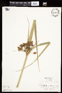 Bolboschoenus fluviatilis (Torrey) Soj 744735[1006393;1006394]Converse, C. 17151982-07-20 United States, Minnesota, Otter Tail, Otter Tail Preserve.;Ottertail Prairie Scientific Natural Area;131N;44W;17, 46.159244 -96.235363 |
MIN:Plants | 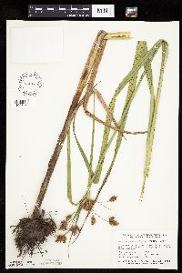 Bolboschoenus fluviatilis (Torrey) Soj 746133[1006369]Smith, Welby 47861981-07-11 United States, Minnesota, Martin, On the N side of hwy. 50, ca. 2 1/4 mi. W of its jct. with hwy. 15 in Truman.;;104N;30W;7, 43.825466 -94.48011 |
MIN:Plants | 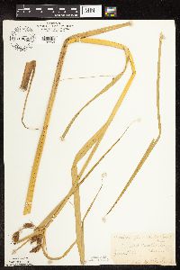 Bolboschoenus fluviatilis (Torrey) Soj 764629[1102264]Ballard, C. s.n.1892-06-00 United States, Minnesota, Nicollet, Nicollet.;;109N;28W;, 44.239687 -94.190492 |
MIN:Plants | 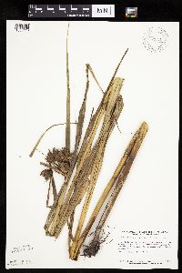 Bolboschoenus fluviatilis (Torrey) Soj 792221[1006413]Smith, Welby 108751985-07-24 United States, Minnesota, Lyon, Prairie Marshes State Wildlife Management Area, ca. 4 mi. N-NW of Russell.;Prairie Marshes Wildlife Management Area;111N;43W;36, 44.378119 -95.968102 |
MIN:Plants | 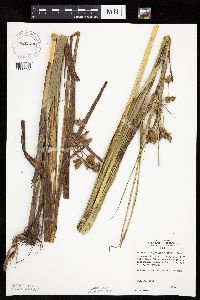 Bolboschoenus fluviatilis (Torrey) Soj 820328[1006399]Monson, Paul 64231964-08-22 United States, Minnesota, Mahnomen, White Earth Indian Reservation / White Earth State Forest. Mahnomen Co. R40W, T143N, Sec. 19 & 30. White Earth River and adjacent low floodplain at Hwy. 113, crossing 6.5 mi. E o Mahnomen Co. R40W, T143N, Sec. 19 & 30. White Earth River and adjacent low floodplain at Hwy. 113, crossing 6.5 mi. E of Waubun.. 143N 40W , 47.193691 -95.741927 |
MIN:Plants | 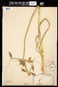 Bolboschoenus fluviatilis (Torrey) Soj 83199[1006375]Ballard, C. B14541893-06-00 United States, Minnesota, Cass, Lake Kilpatrick. Cass Co.;;135N;29W;, 46.500163 -94.32908 |
MIN:Plants | 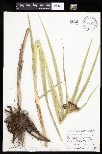 Bolboschoenus fluviatilis (Torrey) Soj 833875[1006395]Smith, Welby 141661988-05-31 United States, Minnesota, Lac Qui Parle, Quilitz Wildlife Management Area. Lac Qui Parle Co. Quilitz State Wildlife Management Area, about 5 mi E of Nassau, on the S side of State Hwy 24. NE1/4 N Lac Qui Parle Co. Quilitz State Wildlife Management Area, about 5 mi E of Nassau, on the S side of State Hwy 24. NE1/4 NW1/4 sec 6, T118N R45W. 118N 45W 6, 45.059265 -96.341101 |
MIN:Plants | 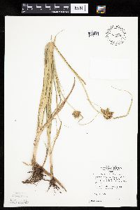 Bolboschoenus fluviatilis (Torrey) Soj 834286[1006379]Monson, Paul 50301974-08-02 United States, Minnesota, Lac Qui Parle, Lac Qui Parle Co. R-46W, T-118N, Salt Lake, wayside on E side, 6 mi SW of Marietta on MN.-S.Dak. border.;;118N;46W;, 45.022853 -96.402632 |
MIN:Plants | 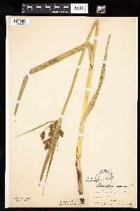 Bolboschoenus fluviatilis (Torrey) Soj 83489[1006422]Moyer, Lycurgus 6281898-06-13 United States, Minnesota, Big Stone, Ortonville.;;121N;46W;, 45.284263 -96.412452 |
MIN:Plants |  Bolboschoenus fluviatilis (Torrey) Soj 83490[1006391]Taylor, B. s.n.1892-07-00 United States, Minnesota, Chisago, Center City.;;034N;20W;, 45.42608 -92.83619 |
MIN:Plants |  Bolboschoenus fluviatilis (Torrey) Soj 83491[1006376]Rosendahl, C.; Butters, F. 32681916-06-14 United States, Minnesota, Waseca, Near Waseca.;;N;;, 44.077741 -93.507443 |
MIN:Plants |  Bolboschoenus fluviatilis (Torrey) Soj 83492[1006425]Skinner, S. 491902-06-09 United States, Minnesota, Jackson, Heron Lake.;;N;;, 43.771287 -95.272522 |
MIN:Plants |  Bolboschoenus fluviatilis (Torrey) Soj 83493[1006445]Arthur, J.; et al. B211886-07-18 United States, Minnesota, Saint Louis, Vermilion Lake;;;;, 47.879148 -92.351718 |
MIN:Plants |  Bolboschoenus fluviatilis (Torrey) Soj 83494[1006432]Cheney, L. s.n.1891-07-23 United States, Minnesota, Cook, On an island in Lake Seiganagah. [sic];Boundary Waters Canoe Area Wilderness / Superior National Forest;066N;05W;, 48.18482 -90.958487 |
MIN:Plants |  Bolboschoenus fluviatilis (Torrey) Soj 83495[1006415]Sheldon, Edmund S2491891-06-00 United States, Minnesota, Le Sueur, Lake Washington. Le Sueur Co.;;109N;25W;, 44.239469 -93.828345 |
MIN:Plants |  Bolboschoenus fluviatilis (Torrey) Soj 83496[1006449]Ballard, C. B451900-06-10 United States, Minnesota, Carver, Chaska.;;116N;23W;34, 44.812043 -93.571507 |
MIN:Plants |  Bolboschoenus fluviatilis (Torrey) Soj 83497[1006437]Sheldon, Edmund S9821891-07-00 United States, Minnesota, Brown, Cross Lake.;;N;;, 44.362336 -94.695036 |
MIN:Plants |  Bolboschoenus fluviatilis (Torrey) Soj 83498[1006402]Ballard, C. B9291892-06-00 United States, Minnesota, Nicollet, Nicollet.;;109N;28W;, 44.239687 -94.190492 |
MIN:Plants |  Bolboschoenus fluviatilis (Torrey) Soj 83502[1006406]Sheldon, Edmund S58101893-07-00 United States, Minnesota, Dakota, Lakeville Lake.;;N;;, 44.649687 -93.24272 |
MIN:Plants |  Bolboschoenus fluviatilis (Torrey) Soj 83503[1102263]Anonymous s.n. United States, Minnesota, Hennepin, Minneapolis.;;029N;24W;25, 44.969959 -93.237021 |
MIN:Plants |  Bolboschoenus fluviatilis (Torrey) Soj 83504[1102268]Frost, W. F1701892-06-00 United States, Minnesota, Meeker, Meeker Co.;;;;, 45.12 -94.53 |
MIN:Plants |  Bolboschoenus fluviatilis (Torrey) Soj 83590[1006416]Campbell, Jennie C-731896-07-00 United States, Minnesota, Stearns, Grand Lake. Stearns Co.;;123N;29W;, 45.45742 -94.322478 |
MIN:Plants |  Bolboschoenus fluviatilis (Torrey) Soj 83591[1006450]Taylor, B. T13821892-07-00 United States, Minnesota, Chisago, Center City.;;034N;20W;, 45.42608 -92.83619 |
MIN:Plants |  Bolboschoenus fluviatilis (Torrey) Soj 83595[1102266]Sandberg, John s.n.1891-07-00 United States, Minnesota, Saint Louis, Lake Vermillion.;;N;;, 47.862026 -92.331033 |
Google Map
Google Maps is a web mapping service provided by Google that features a map that users can pan (by dragging the mouse) and zoom (by using the mouse wheel). Collection points are displayed as colored markers that when clicked on, displays the full information for that collection. When multiple species are queried (separated by semi-colons), different colored markers denote each individual species.