University of Minnesota
http://www.umn.edu/
612-625-5000
http://www.umn.edu/
612-625-5000
Minnesota Biodiversity Atlas
Bell Museum
Dataset: MIN-Plants
Taxa: Triadenum
Search Criteria: excluding cultivated/captive occurrences
Bell Museum plants | |
 MIN:Plants | Triadenum fraseri (Spach) Gleason 426956[]Whitfeld, T.J.S. 2892001-07-17 United States, Minnesota, Kandiyohi, Kandiyohi County ... 1 1.2 miles northeast of New London; south of State Hwy. 9 where it runs along the south shore of Mud Lake ... T121N R34W NE1/4 of SW1/4 of NE1/4 of Section 4. 121N 34W 4, 45.318524 -94.958222 |
MIN:Plants | Triadenum fraseri (Spach) Gleason 909861[]Smith, Welby 245121994-06-29 United States, Minnesota, Polk, Polk County...Rydell National Wildlife Refuge, about 3 miles southeast of Mentor...T 148N R 43W NW1/4 of SE1/4 of Sec 2;Rydell National Wildlife Refuge;148N;43W;02, 47.6625 -96.0977778 |
MIN:Plants | Triadenum fraseri (Spach) Gleason 438995[]Smith, Welby 257341995-07-09 United States, Minnesota, Isanti, Isanti County ... At Mud Lake, In Crooked Road State Wildlife Management Area ... T35N R25W NW1/4 of NE1/4 of Sec 33;Crooked Road Wildlife Management Area;035N;25W;33, 45.485 -93.4575 |
MIN:Plants | Triadenum fraseri (Spach) Gleason 910960[]Smith, Welby 246221994-07-11 United States, Minnesota, Koochiching, Koochiching County...About 3 miles E of Northome. Along margin of Tuefer Lake...T 151N R 28W SW1/4 of NE1/4 of Sec 27;;151N;28W;27, 47.8694444 -94.2183333 |
MIN:Plants | Triadenum fraseri (Spach) Gleason 430209[]Lee, Michael MDL19221997-08-20 United States, Minnesota, Stearns, Birch Lakes State Forest. Stearns Co.; Birch Lakes State Forest 4 miles south-southwest of Grey Eagle; T127N R33W SE1/4 of SE1/4 of NW1/4 Sec. 36, NW1/4 of SW1/4 of NE1/4 Sec. 36. 127N 33W 36, 45.766949 -94.777658 |
MIN:Plants | Triadenum fraseri (Spach) Gleason 903828[]Lee, Michael MDL41112005-08-24 United States, Minnesota, Becker, Two Inlets State Forest / White Earth Indian Reservation. Becker County...moraine on the east side of Juggler Lake 5.5 miles east-southeast of Elbow Lake Village...T142N R38W S1/2 of SE1/4 of SE1/4 Sec. 11. 142N 38W 11, 47.111973 -95.451519 |
MIN:Plants | Triadenum fraseri (Spach) Gleason 908506[]Lee, Michael MDL41412005-08-31 United States, Minnesota, Otter Tail, Sonnenberg Wildlife Management Area. Ottertail County...Sonnenberg State Wildlife Management Area...1.5 miles north-northeast of Vergas...T137N R40W NW1/4 of SW1/4 Sec. 18. 137N 40W 18, 46.679884 -95.784111 |
MIN:Plants | Triadenum fraseri (Spach) Gleason 432300[]Lee, Michael; et al. MDL28992000-08-13 United States, Minnesota, Todd, Todd County...five miles north-northeast of Clarissa...T131N R34W NW1/4 of NE1/4 Sec. 1;;131N;34W;01, 46.186817 -94.905948 |
MIN:Plants | Triadenum fraseri (Spach) Gleason 896865[]Haferman, J. 3001996-09-22 United States, Minnesota, Scott, Approximately 0.25 miles east of State Highway 13 and 0.5 miles south of County Road 42. Site lies directly under transmission lines. SW of NW of section;;115N;21W;20, 44.75103 -93.376037 |
MIN:Plants | Triadenum fraseri (Spach) Gleason 915081[]Smith, Welby; et al. 314092009-08-28 United States, Minnesota, Cook, Boundary Waters Canoe Area Wilderness / Superior National Forest. Cook County...Boundary Waters Canoe Area Wilderness, Superior National Forest...unnamed lake/pond between Wanihigan and Mulligan Lakes...T 63N R 3W NW1/4 of SE1/4 of Sec 1. 063N 03W 1, 47.9655556 -90.6427778 |
MIN:Plants | Triadenum fraseri (Spach) Gleason 155068[]Rosendahl, C. s.n.1919-07-11 United States, Minnesota, Anoka, [no further data];;N;;, 45.198637 -93.238648 |
MIN:Plants | Triadenum fraseri (Spach) Gleason 155069[]Rosendahl, C.; et al. s.n.1917-09-00 United States, Minnesota, Anoka, Moore Lake;;030N;24W;, 45.07639 -93.2475 |
MIN:Plants | Triadenum fraseri (Spach) Gleason 155070[]Rosendahl, C.; Butters, F. 33711916-08-11 United States, Minnesota, Anoka, Near Ham Lake;;032N;23W;, 45.257018 -93.222366 |
MIN:Plants | Triadenum fraseri (Spach) Gleason 155071[]Taylor, B. T15511892-08-00 United States, Minnesota, Chisago, Center City;;N;;, 45.389814 -92.821151 |
MIN:Plants | Triadenum fraseri (Spach) Gleason 155072[]Ballard, C. B9021891-08-00 United States, Minnesota, Hennepin, St. Bonifacius, Carver Co. [actually in Hennepin Co.];;117N;24W;, 44.907881 -93.746736 |
MIN:Plants | Triadenum fraseri (Spach) Gleason 155073[]Ballard, C. B8171891-08-00 United States, Minnesota, Carver, Page Lake, Carver Co.;;N;;, 44.820759 -93.802586 |
MIN:Plants | Triadenum fraseri (Spach) Gleason 155074[]Sandberg, John 7851891-08-12 United States, Minnesota, Hennepin, Sandy Lake [prob. the one in Hennepin Co.];<No data>;;;, 45.01667 -93.45 |
MIN:Plants | Triadenum fraseri (Spach) Gleason 155075[]Arthur, J.; et al. B551886-07-19 United States, Minnesota, Saint Louis, Vermilion Lake;;;;, 47.89167 -92.36667 |
MIN:Plants | Triadenum fraseri (Spach) Gleason 155076[]Roberts, Thomas s.n.1879-09-02 United States, Minnesota, Saint Louis, Duluth;;N;;, 46.7833 -92.1 |
MIN:Plants | Triadenum fraseri (Spach) Gleason 155077[]Sheldon, Edmund S31011892-07-00 United States, Minnesota, Mille Lacs, Princeton;;036N;26W;, 45.569965 -93.581628 |
MIN:Plants | Triadenum fraseri (Spach) Gleason 155078[]Ballard, C. B8551891-08-00 United States, Minnesota, Carver, Page Lake, Carver Co.;;N;;, 44.820759 -93.802586 |
MIN:Plants | Triadenum fraseri (Spach) Gleason 155079[]Sheldon, Edmund S39401892-08-00 United States, Minnesota, Otter Tail, Anna Battle Lake;;;;, 46.280516 -95.713658 |
MIN:Plants | Triadenum fraseri (Spach) Gleason 155080[]Sheldon, Edmund S3271891-06-00 United States, Minnesota, Blue Earth, Smith's Mill;;N;;, 44.138266 -93.766707 |
MIN:Plants | Triadenum fraseri (Spach) Gleason 155081[]Sandberg, John s.n.1890-08-00 United States, Minnesota, Isanti, [no further data];;;;, 45.566613 -93.289917 |
MIN:Plants | Triadenum fraseri (Spach) Gleason 155082[]Sandberg, John s.n.1891-08-00 United States, Minnesota, Hennepin, Sandy Lake [prob. the one in Hennepin Co.];<No data>;;;, 45.01667 -93.45 |
MIN:Plants | Triadenum fraseri (Spach) Gleason 155083[]Sandberg, John s.n.1890-08-00 United States, Minnesota, Isanti, [no further data];;;;, 45.566613 -93.289917 |
MIN:Plants | Triadenum fraseri (Spach) Gleason 155084[]Anderson, A. An9131894-07-00 United States, Minnesota, Chisago, Lindstrom;;;;, 45.378075 -92.847305 |
MIN:Plants | Triadenum fraseri (Spach) Gleason 155085[]Holzinger, John s.n.1886-06-00 United States, Minnesota, Winona, Lake W[inona]. Winona Co.;;107N;07W;, 44.0525878 -91.6726869 |
MIN:Plants | Triadenum fraseri (Spach) Gleason 155086[]Campbell, Jennie s.n.1897-08-00 United States, Minnesota, Lundquist [Lundquist Lake?];;; 44.699184 -93.654741, 44.699184 -93.654741 |
MIN:Plants | Triadenum fraseri (Spach) Gleason 155087[]Sandberg, John s.n.1886-07-00 United States, Minnesota, Chisago, [no further data];;;;, 45.506011 -92.825745 |
MIN:Plants | Triadenum fraseri (Spach) Gleason 155088[]Campbell, Jennie s.n.1895-07-00 United States, Minnesota, Stearns, Pleasant Lake, Stearns Co.;;124N;28W;, 45.494687 -94.285826 |
MIN:Plants | Triadenum fraseri (Spach) Gleason 155089[]Ballard, C. B16501893-07-00 United States, Minnesota, Cass, Lake Kilpatrick;;135N;29W;, 46.495108 -94.365032 |
MIN:Plants | Triadenum fraseri (Spach) Gleason 155090[]MacMillan, C.; et al. 165Sk1900-08-00 United States, Minnesota, Polk, Crookston;;150N;46W;30, 47.77414 -96.60812 |
MIN:Plants | Triadenum fraseri (Spach) Gleason 232413[]Stork, H. 12321925-06-00 United States, Minnesota, Itasca, Bowstring;Chippewa National Forest;;;, 47.54306 -93.79639 |
MIN:Plants | Triadenum fraseri (Spach) Gleason 262380[]Rosendahl, C.; Butters, F. 53261927-07-30 United States, Minnesota, Anoka, S of Ham Lake;;032N;23W;, 45.257018 -93.222366 |
MIN:Plants | Triadenum fraseri (Spach) Gleason 262381[]Rosendahl, C.; Butters, F. 53261927-07-30 United States, Minnesota, Anoka, S of Ham Lake;;032N;23W;, 45.257018 -93.222366 |
MIN:Plants | Triadenum fraseri (Spach) Gleason 262386[]Rosendahl, C.; Butters, F. 41151921-08-29 United States, Minnesota, Anoka, ca 1 mi NE of Coon Lake;;033N;22W;, 45.30553 -93.166567 |
MIN:Plants | Triadenum fraseri (Spach) Gleason 262414[]Stork, H. 12311925-00-00 United States, Minnesota, Itasca, Bowstring;Chippewa National Forest;;;, 47.54306 -93.79639 |
MIN:Plants | Triadenum fraseri (Spach) Gleason 264061[]White, Sidney s.n.1887-07-00 United States, Minnesota, Winona, Winona Co.;;N;;, 43.98685 -91.779129 |
MIN:Plants | Triadenum fraseri (Spach) Gleason 264103[]Holzinger, John s.n.1901-08-00 United States, Minnesota, Winona, Winona Co.;;N;;, 43.98685 -91.779129 |
MIN:Plants | Triadenum fraseri (Spach) Gleason 267072[]Stevenson, J. 3201912-08-15 United States, Minnesota, Itasca, Grand Rapids;;055N;25W;, 47.2349 -93.564359 |
MIN:Plants | Triadenum fraseri (Spach) Gleason 267073[]Stevenson, J. 3201912-08-05 United States, Minnesota, Itasca, Grand Rapids;;055N;25W;, 47.2349 -93.564359 |
MIN:Plants | Triadenum fraseri (Spach) Gleason 276055[]Grant, Martin 32251929-09-04 United States, Minnesota, Clearwater, Itasca Park, Bohall Lake, SE-SW-9, T143, R36;Itasca State Park;143N;36W;9, 47.21679 -95.24474 |
MIN:Plants | Triadenum fraseri (Spach) Gleason 276863[]Huff, N. 2121914-08-12 United States, Minnesota, Lake, Rice Lake;;N;;, 47.8167 -91.35 |
MIN:Plants | Triadenum fraseri (Spach) Gleason 282228[]Butters, F.; et al. 63561930-08-29 United States, Minnesota, Cook, pond near Hungry Jack Lake. Cook Co.;Superior National Forest;064N;01W;, 48.054938 -90.437086 |
MIN:Plants | Triadenum fraseri (Spach) Gleason 298390[]Moyle, J.; et al. 18461934-08-18 United States, Minnesota, Itasca, S end of Sunken Lake, Itasca Co.;Chippewa National Forest;;;, 47.5333 -94.0833 |
MIN:Plants | Triadenum fraseri (Spach) Gleason 336492[]Reif, Charles A101936-07-23 United States, Minnesota, Cook, Temperance River;North Shore / Temperance River State Park;059N;04W;, 47.557593 -90.875149 |
MIN:Plants | 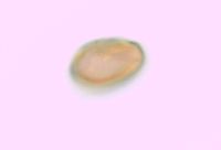 Triadenum fraseri (Spach) Gleason 337044[]Lakela, Olga 16861936-08-12 United States, Minnesota, Saint Louis, Bayside, Duluth; Sec. 19 [other collections indicates this is in T49N R13W, Minnesota Point];Minnesota Point;049N;13W;19, 46.72833 -92.04778 |
MIN:Plants | Triadenum fraseri (Spach) Gleason 345492[]Lakela, Olga 21641937-08-07 United States, Minnesota, Saint Louis, Shore of lake ca. 2 mi S of Biwabik, on the road to Palo;;N;;, 47.415205 -92.259625 |
MIN:Plants | Triadenum fraseri (Spach) Gleason 346696[]Morse, Marius 11937-00-00 United States, Minnesota, Saint Louis, Big Comstock Lake;Cloquet Valley State Forest;N;;, 47.220232 -92.223436 |
MIN:Plants | Triadenum fraseri (Spach) Gleason 347664[]Morse, Marius 31937-00-00 United States, Minnesota, Saint Louis, Little Pequaywan Lake;Cloquet Valley State Forest;N;;, 47.1833 -92.05 |
MIN:Plants | Triadenum fraseri (Spach) Gleason 354644[]Lakela, Olga 26161938-07-29 United States, Minnesota, Saint Louis, Hwy No. 4, at the Johnson Farm, Palo;;057N;15W;, 47.415205 -92.259625 |
MIN:Plants | Triadenum fraseri (Spach) Gleason 356040[]Rosendahl, C.; Butters, F. 68931937-08-27 United States, Minnesota, Saint Louis, Ravine some 10 mi SE of Ely;Superior National Forest;N;;, 47.789258 -91.83321 |
MIN:Plants | Triadenum fraseri (Spach) Gleason 356244[]Rosendahl, C.; Dahlberg, R. s.n.1918-08-00 United States, Minnesota, Marshall, Golden Valley Peat Farm;;N;;, 48.324005 -95.916368 |
MIN:Plants | Triadenum fraseri (Spach) Gleason 356708[]Lakela, Olga 3369a1939-09-24 United States, Minnesota, Saint Louis, Shore of Nymphaea pond, hwy 53, ca. 19 mi N of Duluth;;N;;, 47.058331 -92.106579 |
MIN:Plants | Triadenum fraseri (Spach) Gleason 361428[]Lakela, Olga 40951940-08-18 United States, Minnesota, Carlton, Shore of Moosehead Lake;;N;;, 46.447795 -92.757636 |
MIN:Plants | Triadenum fraseri (Spach) Gleason 362270[]Lakela, Olga 38351940-08-01 United States, Minnesota, Saint Louis, Shore of Sand Lake, hwy 53;Superior National Forest;N;;, 48.483546 -92.838098 |
MIN:Plants | Triadenum fraseri (Spach) Gleason 365028[]Buell, Murray 20051940-08-16 United States, Minnesota, Clearwater, Bohall Lake, Itasca Park;Itasca State Park;143N;36W;, 47.197458 -95.201964 |
MIN:Plants | Triadenum fraseri (Spach) Gleason 367070[]Moore, John; Moore, Marjorie 103571938-08-28 United States, Minnesota, Saint Louis, N shore of Auto Lake;Superior National Forest;N;;, 47.739511 -92.362392 |
MIN:Plants | Triadenum fraseri (Spach) Gleason 368857[]Lakela, Olga 46011941-07-28 United States, Minnesota, Saint Louis, Ravine on Meadowlands road W of hwy 53;;N;;, 47.071884 -92.732416 |
MIN:Plants | Triadenum fraseri (Spach) Gleason 369187[]Jackson, Margaret 5171939-08-29 United States, Minnesota, Pine, Pine Co. Coffee Lake, near Moose Lake on Hwy 61;;045N;19W;, 46.414806 -92.701373 |
MIN:Plants | Triadenum fraseri (Spach) Gleason 369776[]Lakela, Olga 48301941-08-18 United States, Minnesota, Saint Louis, Shore of lake S of Ely on Embarrass road;;N;;, 47.658154 -92.179123 |
MIN:Plants | Triadenum fraseri (Spach) Gleason 385975[]Lakela, Olga 58001944-08-03 United States, Minnesota, Saint Louis, Small lake N of Sturgeon Lake Observation Tower, St. Louis Co.;Sturgeon River State Forest;T060N R21W S16, 47.683391 -93.008095 |
MIN:Plants | Triadenum fraseri (Spach) Gleason 393315[]Lakela, Olga 70551947-07-29 United States, Minnesota, Saint Louis, Lake shore near Skibo;;057N;15W;, 47.4833 -91.9833 |
MIN:Plants | Triadenum fraseri (Spach) Gleason 395232[]Butters, F.; Abbe, E. 9701944-08-09 United States, Minnesota, Cook, Foot of Mt. Josephine, Grand Portage; T63N R8E Cook Co. [actually R6E];Grand Portage Indian Reservation / North Shore;T063N R06E S03, 47.963776 -89.684812 |
MIN:Plants | Triadenum fraseri (Spach) Gleason 407072[]Lakela, Olga 92901949-08-07 United States, Minnesota, Saint Louis, Camp du Nord, Echo Trail N of Ely;Superior National Forest;N;;, 47.9 -91.8667 |
MIN:Plants | Triadenum fraseri (Spach) Gleason 407165[]Lakela, Olga 97601949-09-12 United States, Minnesota, Saint Louis, Fenske Lake, Echo Trail, N of Ely;Superior National Forest;;;, 47.9833 -91.9 |
MIN:Plants | Triadenum fraseri (Spach) Gleason 418895[]Ahlgren, Clifford 4401949-07-13 United States, Minnesota, Lake, Sec. 20 T64N R10W. Lake Co.;Boundary Waters Canoe Area Wilderness / Superior National Forest;064N;10W;20, 48.002267 -91.639632 |
MIN:Plants | Triadenum fraseri (Spach) Gleason 419321[]Briggs, John De Q.; Briggs, Marjorie 721945-08-04 United States, Minnesota, Cook, Small pond, S of portage between Alton Lake and Sawbill Lake; T62N R4W;Boundary Waters Canoe Area Wilderness / Superior National Forest;062N;04W;, 47.88583 -90.87778 |
MIN:Plants | Triadenum fraseri (Spach) Gleason 426889[]Myhre, K. 62581995-09-07 United States, Minnesota, Aitkin, Savanna Portage State Park. Aitkin Co. Located in Savana [sic] Portage State Park, 1 mi NW of park headquarters. Plants occur along the shores of Lo Aitkin Co. Located in Savana [sic] Portage State Park, 1 mi NW of park headquarters. Plants occur along the shores of Loon Lake; T50N R23W SE1/4 of SE1/4 of Sec 12. 050N 23W 12, 46.827111 -93.19323 |
MIN:Plants | Triadenum fraseri (Spach) Gleason 427689[]Jones, George Neville 181491946-07-15 United States, Minnesota, Saint Louis, Armstrong Lake, near Ely;;062N;14W;, 47.850158 -92.075839 |
MIN:Plants | Triadenum fraseri (Spach) Gleason 427812[]Jones, George Neville 185861946-08-01 United States, Minnesota, Saint Louis, Armstrong Lake, near Ely;;N;;, 47.850158 -92.075839 |
MIN:Plants | Triadenum fraseri (Spach) Gleason 432751[]Smith, Welby 148521988-08-12 United States, Minnesota, Washington, Belwin Outdoor Education Laboratory. Washington Co. Belwin Outdoor Education Laboratory, about 1/2 mi W of St. Mary's Point. Bog (Trails End Marsh); NE1/4 NE1/4 sec.15, T28N R20W. 028N 20W 15, 44.9213889 -92.7833333 |
MIN:Plants | Triadenum fraseri (Spach) Gleason 439654[]Smith, Welby 163091989-08-30 United States, Minnesota, Kanabec, Lake Five Wildlife Management Area. Kanabek [sic] County ... Lake Five State Wildlife Management Area, on the S side of Bland Lake (Lake Five), about 17 mi N-NE of Mora ... NE1/4 NE1/4 sec.8, T42N R22W. 042N 22W 8, 46.1433334 -93.1388855 |
MIN:Plants | Triadenum fraseri (Spach) Gleason 442696[]Lakela, Olga 137101951-09-03 United States, Minnesota, Saint Louis, Esquagama Lake, Hwy No. 4, 6 mi S of Biwabik;;N;;, 47.467001 -92.356147 |
MIN:Plants | Triadenum fraseri (Spach) Gleason 443103[]Lakela, Olga 138461951-09-14 United States, Minnesota, Saint Louis, Shore of Crane Lake at the Congdon Resort;Kabetogama State Forest;067N;17W;, 48.2833 -92.4667 |
MIN:Plants | Triadenum fraseri (Spach) Gleason 443144[]Lakela, Olga 132521951-07-15 United States, Minnesota, Saint Louis, Shore of Rainy Lake at Kettle Falls;Voyageurs National Park;070N;18W;, 48.49944 -92.63889 |
MIN:Plants | Triadenum fraseri (Spach) Gleason 444845[]Moore, John; et al. 187651946-07-25 United States, Minnesota, Anoka, Anoka County...Ham Lake Meadow, 1/2 mi E of hwy 65;;032N;23W;00, 45.257018 -93.222366 |
MIN:Plants | Triadenum fraseri (Spach) Gleason 447119[]Smith, Welby 191281991-07-08 United States, Minnesota, Koochiching, Koochiching County...About 6 miles south of Birchdale...T 159N r 27W NE1/4 of SE1/4 of sec 3;;159N;27W;34, 48.5475006 -94.082222 |
MIN:Plants | Triadenum fraseri (Spach) Gleason 458750[]Smith, Welby 146141988-07-25 United States, Minnesota, Pine, Pine Co.; on the west side of Pickerel Lake, about 5 miles S-SW of Holyoke. SE1/4 SW1/4 sec.1, T 45N R 17W;Nemadji State Forest;045N;17W;1, 46.410417 -92.435581 |
MIN:Plants | Triadenum fraseri (Spach) Gleason 460303[]Smith, Welby 196491991-07-17 United States, Minnesota, Itasca, Scenic State Park. Itasca Co.; Scenic State Park, about 4.5 miles southeast of Bigfork; west side of Coon Lake; Itasca Co.; Scenic State Park, about 4.5 miles southeast of Bigfork; west side of Coon Lake; T 60N R 25W SE1/4 of NW1/4 of sec 6. 060N 25W 6, 47.7166672 -93.5716629 |
MIN:Plants | Triadenum fraseri (Spach) Gleason 462551[]Lakela, Olga 144681952-08-16 United States, Minnesota, Saint Louis, Vermilion Lake at West Bay;;N;;, 47.891581 -92.366824 |
MIN:Plants | Triadenum fraseri (Spach) Gleason 463235[]Lakela, Olga 156151952-08-23 United States, Minnesota, Saint Louis, Bear Trap River, above the gorge inlet to Iron Lake, Canadian border;Boundary Waters Canoe Area Wilderness / Superior National Forest;066N;13W;13, 48.219513 -91.957793 |
MIN:Plants | Triadenum fraseri (Spach) Gleason 466793[]Smith, Michael 4161997-07-30 United States, Minnesota, Koochiching, Voyageurs National Park. Koochiching Co.; Rat Root Peatland, UTM 5370543N 485114E;Voyageurs National Park;;;, 48.549811 -93.21757 |
MIN:Plants | Triadenum fraseri (Spach) Gleason 486704[]Sheldon, Edmund s.n.1894-07-00 United States, Minnesota, Chisago, Lindstrom;;N;;, 45.378075 -92.847305 |
MIN:Plants | Triadenum fraseri (Spach) Gleason 491712[]Lakela, Olga 169401953-09-02 United States, Minnesota, Saint Louis, Beach of Trout Lake N of Vermilion Lake;Boundary Waters Canoe Area Wilderness / Superior National Forest;N;;, 47.891581 -92.366824 |
MIN:Plants | Triadenum fraseri (Spach) Gleason 491867[]Lakela, Olga 167881953-08-10 United States, Minnesota, Saint Louis, St. Louis County...Loon Lake at Beatty portage from Lac La Croix;Boundary Waters Canoe Area Wilderness / Superior National Forest;067N;15W;20, 48.3333 -92.1167 |
MIN:Plants | Triadenum fraseri (Spach) Gleason 491914[]Lakela, Olga 166511953-08-07 United States, Minnesota, Saint Louis, Lac La Croix at Lac La Croix Lodge;Boundary Waters Canoe Area Wilderness / Superior National Forest;N;;, 48.3333 -92.1167 |
MIN:Plants | Triadenum fraseri (Spach) Gleason 505265[]Smith, Welby 194241991-07-10 United States, Minnesota, Koochiching, Koochiching State Forest. Koochiching County...On the north side of Moose Lake, about 6 miles east of Little Fork... T 68N R 24W SE1/4 of SE1/4 of Sec 9. 068N 24W 9, 48.3922234 -93.4236145 |
MIN:Plants | Triadenum fraseri (Spach) Gleason 515648[]Smith, Welby 179521990-08-09 United States, Minnesota, Roseau, Roseau River Wildlife Management Area. Roseau Co.; Roseau River State Wildlife Management Area, about 6.5 miles west of the town of Pine Creek; Roseau Co.; Roseau River State Wildlife Management Area, about 6.5 miles west of the town of Pine Creek; T 163N R 42W NW1/4 of NE1/4 of SEc 4. 163N 42W 4, 48.9666672 -96.0827789 |
MIN:Plants | Triadenum fraseri (Spach) Gleason 519416[]U.S. Fish & Wildlife personnel s.n.1997-07-28 United States, Minnesota, Sherburne, Sherburne National Wildlife Refuge; NWNE 3-34-27, GLYSA1 09;Sherburne National Wildlife Refuge;T034N R27W S03, 45.465423 -93.684687 |
MIN:Plants | Triadenum fraseri (Spach) Gleason 520273[]Smith, Welby 211621992-07-31 United States, Minnesota, Le Sueur, Le Sueur Co.; at the S end of Fish Lake, about 2 miles N of Elysian; T109N R24W SE1/4 of SE1/4 of Sec 23;;109N;24W;23, 44.2272224 -93.6699982 |
MIN:Plants | Triadenum fraseri (Spach) Gleason 525767[]Lakela, Olga 189591955-07-22 United States, Minnesota, Saint Louis, Shore of Vermilion River at Gold Mine Camp, S of Crane Lake;Superior National Forest;N;;, 48.2833 -92.4667 |
MIN:Plants | Triadenum fraseri (Spach) Gleason 526915[]Lakela, Olga 181981954-08-14 United States, Minnesota, Lake, Shore of Chippewa Lake;;N;;, 48.156545 -91.788226 |
MIN:Plants | Triadenum fraseri (Spach) Gleason 527481[]Lakela, Olga 179831954-07-24 United States, Minnesota, Saint Louis, Moose [=Moosecamp] Lake at portage from Gun Lake, Superior Nat'l Forest N of Ely;Boundary Waters Canoe Area Wilderness / Superior National Forest;065N;12W;13, 47.530193 -92.092108 |
MIN:Plants | Triadenum fraseri (Spach) Gleason 529123[]Lakela, Olga 194991955-09-12 United States, Minnesota, Saint Louis, Border of Sand Lake N of Virginia;Superior National Forest;N;;, 48.483546 -92.838098 |
MIN:Plants | Triadenum fraseri (Spach) Gleason 533085[]Lakela, Olga; et al. 206921956-08-07 United States, Minnesota, Saint Louis, St. Louis County...In the narrows of Bullet Lake, Superior National Forest, N of Ely;Boundary Waters Canoe Area Wilderness / Superior National Forest;065N;12W;12, 48.1167 -91.8 |
MIN:Plants | Triadenum fraseri (Spach) Gleason 542249[]Stevens, O. s.n.1921-08-13 United States, Minnesota, Becker, Frazee, Becker Co.;;138N;40W;, 46.7536 -95.738213 |
MIN:Plants | Triadenum fraseri (Spach) Gleason 543616[]Lakela, Olga 221061957-08-19 United States, Minnesota, Lake, Stony River, Hwy #1;Superior National Forest;N;;, 47.483363 -91.550019 |
MIN:Plants | Triadenum fraseri (Spach) Gleason 568982[]Moore, John 253241960-10-06 United States, Minnesota, Rice, Rice Co. 1/2 mi S of Shields Lake;;110N;22W;, 44.362804 -93.441437 |
Google Map
Google Maps is a web mapping service provided by Google that features a map that users can pan (by dragging the mouse) and zoom (by using the mouse wheel). Collection points are displayed as colored markers that when clicked on, displays the full information for that collection. When multiple species are queried (separated by semi-colons), different colored markers denote each individual species.