University of Minnesota
http://www.umn.edu/
612-625-5000
http://www.umn.edu/
612-625-5000
Minnesota Biodiversity Atlas
Bell Museum
Dataset: MIN-Plants
Taxa: Equisetaceae
Search Criteria: excluding cultivated/captive occurrences
Bell Museum plants | |
 MIN:Plants |  Equisetum variegatum Schleich. ex F. Weber & D. Mohr 800891[1336812]Garton, C.E. 1983-08-11 Canada, Ontario, Thunder Bay District, Nordic Lake. 4 km N of Highway 11, Irwin Twp. |
MIN:Plants |  Equisetum variegatum Schleich. ex F. Weber & D. Mohr 805579[1336813]Garton, C.E. 1987-07-07 Canada, Ontario, Thunder Bay District. Thunder Bay City on Current River |
MIN:Plants |  Equisetum variegatum Schleich. ex F. Weber & D. Mohr 54986[1336821]Eggleston, Willard W. 1893-07-03 United States, Vermont, banks of White River, Royalton |
MIN:Plants |  Equisetum variegatum Schleich. ex F. Weber & D. Mohr 566144[1336822]Tryon, Jr., R.M. 1945-09-04 Canada, Manitoba, Junction of Limestone River and Nelson River |
MIN:Plants |  Equisetum variegatum Schleich. ex F. Weber & D. Mohr 566120[1336823]Tryon, Jr., R.M. 1945-09-04 Canada, Manitoba, Junction of the Limestone River and Nelson River |
MIN:Plants |  Equisetum variegatum Schleich. ex F. Weber & D. Mohr 81460[1336824]Schofield, W.B. 1950-06-01 Canada, Manitoba, Churchill District, 0.5 miles E of Kettle Rapids |
MIN:Plants |  Equisetum variegatum Schleich. ex F. Weber & D. Mohr 54967[1336825]Collins, J.F. 1904-08-23 Canada, Quebec, Gaspe, St. John RIver |
MIN:Plants |  Equisetum variegatum Schleich. ex F. Weber & D. Mohr 354961[1336826]Butters, F.K. 1900-07-05 Canada, British Columbia, Selkirk, Gold River, 762m |
MIN:Plants |  Equisetum variegatum Schleich. ex F. Weber & D. Mohr 302007[1336827]Weatherby, C.A. 1932-06-04 United States, Connecticut, Salisbury |
MIN:Plants |  Equisetum variegatum Schleich. ex F. Weber & D. Mohr 521085[1336828]Beckett, Eva 1955-09-02 Canada, Northwest Territories, Coral Harbor, Southampton |
MIN:Plants |  Equisetum variegatum Schleich. ex F. Weber & D. Mohr 521182[1336829]Beckett, Eva 1955-08-28 Canada, Northwest Territories, Repluse |
MIN:Plants |  Equisetum variegatum Schleich. ex F. Weber & D. Mohr 54984[1336830]Eggleston, Willard W. 1893-07-03 United States, Vermont, White River, Royalton |
MIN:Plants |  Equisetum variegatum Schleich. ex F. Weber & D. Mohr 579731[1336831]Raup, H.M. 1939-08-15 Canada, Mackenzie District, vicinity of W end of Brintnell Lake |
MIN:Plants |  Equisetum variegatum Schleich. ex F. Weber & D. Mohr 576310[1336832]Calder, J.A. 1960-06-13 Canada, British Columbia, Alaska Highway and Toad River at mile 432, 762m |
MIN:Plants |  Equisetum variegatum Schleich. ex F. Weber & D. Mohr 579771[1336833]Raup, H.M. 1939-07-05 Canada, Alberta, Mackenzie District, S shore of Brintnell Lake, 55.785331 -114.72628 |
MIN:Plants |  Equisetum variegatum Schleich. ex F. Weber & D. Mohr 583812[1336834]Cody, W.J. 1953-08-02 Canada, Northwest Territories, Carcajou River, mile 23E. Canol Road |
MIN:Plants |  Equisetum variegatum Schleich. ex F. Weber & D. Mohr 559451[1336835]Hosie, R.C. 1938-07-18 Canada, Ontario, Algoma District, Michipicoten River. Vicinity of Michipicoten Harbor |
MIN:Plants | 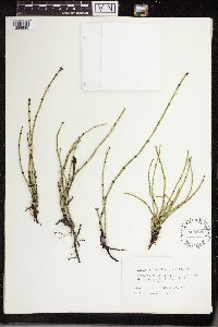 Equisetum variegatum Schleich. ex F. Weber & D. Mohr 565179[1336836]Cotter, Shirley 1951-08-11 Canada, Alberta, campground at Lower Waterfowl lake, Banff National Park |
MIN:Plants | 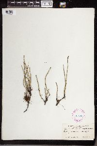 Equisetum variegatum Schleich. ex F. Weber & D. Mohr 267901[1336837]Ulke, Titus F171927-08-28 Canada, British Columbia, Sherbrook Lake, 1582m |
MIN:Plants | 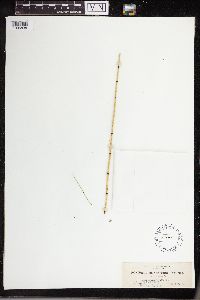 Equisetum variegatum Schleich. ex F. Weber & D. Mohr 54985[1336838]Suksdorf, W.N. 1892-05-04 United States, Washington, Klickitat, Columbia River |
MIN:Plants | 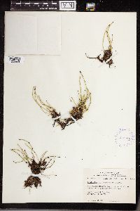 Equisetum variegatum Schleich. ex F. Weber & D. Mohr 413941[1336839]Gillett, J.M. 1948-06-22 Canada, Manitoba, Fort Churchill |
MIN:Plants |  Equisetum variegatum Schleich. ex F. Weber & D. Mohr 388048[1336840]Dodge, Charles K. s.n.1896-06-19 United States, Michigan, Saint Clair, near Port Huron |
MIN:Plants |  Equisetum variegatum Schleich. ex F. Weber & D. Mohr 553487[1336841]Rolland-Germain 1955-05-07 Canada, Quebec, Deux-Montagnes, Oka |
MIN:Plants |  Equisetum variegatum Schleich. ex F. Weber & D. Mohr 388046[1336842]Robinson, B.L. 1901-08-16 United States, Maine, Fort Fairfield, Aroostook River |
MIN:Plants |  Equisetum variegatum Schleich. ex F. Weber & D. Mohr 54971[1336843]Eggleston, Willard W. 1902-06-25 United States, New Hampshire, Summer's Falls, Plainfield |
MIN:Plants | 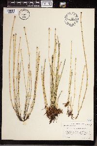 Equisetum variegatum Schleich. ex F. Weber & D. Mohr 463962[1336844]Abbott, R.S. 1952-07-27 United States, New York, Cortlnad State Fish Hatchery, SW of Cortland |
MIN:Plants | 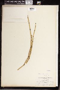 Equisetum variegatum Schleich. ex F. Weber & D. Mohr 354965[1336845]Shaw, Charles H. 8751905-07-10 Canada, Selkirk. Columbia River, Revelstoke |
MIN:Plants | 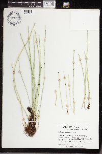 Equisetum variegatum Schleich. ex F. Weber & D. Mohr 702354[1336846]Brisson, Sam 1977-08-30 Canada, Quebec, western limits of Sherbrooke, St. Elie Street [Chemin St-Elie] |
MIN:Plants | 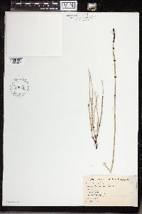 Equisetum variegatum Schleich. ex F. Weber & D. Mohr 763884[1336847]Lugger, Otto United States, Pennsylvania, Manchester |
MIN:Plants |  Equisetum variegatum Schleich. ex F. Weber & D. Mohr 523369[1336848]Cooper, W.S. 1902-07-12 United States, Michigan, Elk Rapids |
MIN:Plants |  Equisetum variegatum Schleich. ex F. Weber & D. Mohr 416050[1336849]Spetzman, L.A. 1950-07-14 United States, Alaska, Noatak River, 168m |
MIN:Plants |  Equisetum variegatum Schleich. ex F. Weber & D. Mohr 416051[1336850]Spetzman, L.A. 1950-07-17 United States, Alaska, Noatak and Kugururok Rivers, 152m |
MIN:Plants |  Equisetum variegatum Schleich. ex F. Weber & D. Mohr 434005[1336851]Richards, Charles D. 13941949-04-30 United States, Michigan, Houghton, McLain State Park |
MIN:Plants |  Equisetum variegatum Schleich. ex F. Weber & D. Mohr 54975[1336852]Rosendahl, C.O. 1907-06-17 Canada, British Columbia, Vancouver Island, shores of Cawichan Lake |
MIN:Plants |  Equisetum variegatum Schleich. ex F. Weber & D. Mohr 354966[1336853]Butters, F.K. 1906-08-00 Canada, British Columbia, Selkirk Mountains, Fish Creek Valley, 1555m |
MIN:Plants |  Equisetum variegatum Schleich. ex F. Weber & D. Mohr 260796[1336854]Eggleston, Willard W. 1898-06-27 United States, New Hampshire, Summer's Falls |
MIN:Plants |  Equisetum variegatum Schleich. ex F. Weber & D. Mohr 260797[1336855]Robinson, B.L. 1901-08-16 United States, Maine, Fort Fairfield, Aroostook River |
MIN:Plants |  Equisetum variegatum Schleich. ex F. Weber & D. Mohr 302376[1336856]Goodman, G.J. 1931-06-28 United States, Utah, Summit, near Bear River, Nintan Mountains, 823m |
MIN:Plants |  Equisetum variegatum Schleich. ex F. Weber & D. Mohr 54980[1336857]Macoun, John 1890-05-31 Canada, British Columbia, Eagle Pass |
MIN:Plants |  Equisetum variegatum Schleich. ex F. Weber & D. Mohr 54977[1336858]Eggleston, Willard W. 1899-06-27 United States, New Hampshire, Summer's Falls |
MIN:Plants |  Equisetum variegatum Schleich. ex F. Weber & D. Mohr 54968[1336859]Clark, June A. 1911-07-27 United States, Idaho, Boise, 878m |
MIN:Plants |  Equisetum variegatum Schleich. ex F. Weber & D. Mohr 279083[1336860]Dutton, E. Lewis s.n.1925-07-07 United States, Vermont, Goshen |
MIN:Plants |  Equisetum variegatum Schleich. ex F. Weber & D. Mohr 54979[1336861]Camp, S.H. s.n.1897-07-18 United States, Michigan, Jackson, Ackerman Lake |
MIN:Plants |  Equisetum variegatum Schleich. ex F. Weber & D. Mohr 54982[1336862]Nelson, N.L.T. 1898-06-00 United States, Illinois, Chicago |
MIN:Plants |  Equisetum variegatum Schleich. ex F. Weber & D. Mohr 359906[1336863]Breitung, A.J. 291939-05-11 Canada, Saskatchewan, Saskatchewan, 4 miles W and 3 miles S of McKague |
MIN:Plants |  Equisetum variegatum Schleich. ex F. Weber & D. Mohr 408389[1336864]Spetzman, L.A. 1949-08-20 United States, Alaska, Itkillik River, 70.15 -150.938889, 762m |
MIN:Plants |  Equisetum variegatum Schleich. ex F. Weber & D. Mohr 54972[1336865]Robinson, B.L. 1901-08-16 United States, Maine, Fort Fairfield, Aroostook River |
MIN:Plants |  Equisetum variegatum Schleich. ex F. Weber & D. Mohr 399243[1336866]Spetzman, L.A. 1947-06-09 United States, Alaska, Saviovik River, E fork., 305m |
MIN:Plants |  Equisetum variegatum Schleich. ex F. Weber & D. Mohr 961057[1336890]Langenheim, Jean 15231951-08-23 United States, Colorado, Gunnison, Cement Creek Bog., 2896m |
MIN:Plants |  Equisetum variegatum Schleich. ex F. Weber & D. Mohr 341296[1338066]Smith, Harry s.n.1913-06-28 Sweden, Nordvestra Harjedalens fjallomrade: Krustyirmania |
MIN:Plants |  Equisetum variegatum Schleich. ex F. Weber & D. Mohr 54996[1338068] Hungary, Velenovsky, Bohemia, near Vsetat |
MIN:Plants |  Equisetum variegatum Schleich. ex F. Weber & D. Mohr 260837[1338071] s.n.1907-06-00 Czech Republic, Moravia [more illegible] |
MIN:Plants |  Equisetum variegatum Schleich. ex F. Weber & D. Mohr 54997[1338078]Boniface s.n.1880-08-00 Switzerland, Mamaamun bei [remainder illegible] |
MIN:Plants |  Equisetum variegatum Schleich. ex F. Weber & D. Mohr 343472[1338079]Florstrom, Bruno s.n.1909-08-07 Finland, Alandia, Echerstvid, Storleyn |
MIN:Plants |  Equisetum variegatum Schleich. ex F. Weber & D. Mohr 54995[1338080]Jeanpert 1896-06-24 France, Marly Forest |
MIN:Plants |  Equisetum variegatum Schleich. ex F. Weber & D. Mohr 54998[1338081] s.n.1885-07-24 Switzerland, Orlzirsfurn by Biddofus |
MIN:Plants |  Equisetum variegatum Schleich. ex F. Weber & D. Mohr 54994[1338082] s.n.1885-07-24 Switzerland, Orlzrifurn by Blildofut |
MIN:Plants |  Equisetum variegatum Schleich. ex F. Weber & D. Mohr 54993[1338087]Fest, B. 1899-00-00 Austria, near Murau, 900m |
MIN:Plants |  Equisetum variegatum Schleich. ex F. Weber & D. Mohr 54992[1338090]Rensch Germany, Sabsburg, Frvischen Hof, Bad Gastein |
MIN:Plants |  Equisetum variegatum Schleich. ex F. Weber & D. Mohr 54969[1338093]Prager, E. 1895-06-30 Germany, Frankfurt |
MIN:Plants |  Equisetum variegatum Schleich. ex F. Weber & D. Mohr 54990[1338094]Kaulfuss, T. 1901-06-06 Germany, Bavaria, Steinach near Norimbergam |
MIN:Plants |  Equisetum variegatum Schleich. ex F. Weber & D. Mohr 54989[1338095]Silven, Jarl 1899-06-08 Sweden, Jemtlandiae: Ragunda |
MIN:Plants |  Equisetum variegatum Schleich. ex F. Weber & D. Mohr 54991[1338096]Kaulfuss, T. 1901-07-27 Germany, Bavaria, Steinach near Norimbergam |
MIN:Plants | 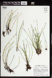 Equisetum variegatum Schleich. ex F. Weber & D. Mohr 963730[1352698]Welby R Smith 353812015-08-04 United States, Minnesota, Koochiching, About 18 km (11 miles) southeast of the approximate center of International Falls. SW of SE of section, 48.4897278 -93.2320972 |
MIN:Plants | 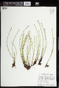 Equisetum variegatum Schleich. ex F. Weber & D. Mohr 963797[1352702]Welby R Smith 353912015-08-05 United States, Minnesota, Koochiching, A wet\moist, non-forested roadside habitat about 12 km (7.5 miles) S-SW of Littlefork. NE of NW of section, 48.3013611 -93.6293056 |
MIN:Plants | 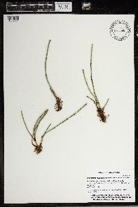 Equisetum variegatum Schleich. ex F. Weber & D. Mohr 966686[1359377]Whitfeld, T.J.S., Weiblen, G.D., Yang, Y., & Lee, A.K. 31092021-06-28 United States, Minnesota, Crow Wing, Cross Lake Recreation Area; Big Trout Lake; shoreline, 46.723056 -94.13 |
MIN:Plants | 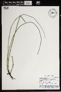 Equisetum variegatum Schleich. ex F. Weber & D. Mohr 966678[1359343]Whitfeld, T.J.S., Weiblen, G.D., Yang, Y., & Lee, A.K. 28102021-06-28 United States, Minnesota, Crow Wing, Cross Lake Recreation Area; Big Trout Lake; shoreline, 46.722978 -94.130036 |
MIN:Plants |  Equisetum variegatum Schleich. ex F. Weber & D. Mohr 974351[1396715]Smith, Welby R WRS363502019-07-10 United States, Minnesota, Roseau, Along the side of a township road heading north (380 meters) from Highway 11, about 12.7 km (7.9 miles) W-SW of the approximate center of Greenbush at a heading of 250 degrees., 48.65954 -96.34397 |
MIN:Plants |  907204[1331690]Smith, Welby 309432008-06-18 United States, Minnesota, Cook, Boundary Waters Canoe Area Wilderness / Superior National Forest. Cook County...Eagle Mountain in the Coundary Waters Canoe Area Wilderness, Superior National Forest...T 63N R 2W NW1/4 of SE1/4 of Sec 34. 063N 02W 34, 47.895 -90.56 |
MIN:Plants |  473055[1305963]Lee, Michael MDL17391997-06-19 United States, Minnesota, Stearns, Stearns Co.; Tamarack Lake Wildlife Managemetn Area three miles south of Brooten; T123N R35W SE1/4 of SE1/4 Sec. 18;Tamarack Wildlife Management Area;123N;35W;18, 45.433584 -95.121269 |
MIN:Plants |  907263[1331476]Smith, Welby 284952000-06-05 United States, Minnesota, Wabasha, McCarthy Lake Wildlife Management Area. Wabasha County...McCarthy Lake State Wildlife Management Area, about 2 miles south of Kellogg...T 109N R 10W SW1/4 of NW1/4 of Sec 2. 109N 10W 2, 44.2766667 -91.9861111 |
MIN:Plants | 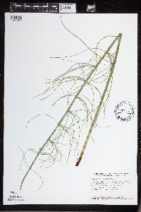 489619[1331477]Smith, Welby 154811989-06-26 United States, Minnesota, Houston, Houston County ... Beaver Creek Valley State Park, about 4 miles west of Caledonia ... NW1/4 NW1/4 section 17, T102N R6W;Beaver Creek Valley State Park;102N;06W;17, 43.6436111 -91.5869444 |
MIN:Plants | 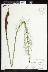 432044[1305962]Whitfeld, T.J.S. 2352001-06-12 United States, Minnesota, Kandiyohi, Kandiyohi County...1/2 mile east of County Hwy. 5, 1 1/2 miles north of State Hwy. 9...east of Timber Lake...T122N R35W SE1/4 of SE1/4 of NW1/4 of Section 21.. 122N 35W 21, 45.361817 -95.081014 |
MIN:Plants | 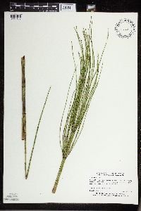 478315[1331517]Myhre, K. 66271996-08-21 United States, Minnesota, Crow Wing, Crow Wing County ... Located 15 miles southeast of the town of Brainerd. Plants occur along the northwest shore of Jack Pine Lake ... T 44N R 28W NW1/4 of NE1/4 of Sec. 30. 044N 28W 30, 46.270405 -93.923267 |
MIN:Plants | 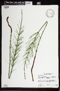 916969[1331595]Gerdes, Lynden 57982009-07-14 United States, Minnesota, Cook, Superior National Forest. T64N R02E S14SWSENWSE. Cook County, MN. Superior National Forest. Greenwood Lake area. North of FR 313 and approx. 0.13 miles south of Tittle Lake...NAD 83 / 712211 / 5322913. 064N 02E 14, 48.0241667 -90.1536111 |
MIN:Plants | 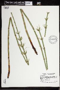 914613[1331582]Smith, Welby 226741993-07-01 United States, Minnesota, Otter Tail, Otter Tail County ... On the north side of CSAH 38; 0.8 mile east of its junction with TH 78, and about 11 miles south of Battle Lake (town) ... T131N R40W SE1/4 of SE1/4 of Sec 22. 131N 40W 22, 46.1380556 -95.6908333 |
MIN:Plants | 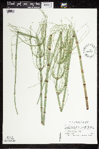 454837[1305953]Smith, Welby 206901992-07-08 United States, Minnesota, Goodhue, Goodhue County ... About 3 miles west of Red Wing ... in the Cannon River Valley ... T113N R15W SW1/4 of SE1/4 of Sec 21;Dorer Memorial Hardwood State Forest;113N;15W;21, 44.5738889 -92.6194444 |
MIN:Plants | 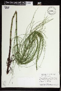 478890[1331516]Smith, Welby 158241989-07-20 United States, Minnesota, Mille Lacs, Mille Lacs County ... Mille Lacs Kathio State Park, about 5 mi northwest of Onamia ... NE1/4 SE1/4 sec. 10, T 42N R 27W;Mille Lacs Kathio State Park;042N;27W;10, 46.1336098 -93.7272186 |
MIN:Plants | 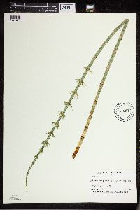 912986[1331531]Smith, Welby 243091994-07-02 United States, Minnesota, Polk, Polk County... Along the south side of the Sand Hill River, about 1.5 miles west of Fertile... T147N R44W NE1/4 of SW1/4 of Sec 19. 147N 44W 19, 47.5325 -96.3116667 |
MIN:Plants | 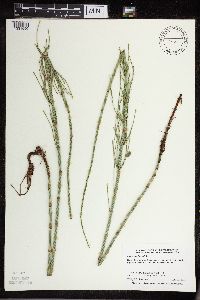 505397[1331590]Smith, Welby 291802001-06-13 United States, Minnesota, Pipestone, Burke Wildlife Management Area. Pipestone County ... Burke State Wildlife Management Area, about 5 miles north of Edgerton ... T106N R44W SE1/4 of SE1/4 of Sec 28. 106N 44W 28, 43.9536095 -96.1266632 |
MIN:Plants | 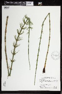 907005[1331576]Smith, Welby 308712008-06-07 United States, Minnesota, Sherburne, Sherburne National Wildlife Refuge. Sherburne County...Sherburne National Wildlife Refuge, about 6 miles NW of Zimmerman...north side of Rice Lake... T 35N R 27W SE1/4 of NE1/4 of Sec 27. 035N 27W 27, 45.4969444 -93.6786111 |
MIN:Plants | 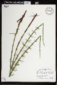 910987[1331594]Smith, Welby 309132008-06-13 United States, Minnesota, Hubbard, Hubbard County...On the NW side of Mantrap Lake, in Paul Bunyan State Forest...T 142N R 34W NE1/4 of NW1/4 of Sec 36;Paul Bunyan State Forest;142N;34W;36, 47.0769444 -94.9325 |
MIN:Plants | 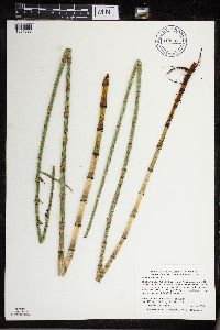 910993[1331593]Smith, Welby 285792000-06-16 United States, Minnesota, Marshall, Thief Lake Wildlife Management Area. Marshall County...Thief Lake State Wildlife Management Area; about 5 miles NE of Gatzke...T 158N R 39W NW1/4 of SW1/4 of Sec 19. 158N 39W 19, 48.4877778 -95.7297222 |
MIN:Plants | 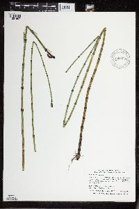 908436[1331697]Smith, Welby 310172008-07-21 United States, Minnesota, Saint Louis, Boundary Waters Canoe Area Wilderness / Superior National Forest. St. Louis County...In a small bay at the northwest end of Fountain Lake in the Boundary Waters Canoe Area Wilderness, Superior National Forest...T 65N R 12W SW1/4 of SE1/4 of Sec 24. 065N 12W 24, 48.0958333 -91.8058333 |
MIN:Plants | 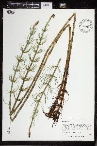 515484[1331677]Lee, Michael MDL36882004-07-01 United States, Minnesota, Becker, Tamarac National Wildlife Refuge. BECKER COUNTY ... Tamarac National Wildlife Refuge ... North of Flat Lake, ten miles north-northwest of Rochert ... T141N R39W SE1/4 of NW1/4 of NW1/4 Sec.28. 141N 39W 28, 47.003989 -95.633773 |
MIN:Plants | 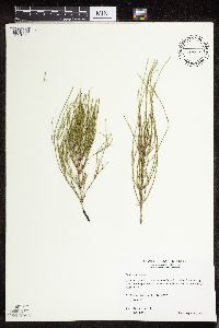 509727[1331069]Wheeler, Gerald 175081997-08-31 United States, Minnesota, Renville, Ca. 3 mi. W of Bird Island, N side of Rte. 212. N1/2 N1/2 of section;;115N;34W;16, 44.767445 -94.956746 |
MIN:Plants | 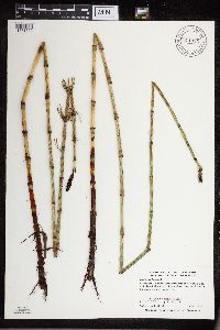 911033[1331502]Smith, Welby 285492000-06-15 United States, Minnesota, Otter Tail, Eastern Wildlife Management Area. Otter Tail County... Eastern State Wildlife Area, about 4 miles E-NE of Parkers Prairie (town)... T131N R36W SW1/4 of NW1/4 of Sec 9. 131N 36W 9, 46.1733333 -95.2258333 |
MIN:Plants | 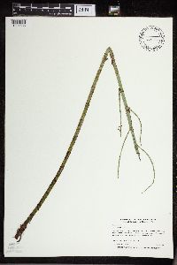 454623[1331535]Myhre, K. 68771997-07-09 United States, Minnesota, Carlton, Carlton County ... Torchlight Lake. Located 12 miles west of the town of Carlton. Plants occur along the northeast by of lake ... T 48N R 18W SW1/4 of NE1/4 of Sec 8. 048N 18W 8, 46.658787 -92.647511 |
MIN:Plants | 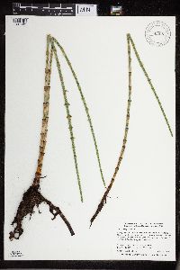 907081[1331603]Smith, Welby 284562000-05-25 United States, Minnesota, Beltrami, Beltrami County...Along Hwy 15, 3.3 mi N of its junction with Co Rd 32 in Nebish...T150N R33W SW1/4 of SW1/4 of Sec 11;Red Lake Indian Reservation;150N;33W;11, 47.8194444 -94.8480556 |
MIN:Plants | 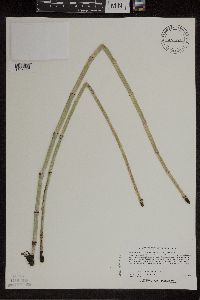 430321[1305938]Lee, Michael MDL18011997-07-03 United States, Minnesota, Stearns, Stearns County...Along Sedan Brook 3-1/2 miles north-northeast of Brooten...T124N R35W NE1/4 of SE1/4 of NW1/4 Sec. 17;Sedan Brook Prairie Scientific Natural Area;124N;35W;17, 45.552738 -95.100391 |
MIN:Plants | 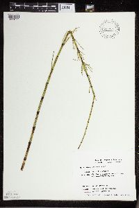 435763[1331572]Smith, Michael 2411996-08-27 United States, Minnesota, Saint Louis, Voyageurs National Park. St. Louis Co.; Plot name: Voya 28 DNR # 5786; 48 35'27"N 93 02'28"W;Voyageurs National Park;071N;21W;, 48.5908318 -93.0577774 |
MIN:Plants |  574128[1336027]Chase, Virginius 151981958-05-26 United States, Illinois, Tazewell, North of East Peoria, Tazewell Co.;;;;, 40.733193 -89.593071 |
MIN:Plants |  907117[1331583]Smith, Welby 285362000-06-15 United States, Minnesota, Otter Tail, Otter Tail County...Almora State Wildlife Management Area about 0.75 mi W of Almora...T132N R37W SW1/4 of NE1/4 of Sec18;Almora Wildlife Management Area;132N;37W;18, 46.2466667 -95.3786111 |
MIN:Plants |  220257[1331619]Rosendahl, C.O. 53351927-07-30 United States, Minnesota, Anoka, S of Ham Lake, Anoka Co.;;032N;23W;, 45.257018 -93.222366 |
MIN:Plants |  220258[1331614]Rosendahl, C.O. 53351927-07-30 United States, Minnesota, Anoka, S of Ham Lake, Anoka Co.;;032N;23W;, 45.257018 -93.222366 |
MIN:Plants |  225778[1331587]Holzinger, John s.n.1901-00-00 United States, Minnesota, Winona, In Winona Co.;;N;;, 44.049963 -91.639315 |
MIN:Plants |  225779[1331480]Holzinger, John s.n.1901-00-00 United States, Minnesota, Winona, In Winona Co.;;N;;, 44.049963 -91.639315 |
MIN:Plants | 225780[1331631]Holzinger, John s.n.1900-00-00 United States, Minnesota, Winona, In Winona Co.;;N;;, 44.049963 -91.639315 |
MIN:Plants |  225781[1331586]Holzinger, John s.n.1897-00-00 United States, Minnesota, Winona, In Winona Co.;;N;;, 44.049963 -91.639315 |
MIN:Plants |  275795[1331672]Moyle, J. 1930-07-06 United States, Minnesota, Clearwater, Itasca Park. Clearwater Co. Garrison Point. T143 R36.;Itasca State Park;143N;36W;, 47.197458 -95.201964 |
Google Map
Google Maps is a web mapping service provided by Google that features a map that users can pan (by dragging the mouse) and zoom (by using the mouse wheel). Collection points are displayed as colored markers that when clicked on, displays the full information for that collection. When multiple species are queried (separated by semi-colons), different colored markers denote each individual species.