University of Minnesota
http://www.umn.edu/
612-625-5000
http://www.umn.edu/
612-625-5000
Minnesota Biodiversity Atlas
Bell Museum
Dataset: MIN-Plants
Taxa: Amaranthaceae
Search Criteria: excluding cultivated/captive occurrences
Bell Museum plants | |
 MIN:Plants | 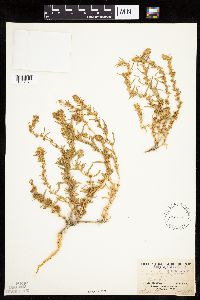 Krascheninnikovia lanata (Pursh) A. Meeuse & A. Smit 104965[1037573]Burglehaus, F. s.n.1893-07-00 United States, Wyoming, Park, Yellowstone National Park...near Mammoth Hot Springs;Yellowstone National Park, 1829m |
MIN:Plants | 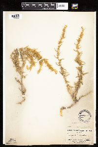 Krascheninnikovia lanata (Pursh) A. Meeuse & A. Smit 104960[1037575]Burglehaus, F. s.n.1893-07-00 United States, Wyoming, Park, Near Mammoth Hot Springs;Yellowstone National Park, 1890m |
MIN:Plants |  Krascheninnikovia lanata (Pursh) A. Meeuse & A. Smit 794777[1037572]Schaaf, J. 251982-12-08 United States, Nevada, Nye, Nye Co. ... along SR 375 MP-29.5 ... Elev.: 4880 ft. |
MIN:Plants | 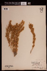 Krascheninnikovia lanata (Pursh) A. Meeuse & A. Smit 953387[1292805]Stork, H. E. s.n.1927-08-06 United States, Wyoming, Park, Yellowstone National Park |
MIN:Plants | 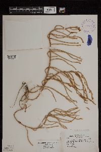 Salicornia depressa Standley 394909[1299067]Wadmond, S. 13911898-08-21 United States, New Jersey, Monmouth, near Highland Beach, Sandy Hook, 2000m |
MIN:Plants | 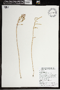 Salicornia depressa Standley 968060[1368693]Timothy J. S. Whitfeld 14702016-09-17 United States, Rhode Island, Bristol, Tillinghast Farm, Rhode Island School of Design Beach, 0.25 miles southwest of intersection between Nyatt Road and Freemont Avenue., 41.72567 -71.32468 |
MIN:Plants | 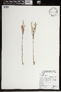 Salicornia depressa Standley 968144[1368758]Vivan Lu 182017-09-22 United States, Rhode Island, Bristol, Tillinghast Farm, Rhode Island School of Design Beach, 0.25 miles southwest of intersection between Nyatt Road and Freemont Avenue., 41.72567 -71.32468, 2m |
MIN:Plants | Blutaparon vermiculare (L.) Mears 443943[]Abbott, Robinson s.n.1981-09-13 United States, Texas, Nueces, Kleberg County...my [Abbott] test plots, Padre Island National Seashore, Padre Island.;Padre Island National Seashore |
MIN:Plants | 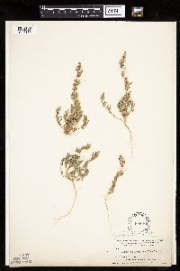 Chenopodium pratericola Rydberg 104684[1037187]Nelson, Aven; et al. 66411899-08-23 United States, Wyoming, Park, Yellowstone National Park...Yellowstone Lake;Yellowstone National Park |
MIN:Plants | 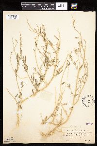 Chenopodium pratericola Rydberg 246433[1037188]Mearns, E. 29221902-08-07 United States, Wyoming, Park, Gardiner River;Yellowstone National Park |
MIN:Plants |  Chenopodium pratericola Rydberg 104689[1037171]Ballard, C. 30721901-08-08 United States, Minnesota, Clay, Glyndon;;139N;47W;11, 46.869895 -96.578669 |
MIN:Plants |  Chenopodium pratericola Rydberg 391817[1037169]Lakela, Olga 61811945-09-06 United States, Minnesota, Lake, Beaver Island in Lake Superior, 2 mi. E of Beaver Bay, Lake Co.;North Shore;055N;07W;05, 47.283575 -91.254452 |
MIN:Plants |  Chenopodium pratericola Rydberg 53298[1037170]Lakela, Olga 67441946-09-03 United States, Minnesota, Saint Louis, St. Louis River terrace near Fond du Lac.;;048N;15W;, 46.657011 -92.257257 |
MIN:Plants |  Chenopodium pratericola Rydberg 704579[1037183]Smith, Welby 16311979-08-16 United States, Minnesota, Wabasha, Wabasha County...T 109N R 09W; NE1/4 SW1/4 section 7. 20 m due east of county road 84.;Kellogg-Weaver Dunes Scientific Natural Area / Kellogg-Weaver Dunes, The Nature Conservancy;109N;09W;07, 44.258106 -91.93891 |
MIN:Plants | 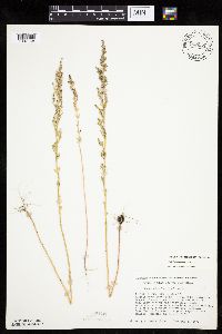 Chenopodium pratericola Rydberg 708053[1037168]Smith, Welby 13961979-08-22 United States, Minnesota, Clay, Clay County...T 139N R 46W; NW1/4 Sec. 15. Buffalo River State Park. 7.5 mi. W-SW of Hawley.;Buffalo River State Park;139N;46W;15, 46.854948 -96.473403 |
MIN:Plants | 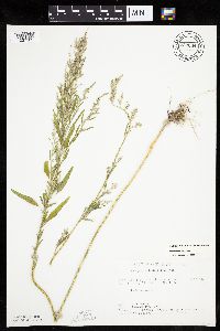 Chenopodium pratericola Rydberg 722664[1037182]Lustig, K. 9011979-08-13 United States, Minnesota, Anoka, 18 mi. SE of Cambridge;Boot Lake Scientific Natural Area;033N;22W;, 45.340658 -93.081463 |
MIN:Plants | 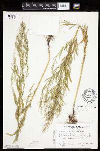 Chenopodium pratericola Rydberg 743827[1037159]Ownbey, Gerald 68541982-07-01 United States, Minnesota, Dakota, Dakota County...Sand Coulee, E side of Minn. Rte. 316, 1.9 mi. SE of its jct. with U.S.Rte. 61 at Hastings...etc.;;114N;17W;11, 44.69499 -92.822836 |
MIN:Plants | 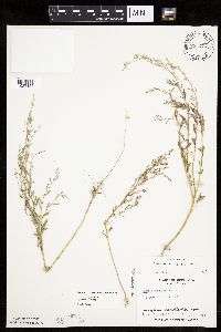 Chenopodium pratericola Rydberg 753274[1037156]Boe, J. 20051983-08-03 United States, Minnesota, Kittson, Kittson County...Norway Dunes: SW1/4 SE1/4 Sec. 10 T160N, R46W;Norway Dunes, The Nature Conservancy;160N;46W;10, 48.695736 -96.57277 |
MIN:Plants | 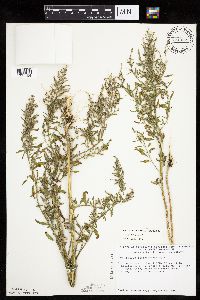 Chenopodium pratericola Rydberg 774332[1037154]Monson, Paul 58041983-08-30 United States, Minnesota, Saint Louis, Kabetogama Lake; shore 1 mi. nnw. of Wolf Island. SE1/4 of section;Voyageurs National Park;069N;20W;16, 48.462947 -92.906935 |
MIN:Plants | 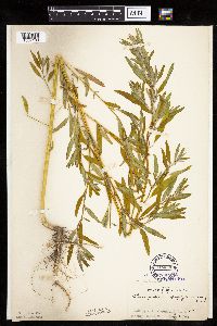 Chenopodium pratericola Rydberg 104690[1037180]Rosendahl, C. 6851902-07-02 United States, Minnesota, Houston, Spring Grove;;101N;07W;, 43.543923 -91.6707 |
MIN:Plants | 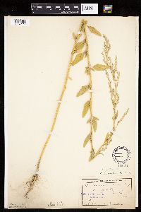 Chenopodium pratericola Rydberg 104691[1037174]Ballard, C. B17051893-07-00 United States, Minnesota, Cass, Lake Kilpatrick;;135N;29W;, 46.500163 -94.32908 |
MIN:Plants | 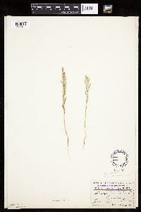 Chenopodium pratericola Rydberg 104693[1037179]Menzel, Max s.n.1895-06-00 United States, Minnesota, Pipestone, Pipestone [assuming the quarry area; town generally noted as Pipestone City by collector];Pipestone National Monument;106N;46W;01, 44.01585 -96.31767 |
MIN:Plants | 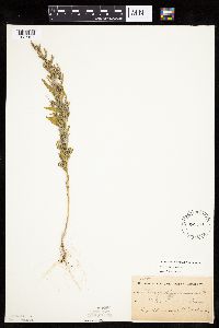 Chenopodium pratericola Rydberg 104694[1037167]Sheldon, Edmund S15851891-08-00 United States, Minnesota, Lincoln, Lake Benton;;109N;45W;, 44.24108 -96.26172 |
MIN:Plants | 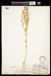 Chenopodium pratericola Rydberg 104696[1037163]Menzel, Max s.n.1895-07-00 United States, Minnesota, Pipestone, Pipestone [assuming the quarry area; town generally noted as Pipestone City by collector];Pipestone National Monument;106N;46W;01, 44.01585 -96.31767 |
MIN:Plants | 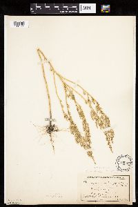 Chenopodium pratericola Rydberg 104697[1037165]MacMillan, C.; et al. 3321900-08-00 United States, Minnesota, Polk, Crookston;;150N;46W;30, 47.782 -96.60007 |
MIN:Plants | 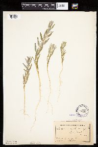 Chenopodium pratericola Rydberg 104698[1037173]MacMillan, C.; et al. MS10951894-07-00 United States, Minnesota, Lake of the Woods, Oak Point [Lake of the Woods Co. according to other collections by M&S];Pine & Curry Islands Scientific Natural Area;162N;31W;06, 48.87976 -94.690246 |
MIN:Plants |  Chenopodium pratericola Rydberg 104699[1037164]Menzel, Max s.n.1896-07-00 United States, Minnesota, Pipestone, Pipestone [assuming the quarry area; town generally noted as Pipestone City by collector];Pipestone National Monument;106N;46W;01, 44.01585 -96.31767 |
MIN:Plants |  Chenopodium pratericola Rydberg 104700[1037166]Campbell, Jennie C1011896-07-00 United States, Minnesota, Stearns, Grand Lake, Stearns Co.;;123N;29W;, 45.45742 -94.322478 |
MIN:Plants |  Chenopodium pratericola Rydberg 104701[1037185]Menzel, Max s.n.1895-07-00 United States, Minnesota, Pipestone, Pipestone [assuming the quarry area; town generally noted as Pipestone City by collector];Pipestone National Monument;106N;46W;01, 44.01585 -96.31767 |
MIN:Plants |  Chenopodium pratericola Rydberg 275707[1304337]Cook, Louis s.n.1930-05-00 United States, Minnesota, Near the Canadian border.;;;;, 48.399623 -92.552833 |
MIN:Plants | 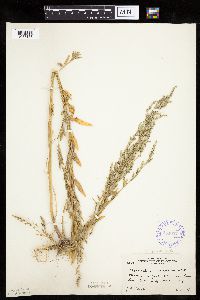 Chenopodium pratericola Rydberg 354657[1037178]Moyle, J. 12791934-07-21 United States, Minnesota, Cass, Near Cass Lake.;Leech Lake Indian Reservation;N;;, 47.41903 -94.53255 |
MIN:Plants | 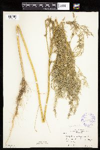 Chenopodium pratericola Rydberg 359214[1037172]Moyle, J. 33171939-08-25 United States, Minnesota, Morrison, Near Royalton.;;N;;, 45.829965 -94.293609 |
MIN:Plants | 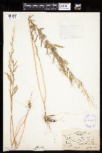 Chenopodium pratericola Rydberg 360367[1037181]Butters, F.; et al. 65831934-09-09 United States, Minnesota, Beltrami, W side of Star Island, Cass Lake.;;;;, 47.41662 -94.578313 |
MIN:Plants | 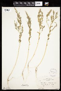 Chenopodium pratericola Rydberg 364250[1037161]Moyle, J. 29501937-08-24 United States, Minnesota, Jackson, Shore of Heron Lake.;;N;;, 43.793292 -95.291942 |
MIN:Plants |  Chenopodium pratericola Rydberg 383557[1037177]Moore, John; et al. 158891943-07-31 United States, Minnesota, Washington, Washington County...About 1 1/2 mi. S of Bayport.;;029N;20W;, 44.99172 -92.814208 |
MIN:Plants |  Chenopodium pratericola Rydberg 383566[1037162]Moore, John 159211943-08-18 United States, Minnesota, Dakota, Dakota Co. Four Corners.;;113N;17W;9, 44.608302 -92.863172 |
MIN:Plants |  Chenopodium pratericola Rydberg 412686[1037186]Moore, John; et al. 116451939-08-12 United States, Minnesota, Koochiching, Koochiching County...In the vic. of the Island View Hotel, T71N, R22W, Sec. 25. Along the S shore of Rainy Lake.;Voyageurs National Park;071N;22W;25, 48.609275 -93.099933 |
MIN:Plants |  Chenopodium pratericola Rydberg 488679[1037175]Moore, John; et al. 198601947-10-02 United States, Minnesota, Fillmore, Fillmore County...2 mi. SW of Rushford.;;104N;08W;00, 43.803542 -91.790268 |
MIN:Plants |  Chenopodium pratericola Rydberg 578857[1037176]Ownbey, Gerald 32881962-07-26 United States, Minnesota, Becker, Becker Co. Itasca State Park. Morrison Lake. T142N, R36W, NE1/4 Sec. 4.;Itasca State Park;142N;36W;4, 47.14513 -95.244163 |
MIN:Plants |  Chenopodium pratericola Rydberg 814796[1037160]Wheeler, Gerald 11271988-07-16 United States, Minnesota, Traverse, Traverse County...Browns Valley (NE side); W of Rte. 2...NW1/4 NW1/4 Sec. 34, T125N, R49W (Folsom Twp.);;125N;49W;34, 45.593308 -96.813211 |
MIN:Plants |  Chenopodium pratericola Rydberg 815861[1037155]Wheeler, Gerald 114471988-07-26 United States, Minnesota, Big Stone, Big Stone County...Ca. 14 mi. N of Ortonville; N of Rte. 7...NW1/4 SW1/4 Sec. 35, T123N, R48W (Foster Twp.);;123N;48W;35, 45.421214 -96.646948 |
MIN:Plants |  Chenopodium pratericola Rydberg 841696[1037157]Smith, Welby 136511987-07-30 United States, Minnesota, Washington, Grey Cloud Dunes Scientific Natural Area. Washington County...About 2 mi south of St. Paul Park ... southwest-facing terrace of the Mississippi River ... SW1/4 SW1/4 sec.29, T 27N R 21W. 027N 21w 29, 44.7933333 -92.9625 |
MIN:Plants |  Chenopodium pratericola Rydberg 479443[1037158]Swanson, Scott 21832001-08-13 United States, Minnesota, Sherburne, Sherburne National Wildlife Refuge...NESE 9-34-27...FQUAN1-21 off transect;Sherburne National Wildlife Refuge;034N;27W;09, 45.451294 -93.70477 |
MIN:Plants |  Chenopodium pratericola Rydberg 923112[1122502]Smith, Welby 237221993-08-27 United States, Minnesota, Sibley, About 3.5 miles northwest of Henderson. SE1/4 of SW1/4 of section;High Island Creek County Park;113N;26W;21, 44.5752778 -93.9583333 |
MIN:Plants |  Chenopodium pratericola Rydberg 923460[1037184]Smith, Welby 236081993-08-13 United States, Minnesota, Kandiyohi, About 3.5 miles northwest of New London. NE1/4 of SW1/4 of section;;122N;33W;31, 45.3313889 -94.8797222 |
MIN:Plants |  Chenopodium pratericola Rydberg 927869[1122503]Chayka, K. KC-11382011-08-31 United States, Minnesota, Ramsey, Near the parking lot across from the train depot. SW1/4 of SE1/4 of section;Long Lake County Park;030N;23W;17, 45.0802778 -93.1955556 |
MIN:Plants | 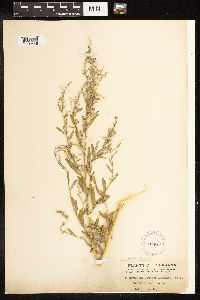 Chenopodium pratericola Rydberg 104679[1192448]Ball, C. R. 444 United States, Louisiana, Rapides |
MIN:Plants | 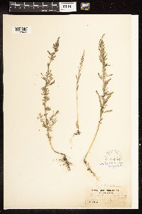 Chenopodium pratericola Rydberg 104681[1192449]Parlin, J. C. s.n. United States, Maine, York |
MIN:Plants | 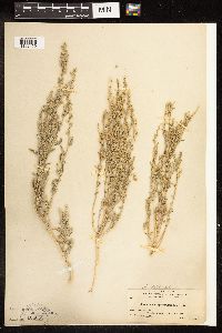 Chenopodium pratericola Rydberg 104668[1192450]Nelson, A. 1314 United States, Idaho, Lincoln |
MIN:Plants | 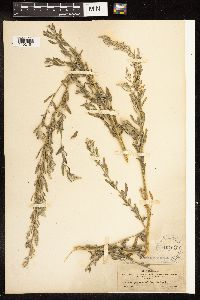 Chenopodium pratericola Rydberg 104670[1192451]Metcalfe, O. B. 215 United States, New Mexico, Grant |
MIN:Plants |  Chenopodium pratericola Rydberg 104671[1192452]Wooton, E. O. 3230 United States, New Mexico, Dona Ana |
MIN:Plants |  Chenopodium pratericola Rydberg 104672[1192453]Thornber, J. J. 231 United States, Arizona, Pima |
MIN:Plants |  Chenopodium pratericola Rydberg 104669[1192454]Blumer, J. C. 1568 United States, Arizona, Cochise |
MIN:Plants |  Chenopodium pratericola Rydberg 104682[1192455]Sandberg, J. H. s.n. United States, Washington, Grant |
MIN:Plants | 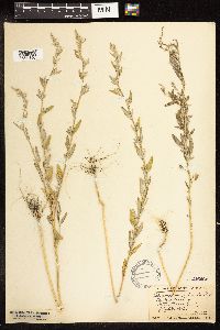 Chenopodium pratericola Rydberg 246460[1192456]Lunell, J. 600 United States, North Dakota, Benson |
MIN:Plants | 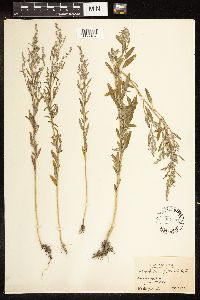 Chenopodium pratericola Rydberg 307081[1192457]Bush, B. F. 5006 United States, Missouri, Jackson |
MIN:Plants | 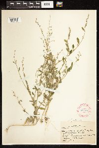 Chenopodium pratericola Rydberg 287660[1192458]Harris, J. A. N2971 United States, Utah, San Juan |
MIN:Plants | 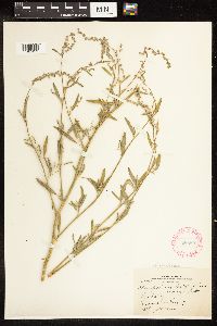 Chenopodium pratericola Rydberg 286895[1192459]Harris, J. A. N29130 United States, Utah, San Juan |
MIN:Plants |  Chenopodium pratericola Rydberg 286221[1192460]Harris, J. A. N29208 A&B United States, Utah, Washington |
MIN:Plants |  Chenopodium pratericola Rydberg 285026[1192461]Harris, J. A. C23979 United States, Utah, Juab |
MIN:Plants |  Chenopodium pratericola Rydberg 489348[1192462]Weiblen, G. D. GW1322 United States, Colorado |
MIN:Plants |  Chenopodium pratericola Rydberg 225226[1192463]Bush, B. F. 8351A United States, Missouri, Jackson |
MIN:Plants |  Chenopodium pratericola Rydberg 504542[1192464]Dunn, D. B. 11746 United States, Montana, Flathead |
MIN:Plants |  Chenopodium pratericola Rydberg 372316[1192465]Cronquist, A. 3479 United States, Idaho, Blaine |
MIN:Plants |  Chenopodium pratericola Rydberg 267161[1192466]Bush, B. F. 8552 United States, Missouri, Jackson |
MIN:Plants |  Chenopodium pratericola Rydberg 247380[1192467]Rich, W. P. s.n. United States, Massachusetts, Suffolk |
MIN:Plants | 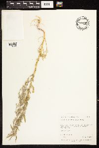 Chenopodium pratericola Rydberg 714135[1192468]Neese, E. 6294 United States, Utah, Daggett |
MIN:Plants | 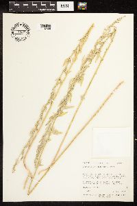 Chenopodium pratericola Rydberg 714374[1192469]Neese, E. 6012 United States, Utah, Garfield |
MIN:Plants | 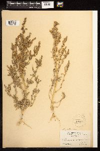 Chenopodium pratericola Rydberg 104674[1192470]Brown, H. E. 615 United States, California, Siskiyou |
MIN:Plants | 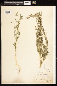 Chenopodium pratericola Rydberg 104675[1192471]Nelson, A. 2644 United States, Wyoming, Albany |
MIN:Plants | 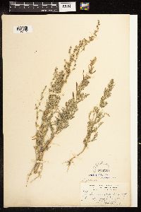 Chenopodium pratericola Rydberg 104676[1192472]Baker, C. F. 896 United States, Colorado, Gunnison |
MIN:Plants | 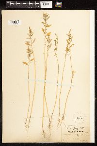 Chenopodium pratericola Rydberg 104683[1192473]Mackenzie, K. K. 22 United States, Missouri, Jackson |
MIN:Plants | 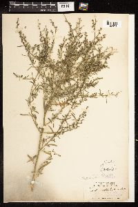 Chenopodium pratericola Rydberg 104678[1192474]Earle, F. S. 326 United States, New Mexico, Chaves |
MIN:Plants | 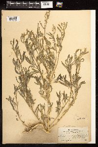 Chenopodium pratericola Rydberg 104688[1192475]Heller, A. A. 3244 United States, Idaho, Nez Perce |
MIN:Plants |  Chenopodium pratericola Rydberg 261507[1192476]Harris, J. A. C23979 United States, Utah, Juab |
MIN:Plants |  Chenopodium pratericola Rydberg 104687[1192477]Wooton, E. O. 84 United States, New Mexico, Dona Ana |
MIN:Plants |  Chenopodium pratericola Rydberg 468924[1192478]Shimek, B. s.n. United States, Iowa, Louisa |
MIN:Plants |  Chenopodium pratericola Rydberg 394785[1192479]Hitchcock, A. S. s.n. United States, Kansas, Dickinson |
MIN:Plants |  Chenopodium pratericola Rydberg 104695[1192480]Sheldon, E. P. S.6157 United States, Minnesota, 46 -94 |
MIN:Plants |  Chenopodium pratericola Rydberg 609396[1192481]Twisselmann, E. C. 6443 United States, California, Kern |
MIN:Plants |  Chenopodium pratericola Rydberg 716022[1192482]Hartman, R. L. 4931 United States, Wyoming, Albany |
MIN:Plants |  Chenopodium pratericola Rydberg 585770[1192483]Porter, C. L. 9440 United States, Wyoming, Carbon |
MIN:Plants |  Chenopodium pratericola Rydberg 104667[1192484]Moyer, L. R. 1361 United States, South Dakota, Walworth |
MIN:Plants |  Chenopodium pratericola Rydberg 269592[1192485]Moore, John W. 19761925-07-00 United States, South Dakota, Custer, Lime Stone District west of Custer, 43.777311 -103.78008 |
MIN:Plants |  Chenopodium pratericola Rydberg 269816[1192486]Moore, J. W. 19281923-06-00 United States, South Dakota, Pennington, 30 miles east of Rapid City, 44.078948 -102.626151 |
MIN:Plants |  Chenopodium pratericola Rydberg 104666[1192487]Moyer, L. R. 1361 United States, South Dakota, Walworth |
MIN:Plants | 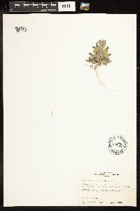 Chenopodium pratericola Rydberg 604219[1192488]Wright, H. E. s.n. United States, New Mexico, San Juan |
MIN:Plants | 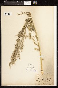 Chenopodium pratericola Rydberg 104685[1192489]Rydberg, P. A. 965 United States, South Dakota, Fall River |
MIN:Plants | 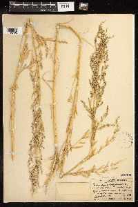 Chenopodium pratericola Rydberg 246466[1192490]Lunell, J. 378 United States, North Dakota, Burleigh |
MIN:Plants | 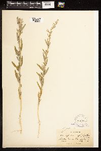 Chenopodium pratericola Rydberg 104686[1192491]Nelson, A. 483 United States, Wyoming |
MIN:Plants |  Chenopodium pratericola Rydberg 534876[1192492]Stemen, T. R. s.n. United States, Oklahoma, Cleveland |
MIN:Plants |  Chenopodium pratericola Rydberg 246465[1192493]Stevens, O. A. 378 United States, North Dakota, Stark |
MIN:Plants |  Chenopodium pratericola Rydberg 350389[1192494]Nielsen, E. L. 2145 United States, North Dakota, Stutsman |
MIN:Plants |  Chenopodium pratericola Rydberg 246471[1000602]Lunell, J. 3791911-08-14 United States, North Dakota, Benson, Pleasant Lake |
MIN:Plants | 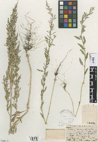 Chenopodium pratericola Rydberg 246470[1000603]Lunell, J. 3791915-08-15 United States, North Dakota, Benson, Butte |
MIN:Plants | 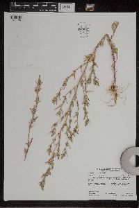 Chenopodium pratericola Rydberg 959306[1311148]Lynden B. Gerdes 67582012-08-29 United States, Minnesota, Lake, Superior National Forest. Birch Lake dam area, parking area approximately 6.63 miles SE of Ely, MN and 0.11 miles east of the dam. South side of Highway 1., 47.81611111 -91.78138889 |
MIN:Plants | 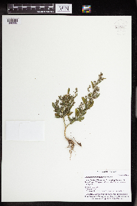 Chenopodium pratericola Rydberg 963085[1346846]Whitfeld, T.J.S. 24552019-08-30 United States, Minnesota, Crow Wing, US Army Corps of Engineers Cross Lake Recreation Area, campground, 46.669138 -94.112253 |
MIN:Plants | 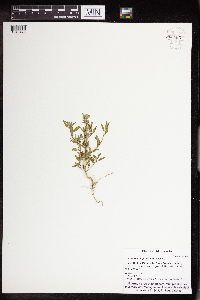 Chenopodium pratericola Rydberg 962883[1346478]Whitfeld, T.J.S. 24272019-08-29 United States, Minnesota, Cass, Us Army Corps of Engineers Winnibigoshish Recreation Area, dam-roadside, 47.429797 -94.049725 |
MIN:Plants |  Chenopodium pratericola Rydberg 962651[1346355]Graham, Dustin R. DRJG232015-07-08 United States, Minnesota, Marshall, Growing short way(ca. 10 m) to the west of Hwy 118., 48.46 -96.27, 347m |
MIN:Plants |  Chenopodium pratericola Rydberg 962655[1346351]Graham, Dustin R. DRJG402015-07-13 United States, Minnesota, Marshall, Located in roadside, just north of the intersection of 114 and highway 6., 48.44 -96.54, 318m |
Google Map
Google Maps is a web mapping service provided by Google that features a map that users can pan (by dragging the mouse) and zoom (by using the mouse wheel). Collection points are displayed as colored markers that when clicked on, displays the full information for that collection. When multiple species are queried (separated by semi-colons), different colored markers denote each individual species.