University of Minnesota
http://www.umn.edu/
612-625-5000
http://www.umn.edu/
612-625-5000
Minnesota Biodiversity Atlas
Bell Museum
Dataset: MIN-Plants
Taxa: Crataegus chrysocarpa
Search Criteria: excluding cultivated/captive occurrences
Bell Museum plants | |
 MIN:Plants | 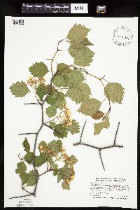 462332[1025649]Smith, Welby 270181998-05-11 United States, Minnesota, Benton, along the east bank of the Mississippi River, about 2 miles north-northeast of Sartell. SW1/4 of NW1/4 of Sec.;;037N;31W;34, 45.6572222 -94.1913889 |
MIN:Plants | 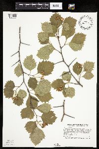 471850[1025656]Smith, Welby 272051998-06-04 United States, Minnesota, Cook, North Shore. Cook County ... east bank of the Cascade River, about 2.4 air miles inland from the shore of lake Superior ... T60N [sic - should be T61] R 2W NE1/4 of NW1/4 of Sec 25. 061N 02W 25, 47.7452778 -90.5258333 |
MIN:Plants | 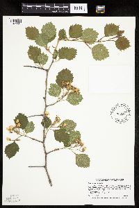 429333[1025847]Smith, Welby 266141997-06-13 United States, Minnesota, Saint Louis, St. Louis County ... along the East Branch Sturgeon River ... T60N R20W NW1/4 of SE1/4 of Sec 33;Superior National Forest;060N;20W;33, 47.6372223 -92.8769455 |
MIN:Plants | 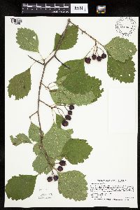 493745[1025681]Smith, Welby 268361997-09-09 United States, Minnesota, Carlton, Carlton County ... Moose Lake State Park, about 5 miles south-southwest of Barnum ... T46N R19W SW1/4 of SE1/4 of Sec 27;Moose Lake State Park;046N;19W;27, 46.4355545 -92.7313919 |
MIN:Plants | 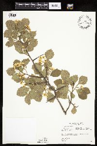 477811[1025732]Gerdes, Lynden 39522000-07-04 United States, Minnesota, Lake, Finland State Forest / North Shore. Near Ecbeck Forest Campground, Finland, MN. North of the campground; west side of River and N. of Hwy 1. of River and N. of Hwy. 1.. 057N 07W 33, 47.3789 -91.22489 |
MIN:Plants | 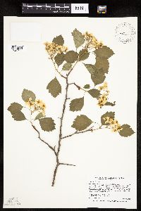 487888[1025848]Smith, Welby 256261995-05-28 United States, Minnesota, Rice, Three miles N of Faribault; on the W side of HWy 3 about 1 miles S of jct with Co Rd 29. NW1/4 of SW1/4 of section;;110N;20W;08, 44.3463889 -93.2572222 |
MIN:Plants | 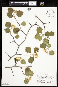 462227[1025647]Smith, Welby 270341998-05-12 United States, Minnesota, Itasca, Along Highway 7, about 9 air miles SE of Big Fork. SW1/4 of NW1/4 of Sec.;George Washington State Forest;060N;25W;26, 47.6547222 -93.4894444 |
MIN:Plants | 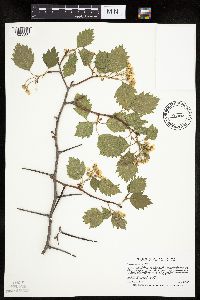 462020[1025580]Smith, Welby 266091997-06-12 United States, Minnesota, Lake, On the north side of Highway 1, about 4 miles north of Isabella. NE1/4 of NW1/4 of Sec.;Superior National Forest;060N;09W;36, 47.6452778 -91.4188889 |
MIN:Plants | 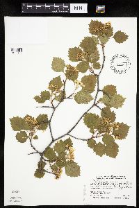 455583[1025499]Smith, Welby 278051999-05-28 United States, Minnesota, Marshall, Marshall County ... Old Mill State Park; about 11 miles west of Newfolden ... T156N R46W NW1/4 of SW1/4 of Sec 4;Old Mill State Park;156N;46W;04, 48.3611107 -96.5730591 |
MIN:Plants | 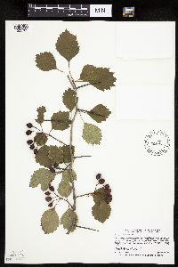 429191[1025785]Smith, Welby 268491997-09-14 United States, Minnesota, Saint Louis, St. Louis County ... along the East Branch Sturgeon River ... T60N R20W NW1/4 of SE1/4 of Sec 33;;060N;20W;33, 47.6372223 -92.8769455 |
MIN:Plants | 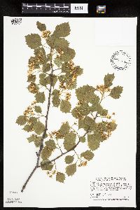 302931[1025781]Smith, Welby 278151999-05-28 United States, Minnesota, Marshall, Along the Middle river, on the west side of Newfolden. NE1/4 of NW1/4 of section;;156N;44W;08, 48.3563889 -96.3380556 |
MIN:Plants | 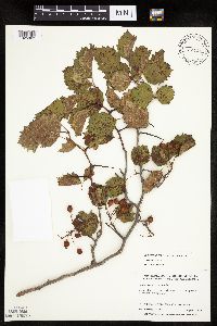 479310[1025803]Harris, Fred 992101999-08-11 United States, Minnesota, Yellow Medicine, Yellow Medicine Co.; T116N R40W: SE /4 of SW1/4 of SE 1/4 of Sect. 3;;116N;40W;3, 44.88402 -95.65767 |
MIN:Plants | 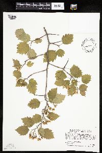 429295[1025510]Smith, Welby 277951999-05-27 United States, Minnesota, Otter Tail, Maplewood State Park. Otter Tail County ... Maplewood State Park; about 7.5 miles east of Pelican Rapids ... T 135N R 42W SW1/4 of NW1/4 of Sec 2. 135N 42W 2, 46.5374985 -95.9472198 |
MIN:Plants | 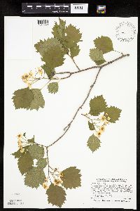 488183[1025839]Smith, Welby 277391999-05-16 United States, Minnesota, Steele, Steele County ... Rice Lake State Park, about 4 miles NW of Claremont ... T107N R19W NE1/4 of SE1/4 of Sec 11;Rice Lake State Park;107N;19W;11, 44.0866661 -93.0674973 |
MIN:Plants | 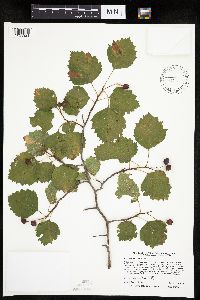 493676[1025921]Smith, Welby 259491995-09-08 United States, Minnesota, Wright, Wright County ... Collinwood County Park, about 3 miles SW of Cokato ... T 118N R 28W NE1/4 of SW1/4 of Sec 7;Collinwood County Park;118N;28W;07, 45.0422211 -94.2649994 |
MIN:Plants | 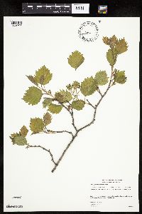 480717[1025705]Gerdes, Lynden 39202000-05-30 United States, Minnesota, Lake, North shore of Baptism River and NW of Hwy. 61. SW1/4 NE1/4 of section;North Shore / Tettegouche State Park;056N;07W;15, 47.33679 -91.20911 |
MIN:Plants | 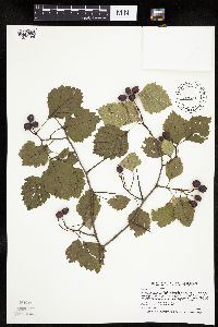 429244[1025786]Smith, Welby 268871997-10-01 United States, Minnesota, Pine, Pine County ... Banning State Park, about 2.5 miles north-northeast of Sandstone ... T43N R20W NW1/4 of NW1/4 of Sec 35;Banning State Park;043N;20W;35, 46.1708336 -92.8430557 |
MIN:Plants | 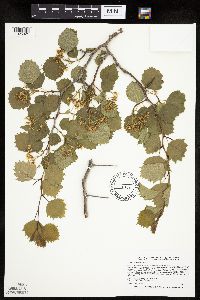 475241[1025825]Smith, Welby 265611997-06-02 United States, Minnesota, Cottonwood, Talcot Lake Wildlife Management Area. Cottonwood County ... Talcot Lake State Wildlife Management Area, about 2 miles north-northeast of Dundee ... at the southeast end of Talcot Lake ... R38W NW1/4 of SE1/4 of Sec 30. 105N 38W 30, 43.8680573 -95.4491653 |
MIN:Plants | 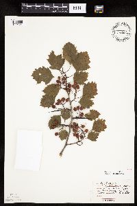 474208[1025801]Moore, John 4151971-07-29 United States, Minnesota, Sherburne, SW1/4 S-14 SantiagoTshp. [Sherburne Natinal Wildlife Refuge];Sherburne National Wildlife Refuge;035N;27W;14, 45.52313 -93.66503 |
MIN:Plants | 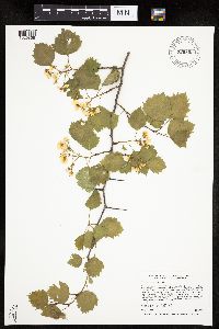 920802[1025868]Smith, Welby 256221995-05-28 United States, Minnesota, Scott, Scott County...At the rest stop on south-bound I35 just north of the Scott-Rice county line...T113N R21W NE1/4 of SE1/4 of Sec 35. 113N 21W 35, 44.551349 -93.308909 |
MIN:Plants | 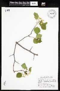 905338[1025537]Smith, Welby; et al. 293642003-05-16 United States, Minnesota, Wadena, Wadena County ... About 6 miles northeast of Wadena (town) ... T135N R34W SW1/4 of SW1/4 of Sec 30;;135N;34W;30, 46.47763 -95.01995 |
MIN:Plants | 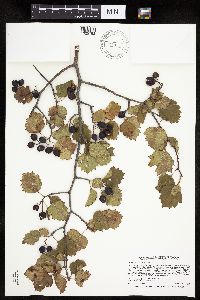 462263[1025782]Smith, Welby 268861997-09-23 United States, Minnesota, Chippewa, Chippewa County ... On the north side of Highway 212, about 0.6 mile east of where it crosses the Minnesota River in Granite Falls ... T116N R39WSW1/4 of SE1/4 of Sec 34. 116N 39W 34, 44.805 -95.5302778 |
MIN:Plants | 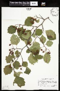 429166[1025665]Smith, Welby 268211997-08-25 United States, Minnesota, Lake, About 4 miles north of Isabella; Little Isabella River. NE1/4 of NW1/4 of Sec.;Superior National Forest;060N;09W;36, 47.6452778 -91.4188889 |
MIN:Plants | 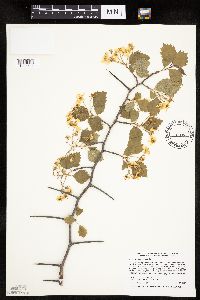 519606[1025581]Smith, Welby 256201995-05-27 United States, Minnesota, Wright, Abandoned railroad embankment just north of I94, 1.7 miles E-SE of Hasty. NW1/4 of SE1/4 of section;;122N;26W;22, 45.3602778 -93.9416667 |
MIN:Plants | 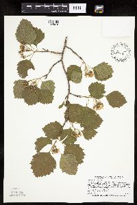 493777[1025818]Smith, Welby 265921997-06-09 United States, Minnesota, Crow Wing, Crow Wing County ... Crow Wing State Park, about 7 miles north of Fort Ripley ... T44N R32W SW1/4 of SW1/4 of Sec 26;Crow Wing State Park;044N;32W;26, 46.2622223 -94.3424988 |
MIN:Plants | 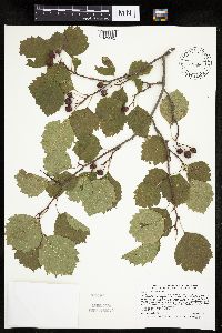 493304[1025682]Smith, Welby 268611997-09-15 United States, Minnesota, Crow Wing, Crow Wing County ... Crow Wing State Park, about 7 miles north of Fort Ripley ... T44N R32W SW1/4 of SW1/4 of Sec 26;Crow Wing State Park;044N;32W;26, 46.2622223 -94.3424988 |
MIN:Plants | 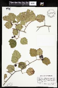 475242[1025793]Smith, Welby 268591997-09-15 United States, Minnesota, Crow Wing, Crow Wing County ... Crow Wing State Park, ca 7 miles N of Fort Ripley ... T44N R32W SW1/4 of SW1/4 of Sec 26;Crow Wing State Park;044N;32W;26, 46.2622223 -94.3424988 |
MIN:Plants | 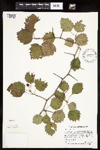 429311[1025739]Smith, Welby 259271995-09-01 United States, Minnesota, Scott, At the rest stop on south-bound I35 just north of the Scott-Rice county line. NE1/4 of SE1/4 of section SE1/4 of Sec 35. 113N 21W 35, 44.546565 -93.300959 |
MIN:Plants | 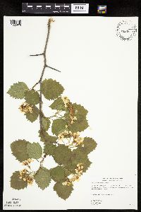 454145[1025608]Gerdes, Lynden 39552000-06-04 United States, Minnesota, Lake, Finland State Forest / North Shore. Lake County ... Near Ecbeck Forest Campground, Finland, MN ... North of the campground; west side of River and N of Hwy. 1 ... T57N R07W S33SESW. 057N 07W 33, 47.3789 -91.22489 |
MIN:Plants | 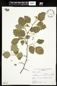 482177[1025670]Gerdes, Lynden; et al. 26221998-06-07 United States, Minnesota, Cook, Superior National Forest. T65N R04W S26NWSE. Cook County; Superior National Forest. Cross River riparian zone, east side of river and north of the Gunflint Trail (Cty. 12). 065N 04W 26, 48.0845 -90.80375 |
MIN:Plants | 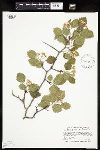 489285[1025789]Smith, Welby 270591998-05-13 United States, Minnesota, Koochiching, Pine Island State Forest. Koochiching County ... east bank of the Big Fork River, about 5 miles south of Lindford ... T 156N R 25W SW1/4 of SE1/4 of Sec 11. 156N 25W 11, 48.3408318 -93.8097229 |
MIN:Plants | 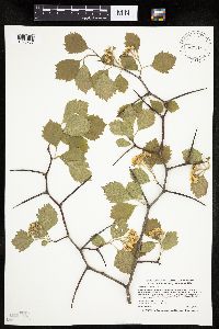 489292[1025787]Smith, Welby 270771998-05-13 United States, Minnesota, Itasca, Itasca County ... About 3 miles south of Northome, at the NW end of Island Lake ... T 150N R28W SW1/4 of SW1/4 of Sec 5;Chippewa National Forest;150N;28W;05, 47.831665 -94.2624969 |
MIN:Plants | 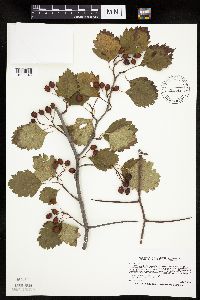 505595[1025845]Smith, Welby 268371997-09-09 United States, Minnesota, Saint Louis, St. Louis County ... About 200 meters E of where the Willard Munger Trail crosses Hwy 23, on the western edge of Duluth ... T49N R15W SE1/4 of SE1/4 of Sec 32. 049N 15W 32, 46.6777763 -92.2588882 |
MIN:Plants | 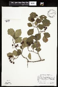 461913[1025758]Smith, Welby 268421997-09-10 United States, Minnesota, Washington, William O'Brien State Park. Washington County ... William O'Brien State Park. In the St. Croix Valley, about 1.5 miles north of Marine ... T32N R19W SW1/4 of SW1/4 of Sec 30. 032N 19W 30, 45.2249985 -92.7600021 |
MIN:Plants | 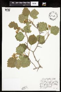 453500[1025629]Smith, Welby 278011999-05-27 United States, Minnesota, Red Lake, Red Lake County ... Old Crossing Treaty State Wayside Park. Along the Red Lake River about 5 miles N-NE of Gentilly ... T 151N R 45W NE1/4 of SE1/4 of Sec 28. 151N 45W 28, 47.8672218 -96.421669 |
MIN:Plants | 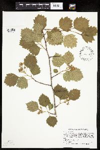 493673[1025745]Smith, Welby 265961997-06-09 United States, Minnesota, Crow Wing, Crow Wing County ... Crow Wing State Park, ca 7 miles N of Fort Ripley ... T44N R32W SW1/4 of SW1/4 of Sec 26;Crow Wing State Park;044N;32W;26, 46.2622223 -94.3424988 |
MIN:Plants | 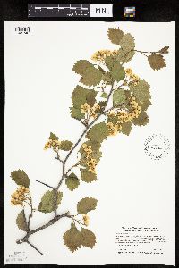 488185[1025748]Smith, Welby 270191998-05-11 United States, Minnesota, Cass, Cass County ... On the north side of County Highway 36, about 7 miles W-SW of Brainerd ... T 133N R 29W SW1/4 of SW1/4 of Sec 21. 133N 29W 21, 46.3130569 -94.3477783 |
MIN:Plants | 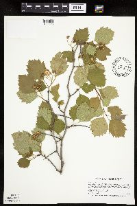 475263[1025628]Smith, Welby 266241997-06-18 United States, Minnesota, Lake, Lake County ... About 2 miles northwest of Two Harbors ... T53N R11W SW1/4 of NW1/4 of Sec 26;North Shore;053N;11W;26, 47.0491676 -91.707222 |
MIN:Plants | 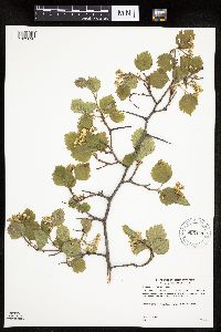 905443[1025698]Gerdes, Lynden 46752003-06-03 United States, Minnesota, Lake, Wanless Farm Wildlife Opening (west of Harriet Lake); approximately 11.41 miles ENE of Isabella, MN.;Superior National Forest;060N;06W;29, 47.65194 -91.11852 |
MIN:Plants | 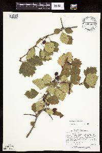 435089[1025693]Lee, Michael MDL19711997-09-24 United States, Minnesota, Stearns, Stearns County...4 miles south of St. Stephen...T125N R29W NW1/4 NE1/4 NE1/4 Sec. 13;;125N;29W;13, 45.6374 -94.27394 |
MIN:Plants | 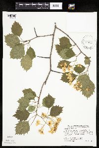 487865[1025579]Smith, Welby 278161999-05-28 United States, Minnesota, Marshall, along the Middle River, on the west side of Newfolden. NE1/4 of NW1/4 of Sec.;;156N;44W;08, 48.3563889 -96.3380556 |
MIN:Plants | 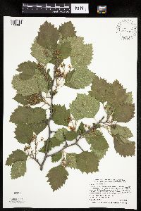 488049[1025831]Smith, Welby 270971998-05-18 United States, Minnesota, Le Sueur, Le Sueur County ... On the south side of Highway 99 at its junction with County road 110, about one mile east of Le Center ... T111N R24W NE1/4 of NE1/4 of Sec 33. 111N 24W 33, 44.3841667 -93.7074966 |
MIN:Plants | 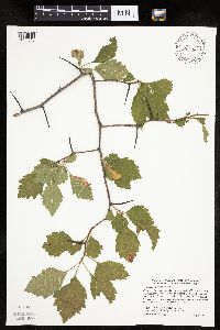 488306[1025843]Smith, Welby 279801999-07-09 United States, Minnesota, Swift, Swift County ... Monson Lake State Park, about 9 miles north of Kerkhoven ... T121N R37W NE1/4 of NW1/4 of Sec 1;Monson Lake State Park;121N;37W;01, 45.3236122 -95.2688904 |
MIN:Plants | 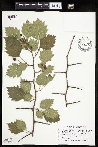 475239[1025494]Smith, Welby 268201997-08-25 United States, Minnesota, Lake, Lake County ... On the north side of Highway 1, about 4 miles north of Isabella ... T60N R9W NE1/4 of NW1/4 of sec 36;Superior National Forest;060N;09W;36, 47.6452789 -91.4188919 |
MIN:Plants | 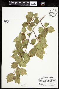 429291[1025565]Smith, Welby 265941997-06-09 United States, Minnesota, Crow Wing, Crow Wing State Park. Crow Wing County ... Crow Wing State Park, ca 7 miles N of Fort Ripley ... On floodplain but above floodway ... T44N R32W SW1/4 of SW1/4 of Sec 26. 044N 32W 26, 46.2622222 -94.3425 |
MIN:Plants | 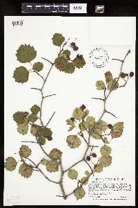 453991[1025603]Smith, Welby 268651997-09-15 United States, Minnesota, Crow Wing, At the confluence of the Nokasippi and Mississippi Rivers, about one mile N of Fort Ripley. NE1/4 of SW1/4 of Sec.;;043N;32W;27, 46.1780556 -94.3644444 |
MIN:Plants | 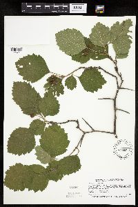 429328[1025741]Smith, Welby 266731997-07-03 United States, Minnesota, Sherburne, Sherburne National Wildlife Refuge. Sherburne County ... Sherburne National Wildlife Refuge, on the north side of Rice Lake, about 5 miles northwest of Zimmerman ... T35N R27W NW1/4 of NW1/4 of Sec 26. 035N 27W 26, 45.4963875 -93.6688919 |
MIN:Plants | 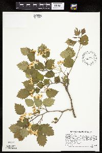 454968[1025634]Smith, Welby 265371997-05-27 United States, Minnesota, Washington, in the St. Croix Valley about 1.5 miles north of Marine. SW1/4 of SW1/4 of Sec.;William O'Brien State Park;032N;19W;30, 45.225 -92.76 |
MIN:Plants | 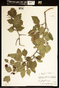 929035[1283936]Anderson, Chel 22262011-08-30 United States, Minnesota, Lake, UTM: 5329912 / 635038. SESE of section;Boundary Waters Canoe Area Wilderness / Superior National Forest;065N;07W;14, 48.1081372 -91.1859031 |
MIN:Plants | 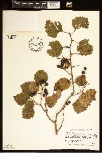 923724[1283939]Smith, Welby 268731997-09-22 United States, Minnesota, Cottonwood, Talcot Lake Wildlife Management Area. Talcot Lake State Wildlife Management Area, about 2 miles north-northeast of Dundee ... at the southeast end of Talcot Lake ... R38W NW1/4 of SE1/4 of Sec 30. 105N 38W 30, 43.8680556 -95.4491667 |
MIN:Plants | 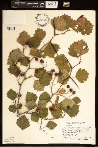 923723[1283941]Smith, Welby 259391995-09-04 United States, Minnesota, Dakota, One mile south of Eagen [sic] corporate boundary, on the west side of Highway 3 (South Robert Trail) at jct with 130th St. NW1/4 of NE1/4 of section;;115N;19W;20, 44.7605556 -93.1230556 |
MIN:Plants | 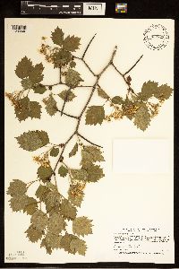 923725[1283940]Smith, Welby 266261997-06-18 United States, Minnesota, Lake, Where Highway 1 crosses the Baptism River ... T57N R7W SE1/4 of SW1/4 of Sec 33;Finland State Forest / North Shore;057N;07W;33, 47.3738889 -91.2297222 |
MIN:Plants | 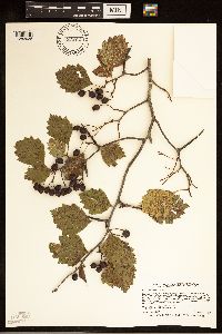 923722[1283938]Smith, Welby 268841997-09-23 United States, Minnesota, Meeker, Between Highway 7 and the old Chicago & Northwestern Railroad tracks ... about 1.5 miles east of Corvuso ... T117N R31W NE1/4 of SW1/4 of Sec 16. 117N 31W 16, 44.9411111 -94.5744444 |
MIN:Plants | 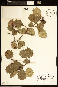 844386[1283931]Smith, Welby R. 268471997-09-14 United States, Minnesota, Saint Louis, About 6 miles northwest of Chisholm. T59N R21W SW1/4 of SW1/4 of Sec 23, 47.573056 -92.972778 |
MIN:Plants | 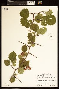 930593[1283937]Gerdes, Lynden B.; Walewski, Joe W. 61832010-08-09 United States, Minnesota, Lake, Swamp Portage; between Mud Bay and Swamp Lake. SW1/4 of NW1/4 of section;Superior National Forest;066N;06W;24, 48.1883333 -91.0516667 |
MIN:Plants | 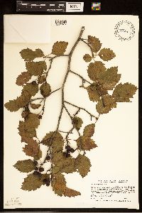 507899[1283942]Smith, Welby R. 268451997-09-10 United States, Minnesota, Washington, St. Croix Valley, about 2 miles northeast of Stillwater. West side of Highway 95. NW1/4 SE1/4 of section.;;030N;20W;10, 45.0977778 -92.7877778 |
MIN:Plants | 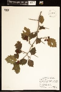 939640[1283935]Smith, Welby R. 321332010-08-29 United States, Minnesota, Cook, About 12 miles north of Tofte on Highway 2. Bank of Temperance River. SW of SE of section;Superior National Forest;061N;04W;30, 47.7331265 -90.8799058 |
MIN:Plants | 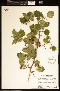 937700[1283934]Gerdes, Lynden B. 66652012-08-01 United States, Minnesota, Lake, Birch Lake dam area, approximately 6.47 miles SE of Ely, MN and 0.12 miles NNW of the dam. NWSWNENW of sec.;Superior National Forest;062N;11W;31, 47.817222 -91.786111 |
MIN:Plants | 940608[]Smith, Welby R. 260191996-05-22 United States, Minnesota, Martin, At the southwest end of Bright Lake, about 8 miles southwest of Fairmont; NW of SW of section;;101N;31W;17, 43.5494444 -94.5888889 |
MIN:Plants | 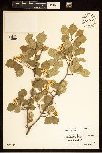 940606[1283957]Smith, Welby R. 260361996-05-25 United States, Minnesota, Scott, In the Louisville Swamp area; NW of SW of section;;115N;23W;28, 44.7388889 -93.5988889 |
MIN:Plants | 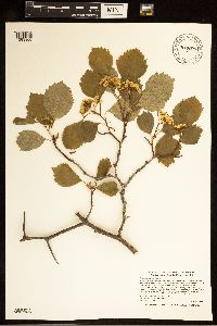 940605[1283966]Smith, Welby R. 260421996-05-26 United States, Minnesota, Scott, just SW of Burnsville. An unusually large specimen with several trunks from one base SE of SE of section;;114N;21W;04, 44.7061111 -93.3413889 |
MIN:Plants | 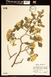 940604[1283982]Smith, Welby R. 260441996-05-28 United States, Minnesota, Olmsted, In a grassy old field on the east side of U.S. Hwy 52, about 2 miles south of Oronoco. A large, dense colony (thicket) occupying about 50 sq m SW of SE of section;;108N;14W;20, 44.1375 -92.525 |
MIN:Plants | 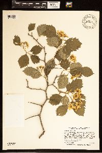 940603[1283959]Smith, Welby R. 260531996-05-29 United States, Minnesota, Mower, about 2 miles northwest of Le Roy; SW of NW of section;;101N;14W;21, 43.5388889 -92.5286111 |
MIN:Plants | 940602[]Smith, Welby R. 260851996-06-03 United States, Minnesota, Pipestone, ca 7 mi S-SW of Pipestone. In a narrow band of deciduous forest along shore shore of Split Rock Lake. Under broken canopy of green ash NW of NW of section;;105N;46W;22, 43.8916667 -96.3636111 |
MIN:Plants | 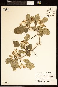 940601[1283933]Smith, Welby R. 260861996-06-03 United States, Minnesota, Rock, about 3 miles N-NE of Luverne. In a brushy habitat on a shallow east-facing cliff of Souix quartzite; rooted in a narrow rock crevice NW of NW of section;;103N;45W;24, 43.7163889 -96.1897222 |
MIN:Plants | 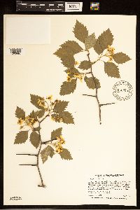 940599[1283946]Smith, Welby R. 260971996-06-05 United States, Minnesota, Pine, Along the Willard Munger State Trail, about 4 miles north of Hinkley. In a moist brushy pasture being invaded by aspen and birch saplings. SE of NE of section;;042N;21W;36, 46.0788889 -92.9344444 |
MIN:Plants | 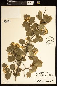 940598[1283944]Smith, Welby R. 260981996-06-05 United States, Minnesota, Carlton, Along the Willard Munger State Trail, 1/4 mile east of the trail head in Carlton (town). In a brushy habitat on thin soil over bedrock. NW of NE of section;;048N;16W;07, 46.6622222 -92.4161111 |
MIN:Plants | 940597[]Smith, Welby R. 260991996-06-05 United States, Minnesota, Kanabec, On the north side of Hwy 27, 3.75 miles east of its jct with Hwy 47 near Isle. In a grassy/brushy roadside; full sun, mesic soil SW of SE of section;;042N;24W;15, 46.1158333 -93.3541667 |
MIN:Plants | 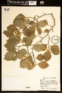 940596[1283979]Smith, Welby R. 261001996-06-05 United States, Minnesota, Mille Lacs, on the SW shore of Mille Lacs lake. In a partial opening in an oak-aspen woodland. Forming a loose thicket about 8 meters across SW of SE of section;;042N;27W;05, 46.1286111 -93.7725 |
MIN:Plants | 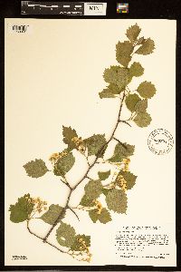 940593[1283965]Smith, Welby R. 261041996-06-06 United States, Minnesota, Wadena, Two miles NE of Staples. Along a fence row that separates the road right-of-way from a plowed field. Large open-grown shrub with more or less ascending branches NW of NE of section;;134N;32W;31, 46.3786111 -94.7680556 |
MIN:Plants | 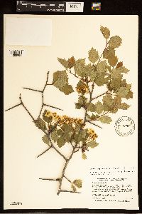 940592[1283981]Smith, Welby R. 261051996-06-06 United States, Minnesota, Wadena, About 2 miles NE of Staples. In a brushy strip between an old field and an open- canopy bur oak woodland. NW of NE of section;;134N;32W;31, 46.3786111 -94.7680556 |
MIN:Plants | 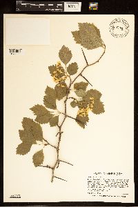 940591[1283963]Smith, Welby R. 261081996-06-06 United States, Minnesota, Wadena, The 'Old Wadena Site', 8 mi NW of Staples. An opening in dryish oak-aspen woods (bur oak, trembling aspen). A large open-grown shrub with ascending branches SW of SW of section;;134N;33W;11, 46.4313889 -94.8155556 |
MIN:Plants | 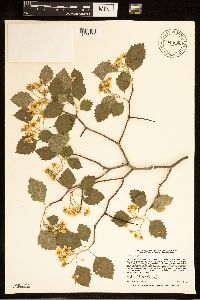 940590[1283952]Smith, Welby R. 261101996-06-06 United States, Minnesota, Wadena, Just E of the Wadena - Otter tail County line, ca 3 miles N of Wadena (town). Growing in shrub thicket along a fence row between a pasture and a plowed field SW of SW of section;;135N;35W;17, 46.5025 -95.1536111 |
MIN:Plants | 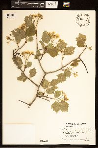 940589[1283980]Smith, Welby R. 261121996-06-06 United States, Minnesota, Wadena, In a narrow strip of deciduous trees (mostly green ash) along the northeast end of Blueberry Lake, ca 2.5 miles north of Menahga. A large multi-stemmed shrub NE of SW of section;;138N;35W;02, 46.7961111 -95.0716667 |
MIN:Plants | 940588[]Smith, Welby R. 261131996-06-06 United States, Minnesota, Wadena, About 1 mile N-NW of Blue Grass. In an abandoned pasture, now being invaded by shrubs and tree saplings. A large open-grown shrub with ascending branches NE of NE of section;;136N;34W;31, 46.5577778 -95.0111111 |
MIN:Plants | 940586[]Smith, Welby R. 261161996-06-06 United States, Minnesota, Wadena, About one mile N-NW of Blue Grass. In a long-abandoned pasture now being invaded by shrubs and tree saplings. A large multi-stemmed shrub NE of NE of section;;136N;34W;31, 46.5577778 -95.0111111 |
MIN:Plants | 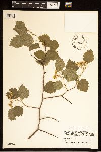 940585[1283948]Smith, Welby R. 261171996-06-06 United States, Minnesota, Wadena, About 1.5 miles W-SW of Sebeka. Along a fence row running adjacent to the south side of County Road 134. NW of NE of section;;136N;35W;08, 46.6158333 -95.1216667 |
MIN:Plants | 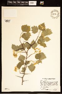 940584[1283961]Smith, Welby R. 261201996-06-06 United States, Minnesota, Wadena, About 5 miles SE of Nimrod. On the N side of County Road 139. Along the edge between a cow pasture and a bur oak woodland. A large dense multi-stemmed shrub SW of SE of section;;136N;33W;01, 46.6188889 -94.7888889 |
MIN:Plants | 940582[]Smith, Welby R. 261281996-06-07 United States, Minnesota, Morrison, about one mile N-NW of Fort Ripley (town). In dry sandy soil at the edge of an oak-aspen woodland NW of NW of section;;131N;29W;08, 46.1772222 -94.3702778 |
MIN:Plants | 940580[]Smith, Welby R. 261371996-06-10 United States, Minnesota, Lake, about 10 miles E-NE of Ely along Fernberg Road. In a released aspen stand (cut 8-15 yrs previous), in thin soil over bedrock SE of NW of section;;063N;10W;08, 47.9569444 -91.6338889 |
MIN:Plants | 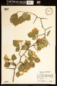 940579[1283971]Smith, Welby R. 261381996-06-10 United States, Minnesota, Saint Louis, In the town of Ely. Along Shagawa St, 1 block W of it's jct with Lakeview St. In a brushy roadside habitat (a natural occurrence) SE of SW of section;;063N;12W;28, 47.9068808 -91.8773316 |
MIN:Plants | 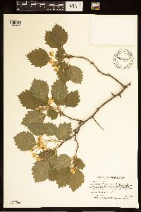 940577[1283983]Smith, Welby R. 261411996-06-10 United States, Minnesota, Saint Louis, On the south side of Tower (town). In a brushy habitat on an abandoned railroad right-of-way SE of SW of section;;062N;15W;32, 47.8035383 -92.2805605 |
MIN:Plants | 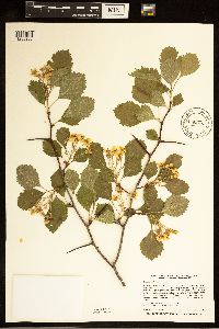 940576[1283955]Smith, Welby R. 261471996-06-12 United States, Minnesota, Lake, On the E side of Hwy 1, 1/4 mile S of its jct with Forest Road 173. At the brushy margin of an aspen clear-cut. NE of SE of section;;061N;10W;31, 47.7252778 -91.6422222 |
MIN:Plants | 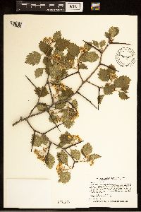 940574[1283953]Smith, Welby R. 261501996-06-12 United States, Minnesota, Cook, Along the Temperance River, about 12 miles north of Tofte. In a young aspen forest. A small thicket of several large upright shrubs NW of SW of section;;061N;04W;29, 47.7355556 -90.8708333 |
MIN:Plants | 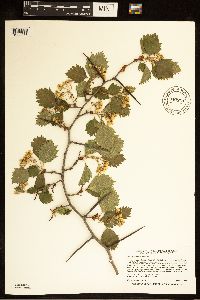 940573[1283973]Smith, Welby R. 261511996-06-12 United States, Minnesota, Cook, About 1/8 mile E of the Sawbill Trail, and 7 miles N of Tofte. Opening in a boreal-type forest of white spruce and trembling aspen SE of SE of section;;060N;04W;17, 47.6763889 -90.8569444 |
MIN:Plants | 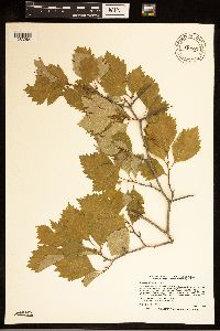 940571[1283984]Smith, Welby R. 261721996-06-19 United States, Minnesota, Douglas, About 6 miles N-NE of Alexandria. In a grassy/brushy old field near the park entrance NE of NW of section;;129N;37W;15, 45.9905556 -95.3191667 |
MIN:Plants | 940570[]Smith, Welby R. 261741996-06-19 United States, Minnesota, Otter Tail, ca 3 mi NE of Battle Lake (town). In a narrow strip of woods along the W shore of Molly Stark Lake. A dense shrub with a single stem NW of SW of section;;133N;40W;24, 46.3177778 -95.6758333 |
MIN:Plants | 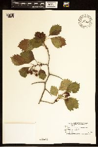 940568[1283978]Smith, Welby R. 262101996-07-05 United States, Minnesota, Sherburne, About one mile S-SW of Princeton NW of SE of section;;035N;26W;05, 45.5486111 -93.6013889 |
MIN:Plants | 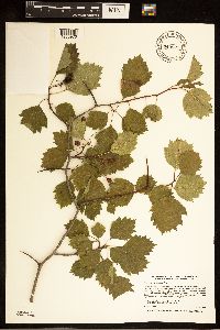 940567[1283976]Smith, Welby R. 262521996-07-23 United States, Minnesota, Saint Louis, On the east side of Indian Lake, about one mile north of Rollins. On the sandy beach in a zone between the willows (lake side) and the jack pine (inland side) SE of SW of section;;055N;12W;03, 47.2734473 -91.8492199 |
MIN:Plants | 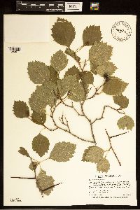 940566[1283977]Smith, Welby R. 262761996-07-25 United States, Minnesota, Cook, In brushy thicket along Grand Portage Creek, about 1/8 mile from its mouth at lake Superior SE of SW of section;;063N;06E;04, 47.9636111 -89.6827778 |
MIN:Plants | 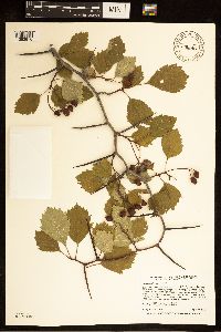 940564[1283970]Smith, Welby R. 263821996-08-27 United States, Minnesota, Saint Louis, In the town of Ely. Along Shagawa St, 1 block W of it's jct with Lakeview St. In a brushy roadside habitat (a natural occurrence) SE of SW of section;;063N;12W;28, 47.9068808 -91.8773316 |
MIN:Plants | 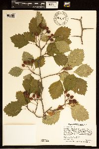 940563[1283985]Smith, Welby R. 263831996-08-27 United States, Minnesota, Lake, about 10 miles E-NE of Ely along Fernberg Road. In a released aspen stand (cut 8-15 yrs previous), in thin soil over bedrock SE of NW of section;;063N;10W;08, 47.9569444 -91.6338889 |
MIN:Plants | 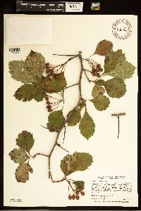 940562[1283954]Smith, Welby R. 263851996-08-28 United States, Minnesota, Lake, On the E side of Hwy 1, 1/4 mile S of its jct with Forest Road 173. At the brushy margin of an aspen clear-cut. NE of SE of section;;061N;10W;31, 47.7252778 -91.6422222 |
MIN:Plants | 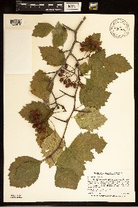 940561[1283949]Smith, Welby R. 263861996-08-28 United States, Minnesota, Lake, About 1/2 mile S of Flat Horn Lake. In a young aspen stand (cut 20+ years previous). A large shrub with 3 stems SE of NE of section;;060N;09W;27, 47.6563889 -91.4538889 |
MIN:Plants | 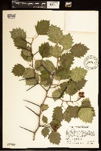 940560[1283969]Smith, Welby R. 263891996-08-28 United States, Minnesota, Cook, Along the Temperance River, about 12 miles north of Tofte. In a young aspen forest. A small thicket of several large upright shrubs NW of SW of section;;061N;04W;29, 47.7355556 -90.8708333 |
MIN:Plants | 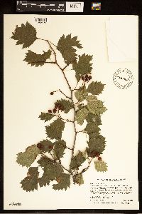 940559[1283972]Smith, Welby R. 263901996-08-28 United States, Minnesota, Cook, About 1/8 mile E of the Sawbill Trail, and 7 miles N of Tofte. Opening in a boreal-type forest of white spruce and trembling aspen SE of SE of section;;060N;04W;17, 47.6763889 -90.8569444 |
MIN:Plants | 940558[]Smith, Welby R. 263981996-09-06 United States, Minnesota, Morrison, about one mile N-NW of Fort Ripley (town). In dry sandy soil at the edge of an oak-aspen woodland NW of NW of section;;131N;29W;08, 46.1772222 -94.3702778 |
MIN:Plants | 940555[]Smith, Welby R. 264051996-09-06 United States, Minnesota, Kanabec, On the north side of Hwy 27, 3.75 miles east of its jct with Hwy 47 near Isle. In a grassy/brushy roadside; full sun, mesic soil SW of SE of section;;042N;24W;15, 46.1158333 -93.3541667 |
MIN:Plants | 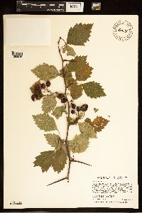 940553[1283945]Smith, Welby R. 264081996-09-09 United States, Minnesota, Pine, Along the Willard Munger State Trail, about 4 miles north of Hinkley. In a moist brushy pasture being invaded by aspen and birch saplings. SE of NE of section;;042N;21W;36, 46.0788889 -92.9344444 |
MIN:Plants | 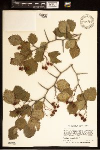 940552[1283943]Smith, Welby R. 264091996-09-09 United States, Minnesota, Carlton, Along the Willard Munger State Trail, 1/4 mile east of the trail head in Carlton (town). In a brushy habitat on thin soil over bedrock. NW of NE of section;;048N;16W;07, 46.6622222 -92.4161111 |
Google Map
Google Maps is a web mapping service provided by Google that features a map that users can pan (by dragging the mouse) and zoom (by using the mouse wheel). Collection points are displayed as colored markers that when clicked on, displays the full information for that collection. When multiple species are queried (separated by semi-colons), different colored markers denote each individual species.