University of Minnesota
http://www.umn.edu/
612-625-5000
http://www.umn.edu/
612-625-5000
Minnesota Biodiversity Atlas
Bell Museum
Dataset: MIN-Plants
Taxa: Quercus
Search Criteria: excluding cultivated/captive occurrences
Bell Museum plants | |
 MIN:Plants |  Quercus velutina Lamarck 99140[1096487]Wheeler, William 6421899-08-26 United States, Minnesota, Houston, Jefferson;Dorer Memorial Hardwood State Forest;101N;04W;35, 43.50806 -91.28287 |
MIN:Plants |  Quercus velutina Lamarck 99141[1096486]Wheeler, William 6421899-08-26 United States, Minnesota, Houston, Jefferson;Dorer Memorial Hardwood State Forest;101N;04W;35, 43.50806 -91.28287 |
MIN:Plants |  Quercus velutina Lamarck 357976[1005443]Butters, F.; Rosendahl, C. 39561920-06-29 United States, Minnesota, Houston, Ca. 5 mi NW of Reno;Dorer Memorial Hardwood State Forest;102N;04W;, 43.6523 -91.34572 |
MIN:Plants |  Quercus velutina Lamarck 99144[1005431]Butters, F.; et al. 30521915-06-26 United States, Minnesota, Houston, 4 mi. SE from Houston.;Dorer Memorial Hardwood State Forest;103N;06W;, 43.72235 -91.5116 |
MIN:Plants |  Quercus velutina Lamarck 99145[1005447]Rosendahl, C.; Butters, F. 33121916-07-11 United States, Minnesota, Houston, Winnebago Valley, Houston Co.;Dorer Memorial Hardwood State Forest;;;, 43.66667 -91.50056 |
MIN:Plants |  Quercus velutina Lamarck 99146[1096493]Rosendahl, C.; Butters, F. 32121916-07-11 United States, Minnesota, Houston, Winnebago Valley, Houston Co.;Dorer Memorial Hardwood State Forest;N;;, 43.51071 -91.45844 |
MIN:Plants |  Quercus velutina Lamarck 99149[1005439]Butters, F.; et al. 32921916-07-05 United States, Minnesota, Houston, Along the roadside, Root River Valley near Hokah;;;;, 43.75944 -91.34639 |
MIN:Plants |  Quercus velutina Lamarck 99151[1005451]Butters, F.; et al. 30521915-06-26 United States, Minnesota, Houston, Ca. 4 mi. SE from Houston.;Dorer Memorial Hardwood State Forest;103N;04W;, 43.72235 -91.5116 |
MIN:Plants |  Quercus velutina Lamarck 99152[1005432]Rosendahl, C. 38731919-08-08 United States, Minnesota, Houston, Along Reno - New Albin Hwy. Jefferson Twp.;Dorer Memorial Hardwood State Forest;101N;04W;00, 43.54639 -91.30944 |
MIN:Plants |  Quercus velutina Lamarck 99153[1096489]Butters, F.; et al. 39541920-06-29 United States, Minnesota, Houston, 4 to 5 mi. NW of Reno.;Dorer Memorial Hardwood State Forest;102N;04W;, 43.62916 -91.31853 |
MIN:Plants |  Quercus velutina Lamarck 99154[1005454]Wheeler, William 6431899-08-26 United States, Minnesota, Houston, Jefferson;Dorer Memorial Hardwood State Forest;101N;04W;35, 43.50806 -91.28287 |
MIN:Plants |  Quercus x bebbiana C.K. Schneider 367144[1004727]Moore, John; Butters, F. 134491940-09-03 United States, Minnesota, Carlton, Beside wood-road. 8 mi. E of Barnum.;;;;, 46.50294 -92.52007 |
MIN:Plants |  Quercus x bebbiana C.K. Schneider 98684[1004729]Rosendahl, C.; Butters, F. s.n.1919-09-20 United States, Minnesota, Aitkin, near Mille Lacs [Lake], Aitkin Co.;;;;, 46.24825 -93.65295 |
MIN:Plants |  Quercus x hawkinsiae Sudworth 747389[1005456]Galatowitsch, S. 6611982-08-18 United States, Minnesota, Houston, Houston County ... Caledonia Oaks ... T102N R5W E1/2 SW1/4 Sec. 24;Caledonia Oaks, The Nature Conservancy;102N;05W;24, 43.6231 -91.38242 |
MIN:Plants |  Quercus x hawkinsiae Sudworth 99147[1005458]Butters, F.; et al. 32911916-07-05 United States, Minnesota, Houston, About 5 mi N of Caledonia;Dorer Memorial Hardwood State Forest;103N;05W;29, 43.69592 -91.46207 |
MIN:Plants |  Quercus x hawkinsiae Sudworth 99148[1005457]Rosendahl, C. 38741919-08-08 United States, Minnesota, Houston, Along Reno - New Albin hwy; Jefferson Twp.;Dorer Memorial Hardwood State Forest;101N;04W;00, 43.60111 -91.275 |
MIN:Plants |  Quercus x schuettei Trelease 98676[1096482]Rosendahl, C. 34611918-05-14 United States, Minnesota, Hennepin, 13 Ave. SE, between University and 4th St, near Dr. Alges barn, about 30 ft. from sidewalk;;028N;23W;, 44.9051624 -93.1664625 |
MIN:Plants |  Quercus x schuettei Trelease 98677[1096481]Rosendahl, C. 34591918-05-12 United States, Minnesota, Ramsey, S side of Carter Ave, 400 ft. W of Como Ave.;;029N;23W;, 44.9920769 -93.1663869 |
MIN:Plants |  Quercus x schuettei Trelease 98678[1005426]Rosendahl, C. 34261916-10-30 United States, Minnesota, Ramsey, S side Carter Ave, ca. 400 ft. W of Como Ave.;;029N;23W;, 44.980626 -93.195017 |
MIN:Plants |  Quercus macrocarpa Michaux 98679[1096423]Rosendahl, C. 34301917-09-00 United States, Minnesota, Houston, Rosendahl's farm, Spring Grove;;101N;07W;, 43.54392 -91.6707 |
MIN:Plants |  Quercus macrocarpa Michaux 98681[1096422]Rosendahl, C. 34271916-10-30 United States, Minnesota, Ramsey, S side of Carter Ave, ca. 400 ft. W from Como Ave.;;029N;23W;, 44.9920769 -93.1663869 |
MIN:Plants | Quercus bicolor Willdenow 98682[1005425]Rosendahl, C. United States, Minnesota, Hennepin, Detailed locality information protected. This is typically done to protect rare or threatened species localities. |
MIN:Plants |  Quercus x paleolithicola Trelease 99150[1005460]Butters, F.; et al. 30521915-06-26 United States, Minnesota, Houston, About 4 mi SE from Houston;Dorer Memorial Hardwood State Forest;103N;06W;14, 43.72505 -91.52147 |
MIN:Plants |  Quercus ellipsoidalis E.J. Hill 487852[1004766]Smith, Welby 275551998-08-28 United States, Minnesota, Wright, Wright County ... Lake Maria State Park, about 3 miles south-southwest of Hasty ... T 121N R 26W NE1/4 of NW1/4 of Sec 3;Lake Maria State Park;121N;26W;03, 45.3252792 -93.9430542 |
MIN:Plants |  680245[1005472;1005471]US Nat. Arboretum staff s.n.1975-10-16 United States, Virginia, Accomack, Assateague Isl, Nat. Wildlife Refuge;Chincoteague National Wildlife Refuge;;;, 37.976409 -75.304756 |
MIN:Plants | Quercus velutina Lamarck 680236[]US Nat. Arboretum staff s.n.1975-08-19 United States, District of Columbia, U.S. National Arboretum ... [cultivated] |
MIN:Plants |  919571[1005397]Smith, Welby 222121993-05-25 United States, Minnesota, McLeod, Piepenburg CP. McLeod County ... Piepenberg [sic] County Park, on the east side of Belle Lake about 6 miles northwest of Hutchinson...T117N R30W SE1/4 of NE1/4 of Sec 3. 117N 30W 3, 44.9736111 -94.4211111 |
MIN:Plants |  509918[1005297]Smith, Welby 290382000-08-23 United States, Minnesota, Rice, Rice County ... At the I35 north-bound reat stop, about 4 miles west of Dundas ... T 111N R 21W SE1/4 of SW1/4 of Sec 12;;111N;21W;12, 44.4308319 -93.2938919 |
MIN:Plants |  Quercus macrocarpa Michaux 491659[1005164]Smith, Welby 254751994-09-08 United States, Minnesota, Beltrami, Beltrami County ... At the Waskish Municipal Campground ... T 154N R 30W SE1/4 of NE1/4 of Sec 8;;154N;30W;08, 48.1722222 -94.5116667 |
MIN:Plants |  Quercus alba L. 476737[1004682]Smith, Welby 290142000-08-20 United States, Minnesota, Ramsey, Ramsey County ... Snail Lake regional Park, in Shoreview ... t30N R23W SW1/4 of SE1/4 of Sec. 24;Snail Lake Vadnais Lake County Park;030N;23W;24, 45.0720209 -93.1165486 |
MIN:Plants | Quercus glandulifera Blume 430190[]US Nat. Arboretum staff s.n.1975-00-00 United States, District of Columbia, USNA [Nat. Arboretum]. Cultivated |
MIN:Plants |  Quercus macrocarpa Michaux 499468[1005191]Juhnke, C. 521 CMJ FRO1999-08-17 United States, Minnesota, Goodhue, Frontenac State Park Goodhue County ... On south-facing slope of Rattlesnake Bluff ...T112N R13W NW SE NW 4;Frontenac State Park;112N;13W;04, 44.53519 -92.37974 |
MIN:Plants |  Quercus macrocarpa Michaux 494875[1005031]Lee, Michael MDL15951996-09-19 United States, Minnesota, Kandiyohi, Sibley State Park. Kandiyohi County ... Sibley State Park. Seven miles WNW of New London ... between Swan & Middle Lakes ... T121N R35W NW1/4 SE1/4 Sec. 4. 121N 35W 4, 45.31794 -95.07465 |
MIN:Plants |  Quercus macrocarpa Michaux 898955[1005051]Smith, Welby 275201998-08-11 United States, Minnesota, Koochiching, Pine Island State Forest. Koochiching County...Big Fork River, on the south side of Bigfork [sic - should be Big Falls]...T155N R25W SE1/4 of SE1/4 of Sec 35. 155N 25W 35, 48.1972222 -93.8030556 |
MIN:Plants |  Quercus macrocarpa Michaux 913896[1005173]Smith, Welby 251211994-08-16 United States, Minnesota, Itasca, Itasca County...At Bowstring Lodge, on the north side of Bowstring Lake...T 147N R 25W SW1/4 of SW1/4 of Sec 6;Chippewa National Forest;147N;25W;06, 47.5716667 -93.9030556 |
MIN:Plants |  Quercus ellipsoidalis E.J. Hill 454686[1004872]Smith, Welby 275401998-08-18 United States, Minnesota, Pine, General C C Andrews State Forest. Pine County ... In General C.C. Andrews State forest, about 3 miles east of Willow river (town) ... T44N R19W NW1/4 of SW1/4 of Sec 5. 044N 19W 5, 46.3213882 -92.7819443 |
MIN:Plants | Quercus macrocarpa Michaux 680233[]US Nat. Arboretum staff 48831975-10-15 United States, District of Columbia, U.S. National Arboretum |
MIN:Plants |  511261[1005309]Smith, Welby 254891994-09-11 United States, Minnesota, Goodhue, About one mile north-northwest of the town of Frontenac. SE1/4 of NW1/4 of section;Frontenac State Park;112N;13W;02, 44.5383333 -92.3397222 |
MIN:Plants |  453893[1005343]Kaul, R.; et al. 27621983-07-14 United States, Minnesota, Rice, Rice Co.; east side of Shield's Lake;;110N;22W;, 44.32669 -93.46404 |
MIN:Plants |  690673[1005473]Shane, L. 77-301977-07-11 United States, Maine, Oxford, Oxford County ... summit of Mt. Sabattus, Lovell Township ... Freyberg;;;;, 44.14403 -70.07732, 390m |
MIN:Plants | Quercus bicolor Willdenow 431995[1004730]Smith, Welby United States, Minnesota, Winona, Detailed locality information protected. This is typically done to protect rare or threatened species localities. |
MIN:Plants |  909145[1005265]Anderson, G.; et al. 32008-09-27 United States, Minnesota, Hennepin, Hennepin County ... At E 36th St & West River Pkwy, in Minneapolis' Longfellow neighborhood ...Between Edmund Blvd & W. River Plwy [sic].. 028N 23W 5, 44.941 -93.204 |
MIN:Plants |  Quercus alba L. 911294[1004677]Smith, Welby 253931994-09-02 United States, Minnesota, Dodge, Vorce Wildlife Management Area. Dodge County...Vorce State Wildlife Management Area, about 2 miles north-northeast of Claremont...T 107 R 18W SE1/4 of SW1/4 of Sec 15. 107N 18W 15, 44.0672222 -92.9763889 |
MIN:Plants | Quercus muhlenbergii Engelmann 225962[]Wheeler, William 3601899-07-15 United States, Minnesota, Houston, Dorer Memorial Hardwood State Forest. Houston Co. [later annotation adds '3/4 mi N.W. from Freeburg on E. side of road going N.W. up tributary of C. [i.e, Crooked] Cr. valley.'. 102N 05W , 43.63068 -91.43198 |
MIN:Plants |  Quercus ellipsoidalis E.J. Hill 476680[1004846]Kaul, R.; et al. 27641983-07-14 United States, Minnesota, Steele, Steele County...along road north of Medford;;108N;20W;, 44.17556 -93.2468 |
MIN:Plants |  Quercus ellipsoidalis E.J. Hill 456139[1004884]Smith, Welby 250641994-08-11 United States, Minnesota, Olmsted, Oxbow County Park. Olmsted County ... Oxbow County Park, about 2 miles north of Byron ... South Branck Middle Fork Zumbro River ... T 107N R 15W NW1/4 of NW1/4 of Sec 17. 107N 15W 17, 44.0769463 -92.6538925 |
MIN:Plants |  Quercus ellipsoidalis E.J. Hill 911454[1004770]Smith, Welby 253921994-09-02 United States, Minnesota, Dodge, Vorce Wildlife Management Area. Dodge County...Vorce State Wildlife Management Area, about 2 miles north-northeast of Claremont...T 107N R 18W SE1/4 of SW1/4 of Sec 15. 107N 18W 15, 44.0672222 -92.9763889 |
MIN:Plants |  Quercus alba L. 436724[1004689]McNaughton, Lynn 1622003-09-23 United States, Minnesota, Waseca, Maplewood Park Waseca County ... SE1/4 of SW1/4 of Sect.9, T107N R22W;Maplewood County Park;107N;22W;09, 44.08766 -93.47676 |
MIN:Plants |  Quercus ellipsoidalis E.J. Hill 897405[1004843]Smith, Welby 154641989-06-25 United States, Minnesota, Freeborn, Myre Big Island State Park. Freeborn County...Helmer Myre State Park, about 2 mi southeast of Albert Lea. On 'Big Island' in Albert Lea Lake... SW1/4 NW1/4 section 19, T 102N R 20W. 102N 20W 19, 43.625 -93.2875 |
MIN:Plants |  Quercus macrocarpa Michaux 911996[1005174]Smith, Welby 253521994-09-01 United States, Minnesota, Houston, Upper Mississippi National Wildlife Refuge. Houston County...Upper Mississippi River Wildlife and Fish Refuge, about 1.5 miles east of La Crescent...floodplain of the Mississippi River...NE1/4 of NE1/4 of Sec 14. 104N 08W 14, 43.8175 -91.2755556 |
MIN:Plants |  439280[1005417]Smith, Welby 280901999-07-28 United States, Minnesota, Dodge, Dodge County ... Along the Zumbro River on the west side of Mantorville ... T107N R16W SW1/4 of SE1/4 of Sec 21;;107N;16W;21, 44.0625 -92.7444444 |
MIN:Plants |  Quercus ellipsoidalis E.J. Hill 919294[1004791]Cholewa, A. 27092010-04-24 United States, Minnesota, Anoka, City of Blaine, Aquatore city park, east of picnic area.;;031N;23W;29, 45.1372222 -93.2380556 |
MIN:Plants |  477213[1005365]Smith, Welby 290532000-08-24 United States, Minnesota, Mille Lacs, Mille Lacs County ... Mille Lacs State Wildlife Management Area ... T40N R26W SW1/4 of SW1/4 of Sec 14;Mille Lacs Wildlife Management Area;040N;26W;14, 45.9527778 -93.5569444 |
MIN:Plants | 680259[]US Nat. Arboretum staff s.n.1975-09-08 United States, District of Columbia, U.S. National Arboretum |
MIN:Plants | Quercus alba L. 473157[]Arboretum, Cary 73-321973-00-00 United States, New York, Dutchess, Dutchess Co. [cultivated ?] |
MIN:Plants |  Quercus macrocarpa Michaux 499698[1005144]Gerdes, Lynden 45872002-08-01 United States, Minnesota, Lake, T56N R09W S21SWSE. Lake County ... Approx. 21.35 miles NE of Two Harbors, MN and 1.75 miles ESE of Water Tank Lake.;Superior National Forest;056N;09W;21, 47.32152 -91.48422 |
MIN:Plants |  488062[1005396]Smith, Welby 289712000-08-13 United States, Minnesota, Wright, Harry Larson County Forest. Wright County ... In Harry Larson County Memorial Forest, about 3 miles northeast of Silver Creek ...T122N R26W SW1/4 of NW1/4 of Sec 35. 122N 26W 35, 45.3352776 -93.9266663 |
MIN:Plants |  Quercus alba L. 896895[1004684]Haferman, J. 2951996-08-25 United States, Minnesota, Scott, Approximately 0.1 miles north-northeast of intersection of State Highway 13 and County Road 44, north side of highway. SW of SW of section;;115N;22W;36, 44.7245862 -93.4090306 |
MIN:Plants | 680258[]US Nat. Arboretum staff s.n.1975-09-15 United States, District of Columbia, U.S. National Arboretum [cultivated ?] |
MIN:Plants |  Quercus ellipsoidalis E.J. Hill 916523[1004792]Smith, Welby 224131993-06-15 United States, Minnesota, Brown, MinnRiver Wildlife Management Area. Brown County ... In the Minnesota River Valley (River Valley Wildlife Management Area), about 4 miles northwest of New Ulm ... T110N R31W SE1/4 of SW1/4 of Sec 2. 110N 31W 2, 44.3566667 -94.5241667 |
MIN:Plants |  Quercus ellipsoidalis E.J. Hill 509715[1004970]Smith, Welby 291152000-09-14 United States, Minnesota, Washington, William O'Brien State Park. Washington County ... William O'Brien State Park, about 1.5 miles north of Marine on St. Croix ... T 32N R 19W NW1/4 of NE1/4 of Sec 31. 032N 19W 31, 45.2233333 -92.7613889 |
MIN:Plants |  680234[1005470;1005469]US Nat. Arboretum staff s.n.1975-09-17 United States, New Jersey, Burlington, Burlington Co, Pakim Pond, Lebanon State Forest;;;;, 39.88083 -74.53278 |
MIN:Plants |  Quercus velutina Lamarck 899548[1005435]Smith, Welby 291362001-05-02 United States, Minnesota, Winona, Great River Bluffs State Park. Winona County...O.L. Kipp State Park, about one mile N-NW of Dakota...ridge overlooking the Mississippi River... T 105N R 5W SW1/4 of NE1/4 of Sec 1. 105N 05W 1, 43.9302778 -91.3708333 |
MIN:Plants | Quercus bicolor Willdenow 453132[1004737]Smith, Welby United States, Minnesota, Wabasha, Detailed locality information protected. This is typically done to protect rare or threatened species localities. |
MIN:Plants | 680237[]US Nat. Arboretum staff s.n.1975-08-21 United States, Maryland, Frederick, [no further data] |
MIN:Plants |  477221[1005276]Lee, Michael MDL15801996-09-18 United States, Minnesota, Todd, Oak Ridge Wildlife Management Area. Todd County ... Oak Ridge Wildlife Management Area 3 miles southeast of Burtrum ... east side of Stump Lake ... T127N R32W NE1/4 NW1/4 Sec. 12. 127N 32W 12, 45.82874 -94.65357 |
MIN:Plants |  Quercus alba L. 477216[1004690]Lee, Michael MDL15811996-09-18 United States, Minnesota, Todd, Oak Ridge Wildlife Management Area. Todd County ... Oak Ridge Wildlife Management Area 3 miles southeast of Burtrum ... east side of Stump Lake ... T127N R32W NE1/4 NW1/4 Sec. 12. 127N 32W 12, 45.82874 -94.65357 |
MIN:Plants |  Quercus velutina Lamarck 438863[1005433]Juhnke, C. 028 CMJ FRO2000-06-15 United States, Minnesota, Goodhue, Frontenac State Park Goodhue County ... Just north of highest numbered campground loop ... T112N R13W SENENE 3;Frontenac State Park;112N;13W;03, 44.53515 -92.35936 |
MIN:Plants | Quercus velutina Lamarck 680244[]US Nat. Arboretum staff s.n.1975-08-21 United States, Maryland, Frederick, [no further data] |
MIN:Plants |  Quercus macrocarpa Michaux 428977[1005087]Smith, Welby 276431999-05-02 United States, Minnesota, Chisago, Chisago County ... Interstate State Park; about 1.5 miles SW of Taylor's Falls ... T 34N R 19W SE1/4 of SE1/4 of Sec 35;Interstate State Park;034N;19W;35, 45.3866653 -92.671669 |
MIN:Plants |  Quercus macrocarpa Michaux 913757[1005143]Smith, Welby 227481993-07-08 United States, Minnesota, Rock, Blue Mounds State Park. Rock County ... Blue Mounds State Park, about 2 miles north-northeast of Luverne. T 103N R 45W NW 1/4 of SW 1/4 of Sec 25. 103N 45W 25, 43.6944444 -96.1888889 |
MIN:Plants |  Quercus macrocarpa Michaux 898403[1005028]Smith, Welby 291542001-05-12 United States, Minnesota, Ramsey, Ramsey County...Snail Lake Regional Park; on the E side of Grass Lake in Shoreview...T30N R23W NE1/4 of SE1/4 of Sec 25;Snail Lake Vadnais Lake County Park;030N;23W;25, 45.1191667 -93.1105556 |
MIN:Plants |  Quercus alba L. 920840[1004717]Smith, Welby 222981993-06-03 United States, Minnesota, Sibley, Vale Wildlife Management Area. Valley of High Island Creek, about 2.5 miles southwest of its confluence with the Minnesota River. NE1/4 of SW1/4. 113N 26W 27, 44.5625 -93.9427778 |
MIN:Plants | 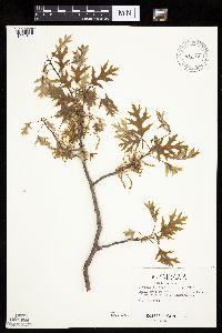 Quercus ellipsoidalis E.J. Hill 484708[1004844]Kaul, R.; et al. 29251984-05-18 United States, Minnesota, Steele, Rice County...along tracks north of Medford [this is in Steele Co.];;108N;20W;, 44.06119 -93.13437 |
MIN:Plants | Quercus muhlenbergii Engelmann 98933[]Wheeler, William 3601899-07-15 United States, Minnesota, Houston, Dorer Memorial Hardwood State Forest. Houston Co. [later annotation adds '3/4 mi N.W. from Freeburg on E. side of road going N.W. up tributary of C. [i.e, Crooked] Cr. valley.'. 102N 05W , 43.63068 -91.43198 |
MIN:Plants | 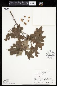 Quercus ilicifolia Wangenheim 690725[1005467]Shane, L. 77-431977-07-15 United States, Maine, Oxford, Oxford County ... summit of Jockey Cap ... 1/2 mile ne of Freyberg...on US 302.;;;;, 44.02194 -70.96278, 183m |
MIN:Plants | Quercus bicolor Willdenow 438082[1004735]Juhnke, C. United States, Minnesota, Goodhue, Detailed locality information protected. This is typically done to protect rare or threatened species localities. |
MIN:Plants | 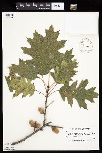 477420[1005289]Smith, Welby 263971996-09-04 United States, Minnesota, Anoka, About 2 miles southwest of Forest Lake. SW1/4 of NE1/4 of section;Lamprey Pass Wildlife Management Area;032N;22W;13, 45.2619444 -93.0294444 |
MIN:Plants | 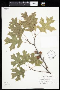 Quercus ellipsoidalis E.J. Hill 758320[1004805]Smith, Welby 253921994-09-02 United States, Minnesota, Dodge, Vorce Wildlife Management Area. Dodge County ... Vorce State Wildlife Management Area, about 2 miles north-northeast of Claremont ..T107N R18W SE/14 SW1/4 of Sec 15. 107N 18W 15, 44.0672226 -92.976387 |
MIN:Plants |  Quercus macrocarpa Michaux 914313[1005064]Smith, Welby 226161993-06-29 United States, Minnesota, Swift, Swift County...Lake Monson State Park, about 17 miles northwest of Wilmar [sic]...T 121N R 37W SW1/4 of NW1/4 of Sec 1;Monson Lake State Park;121N;37W;01, 45.3236111 -95.2688889 |
MIN:Plants | 426777[]Arboretum, Cary 73-331973-00-00 United States, New York, Dutchess, Dutchess Co. [cultivated ?] |
MIN:Plants |  Quercus ellipsoidalis E.J. Hill 453703[1004764]Smith, Welby 258811995-08-22 United States, Minnesota, Chisago, At the rest stop on north-bound I35, about one mile northwest of Harris ... T36N R21W NE1/4 of NW1/4 of Sec 20;;036N;21W;20, 45.5991669 -92.9930573 |
MIN:Plants | Quercus bicolor Willdenow 914328[1004749]Smith, Welby United States, Minnesota, Wabasha, Detailed locality information protected. This is typically done to protect rare or threatened species localities. |
MIN:Plants |  Quercus vaccinifolia Kellogg ex Curran 234662[1005478]Congdon, J. s.n.1888-05-25 United States, California, Mariposa, Glacier Point, Mariposa County;Yosemite National Park;;;, 37.73083 -119.57278 |
MIN:Plants |  487851[1005271]Smith, Welby 276911999-05-11 United States, Minnesota, Morrison, Morrison County ... Camp Ripley Military Reservation ... T 131N R 29W SE1/4 of NW1/4 of Sec 19;Camp Ripley Military Reservation;131N;29W;19, 46.1466675 -94.3811111 |
MIN:Plants |  Quercus x paleolithicola Trelease 456136[1005459]Smith, Welby 290052000-08-18 United States, Minnesota, Wabasha, Dorer Memorial Hardwood State Forest. Wabasha County ... Kruger State Recreation Area. In the Zumbro River Valley about 4 miles N-NW of Kellogg ... T 110N R 11W SE1/4 of SE1/4 of sec 12. 110N 11W 12, 44.3397222 -92.0763889 |
MIN:Plants |  476845[1004676]Smith, Welby 273591998-07-10 United States, Minnesota, Hubbard, Hubbard County ... About 9 miles N-NW of Akeley ... T 142N R 32W NW1/4 of NW1/4 of Sec 17.;Paul Bunyan State Forest;142N;32W;17, 47.0125008 -94.7416687 |
MIN:Plants |  Quercus chrysolepis Liebmann 567680[1005464]Hunnewell, F. 83521922-07-24 United States, California, Mariposa, Yosemite Park. Mariposa County;Yosemite National Park;;;, 37.55 -119.9 |
MIN:Plants | Quercus glauca Thunberg 430187[]US Nat. Arboretum staff s.n.1975-00-00 United States, District of Columbia, USNA [Nat. Arboretum]. Cultivated |
MIN:Plants |  Quercus alba L. 454658[1004726]Smith, Welby 290632000-08-31 United States, Minnesota, Anoka, Carlos Avery Wildlife Management Area. Anoka County ... Carlos Avery State Wildlife Management Area. On the west side of Linwood lake, about 4.5 miles west of Wyoming (town) ... T33N R22W SE1/4 of NW1/4 of Sec. 16. 033N 22W 16, 45.3491669 -93.0969467 |
MIN:Plants |  477257[1005420]Smith, Welby 274341998-07-23 United States, Minnesota, Renville, About 4 miles N of Delhi, in the Minnesota River valley. NE1/4 of NW1/4 of section;Town & Country County Park;114N;36W;30, 44.6538889 -95.2277778 |
MIN:Plants |  Quercus ellipsoidalis E.J. Hill 480891[1004771]Smith, Welby 289772000-08-14 United States, Minnesota, Ramsey, Ramsey County ... Battle Creek County Park, in St. Paul ... T 28N R 22W SE1/4 of SE1/4 of Sec 3;Battle Creek County Park;028N;22W;03, 44.9361111 -93.0280556 |
MIN:Plants |  478190[1005336]Smith, Welby 275571998-08-28 United States, Minnesota, Wright, About 3 miles south-southwest of Hasty . NE1/4 of NW1/4 of section;Lake Maria State Park;121N;26W;03, 45.3252778 -93.9430556 |
MIN:Plants |  Quercus macrocarpa Michaux 913671[1005065]Smith, Welby 254751994-09-08 United States, Minnesota, Beltrami, Beltrami County... At the Waskish Municipal Campground...T154N R30W SE1/4 of NE1/4 of Sec8;;154N;30W;08, 48.1722222 -94.5116667 |
MIN:Plants | 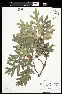 Quercus alba L. 492675[1004721]Smith, Welby 289862000-08-15 United States, Minnesota, Washington, Afton State Park. Washington County ... Afton State Park; about 7 miles NE of Hastings ... bluff overlooking the St. Croix River ... T 27N R 20W NE1/4 of NW1/4 of Sec 11. 027N 20W 11, 44.8466682 -92.7705536 |
MIN:Plants | 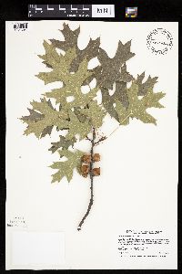 Quercus ellipsoidalis E.J. Hill 509929[1004897]Smith, Welby 257871995-07-26 United States, Minnesota, Sherburne, Sherburne National Wildlife Refuge. Sherburne County ... Along the Blue Hill Trail in Sherburne National Wildlife Refuge ... T 35N R 27W NW1/4 of SW1/4 of sec 28. 035N 27W 28, 45.4991684 -93.711113 |
MIN:Plants | 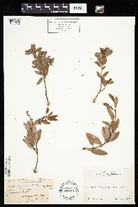 Quercus vaccinifolia Kellogg ex Curran 234661[1005479]Congdon, J. s.n.1885-07-01 United States, California, Mariposa, Glacier Point, Mariposa County;Yosemite National Park;;;, 37.73083 -119.57278 |
MIN:Plants | 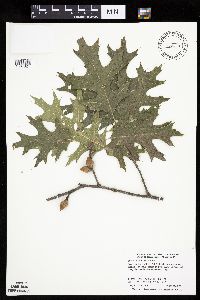 Quercus ellipsoidalis E.J. Hill 478079[1004821]Smith, Welby 275011998-08-11 United States, Minnesota, Itasca, Itasca County ... On the west side of Little Ball Club Lake ... T 146N R 26W NW1/4 of SE1/4 of sec 32;Chippewa National Forest / Leech Lake Indian Reservation;146N;26W;32, 47.4188881 -93.9986115 |
MIN:Plants | 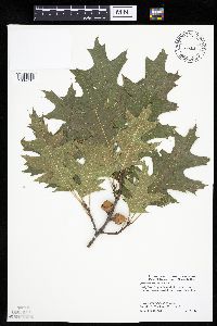 Quercus ellipsoidalis E.J. Hill 477210[1004781]Smith, Welby 273981998-07-19 United States, Minnesota, Ramsey, Ramsey County ... Crosby Park, along the Mississippi River in St. Paul.;Hidden Falls - Crosby Farm Regional Park;028N;23W;22, 44.9005556 -93.1552778 |
MIN:Plants | 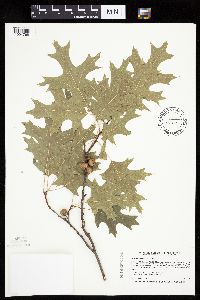 Quercus ellipsoidalis E.J. Hill 454641[1004768]Smith, Welby 207941992-07-13 United States, Minnesota, Wadena, Dry Sand Lake Wildlife Management Area. Wadena County ... In Dry Sand Lake State Wildlife Management Area, on the west side of CSAH 30, about 2.5 miles south of Oylen ... T 135N R33W NW 1/4 of SW 1/4 of Sec 1. 135N 33W 1, 46.5338898 -94.7980576 |
Google Map
Google Maps is a web mapping service provided by Google that features a map that users can pan (by dragging the mouse) and zoom (by using the mouse wheel). Collection points are displayed as colored markers that when clicked on, displays the full information for that collection. When multiple species are queried (separated by semi-colons), different colored markers denote each individual species.