University of Minnesota
http://www.umn.edu/
612-625-5000
http://www.umn.edu/
612-625-5000
Minnesota Biodiversity Atlas
Bell Museum
Dataset: MIN-Plants
Taxa: Quercus
Search Criteria: excluding cultivated/captive occurrences
Bell Museum plants | |
 MIN:Plants |  Quercus macrocarpa Michaux 837404[1005237]Smith, Welby 174591990-07-27 United States, Minnesota, Morrison, Camp Ripley Military Reservation. Camp Ripley Military Reservation Morrison Co. Picnic area #3, on the floodplain of the Mississippi River. UTM: 393800E 5 Camp Ripley Military Reservation Morrison Co. Picnic area #3, on the floodplain of the Mississippi River. UTM: 393800E 5108900N T131N R29W SE1/4 of SE1/4 of Sec 30. 131N 29W 30, 46.12888 -94.38198 |
MIN:Plants |  Quercus macrocarpa Michaux 352623[1005162]Nielsen, E. 29391934-08-16 United States, Minnesota, Lincoln, 4 mi. S of Porter Creek;;;;, 44.57846 -96.16528 |
MIN:Plants |  Quercus macrocarpa Michaux 97915[1095794]Aiton, G. s.n.1890-00-00 United States, Minnesota, Hennepin, [no further data];;;;, 45 -93.47 |
MIN:Plants |  Quercus macrocarpa Michaux 98305[1096413]Sheldon, Edmund 21331892-06-00 United States, Minnesota, Mille Lacs, Mille Lacs.;;;;, 46.2381 -93.6434 |
MIN:Plants | 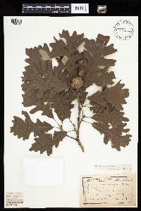 Quercus macrocarpa Michaux 98374[1005121]Wheeler, William 6391899-08-26 United States, Minnesota, Houston, Jefferson;Dorer Memorial Hardwood State Forest;101N;04W;35, 43.50806 -91.28287 |
MIN:Plants | 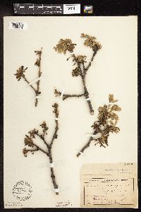 Quercus macrocarpa Michaux 98700[1096414]Sheldon, Edmund s.n.1895-04-00 United States, Minnesota, Hennepin, Prospect Park.;;;;, 45.18389 -93.34667 |
MIN:Plants | 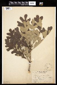 Quercus macrocarpa Michaux 98701[1005166]Butters, F.; et al. 33531916-08-09 United States, Minnesota, Stearns, SW from St. Cloud;;;;, 45.584479 -94.58656 |
MIN:Plants | 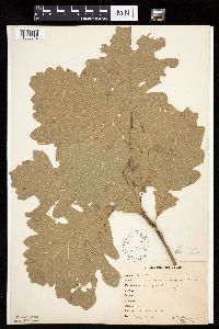 Quercus macrocarpa Michaux 98702[1005012]Bergman, H. 29591914-07-31 United States, Minnesota, Hubbard, Quadrat 3, Benedict;Paul Bunyan State Forest;143N;32W;35, 47.15729 -94.6957 |
MIN:Plants | 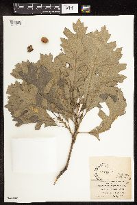 Quercus macrocarpa Michaux 98703[1096440]Moyer, Lycurgus s.n.1913-08-24 United States, Minnesota, Ramsey, Hamline [neighborhood near Hamline Univ.], St. Paul;;029N;23W;, 44.9920769 -93.1663869 |
MIN:Plants |  Quercus macrocarpa Michaux 98704[1005137]Sheldon, Edmund S25511892-06-00 United States, Minnesota, Mille Lacs, Mille Lacs Reservation;Mille Lacs Indian Reservation;;;, 46.252983 -93.660534 |
MIN:Plants | 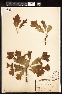 Quercus macrocarpa Michaux 98705[1096455]Sheldon, Edmund s.n.1895-05-00 United States, Minnesota, Hennepin, Prospect Park, Mpls;;;;, 45.18389 -93.34667 |
MIN:Plants | 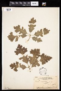 Quercus macrocarpa Michaux 98706[1005025]Sheldon, Edmund S12431895-05-00 United States, Minnesota, Hennepin, Prospect Park, Minneapolis;;;;, 44.96783 -93.21479 |
MIN:Plants | 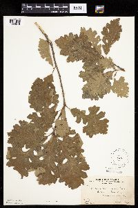 Quercus macrocarpa Michaux 98707[1005015]Butters, F.; et al. 27741914-06-13 United States, Minnesota, Morrison, Culdrum Twp;;129N;31W;00, 45.9769 -94.58156 |
MIN:Plants | 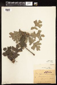 Quercus macrocarpa Michaux 98708[1096437]Oestlund, O. 451-21888-08-22 United States, Minnesota, Hennepin, [no further data];;;;, 45 -93.47 |
MIN:Plants | 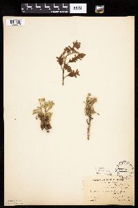 Quercus macrocarpa Michaux 98709[1005246]Moore, W. s.n.1907-00-00 United States, Minnesota, Hennepin, Spring Park;;;;, 44.93528 -93.63194 |
MIN:Plants | 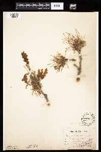 Quercus macrocarpa Michaux 98711[1005034]Sandberg, John 3491886-05-00 United States, Minnesota, Goodhue, Red Wing.;;113N;14W;, 44.5625 -92.53361 |
MIN:Plants | 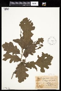 Quercus macrocarpa Michaux 98712[1005179]Taylor, B. T6921891-06-00 United States, Minnesota, Faribault, Minnesota Lake;;104N;25W;, 43.80442 -93.82769 |
MIN:Plants |  Quercus macrocarpa Michaux 98713[1005156]MacMillan, C.; et al. 280sk1900-08-00 United States, Minnesota, Pennington, Thief River Falls.;;154N;43W;00, 48.15199 -96.17455 |
MIN:Plants | 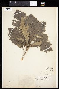 Quercus macrocarpa Michaux 98714[1005240]Goldsmith, G. G1231912-00-00 United States, Minnesota, Rice, Northfield;;;;, 44.45833 -93.16139 |
MIN:Plants | 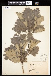 Quercus macrocarpa Michaux 98715[1005122]Goldsmith, G. G1231912-00-00 United States, Minnesota, Rice, Northfield;;;;, 44.45833 -93.16139 |
MIN:Plants |  Quercus macrocarpa Michaux 98717[1005188]Arthur, J.; et al. B5341886-07-28 United States, Minnesota, Saint Louis, Vermilion Lake ... Mud L.;;062N;14W;03, 47.88109 -92.10443 |
MIN:Plants | 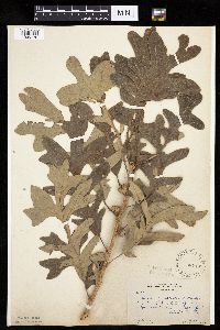 Quercus macrocarpa Michaux 98718[1005170]Butters, F. 39711920-07-20 United States, Minnesota, Wabasha, 2 mi E of Lake City;;;;, 44.44943 -92.2261 |
MIN:Plants | 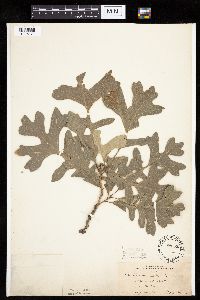 Quercus macrocarpa Michaux 98720[1005171]Bergman, H. 28561913-07-10 United States, Minnesota, Otter Tail, Dent;;136N;40W;, 46.58544 -95.71959 |
MIN:Plants | 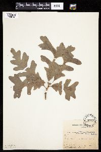 Quercus macrocarpa Michaux 98722[1005169]Bailey, L. s.n.1886-07-16 United States, Minnesota, Sherburne, Elk River;;;;, 45.30389 -93.56694 |
MIN:Plants | 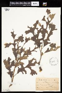 Quercus macrocarpa Michaux 98723[1005178]Sheldon, Edmund S4741891-06-00 United States, Minnesota, Blue Earth, Madison Lake;;109N;25W;, 44.23947 -93.82835 |
MIN:Plants | 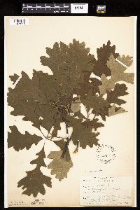 Quercus macrocarpa Michaux 98886[1005221]Rosendahl, C. 32751916-06-26 United States, Minnesota, Freeborn, About 4 mi W of Albert Lea;;;;, 43.64803 -93.44813 |
MIN:Plants | 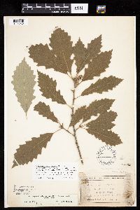 Quercus muhlenbergii Engelmann 98932[1005262]Wheeler, William 3601899-07-15 United States, Minnesota, Houston, Dorer Memorial Hardwood State Forest. Houston Co. [later annotation adds '3/4 mi N.W. from Freeburg on E. side of road going N.W. up tributary of C. [i.e, Crooked] Cr. valley.'. 102N 05W , 43.63068 -91.43198 |
MIN:Plants | 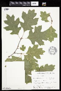 734394[1005321]Severson, M. 6121980-07-30 United States, Minnesota, Becker, 5 mi. W of Ponsford. NW1/4 SE1/4 of section;Greenwater Lake Scientific Natural Area / White Earth Indian Reservation;141N;38W;33, 46.98389 -95.4977 |
MIN:Plants | 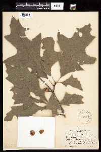 225999[1005318]Rosendahl, C. 53701927-08-14 United States, Minnesota, Fillmore, Root River Valley, 3 mi W of Peterson;Dorer Memorial Hardwood State Forest;104N;09W;, 43.80361 -91.90995 |
MIN:Plants | 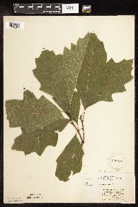 262056[1096463]Stork, H. 11471925-00-00 United States, Minnesota, Itasca, Bowstring;Chippewa National Forest;;;, 47.54306 -93.79639 |
MIN:Plants | 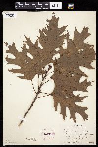 262209[1005391]Rosendahl, C. 41661921-09-16 United States, Minnesota, Hennepin, East side of Glenwood Park [= Theodore Wirth Park, Minneapolis];;029N;24W;00, 44.97833 -93.32306 |
MIN:Plants |  281263[1005281]Moyle, J. 6401931-07-25 United States, Minnesota, Clearwater, Itasca Park. NE1/4 SW1/4 Sec. 1, T143N, R36W.;Itasca State Park;143N;36W;1, 47.23229 -95.18024 |
MIN:Plants | 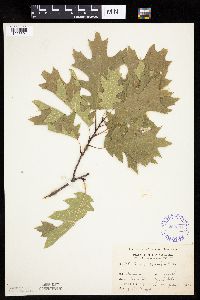 292031[1005301]Moyle, J. 7181933-07-04 United States, Minnesota, Clearwater, Itasca Park, Squaw Lake; SE1/4 SW1/4 Sec. 5 T143N R36W;Itasca State Park;143N;36W;5, 47.23143 -95.26579 |
MIN:Plants | 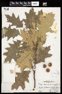 295705[1005368]Moyle, J.; et al. 19671934-08-23 United States, Minnesota, Pine, Near Fox Lake, Willow River. Pine Co.;;044N;20W;, 46.30972 -92.89167 |
MIN:Plants | 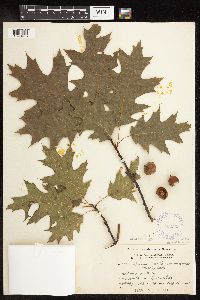 332563[1096475]Grant, Martin 66331935-08-16 United States, Minnesota, Clearwater, Itasca Park. Squaw Lake. NW1/4 NW1/4 Sec. 4, T143N, R36W.;Itasca State Park;143N;36W;4, 47.23161 -95.24462 |
MIN:Plants | 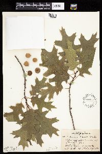 348439[1005322]Zeck, Otto; et al. 22571933-08-11 United States, Minnesota, Becker, Detroit Lakes.;;;;, 46.81722 -95.845 |
MIN:Plants |  351968[1005404]Nielsen, E. 2398A1934-05-08 United States, Minnesota, Olmsted, 10 mi S of Rochester;;;;, 43.87683 -92.46972 |
MIN:Plants |  352289[1096468]Moyle, J.; et al. 23891933-07-04 United States, Minnesota, Clearwater, North shore road, Itasca Park.;Itasca State Park;143N;36W;00, 47.19557 -95.23322 |
MIN:Plants |  352290[1005302]Moyle, J.; et al. 23851933-07-04 United States, Minnesota, Clearwater, North border drive, Itasca Park;Itasca State Park;143N;36W;00, 47.19557 -95.23322 |
MIN:Plants |  352551[1096461]Zeck, Otto; et al. 22531933-08-11 United States, Minnesota, Becker, Becker Co.; On Rudolf's farm ca. 6 mi E of Detroit Lakes, Detroit Lakes;;139N;40W;, 46.84697 -95.73139 |
MIN:Plants | 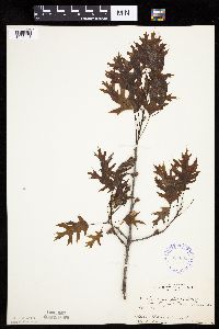 352605[1005413]Nielsen, E. 19811933-05-30 United States, Minnesota, Clearwater, Peace Pipe Spring, Itasca State Park;Itasca State Park;143N;36W;, 47.1975 -95.20167 |
MIN:Plants | 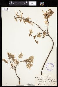 353167[1005382]Nielsen, E.; Moyle, J. 26671934-05-08 United States, Minnesota, Benton, On Rouche Mountain. 2 mi. N of St. Cloud.;;;;, 45.5539 -94.1703 |
MIN:Plants | 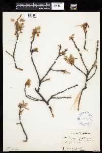 353168[1005386]Nielsen, E.; Moyle, J. 26561934-05-08 United States, Minnesota, Crow Wing, 4 mi E of Brainerd;;;;, 46.35803 -94.11665 |
MIN:Plants | 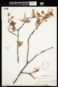 353169[1005384]Nielsen, E.; Moyle, J. 25681934-05-08 United States, Minnesota, Sherburne, 3 mi E of Zimmerman;;;;, 45.4439 -93.5908 |
MIN:Plants | 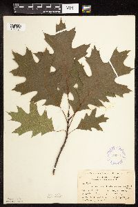 353413[1096464]Buell, Murray 4871932-07-22 United States, Minnesota, Clearwater, Itasca Park. N boundary. SE1/4 Sec. 33, T144N, R36W.;Itasca State Park;144N;36W;33, 47.24601 -95.24456 |
MIN:Plants | 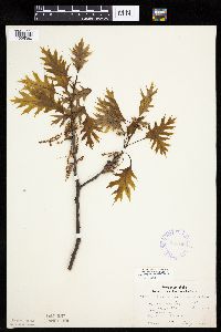 356469[1005380]Lakela, Olga 28971939-05-31 United States, Minnesota, Saint Louis, Slope of Hunters Hill, Duluth;;;;, 46.78333 -92.10639 |
MIN:Plants | 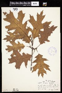 356651[1005295]Lakela, Olga 33921939-10-16 United States, Minnesota, Saint Louis, Slope of Bardon's Peak, near Fond du Lac Road;;;;, 46.65972 -92.27306 |
MIN:Plants | 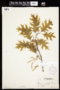 367710[1005403]Moore, John; et al. 126381940-05-25 United States, Minnesota, Stearns, SE1/4 Sec. 35, Paynesville Twp. Stearns Co.;;122N;32W;35, 45.40551 -94.73258 |
MIN:Plants | 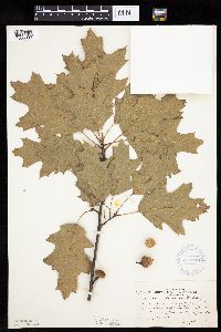 371274[1005393]Moore, John; et al. 150041941-08-07 United States, Minnesota, Aitkin, Along Hwy. 56 [hwy 65?], 3 mi. N of Mille Lacs - Aitkin Co. line.;;;;, 46.26819 -93.82599 |
MIN:Plants | 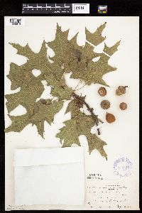 371546[1005373]Anderson, Roy 142431941-09-12 United States, Minnesota, Mower, 1 mi E of Austin;;;;, 43.66667 -92.95442 |
MIN:Plants | 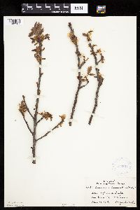 371647[1005381]Lakela, Olga 42881941-05-10 United States, Minnesota, Carlton, Shore of Big Lake.;Fond du Lac Indian Reservation;049N;18W;, 46.72287 -92.61839 |
MIN:Plants | 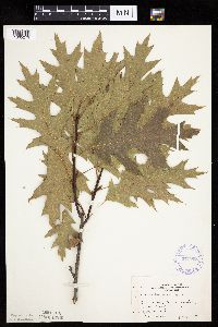 371968[1005279]Moore, John; et al. 147861941-07-07 United States, Minnesota, Becker, Becker Co. E shore of Tamarack Lake;Tamarac National Wildlife Refuge;;;, 46.95 -95.68333 |
MIN:Plants | 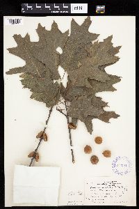 372184[1005323]Moore, John; et al. 149741941-08-07 United States, Minnesota, Kanabec, NE shore of Knife Lake. Kanabec Co.;;041N;24W;, 45.96167 -93.31389 |
MIN:Plants | 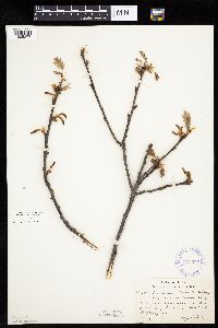 373575[1005377]Lakela, Olga 48991942-05-08 United States, Minnesota, Saint Louis, On the grounds of Duluth Gun Club, Hwy. 4.;;;;, 46.78333 -92.10639 |
MIN:Plants | 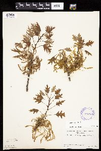 373984[1005375]Linnaean Club, U of M, 1831940-05-19 United States, Minnesota, Rice, Nerstrand Woods. Rice Co.;Nerstrand Woods State Park;110N;19W;, 44.32706 -93.10089 |
MIN:Plants | 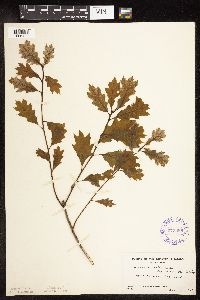 373985[1096466]Linnaean Club, U of M, 711939-05-21 United States, Minnesota, Rice, Nerstrand Woods. Rice Co. Along East Road.;Nerstrand Woods State Park;110N;19W;, 44.32706 -93.10089 |
MIN:Plants | 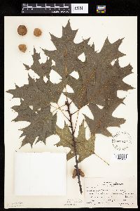 383637[1005410]Moore, John 160231943-08-25 United States, Minnesota, Winona, Creek below Gwinn's Bluff, Winona Co. Winona.;Great River Bluffs State Park;106N;05W;, 44.05 -91.63917 |
MIN:Plants | 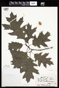 385629[1005369]Ericson, Mildred s.n.1945-08-22 United States, Minnesota, Hennepin, Minnehaha Park;Minnehaha Falls Park;028N;23W;, 44.91722 -93.20583 |
MIN:Plants | 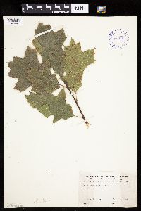 393115[1005341]Jenkins, D. s.n.1948-09-08 United States, Minnesota, Polk, Polk County...Maple Lake near Erskine.;;;;, 47.67833 -96.12333 |
MIN:Plants | 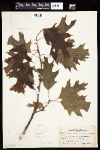 407293[1005305]Lakela, Olga 82791949-06-09 United States, Minnesota, Saint Louis, Near Duluth Heights, Duluth.;;;;, 46.80083 -92.13167 |
MIN:Plants | 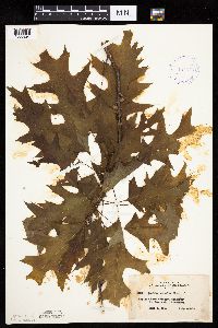 407579[1005294]Lakela, Olga 82061949-06-04 United States, Minnesota, Saint Louis, Prairie Lake terrace, SW St. Louis Co.;;050N;20W;, 46.79139 -92.90472 |
MIN:Plants | 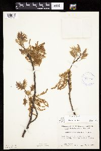 413164[1005405]Moore, John; Moore, Marjorie 106511939-05-07 United States, Minnesota, Dakota, Bluffs of the Minnesota River Valley, 1 mi. S of Mendota.;;028N;23W;, 44.87274 -93.16417 |
MIN:Plants | 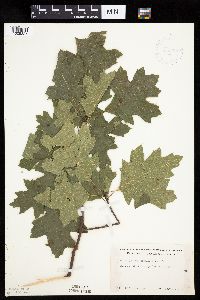 419109[1005327]Ahlgren, Clifford 3031949-07-11 United States, Minnesota, Lake, Basswood River Portage...Lake Co....T65N R10W;Boundary Waters Canoe Area Wilderness / Superior National Forest;065N;10W;00, 48.08578 -91.6199 |
MIN:Plants | 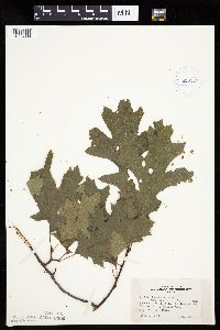 419547[1005339]Lakela, Olga 118281950-08-23 United States, Minnesota, Saint Louis, Shore of Lac La Croix, 8 mi W of Curtain Falls, Crooked Lake;Boundary Waters Canoe Area Wilderness / Superior National Forest;;;, 48.23654 -92.07995 |
MIN:Plants | 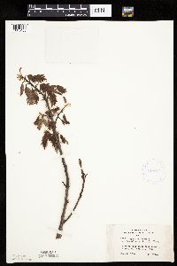 420947[1005406]Lakela, Olga 101631950-06-03 United States, Minnesota, Saint Louis, Pioneer Road, near Sucker River;;;;, 47.58 -92.46 |
MIN:Plants | 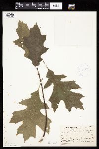 421572[1005395]Ahlgren, Clifford 10171950-08-22 United States, Minnesota, Saint Louis, Curtain Falls, Crooked Lake.;Boundary Waters Canoe Area Wilderness / Superior National Forest;066N;12W;, 48.23667 -91.90611 |
MIN:Plants |  424067[1005328]Emanuel, J. 1201946-09-03 United States, Minnesota, Itasca, County: Itasca. Locality: Nashwauk Township (Bennett Mine);;057N;22W;30, 47.39216 -93.18511 |
MIN:Plants |  430715[1005298]Smith, Welby 194501991-07-15 United States, Minnesota, Aitkin, Savanna Portage State Park. Aitkin Co.; Savanna Portage State Park, along plath around the north side of Loon Lake; Aitkin Co.; Savanna Portage State Park, along plath around the north side of Loon Lake; T 50N R 23W SE1/4 of SE1/4 of sec 12. 050N 23W 12, 46.8280563 -93.191391 |
MIN:Plants | 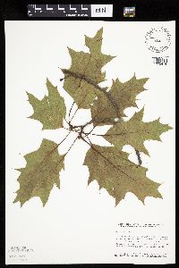 440122[1005414]Smith, Welby 164851989-09-08 United States, Minnesota, Freeborn, White Woods County Park. Freeborn Co. Lower Twin Lakes County Park (White Woods County Park), about 1.5 mi W of the town of Twin Lakes; NE1/4 SE1/4 sec.10, T101N R22W. 101N 22W 10, 43.55972 -93.45276 |
MIN:Plants | 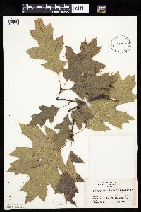 442288[1005320]Lakela, Olga 137251951-09-12 United States, Minnesota, Saint Louis, Shore of Myrtle Lake, between Orr and Buyck.;Kabetogama State Forest;;;, 48.08167 -92.68194 |
MIN:Plants | 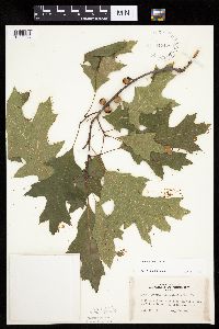 442429[1005356]Lakela, Olga 130401951-07-11 United States, Minnesota, Saint Louis, High slope on Rainy Lake at Kettle Falls.;Voyageurs National Park;070N;18W;, 48.49944 -92.63889 |
MIN:Plants | 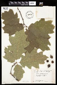 446244[1005304]Moore, John; Huff, N. 188911946-08-01 United States, Minnesota, Benton, 2 mi. SW of Foley.;;036N;29W;, 45.64424 -93.93874 |
MIN:Plants | 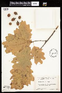 446507[1005293]Moore, John; Huff, N. 183631945-10-06 United States, Minnesota, Benton, Along the St. Francis River, 5 mi W of Oak Park;;;;, 45.69773 -93.92144 |
MIN:Plants | 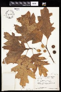 446508[1005313]Moore, John; Huff, N. 183611945-10-06 United States, Minnesota, Benton, Along the St. Francis River, 5 mi. W of Oak Park.;;;;, 45.69773 -93.92144 |
MIN:Plants |  449055[1005407]Moore, John; Hall, Robert 167881944-08-03 United States, Minnesota, Itasca, 1 mi. W of Grand Rapids.;;;;, 47.23722 -93.55132 |
MIN:Plants | 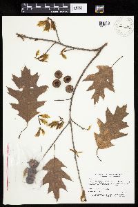 460603[1005303]Myhre, K. 54181995-05-24 United States, Minnesota, Mahnomen, White Earth Indian Reservation. Mahnomen Co.; Located 1.5 miles northeast of the town of Nay-tah-waush. Plants occur along the hillsides surrounding Bad Mahnomen Co.; Located 1.5 miles northeast of the town of Nay-tah-waush. Plants occur along the hillsides surrounding Badboy Creek; T 144N R 39W NW1/4 of SE1/4 of Sec 13. 144N 39W 13, 47.289266 -95.5617789 |
MIN:Plants | 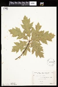 462944[1005330]Lakela, Olga 154531952-08-16 United States, Minnesota, Saint Louis, Lake Vermilion at West Bay;;;;, 47.94139 -92.35972 |
MIN:Plants | 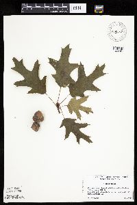 475752[1005421]Locke, M. 101999-07-29 United States, Minnesota, Clearwater, Clearwater Co, Itasca State Park, west side of Bud [sic] Lake, T143N R36W sec 36;Itasca State Park;143N;36W;36, 47.15985 -95.17988 |
MIN:Plants | 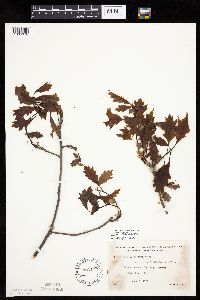 471195[1005378]Lakela, Olga 160421953-06-08 United States, Minnesota, Saint Louis, At Oak View Narrows, Vermilion Lake;;;;, 47.89167 -92.36667 |
MIN:Plants | 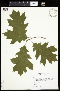 484664[1005288]Wheeler, Gerald 158461997-06-05 United States, Minnesota, Renville, Renville County...Ca. 9 mi. SSW of Renville on Rte. 6; W of road; County Park No. 2...E1/2 SW1/4 Sec. 19 T114N R36W;Renville County Park #2;114N;36W;19, 44.66531 -95.22826 |
MIN:Plants | 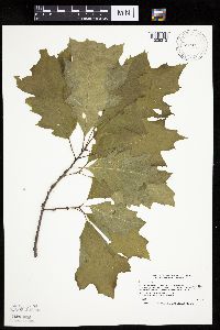 508222[1005272]Smith, Welby 186131991-05-23 United States, Minnesota, Cass, Cass Co.; about 5 mi NE of Pillager, in Pillsbury State Forest; T134N R30W SW1/4 of NE1/4 of Sec 26;Pillsbury State Forest;134N;30W;26, 46.3916664 -94.421669 |
MIN:Plants | 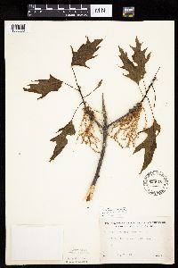 525610[1005383]Lakela, Olga 185931955-05-23 United States, Minnesota, Saint Louis, Tischer Creek woods, Hunter's Hill, Duluth.;;;;, 46.81417 -92.05111 |
MIN:Plants | 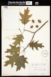 529179[1005370]Roe, E. C8551938-09-04 United States, Minnesota, Hennepin, Glenwood Park [= Theodore Wirth Park, Minneapolis];;029N;24W;00, 44.97833 -93.32306 |
MIN:Plants | 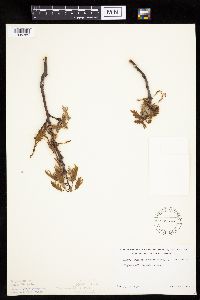 539576[1005385]Lakela, Olga 212471957-05-16 United States, Minnesota, Saint Louis, Hwy. 61, Nopeming area.;;;;, 47.58 -92.46 |
MIN:Plants | 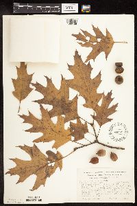 541529[1096458]Morley, T. 9441957-10-19 United States, Minnesota, Isanti, Athens Twp, sec. 22 SW1/4 of SW1/4; ca. 2/3 of the way E from sec. line, 4/9 of the way S from quarter-section line, al Athens Twp, sec. 22 SW1/4 of SW1/4; ca. 2/3 of the way E from sec. line, 4/9 of the way S from quarter-section line, also ca. 150 yards N of Mrs. Cornea's house at edge of clearing. 22, 45.43861 -93.22222 |
MIN:Plants | 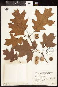 541533[1096476]Morley, T. 9451957-10-19 United States, Minnesota, Isanti, Cedar Creek National History Area. Cedar Creek Forest. Athens Twp, Sec. 22, Center of S boundary of SW corner. Also ca. 150 yds. NE of Mrs. Cornea's hou Cedar Creek Forest. Athens Twp, Sec. 22, Center of S boundary of SW corner. Also ca. 150 yds. NE of Mrs. Cornea's house on old fence line in corner of clearing.. 034N 23W 22, 45.4213 -93.19393 |
MIN:Plants | 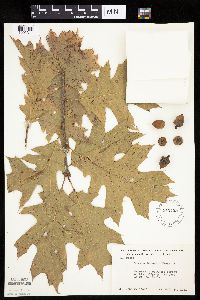 542425[1005311]Moore, John 214211951-10-10 United States, Minnesota, Steele, 1/2 mi E of Clinton Falls;;;;, 44.13888 -93.20631 |
MIN:Plants | 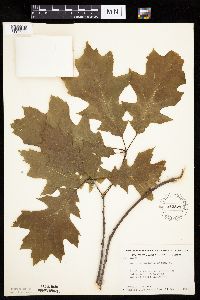 542821[1005290]Moore, John; Breckenridge, Walter 214681952-05-16 United States, Minnesota, Chisago, At Interstate State Park, Taylors Falls;Interstate State Park;034N;19W;, 45.395 -92.66944 |
MIN:Plants | 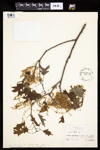 551334[1005379]Cotter, Shirley 18221951-05-20 United States, Minnesota, Rice, Nerstrand Woods, 5 mi. E of Faribault.;Nerstrand Woods State Park;110N;19W;, 44.29496 -93.16744 |
MIN:Plants | 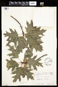 554442[1005363]Moore, John; Hsi, Yu-tseng [Eugene] 232991957-08-05 United States, Minnesota, Blue Earth, On the N shore of Eagle Lake.;;;;, 44.18806 -93.89444 |
MIN:Plants | 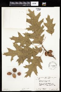 558154[1005362]Moore, John; Moore, Marjorie 235761957-09-19 United States, Minnesota, Isanti, N of the Cornea House. Cedar Creek Forest.;Cedar Creek National History Area;034N;23W;, 45.42806 -93.204 |
MIN:Plants | 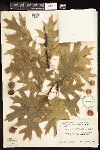 558241[1096477]Moore, John 236791957-09-27 United States, Minnesota, Clay, NE1/4 Sec. 36 Tansem Twp.;;;;36, 46.66833 -96.22583 |
MIN:Plants |  558300[1096462]Moore, John 236781957-09-27 United States, Minnesota, Clay, NE1/4 of Sec;;137N;44W;36, 46.6379419 -96.1830968 |
MIN:Plants |  558302[1005296]Moore, John 236801957-09-27 United States, Minnesota, Clay, NE1/4 Sec. 36, Tansem Twp.;;137N;44W;36, 46.63794 -96.1831 |
MIN:Plants | 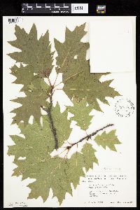 568710[1005306]Moore, John 248711959-09-28 United States, Minnesota, Blue Earth, 2 mi. N of Mankato.;;;;, 44.19258 -93.99917 |
MIN:Plants | 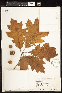 581855[1096473]Wertman, Freida 3741960-10-07 United States, Minnesota, Isanti, Cornea's estate. Athens Twp. Coordinates: 883.8-2206.2;Cedar Creek National History Area;034N;23W;22, 45.4213 -93.19393 |
MIN:Plants | 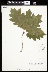 583403[1005394]Kellner, H. 1681956-07-17 United States, Minnesota, Lake, Lake County...Along Porcupine Ridge, Encampment Forest.;North Shore;053N;10W;00, 47.63333 -91.41667 |
MIN:Plants | 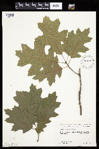 583894[1005317]Gunderson, R. 4651961-07-18 United States, Minnesota, Washington, Washington County ... St. Croix River, 3 mi N of Stillwater, S shore;Saint Croix National Riverway;030N;20W;, 45.08498 -92.81735 |
MIN:Plants | 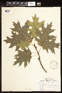 588830[1096465]Stevens, O. 27461964-08-30 United States, Minnesota, Clearwater, Itasca State Park.;Itasca State Park;143N;36W;, 47.19557 -95.23322 |
MIN:Plants | 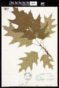 594301[1005355]Thorne, Robert 304841962-06-18 United States, Minnesota, Clearwater, Near entrance to tourist campground, Itasca State Park.;Itasca State Park;143N;36W;, 47.19485 -95.22263 |
Google Map
Google Maps is a web mapping service provided by Google that features a map that users can pan (by dragging the mouse) and zoom (by using the mouse wheel). Collection points are displayed as colored markers that when clicked on, displays the full information for that collection. When multiple species are queried (separated by semi-colons), different colored markers denote each individual species.