University of Minnesota
http://www.umn.edu/
612-625-5000
http://www.umn.edu/
612-625-5000
Minnesota Biodiversity Atlas
Bell Museum
Dataset: MIN-Plants
Taxa: Quercus
Search Criteria: excluding cultivated/captive occurrences
Bell Museum plants | |
 MIN:Plants |  Quercus macrocarpa Michaux 282435[1005082]Buell, Murray 4861932-07-22 United States, Minnesota, Clearwater, Itasca Park. N boundary. E1/4 Sec. 33, T144N, R36W.;Itasca State Park;144N;36W;33, 47.24601 -95.24456 |
MIN:Plants |  Quercus macrocarpa Michaux 282678[1005049]Swanson, Gustav s.n.1932-08-14 United States, Minnesota, Lake of the Woods, Northwest Angle;Northwest Angle;;;, 48.77 -94.9 |
MIN:Plants |  Quercus macrocarpa Michaux 282702[1096450]Swanson, Gustav s.n.1932-08-14 United States, Minnesota, Lake of the Woods, [no further data];Northwest Angle;;;, 49.2497 -94.7508 |
MIN:Plants |  Quercus macrocarpa Michaux 282892[1096429]Rosendahl, C. 64311932-08-28 United States, Minnesota, Houston, near garage, P.J. Rosendahl's farm, Spring Grove;;101N;07W;, 43.54392 -91.6707 |
MIN:Plants | 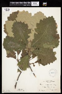 Quercus macrocarpa Michaux 284566[1005193]Cooper, William s.n.1930-08-00 United States, Minnesota, Pine, Sturgeon Lake. Pine Co.;;045N;19W;, 46.38111 -92.755 |
MIN:Plants | 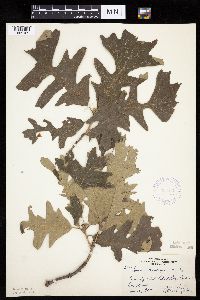 Quercus macrocarpa Michaux 306448[1005109]Nielsen, E. 27091934-06-30 United States, Minnesota, Becker, Detroit Lakes;;;;, 46.81722 -95.845 |
MIN:Plants | 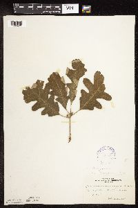 Quercus macrocarpa Michaux 306878[1096420]Cottrell, R. s.n.1935-06-19 United States, Minnesota, Anoka, Fridley;;030N;24W;, 45.08098 -93.25553 |
MIN:Plants | 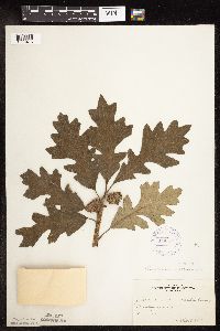 Quercus macrocarpa Michaux 306879[1096415]Cottrell, R. s.n.1935-07-25 United States, Minnesota, Anoka, Fridley area;;030N;24W;, 45.08098 -93.25553 |
MIN:Plants | 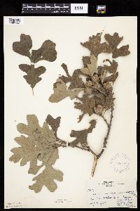 Quercus macrocarpa Michaux 332105[1005102]Moyle, J.; et al. 17231934-08-14 United States, Minnesota, Otter Tail, Paul Lake.;;;;, 46.59722 -95.69944 |
MIN:Plants | 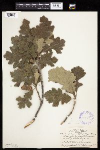 Quercus macrocarpa Michaux 348438[1005239]Zeck, Otto; et al. 22381933-08-11 United States, Minnesota, Becker, 3 mi W of Rudolph's farm, Detroit Lakes;;;;, 46.8172 -95.90846 |
MIN:Plants | 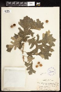 Quercus macrocarpa Michaux 349295[1096430]Dyal, S.; et al. 28261934-08-26 United States, Minnesota, Anoka, Anoka Sandplains;;;;, 45.19778 -93.38694 |
MIN:Plants | 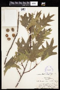 Quercus macrocarpa Michaux 349298[1005286]Dyal, S.; et al. 28381934-08-26 United States, Minnesota, Dakota, 1 mi S of Minnesota River Valley; on Cedar Avenue, Mpls.;;027N;23W;, 44.88246 -93.14889 |
MIN:Plants | 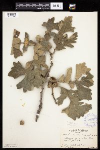 Quercus macrocarpa Michaux 349568[1005044]Nielsen, E. 22861933-08-20 United States, Minnesota, Lincoln, Stony bend, Dead Coon Lake;;;;, 44.36222 -96.09611 |
MIN:Plants | 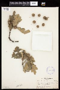 Quercus macrocarpa Michaux 349570[1005105]Nielsen, E. 22871933-08-20 United States, Minnesota, Lincoln, Near inlet of Dead Coon Lake.;;;;, 44.36222 -96.09611 |
MIN:Plants | 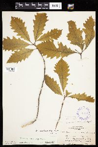 Quercus macrocarpa Michaux 350097[1005253]Nielsen, E. 19091933-05-28 United States, Minnesota, Clearwater, near Floating Bog Bay, Itasca Park;Itasca State Park;143N;36W;, 47.19557 -95.23322 |
MIN:Plants | 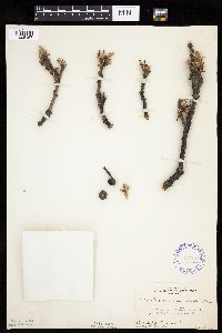 Quercus macrocarpa Michaux 351251[1005157]Nielsen, E. 23981934-05-08 United States, Minnesota, Olmsted, 10 mi. S of Rochester.;;;;, 43.87683 -92.46972 |
MIN:Plants | 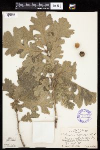 Quercus macrocarpa Michaux 351253[1005228]Nielsen, E. 28641934-08-15 United States, Minnesota, Chippewa, S of Montevideo;;117N;40W;, 44.93463 -95.67577 |
MIN:Plants | 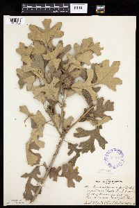 Quercus macrocarpa Michaux 351258[1005189]Dyal, S.; et al. 28461934-08-26 United States, Minnesota, Dakota, 2 mi S of Minnesota River on Cedar Ave, Minneapolis;;027N;23W;, 44.81875 -93.16682 |
MIN:Plants | 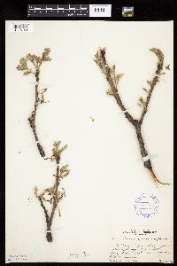 Quercus macrocarpa Michaux 351974[1005148]Nielsen, E. 23921934-05-03 United States, Minnesota, Hennepin, On a Mississippi River bluff opposite Motley School, East River Road, Minneapolis.;;;;, 44.96833 -93.22472 |
MIN:Plants | 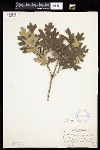 Quercus macrocarpa Michaux 352553[1005130]Nielsen, E. 701928-00-00 United States, Minnesota, Lincoln, SW bluff of Dead Coon Lake, near Tyler;;;;, 44.36222 -96.09611 |
MIN:Plants |  Quercus macrocarpa Michaux 352554[1096427]Nielsen, E. 711928-00-00 United States, Minnesota, Lincoln, SW bluff of Dead Coon Lake, near Tyler;;;;, 44.36222 -96.09611 |
MIN:Plants |  Quercus macrocarpa Michaux 353157[1005167]Nielsen, E.; Moyle, J. 25691934-05-08 United States, Minnesota, Sherburne, 3 mi E of Zimmerman;;N;;, 45.464461 -93.729898 |
MIN:Plants |  Quercus macrocarpa Michaux 353269[1005235]Nielsen, E.; Moyle, J. 26681934-05-08 United States, Minnesota, Benton, 2 mi. N of St. Cloud on Rouche Mountain.;;N;;, 45.58776 -94.155777 |
MIN:Plants |  Quercus macrocarpa Michaux 358539[1005045]Buell, Murray 18251939-08-26 United States, Minnesota, Clearwater, Itasca Park.;Itasca State Park;143N;36W;, 47.19557 -95.2332161 |
MIN:Plants | 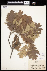 Quercus macrocarpa Michaux 360325[1005217]Rosendahl, C. 66241934-09-13 United States, Minnesota, Becker, E side of Cotton Lake, Becker Co.;;;;, 46.88583 -95.69639 |
MIN:Plants | 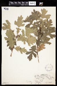 Quercus macrocarpa Michaux 360728[1005133]Rosendahl, C.; et al. 70321938-09-04 United States, Minnesota, Roseau, Campbell Beach, 5 mi W of Greenbush;;;;, 48.70051 -96.29103 |
MIN:Plants | 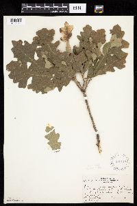 Quercus macrocarpa Michaux 360742[1005218]Rosendahl, C.; et al. 70081938-09-05 United States, Minnesota, Lake of the Woods, Rocky Point, Lake of the Woods;;163N;34W;, 48.93051 -95.02576 |
MIN:Plants | 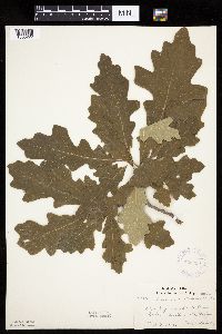 Quercus macrocarpa Michaux 362296[1005222]Lakela, Olga 38931940-08-02 United States, Minnesota, Saint Louis, Crane Lake.;Kabetogama State Forest;;;, 48.26667 -92.48833 |
MIN:Plants | 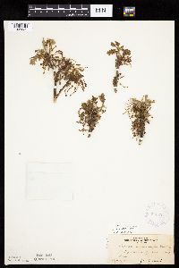 Quercus macrocarpa Michaux 363224[1005035]Beach, W. 571913-05-06 United States, Minnesota, Ramsey, W of University [of Minnesota] Farm;;029N;23W;, 44.98866 -93.17762 |
MIN:Plants | 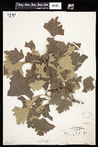 Quercus macrocarpa Michaux 365227[1005149]Moyle, J. 29271937-08-23 United States, Minnesota, Jackson, Bank of Heron Lake.;;;;, 43.79333 -95.29167 |
MIN:Plants | 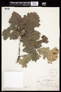 Quercus macrocarpa Michaux 365228[1005047]Moyle, J. 30151937-08-29 United States, Minnesota, Big Stone, Big Stone Lake.;;;;, 45.30278 -96.45167 |
MIN:Plants | 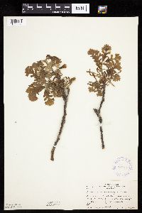 Quercus macrocarpa Michaux 367519[1005232]Moore, John; et al. 124141940-05-17 United States, Minnesota, Freeborn, NW1/4 Sec. 6, Manchester Twp. Freeborn Co.;;103N;22W;06, 43.75309 -93.51857 |
MIN:Plants |  Quercus macrocarpa Michaux 367674[1005234]Moore, John; et al. 126041940-05-25 United States, Minnesota, Stearns, Stearns County...along Hwy 55, about 3 1/2 mi W of Kimball; SW1/4 S6, Main Prairie Twp;;122N;29W;06, 45.40646 -94.3737 |
MIN:Plants |  Quercus macrocarpa Michaux 368149[1005165]Moore, John; et al. 127141940-05-25 United States, Minnesota, Otter Tail, Inspiration Peak. Otter Tail Co.;;131N;39W;22, 46.14425 -95.57354 |
MIN:Plants |  Quercus macrocarpa Michaux 368272[1005092]Moore, John; et al. 127551940-05-25 United States, Minnesota, Pope, N shore of Lake Leven; SW1/4 S12, Leven Twp. Pope Co.;;126N;37W;12, 45.73732 -95.27329 |
MIN:Plants |  Quercus macrocarpa Michaux 369919[1005041]Moore, John; et al. 138571941-05-10 United States, Minnesota, Mower, Bear Creek, near the school-house, 1 1/2 mi. S of Racine on Hwy. 63.;;;;, 43.74714 -92.48278 |
MIN:Plants | 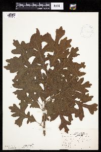 Quercus macrocarpa Michaux 370054[1005145]Moore, John; et al. 144741941-06-15 United States, Minnesota, Marshall, Beside Hwy. 32, 1 mi. S of Holt.;;;;, 48.27747 -96.19222 |
MIN:Plants | 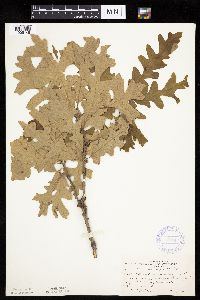 Quercus macrocarpa Michaux 370242[1005146]Moore, John; et al. 140091941-05-24 United States, Minnesota, Pine, Snake River, near dam at the outlet of Cross Lake, SE1/4 Sec. 36, Pine City Twp.;;039N;21W;, 45.82455 -92.90847 |
MIN:Plants | 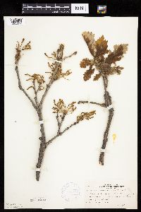 Quercus macrocarpa Michaux 370279[1005147]Moore, John; et al. 139071941-05-11 United States, Minnesota, Fillmore, On the S side of Hwy. 16, 1 mi SE of Preston, Fillmore Co.;;102N;10W;, 43.63056 -92.02969 |
MIN:Plants | 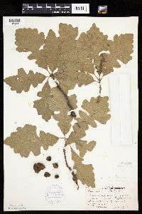 Quercus macrocarpa Michaux 370288[1005241]Moore, John; et al. 145101941-06-15 United States, Minnesota, Pennington, beside Hwy 59; 3 mi SE of Thief River Falls. Pennington Co.;;;;, 48.08846 -96.13484 |
MIN:Plants | 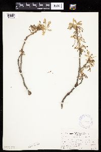 Quercus macrocarpa Michaux 370346[1005039]Moore, John; et al. 138121941-05-03 United States, Minnesota, Chisago, Adjacent to the jct. of Hwy. 95 & 8, 3 mi. SW of Taylors Falls. Chisago Co.;;;;, 45.37121 -92.69597 |
MIN:Plants | 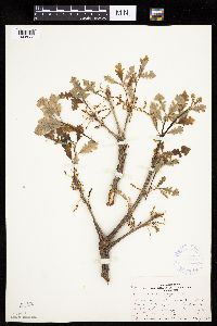 Quercus macrocarpa Michaux 370798[1005038]Moore, John; et al. 137731941-05-03 United States, Minnesota, Washington, Washington Co. 2 mi NE of North St. Paul; NE1/4 S6, Oakdale Twp;;029N;21W;06, 45.02843 -92.9746 |
MIN:Plants | 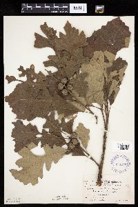 Quercus macrocarpa Michaux 371524[1005248]Moore, John; et al. 149151941-08-07 United States, Minnesota, Kanabec, Along the Snake River, 1/2 mi S of Mora, Kanabec Co.;;039N;24W;, 45.86068 -93.32753 |
MIN:Plants | 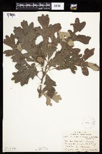 Quercus macrocarpa Michaux 372418[1005134]Lakela, Olga 47551941-08-13 United States, Minnesota, Carlton, Between Holyoke and Blackhoof.;;;;, 46.53278 -92.46194 |
MIN:Plants | 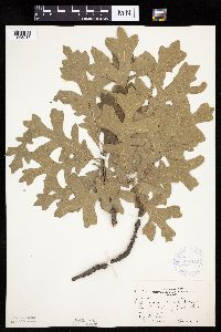 Quercus macrocarpa Michaux 372476[1005215]Moore, John; et al. 145521941-06-15 United States, Minnesota, Red Lake, Beside Hwy. 59, SE1/4 Sec. 34, Emardville Twp.;;151N;42W;34, 47.85481 -96.02045 |
MIN:Plants | 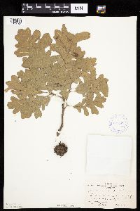 Quercus macrocarpa Michaux 372871[1005161]Moore, John; et al. 143561941-06-13 United States, Minnesota, Polk, 1 1/4 mi. SW of Fertile.;;;;, 47.49515 -96.34064 |
MIN:Plants | 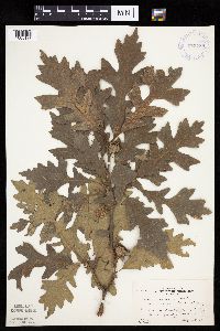 Quercus macrocarpa Michaux 373758[1005138]Moore, John; et al. 150541941-08-08 United States, Minnesota, Crow Wing, 2 mi W of Crosby;;;;, 46.48221 -93.99955 |
MIN:Plants | 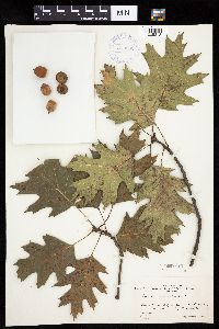 Quercus borealis Michx. 373862[1005312]Moore, John; et al. 151391941-09-19 United States, Minnesota, Dakota, 1 1/2 mi S of Nicols, Dakota Co.;;027N;23W;30, 44.79746 -93.21776 |
MIN:Plants | 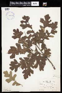 Quercus macrocarpa Michaux 373906[1005238]Moore, John; et al. 150711941-08-09 United States, Minnesota, Beltrami, W shore of Lake Bemidji. Beltrami Co.;;;;, 47.47194 -94.87611 |
MIN:Plants | 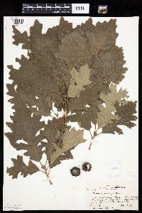 Quercus macrocarpa Michaux 381194[1005216]Moore, John; et al. 153291942-06-19 United States, Minnesota, Steele, Straight River, bridge at N end of Medford, Medford Twp, NE1/4 S8. Steele Co.;;108N;20W;08, 44.17506 -93.25668 |
MIN:Plants | 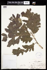 Quercus macrocarpa Michaux 381471[1005068]Moore, John; et al. 153611942-06-20 United States, Minnesota, Olmsted, 1 mi. N of Rochester on Hwy. 63, Olmsted Co.;;;;, 44.03615 -92.46972 |
MIN:Plants | 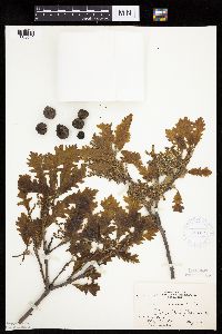 Quercus macrocarpa Michaux 381627[1005040]Moore, John; et al. 152301942-05-23 United States, Minnesota, Beltrami, Red Lake Village;;;;, 47.87639 -95.01667 |
MIN:Plants | 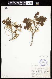 Quercus macrocarpa Michaux 386904[1005233]Hero, C. s.n.1940-05-20 United States, Minnesota, Redwood, Near Minn. River, 12 mi SW of Renville;;;;, 44.66616 -95.38454 |
MIN:Plants | 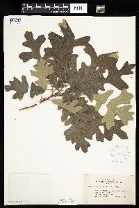 Quercus macrocarpa Michaux 407373[1005076]Lakela, Olga 95111949-08-28 United States, Minnesota, Saint Louis, Lake Kabetogama, near Park Point Resort.;Voyageurs National Park;;;, 48.48028 -93.055 |
MIN:Plants | 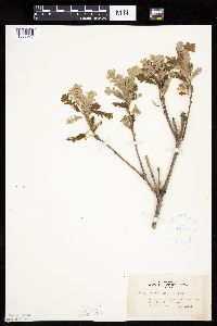 Quercus macrocarpa Michaux 407562[1005077]Lakela, Olga 81751949-06-11 United States, Minnesota, Saint Louis, Terrace of Prairie Lake.;;050N;20W;, 46.80928 -92.87068 |
MIN:Plants | 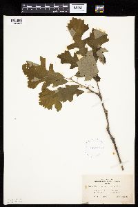 Quercus macrocarpa Michaux 407573[1005084]Lakela, Olga 82211949-06-04 United States, Minnesota, Saint Louis, Terrace of Prairie Lake, SW St. Louis Co.;;;;, 46.79139 -92.90472 |
MIN:Plants | 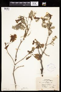 Quercus macrocarpa Michaux 407775[1005230]Lakela, Olga 81451949-05-29 United States, Minnesota, Saint Louis, Shorewoods of Birch Lake, near Babbitt.;;;;, 47.70861 -91.94444 |
MIN:Plants | 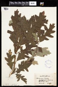 Quercus macrocarpa Michaux 407849[1005083]Lakela, Olga 96331949-09-01 United States, Minnesota, Saint Louis, Low terrace of Lake Kabetogama near Gappas Landing.;Voyageurs National Park;;;, 48.43778 -93.02722 |
MIN:Plants | 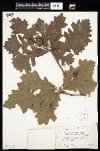 Quercus macrocarpa Michaux 412395[1005104]Moore, John; Moore, Marjorie 120571939-08-23 United States, Minnesota, Koochiching, Koochiching Co.; West bank of the Big Fork River near the mouth, Reedy Twp;;070N;26W;, 48.51667 -93.71667 |
MIN:Plants | 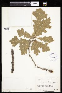 Quercus macrocarpa Michaux 412445[1005075]Moore, John; Moore, Marjorie 111831939-07-27 United States, Minnesota, Lake of the Woods, Along the W side of Harrison River, Northwest Angle.;Northwest Angle;;;, 49.26781 -95.00977 |
MIN:Plants |  Quercus macrocarpa Michaux 412620[1005048]Moore, John; Moore, Marjorie 117751939-08-15 United States, Minnesota, Koochiching, Koochiching Co. E of Black Bay Landing, T71N, R22W, Rainy Lake.;Voyageurs National Park;071N;22W;, 48.56667 -93.15 |
MIN:Plants | 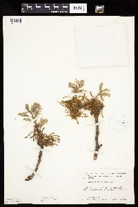 Quercus macrocarpa Michaux 413140[1005231]Moore, John; Moore, Marjorie 106421939-05-07 United States, Minnesota, Dakota, W-facing bluffs of the Minnesota River Valley, 1 mi. S of Mendota.;;028N;23W;, 44.874409 -93.179837 |
MIN:Plants | 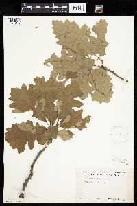 Quercus macrocarpa Michaux 418954[1005186]Ahlgren, Clifford 1381949-07-10 United States, Minnesota, Lake, Quetico-Superior Wilderness Research Center...Lake Co. S9, T64N, R10;Boundary Waters Canoe Area Wilderness / Superior National Forest;064N;10W;09, 48.03165 -91.61886 |
MIN:Plants | 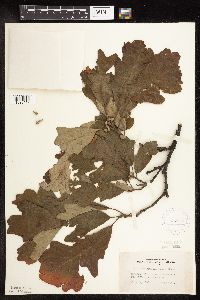 Quercus macrocarpa Michaux 419480[1096449]Lakela, Olga 109731950-07-30 United States, Minnesota, Saint Louis, Savanna River bank at Floodwood;;051N;20W;, 46.89584 -92.86911 |
MIN:Plants | 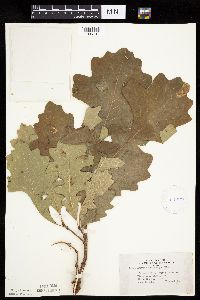 Quercus macrocarpa Michaux 419679[1005197]Lakela, Olga 111691950-08-08 United States, Minnesota, Saint Louis, Savanna River woods, W of Floodwood, hwy 29;;;;, 46.92917 -92.91944 |
MIN:Plants | 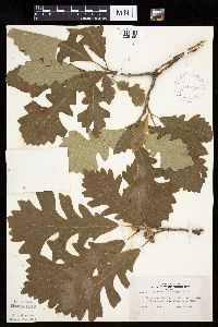 Quercus macrocarpa Michaux 419789[1005195]Lakela, Olga 119691950-09-01 United States, Minnesota, Saint Louis, Hwy 73, 2 mi N of Floodwood;;;;, 46.95812 -92.91944 |
MIN:Plants | 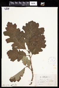 Quercus macrocarpa Michaux 420052[1005196]Lakela, Olga 110341950-08-02 United States, Minnesota, Saint Louis, St. Louis River bank at the hwy No. 4 bridge, 3 mi from Palo;;;;, 47.41528 -92.25944 |
MIN:Plants | 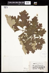 Quercus macrocarpa Michaux 420603[1005071]Lakela, Olga 111891950-08-08 United States, Minnesota, Saint Louis, On Hwy. 29, near the end of the Savanna River, W Floodwood.;;;;, 46.92917 -92.91944 |
MIN:Plants | 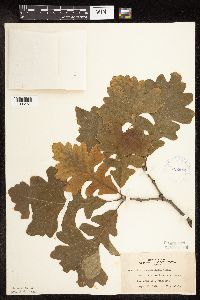 Quercus macrocarpa Michaux 422684[1096451]Lakela, Olga 78951948-09-26 United States, Minnesota, Saint Louis, Bank of Prairie Lake, SW corner St. Louis Co.;;050N;20W;, 46.80928 -92.87068 |
MIN:Plants | 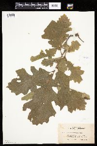 Quercus macrocarpa Michaux 422701[1005249]Lakela, Olga 79081948-09-18 United States, Minnesota, Saint Louis, St. Louis River bank, near Floodwwod;;N;;, 46.928692 -92.905159 |
MIN:Plants | 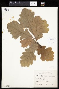 Quercus macrocarpa Michaux 424051[1005187]Emanuel, J. 1881946-09-10 United States, Minnesota, Itasca, Nashwauk Township (McCarty Lake);;057N;23W;21, 47.40665 -93.27004 |
MIN:Plants | 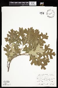 Quercus macrocarpa Michaux 427669[1005140]Smith, Welby 127261987-05-20 United States, Minnesota, Nicollet, Nicollet Co. In the Minnesota Valley, about 9 mi N-NE of Sleepy Eye; SE1/4 SW1/4 sec.15, T111N R32W;;111N;32W;15, 44.42006 -94.6743 |
MIN:Plants | 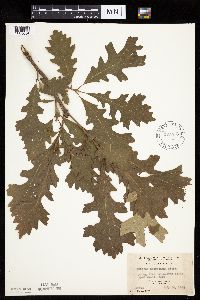 Quercus macrocarpa Michaux 427917[1005054]Jones, George Neville 184031946-07-20 United States, Minnesota, Saint Louis, Armstrong Lake, near Ely;;062N;14W;, 47.84972 -92.07778 |
MIN:Plants |  Quercus macrocarpa Michaux 430725[1005153]Smith, Welby 192371991-07-08 United States, Minnesota, Koochiching, Franz Jevne State Park. Koochiching County ... Franz Jevne State Park; in the Rainy River Valley, about 2 miles northeast of Birchdale ... T 160N R 27W SW1/4 of SW1/4 of sec 26. 160N 27W 26, 48.6427765 -94.078331 |
MIN:Plants |  Quercus macrocarpa Michaux 437371[1005046]Moore, John; Moore, Marjorie 122181939-08-29 United States, Minnesota, Lake of the Woods, On the shore of Four Mile Bay.;;N;;, 48.841584 -94.729813 |
MIN:Plants |  Quercus macrocarpa Michaux 442262[1005200]Rosendahl, C.; Butters, F. s.n.1934-09-00 United States, Minnesota, Becker, W of Height of Land Lake, T139-140, R39;;;;, 46.84653 -95.60478 |
MIN:Plants |  Quercus macrocarpa Michaux 442701[1005152]Lakela, Olga 132071951-07-13 United States, Minnesota, Saint Louis, Finger Bay Creek, along the creek, Rainy Lake;Voyageurs National Park;;;, 48.53472 -92.76083 |
MIN:Plants | 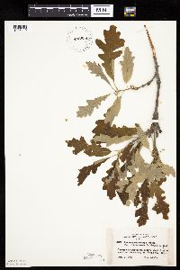 Quercus macrocarpa Michaux 442838[1005110]Lakela, Olga 123891951-06-09 United States, Minnesota, Saint Louis, Terrace of Floodwood River, about 7 mi N of Floodwood;;;;, 47.0305 -92.91944 |
MIN:Plants | 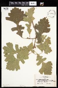 Quercus macrocarpa Michaux 443212[1005069]Lakela, Olga 137491953-09-13 United States, Minnesota, Saint Louis, Woods at Crane Lake, the Congdon Resort.;Kabetogama State Forest;;;, 48.28972 -92.47417 |
MIN:Plants | 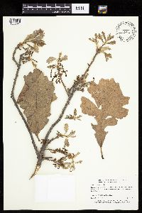 Quercus macrocarpa Michaux 443712[1005024]Myhre, K. 54101995-05-23 United States, Minnesota, Mahnomen, Wambach Wildlife Management Area / White Earth Indian Reservation. Mahnomen Co.; Located 5 miles northeast of the town of Mahnomen; in a mostly open Wildlife Management Area; T 145N R 42W Mahnomen Co.; Located 5 miles northeast of the town of Mahnomen; in a mostly open Wildlife Management Area; T 145N R 42W SW1/4 of NE1/4 of sec 12. 145N 42W 12, 47.39068 -95.94398 |
MIN:Plants | 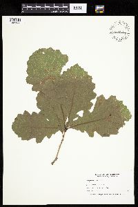 Quercus macrocarpa Michaux 444355[1005033]Nation, R. 94-1661994-06-21 United States, Minnesota, Mower, Lake Louise State Park. Mower Co.; Tract #22B. T101N R14W N1/2 NE1/4 of Sec. 21;Lake Louise State Park;101N;14W;21, 43.53658 -92.51904 |
MIN:Plants | 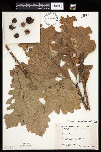 Quercus macrocarpa Michaux 445791[1005225]Moore, John; Huff, N. 183341945-10-05 United States, Minnesota, Kanabec, 2 mi W of Quamba;;;;, 45.91555 -93.21468 |
MIN:Plants | 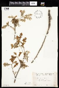 Quercus macrocarpa Michaux 446052[1005183]Moore, John 171821945-06-16 United States, Minnesota, Kittson, 1/2 mi E of St. Vincent;;N;;, 48.967621 -97.211349 |
MIN:Plants | 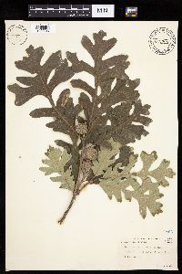 Quercus macrocarpa Michaux 447926[1005032]Abbott, Robinson s.n.1961-08-20 United States, Minnesota, Big Stone, Big Stone Co.; Toqua Lake, Graceville;;124N;46W;, 45.54239 -96.43145 |
MIN:Plants | 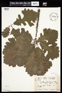 Quercus macrocarpa Michaux 448741[1005184]Moore, John 166361944-06-30 United States, Minnesota, Washington, 1 1/2 mi s Bayport;;029N;20W;, 44.99172 -92.81421 |
MIN:Plants | 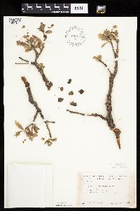 Quercus macrocarpa Michaux 448970[1005160]Moore, John 170671945-06-06 United States, Minnesota, Todd, 1 mi N of Philbrook;;;;, 46.29781 -94.71667 |
MIN:Plants | 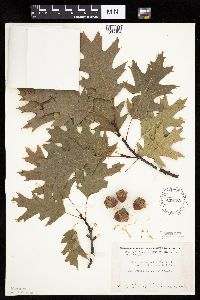 Quercus macrocarpa Michaux 449183[1005364]Moore, John; Hall, Robert 168481944-08-04 United States, Minnesota, Morrison, Little Falls;;;;, 45.97639 -94.36222 |
MIN:Plants | 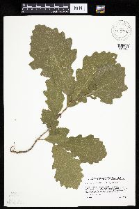 Quercus macrocarpa Michaux 455208[1005088]Sather, Nancy s.n.1996-08-22 United States, Minnesota, Mahnomen, White Earth Indian Reservation. Mahnomen Co.; east of Long Lake and northeast of Greer Lake in far northeastern corner of county; T 146 R39 NWSW of Sec Mahnomen Co.; east of Long Lake and northeast of Greer Lake in far northeastern corner of county; T 146 R39 NWSW of Sec 1. 146N 39W 1, 47.49203 -95.56193 |
MIN:Plants | 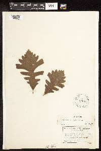 Quercus macrocarpa Michaux 458013[1096436]Garrison, O. s.n.1952-11-19 United States, Minnesota, Upper Mississippi.;;;;, 47.218056 -95.207222 |
MIN:Plants | 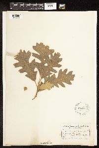 Quercus macrocarpa Michaux 458078[1096434]Garrison, O. s.n. United States, Minnesota, Upper Missisippi.;;;;, 47.2181 -95.2072 |
MIN:Plants | 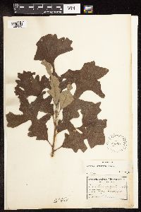 Quercus macrocarpa Michaux 458097[1096435]Garrison, O. s.n. United States, Minnesota, Upper Mississippi.;;;;, 47.218056 -95.207222 |
MIN:Plants | 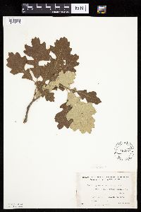 Quercus macrocarpa Michaux 462507[1005219]Lakela, Olga 142071952-06-18 United States, Minnesota, Saint Louis, Namakan Narrows, Resort grounds;Voyageurs National Park;069N;17W;, 48.42824 -92.52702 |
MIN:Plants | 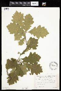 Quercus macrocarpa Michaux 462607[1005154]Lakela, Olga 148021952-07-10 United States, Minnesota, Saint Louis, Rainy Lake, Cranberry Bay area.;Voyageurs National Park;;;, 48.5925 -93.03806 |
MIN:Plants | 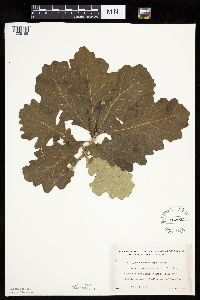 Quercus macrocarpa Michaux 462923[1005159]Lakela, Olga 151911952-07-17 United States, Minnesota, Saint Louis, N shore of Kabetogama Lake, 3 mi. W of Pine Island.;Voyageurs National Park;;;, 48.44859 -92.99602 |
MIN:Plants | 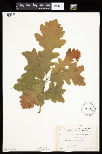 Quercus macrocarpa Michaux 463013[1005155]Lakela, Olga 149401952-07-13 United States, Minnesota, Saint Louis, Pine Island, Kabetogama Lake.;Voyageurs National Park;;;, 48.44861 -92.93056 |
MIN:Plants |  Quercus macrocarpa Michaux 463107[1005158]Lakela, Olga 143591952-06-21 United States, Minnesota, Saint Louis, Sand Point Lake, S of the Narrows.;Voyageurs National Park;;;, 48.4 -92.45833 |
MIN:Plants | 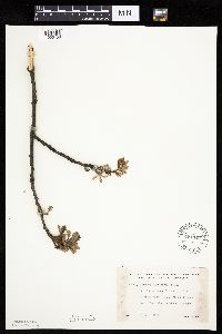 Quercus macrocarpa Michaux 481147[1005150]Lakela, Olga 160411953-06-08 United States, Minnesota, Saint Louis, Oak View Narrows of Vermilion Lake.;Voyageurs National Park;;;, 47.89167 -92.36667 |
MIN:Plants | 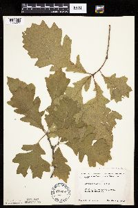 Quercus macrocarpa Michaux 488630[1005226]Moore, John 200851949-06-03 United States, Minnesota, Todd, 1 mi S of Staples;;;;, 46.34108 -94.79194 |
MIN:Plants | 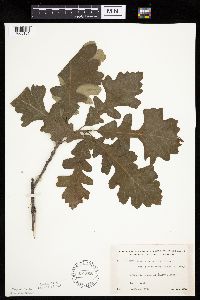 Quercus macrocarpa Michaux 491868[1005151]Lakela, Olga 167791953-08-10 United States, Minnesota, Saint Louis, St. Louis County...Beatty portage, Lac La Croix.;Boundary Waters Canoe Area Wilderness / Superior National Forest;067N;15W;20, 48.27403 -92.2871 |
MIN:Plants | 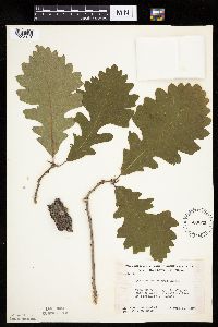 Quercus macrocarpa Michaux 500035[1005194]Rustad, Orwin 471946-06-11 United States, Minnesota, Rice, At edge of lake, at Faribault;;;;, 44.295 -93.26861 |
Google Map
Google Maps is a web mapping service provided by Google that features a map that users can pan (by dragging the mouse) and zoom (by using the mouse wheel). Collection points are displayed as colored markers that when clicked on, displays the full information for that collection. When multiple species are queried (separated by semi-colons), different colored markers denote each individual species.