University of Minnesota
http://www.umn.edu/
612-625-5000
http://www.umn.edu/
612-625-5000
Minnesota Biodiversity Atlas
Bell Museum
Dataset: MIN-Plants
Taxa: Salicaceae
Search Criteria: excluding cultivated/captive occurrences
Bell Museum plants | |
 MIN:Plants |  Salix arctophila Cockerell ex A. Heller 557705[1206762]Moir, D.R. 1781 Canada, Ontario, Kenora |
MIN:Plants |  Salix arctophila Cockerell ex A. Heller 571432[1206763]Schofield, W.B. 6844 Canada, Manitoba |
MIN:Plants |  Salix arctophila Cockerell ex A. Heller 571431[1206764]Schofield, W.B. 6704 Canada, Manitoba |
MIN:Plants |  Salix arctophila Cockerell ex A. Heller 534053[1206765]Oldenburg, M.E. 102B Canada, Nunavut |
MIN:Plants |  Salix arctophila Cockerell ex A. Heller 557706[1206766]Moir, D.R. 1809 Canada, Ontario, Kenora |
MIN:Plants |  Salix arctophila Cockerell ex A. Heller 497148[1206768]Harper, F. 3430 Canada, Quebec |
MIN:Plants |  Salix arctophila Cockerell ex A. Heller 534031[1206769]Oldenburg, M.E. 157C Canada, Quebec |
MIN:Plants |  Salix arctophila Cockerell ex A. Heller 538032[1206770]Abbe, E.C. 234 Canada, Newfoundland and Labrador |
MIN:Plants |  Salix arctophila Cockerell ex A. Heller 530306[1206771]Floderus, B. s.n. Greenland |
MIN:Plants |  Salix arctophila Cockerell ex A. Heller 614662[1206772]Munns, C.E. 766 Canada, Manitoba |
MIN:Plants |  Salix arctophila Cockerell ex A. Heller 521035[1206773]Beckett, Mrs. E. 346 Canada, Nunavut |
MIN:Plants |  Salix arctophila Cockerell ex A. Heller 530299[1206774]Lagerkranz, J. s.n. Greenland |
MIN:Plants | 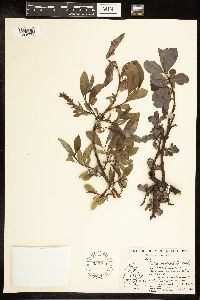 Salix arctophila Cockerell ex A. Heller 533974[1206775]Abbe, E.C. 3028 Canada, Quebec |
MIN:Plants | 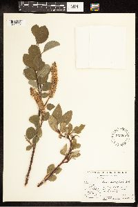 Salix arctophila Cockerell ex A. Heller 533202[1206776]Abbe, E.C. 3478 Canada, Quebec |
MIN:Plants | 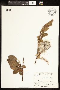 Salix arctophila Cockerell ex A. Heller 671457[1206777]Oldenburg, M.E. 44-779 Canada, Nunavut |
MIN:Plants | 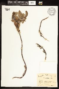 Salix arctophila Cockerell ex A. Heller 671458[1206778]Oldenburg, M.E. 46-2096 Canada, Nunavut |
MIN:Plants | 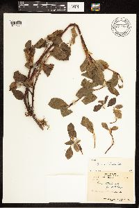 Salix arctophila Cockerell ex A. Heller 671459[1206779]Oldenburg, M.E. 47-50 Canada, Quebec |
MIN:Plants | 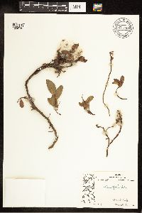 Salix arctophila Cockerell ex A. Heller 671461[1206780]Oldenburg, M.E. 52-133 Canada, Nunavut |
MIN:Plants | 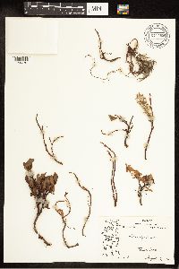 Salix arctophila Cockerell ex A. Heller 671462[1206781]Oldenburg, M.E. 52-131 Canada, Nunavut |
MIN:Plants | 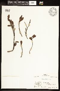 Salix arctophila Cockerell ex A. Heller 671464[1206782]Oldenburg, M.E. 54-683 Canada, Northwest Territories |
MIN:Plants |  Salix arctophila Cockerell ex A. Heller 667932[1206783]Breckenridge, W.J. 53-56 Canada, Nunavut |
MIN:Plants |  Salix arctophila Cockerell ex A. Heller 667946[1206784]Breckenridge, W.J. 53-200 Canada, Nunavut |
MIN:Plants |  Salix arctophila Cockerell ex A. Heller 667947[1206785]Breckenridge, W.J. 53-46 Canada, Nunavut |
MIN:Plants |  Salix arctophila Cockerell ex A. Heller 667934[1206786]Breckenridge, W.J. 53-202 Canada, Nunavut |
MIN:Plants | 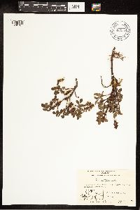 Salix arctophila Cockerell ex A. Heller 667948[1206787]Breckenridge, W.J. 53-52 Canada, Nunavut |
MIN:Plants | 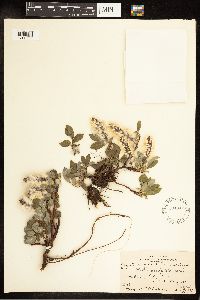 Salix arctophila Cockerell ex A. Heller 534347[1206788]Oldenburg, M.E. 5 Canada, Newfoundland and Labrador |
MIN:Plants | 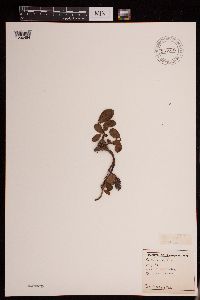 Salix arctophila Cockerell ex A. Heller 951078[1290484]Gerenday, A. s.n.1977-08-00 Canada, Northwest Territories, Baffin Island. |
MIN:Plants | 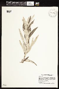 912709[1090437]Smith, Welby 230051993-07-21 United States, Minnesota, Meeker, Meeker County...At the north end of Little Swan Lake, about 3 mi north of Dassel...T 119N R 29W SW1/4 of NW1/4 of Sec 11;;119N;29W;11, 45.1344444 -94.2919444 |
MIN:Plants | 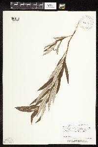 478907[1090313]Carlson, Bruce 002811997-08-17 United States, Minnesota, Mille Lacs, Mille Lacs Kathio State Park. Mille Lacs Co.; Mille Lacs Kathio State Park, 0.5 miles NNE of the interpretive center; eastern side of Ogechi Lake; DNR Releve 7202. T42N R27W SWNE08. 042N 27W 8, 46.13508 -93.77658 |
MIN:Plants | 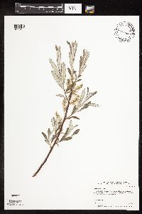 498934[1090433]Whitfeld, T.J.S. 3362002-06-05 United States, Minnesota, Douglas, Douglas County ... Spruce Creek WPA; 2 miles west of Rose City ... T130N R36W NESE9;Spruce Creek Wildlife Management Area;130N;36W;09, 46.083208 -95.211321 |
MIN:Plants | 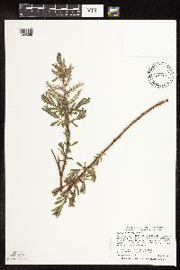 462053[1090286]Smith, Welby 277011999-05-11 United States, Minnesota, Cass, Cass County ... On the west side of Hwy 6, about 3.5 miles N of Outing ... along Brook Creek ... T 139N R 26W NW1/4 of NE1/4 of Sec 10. 139N 26W 10, 46.8708344 -93.9480591 |
MIN:Plants | 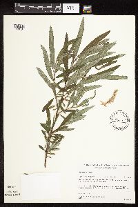 489311[1090431]Gerdes, Lynden; et al. 34981999-06-24 United States, Minnesota, Cook, Superior National Forest. T65N R02W S17SWSE Cook County ... Superior National Forest. Thuja/Picea swamp south of small drainage entering the northeastern most bay of Gunflint Lake.. 065N 02W 17, 48.09615 -90.694288 |
MIN:Plants | 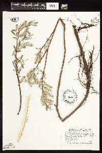 462228[1090293]Smith, Welby 269741998-05-04 United States, Minnesota, Norman, Faith Wildlife Management Area. Norman County ... Faith State Wildlife Management Area, about 2 miles south of the town of Faith ... T 144N R 43W SE1/4 of NW1/4 of Sec 26. 144N 43W 26, 47.260348 -96.09879 |
MIN:Plants | 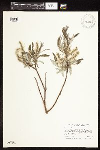 912813[1090438]Smith, Welby 241461994-05-30 United States, Minnesota, Itasca, Itasca County... In Scenic State Park; about 9 miles south-southeast of Effie. T60N R26W NE1/4 of NE1/4 of Sec 1;Scenic State Park;060N;26W;01, 47.7186111 -93.5808333 |
MIN:Plants | 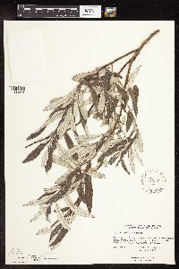 575359[1096823]Garton, C. 89331961-07-24 Canada, Ontario, Rainy River, Rainy River District...9 mi. N. of Rainy R. Town, on the Ridge, H. 600, Wildland Reserve |
MIN:Plants | 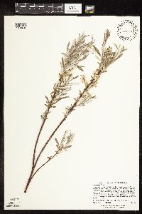 526515[1090405]Lee, Michael MDL20201998-05-13 United States, Minnesota, Stearns, Stearns County ... Large wetland complex along Kolling Creek and Roschien Lake two miles west of Richmond ... T123N R31W NE1/4 of NE1/4 Sec. 21, NW1/4 of NW1/4 Sec. 22. 123N 31W 21, 45.446554 -94.575053 |
MIN:Plants | 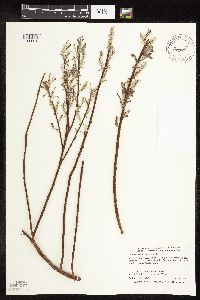 509058[1090316]Smith, Welby 283962000-05-04 United States, Minnesota, Morrison, Morrison County ... About 2 miles northwest of Cushing ... T 131N R 31W NE1/4 of NW1/4 of Sec 8;;131N;31W;08, 46.1777763 -94.609726 |
MIN:Plants | 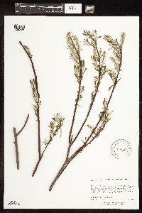 906581[1090436]Lee, Michael MDL35782004-05-11 United States, Minnesota, Morrison, Morrison County...valley of the Crow Wing River 3-1/2 miles southwest of Pillager...T133N R31W NE1/4 of SW1/4 Sec. 36;;133N;31W;36, 46.289663 -94.527456 |
MIN:Plants | 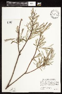 475267[1090428]Smith, Welby 277091999-05-12 United States, Minnesota, Clearwater, About 2 miles north of Clearbrook.. SW1/4 of NW1/4 of section;<No data>;149N;37W;17, 47.7272222 -95.4280556 |
MIN:Plants | 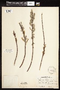 229636[1090362]Rosendahl, C. 52121927-05-14 United States, Minnesota, Goodhue, About 2 mi above Frontenac;;;;, 44.540044 -92.356571 |
MIN:Plants | 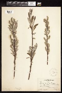 229655[1090355]Rosendahl, C. 52121927-05-14 United States, Minnesota, Goodhue, Ca. 2 mi. above Frontenac.;;N;;, 44.540044 -92.356571 |
MIN:Plants | 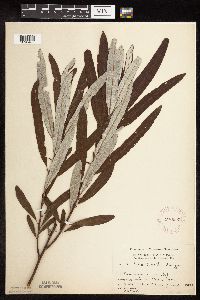 276005[1090407]Moyle, J. 921930-06-30 United States, Minnesota, Clearwater, Itasca Park, Floating Bog Bay; SW NE Sec. 11 T143N R36W;Itasca State Park;143N;36W;, 47.197458 -95.201964 |
MIN:Plants | 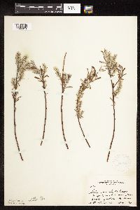 281895[1090319]Rosendahl, C. 63991931-05-04 United States, Minnesota, Dakota, Nicols.;;027N;23W;18, 44.822192 -93.220589 |
MIN:Plants | 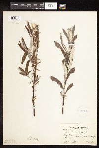 282082[1090320]Rosendahl, C. 24721910-05-30 United States, Minnesota, Hennepin, Deephaven Swamp, near Minneapolis.;;N;;, 44.928253 -93.524063 |
MIN:Plants | 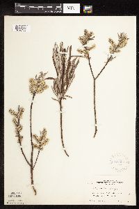 282390[1090408]Rosendahl, C. 61851930-05-25 United States, Minnesota, Anoka, E of Cedar Creek;;N;;, 45.329955 -93.288989 |
MIN:Plants | 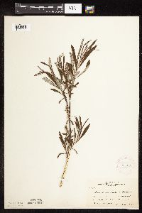 284448[1090409]Rosendahl, C. 57891929-05-22 United States, Minnesota, Isanti, So. Isanti Co.;;N;;, 45.508531 -93.231249 |
MIN:Plants | 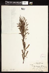 284449[1090388]Rosendahl, C. 5789a1929-05-22 United States, Minnesota, Isanti, [no further data];;;;, 45.566613 -93.289917 |
MIN:Plants | 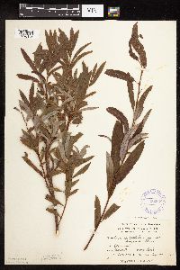 332638[1090345]Grant, Martin 66941935-08-27 United States, Minnesota, Clearwater, Itasca Park. Mary Lake. NE1/4 SE1/4 Sec. 24, T143N, R36W.;Itasca State Park;143N;36W;24, 47.188748 -95.18007 |
MIN:Plants | 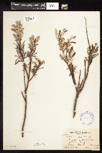 351943[1090332]Nielsen, E. 18941933-05-28 United States, Minnesota, Clearwater, Floating Bog Bay, Itasca State Park.;Itasca State Park;143N;36W;, 47.197458 -95.201964 |
MIN:Plants | 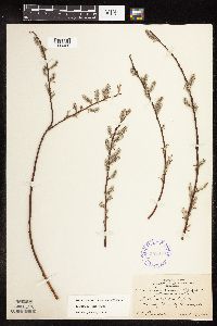 352350[1090426]Rosendahl, C. 69181938-04-26 United States, Minnesota, Ramsey, South end of Snail Lake. Ramsey County;Snail Lake Vadnais Lake County Park;030N;23W;24, 45.067757 -93.122105 |
MIN:Plants | 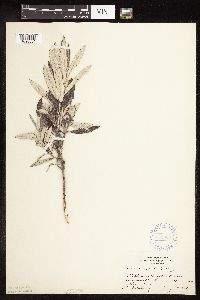 355620[1090384]Rosendahl, C.; Dahlberg, R. s.n.1918-08-00 United States, Minnesota, Marshall, Golden Valley Peat Farm.;;N;;, 48.324005 -95.916368 |
MIN:Plants | 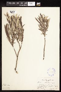 355629[1090360]Rosendahl, C.; Dahlberg, R. s.n.1918-08-00 United States, Minnesota, Pennington, Peat farm, Goodridge.;;N;;, 48.143296 -95.809459 |
MIN:Plants | 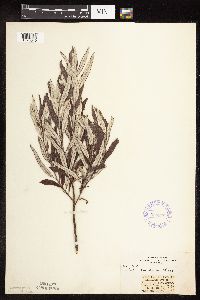 358348[1090340]Stork, H. 11521925-00-00 United States, Minnesota, Itasca, Bowstring;Chippewa National Forest;;;, 47.54306 -93.79639 |
MIN:Plants | 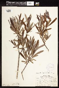 369028[1090390]Lakela, Olga 43391941-05-30 United States, Minnesota, Saint Louis, S of Central Lakes, Hwy. 53.;;N;;, 47.225767 -92.476578 |
MIN:Plants | 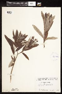 412479[1090343]Moore, John; Moore, Marjorie 112291939-07-28 United States, Minnesota, Lake of the Woods, Near the source of Pine Creek, Angle Inlet;Northwest Angle;168N;34W;, 49.353711 -95.002845 |
MIN:Plants | 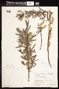 413625[1090386]Moore, John; et al. 107021939-05-28 United States, Minnesota, Clearwater, Along old Lake Alice Trail, E of the Forestry Station, Itasca State Park.;Itasca State Park;143N;36W;, 47.197458 -95.201964 |
MIN:Plants | 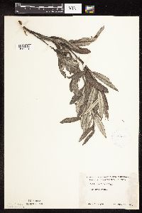 426008[1090341]Moyle, J. s.n.1951-08-17 United States, Minnesota, Roseau, Noracres Swamp;;N;;, 48.777189 -95.819519 |
MIN:Plants | 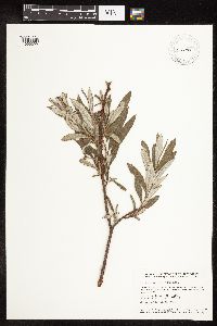 433149[1090299]Smith, Welby 132691987-06-29 United States, Minnesota, Washington, Washington County... Corries swamp, large wetland about 8 miles west of Marine on St. Croix; NW1/4 SE1/4 section 26, T 32N R 21W. 032N 21W 26, 45.2161111 -92.9244444 |
MIN:Plants | 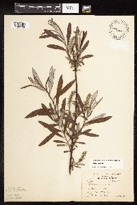 440088[1090403]Kukachka, B. 3511937-05-23 United States, Minnesota, Ramsey, Battle Creek Park;Battle Creek County Park;028N;22W;, 44.940556 -93.014299 |
MIN:Plants | 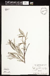 440991[1090306]Smith, Welby 115221986-05-26 United States, Minnesota, Goodhue, Goodhue Co. Perched Valley State Wildlife Management Area, about 4 mi W of Frontenac. NW1/4 SW1/4 sec 8, T112N R13W;Perched Valley Wildlife Management Area;112N;13W;8, 44.5172234 -92.4063873 |
MIN:Plants | 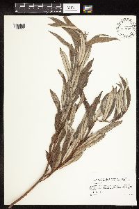 444547[1090305]Sather, Nancy s.n.1995-08-29 United States, Minnesota, Mahnomen, Mahnomen Co.; Washington Lake; Biological Survey Site 117. T145 R39 NE of Sec. 4;White Earth Indian Reservation;145N;39W;4, 47.401476 -95.625484 |
MIN:Plants | 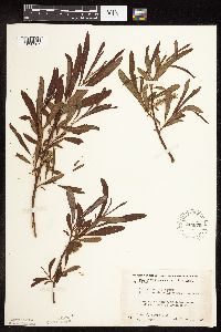 444870[1090387]Moore, John; Huff, N. 195671947-06-14 United States, Minnesota, Itasca, 6 mi. N of Grand Rapids.;;N;;, 47.324019 -93.530214 |
MIN:Plants | 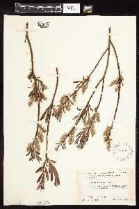 445060[1090365]Moore, John; Huff, N. 193991947-05-28 United States, Minnesota, Pine, 3 mi. SE of Hinckley.;;N;;, 45.980618 -92.900147 |
MIN:Plants | 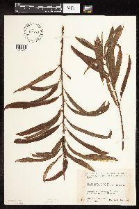 448276[1090357]Moore, John; Huff, N. 19171a1946-08-30 United States, Minnesota, Koochiching, Koochiching Co.; 8.1 mi. west of Mizpah.;Pine Island State Forest;152N;29W;, 47.92399 -94.378783 |
MIN:Plants | 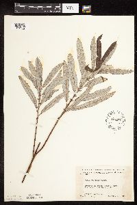 448277[1090352]Moore, John; Huff, N. 191711946-08-30 United States, Minnesota, Koochiching, Koochiching Co.; 8.1 mi west of Mizpah;Pine Island State Forest;152N;29W;, 47.92399 -94.378783 |
MIN:Plants | 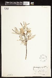 458093[1096556]Garrison, O. s.n. United States, Minnesota, Upper Mississippi.;;;;, 47.218056 -95.207222 |
MIN:Plants | 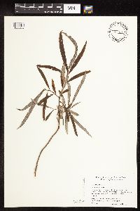 464353[1090292]Smith, Michael 6221997-08-26 United States, Minnesota, Koochiching, East Rat Root River Peatland Scientific Natural Area. Voyageurs National Park. Koochiching Co.; Rat Root Peatland, 48 29'00' N 93 09'20' W [this locale not in the national park]. 069N 22W , 48.4833336 -93.1555557 |
MIN:Plants | 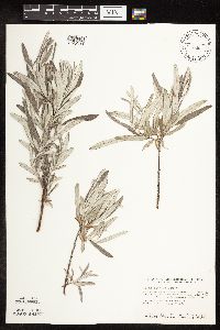 475136[1090309]Smith, Welby 116041986-06-03 United States, Minnesota, Olmsted, Olmsted Co. About 2 mi S-SE of Rock Dell (town) and 1/4 mi N of State Hwy.30; NW1/4 SW1/4 SE1/4 sec.16, T105N R15W;;105N;15W;16, 43.894722 -92.6255569 |
MIN:Plants | 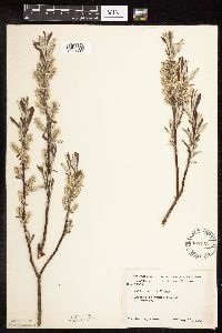 488743[1090397]Moore, John 199091949-05-10 United States, Minnesota, Red Lake, Red Lake Co. At Dorothy.;;151N;45W;, 47.9167 -96.4333 |
MIN:Plants | 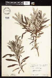 497496[1090338]Moore, John 202651949-06-23 United States, Minnesota, Beltrami, Along the E shore of Big Lake;;N;;, 47.513292 -94.608173 |
MIN:Plants | 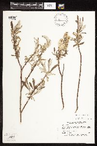 508286[1090284]Myhre, K. 19411992-05-20 United States, Minnesota, Cass, Cass County...Located on the W side of Jack Lake...T141N R30W NE1/4 of SE1/4 of Sec 3;Chippewa National Forest / Leech Lake Indian Reservation;141N;30W;03, 47.057361 -94.451767 |
MIN:Plants | 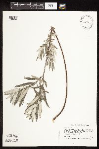 508302[1090288]Smith, Welby 169251990-06-20 United States, Minnesota, Dodge, Dodge Co.; "Pheasants Forever" State Wildlife Management Area, about 2.5 mi W-SW of Mantorville;Pheasants Forever Wildlife Management Area;107N;17W;24, 44.0530548 -92.9300003 |
MIN:Plants | 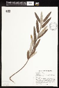 518480[1090290]Ostlie, Wayne 1531993-09-12 United States, Minnesota, Chippewa, Zion Lutheran Church Fen. N2, SW4, Sec.6, T118N, R42W, Kragero Township, Chippewa County;Lac Qui Parle Wildlife Management Area;118N;42W;6, 45.055651 -95.975826 |
MIN:Plants | 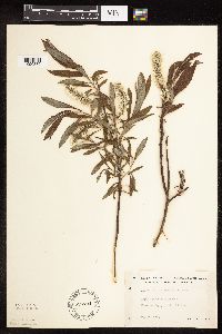 525734[1090389]Lakela, Olga 186241955-05-29 United States, Minnesota, Saint Louis, Normanna Twp, N of Duluth.;;N;;, 46.783273 -92.106579 |
MIN:Plants | 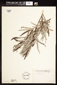 527241[1090344]Lakela, Olga 178191954-07-12 United States, Minnesota, Saint Louis, At Pale Face Creek N of Cotton;;N;;, 47.16938 -92.4763 |
MIN:Plants | 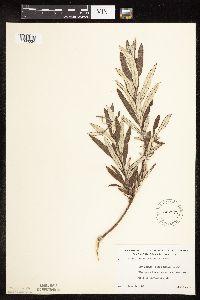 532372[1090334]Lakela, Olga 203181956-07-09 United States, Minnesota, Saint Louis, Along Floodwood river above the lake inlet W of hwy no.73;;N;;, 47.073252 -92.978368 |
MIN:Plants | 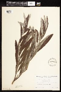 532726[1090347]Lakela, Olga 206421956-07-29 United States, Minnesota, Saint Louis, Bank of the Prairie River, Mississippi River watershed, SW corner of the county.;;N;;, 47.5167 -93.0167 |
MIN:Plants | 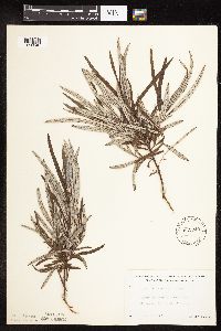 532940[1090348]Lakela, Olga 203811956-07-10 United States, Minnesota, Saint Louis, W shore of Island Lake, hwy no. 73, S of Hibbing;;N;;, 47.738892 -92.866469 |
MIN:Plants | 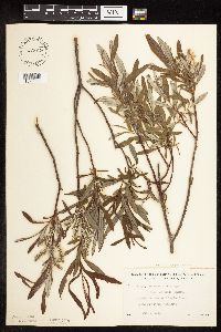 533019[1090394]Lakela, Olga 196771956-06-09 United States, Minnesota, Saint Louis, Terrace of the Paleface River, N of Cotton Hwy. 53.;;N;;, 47.16938 -92.4763 |
MIN:Plants | 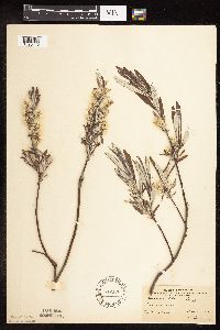 542190[1090413]Bergman, H. s.n.1911-05-21 United States, Minnesota, Becker, Detroit;;N;;, 46.817181 -95.845325 |
MIN:Plants |  542474[1090350]Moore, John; et al. 215061952-05-18 United States, Minnesota, Anoka, Anoka County...Cedar Creek Forest, 48C, along Cedar Creek W of Lawrence's Woods;Cedar Creek National History Area;034N;23W;, 45.40217 -93.199397 |
MIN:Plants |  543618[1090364]Lakela, Olga 195961956-05-20 United States, Minnesota, Saint Louis, Side of the road, Paleface River, N of Cotton, Hwy. 53.;;N;;, 47.177991 -92.497412 |
MIN:Plants |  549848[1090356]Moore, John 218921954-07-21 United States, Minnesota, Wilkin, 1 mi. S of Lawndale.;;N;;, 46.541912 -96.36 |
MIN:Plants |  551548[1090339]Cotter, Shirley 7521948-08-00 United States, Minnesota, Clearwater, Itasca Park;Itasca State Park;143N;36W;, 47.197458 -95.201964 |
MIN:Plants | 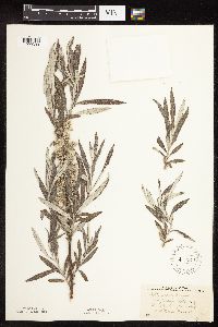 572944[1090393]Stevens, O. 25571962-06-06 United States, Minnesota, Clay, W of Ulen.;;N;;, 47.07885 -96.258949 |
MIN:Plants | 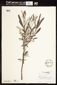 594378[1090415]Thorne, Robert 303611962-06-13 United States, Minnesota, Hubbard, Bog D, ca. 1/2 mi SE of Mary Lake, Itasca State Park;Itasca State Park;143N;35W;, 47.194443 -95.1103 |
MIN:Plants | 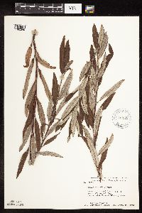 615925[1090349]Moore, John; Moore, Marjorie 273161969-09-23 United States, Minnesota, Anoka, Cedar Creek Natural History Area; SE1/4 Sec. 27;Cedar Creek National History Area;034N;23W;27, 45.319728 -93.316639 |
MIN:Plants | 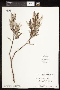 616389[1090414]Moore, John; Moore, Marjorie 3311969-07-22 United States, Minnesota, Crow Wing, S end of Chandler Lake; SW1/4 Sec. 22 Garrison Twp.;;044N;28W;22, 46.278961 -93.86289 |
MIN:Plants | 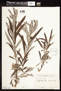 627696[1090368]Ownbey, Gerald 45561972-07-09 United States, Minnesota, Cass, Cass Co. Boy River Bog, 3 mi. E of Boy River, N1/2 NE1/4 Sec. 23, T143N, R27W.;Chippewa National Forest;143N;27W;23, 47.101979 -94.06127 |
MIN:Plants | 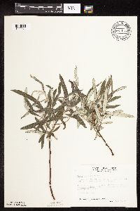 687116[1090372]Wheeler, Gerald; Glaser, Paul 15431977-06-04 United States, Minnesota, Itasca, NW1/4 NW1/4 Sec. 21, T55N, R26W; ca. 5 mi. W of Grand Rapids.;;055N;26W;21, 47.237978 -93.657549 |
MIN:Plants | 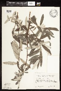 690048[1090423]Ownbey, Gerald 56171977-07-19 United States, Minnesota, Wadena, Wadena Co. E side of U.S. Rte 71, 3.2 mi S of its jnc with U.S. rte 10 in Wadena; T134N R35W Sec. 20 SE1/4;;134N;35W;20, 46.405284 -95.124794 |
MIN:Plants | 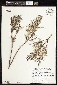 698068[1090363]Wheeler, Gerald; Glaser, Paul 28681978-05-31 United States, Minnesota, Beltrami, Red Lake Peatland Scientific Natural Area. Red Lake Peatland. NE1/4 NW1/4 Sec. 1, T156N, R31W; ca. 14.5 mi. N of the Waskish Airport on Rte. 72, ca. 0.5 mi. W of Red Lake Peatland. NE1/4 NW1/4 Sec. 1, T156N, R31W; ca. 14.5 mi. N of the Waskish Airport on Rte. 72, ca. 0.5 mi. W of the road. Site 1.. 156N 31W 1, 48.365385 -94.56753 |
MIN:Plants | 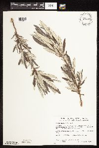 698129[1090425]Wheeler, Gerald; Glaser, Paul 29291978-06-08 United States, Minnesota, Beltrami, Ca. 12 mi N of the Waskish Airport on rte 72, ca. 0.1 mi W of the road, Coll. Site No. 11; NE1/4 SE1/4 Sec. 13 T156N R31 Ca. 12 mi N of the Waskish Airport on rte 72, ca. 0.1 mi W of the road, Coll. Site No. 11; NE1/4 SE1/4 Sec. 13 T156N R31W. 156N 31W 13, 48.328969 -94.557215 |
MIN:Plants | 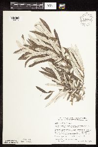 698394[1090416]Wheeler, Gerald; Glaser, Paul 31951978-07-13 United States, Minnesota, Beltrami, Approx. 20.5 mi NW of the Waskish Airport. Western Water Track. Coll. site no. 54. NE1/4 NW1/4 of section;Red Lake Peatland Scientific Natural Area;155N;33W;05, 48.27839 -94.917974 |
MIN:Plants | 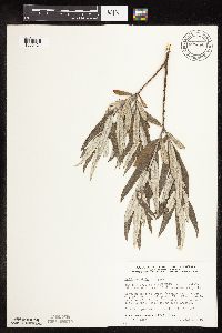 698466[1090424]Wheeler, Gerald; Glaser, Paul 32671978-07-15 United States, Minnesota, Beltrami, Ca. 16 mi NW of the Waskish Airport, western edge of Ovoid Island Area, ca. 0.5 mi W of Camp No. II; SE1/4 NW1/4 Sec. 15 Ca. 16 mi NW of the Waskish Airport, western edge of Ovoid Island Area, ca. 0.5 mi W of Camp No. II; SE1/4 NW1/4 Sec. 15 T156N R32W. 156N 32W 15, 48.332044 -94.742064 |
MIN:Plants | 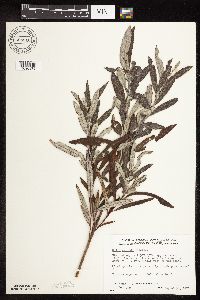 698510[1090370]Wheeler, Gerald; Glaser, Paul 33141978-08-30 United States, Minnesota, Beltrami, Red Lake Peatland Scientific Natural Area. Red Lake Peatland. NE1/4 NW1/4 Sec. 1, T156N, R31W; ca. 14.5 mi. N of the Waskish Airport on Rte. 72, ca. 0.5 mi. W of Red Lake Peatland. NE1/4 NW1/4 Sec. 1, T156N, R31W; ca. 14.5 mi. N of the Waskish Airport on Rte. 72, ca. 0.5 mi. W of the road. Site 1.. 156N 31W 1, 48.365385 -94.56753 |
MIN:Plants | 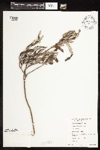 699032[1090369]Sather, Nancy; et al. 3461976-08-11 United States, Minnesota, Lake, Lake Co. First bird transect going S on USFS 424. S1/2 NE1/4 Sec. 31, T61N, R10W.;Superior National Forest;061N;10W;31, 47.726089 -91.651851 |
MIN:Plants | 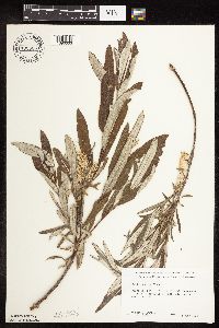 700535[1090333]Ownbey, Gerald 58681978-06-14 United States, Minnesota, Clearwater, Along Rte. 5, 5.5 mi. N of Clearbrook. T150N, R37W, SE1/4 Sec. 30.;;150N;37W;30, 47.778994 -95.436208 |
MIN:Plants | 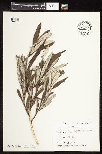 715260[1090371]Farrell, P. 111A1979-07-19 United States, Minnesota, Beltrami, Lake Bemidji Bog SNA: 1 mi. NW of Lake Bemidji, N1/2 of NW1/4 of Sec. 24, T147N, R33W.;;147N;33W;24, 47.536135 -94.815118 |
MIN:Plants | 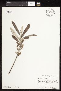 724343[1090335]Smith, Welby 21651980-05-22 United States, Minnesota, Dakota, Dakota Co. T27N, R24W, NW1/4 NW1/4 NE1/4 Sec. 34. About 1 mi. S of Black Dog Lake, in the Minnesota Valley.;Black Dog Preserve Scientific Natural Area;027N;24W;34, 44.789482 -93.276966 |
Google Map
Google Maps is a web mapping service provided by Google that features a map that users can pan (by dragging the mouse) and zoom (by using the mouse wheel). Collection points are displayed as colored markers that when clicked on, displays the full information for that collection. When multiple species are queried (separated by semi-colons), different colored markers denote each individual species.