University of Minnesota
http://www.umn.edu/
612-625-5000
http://www.umn.edu/
612-625-5000
Minnesota Biodiversity Atlas
Bell Museum
Dataset: MIN-Plants
Taxa: Urticaceae
Search Criteria: excluding cultivated/captive occurrences
Bell Museum plants | |
 MIN:Plants | 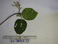 949693[1297999]Weiblen, G.D. YS3H00732012-09-18 Papua New Guinea, Morobe, Yawan Village, -6.1641 146.843567, 1851m |
MIN:Plants | 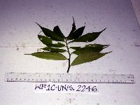 Elatostema integrifolium (D.Don) Wedd. 916835[]Weiblen, G.D. & Binatang Research Center WP1C22462006-05-20 Papua New Guinea, Madang, Wanang Village, -5.2373 145.177183, 115m |
MIN:Plants | 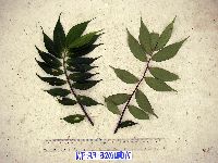 Elatostema integrifolium (D.Don) Wedd. 916817[]Weiblen, G.D. & Binatang Research Center WP3B32002007-06-21 Papua New Guinea, Madang, Wanang Village, -5.2373 145.177183, 115m |
MIN:Plants | 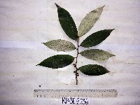 Leucosyke australis Unruh 916834[]Weiblen, G.D. & Binatang Research Center WP3E26362006-09-18 Papua New Guinea, Madang, Wanang Village, -5.2373 145.177183, 115m |
MIN:Plants | 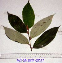 Leucosyke australis Unruh 916841[]Weiblen, G.D. & Binatang Research Center WS1B22332006-07-18 Papua New Guinea, Madang, Wanang Village, -5.229583 145.178467, 115m |
MIN:Plants | Leucosyke australis Unruh 916818[]Weiblen, G.D. & Binatang Research Center WS1Z32292008-04-24 Papua New Guinea, Madang, Wanang Village, -5.229583 145.178467, 115m |
MIN:Plants | 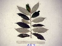 Leucosyke australis Unruh 916843[]Weiblen, G.D. & Binatang Research Center WS3C06662006-12-06 Papua New Guinea, Madang, Wanang Village, -5.229583 145.178467, 115m |
MIN:Plants | 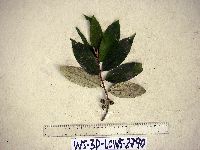 Leucosyke australis Unruh 916836[]Weiblen, G.D. & Binatang Research Center WS3D27902007-05-22 Papua New Guinea, Madang, Wanang Village, -5.229583 145.178467, 115m |
MIN:Plants | 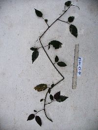 Nothocnide repanda (Blume) Blume 923631[]Whitfeld, T.J.S. SB5D03702008-07-18 Papua New Guinea, Madang, Wanang Village, -5.242633 145.166733, 113m |
MIN:Plants | 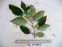 Pipturus argenteus (G. Forst.) Wedd. 921367[]Whitfeld, T.J.S. OA1A00052008-07-23 Papua New Guinea, Madang, Wanang Village, -5.233683 145.171867, 179m |
MIN:Plants | 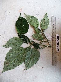 Pipturus argenteus (G. Forst.) Wedd. 920744[]Whitfeld, T.J.S. OD1B00132008-08-05 Papua New Guinea, Madang, Wanang Village, -5.230783 145.165833, 170m |
MIN:Plants | 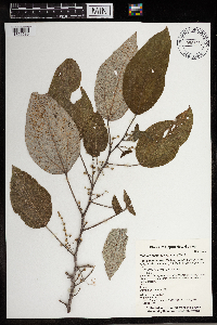 Pipturus argenteus (G. Forst.) Wedd. 965853[1356589]Whitfeld, T. J. S. 20762019-02-16 Papua New Guinea, Madang, Wanang Conservation Area, inside the Wanang 50 hectare Forest Dynamics Plot, -5.232975 145.07455, 150m |
MIN:Plants | 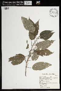 Pipturus argenteus (G. Forst.) Wedd. 965863[1356579]Whitfeld, T. J. S. 12432016-06-17 Papua New Guinea, Madang, Wanang Conservation Area, on bank of Digitam Creek, -5.230756 145.098243, 150m |
MIN:Plants |  Cecropia gabrielis Cuatrec. 951329[1290198]Bevington, J. 842012-06-06 Ecuador |
MIN:Plants |  Cecropia gabrielis Cuatrec. 951330[1290197]Bevington, J. 872012-06-06 Ecuador |
MIN:Plants |  Cecropia gabrielis Cuatrec. 951327[1290196]Bevington, J. 872012-06-06 Ecuador |
MIN:Plants |  Cecropia polystachya Trécul 951328[1290199]Bevington, J. 84A2013-06-09 Peru |
MIN:Plants | 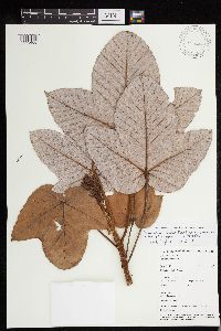 Pourouma bicolor subsp. chocoana (Stadl.) C.C. Berg & Heusden 493714[1293466]Weiblen, G.D. GW14422001-09-27 Panama, Fort Sherman, 9.366667 -79.95, 1m |
MIN:Plants | 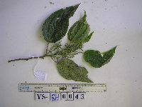 Cypholophus Wedd. 949697[1299002]Weiblen, G.D. YS2H00432012-09-12 Papua New Guinea, Morobe, Yawan Village, -6.1641 146.843567, 1851m |
MIN:Plants | 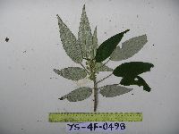 Debregeasia longifolia (Burm.f.) Wedd. 949691[1297997]Weiblen, G.D. YS4F04982010-09-04 Papua New Guinea, Morobe, Yawan Village, -6.16255 146.839933, 1721m |
MIN:Plants |  Urtica chamaedryoides Pursh 0968707[1391305] s.n.1938-03-09 United States, Texas, College St. [Station] |
MIN:Plants | 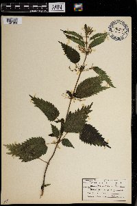 Urtica gracilis Aiton 0968706[1391304]Manhart, Warren D. 461938-06-00 United States, Yellowstone Park |
MIN:Plants | 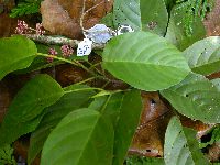 Poikilospermum amboinense Zipp. & Miq. 488157[]Weiblen, G.D. GW18732003-02-17 Papua New Guinea, East Sepik, Along main trail going East along Yuat river, NNE side of the airstrip, Elem village, -4.8 143.916667, 200m |
MIN:Plants | 488225[]Weiblen, G.D. GW18392003-02-14 Papua New Guinea, East Sepik, Elem village, near Yuat river, -4.8 143.916667, 200m |
MIN:Plants | 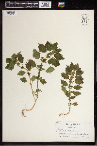 Urtica urens L. 961475[1334914] United States, Massachusetts |
MIN:Plants | 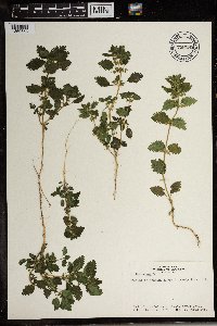 Urtica urens L. 738285[1369653]Hunn, John 271981-03-11 Egypt |
MIN:Plants | 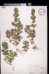 Urtica urens L. 972593[1398143]Janssens, J. 76/1051976-06-24 Belgium, Luipegem |
MIN:Plants | 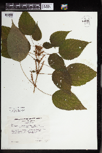 Pilea pumila var. deamii (Lunell) Fernald 961896[1340323] United States, Illinois |
MIN:Plants |  Boehmeria platyphylla Buch.-Ham. ex D. Don 974149[1396520]W. Takeuchi 87611993-02-11 Papua New Guinea, Morobe, N of Busu RIver and E of Sankwep River, near Gwabadik village, 365m |
Google Map
Google Maps is a web mapping service provided by Google that features a map that users can pan (by dragging the mouse) and zoom (by using the mouse wheel). Collection points are displayed as colored markers that when clicked on, displays the full information for that collection. When multiple species are queried (separated by semi-colons), different colored markers denote each individual species.