University of Minnesota
http://www.umn.edu/
612-625-5000
http://www.umn.edu/
612-625-5000
Minnesota Biodiversity Atlas
Bell Museum
Dataset: MIN-Plants
Taxa: Urticaceae
Search Criteria: excluding cultivated/captive occurrences
Bell Museum plants | |
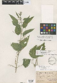
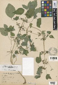
MIN:Plants | Urtica dioica subsp. gracilis (Aiton) Selander 729830[]Converse, C. 6401980-08-29 United States, Minnesota, Pine, Pine Co. Kettle River Natural Area: 5.5 mi. E of Hinckley. NE1/4 NE1/4 Sec. 22, T41N, R20W.;Kettle River Scientific Natural Area / Sandstone National Wildlife Refuge;041N;20W;22, 46.021973 -92.855355 |
MIN:Plants | Urtica dioica subsp. gracilis (Aiton) Selander 730096[]Cutler, S. 1851980-07-25 United States, Minnesota, Chisago, Rush Lake Island Natural Area, 7 mi WSW of Rush City; SE1/4 SW1/4 Sec. 21 T37N R22W;Rush Lake Island Scientific Natural Area;037N;22W;21, 45.673966 -93.094318 |
MIN:Plants | Urtica dioica subsp. gracilis (Aiton) Selander 730110[]Converse, C. 6101980-08-14 United States, Minnesota, Chisago, Rush Lake Island Natural Area: 7 mi. WSW of Rush City. NE1/4 NW1/4 Sec. 28, T37N, R22W.;Rush Lake Island Scientific Natural Area;037N;22W;28, 45.669861 -93.088926 |
MIN:Plants | Urtica dioica subsp. gracilis (Aiton) Selander 732590[]Severson, M. 5311980-07-21 United States, Minnesota, Becker, Zimmerman Prairie: 10 mi. W of Ogema. NE1/4 SW1/4 Sec. 16, T142N, R43W.;Zimmerman Prairie [TNC];142N;43W;16, 47.111989 -96.14657 |
MIN:Plants | Urtica dioica subsp. gracilis (Aiton) Selander 734373[]Petron, T. 4461980-09-03 United States, Minnesota, Becker, Green Water Lake Natural Area: 5 mi. W of Ponsford. SE1/4 SE1/4 Sec. 33, T141N, R38W.;Greenwater Lake Scientific Natural Area / White Earth Indian Reservation;141N;38W;33, 46.978448 -95.489889 |
MIN:Plants | Urtica dioica subsp. gracilis (Aiton) Selander 734668[]Petron, T. 3431980-08-27 United States, Minnesota, Clay, Bluestem Prairie, 13 mi E of Moorhead; SE1/4 SE1/4 Sec. 15 T139N R46W;Bluestem Prairie Scientific Natural Area;139N;46W;15, 46.855337 -96.473419 |
MIN:Plants | Urtica dioica subsp. gracilis (Aiton) Selander 735709[]Benson, Douglas 3601981-08-06 United States, Minnesota, Wilkin, Just N of cottonwood grove. Foxhome Prairie: NE corner SE1/4 SE1/4 NE1/4 Sec. 24, T133N, R45W.;Foxhome Prairie, The Nature Conservancy;133N;45W;24, 46.318653 -96.290714 |
MIN:Plants | Urtica dioica subsp. gracilis (Aiton) Selander 735722[]Benson, Douglas 3011981-07-20 United States, Minnesota, Wilkin, Town Hall Prairie: T134N, R45W, NW1/4 SW1/4 Sec. 15.;Town Hall Prairie, The Nature Conservancy;134N;45W;15, 46.420333 -96.333183 |
MIN:Plants | Urtica dioica subsp. gracilis (Aiton) Selander 739558[]Converse, C. 19721982-08-08 United States, Minnesota, Otter Tail, Otter Tail Preserve: T131N, R44W, SW1/4 SE1/4 Sec. 17.;Ottertail Prairie Scientific Natural Area;131N;44W;17, 46.159245 -96.235364 |
MIN:Plants | Urtica dioica subsp. gracilis (Aiton) Selander 739568[]Converse, C. 14421982-07-05 United States, Minnesota, Douglas, Staffanson Prairie; T127N R40W Sec. 18;Staffanson Prairie, The Nature Conservancy;127N;40W;18, 45.810665 -95.748006 |
MIN:Plants | Urtica dioica subsp. gracilis (Aiton) Selander 739571[]Converse, C. 14981982-07-07 United States, Minnesota, Pope, Ordway Prairie: T123N, R36W, NE1/4 SW1/4 Sec. 19.;Ordway Prairie, The Nature Conservancy;123N;36W;19, 45.434262 -95.245019 |
MIN:Plants | Urtica dioica subsp. gracilis (Aiton) Selander 739801[]Converse, C. 20351982-08-12 United States, Minnesota, Chippewa, Chippewa and Swift Cos. SE1/4 SW1/4 Sec.12. Chippewa Prairie: T119N, R43W;Chippewa Prairie, The Nature Conservancy;119N;43W;12, 45.130214 -95.990565 |
MIN:Plants | Urtica dioica subsp. gracilis (Aiton) Selander 740097[]Converse, C. 16491982-07-14 United States, Minnesota, Pope, Moe Woods; SW1/4 SW1/4 Sec. 34 T123N R36W;Moe Woods, The Nature Conservancy;123N;36W;34, 45.41981 -95.183337 |
MIN:Plants | Urtica dioica subsp. gracilis (Aiton) Selander 744899[]Smith, Welby 44341981-06-24 United States, Minnesota, Mower, Wild Indigo Scientific Natural Area. Wild Indigo Scientific and Natural Area. Ca. 2 mi. ESE of the jct. of Hwy. 56 and Hwy. 2 in Brownsdale. SE1/4 SE1/4 Se Wild Indigo Scientific and Natural Area. Ca. 2 mi. ESE of the jct. of Hwy. 56 and Hwy. 2 in Brownsdale. SE1/4 SE1/4 Sec. 11, T103N, R17W. Near a culvert.. 103N 17W 11, 43.739546 -92.839221 |
MIN:Plants | Urtica dioica subsp. gracilis (Aiton) Selander 745294[]Smith, Welby 49971981-07-21 United States, Minnesota, Mower, Wild Indigo Scientific and Natural Area. Ca. 2 1/2 mi. W of Dexter. SW1/4 NE1/4 Sec. 16, T103N, R16W.;Wild Indigo Scientific Natural Area;103N;16W;16, 43.724883 -92.759467 |
MIN:Plants | Urtica dioica subsp. gracilis (Aiton) Selander 745492[]Smith, Welby 47971981-07-11 United States, Minnesota, Martin, On the N side of Hwy. 50, ca. 2 1/4 mi. W of it's jct. with Hwy. 15 in Truman. SW1/4 SE1/4 Sec. 7, T104N, R30W.;;104N;30W;7, 43.825466 -94.48011 |
MIN:Plants | Urtica dioica subsp. gracilis (Aiton) Selander 747349[]Galatowitsch, S. 3661982-07-01 United States, Minnesota, Wabasha, Wabasha County...Weaver Dunes: T109N, R09W, SE1/4 and E1/2 NE1/4 of Sec. 7; NW1/4 and W1/2 NE1/4 of Sec. 8.;Kellogg-Weaver Dunes Scientific Natural Area / Kellogg-Weaver Dunes, The Nature Conservancy;109N;09W;00, 44.258107 -91.938909 |
MIN:Plants | Urtica dioica subsp. gracilis (Aiton) Selander 747351[]Galatowitsch, S. 5241982-07-16 United States, Minnesota, Goodhue, Grace Nature Preserve: T109N, R18W, parts of NW1/4 SW1/4 and SW1/4 SW1/4 of Sec. 8.;Grace Nature Preserve, The Nature Conservancy;109N;18W;8, 44.262012 -93.010543 |
MIN:Plants | Urtica dioica subsp. gracilis (Aiton) Selander 750544[]Almendinger, J. s.n.1982-08-14 United States, Minnesota, Becker, Becker Co. SW1/4 of NE1/4 of Sec. 2, T140N, R37W.;;140N;37W;2, 46.97045 -95.320494 |
MIN:Plants | Urtica dioica subsp. gracilis (Aiton) Selander 753092[]Boe, J. 20791983-08-27 United States, Minnesota, Kittson, Norway Dunes: NW1/4 SE1/4 Sec. 10, T160N, R46W.;Norway Dunes, The Nature Conservancy;160N;46W;10, 48.695736 -96.572771 |
MIN:Plants | Urtica dioica subsp. gracilis (Aiton) Selander 753363[]Duxbury, Alexis 20751983-08-08 United States, Minnesota, Lyon, Glynn Prairie; S1/2 NE1/4 Sec. 7 T109N R40W;Glynn Prairie Scientific Natural Area;109N;40W;7, 44.262693 -95.699254 |
MIN:Plants | Urtica dioica subsp. gracilis (Aiton) Selander 753364[]Duxbury, Alexis 18021983-07-23 United States, Minnesota, Murray, Lundblad Prairie: W1/2 NW1/4 Sec. 1, T105N, R41W.;Lundblad Prairie Scientific Natural Area;105N;41W;1, 43.927817 -95.713386 |
MIN:Plants | Urtica dioica subsp. gracilis (Aiton) Selander 753385[]Duxbury, Alexis 18591983-07-24 United States, Minnesota, Nobles, Compass Prairie: part of SE1/4 SW1/4 Sec. 3; T101N, R41W.;Compass Prairie Scientific Natural Area;101N;41W;3, 43.580108 -95.743853 |
MIN:Plants | Urtica dioica subsp. gracilis (Aiton) Selander 758626[]Smith, Welby 68941982-07-28 United States, Minnesota, Mower, Racine Prairie Scientific Natural Area. Racine Prairie State Scientific and Natural Area, adjacent to the E side of U.S. Trunk hwy 63, ca. 2 mi N of Racine; NE1 Racine Prairie State Scientific and Natural Area, adjacent to the E side of U.S. Trunk hwy 63, ca. 2 mi N of Racine; NE1/4 NE1/4 Sec. 22 T104N R14W. 104N 14W 22, 43.797643 -92.499266 |
MIN:Plants | Urtica dioica subsp. gracilis (Aiton) Selander 772985[]Boe, J. 9961979-07-20 United States, Minnesota, Lake of the Woods, Rapid River Road E of Range Line; Sec. 18 R33W T157N;Beltrami Island State Forest;157N;33W;18, 48.412857 -94.814723 |
MIN:Plants | Urtica dioica subsp. gracilis (Aiton) Selander 773383[]Boe, J. 11671979-07-29 United States, Minnesota, Lake of the Woods, Northwest Angle, between old feldspar mine and Sugar Point; Sec. 7 R33W T167N;Northwest Angle;167N;33W;7, 49.288052 -94.921621 |
MIN:Plants | Urtica dioica subsp. gracilis (Aiton) Selander 774449[]Monson, Paul 56941983-07-30 United States, Minnesota, Saint Louis, Voyageurs National Park, Net Lake, at N end; R18W T68N SW1/4 Sec. 4;Voyageurs National Park;068N;18W;4, 48.404611 -92.661405 |
MIN:Plants | Urtica dioica subsp. gracilis (Aiton) Selander 777655[]Coffin, Barbara; Engstrom, D. 83-2871983-09-10 United States, Minnesota, Cook, Devil's Track Wayside, DNR Parks, on bank of river S of falls with old logging dam site; T61N R1E SW1/4 SE1/4 Sec. 3;Superior National Forest;061N;01E;3, 47.795039 -90.307443 |
MIN:Plants | Urtica dioica subsp. gracilis (Aiton) Selander 781457[]Smith, Welby 97881984-07-29 United States, Minnesota, Lake of the Woods, Ca. 26 mi. S of Warroad. Habitats associated with the Roseau River. SE1/4 SE1/4 Sec. 33, T159N, R36W.;;159N;36W;33, 48.544567 -95.288653 |
MIN:Plants | Urtica dioica subsp. gracilis (Aiton) Selander 781907[]Smith, Welby 93241982-06-23 United States, Minnesota, Mower, Lake Louise State Park, ca. 1 mi. NNW of LeRoy. The Upper Iowa River. NW1/4 NE1/4 Sec. 28, T101N, R14W.;Lake Louise State Park;101N;14W;28, 43.522099 -92.518958 |
MIN:Plants | Urtica dioica subsp. gracilis (Aiton) Selander 787223[]Smith, Welby 110011985-08-10 United States, Minnesota, Dodge, Iron Horse Prairie Scientific Natural Area. Dodge County...Iron Horse Prairie State Scientific and Natural Area, about 1 1/2 mi. S of Hayfield. NW1/4 SE1/4 Sec. 27, T105N, R17W. 105N 17W 27, 43.8675 -92.8486111 |
MIN:Plants | Urtica dioica subsp. gracilis (Aiton) Selander 787487[]Smith, Welby 106411985-07-01 United States, Minnesota, Wright, Near the SW shore of Schmidt Lake. NW1/4 SE1/4 Sec. 25, T120N, R25W.;;120N;25W;25, 45.171 -93.773669 |
MIN:Plants | Urtica dioica subsp. gracilis (Aiton) Selander 801024[]Smith, Welby 124621986-08-11 United States, Minnesota, Goodhue, Hay Creek Recreation Area, ca. 3 mi. S of Red Wing. SW1/4 NE1/4 Sec. 13, T112N, R15W;;112N;15W;13, 44.5069427 -92.5588913 |
MIN:Plants | Urtica dioica subsp. gracilis (Aiton) Selander 804577[]Smith, Welby 122951986-07-30 United States, Minnesota, Olmsted, Olmsted Co.; about 2 mi SSE of Rock Dell (town), and 1/4 mi N of st. hwy 30; SW1/4 SE1/4 Sec. 16 T105N R15W;;105N;15W;16, 43.894722 -92.6255569 |
MIN:Plants | Urtica dioica subsp. gracilis (Aiton) Selander 804812[]Ordway, E. 11977-08-24 United States, Minnesota, Pope, Pope County, Strandness Prairie...4 mi NE Starbuck;Strandness Prairie, The Nature Conservancy;125N;38W;06, 45.665007 -95.50008 |
MIN:Plants | Urtica dioica subsp. gracilis (Aiton) Selander 816274[]Wheeler, Gerald 113581988-07-25 United States, Minnesota, Lac Qui Parle, Lac Qui Parle State Park. Lac Qui Parle Co. Ca. 15 mi E of Madison, Lac Qui Parle State Park, N of Rt. 33. Bordering Lac Qui Parle River; N1/2 NE Lac Qui Parle Co. Ca. 15 mi E of Madison, Lac Qui Parle State Park, N of Rt. 33. Bordering Lac Qui Parle River; N1/2 NE1/4 Sec. 23, T118N, R42W (Lac Qui Parle Twp.). 118N 42W 23, 45.029905 -95.909318 |
MIN:Plants | Urtica dioica subsp. gracilis (Aiton) Selander 816399[]Bender, J. s.n.1986-08-07 United States, Minnesota, Washington, Belwin Outdoor Education Laboratory, T28N, R20W, S10.;Belwin Outdoor Education Laboratory;028N;20W;10, 44.927188 -92.791852 |
MIN:Plants | Urtica dioica subsp. gracilis (Aiton) Selander 822283[]Vixie, D. 5391980-07-18 United States, Minnesota, Clearwater, Clearwater Co. Lake Itasca, Bear Paw Point. T143N R36W S11. Elev. 1488 ft.;Itasca State Park;143N;36W;11, 47.218013 -95.200853 |
MIN:Plants | Urtica dioica subsp. gracilis (Aiton) Selander 833435[]Juhnke, C. 2171991-07-27 United States, Minnesota, Fillmore, Forestville State Park. Fillmore Co. T102N R12W Sec.13 SE NW NE; near Root River;Forestville State Park;102N;12W;13, 43.637724 -92.219269 |
MIN:Plants | Urtica dioica subsp. gracilis (Aiton) Selander 834159[]Smith, Welby 198211991-07-31 United States, Minnesota, Todd, Todd Co. Grey Eagle State Wildlife Management Area, about 4 mi W of Grey Eagle; T127N R33W SW1/4 of SE1/4 of Sec 9;Grey Eagle Wildlife Management Area;127N;33W;9, 45.8202782 -94.8366699 |
MIN:Plants | Urtica dioica subsp. gracilis (Aiton) Selander 834318[]Monson, Paul 60381984-08-02 United States, Minnesota, Cook, Grand Portage National Monument...Cook Co. R-5E, T-64N, NE1/4, S-27, Beaver Pond. 5.5 mi NW of visitor center;Grand Portage National Monument / North Shore;064N;05E;27, 47.999682 -89.760688 |
MIN:Plants | Urtica dioica subsp. gracilis (Aiton) Selander 836176[]Smith, Welby 172581990-07-17 United States, Minnesota, Morrison, Camp Ripley Military Reservation. Camp Ripley Military Reservation. Morrison Co.; between East Boundary Road and the Mississippi River; UTM: 394800E 51077 Camp Ripley Military Reservation. Morrison Co.; between East Boundary Road and the Mississippi River; UTM: 394800E 5107700N R131N R30W SE1/4 of NW1/4 of Sec 32. T131N R30W S32, 46.114584 -94.484628 |
MIN:Plants | Urtica dioica subsp. gracilis (Aiton) Selander 838472[]Smith, Welby 178291990-08-08 United States, Minnesota, Red Lake, Red Lake County ... At 'Old Crossing Treaty State Wayside Park'. On the N bank of the Red Lake River, about 6 miles W of the town of Red Lake Falls ... T151N R45W SE1/4 of SW1/4 of Sec. 27. 151N 45W 27, 47.8666649 -96.4113922 |
MIN:Plants | Urtica dioica subsp. gracilis (Aiton) Selander 840581[]Smith, Welby 183411990-09-05 United States, Minnesota, Faribault, Pihls County Park. Faribault County ... Pihls County Park. On the west side of Rice Lake, about 6 mi south of Wells... T102N R24W SW1/4 of NW1/4 of Sec 16. 102N 24W 16, 43.6402779 -93.7258301 |
MIN:Plants | Urtica dioica subsp. gracilis (Aiton) Selander 911843[]Smith, Welby 246491994-07-12 United States, Minnesota, Saint Louis, St. Louis County...About 0.5 mile south of Zim...outflow from Stone Lake...T 56N R 18W SE1/4 of SE1/4 of Sec 27;;056N;18W;27, 47.3013889 -92.6002778 |
MIN:Plants | Urtica dioica subsp. gracilis (Aiton) Selander 489241[]Juhnke, C. 031 CMJ FRO1998-08-19 United States, Minnesota, Goodhue, Frontenac State Park Goodhue County ... near trail to Sand Point ... T112N R13W SW SE NE 13;Frontenac State Park;112N;13W;13, 44.50502 -92.31891 |
MIN:Plants | Urtica dioica subsp. gracilis (Aiton) Selander 915787[]Smith, Welby 250871994-08-15 United States, Minnesota, Carlton, Carlton County...On the north side of Echo Lake in Moose Lake State Park...T46N R19W SE1/4 of SW1/4 of Sec 27;Moose Lake State Park;046N;19W;27, 46.4344444 -92.7325 |
MIN:Plants | Urtica dioica subsp. gracilis (Aiton) Selander 909788[]Smith, Welby 246021994-07-11 United States, Minnesota, Koochiching, Koochiching County ... About three miles east of Northome ... Tuefer Lake, at the public access ... T 151N R 28W SW1/4 of NE1/4 of Sec 27. 151N 28W 27, 47.8694444 -94.2183333 |
MIN:Plants | Urtica dioica subsp. gracilis (Aiton) Selander 430194[]Bright, R. 72-11972-00-00 United States, Idaho, Franklin, [no further data] |
MIN:Plants | Urtica dioica subsp. gracilis (Aiton) Selander 912981[]Smith, Welby 228661993-07-14 United States, Minnesota, Sibley, Vale Wildlife Management Area. Sibley County... Vale State Wildlife Management Area; ca 2.5 miles N-NW of Henderson; in the valley of High Island... Creek, ca 2.5 miles SW of its confluence with the Minn R... T113N R26W NE1/4 of SW1/4 of Sec 27. 113N 26W 27, 44.5625 -93.9427778 |
MIN:Plants | Urtica dioica subsp. gracilis (Aiton) Selander 489385[]Gerdes, Lynden; et al. 37781999-08-08 United States, Minnesota, Cook, Lower Stump River. SWNE of section;Superior National Forest;064N;03E;22, 48.014674 -90.00009 |
MIN:Plants | Urtica dioica subsp. gracilis (Aiton) Selander 454882[]Smith, Welby 206241992-06-30 United States, Minnesota, Rice, About 6.5 miles north-northeast of Faribault. NE1/4 of NE 1/4 of Sec.;Cannon River Wilderness Park;110N;20W;4, 44.3708344 -93.223053 |
MIN:Plants | Urtica dioica subsp. gracilis (Aiton) Selander 912723[]Smith, Welby 230761993-07-22 United States, Minnesota, Carver, Carver County...Carver Park Reserve; about 5 miles west of Chanhassen...T 116N R 24W SE1/4 of NE1/4 of Sec 11;Carver Park Reserve County Park;116N;24W;11, 44.8716667 -93.6644444 |
MIN:Plants | Urtica dioica subsp. gracilis (Aiton) Selander 896438[]Smith, Welby 156681989-07-11 United States, Minnesota, Kanabec, Mille Lacs Wildlife Management Area. Kanabek County ... Mille Lacs State Wildlife Management Area, about 9 miles northwest of Mora ...SW1/4 SW1/4 section 16, T40N R 25W. 040N 25W 16, 45.9511111 -93.4711111 |
MIN:Plants | Urtica dioica subsp. gracilis (Aiton) Selander 477126[]Bosch, T. 212002-07-25 United States, Minnesota, Big Stone, Lac Qui Parle Wildlife Management Area. Big Stone County ... Lac Qui Parle Wildlife Area ... Approx. 0.5 east of Hwy. 75 and 2 miles south of Hwy. 7 ... T120N R45W sec. 1-2. 120N 45W 42371, 45.314294 -96.155644 |
MIN:Plants | Urtica dioica subsp. gracilis (Aiton) Selander 545335[]Daubenmire, R. s.n.1930-08-11 United States, Indiana, Parke, Parke Co. |
MIN:Plants | Urtica dioica subsp. gracilis (Aiton) Selander 922305[]Smith, Welby 232831993-08-03 United States, Minnesota, Renville, in the Minnesota Valley about 4 miles southwest of Sacred Heart. north bank of the Minnesota River. SW1/4 of SE1/4 of Sec.;Skalbakken County Park;115N;38W;27, 44.7338889 -95.4097222 |
MIN:Plants | Urtica dioica subsp. gracilis (Aiton) Selander 922173[]Smith, Welby 231941993-07-29 United States, Minnesota, Grant, south side of Ask Lake, about 1.5 mi east-southeast of Ashby. NW1/4 of SW1/4 of Sec.;;130N;41W;12, 46.0847222 -95.7886111 |
MIN:Plants | Urtica dioica subsp. gracilis (Aiton) Selander 922707[]Smith, Welby 234831993-08-10 United States, Minnesota, Cottonwood, About 6 miles north-northwest of Storden, along Dutch Charley Creek. SW1/4 of NE1/4 of Sec;;108N;38W;36, 44.1194444 -95.3513889 |
MIN:Plants | Urtica dioica subsp. gracilis (Aiton) Selander 921933[]Smith, Welby 248991994-07-26 United States, Minnesota, Aitkin, About one mile west of Shumway Lake. SW1/4 of SE1/4 of section;Savanna Portage State Park;050N;22W;07, 46.8286111 -93.1744444 |
MIN:Plants | Urtica dioica subsp. gracilis (Aiton) Selander 934395[]Smith, Welby R. 216441992-08-26 United States, Minnesota, Nicollet, about 7 miles north of Mankato. NW1/4 of NE1/4 of section;Seven Mile Creek County Park;109N;27W;11, 44.2680556 -94.0344444 |
MIN:Plants | Urtica dioica subsp. gracilis (Aiton) Selander 956155[1296097]Lawrence, D. B. s.n.1952-08-17 United States, Alaska, Glacier Bay National Monument. Sandy Cove. [Glacier Bay National Park], 58.797428 -136.838127 |
MIN:Plants | Urtica dioica subsp. gracilis (Aiton) Selander 960769[1329374]Lee, Michael MDL31762002-06-28 United States, Minnesota, Lake, On broad ridges in rolling to moderately rugged bedrock terrain between County Road 2 and the Duluth, Missabe, and Iron Range Railroad, six miles north-northwest of Two Harbors. NW1/4 of NE1/4 Sec. 35, 47.119341 -91.696935 |
MIN:Plants | Urtica dioica subsp. gracilis (Aiton) Selander 966155[1356918]T. J. S. Whitfeld 26572020-07-17 United States, Minnesota, Washington, Lost Valley Prairie Scientific and Natural Area, 2 miles east north east of intersection of State Highway 95 and 110th Street, at dead-end of Nyberg Avenue South., 44.799068 -92.820492, 264m |
MIN:Plants | Urtica dioica subsp. gracilis (Aiton) Selander 973430[1398983]Lee, Michael MDL57672011-09-11 United States, Minnesota, Lake, Boundary Waters Canoe Area Wilderness; Strongly rolling bedrock terrain between Horse and Jackfish Lakes, 16 miles north-northeast of Ely, on the west side of Section 16 Lake., 48.11961789 -91.74674051, 418m |
MIN:Plants | Pipturus kauaiensis Heller 99951[1002094]Heller, A.A. 24281895-06-24 United States, Hawaii, Kauai, Island of Kauai, on the Hanapepe and Wahiawa Watershed |
MIN:Plants | Pipturus kauaiensis Heller 99952[1002095]Heller, A.A. 24281895-06-24 United States, Hawaii, Kauai, Island of Kauai, on the Hanapepe and Wahiawa Watershed |
MIN:Plants | Pouzolzia pringlei Greenman 99955[1002141]Pringle, C.G. 67361897-07-09 Mexico, Oaxaca, Tomellin Canyon, 1219m |
MIN:Plants | Urtica gracilenta Greene 514806[1002717]Rusby, H.H. 3671881-08-00 United States, New Mexico, Mogollon Mts. |
MIN:Plants | Urtica gracilenta Greene 99999[1002718]Rusby, H.H. 3671881-08-00 United States, New Mexico, Mogollon Mts. |
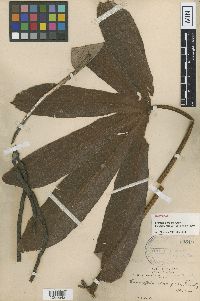
MIN:Plants | Cecropia elongata Rusby 99510[1000542]Bang, M. 22600000-00-00 Bolivia, [no further data] |
MIN:Plants | Pipturus ruber Heller 99954[1002096]Heller, A.A. 28521895-10-01 United States, Hawaii, Kauai, Island of Kauai, on Kaholuamanoa, above Waimea |
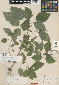
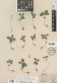
MIN:Plants | Adicea deamii Lunell 298675[1000038]Deam, C.C. s.n.1902-08-24 United States, Indiana, Wells, in Lancaster Township, in sec. 16 |
MIN:Plants | Adicea deamii Lunell 298679[1000039]Nieuwland, J.A. 102361912-09-26 United States, Indiana, Lake, [Lake?]; Mineral Springs |
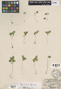
MIN:Plants | Adicea fontana Lunell 245826[1000040]Lunell, J. 3361912-09-02 United States, North Dakota, Benson, Pleasant Lake |
MIN:Plants | Adicea fontana Lunell 260245[1000041]Lunell, J. 3361912-07-03 United States, North Dakota, Benson, Pleasant Lake |
MIN:Plants | Adicea fontana Lunell 260246[1000042]Lunell, J. 3361912-07-28 United States, North Dakota, Benson, Pleasant Lake |
MIN:Plants | Adicea fontana Lunell 298677[1000043]Lunell, J. 6341912-09-02 United States, North Dakota, Benson, Pleasant Lake |
MIN:Plants | Adicea fontana Lunell 260247[1000053]Lunell, J. 3361911-08-14 United States, North Dakota, Benson, Pleasant Lake |
MIN:Plants | Adicea nieuwlandii Lunell 298680[1000044]Nieuwland, J.A. 103411912-10-09 United States, Indiana, Saint Joseph, Notre Dame |
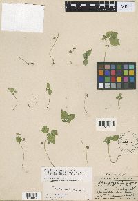
MIN:Plants | Adicea opaca Lunell 245827[1000045]Lunell, J. 3371912-09-02 United States, North Dakota, Benson, Pleasant Lake |
MIN:Plants | Adicea opaca Lunell 298676[1000046]Lunell, J. 6351912-09-02 United States, North Dakota, Benson, Pleasant Lake |
MIN:Plants | Adicea opaca Lunell 245828[1000054]Lunell, J. 3371912-09-02 United States, North Dakota, Benson, Pleasant Lake |
MIN:Plants | Phenax pallidus Rusby 99889[1001986]Bang, M. 3411890-00-00 Bolivia, Yungas |
MIN:Plants | Urtica strigosissima Rydberg 100014[1002719]Heller, A.A. 34751896-07-29 United States, Idaho, Nez Perce, [no further data], 1067m |
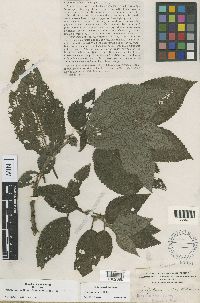
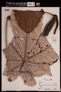
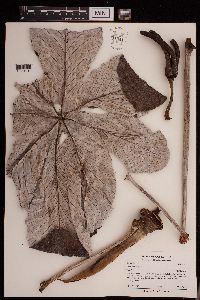
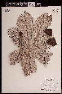
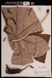
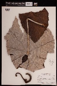
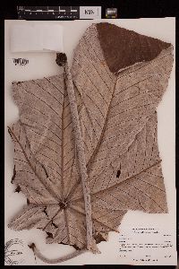
MIN:Plants | Cecropia insignis Liebm. 432538[]Weiblen, G.D. GW14242001-09-14 Costa Rica, La Selva, 9.766667 -83.75, 972m |
MIN:Plants | Cecropia insignis Liebm. 951040[1290195]Barriga, P. 2010-0012010-05-19 Costa Rica |
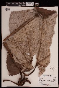
MIN:Plants | Cecropia insignis Liebm. 951035[1290194]Barriga, P. 2010-0182010-05-23 Costa Rica |
MIN:Plants | Cecropia insignis Liebm. 951024[1290193]Barriga, P. 2010-0302010-05-27 Costa Rica |
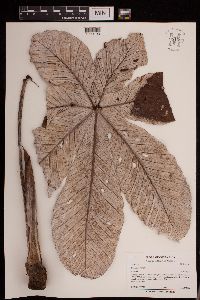
MIN:Plants | Cecropia insignis Liebm. 951037[1290192]Barriga, P. 2010-0042010-05-19 Costa Rica |
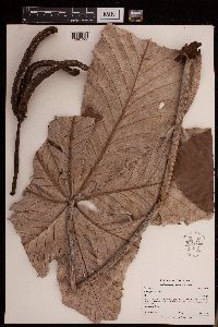
MIN:Plants | Cecropia insignis Liebm. 951041[1290191]Barriga, P. 2010-0192010-05-23 Costa Rica |
MIN:Plants | Cecropia insignis Liebm. 951036[1290190]Barriga, P. 2010-0202010-05-23 Costa Rica |
MIN:Plants | Cecropia insignis Liebm. 951038[1290189]Barriga, P. 2010-0032010-05-19 Costa Rica |
MIN:Plants | Cecropia insignis Liebm. 951030[1290188]Barriga, P. 2010-0112010-05-21 Costa Rica |
MIN:Plants | Cecropia insignis Liebm. 951031[1290187]Barriga, P. 2010-0122010-05-21 Costa Rica |
MIN:Plants | Cecropia insignis Liebm. 951027[1290186]Barriga, P. 2010-0082010-05-20 Costa Rica |
MIN:Plants | Cecropia insignis Liebm. 478886[1291774]Barriga, P. 2010-0112010-05-21 Costa Rica, Sarapiqui canton. La Selva Biological Station, Tres Rios trail, 4750m |
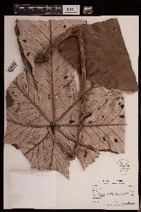
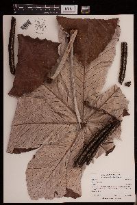
MIN:Plants | Cecropia obtusifolia Bertol. 432536[]Weiblen, G.D. GW14352001-09-25 Panama, Parque Metropolitano, 8.966667 -79.516667, 60m |
MIN:Plants | Cecropia obtusifolia Bertol. 488290[]Weiblen, G.D. GW14362001-09-25 Panama, Parque Metropolitano, 8.966667 -79.516667, 60m |
MIN:Plants | Cecropia obtusifolia Bertol. 910344[]Weiblen, G.D. GW28092001-09-14 Costa Rica, La Selva, 9.766667 -83.75, 972m |
Google Map
Google Maps is a web mapping service provided by Google that features a map that users can pan (by dragging the mouse) and zoom (by using the mouse wheel). Collection points are displayed as colored markers that when clicked on, displays the full information for that collection. When multiple species are queried (separated by semi-colons), different colored markers denote each individual species.
