University of Minnesota
http://www.umn.edu/
612-625-5000
http://www.umn.edu/
612-625-5000
Minnesota Biodiversity Atlas
Bell Museum
Dataset: MIN-Plants
Taxa: Fragaria
Search Criteria: excluding cultivated/captive occurrences
Bell Museum plants | |
 MIN:Plants | 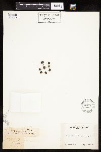 Fragaria virginiana var. illinoensis Duchesne 238709[1027203]Congdon, J. s.n.1888-05-28 United States, California, Mariposa, Yosemite Valley;Yosemite National Park |
MIN:Plants | 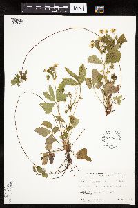 Fragaria virginiana Duchesne 607016[1026955]Davidson, Donald s.n.1967-06-23 United States, Minnesota, Saint Louis, Minnesota Point, Duluth;Minnesota Point;049N;13W;18, 46.7833 -92.1 |
MIN:Plants | 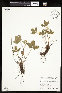 Fragaria virginiana Duchesne 435219[1027201]Smith, Welby 151381989-05-21 United States, Minnesota, Mille Lacs, Kunkel Wildlife Management Area. Mille Lacs County ... Kunkel State Wildlife Management Area, about 4.5 miles west of Princeton ... SW1/4 SE1/4 of Sec. 26 T 36N R 27W. 036N 27W 26, 45.5763889 -93.6655556 |
MIN:Plants | 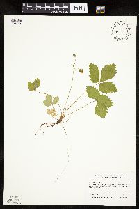 435183[1026750]Boe, J. 970618021997-06-18 United States, Minnesota, Aitkin, Aitkin Co.; East of "Junction 7" knob in Savanna Portage State Park. In releve 97-05; T 51N R 22W SW1/4 of NE1/4 of Sec;Savanna Portage State Park;051N;22W;03, 46.847837 -93.111029 |
MIN:Plants | 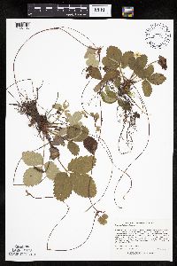 Fragaria virginiana Duchesne 498952[1027106]Lee, Michael MDL31292001-09-18 United States, Minnesota, Lake, Superior National Forest. Lake County ... Superior National Forest ... Between Thunderbird and Shoepack Lakes, 4 1/2 miles north-northwest of Cramer ... Just east of Shoepack Lake ... T59N R6W N1/2 of SE1/4 of NE1/4 Sec. 17. 059N 06W 17, 47.594586 -91.118039 |
MIN:Plants | 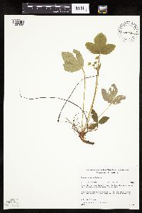 Fragaria virginiana Duchesne 508092[1027043]Gerdes, Lynden; et al. 24641998-05-22 United States, Minnesota, Cook, T064N R03E S3, 48.057476 -90.046009 |
MIN:Plants | 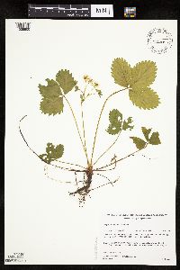 Fragaria virginiana Duchesne 508058[1026900]Gerdes, Lynden; et al. 24711998-05-22 United States, Minnesota, Cook, Boundary Waters Canoe Area Wilderness / Superior National Forest. T64N R03E S03NWNE. Cook County ... Superior National Forest, BWCAW. In vicinity of portage between John Lake and the Royal River. Riparian zone between river and upland.. T064N R03E S3, 48.057476 -90.046009 |
MIN:Plants | 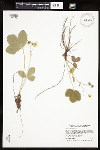 Fragaria virginiana Duchesne 920828[1027146]Smith, Welby 222891993-06-03 United States, Minnesota, Sibley, Vale Wildlife Management Area. Sibley County ... Vale State Wildlife Management Area; in the valley of High Island Creek, about 2.5 miles southwest of its confluence with the Missesota River ... T113N R26W NE1/4 of SW1/4 of Sec 27. 113N 26W 27, 44.5625 -93.9427778 |
MIN:Plants | 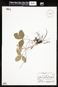 Fragaria virginiana Duchesne 920642[1027128]Smith, Welby 185091991-05-20 United States, Minnesota, Morrison, Camp Ripley Military Reservation. Camp Ripley Military Reservation. Morrison County...On the north side of Pusan Road, about 5.5 km east-southeast of Pillager...UTM: 392000E 5129500N. T 133N R 30W NW1/4 of NE1/4 of Sec 25. 133N 30W 25, 46.3125 -94.4027778 |
MIN:Plants | 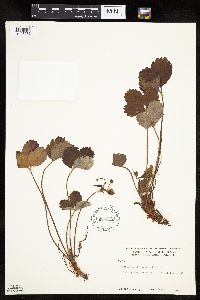 Fragaria chiloensis (L.) Miller 600045[1026732]Cooper, William 1171916-08-21 United States, Alaska, Glacier Bay, Station 1;Glacier Bay National Park;;;, 58.38326 -135.91824 |
MIN:Plants | 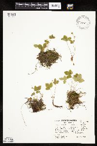 459915[1026751]Kaul, R.; et al. 69721991-06-25 United States, Minnesota, Cook, North Shore / Superior National Forest. Cook County...Near the mouth of the Onion River gorge, where it opens to Lake Superior. On massive basalt outcrops directly above the lakeshore.. 059N 04W , 47.608421 -90.77092 |
MIN:Plants | 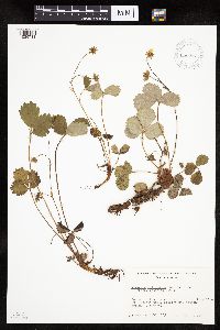 663833[1026731]Noble, Mark 1551974-07-24 United States, Alaska, Bartlett Cove.;Glacier Bay National Park;;;, 58.45 -135.91667 |
MIN:Plants | 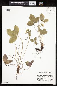 Fragaria virginiana Duchesne 919979[1027184]Smith, Welby 221901993-05-20 United States, Minnesota, Otter Tail, Inman Wildlife Management Area. Otter Tail County...Inman State Wildlife Management Area, about 7 miles south of Deer Creek (town)...T133N R37W SE1/4 of SE1/4 of Sec 33. 133N 37W 33, 46.2847222 -95.3463889 |
MIN:Plants | 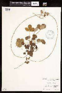 Fragaria chiloensis (L.) Miller 520094[1026728]Lawrence, Donald s.n.1952-08-17 United States, Alaska, Glacier Bay National Monument. Sandy Cove.;Glacier Bay National Park;;;, 58.797428 -136.838127 |
MIN:Plants | 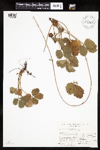 657000[1026729]Noble, Mark; et al. 4961974-08-05 United States, Alaska, Muir Point; from site deglaciated ca. 1880.;Glacier Bay National Park;;;, 58.82694 -136.07722 |
MIN:Plants | 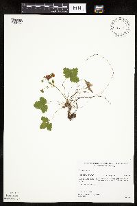 520674[1026753]Gerdes, Lynden; et al. 27271998-06-17 United States, Minnesota, Cook, Superior National Forest. T65N R04W S27NESE. Cook County ... Superior National Forest. North and NW facing cliffs approx. 0.75 miles NE of Rund Lake. South of Hwy 12 & Cross River; on rock face/cliff observable from Hwy 12.. 065N 04W 27, 48.079357 -90.823724 |
MIN:Plants | 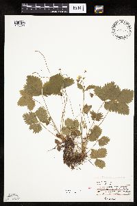 474250[1026830]Moore, John 231971-06-09 United States, Minnesota, Sherburne, SE1/4 S-14 Santiago [Sherburne Natinal Wildlife Refuge];Sherburne National Wildlife Refuge;035N;27W;14, 45.523261 -93.789075 |
MIN:Plants | 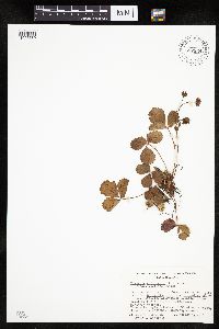 657334[1026730]Noble, Mark; et al. 4651974-08-05 United States, Alaska, Muir Point; from site deglaciated ca. 1880.;Glacier Bay National Park;;;, 58.82694 -136.07722 |
MIN:Plants | 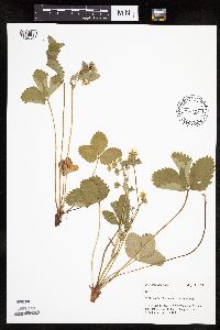 Fragaria virginiana Duchesne 436772[1026909]Mason, Harriet; et al. NSP98-021998-05-13 United States, Minnesota, Rice, SW corner of sec. 16 in Nerstrand Big Woods State Park ... In central area along the west boundary.;Nerstrand Woods State Park;110N;19W;16, 44.335175 -93.111211 |
MIN:Plants | 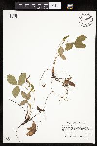 Fragaria virginiana Duchesne 913495[1026908]Smith, Welby 242501994-06-01 United States, Minnesota, Saint Louis, St. Louis County...McCarthy Beach State Park; on the north side of Sturgeon Lake...T 60N R 21W SW1/4 of SE1/4 of Sec 18;McCarthy Beach State Park;060N;21W;18, 47.6922222 -93.0263889 |
MIN:Plants | 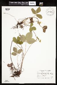 Fragaria virginiana Duchesne 912849[1026907]Smith, Welby 242181994-05-31 United States, Minnesota, Koochiching, Grand Mound Historical Site. Koochiching County...Grand Mound State Historic Area; about 18 miles west of International Falls...T70N R26W NW1/4 of NE1/4 of Sec 32. 070N 26W 32, 48.5158333 -93.7083333 |
MIN:Plants | 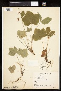 127665[1026782]Rosendahl, C. 21371909-06-21 United States, Minnesota, Fort Snelling Reservation [old regional park spanning junction of Minnesota and Mississippi rivers];;028N;23W;, 44.875594 -93.213123 |
MIN:Plants | 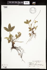 519277[1026741]Swanson, Gary s.n.1997-05-30 United States, Minnesota, Sherburne, Sherburne National Wildlife Refuge; NWNW 27-35-27, east side of Brande Road;Sherburne National Wildlife Refuge; T035N R27W S27, 45.494037 -93.685105 |
MIN:Plants | 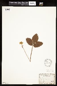 566710[1026887]Lang, H.; et al. 351878-04-14 United States, Minnesota, Ramsey, St. Paul;;;;, 44.9442 -93.0936 |
MIN:Plants | 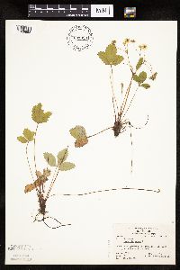 831903[1026888]Oppedahl, R. 131981-06-22 United States, Minnesota, Saint Louis, St. Louis Co.; on SCM Field Station. Elev.1370'. R-12W T-64N Sec.25;Superior National Forest;T064N R12W S25, 47.998543 -91.81063 |
MIN:Plants | 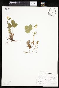 834912[1026740]Haferman, J. 431995-05-06 United States, Minnesota, Scott, Scott Co. T115N R22W S36 SW of SW. Approx. 0.1 mi N-NE of intersection of State Hwy.13 and Co. Rd.44 on N side of hwy;;115N;22W;36, 44.718671 -93.419417 |
MIN:Plants | 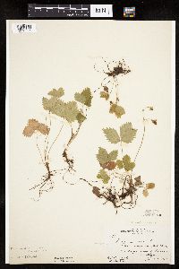 127551[1026785]Rosendahl, C.; Butters, F. 29181915-06-19 United States, Minnesota, Fillmore, E of Preston near Village;;N;;, 43.670242 -92.083216 |
MIN:Plants | 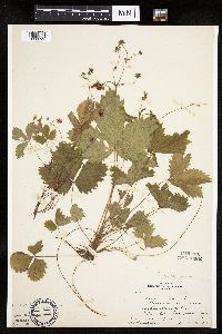 127552[1026892]Butters, F.; Rosendahl, C. 30321915-06-23 United States, Minnesota, Houston, Near Bee;;101N;06W;, 43.50111 -91.57056 |
MIN:Plants | 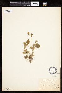 127554[1026807]Moore, W. s.n.1907-05-30 United States, Minnesota, Hennepin, Spring Park;;N;;, 44.935241 -93.632182 |
MIN:Plants | 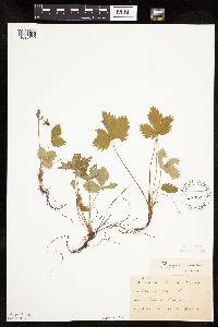 127555[1026769]Ballard, C. B1371891-06-00 United States, Minnesota, Carver, Chaska;;N;;, 44.789407 -93.602179 |
MIN:Plants | 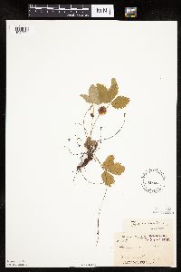 127556[1026771]Arthur, J.; et al. B451886-07-18 United States, Minnesota, Saint Louis, Vermilion Lake;;;;, 47.891581 -92.366824 |
MIN:Plants | 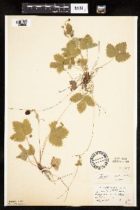 127557[1026835]Aiton, G. s.n.1891-06-00 United States, Minnesota, Clearwater, Lake Itasca;Itasca State Park;143N;36W;, 47.197458 -95.201964 |
MIN:Plants | 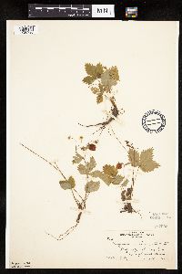 127558[1026790]Rosendahl, C. 26211912-08-24 United States, Minnesota, Cook, Kimball Creek, E of Grand Marais;North Shore / Superior National Forest;061N;02E;, 47.784503 -90.181925 |
MIN:Plants | 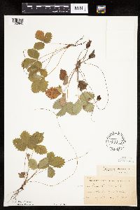 127559[1026845]Sheldon, Edmund S6531891-07-00 United States, Minnesota, Brown, Sleepy Eye;;N;;, 44.297183 -94.72415 |
MIN:Plants | 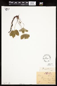 127561[1026793]Oestlund, O. 51-51888-08-22 United States, Minnesota, Hennepin, [no further data];;;;, 45 -93.47 |
MIN:Plants | 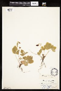 127562[1026872]Aiton, G. s.n.1891-00-00 United States, Minnesota, Clearwater, Lake Itasca;Itasca State Park;143N;36W;, 47.197458 -95.201964 |
MIN:Plants |  127563[1026770]Sheldon, Edmund S371891-06-00 United States, Minnesota, Le Sueur, Elysian;;109N;24W;, 44.198577 -93.673838 |
MIN:Plants |  127564[1026843]Wheeler, William 1351899-06-07 United States, Minnesota, Houston, Winnebago Valley;Dorer Memorial Hardwood State Forest;N;;, 43.537379 -91.40119 |
MIN:Plants | 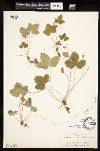 127565[1026861]Rosendahl, C. 3831902-06-06 United States, Minnesota, Houston, Spring Grove;;101N;07W;, 43.543165 -91.672028 |
MIN:Plants | 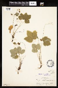 127566[1026758]Rosendahl, C. 3981902-06-08 United States, Minnesota, Houston, Spring Grove;;101N;07W;, 43.543165 -91.672028 |
MIN:Plants | 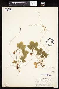 127567[1026787]Rosendahl, C. 4721902-06-11 United States, Minnesota, Houston, Spring Grove;;101N;07W;, 43.543165 -91.672028 |
MIN:Plants | 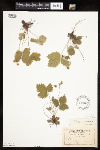 127569[1026844]Sandberg, John s.n.1894-05-00 United States, Minnesota, Hennepin, vicinity of Minneapolis;;N;;, 44.979965 -93.263836 |
MIN:Plants | 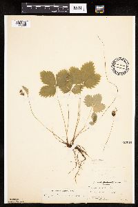 127661[1026890]Manning, Sara; Moyer, Lycurgus s.n.1898-06-30 United States, Minnesota, Wabasha, Lake City;;N;;, 44.449412 -92.266844 |
MIN:Plants | 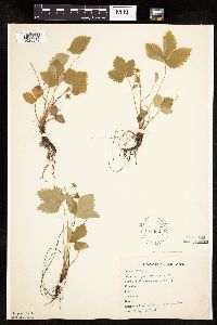 127662[1026847]Anonymous 24661910-05-30 United States, Minnesota, Snelling Reservation [old regional park spanning junction of Minnesota and Mississippi rivers];;028N;23W;, 44.90516 -93.16646 |
MIN:Plants | 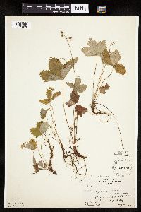 127663[1026860]Butters, F.; et al. 33151915-07-11 United States, Minnesota, Houston, Winnebago Valley;Dorer Memorial Hardwood State Forest;;;, 43.67 -91.49 |
MIN:Plants | 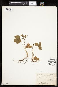 127664[1026891]Manning, Sara s.n.1888-06-28 United States, Minnesota, Wabasha, Lake City;;N;;, 44.449412 -92.266844 |
MIN:Plants | 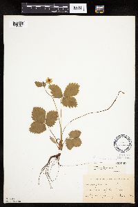 127666[1026851]Kassube, J. s.n.1878-04-00 United States, Minnesota, Hennepin, Minneapolis;;N;;, 44.979965 -93.263836 |
MIN:Plants | 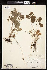 Fragaria virginiana Duchesne 127713[1027073]Skinner, S. s.n.1902-00-00 United States, Minnesota, Jackson, Heron Lake Region;;;;, 43.794959 -95.320276 |
MIN:Plants | 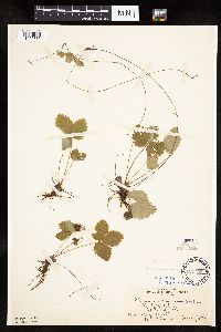 127723[1026885]Wheeler, William; et al. s.n.1902-06-07 United States, Minnesota, Ramsey, Fish Hatchery, St. Paul;;028N;22W;00, 44.944534 -93.05372 |
MIN:Plants | 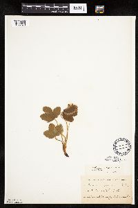 Fragaria virginiana Duchesne 127727[1027070]Kassube, J. s.n.1878-05-00 United States, Minnesota, Hennepin, Minneapolis;;029N;24W;25, 44.979965 -93.263836 |
MIN:Plants |  Fragaria virginiana Duchesne 127728[1027169]Rosendahl, C. 4451902-06-10 United States, Minnesota, Houston, Spring Grove;;101N;07W;, 43.543165 -91.672028 |
MIN:Plants |  Fragaria virginiana Duchesne 127729[1027068]Ballard, C. 28411901-06-05 United States, Minnesota, Clay, Moorhead;;129N;48W;09, 46.873852 -96.767581 |
MIN:Plants |  Fragaria virginiana Duchesne 127730[1027069]Ainslie, G. s.n.1902-05-19 United States, Minnesota, Olmsted, Rochester;;106N;14W;, 43.97834 -92.49834 |
MIN:Plants |  264033[1284161]Holzinger, John s.n.1908-06-00 United States, Minnesota, Winona, Winona Co.;;N;;, 43.98685 -91.779129 |
MIN:Plants | 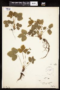 271226[1026846]Alaspa, E. s.n.1923-05-22 United States, Minnesota, Dakota, along cliff road between Mendota and St. Paul;;028N;23W;, 44.91248 -93.128338 |
MIN:Plants | 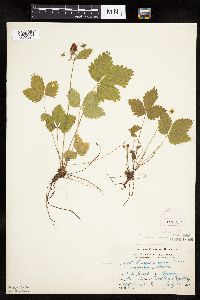 276086[1026828]Grant, Martin 27371929-07-10 United States, Minnesota, Clearwater, Itasca Park, Floating Bog Bay, NE-NE-11, T143, R36;Itasca State Park;143N;36W;11, 47.218013 -95.200853 |
MIN:Plants | 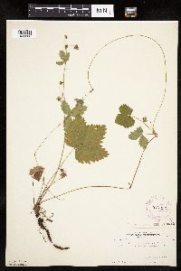 277233[1026806]Rosendahl, C. 4853b1925-07-18 United States, Minnesota, Clearwater, Itasca Park;Itasca State Park;143N;36W;, 47.197458 -95.201964 |
MIN:Plants | 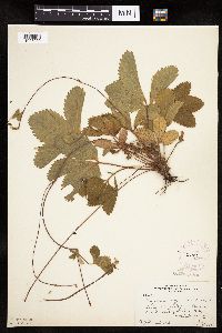 Fragaria virginiana Duchesne 277432[1027059]Rosendahl, C. 56061928-07-04 United States, Minnesota, Hubbard, 5 mi E of Itasca Park;;143N;35W;, 47.197426 -95.116747 |
MIN:Plants | 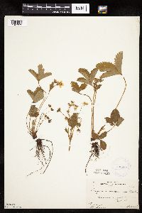 Fragaria virginiana Duchesne 282269[1027072]Gilbert, H. 1531923-06-07 United States, Minnesota, Saint Louis, Duluth;;;;, 46.7833 -92.1 |
MIN:Plants | 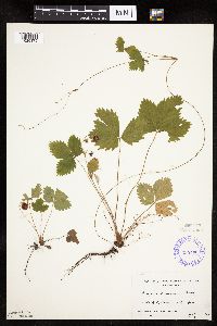 335500[1026875]Linnaean Club, U of M, 2991943-07-10 United States, Minnesota, Rice, Nerstrand Woods, Rice Co.; below falls;Nerstrand Woods State Park;110N;19W;, 44.341172 -93.111247 |
MIN:Plants | 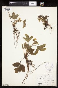 Fragaria virginiana Duchesne 336321[1027056]Lakela, Olga 13641936-05-29 United States, Minnesota, Saint Louis, Duluth; Sec. 18;;;;, 46.7833 -92.1 |
MIN:Plants | 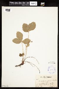 352042[1026882]Benner, F.; Benner, J. 4691929-07-27 United States, Minnesota, Cook, 1 mi N of Grand Portage on old portage trail, W of trail;Grand Portage National Monument / North Shore;063N;06E;, 47.965608 -89.686529 |
MIN:Plants | 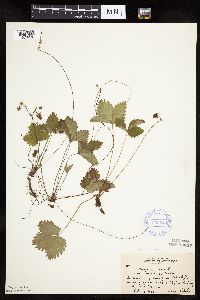 353840[1026836]Lakela, Olga 25501938-07-09 United States, Minnesota, Saint Louis, W side of Haines Road, at Skyline Parkway, Duluth;;N;;, 46.7833 -92.1 |
MIN:Plants |  Fragaria virginiana Duchesne 355998[1027067]Lakela, Olga 29551939-06-11 United States, Minnesota, Saint Louis, About 6 mi S of Gilbert;;;;, 47.401966 -92.464905 |
MIN:Plants | 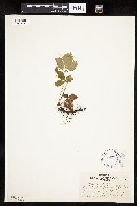 Fragaria virginiana Duchesne 359312[1027066]Alaspa, E.; Alaspa, H. s.n.1940-06-17 United States, Minnesota, Carlton, U of Minn Forest Exp Station, 5 mi SW of Cloquet;;;;, 46.670402 -92.384695 |
MIN:Plants | 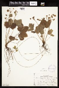 359997[1026754]Lakela, Olga 36171940-07-04 United States, Minnesota, Cook, Windigo Point, Sea Gull Lake. Cook Co.;Boundary Waters Canoe Area Wilderness / Superior National Forest;065N;05W;, 48.149256 -90.887916 |
MIN:Plants | 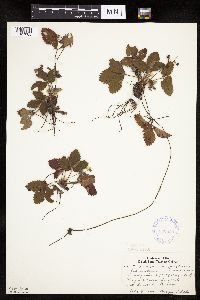 Fragaria virginiana Duchesne 360655[1027065]Lakela, Olga 42351940-09-08 United States, Minnesota, Saint Louis, Pequaywan Lake;Cloquet Valley State Forest;;;, 47.140491 -91.870004 |
MIN:Plants | 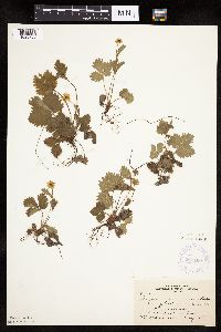 363180[1026766]Beach, W. 761913-05-19 United States, Minnesota, McLeod, Hutchinson;;N;;, 44.88774 -94.369706 |
MIN:Plants | 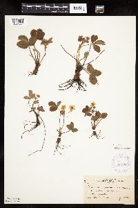 Fragaria virginiana Duchesne 363181[1027064]Beach, W. 74 a1913-05-18 United States, Minnesota, McLeod, Hutchinson;;;;, 44.88774 -94.369706 |
MIN:Plants | 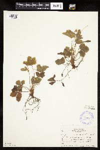 367527[1026849]Moore, John; et al. 124061940-05-17 United States, Minnesota, Freeborn, Above creek, NW1/4 S6, Manchester Twp. Freeborn Co.;;;;, 43.756477 -93.522795 |
MIN:Plants | 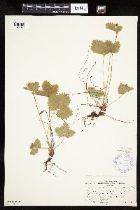 367720[1026853]Moore, John; et al. 126261940-05-25 United States, Minnesota, Meeker, 3/4 mi W of Eden Valley on Hwy 55. Meeker Co.;;;;, 45.326073 -94.561554 |
MIN:Plants | 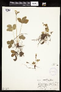 367964[1026850]Moore, John; et al. 128051940-05-27 United States, Minnesota, Becker, Beside Hwy 10, 1 1/2 mi NW of Frazee, Becker Co.;;138N;40W;, 46.7536 -95.738213 |
MIN:Plants | 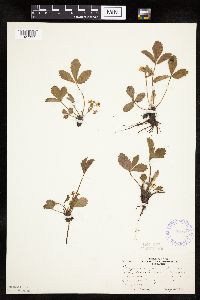 368064[1027397]Moore, John; et al. 126541940-05-25 United States, Minnesota, Kandiyohi, along the North Fork of the Crow River near Hwy 55, NW corner of county, Kandiyohi co.;;;;, 45.409141 -94.867337 |
MIN:Plants |  368145[1026848]Moore, John 127181940-05-25 United States, Minnesota, Otter Tail, Inspiration Peak;Inspiration Peak Scenic Wayside Park;131N;39W;, 46.144254 -95.573544 |
MIN:Plants | 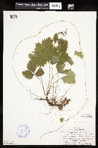 368808[1026874]Lakela, Olga 46351941-07-29 United States, Minnesota, Lake, Lake Superior at the Loranger cottage near Little Marais;;N;;, 47.410745 -91.110162 |
MIN:Plants | 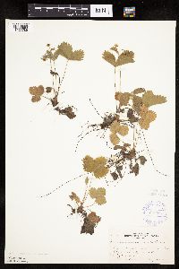 369687[1026786]Moore, John; et al. 139971941-05-24 United States, Minnesota, Pine, S end of Cross Lake, Pine City;;039N;21W;, 45.824761 -92.969858 |
MIN:Plants | 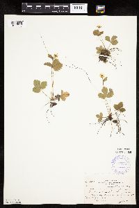 370280[1026805]Moore, John; et al. 138631941-05-10 United States, Minnesota, Mower, Bear Creek, 1 1/2 mi S of Racine on Hwy 63;;;;, 43.745566 -92.479142 |
MIN:Plants | 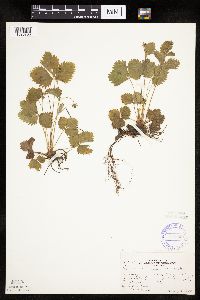 370790[1026760]Moore, John; et al. 137811941-05-03 United States, Minnesota, Washington, Washington Co. NE1/4 S21, Stillwater Twp;;030N;20W;21, 45.042877 -92.853413 |
MIN:Plants | 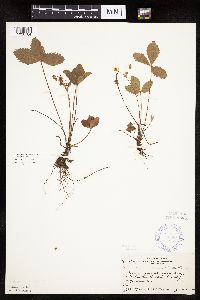 370984[1026784]Moore, John; Moore, Marjorie 132361940-06-25 United States, Minnesota, Aitkin, N of McGrath, Aitkin Co.;;044N;23W;00, 46.28922 -93.24207 |
MIN:Plants | 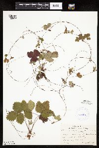 380231[1026854]Lakela, Olga 54301943-08-23 United States, Minnesota, Lake, Lake Superior at East Beaver Bay;;N;;, 47.2677 -91.282943 |
MIN:Plants | 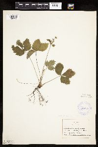 381851[1026855]Allison, Helen s.n.1944-05-07 United States, Minnesota, Grant, NE Grant Co;;N;;, 46.057685 -95.802308 |
MIN:Plants | 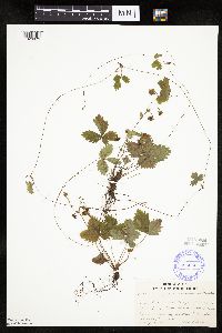 385690[1026873]Lakela, Olga 57511944-08-14 United States, Minnesota, Lake, Pancake Island in Lake Superior, between East Beaver Bay and the Palisades;North Shore;056N;07W;00, 47.2677 -91.282943 |
MIN:Plants | 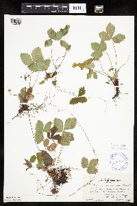 385929[1026767]Rosendahl, C. 77511945-09-15 United States, Minnesota, Houston, West Beaver Springs, Caledonia Twp;;N;;, 43.637926 -91.580425 |
MIN:Plants | 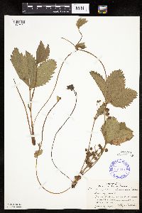 Fragaria virginiana Duchesne 386915[1027074]Lakela, Olga 11961935-06-02 United States, Minnesota, Anoka, Ham Lake, ca 30 mi N of Minneapolis;;;;, 45.257018 -93.222366 |
MIN:Plants | 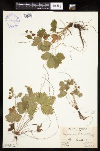 400955[1026772]Butters, F.; et al. s.n.1935-06-29 United States, Minnesota, Cook, Cook Co.; Clearwater Lake. T65N, R1E;Boundary Waters Canoe Area Wilderness / Superior National Forest;065N;01E;00, 48.087449 -90.322587 |
MIN:Plants | 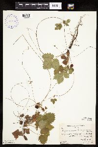 400956[1026837]Butters, F.; et al. 421938-07-07 United States, Minnesota, Cook, W end of cliff on S side of and toward W end of Mountain Lake.;Boundary Waters Canoe Area Wilderness / Superior National Forest;065N;01E;, 48.10737 -90.224172 |
MIN:Plants | 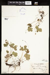 400957[1026834]Butters, F.; Abbe, E. 601936-06-20 United States, Minnesota, Cook, Cook Co.; S side of Clearwater Lake, T65N, R1E;Boundary Waters Canoe Area Wilderness / Superior National Forest;065N;01E;, 48.080224 -90.321042 |
MIN:Plants | 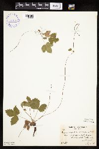 400984[1026856]Butters, F.; Abbe, E.; Abbe, L. 2771937-07-04 United States, Minnesota, Cook, Cook Co.; S side of and toward W end of Mountain Lake, T65N, R1E;Boundary Waters Canoe Area Wilderness / Superior National Forest;065N;01E;, 48.10737 -90.224172 |
MIN:Plants |  400985[1026857]Butters, F.; Abbe, E.; Abbe, L. 2881936-07-05 United States, Minnesota, Cook, Cook Co.; E end of Mountain Lake, T65N, R1E;Boundary Waters Canoe Area Wilderness / Superior National Forest;065N;01E;, 48.10737 -90.224172 |
MIN:Plants |  400995[1026816]Abbe, E.; Abbe, L. 5591937-08-20 United States, Minnesota, Cook, near disintegrated dike, island off SW end of Susie Island, T63N, R7E;North Shore / Susie Islands, The Nature Conservancy;063N;07E;, 47.973776 -89.578978 |
MIN:Plants |  400996[1026878]Butters, F.; Moore, John 108021939-07-01 United States, Minnesota, Cook, N side of cliff on S side of John Lake, T65N, R3E. Cook Co.;Boundary Waters Canoe Area Wilderness / Superior National Forest;065N;03E;, 48.063612 -90.046985 |
MIN:Plants |  405382[1026881]Lakela, Olga 80011949-05-14 United States, Minnesota, Lake, Basswood Lake, Lake Co.;Boundary Waters Canoe Area Wilderness / Superior National Forest;;;, 48.074893 -91.57512 |
MIN:Plants | 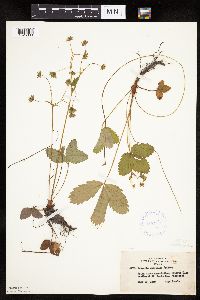 407577[1026880]Lakela, Olga 81731949-06-11 United States, Minnesota, Saint Louis, Prairie Lake, SW St. Louis Co.;;050N;20W;, 46.79124 -92.904888 |
MIN:Plants | 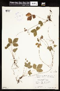 412735[1026815]Moore, John; Moore, Marjorie 118681939-08-18 United States, Minnesota, Koochiching, Koochiching Co.; along the SE shore of Tilson Bay, Rainy Lake along the SE shore of Tilson Bay, Rainy Lake. 071N 23W , 48.606604 -93.401815 |
MIN:Plants | 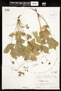 413149[1026820]Moore, John; Moore, Marjorie 111301939-07-25 United States, Minnesota, Lake of the Woods, E side of Pine Creek, Angle Inlet;Northwest Angle;168N;34W;, 49.353711 -95.002845 |
MIN:Plants | 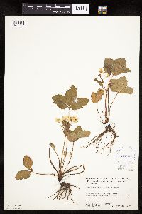 Fragaria virginiana Duchesne 413593[1027062]Moore, John; et al. 107101939-05-28 United States, Minnesota, Clearwater, Along road above Peace Pipe Springs;Itasca State Park;143N;36W;, 47.197458 -95.201964 |
MIN:Plants | 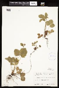 413666[1026859]Moore, John 107191939-05-28 United States, Minnesota, Clearwater, Bear Point, Itasca State Park;Itasca State Park;143N;36W;, 47.197458 -95.201964 |
MIN:Plants | 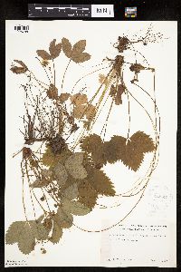 418849[1026788]Ahlgren, Clifford 1361949-06-22 United States, Minnesota, Lake, Quetico-Superior Wilderness Research Center.;Boundary Waters Canoe Area Wilderness / Superior National Forest;064N;10W;09, 48.031651 -91.618861 |
MIN:Plants | 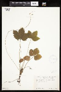 418926[1026789]Ahlgren, Clifford 4021949-08-31 United States, Minnesota, Lake, Quetico-Superior Wilderness Research Center.;Boundary Waters Canoe Area Wilderness / Superior National Forest;064N;10W;09, 48.031651 -91.618861 |
MIN:Plants | 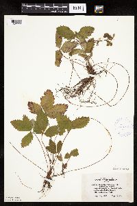 420709[1026768]Lakela, Olga 117451950-08-25 United States, Minnesota, Saint Louis, Crooked Lake at Curtain Falls Resort;Boundary Waters Canoe Area Wilderness / Superior National Forest;066N;12W;, 48.203274 -91.857461 |
Google Map
Google Maps is a web mapping service provided by Google that features a map that users can pan (by dragging the mouse) and zoom (by using the mouse wheel). Collection points are displayed as colored markers that when clicked on, displays the full information for that collection. When multiple species are queried (separated by semi-colons), different colored markers denote each individual species.