University of Minnesota
http://www.umn.edu/
612-625-5000
http://www.umn.edu/
612-625-5000
Minnesota Biodiversity Atlas
Bell Museum
Dataset: MIN-Plants
Taxa: Caryophyllaceae
Search Criteria: excluding cultivated/captive occurrences
Bell Museum plants | |
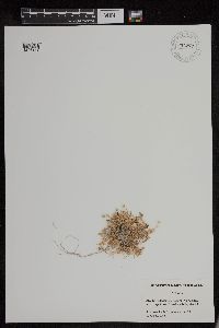
MIN:Plants | Loeflingia NULL 108825[]Macbride, J. Francis 7731911-04-24 United States, Idaho, Canyon, New Plymouth, Canyon County, 671m |
MIN:Plants | Silene NULL 231116[]Congdon, J. s.n.1888-05-24 United States, California, Mariposa, Yosemite Valley, Mariposa County;Yosemite National Park |
MIN:Plants | Silene NULL 564447[]Rhone, R. s.n.1940-09-29 United States, Minnesota, Olmsted, Olmsted County...Rochester [most likely cultivated];;;;, 44.021631 -92.469899 |
MIN:Plants | Silene NULL 284724[]Thompson, J. 55181930-08-02 United States, Washington, Clallam, summit of Mt. Angeles...Olympic Mts, Clallam Co.;Olympic National Park, 1676m |
MIN:Plants | Silene NULL 108827[]Howell, Thomas 2451902-07-02 United States, Washington, Grays Harbor, Higley's promontory, opposite Quiniault [sic];Olympic National Park;;;, 47.468093 -123.84669 |
MIN:Plants | Myosoton NULL 572253[1183279]Cooperrider, T. S. 4229 United States, Iowa, Jackson |
MIN:Plants | Myosoton NULL 301584[1183280]Bright, J. 6486 United States, Pennsylvania, Butler |
MIN:Plants | Myosoton NULL 395521[1183281]Wadmond, S. C. 1932 United States, Illinois, Jo Daviess |
MIN:Plants | Myosoton NULL 395522[1183282]Wadmond, S. C. s.n. United States, Illinois, Jo Daviess |
MIN:Plants | Myosoton NULL 570559[1183283]Malte, M. O. 867 22 Canada, Quebec |
MIN:Plants | Myosoton NULL 361850[1183285]Horton, E. S. s.n. United States, Wisconsin, Douglas |
MIN:Plants | Myosoton NULL 395518[1183286]Wadmond, S. C. 1442 United States, Wisconsin, Rock |
MIN:Plants | Myosoton NULL 386520[1183287]Senn, H. A. 593 Canada, Quebec |
MIN:Plants | Myosoton NULL 549081[1183288]Umbach, L.M. 6552 United States, Illinois |
MIN:Plants | Myosoton NULL 643868[1183289]Ahles, H. E. 77731 United States, Massachusetts, Hampshire |
MIN:Plants | Myosoton NULL 749633[1183290]Boivin, B. 13324 Canada, Quebec |
MIN:Plants | Spergularia NULL 599538[]Cooper, William 3071929-07-23 United States, Alaska, Glacier Bay, Station 26.;Glacier Bay National Park;;;, 58.941072 -136.78764 |
MIN:Plants | Arenaria NULL 766279[]McCarthy, Gerald s.n.1888-10-01 United States, North Carolina, E. NC |
MIN:Plants | Arenaria NULL 584140[]Stork, H.; et al. 141923-06-26 United States, Wyoming, Park, Yellowstone Natl Park;Yellowstone National Park |
MIN:Plants | Arenaria NULL 107569[]Curtiss, A. 63861898-04-29 United States, Florida, Walton, near De Funiak Springs |
MIN:Plants | Arenaria NULL 569173[]Hunnewell, F. 155661938-07-17 Canada, Alberta, Canadian Rocky Mountains, vicinity of Waterton Lakes...Bertha Lake, 1768m |
MIN:Plants | Arenaria NULL 602397[]Calder, J.; et al. 198021956-08-04 Canada, British Columbia, above Scout Lake well above treeline; east flank of Red Mtn. Cathedral Lakes area, Ashnola Range;;;;, 49.0666667 -120.2 |
MIN:Plants | Arenaria NULL 355331[]West, Phebe 451932-07-20 United States, Alaska, Atka, Aleutian Islands;Aleutian Islands Wilderness;;;, 52.196111 -174.20056 |
MIN:Plants | Arenaria NULL 247105[]Biltmore Herbarium personnel 255 b1897-06-20 United States, North Carolina, Bladen, Bladen County |
MIN:Plants | Arenaria NULL 584703[]Morean, Edith 1691962-08-07 United States, Washington, Clallam, Olympic National Park. Trail between Obstruction Point and Hurricane Ridge.;Olympic National Park |
MIN:Plants | Arenaria NULL 108031[]Biltmore Herbarium personnel 255 b1897-06-20 United States, North Carolina, Bladen, Bladen County |
MIN:Plants | Arenaria NULL 380736[]Ownbey, Marion; et al. 22641940-07-23 United States, Washington, Clallam, Clallam Co. ... Obstruction Point, Hurricane Ridge, Olympic National Park.;Olympic National Park |
MIN:Plants | 956186[1296005]Lawrence, D. B. s.n.1949-08-14 United States, Alaska, Glacier Bay National Monument. Station 49-3. [Glacier Bay National Park], 58.797428 -136.838127 |
MIN:Plants | 956277[1296154]Schoenike, R. 55-981955-08-12 United States, Alaska, Anchorage Cove., 58.621111 -137.664722, 61m |
MIN:Plants | Drymaria NULL 108684[]Wooton, E. 4051897-08-28 United States, New Mexico, Dona Ana, Collected on the plains south of the White Sands, Dona Ana Co.;White Sands National Monument, 1250m |
MIN:Plants | 955948[1295503]Lawrence, D. B. s.n.1941-08-17 United States, Alaska, Glacier Bay National Monument; nunatak on east side of head of Muir Inlet. [Glacier Bay National Park], 58.797428 -136.838127, 358m |
MIN:Plants | 956163[1296036]Lawrence, D. B. s.n.1949-08-16 United States, Alaska, Glacier Bay National Monument. Station 49-3. [Glacier Bay National Park], 58.797428 -136.838127 |
MIN:Plants | Stellaria NULL 433031[]Abbott, Robinson s.n.1992-05-24 United States, Minnesota, Stevens, Stevens County...hill S. of pond Scandia Woods Environmental Lab, N. side of trail.;;;;, 45.586111 -95.913889 |
MIN:Plants | 0967749[1368306] s.n.1938-04-10 United States, Texas |
MIN:Plants | Cerastium NULL 520611[]Lawrence, Donald s.n.1952-08-24 United States, Alaska, Bartlett Cove.;Glacier Bay National Park;;;, 58.449279 -135.89734 |
MIN:Plants | 956253[1296008]Schoenike, R. 55-1301955-08-17 United States, Alaska, Glacier Bay National Monument. Russell Island. [Glacier Bay National Park], 58.797428 -136.838127, 305m |
MIN:Plants | 108257[1369722]Haygarth, W. s.n. South Africa, East Griqualand, 4000m |
MIN:Plants | Stellaria crassifolia Ehrhart 900929[]Lee, Michael MDL41202005-08-26 United States, Minnesota, Becker, Becker County...Along the Straight River (Straight Lake Creek), 1/2 mile upstream from Straight Lake, 3.5 miles north-northwest of Osage...T140N R36W SW1/4 of SE1/4 Sec 6. 140N 36W 6, 46.970644 -95.278195 |
MIN:Plants | Stellaria crassifolia Ehrhart 520254[]Lawrence, Donald s.n.1952-08-23 United States, Alaska, Glacier Bay National Monument. Strawberry Island.;Glacier Bay National Park;;;, 58.797428 -136.838127 |
MIN:Plants | Stellaria crassifolia Ehrhart 506851[1402023]Smith, Welby 170391990-06-25 United States, Minnesota, Steele, Pogones Wildlife Management Area. Steele County ... Pogones State Wildlife Management Area, about 12 miles south-southeast of Owatonna ...T 105N R 19W NW1/4 of SE1/4 of sec 18. 105N 19W 18, 43.8977776 -93.2783356 |
MIN:Plants | Stellaria crassifolia Ehrhart 107183[]Sandberg, John 10351891-06-24 United States, Minnesota, Clearwater, Itasca Lake;Itasca State Park;143N;36W;, 47.19557 -95.233216 |
MIN:Plants | Stellaria crassifolia Ehrhart 107208[]Sheldon, Edmund s.n.1892-07-00 United States, Minnesota, Kanabec, Mora, Kanabec Co.;;039N;24W;, 45.860683 -93.327529 |
MIN:Plants | Stellaria crassifolia Ehrhart 107209[]Sandberg, John 2091881-05-00 United States, Minnesota, Goodhue, Cannon Falls;;N;;, 44.506911 -92.905484 |
MIN:Plants | Stellaria crassifolia Ehrhart 276134[]Moyle, J. 1301930-07-01 United States, Minnesota, Clearwater, Itasca Park, Garrison Pt. dock; NE1/4 SW1/4 Sec. 15 T143N R36W;Itasca State Park;143N;36W;15, 47.202782 -95.222917 |
MIN:Plants | Stellaria crassifolia Ehrhart 277319[]Rosendahl, C. 55831928-06-26 United States, Minnesota, Clearwater, old dock, Garrison Point, Itasca Park;Itasca State Park;143N;36W;, 47.19557 -95.233216 |
MIN:Plants | Stellaria crassifolia Ehrhart 277734[]Roberts, Thomas s.n.1877-06-00 United States, Minnesota, Hennepin, Minneapolis;;N;;, 44.979965 -93.263836 |
MIN:Plants | Stellaria crassifolia Ehrhart 357990[]Rosendahl, C. 56041928-07-04 United States, Minnesota, Hubbard, Shore of Lake George;;N;;, 47.197355 -94.980839 |
MIN:Plants | Stellaria crassifolia Ehrhart 359045[]Moyle, J. 33151939-09-03 United States, Minnesota, Cass, Pellager Creek on board dam;;133N;30W;, 46.325752 -94.454003 |
MIN:Plants | Stellaria crassifolia Ehrhart 360896[]Moyle, J. 35281940-10-25 United States, Minnesota, Chippewa, Chippewa Co.; Lac qui Parle [lake];Lac Qui Parle Wildlife Management Area;;;, 45.02218 -95.88713 |
MIN:Plants | Stellaria crassifolia Ehrhart 362672[]Rosendahl, C. 66201934-09-12 United States, Minnesota, Clearwater, Along Mississippi, at outlet of Lake Itasca;Itasca State Park;144N;36W;, 47.282324 -95.233417 |
MIN:Plants | Stellaria crassifolia Ehrhart 451227[]Rosendahl, C. 50121926-07-02 United States, Minnesota, Hubbard, La Salle Creek, North boundary of Itasca Park.;Itasca State Park;143N;35W;, 47.195787 -95.107789 |
MIN:Plants | Stellaria crassifolia Ehrhart 549953[]Moore, John 219101954-07-21 United States, Minnesota, Wilkin, 1 mi S of Lawndale;;N;;, 46.542427 -96.360344 |
MIN:Plants | Stellaria crassifolia Ehrhart 560935[]Ownbey, Gerald 27831959-07-02 United States, Minnesota, Clearwater, 0.7 mi N of northern boundary of Itasca State Park, along Sucker Creek; NW1/4 Sec. 33 T144N R36W;;144N;36W;33, 47.246014 -95.244559 |
MIN:Plants | Stellaria crassifolia Ehrhart 578636[1402026]Ownbey, Gerald 32381962-07-17 United States, Minnesota, Clearwater, 1.5 mi W of Lake Itasca Post Office, just W of Sucker Creek; T144N R36W SE1/4 Sec. 28;;144N;36W;28, 47.260648 -95.244129 |
MIN:Plants | Stellaria crassifolia Ehrhart 598518[]Rosendahl, C. 47161924-07-21 United States, Minnesota, Clearwater, Corporation Spring, Itasca State Park;Itasca State Park;143N;36W;, 47.19557 -95.233216 |
MIN:Plants | Stellaria crassifolia Ehrhart 687371[]Wheeler, Gerald; Glaser, Paul 18081977-06-28 United States, Minnesota, Itasca, Collection Site no. 71, ca. 7 mi SE of Grand Rapids, adjacent to Mississippi River (W side of river); NE1/4 SW1/4 Sec. 1 Collection Site no. 71, ca. 7 mi SE of Grand Rapids, adjacent to Mississippi River (W side of river); NE1/4 SW1/4 Sec. 17 T54N R24W. 054N 24W 17, 47.1597 -93.417024 |
MIN:Plants | Stellaria crassifolia Ehrhart 820287[]Rosendahl, C. 52871927-06-24 United States, Minnesota, Clearwater, along stream, Corporation Spring, Itasca State Park;Itasca State Park;143N;36W;, 47.19557 -95.233216 |
MIN:Plants | Stellaria crassifolia Ehrhart 837461[1402024]Smith, Welby 175421990-07-31 United States, Minnesota, Morrison, Camp Ripley Military Reservation. Camp Ripley Military Reservation. Morrison Co. At Sylvan Dam on the Crow Wing River; UTM: 393900E 5128500N T133N R29W SW Camp Ripley Military Reservation. Morrison Co. At Sylvan Dam on the Crow Wing River; UTM: 393900E 5128500N T133N R29W SW1/4 of NE1/4 of Sec 30. 133N 29W 30, 46.301178 -94.38182 |
MIN:Plants | Stellaria crassifolia Ehrhart 841120[1402025]Smith, Welby 134451987-07-10 United States, Minnesota, Washington, Washington Co. Corries Swamp, about 8 mi W of Marine on St. Croix; NE1/4 SE1/4 sec.34, T32N R21W;;032N;21W;34, 45.205555 -92.9397202 |
MIN:Plants | Stellaria crassifolia Ehrhart 599539[]Cooper, William; et al. s.n.1929-07-14 United States, Alaska, Glacier Bay [station] 7;Glacier Bay National Park;;;, 58.797428 -136.838127 |
MIN:Plants | Stellaria crassifolia Ehrhart 520255[]Lawrence, Donald s.n.1952-08-23 United States, Alaska, Glacier Bay National Monument. Strawberry Island.;Glacier Bay National Park;;;, 58.797428 -136.838127 |
MIN:Plants | Stellaria crassifolia Ehrhart 656952[]Noble, Mark; et al. 3941974-08-05 United States, Alaska, Muir Point.;Glacier Bay National Park;;;, 58.827414 -136.07866 |
MIN:Plants | Stellaria crassifolia Ehrhart 944109[]Schimpf, David J. DJS8272015-07-26 United States, Minnesota, Itasca, Dora Lake. South edge of National Forest boat ramp. NW1/4;Chippewa National Forest;149N;27W;12, 47.740278 -94.051111 |
MIN:Plants | Stellaria crassifolia Ehrhart 971876[1395711]Blytt s.n. Norway, Lysagerkjern |
MIN:Plants | Stellaria alaskana Hult̩n 690157[]Glaser, Paul 8941975-07-24 United States, Alaska, Mt. McKinley National Park...N1/2SW1/4Sec.18 T16S R14W, Thorofare Bluffs;Denali National Park;016S;14W;18, 1433m |
MIN:Plants | Stellaria alaskana Hult̩n 539795[]Viereck, Les 13871956-07-17 United States, Alaska, Denali National Park. Mt. McKinley National Park...Junction of the Muldrow Glacier and the glacier from Anderson Pass...lateral moraine of the Muldrow. , 63.2999992 -150.3000031, 1524m |
MIN:Plants | 451860[1299484]Richards, Charles 21241949-06-23 United States, Michigan, Keweenaw, Keweenaw County ... West Bluff |
MIN:Plants | 492087[]Capistrant, A. AMC11951998-05-05 United States, Minnesota, Steele, Steele Co, T105N R20W S14;;105N;20E;14, 43.899068 -93.195935 |
MIN:Plants | 435756[]Smith, Michael 331996-08-13 United States, Minnesota, Koochiching, Voyageurs National Park. Koochiching Co.; Plot name: Voya 05 DNR # 5763;Voyageurs National Park;071N;22W;00, 48.5925 -93.1511111 |
MIN:Plants | 488403[]Smith, Welby 157931989-07-18 United States, Minnesota, Freeborn, At the public access on the north side of Bear Lake, about 4 miles north of Emmons. SW1/4 SE1/4 of section;;101N;22W;08, 43.564613 -93.498093 |
MIN:Plants | 549682[]Umbach, L. 81381916-06-22 United States, Indiana, Porter, Dune Park;Indiana Dunes National Lakeshore;;;, 41.663093 -87.032128 |
MIN:Plants | 435400[]Wheeler, Gerald 162111997-06-25 United States, Minnesota, Renville, Renville Co.; Morton Rock Outcrop complex, S side of Morton; NW1/4 NE1/4 SW1/4 Sec. 31 T113N R34W (Birch Cooley 31);;113N;34W;31, 44.543269 -94.990327 |
MIN:Plants | 109430[]Elmer, A.D.E. 27501900-07-00 United States, Washington, Clallam, Olympic Mts. [Olympic National Park] |
MIN:Plants | 910885[]Smith, Welby 244411994-06-21 United States, Minnesota, Isanti, Spectacle Lake Wildlife Management Area. Isanti County...Spectacle Lake State Wildlife Management Area; about 8 miles west of Cambridge...T 36N R 25W NW1/4 of SE1/4 of Sec 35. 036N 25W 35, 45.5611111 -93.4133333 |
MIN:Plants | 909234[]Gerdes, Lynden 55842008-07-07 United States, Minnesota, Lake, Superior National Forest. T63N R11W S06SWNW Lake County ... Superior National Forest. Approximately 3.08 miles NNE of Winton ... 1.21 miles east of Low Lake. USFS gravel pit north of FR 1036.. 063N 11W 6, 47.9708333 -91.7913889 |
MIN:Plants | 435239[]Bright, R. 73-2631973-00-00 United States, Idaho, Franklin, [no further data] |
MIN:Plants | 109345[]Rosendahl, C. 35231918-06-22 United States, Minnesota, Wabasha, Zumbro Valley, below Thielman.;;N;;, 44.289167 -92.192222 |
MIN:Plants | 109439[]Ainslie, G. 14671902-07-04 United States, Minnesota, Olmsted, Rochester;;106N;14W;, 43.97834 -92.49834 |
MIN:Plants | 109440[]Butters, F.; et al. 32401916-06-14 United States, Minnesota, Nicollet, St. Peter;;110N;26W;, 44.326424 -93.949079 |
MIN:Plants | 109441[]Skinner, S. 751902-06-12 United States, Minnesota, Jackson, Vicinity of Heron Lake;;N;;, 43.757279 -95.268091 |
MIN:Plants | 109443[]Manning, Sara s.n.1886-06-15 United States, Minnesota, Wabasha, Lake City;;111N;12W;, 44.4081 -92.252454 |
MIN:Plants | 109444[]Rosendahl, C.; Butters, F. 39201920-06-25 United States, Minnesota, Fillmore, Near Vickerman's Springs, Amherst, Fillmore Co.;;102N;09W;, 43.630572 -91.909924 |
MIN:Plants | 109445[]Moyer, Lycurgus 14491892-06-21 United States, Minnesota, Chippewa, Minn. Valley, Montevideo;;117N;40W;, 44.934626 -95.675774 |
MIN:Plants | 109446[]Moyer, Lycurgus 14491895-06-18 United States, Minnesota, Chippewa, Montevideo;;117N;40W;, 44.934626 -95.675774 |
MIN:Plants | 109447[]Rosendahl, C. 2571902-06-02 United States, Minnesota, Houston, Spring Grove;;101N;07W;, 43.543923 -91.6707 |
MIN:Plants | 109448[]Sheldon, Edmund s.n.1895-06-00 United States, Minnesota, Hennepin, Prospect Park, Minneapolis;;N;;, 44.96824 -93.21299 |
MIN:Plants | 109449[]Sheldon, Edmund s.n.1895-06-00 United States, Minnesota, Hennepin, Prospect Park, Minneapolis;;N;;, 44.96824 -93.21299 |
MIN:Plants | 109450[]Ballard, C. B5891891-07-00 United States, Minnesota, Scott, Crystal Lake;;114N;22W;, 44.674042 -93.460284 |
MIN:Plants | 109451[]Herrick, C. 32-11877-06-14 United States, Minnesota, Hennepin, Minneapolis;;N;;, 44.979965 -93.263836 |
MIN:Plants | 109452[]Sheldon, Edmund S30701892-07-00 United States, Minnesota, Mille Lacs, Princeton;;036N;26W;, 45.602777 -93.573848 |
MIN:Plants | 109453[]Holzinger, John s.n.1886-06-00 United States, Minnesota, Winona, Winona Co.;;N;;, 43.936346 -91.686007 |
MIN:Plants | 109454[]Wheeler, William 1711899-06-10 United States, Minnesota, Houston, Jefferson;Dorer Memorial Hardwood State Forest;101N;04W;35, 43.50806 -91.28287 |
MIN:Plants | 109455[]MacMillan, C.; et al. MS11001894-07-00 United States, Minnesota, Lake of the Woods, Oak Point;Pine & Curry Islands Scientific Natural Area;162N;31W;06, 48.87976 -94.69025 |
MIN:Plants | 109456[]Burglehaus, F. s.n.1891-06-00 United States, Minnesota, Hennepin, [no further data];;;;, 45 -93.47 |
MIN:Plants | 109457[]Sandberg, John s.n.1881-05-00 United States, Minnesota, Goodhue, Cannon Falls;;112N;17W;, 44.49989 -92.85476 |
MIN:Plants | 109458[]Taylor, B. s.n.1891-06-00 United States, Minnesota, Waseca, Janesville;;N;;, 44.116078 -93.708004 |
MIN:Plants | 109459[]Sheldon, Edmund s.n.1895-06-00 United States, Minnesota, Snelling Reservation [old regional park spanning junction of Minnesota and Mississippi rivers];;028N;23W;, 44.90516 -93.16646 |
MIN:Plants | 109460[]Sheldon, Edmund S7131891-07-00 United States, Minnesota, Brown, Sleepy Eye;;110N;32W;, 44.325885 -94.684758 |
MIN:Plants | 109461[]MacMillan, C.; et al. 124Sk1900-08-00 United States, Minnesota, Polk, Crookston;;150N;46W;30, 47.77414 -96.60812 |
MIN:Plants | 109462[]Burglehaus, F. s.n.1892-06-00 United States, Minnesota, Hennepin, Minneapolis;;N;;, 44.979965 -93.263836 |
Google Map
Google Maps is a web mapping service provided by Google that features a map that users can pan (by dragging the mouse) and zoom (by using the mouse wheel). Collection points are displayed as colored markers that when clicked on, displays the full information for that collection. When multiple species are queried (separated by semi-colons), different colored markers denote each individual species.
