University of Minnesota
http://www.umn.edu/
612-625-5000
http://www.umn.edu/
612-625-5000
Minnesota Biodiversity Atlas
Bell Museum
Dataset: MIN-Plants
Search Criteria: USA OR United States OR U.S.A. OR United States of America; excluding cultivated/captive occurrences
Bell Museum plants | |
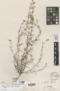
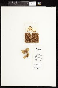
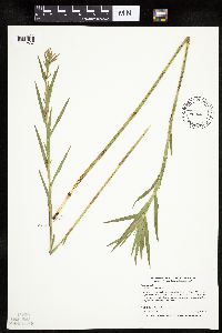
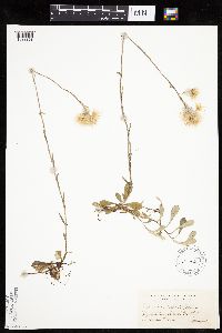
MIN:Plants | Pectis linearifolia Urban 212386[1001953]Nash, G. 24791895-08-24 United States, Florida, Hillsborough, At Tampa;;;;, 27.947522 -82.458428 |
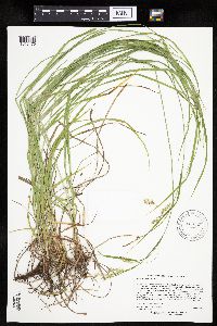
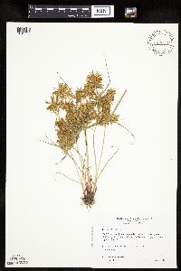
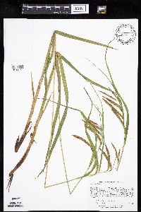
MIN:Plants | Carex sprengelii Dewey ex Sprengel 917045[1016476]Lee, Michael; et al. MDL36192004-06-15 United States, Minnesota, Becker, Sucker Creek County Park. Becker County ... Sucker Creek Park on the southeast side of Big Detroit lake, three miles southeast of the city of Detroit Lakes ... T138N R41W NW1/4 of NE1/4 Sec. 13. 138N 41W 13, 46.767387 -95.806082 |
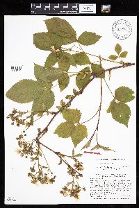
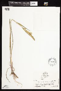
MIN:Plants | Rubus alumnus L.H. Bailey 904129[1031780]Smith, Welby 29463B2004-06-25 United States, Minnesota, Itasca, about one mile west of Coon Lake. NE1/4 of SW1/4 of Section;Scenic State Park;061N;25W;31, 47.7280556 -93.5905556 |
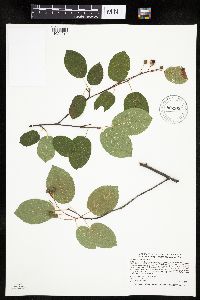
MIN:Plants | 690680[]Shane, L. 77-111977-06-30 United States, Ohio, Erie, Erie County ... bluff above the west bank of Old Woman Creek estuary ca. 1-1/2 miles, s. of Lake Erie. In area of Anderson Site excavation., 41.297726 -82.45677 |
MIN:Plants | Drosera anglica Hudson 505468[1345300]Gerdes, D. Lawson United States, Minnesota, Lake, Detailed locality information protected. This is typically done to protect rare or threatened species localities. |
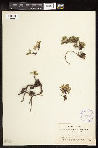
MIN:Plants | Salix nivalis Hooker 290829[1102060]Ball, C.; et al. 5291931-08-05 United States, California, Mono, Yosemite National Park, Mono County...Glacier Canyon, north side of Mount Dana;Yosemite National Park;;;, 37.9 -119.2, 3150 - 3300m |
MIN:Plants | Rubus idaeus var. strigosus (Michaux) Focke 510061[]Bright, R. 73-2401973-00-00 United States, Idaho, Franklin, [no further data];;;;, 42.177077 -111.809713 |
MIN:Plants | Carex cristatella Britton 472756[1109549]Nation, R. 94-4361994-07-24 United States, Minnesota, Mower, Lake Louise State Park. Mower Co.; Tract #2. T101N R14W NW1/4 of NW1/4 of Sec 28;Lake Louise State Park;101N;14W;28, 43.522099 -92.518958 |
MIN:Plants | Silene dioica (L.) Clairville 568661[1373888]Moore, John 249691960-06-13 United States, Minnesota, Kittson, Kittson County...City Park at Hallock;;161N;;, 48.760418 -96.996127 |
MIN:Plants | Osmorhiza claytonii (Michaux) C.B. Clarke 508866[1035143]Wheeler, Gerald 197861999-06-02 United States, Minnesota, Blue Earth, Blue Earth County ... About 0.8 mi. S of jct. of Rte. 68 and Rte. 42; W of road ... W1/2 SE1/2 Sec. 4 T108N R28W;;108N;28W;4, 44.188659 -94.198823 |
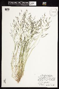
MIN:Plants | Dichanthelium leibergii (Vasey) Freckmann 430210[1063328]Lee, Michael MDL18411997-07-18 United States, Minnesota, Stearns, Stearns County ... along Sedan Brook 3-1/2 miles north-northeast of Brooten ... T124N R35W SW1/4 of NE1/4 Sec. 17;Sedan Brook Prairie Scientific Natural Area;124N;35W;17, 45.552738 -95.100391 |
MIN:Plants | 911570[1047485]Smith, Welby 218171992-08-31 United States, Minnesota, Redwood, Murray County ... Minnesota River Valley, about 3 miles northeast of Belview ... T 114N R 37W NE1/4 of NW1/4 of Sec 27. 114 N 37W 27, 44.6563889 -95.2977778 |
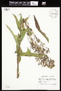
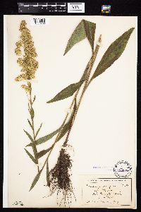
MIN:Plants | Solidago rigida subsp. humilis (Porter) S.B. Heard & Semple 426760[1050936]Biederman, L. 3651999-08-11 United States, Minnesota, Rock, Rock County ... railroad right-of-way and Hwy 16 ... T102N R44W SESE07;;102N;44W;07, 43.652541 -96.163101 |
MIN:Plants | Lepidium densiflorum Schrader 915013[]Smith, Welby 226531993-07-01 United States, Minnesota, Otter Tail, Inspiration Peak Scenic Wayside Park. Otter Tail County ... Inspiration Peak State Wayside Park, about 12 miles west of Parkers Prairie ... T131N R39W SE1/4 of SW1/4 of Sec 22. 131N 39W 22, 46.1383333 -95.5736111 |
MIN:Plants | Alnus viridis subsp. crispa (Aiton) Turrill 509351[1094495]Myhre, K. 62961996-05-28 United States, Minnesota, Aitkin, Aitkin County ... Located 12 miles southeast of the town of Aitkin ... T 46N R 26W SW1/4 of SW1/4 of sec 24;;046N;26W;24, 46.45324 -93.56931 |
MIN:Plants | 507989[]Anderson, Craig 9542000-06-29 United States, Minnesota, Otter Tail, Ottertail County ... T131N R43W: 1/4 of SW1/4 of SW1/4 of Sect. 23;;131N;43W;23, 46.1448487 -96.0501077 |
MIN:Plants | 508944[]Perleberg, D.; et al. s.n.2001-08-30 United States, Minnesota, Rice, Cedar Lake ... Rice County. T110 R22W NWSE Sec 35. GPS location: Northing: 4904150 Easting: 465400. Located about 6 miles west of Faribault, MN on west side of smallest of 4 islands in Cedar Lake. 5 acre island is at SW end of largein basin ... at DNR Ecol Services survey site #105.. 110N 22W 35, 44.294899 -93.390235 |
MIN:Plants | Ranunculus flammula var. reptans (L.) E. Meyer 478851[]Gerdes, Lynden; et al. 28081998-07-02 United States, Minnesota, Cook, T65N R02E S30NESW. Cook County...Superior National Forest, BWCAW. Portage/landing at west end of West Pike Lake;Boundary Waters Canoe Area Wilderness / Superior National Forest;065N;02E;30, 48.084969 -90.242588 |
MIN:Plants | Platanthera hookeri (Torrey ex A. Gray) Lindley 904414[1317446]Anderson, Rebecca United States, Minnesota, Lake, Detailed locality information protected. This is typically done to protect rare or threatened species localities. |
MIN:Plants | Carex novae-angliae Schweinitz 515520[1113017]Greenlee, Jack United States, Minnesota, Lake, Detailed locality information protected. This is typically done to protect rare or threatened species localities. |
MIN:Plants | Solidago uliginosa Nuttall 216162[1050968]Wheeler, William 8321900-08-00 United States, Michigan, Keweenaw, Tobin Harbor, Isle Royale;Isle Royale National Park |
MIN:Plants | Euphrasia mollis (Ledebour) R. Wettstein 657304[]Noble, Mark; et al. 4711974-08-05 United States, Alaska, Muir Point; from site deglaciated ca. 1880.;Glacier Bay National Park;;;, 58.82694 -136.07722 |
MIN:Plants | Myriophyllum sibiricum Komarov 599842[]Cooper, William 2891929-07-23 United States, Alaska, Glacier Bay, Station 25.;Glacier Bay National Park;;;, 58.797845 -136.458473 |
MIN:Plants | 435993[]Lee, Michael; et al. MDL23011998-07-28 United States, Minnesota, Crow Wing, Crow Wing Co.; In the Little Pine River six miles south of Emily. T137N R26W SE1/4 of SW1/4 Sec 28;;137N;26W;28, 46.651305 -93.977796 |
MIN:Plants | 899504[1343215]Smith, Welby 292152001-06-27 United States, Minnesota, Lake, Lake County...Crosby-Manitou State Park, about 3 air miles from Lake Superior...T 58N R 6W NW1/4 of SW1/4 of Sec 28;Crosby Manitou State Park / North Shore;058N;06W;28, 47.4772222 -91.105 |
MIN:Plants | Carex crawei Dewey 459917[1008818]Wheeler, Gerald 163811997-06-30 United States, Minnesota, Swift, Swift County ... Ca. 9.1 mi. W of Kerkhoven on Rte. 5, 2.1 mi. W of jct. of Rte. 6 and Rte. 31, S of road; NE1/4 of NE1/4 Sec. 23 T120N R39W (Cashel 23). 120N 39W 23, 45.187887 -95.522127 |
MIN:Plants | 436746[1080198]Gerdes, Lynden 46932003-06-11 United States, Minnesota, Lake, Superior National Forest. T59N R07W S07SENE. Lake County...Superior National Forest. Dumbell Lake area, approx. 4.35 miles ESE of Isabella... North side of the Dumbell Lake Rd (FR172) near the mouth of private lane ... lane marker #5065. 059N 07W 7, 47.6094 -91.268097 |
MIN:Plants | Carex tonsa var. tonsa (Fernald) E. P. Bicknell 903947[1017421]Lee, Michael MDL39322005-06-06 United States, Minnesota, Todd, Lawrence Lake WMA. TODD COUNTY ... Lawrence Lake State Wildlife Management Area, three miles southeast of Staples ... Lawrence Lake, just east of the small outlet ditch near the public water access ... T133N R32W NE1/4 of SW1/4 of SE1/4 Sec.19. 133N 32W 19, 46.318349 -94.768477 |
MIN:Plants | 477495[1004605]Lee, Michael MDL15571996-09-11 United States, Minnesota, Carlton, Carlton County ... cliff along the St. Louis River gorge immediately downstream from the Thomson dam, just above the HWY 210 bridge ... T48N R16W SE1/4 SE1/4 Sec. 6. 048N 16W 6, 46.665069 -92.409257 |
MIN:Plants | Salix nigra Marshall 896812[1091666]Haferman, J. 1931996-05-18 United States, Minnesota, Scott, Approx. 0.1 miles NNE of intersection of State Highway 13 and County Road 44 on N side of highway. SW1/4 of SW1/4 of section.;;115N;22W;36, 44.72459 -93.40903 |
MIN:Plants | 198436[1038083]Burglehaus, F. s.n.1894-06-29 United States, Wyoming, Park, Yellowstone National Park ... near Mammoth Hot Springs;Yellowstone National Park;;;, 44.9667 -110.7, 2438m |
MIN:Plants | Delphinium menziesii subsp. menziesii de Candolle 112305[]Elmer, A.D.E. 26651900-06-00 United States, Washington, Clallam, Olympic Mts. [Olympic National Park], 47.803236 -123.666112 |
MIN:Plants | Corallorhiza maculata var. maculata (Rafinesque) Rafinesque 600738[1306254]Baker, Gary; Baker, Patricia United States, California, Tuolumne, Detailed locality information protected. This is typically done to protect rare or threatened species localities. |
MIN:Plants | 911156[1019171]Smith, Welby 219621992-09-07 United States, Minnesota, Watonwan, Watonwan County...At the west end of Long Lake, about 6 miles south-southwest of St. James...T 105N R 32W SW1/4 of SW1/4 of Sec 10. 105N 32W 10, 43.9069444 -94.6769444 |
MIN:Plants | Samolus ebracteatus Kunth 295532[]Mueller, C. 8110 United States, Texas, Brewster, Chisos Mts.;Big Bend National Park;;;, 29.25 -103.25 |
MIN:Plants | 920682[1079427]Smith, Welby 93571984-06-27 United States, Minnesota, Jackson, Kilen Woods State Park. Jackson County...Kilen Woods State Park, about 8 miles north-northwest of Jackson...Des Moines River Valley. SW1/4 NE1/4 section 17, T 103N R 35W. 103N 35W 17, 43.7248138 -95.0646485 |
MIN:Plants | 905636[1050896]Gerdes, Lynden 44692001-08-23 United States, Minnesota, Lake, T57N R07W S27NESW. Lake County...Wolf Ridge Environmental Learning Center. Finland. Approx. 1.30 miles NW of Wolf Lake;North Shore / Wolf Ridge Environmental Center;057N;07W;27, 47.393404 -91.203744 |
MIN:Plants | 899944[1026075]Smith, Welby 277621999-05-22 United States, Minnesota, Wadena, Wadena County...About 4.5 miles NW of Staples...T 134N R 33W SW1/4 of SW1/4 of Sec 9;;134N;33W;09, 46.4286111 -94.8619444 |
MIN:Plants | Wyethia angustifolia (de Candolle) Nuttall 232473[1053801]Congdon, J. s.n.1892-07-03 United States, California, Mariposa, Snow Creek, Mariposa Co.;Yosemite National Park;;;, 37.760183 -119.534161 |
MIN:Plants | Silene uralensis (Ruprecht) Bocquet 401498[]Spetzman, L. 5911948-07-11 United States, Alaska, Arctic North Slope ... Lake Peters;Arctic National Wildlife Refuge;;;, 69.3333333 -145, 1372m |
MIN:Plants | Betula occidentalis Hooker 472953[1127410]Bright, R. 73-2221973-00-00 United States, Idaho, Franklin, Franklin Co.;;;;, 53.2999992 -60.4166679 |
MIN:Plants | Rhododendron lapponicum (L.) Wahlenberg 700282[]Glaser, Paul 431a1972-08-11 United States, Alaska, Mt. McKinley National Park...N1/2SW1/4 T15S R11W, pass north of Igloo Mtn.;Denali National Park;T015S R11W S12, 63.287696 -151.058253, 914m |
MIN:Plants | Heuchera parvifolia Nuttall ex Torrey & A. Gray 293345[]Lakela, Olga 10561934-07-19 United States, Montana, Glacier, Lower St. Mary Lake...Glacier National Park.;Glacier National Park;;;, 48.63333 -113.75028 |
MIN:Plants | 460032[1019533]Wheeler, Gerald 173191997-08-28 United States, Minnesota, Nicollet, Nicollet Co.; Ca. 2.5 mi. NW of Courtland on Rte. 14, S of road, sandy area N of quarry; S1/2 NE1/4 SW1/4 Sec. 35 T110N R30W (Courtland 35). 110N 30W 35, 44.290079 -94.401883 |
MIN:Plants | Echinochloa crus-galli (L.) P. Beauvois 635312[1064206]Taylor, John; et al. 88041971-08-21 United States, Wyoming, Crook, County: Crook ... Belle Fouche River just outside Devil's Tower Nat'l Monument Camp.;Devils Tower National Monument;;;, 44.5833 -104.7167 |
MIN:Plants | Amelanchier interior E.L. Nielsen 902960[1024017]Smith, Welby 279531999-06-29 United States, Minnesota, Chisago, Wild River State Park. Chisago County...St. Croix Wild River State Park, about 3 miles NE of Almelund...above the floodplain of the St. Croix River...T 35N R 19W SE1/4 of NE1/4 of Sec 8. 035N 19W 8, 45.5330556 -92.7319444 |
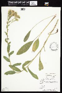
MIN:Plants | Solidago mollis Bartling 276473[1050847]Moore, John United States, South Dakota, Brookings, Detailed locality information protected. This is typically done to protect rare or threatened species localities. |
MIN:Plants | Malaxis monophyllos var. brachypoda (A. Gray) F. Morris & E.A. Eames 909824[1316208]Lee, Michael United States, Minnesota, Wadena, Detailed locality information protected. This is typically done to protect rare or threatened species localities. |
MIN:Plants | Corallorhiza odontorhiza var. odontorhiza (Willdenow) Poiret 920309[1304870]Smith, Welby United States, Minnesota, Wright, Detailed locality information protected. This is typically done to protect rare or threatened species localities. |
MIN:Plants | Lloydia serotina var. serotina (L.) Salisbury ex Reichenbach 478838[]Sills, Cynthia 0071988-07-02 United States, Alaska, Kongakut River Delta. ;Arctic National Wildlife Refuge;005N;41E;16, 69.787124 -141.89777 |
MIN:Plants | Achnatherum richardsonii (Link) Barkworth 74295[1057543]Nelson, Aven; et al. 59401899-07-17 United States, Wyoming, Park, Yellowstone National Park, Yancy's;Yellowstone National Park;;;, 44.758869 -110.411858 |
MIN:Plants | Rorippa palustris subsp. hispida (Desvaux) Jonsell 907669[1134427]Lee, Michael; et al. MDL38312004-08-24 United States, Minnesota, Todd, Along the Long Prairie River, five miles north-northeast of Browerville. W1/2 of NE1/4 of NE1/4 Sec.;;131N;33W;22, 46.143141 -94.823322 |
MIN:Plants | Asplenium septentrionale (L.) Hoffmann 51096[1307366]Cooper, William s.n.1921-06-00 United States, Colorado, Boulder, Long's Peak; Rocky Mountain National Park, 40.028299 -105.226563, 2743m |
MIN:Plants | 599113[1046831]Tryon, R. 14141935-07-17 United States, Indiana, Porter, Dunes State Park;Indiana Dunes National Lakeshore;;;, 41.6333 -87.0333 |
MIN:Plants | Persicaria lapathifolia (L.) A. Gray 897001[1086078]Smith, Welby 156661989-07-11 United States, Minnesota, Kanabec, Mille Lacs Wildlife Management Area. Kanabek [sic] County...Mille Lacs State Wildlife Management Area, about 9 miles northwest of Mora...SW1/4 SW1/4 section 16, T 40N R 25W. 040N 25W 16, 45.9511111 -93.4711111 |
MIN:Plants | Achnatherum hymenoides (Roemer & Schultes) Barkworth 561733[1057518]Watson, Pat United States, New Mexico, San Juan, Detailed locality information protected. This is typically done to protect rare or threatened species localities. |
MIN:Plants | Saxifraga paniculata Miller 124556[]Rosendahl, C. United States, Michigan, Keweenaw, Detailed locality information protected. This is typically done to protect rare or threatened species localities. |
MIN:Plants | Polystichum munitum (Kaulfuss) C. Presl 53862[1379818]Elmer, A.D.E. 28081900-08-00 United States, Washington, Clallam, Olympic Mts. [Olympic National Park], 47.803236 -123.666112 |
MIN:Plants | 492625[1025680]Smith, Welby 268751997-09-22 United States, Minnesota, Lincoln, Lincoln County ... On the north side of Highway 14, about one mile west of its junction with Highway 75 in Lake Benton (town) ... T109N R45W NW1/4 of NE1/4 of Sec 7. 109N 45W 7, 44.2663889 -96.3077778 |
MIN:Plants | Erigeron glabellus Nuttall 522574[1043427]Cooper, William s.n.1904-08-00 United States, Colorado, Larimer, Estes Park;Rocky Mountain National Park;;;, 40.377206 -105.521665, 2743m |
MIN:Plants | Deschampsia elongata (Hooker) Munro 64217[1062782]Elmer, A.D.E. 16641900-06-00 United States, Washington, Clallam, Olympic Mts. [Olympic National Park], 47.83 -123.83 |
MIN:Plants | Koeleria macrantha (Ledebour) Schultes 509315[1067571]Roitsch, C. 5392000-07-31 United States, Minnesota, Morrison, [no further data];Crane Meadows National Wildlife Refuge;;;, 45.9667 -94.3667 |
MIN:Plants | Eriogonum pauciflorum Pursh 445354[1085095]Abbott, Robinson s.n.1969-07-22 United States, South Dakota, Jackson, Jackson County ... by entrance Badlands National Monument, just N. of Cedar Pass;Badlands National Monument;;;, 43.694209 -101.628132 |
MIN:Plants | Xerophyllum tenax (Pursh) Nuttall 582018[]Morean, Edith 1521962-08-09 United States, Washington, Olympic National Park, High Divide.;Olympic National Park;;;, 47.803236 -123.666112 |
MIN:Plants | Saussurea angustifolia var. angustifolia (L.) de Candolle 399522[1050185]Spetzman, L. 3631947-07-23 United States, Alaska, Canning River ... where river leaves mountains.;Arctic National Wildlife Refuge;;;, 69.2833333 -146 |
MIN:Plants | Coeloglossum viride (L.) Hartman 904470[1304654]Lawrence, Donald United States, Alaska, Detailed locality information protected. This is typically done to protect rare or threatened species localities. |
MIN:Plants | Corydalis sempervirens (L.) Persoon 491500[]Wheeler, Gerald 169091997-07-27 United States, Minnesota, Stearns, Stearns County ... Ca. 3 mi. W of Cold Spring on Rte. 23; 0.5 mi. S on Frostview Road, NE of road ... NE1/4 SW1/4 SW1/4 SW1/4 Sec. 20 T123N R30W (Wakefield 20). 123N 30W 20, 45.4492238 -94.4760102 |
MIN:Plants | Geum rivale L. 438879[1027749]Lee, Michael MDL27852000-07-12 United States, Minnesota, Lake, North Shore / Wolf Ridge Environmental Center. Lake County ... Wolf Ridge Environmental Learning Center ... along Sawmill Creek three miles southeast of Finland ... Below the Forest Ecology building ... T57N R7W SE1/4 of NW1/4 of SE1/4 Sec.27. 057N 07W 27, 47.38758 -91.201178 |
MIN:Plants | Cystopteris fragilis (L.) Bernhardi 51808[1322115]Nelson, Aven s.n.1899-08-20 United States, Wyoming, Park, Yellowstone National Park ... Moose Falls;Yellowstone National Park;;;, 44.758869 -110.411858 |
MIN:Plants | Moneses uniflora (L.) A. Gray 461306[]Gerdes, Lynden 27631998-06-21 United States, Minnesota, Cook, Boundary Waters Canoe Area Wilderness / Superior National Forest. T64N R01E S10NWNW. Cook County; Superior National Forest, BWCAW. North to NNW facing cliff towards the SW end of the NW arm of Alder Lake.. 064N 01E 10, 48.0414813 -90.3064583 |
MIN:Plants | 920345[1047585]Smith, Welby 240031993-09-21 United States, Minnesota, Winona, Winona County ... About 3 miles west of Winona ... T107N R8W NE1/4 of NW1/4 of Sec 24;;107N;08W;24, 44.0622222 -91.7313889 |
MIN:Plants | Salix amygdaloides Andersson 477261[1089872]Smith, Welby 270961998-05-15 United States, Minnesota, Nicollet, Little Lake Wildlife Management Area. Nicollet County ... At Little Lake State Wildlife Management Area, about 2 miles northeast of Nicollet ... T 110N R 28W NW1/4 of NW1/4 of Sec 36. 110N 28W 36, 44.2972222 -94.1491667 |
MIN:Plants | Ephedra viridis Coville 372918[]Muenscher, W.; et al. 148441939-00-00 United States, California, Inyo, Along road to Dante's View, Death Valley, Inyo County;Death Valley National Park;;;, 36.48393 -117.132618, 1372m |
MIN:Plants | Carex atherodes Sprengel 912469[1007003]Smith, Welby 229071993-07-14 United States, Minnesota, Sibley, Sibley County... On the north side of Indian Lake, about 4 miles west of Gaylord... T113N R29W NW1/4 of SW1/4 of Sec 21;;113N;29W;21, 44.5791667 -94.3341667 |
MIN:Plants | Poa stenantha Trinius 626764[1071668]Eyerdam, W. 17891932-00-00 United States, Alaska, Unimak Island, False Pass;Aleutian Islands Wilderness;;;, 54.850833 -163.415 |
MIN:Plants | Ribes hirtellum Michaux 489123[1022663]Gerdes, Lynden 33891999-06-03 United States, Minnesota, Cook, T65N R04W S25SENWCook County...Superior National Forest; east of the Cross River and north of Cty 12...Adjacent to river;Superior National Forest;065N;04W;25, 48.08417 -90.78211 |
MIN:Plants | Juniperus osteosperma (Torrey) Little 457673[1004514]Weber, W. 608811951-05-27 United States, Colorado, Mesa, Mesa Co.: hogbacks at base of escarpment, Colorado National;Colorado National Monument;;;, 39.050425 -108.692061 |
MIN:Plants | Thelypteris palustris var. pubescens (Lawson) Fernald 491100[1372805]Gerdes, Lynden 42192000-08-07 United States, Minnesota, Lake, T56N R08W S26SESE Lake County ...Tettegouche State Park. Mixed wetland approximately .25 mile south of Bean Lake.;North Shore / Tettegouche State Park;056N;08W;26, 47.301055 -91.314553 |
MIN:Plants | Rosa arkansana Porter 488990[1031097]Smith, Welby 155121989-06-30 United States, Minnesota, Chisago, Chisago County...Interstate State Park, in Taylors Falls, in the St. Croix Valley...SW1/4 SE1/4 section 25, T34N R19W.;Interstate State Park;034N;19W;25, 45.40474 -92.66223 |
MIN:Plants | Symphyotrichum ontarionis var. ontarionis (Wiegand) G.L. Nesom 907668[1052895]Lee, Michael MDL38672004-09-08 United States, Minnesota, Todd, Todd County ... Along the Crow Wing River 1 1/2 miles west-northwest of Motley ... T133N R32W SE1/4 of NE1/4 Sec. 11;;133N;32W;11, 46.345647 -94.684861 |
MIN:Plants | Hackelia virginiana (L.) I.M. Johnston 912471[]Smith, Welby 229011993-07-14 United States, Minnesota, Sibley, Sibley County... On the north side of Indian Lake, about 4 miles west of Gaylord... T113N R29W NW1/4 of SW1/4 of Sec 21;;113N;29W;21, 44.5791667 -94.3341667 |
MIN:Plants | Heuchera cylindrica Douglas 122952[]Burglehaus, F. s.n.1893-07-00 United States, Wyoming, Park, Yellowstone National Park...near Mammoth Hot Springs;Yellowstone National Park;;;, 44.758869 -110.411858, 2134m |
MIN:Plants | 920844[1283234]Smith, Welby R. 221031993-05-12 United States, Minnesota, Sibley, Minnesota Valley, about 3 miles north-northwest of Henderson. T113N R26W NE1/4 of SE1/4 of Sec 22, 44.5769444 -93.9313889 |
MIN:Plants | Silene acaulis (L.) Jacquin 401531[]Gryc, G. 12861948-07-04 United States, Alaska, Arctic North Slope ... Kaolak-Avalik Rivers;;;;, 70.1666667 -159.6666667, 15m |
MIN:Plants | Arnica lessingii (Torrey & A. Gray) Greene 663790[1039657]Noble, Mark; et al. 5641974-08-05 United States, Alaska, on the shoulder of Mt. Wright;Glacier Bay National Park;;;, 58.809784 -136.05167, 780m |
MIN:Plants | Carex cephalophora Muhlenberg ex Willdenow 436825[1008610]Smith, Welby 168851990-06-18 United States, Minnesota, Waseca, Goose Lake [Was. County] Wildlife Management Area. Waseca County...Goose Lake County Park; at the southwest end of Goose Lake, about 2 miles east of Waseca... T 107N R 22W NW!/4 of SW1/4 of Sec 14. 107N 22W 14, 44.0705556 -93.4436111 |
MIN:Plants | Utricularia cornuta Michaux 478901[1318627]Dahle, R. 010232001-06-27 United States, Minnesota, Anoka, Anoka County...In Pioneer Park in Blaine...T 31N R 23W SE1/4 of SE1/4 of Sec 4;;031N;23W;04, 45.2002778 -93.2083333 |
MIN:Plants | Chrysothamnus viscidiflorus subsp. viscidiflorus (Hooker) Nuttall 353437[1041384]Eggler, W.; Eggler, D. 2041936-08-16 United States, Idaho, Butte, Craters of the Moon National Monument. Butte County;Craters of the Moon National Monument;;;, 43.17714 -113.40637, 1707m |
MIN:Plants | 454607[1019637]Myhre, K. 68701997-07-08 United States, Minnesota, Carlton, Carlton County ... Cole Lake. Located 2 miles southwest of the town of Wright. Plants occur along the northwest bays of lake. T48N R21W SE1/4 of NE1/4 of Sec 7. 048N 21W 7, 46.658395 -93.053682 |
MIN:Plants | Eragrostis pectinacea var. pectinacea (Michaux) Nees 907030[1065860]Smith, Welby 312242008-08-20 United States, Minnesota, Marshall, Thief Lake Wildlife Management Area. Marshall County ... Southwest end of Thief Lake in Thief Lake State Wildlife Management Area, about 8 miles west- northwest of Gatzke ... T158N R41W SW1/4 of SW1/4 of Sec 21. 158N 41W 21, 48.4869444 -95.9433333 |
MIN:Plants | Brasenia schreberi J.F. Gmelin 479212[]Kaul, R. 25631982-07-26 United States, Minnesota, Clearwater, Clearwater Co, Squaw Lake, northwest corner;Itasca State Park;143N;36W;, 47.197458 -95.201964 |
MIN:Plants | Antennaria howellii Greene 199266[1038868]Elmer, A.D.E. 24231900-07-00 United States, Washington, Clallam, Olympic Mts. [Olympic National Park], 47.803236 -123.666112 |
MIN:Plants | 909926[]Lee, Michael MDL43142006-08-04 United States, Minnesota, Becker, Becker County...Two Inlets moraine southwest of Little Mantrap Lake, four miles north-northeast of Two Inlets... small (~4-acre), boggy lake...T142N R36W S1/2 of SE1/4 of SE1/4 Sec. 14...UTM: 5219666N 333548E. 142N 36W 14, 47.111243 -95.194006 |
MIN:Plants | Carex gynandra Schweinitz 437931[1011263]Lee, Michael MDL29792001-06-27 United States, Minnesota, Cook, Finland State Forest / North Shore. Cook County ... Along the shore of Lake Superior 4 1/2 miles southwest of Schroeder ... 50 yards (inland) from the lake shore ...T58N R5W SW1/4 of SE1/4 of SE1/4 Sec.16. 058N 05W 16, 47.508097 -90.969873 |
MIN:Plants | Heuchera parvifolia Nuttall ex Torrey & A. Gray 215174[]Lakela, Olga 10561934-07-19 United States, Montana, Glacier, Lower St. Mary Lake...Glacier National Park.;Glacier National Park;;;, 48.63333 -113.75028 |
MIN:Plants | Agrostis mertensii Trinius 59490[1057780]Allen, O. 179a1895-08-15 United States, Washington, Pierce, Cascade Mountains...Mt. Rainier;Mount Rainier National Park;;;, 46.860917 -121.705626, 1981m |
MIN:Plants | Smilax glauca Walter 454243[]US Nat. Arboretum staff s.n.1981-00-00 United States, New Jersey, Ocean, Ocean Co.;;;;, 39.9 -74.2167 |
MIN:Plants | Carex nardina Fries 636346[1013732]Disrud, D. s.n.1969-08-16 United States, Washington, Pierce, Pierce Co.: Mt. Rainier - top of 3rd Burroughs.;Mount Rainier National Park, 3048m |
MIN:Plants | Ribes triste Pallas 912991[1023298]Smith, Welby 24299A1994-07-02 United States, Minnesota, Polk, Polk County... On Nancy Sather's farm, about 1.25 miles west of Polk-Clearwater County line... T147N R39W NE1/4 of SE1/4 of Sec 11. 147N 39W 11, 47.5633333 -95.5802778 |
MIN:Plants | Botrychium matricariifolium (D̦ll) A. Braun ex W.D.J. Koch 459809[1312579]Gerdes, Lynden 53422006-07-24 United States, Minnesota, Itasca, T54N R23W S14SESESW. Itasca County. Approx. 2.63 miles NE of Warba, and 0.23 mile S of the Feeley Unit Forest Road.;;054N;23W;14, 47.1598 -93.225765 |
Google Map
Google Maps is a web mapping service provided by Google that features a map that users can pan (by dragging the mouse) and zoom (by using the mouse wheel). Collection points are displayed as colored markers that when clicked on, displays the full information for that collection. When multiple species are queried (separated by semi-colons), different colored markers denote each individual species.
