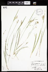
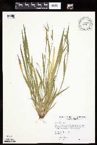
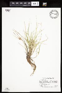
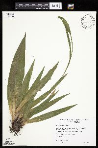
University of Minnesota
http://www.umn.edu/
612-625-5000
http://www.umn.edu/
612-625-5000
Minnesota Biodiversity Atlas
Bell Museum
Dataset: MIN-Plants
Taxa: Carex
Search Criteria: excluding cultivated/captive occurrences
Bell Museum plants | |
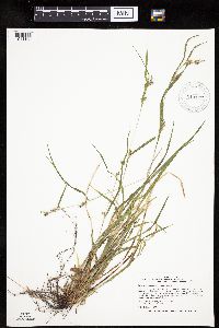
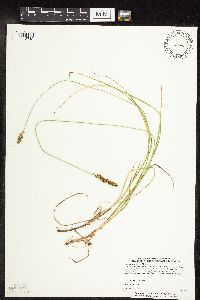
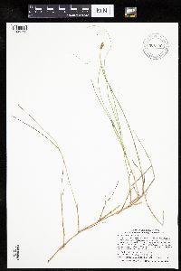
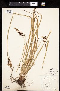
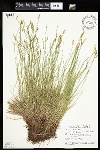
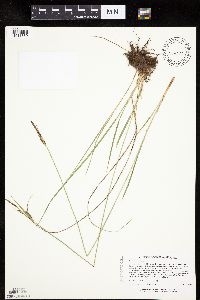
MIN:Plants | Carex michauxiana Boeckeler 489271[1013570]Lee, Michael United States, Minnesota, Lake, Detailed locality information protected. This is typically done to protect rare or threatened species localities. |
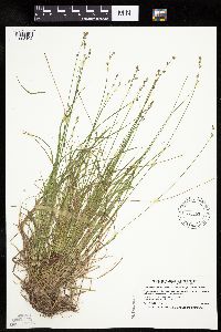
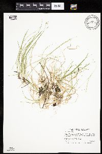
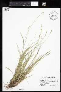
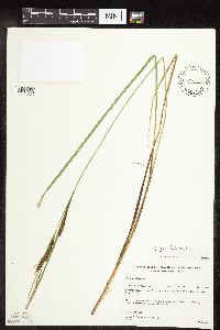
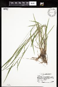
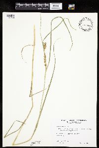
MIN:Plants | Carex grisea Wahlenberg 913177[1011198]Smith, Welby 243551994-06-14 United States, Minnesota, Yellow Medicine, Upper Sioux Agency State Park. Yellow Medicine County...Upper Sioux Agency State Park, about 7 miles southwest of Sacred Heart; in the Minnesota River Valley...T 115N R 38W SE1/4 of SE1/4 of Sec 29. 115N 38W 29, 44.735 -95.4425 |
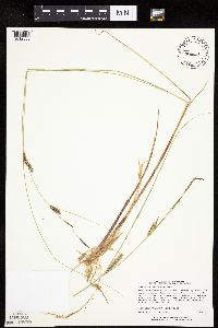
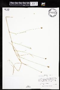
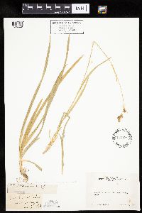
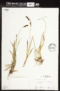
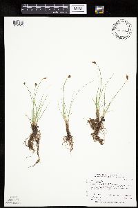
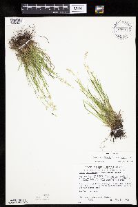
MIN:Plants | Carex brunnescens subsp. sphaerostachya (Tuckerman) Kalela 491663[1008102]Smith, Welby 167981990-06-12 United States, Minnesota, Lake, Lake County ... Tettegouche State Park, about 3 miles west of Illgen City ... T 56N R 7W SE1/4 of SE1/4 of Sec 8;North Shore / Tettegouche State Park;056N;07W;08, 47.3477778 -91.2458333 |
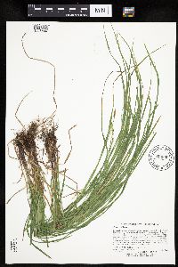
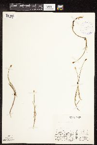
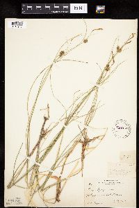
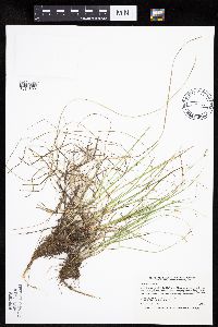
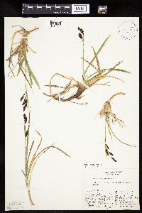
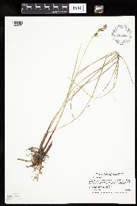
MIN:Plants | Carex lasiocarpa subsp. americana (Fernald) Hultén 456511[1012633]Lee, Michael MDL18631997-07-22 United States, Minnesota, Stearns, Stearns Co.; Birch Lakes State Forest 4 miles south-southwest of Grey Eagle; T127N R33W NW1/4 of SW1/4 of NE1/4 Sec. 36;Birch Lakes State Forest;127N;33W;36, 45.766948 -94.777658 |
MIN:Plants | Carex woodii Dewey 914890[1018544]Lee, Michael; et al. MDL42842006-06-30 United States, Minnesota, Todd, Todd County ... Seven miles northeast of Eagle Bend ... West of County Ditch #25 ... T132N R34W SE1/4 of NE1/4 of NW1/4 Sec. 23 ... UTM: 5121960N 351743E. 132N 34W 23, 46.230664 -94.926155 |
MIN:Plants | Carex deweyana Schweinitz 273333[1109608]Rosendahl, C.; Butters, F. 4798a1925-05-23 United States, Wisconsin, Polk, Near St. Croix Falls;Saint Croix National Riverway;;;, 45.426173 -92.644787 |
MIN:Plants | Carex bigelowii Torrey ex Schweinitz 400833[1007551]Spetzman, L. 1000 B1948-08-03 United States, Alaska, Arctic North Slope ... Ignek Valley;Arctic National Wildlife Refuge;;;, 69.5833359 -145.1666718, 610m |
MIN:Plants | Carex limosa L. 476786[1013076]Gerdes, Lynden; et al. 30251998-07-27 United States, Minnesota, Cook, South shore of small lake/pond; approximately 0.25 mile north of central John Lake.;Boundary Waters Canoe Area Wilderness / Superior National Forest;065N;03E;33, 48.071844 -90.06797 |
MIN:Plants | Carex deweyana var. deweyana Schweinitz 454608[1009572]Myhre, K. 54361995-05-25 United States, Minnesota, Polk, Polk County ... Located 2 miles southeast of the town of Lengby ... T 147N R 39W SW1/4 of SW1/4 of Sec 34;;147N;39W;34, 47.506991 -95.606225 |
MIN:Plants | Carex vulpinoidea Michaux 454341[1118712]Biederman, L. 281B1999-07-16 United States, Minnesota, Pipestone, Pipestone County ... in Prairie Coteau Scientific and Natural Area ... T108N R44 WSWSE32;Prairie Coteau Scientific Natural Area;108N;44W;32, 44.11701 -96.154612 |
MIN:Plants | Carex disperma Dewey 913672[1009908]Smith, Welby 243071994-07-02 United States, Minnesota, Polk, Polk County... Along the south side of the Sand Hill River, about 1.5 miles west of Fertile... T147N R44W NE1/4 of SW1/4 of Sec 19. 147N 44W 19, 47.5325 -96.3116667 |
MIN:Plants | Carex umbellata Schkuhr ex Willdenow 454072[]Lee, Michael MDL19801998-04-25 United States, Minnesota, Fillmore, Dorer Memorial Hardwood State Forest. Fillmore County ... Along the upper reaches of Diamond Creek (north branch) 2-1/2 miles northeast of Highland ... T103N R8W SE1/4 of NW1/4 Sec. 19. 103N 08W 19, 43.709884 -91.840134 |
MIN:Plants | Carex chordorrhiza Ehrhart ex L. f. 921140[1009333]Lee, Michael MDL33472003-05-28 United States, Minnesota, Todd, Todd County...southeast of Rogers Lake, 1.5 miles southwest of Lincoln...T132N R32W E1/2 of SE1/4 of SW1/4 Sec. 36;;132N;32W;36, 46.202264 -94.657896 |
MIN:Plants | Carex chordorrhiza Ehrhart ex L. f. 408745[1109407]Spetzman, L. s.n.1949-07-15 United States, Alaska, Arctic North Slope ... Anaktuvuk Pass;Gates of the Arctic National Park;;;, 68.2833333 -151.4166667, 610m |
MIN:Plants | Carex tonsa var. rugosperma (Mackenzie) Crins 897992[1017409]Scott, P. 16932004-05-22 United States, Minnesota, Lake, Lake Co. By road to August Lake ... T61N R10W sec. 21 SESE.;Superior National Forest;061N;10W;21, 47.754984 -91.608688 |
MIN:Plants | Carex membranacea Hooker 408272[]Spetzman, L. 18181949-07-10 United States, Alaska, Arctic North Slope ... Anaktuvuk Pass;Gates of the Arctic National Park;;;, 68.2833333 -151.4166667, 610m |
MIN:Plants | Carex lacustris Willdenow 915021[1012324]Lee, Michael MDL36952004-07-01 United States, Minnesota, Becker, Tamarac National Wildlife Refuge. Becker County ... Tamarac National Wildlife Refuge ... North of Flat Lake, ten miles north-northeast of Rochert ... Egg River between Lost and Little Flat Lakes ... T141N R39W SE1/4 of SE1/4 of SW1/4 Sec. 20. 141N 39W 20, 47.012903 -95.646254 |
MIN:Plants | Carex pityophila Mackenzie 527885[]Weber, W. 86991954-06-05 United States, Colorado, Mesa, Mesa Co. ... trail to Coke Ovens, Colorado National Monument;Colorado National Monument, 1829m |
MIN:Plants | Carex hoodii Boott 233258[1011536]Congdon, J. s.n.1897-06-07 United States, California, Mariposa, Big Oak Flat Road, above Yosemite, Mariposa County;Yosemite National Park |
MIN:Plants | Carex hoodii Boott 698564[1011526]Wheeler, Gerald 27341978-07-31 United States, Montana, Flathead, Flathead County. Glacier National Park. Hidden Lake Trail, near Logan Pass;Glacier National Park, 2134m |
MIN:Plants | Carex chordorrhiza Ehrhart ex L. f. 906839[1009353]Smith, Welby; et al. 310512008-07-24 United States, Minnesota, Saint Louis, Boundary Waters Canoe Area Wilderness / Superior National Forest. St. Louis County ... About 0.75 miles west of Fourtown Lake in the Boundary Waters Canoe Area Wilderness, Superior National Forest ... T65N R12W SW1/4 of SW1/4 of Sec 36. 065N 12W 36, 48.0669444 -91.8177778 |
MIN:Plants | Carex deweyana var. deweyana Schweinitz 915742[1009514]Smith, Welby 223521993-06-08 United States, Minnesota, Carver, Carver County...Carver Park Reserve; about 5 miles west of Chanhassen...T 116N R 24W SE1/4 of NE1/4 of Sec 11;Carver Park Reserve County Park;116N;24W;11, 44.8716667 -93.6644444 |
MIN:Plants | Carex brunnescens subsp. sphaerostachya (Tuckerman) Kalela 234500[1008228]Congdon, J. s.n.1898-08-06 United States, California, Mariposa, Base Cloud's Rest, Mariposa County;Yosemite National Park |
MIN:Plants | Carex oligosperma Michaux 221970[1013943]Cooper, William 1361909-07-22 United States, Michigan, Keweenaw, Tobins Harbor, Isle Royale;Isle Royale National Park |
MIN:Plants | Carex crinita var. crinita Lamarck 477434[1008990]Myhre, K. 68961997-07-14 United States, Minnesota, Lake, Superior National Forest. Lake County ... Birch Lake. Located directly northest of the town of Babbit. Plants occur along the deep bay northwest of River Point Resort.. 061N 11W 5, 47.7989 -91.758603 |
MIN:Plants | Carex sartwellii Dewey 431825[1015919]Schik, K. 96-601996-06-12 United States, Minnesota, Polk, NW1/4 of NE1/4 of section;Mentor Wildlife Management Area;149N;43W;16, 47.723313 -96.169862 |
MIN:Plants | Carex novae-angliae Schweinitz 897421[1113018]Delaney, B. United States, Minnesota, Lake, Detailed locality information protected. This is typically done to protect rare or threatened species localities. |
MIN:Plants | Carex diandra Schrank 540108[1009767]Porter, C. 73271957-07-09 United States, Wyoming, Teton, Teton County. Grand Teton National Park, on a floating island in Swan Lake north of Moran.;Grand Teton National Park, 1981m |
MIN:Plants | Carex hirtifolia Mackenzie 906483[1011458]Lee, Michael; et al. MDL37632004-07-30 United States, Minnesota, Morrison, Morrison County...Along the Mississippi River 2-1/2 miles west-northwest of Royalton...McDougall Island...T127N R29W NE1/4 of SE1/4. 127N 29W 5, 45.839824 -94.358775 |
MIN:Plants | Carex spectabilis Dewey 78068[1013262]Elmer, A.D.E. 27171900-08-00 United States, Washington, Clallam, Olympic Mts. [Olympic National Park] |
MIN:Plants | Carex stricta Lamarck 493105[1118275]Gerdes, Lynden; et al. 37441999-08-05 United States, Minnesota, Cook, Superior National Forest. T65N R01W S36SESW. Cook County...Superior National Forest, Bogenho Lake. Small, dark water, pond/lake just east of Bearskin Lake.. 065N 01W 36, 48.06963 -90.393739 |
MIN:Plants | Carex stylosa C.A. Meyer 636225[1118341]Disrud, D. 801969-08-16 United States, Washington, Pierce, Pierce Co.: Mt. Rainier - top of 3rd Burroughs.;Mount Rainier National Park |
MIN:Plants | Carex interior L.H. Bailey 437970[1011892]Smith, Welby 167931990-06-07 United States, Minnesota, Carver, Carver County ... In the Minnesota Valley, about 2 miles northwest of Shakopee ... T116N R23W NE1/4 of SW1/4 of Sec 35;;116N;23W;35, 44.8111111 -93.5575 |
MIN:Plants | Carex luzulina ablata (L.H. Bailey) F.J. Hermann 75281[1013269]Cusick, W. 29671902-08-22 United States, Oregon, Klamath, near Crater Lake [Crater Lake National Park] |
MIN:Plants | Carex hoodii Boott 233428[1011533]Congdon, J. s.n.1898-08-03 United States, California, Mariposa, Bridal Veil Trail, Mariposa County;Yosemite National Park |
MIN:Plants | Carex alopecoidea Tuckerman 906315[1006677]Lee, Michael MDL38702004-09-08 United States, Minnesota, Todd, TODD COUNTY ... Along the Crow Wing River 1 1/2 miles west-northwest of Motley ... T133N R32W N1/2 of SE1/4 of NW1/4 Sec. 11, SW1/4 of NE1/4 Sec. 11. 133N 32W 11, 46.345647 -94.684861 |
MIN:Plants | Carex maritima Gunnerus 600061[1013435]Cooper, William 1581929-07-13 United States, Alaska, Glacier Bay, Station 5;Glacier Bay National Park;;;, 58.59655 -135.84048 |
MIN:Plants | Carex blanda Dewey 461187[1007569]Biederman, L. 4152000-06-26 United States, Minnesota, Rice, Rice Co.; N-facing slope; Straight River Nature Conservancy Preserve; T109N R20 SWSE05;Straight River Preserve, The Nature Conservancy;109N;20W;5, 44.276144 -93.252461 |
MIN:Plants | Carex lenticularis limnophila (T. Holm) Cronquist 234429[1012774]Congdon, J. s.n.1895-08-13 United States, California, Mariposa, Crescent Lake;Yosemite National Park |
MIN:Plants | Carex gynandra Schweinitz 439314[1011234]Lee, Michael MDL30622001-07-18 United States, Minnesota, Lake, Superior National Forest. Lake County ... Superior National Forest ... In the Caribou River drainage 4 1/2 miles north-northeast of Cramer ... T59N R6W NE1/4 of NE1/4 Sec. 23 (at north/south Section line - Sec.24). 059N 06W 23, 47.584673 -91.054923 |
MIN:Plants | Carex tenuiflora Wahlenberg 901000[1017326]Lee, Michael MDL39712005-06-15 United States, Minnesota, Becker, White Earth Indian Reservation. Becker County...wetland complex...southeast of Big Rush Lake, one mile northwest of the village of Pine Point... T141N R37W SW1/4 of SW1/4 Sec. 29; NW1/4 of NW1/4 Sec. 32. 141N 37W 29, 46.998835 -95.39205 |
MIN:Plants | Carex macrochaeta C.A. Meyer 520218[1013282]Lawrence, Donald s.n.1952-08-19 United States, Alaska, Tlingit Point area.;Glacier Bay National Park;;;, 58.7577778 -136.18 |
MIN:Plants | Carex leptalea Wahlenberg 488357[1012834]Zager, S. 930609-91993-06-06 United States, Minnesota, Houston, Houston County...Located 0.5 miles south of Camp Winnebago...T 102 N R 05 W NE 1/4 of NE 1/4 of 1/4 [sic] of Section 18, NAD27. 102N 05W 18, 43.638092 -91.481766 |
MIN:Plants | Carex podocarpa R. Brown ex Richardson 565064[1113568]Cotter, Shirley 11871950-07-27 United States, Montana, Logan Pass ... Glacier Park;Glacier National Park, 2012m |
MIN:Plants | Carex comosa Boott 902898[1008672]Smith, Welby 296792006-07-12 United States, Minnesota, Steele, Steele County...Oak Glenn Lake...T 105N R 19W W1/4 of SW1/4 of Sec 2;;105N;19W;02, 43.9255556 -93.0816667 |
MIN:Plants | Carex livida (Wahlenberg) Willdenow 920891[1013148]Lee, Michael MDL34472003-07-10 United States, Minnesota, Todd, Burleene WMA. Todd County...Burleene Wildlife Management Area...three miles east of Rose City seven miles south-southwest of Eagle Bend...headwaters of Dismal and Eagle creeks...T130N R35W SE1/4 of SW1/4 of NW1/4 Sec. 16. 130N 35W 16, 46.087867 -95.086979 |
MIN:Plants | Carex vulpinoidea Michaux 477772[1018336]Smith, Welby 172251990-07-12 United States, Minnesota, Fillmore, Fillmore County ... On the southwest side of State Highway 63, about 6 miles northeast of LeRoy ... T 101N R 13W NW1/4 of NW1/4 of Sec 15. 101N 13W 15, 43.5558319 -92.3866653 |
MIN:Plants | 426936[1015183]Husveth, J. 96-2531996-07-09 United States, Minnesota, Hennepin, Hennepin County ... T119N R25W SW1/4 of the NE1/4 of S2;;119N;25W;02, 45.144089 -93.796362 |
MIN:Plants | Carex sychnocephala J. Carey 493183[1017110]Smith, Welby 157091989-07-12 United States, Minnesota, Mille Lacs, Mille Lacs County ... On the south side of Silver Lake, about one mile east of Princeton ... SE1/4 NE1/4 section 34, T36N R26W. 036N 26W 34, 45.5680542 -93.5527802 |
MIN:Plants | Carex novae-angliae Schweinitz 438181[1113010]Gerdes, Lynden United States, Minnesota, Lake, Detailed locality information protected. This is typically done to protect rare or threatened species localities. |
MIN:Plants | Carex peckii Howe 222037[]Rosendahl, C.; Butters, F. s.n.1920-06-19 United States, Wisconsin, Polk, south of St. Croix Falls;Saint Croix National Riverway;;;, 45.426173 -92.644787 |
MIN:Plants | Carex bigelowii Torrey ex Schweinitz 400838[1007548]Spetzman, L. 10361948-07-02 United States, Alaska, Arctic North Slope...Sadlerochit River;Arctic National Wildlife Refuge;;;, 69.5 -145, 610m |
MIN:Plants | Carex rotundata Wahlenberg 417342[1015827]Spetzman, L. 41981950-07-17 United States, Alaska, Arctic North Slope ... Noatak & Kugururok R.;Noatak National Preserve;;;, 67.9666672 -161.9166718, 152m |
MIN:Plants | Carex projecta Mackenzie 431276[1015069]Lee, Michael MDL28922000-08-03 United States, Minnesota, Lake, North Shore. Lake County...Along the East Branch Beaver River one mile west of Silver Bay...floodplain approximately 20 yards from the river...T56N R8W NE1/4 of NE1/4 of SW1/4 Sec. 35.. 056N 08W 35, 47.293083 -91.314414 |
MIN:Plants | Carex peckii Howe 472834[1014149]Lee, Michael MDL16351997-05-22 United States, Minnesota, Stearns, Stearns County..Mississippi River County Park six miles north of Sartell...on higher areas of floodplain...T126N R28W NE1/4 of SE1/4 Sec. 16. 126N 28W 16, 45.72277 -94.219249 |
MIN:Plants | Carex novae-angliae Schweinitz 438244[1013798]Carlson, Bruce United States, Minnesota, Lake, Detailed locality information protected. This is typically done to protect rare or threatened species localities. |
MIN:Plants | Carex hystericina Muhlenberg ex Willdenow 914930[1011754]Smith, Welby 225961993-06-25 United States, Minnesota, Winona, Winona County...Along Money Creek, about 2 miles west-southwest of Witoka...T 105N R 7W NW1/4 of SW1/4 of Sec 3;Dorer Memorial Hardwood State Forest;105N;07W;03, 43.9230556 -91.6588889 |
MIN:Plants | Carex scoparia var. scoparia Schkuhr ex Willdenow 454146[1016163]Gerdes, Lynden 39972000-07-04 United States, Minnesota, Lake, Superior National Forest. Lake County...Isabella, MN. Baird Station opening.Near Hwy 1 & FR 377 junction.Approx 0.3 mile N of Tony Lake ... T61N R10W S32NWNW. 061N 10W 32, 47.726203 -91.63027 |
MIN:Plants | Carex leptalea Wahlenberg 608063[1012833]Whitfeld, T.J.S. 4262003-06-20 United States, Minnesota, Douglas, Douglas County ...2 miles north of Spruce Center; 1 mile east County Hwy 3; 1/2 mile south of the Douglas/Otter Tail county line ... T130N R36W SWNW 3. 130N 36W 3, 46.099598 -95.198038 |
MIN:Plants | Carex granularis Muhlenberg ex Willdenow 487995[1010849]Gerdes, Lynden 47112003-06-26 United States, Minnesota, Lake, Superior National Forest. T61N R10W S32SENW. Lake County...Superior National Forest. Baird Station area; approximately 15.19 miles NW of Isabella, MN and 0.11 mile N of Tony Lake.. 061N 10W 32, 47.726203 -91.63027 |
MIN:Plants | Carex woodii Dewey 493762[1018539]Smith, Welby 165241990-05-14 United States, Minnesota, Steele, Rice Lake State Park. Steele County ... Rice Lake State Park, about 7 miles east of Owatonna; on the north side of Rice Lake ...T107N R19W NW1/4 of SW1/4 of Sec 12. 107N 19W 12, 44.085556 -93.0655518 |
MIN:Plants | Carex aurea Nuttall 914147[1007190]Lee, Michael MDL42492006-06-22 United States, Minnesota, Becker, White Earth Indian Reservation / White Earth State Forest. Becker County...moraine 6.5 miles north of Pine Point / Ponsford...eastern shore of Squaw (Wahbegon) Lake...T142N R37W NW1/4 of NE1/4 of SW1/4 Sec. 33...UTM: 5215784N 319625E. 142N 37W 33, 47.071639 -95.371262 |
MIN:Plants | Carex blanda Dewey 510437[1007582]Wheeler, Gerald 196491999-05-16 United States, Minnesota, Murray, Murray County ... Ca. 2.5 mi. NW of Currie; Lake Shetek State Park ... S1/2 Sec. 6 T107N R40W (Murray 6);Lake Shetek State Park;107N;40W;6, 44.10183 -95.6934 |
MIN:Plants | Carex sychnocephala J. Carey 913609[1017163]Smith, Welby 231291993-07-28 United States, Minnesota, Grant, National Waterfowl Production Area. At the northwest end of Lee Lake, about six miles east of Elbow Lake (town).;Redhead Slough Wildlife Management Area;129N;41W;08, 45.9938889 -95.8583333 |
MIN:Plants | Carex albursina E. Sheldon 510548[1006611]Wheeler, Gerald 197891999-06-02 United States, Minnesota, Blue Earth, Blue Earth County ... About 0.8 mi. S of jct. of Rte. 68 and Rte. 42; w of road ... W1/2 SE1/4 Sec. 4 T108N R28W;;108N;28W;4, 44.188659 -94.198823 |
MIN:Plants | 913926[1018121]Smith, Welby 227011993-07-02 United States, Minnesota, Becker, Becker County... Two Inlet State Forest, about 7 miles northeast of Ponsford. T141N R36W NW1/4 of SE1/4 of Sec 16;Two Inlets State Forest;141N;36W;16, 47.025 -95.2425 |
MIN:Plants | Carex atherodes Sprengel 914351[1007001]Smith, Welby 225271993-06-22 United States, Minnesota, Stevens, National waterfowl production area, about 4.5 miles south-southwest of Donnelly. SE1/4 of SW1/4 of section;Pepperton Wildlife Management Area;125N;43W;15, 45.636277 -96.05714 |
MIN:Plants | Carex umbellata Schkuhr ex Willdenow 454135[]Lee, Michael MDL27242000-06-12 United States, Minnesota, Lake, North Shore. Lake County ... Rugged terrain along the Superior Hiking Trail 4 1/2 miles east of Finland ... T57N R7W N1/2 of SE1/4 of NE1/4 Sec. 13. 057N 07W 13, 47.422384 -91.161398 |
MIN:Plants | Carex retrorsa Schweinitz 905617[1015377]Vanderbosch, Dana 122005-08-09 United States, Minnesota, Ramsey, Phalen Lake - NW-N; E1/2 of the SW1/4 of Sec 16 and the NE1/4 of the NW1/4 of Sec 21 T29N R22W Ramsey County ... northwest side of Phalen Lake just south of the public access point.. 029N 22W 16, 44.999195 -93.055937 |
MIN:Plants | Carex foenea Willdenow 496114[1109922]Gerdes, Lynden; et al. 35341999-06-28 United States, Minnesota, Cook, Boundary Waters Canoe Area Wilderness / Superior National Forest. T65N R01W S21NENW. Cook County...Superior National Forest, BWCAW. Smaller cliff feature adjacent to the Rose Lake narrows.. 065N 01W 21, 48.099917 -90.464435 |
MIN:Plants | Carex cephalophora Muhlenberg ex Willdenow 477681[1008618]Smith, Welby 153951989-06-14 United States, Minnesota, Chisago, Saint Croix National Riverway. Chisago County ... In the St. Croix Valley, about 5 miles south-southwest of Taylors Falls ... NW1/4 NW1/4 section 22, T 33N R 19W. 033N 19W 22, 45.3283348 -92.7125015 |
MIN:Plants | Carex vernacula L.H. Bailey 233425[1018094]Congdon, J. s.n.1899-08-22 United States, California, Madera, Summit Rush Creek Divide, East of Minarets |
MIN:Plants | Carex prairea Dewey 454104[1014934]Lee, Michael MDL20261998-05-13 United States, Minnesota, Stearns, Stearns Co.; Large wetland complex along Kolling Creek and Roschien Lake two miles west of Richmond; T123N R31W NE1/4 of NE1/4 Sec. 21, NW1/4 of NW1/4 sec. 22. 123N 31W , 45.455613 -94.572732 |
MIN:Plants | Carex prairea Dewey 485021[1014955]Carlson, Bruce 002441997-08-16 United States, Minnesota, Mille Lacs, Mille Lacs Kathio State Park. Mille Lacs County ... Mille Lacs Kathio State Park 1.5 miles due north of the interpretive center ... west side of Ogechi Lake ... DNR Releve 7225. T42N R27W SWNE05. 042N 27W 5, 46.149496 -93.777113 |
MIN:Plants | Carex aquatilis Wahlenberg 917020[1006771]Gerdes, Lynden; et al. 55792008-06-28 United States, Minnesota, Saint Louis, Boundary Waters Canoe Area Wilderness / Superior National Forest. T65N R12W S34SENESW. St. Louis County, MN. Superior National Forest. Boundary Waters Canoe Area Wilderness. Moose River; approximately 17.2 miles NW of Ely, MN and 1.35 miles NW of Big Moose Lake.. 065N 14W 34, 48.0683333 -92.1177778 |
MIN:Plants | 548467[1008490]Spetzman, L. 38621951-07-15 United States, Alaska, Arctic North Slope ... Canning R. & Ignek Cr.;Arctic National Wildlife Refuge;;;, 69.5833359 -145.25, 305m |
MIN:Plants | Carex pellita Willdenow 431828[1014397]Schik, K. 96-991995-08-25 United States, Minnesota, Wilkin, Wilkin County ... T134N R45W NE1/4 of the SE1/4 of S8 ... Anna Gronseth Nature Conservancy Preserve.;Anna Gronseth Prairie, The Nature Conservancy;134N;45W;08, 46.4348332 -96.375181 |
MIN:Plants | Carex pellita Willdenow 447744[1118815]Bright, R. 73-3171973-00-00 United States, Idaho, Bear Lake, [no further data] |
MIN:Plants | Carex mertensii J.D. Prescott ex Bongard 663714[1013567]Noble, Mark; et al. 5481974-08-05 United States, Alaska, on the shoulder of Mt. Wright;Glacier Bay National Park;;;, 58.809784 -136.05167, 780m |
MIN:Plants | Carex bromoides subsp. bromoides Schkuhr ex Willdenow 494860[1008055]Smith, Welby 151761989-05-30 United States, Minnesota, Kanabec, Mille Lacs Wildlife Management Area. Kanabek County...Mille Lacs state Wildlife Management Area, about 9 miles northwest of Mora...SW1/4 SW1/4 section 16, T 40N R 25W. 040N 25W 16, 45.9511108 -93.4711075 |
MIN:Plants | Carex aquatilis Wahlenberg 75429[1006853]Burglehaus, F. s.n.1894-09-05 United States, Wyoming, Park, Yellowstone National Park ... Near Mammoth Hot Springs;Yellowstone National Park, 2256m |
MIN:Plants | Carex hitchcockiana Dewey 913497[1011510]Smith, Welby 228881993-07-14 United States, Minnesota, Sibley, Vale Wildlife Management Area. Sibley County...Vale State Wildlife Management Area, ca 2.5 miles N-NW of Henderson; in the valley of High Island Creek, ca 2.5 miles SW of its confluence with the Minn R...T 113N R 26W NE1/4 of SW1/4 of Sec 27. 113N 26W 27, 44.5625 -93.9427778 |
MIN:Plants | Carex duriuscula C.A. Meyer 477380[1009973]Whitfeld, T.J.S.; Harris, Fred 1742001-05-14 United States, Minnesota, Kandiyohi, Kandiyohi County ... Sibley State Park. At the top of Little Mount Tom ... T 121N R 35W SW1/4 of SE1/4 of SE1/4 sec 35;Sibley State Park;121N;35W;35, 45.326076 -95.032792 |
MIN:Plants | Carex podocarpa R. Brown ex Richardson 401704[1014846]Spetzman, L. 6651948-07-10 United States, Alaska, Arctic North Slope ... Lake Schrader;Arctic National Wildlife Refuge;;;, 69.4166667 -145, 1219m |
MIN:Plants | Carex magellanica Lamarck 472827[1013317]Lee, Michael MDL14861996-08-15 United States, Minnesota, Saint Louis, St. Louis Co.; Fon [sic] du Lac State Forest 7 miles northeast of Cromwell; T49N R19W SE1/4 SE1/4 Sec. 6;Fond du Lac State Forest;049N;19W;6, 46.758835 -92.797514 |
MIN:Plants | Carex canescens subsp. disjuncta (Fernald) Toivonen 515069[1008451]Lee, Michael MDL37032004-07-02 United States, Minnesota, Becker, On a large island on the west side of Big Rush Lake, three miles northwest of the town of Pine Point. SW1/4 of SE1/4 of secton;White Earth Indian Reservation;141N;38W;24, 47.01374 -95.434589 |
MIN:Plants | Carex pensylvanica Lamarck 524672[]Benner, F.; Benner, J. 2631928-05-19 United States, Wisconsin, Polk, 4 mi N. St. Croix Falls on River Road;Saint Croix National Riverway;;;, 45.463011 -92.664013 |
MIN:Plants | Carex peckii Howe 912795[1014206]Smith, Welby 241711994-05-30 United States, Minnesota, Itasca, Itasca County...At Bowstring Lodge; on the north side of Bowstring Lake...T 147N R 25W SW1/4 of SW1/4 of Sec 6;Chippewa National Forest;147N;25W;06, 47.5716667 -93.9030556 |
MIN:Plants | Carex podocarpa R. Brown ex Richardson 401705[1014855]Spetzman, L. 6411948-07-14 United States, Alaska, Arctic North Slope ... Lake Peters;Arctic National Wildlife Refuge;;;, 69.3333333 -145, 914m |
MIN:Plants | Carex stricta Lamarck 510922[1016995]Carlson, Bruce 000981997-06-29 United States, Minnesota, Mille Lacs, Mille Lacs County ... Mille Lacs WMA. 0.25 miles east of Olson Field ... T041N R25W NENE18;Mille Lacs Wildlife Management Area;041N;25W;18, 46.032433 -93.547614 |
MIN:Plants | Carex nelsonii Mackenzie 588185[1013738]Willard, B. 60151960-07-19 United States, Colorado, Larimer, Rocky Mountain National Park ... Larimer Co.: Trail Ridge ... S. Flank of Sundance Mtn.;Rocky Mountain National Park, 3799m |
MIN:Plants | Carex scopulorum scopulorum T. Holm 233590[1016216]Congdon, J. s.n.1898-08-07 United States, California, Mariposa, Cathedral Trail, Mariposa County;Yosemite National Park |
MIN:Plants | Carex grisea Wahlenberg 426927[1110116]Moe, Stephen 96-0481996-07-10 United States, Minnesota, Le Sueur, Chamberlain Woods Scientific Natural Area. Le Sueur County ... T111N R26W SW1/4 of the SW1/4 of S22 ... At the edge of the Minnesota River at Chamberlain Woods Scientific and Natural Area.. 111N 26W 22, 44.406012 -93.939414 |
MIN:Plants | Carex haydenii Dewey 456512[1011369]Lee, Michael MDL18101997-07-09 United States, Minnesota, Stearns, Stearns Co.; on the south side of St. Cloud; T124N R28W SE1/4 of NW1/4 Sec. 34;;124N;28W;34, 45.507866 -94.188422 |
MIN:Plants | Carex laeviconica Dewey 511489[1012494]Wheeler, Gerald 188631998-06-05 United States, Minnesota, Scott, Scott County ... Ca. 1.5 mi. N of Jordan on Rte. 9, E of road ... Minnesota River ... N1/2 SW1/4 SW1/4 Sec. 7 T114N R23W;Minnesota Valley National Wildlife Refuge;114N;23W;7, 44.694137 -93.630874 |
MIN:Plants | 698107[1008483]Wheeler, Gerald; Glaser, Paul 29071978-05-31 United States, Minnesota, Beltrami, Beltrami County ... NW1/4 SE1/4 Sec. 36 T156N R31W; approx. 9 miles north of the Waskish Airport on Route 72, a little over 0.25 mile west of the road ... near the trail leading to Ludlow Lake. Ludlow Lookout Tower Area.. 156N 31W 36, 48.287244 -94.564235 |
MIN:Plants | Carex buxbaumii Wahlenberg 492694[1008247]Smith, Welby 167941990-06-07 United States, Minnesota, Carver, Carver County ... At the base of a south-facing bluff in the Minnesota Valley, about 2 miles northwest of Shakopee ... T 116N R 23W NE1/4 of SW1/4 of Sec 35. 116N 23W 35, 44.8111115 -93.5575027 |
MIN:Plants | Carex rostrata Stokes 221929[1015824]Cooper, William 981909-07-14 United States, Michigan, Keweenaw, Raspberry Id, Isle Royale;Isle Royale National Park |
MIN:Plants | Carex filifolia var. filifolia Nuttall 531202[]Porter, C. 68741956-05-13 United States, Wyoming, Platte, Platte County. Bluffs along the Laramie River 5 miles north of Wheatland., 1433m |
MIN:Plants | Carex michauxiana Boeckeler 477455[1013569]Anderson, Chel United States, Minnesota, Lake, Detailed locality information protected. This is typically done to protect rare or threatened species localities. |
Google Map
Google Maps is a web mapping service provided by Google that features a map that users can pan (by dragging the mouse) and zoom (by using the mouse wheel). Collection points are displayed as colored markers that when clicked on, displays the full information for that collection. When multiple species are queried (separated by semi-colons), different colored markers denote each individual species.
