University of Minnesota
http://www.umn.edu/
612-625-5000
http://www.umn.edu/
612-625-5000
Minnesota Biodiversity Atlas
Bell Museum
Dataset: MIN-Plants
Taxa: Fabaceae
Search Criteria: excluding cultivated/captive occurrences
Bell Museum plants | |
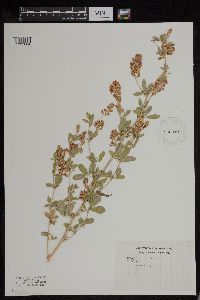
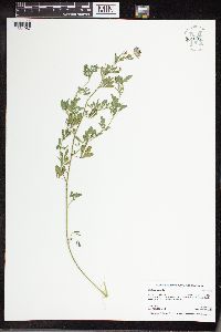
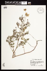
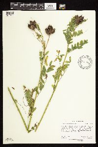
MIN:Plants | 939393[1290848]Kranz, Andy 10132015-06-21 United States, Minnesota, Watonwan |
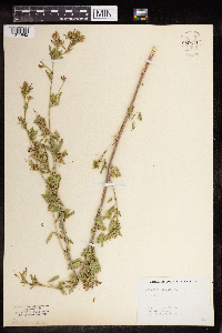
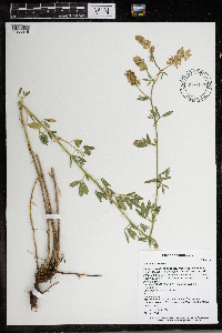
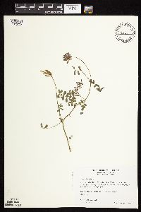
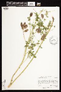
MIN:Plants | 955046[1295667]Anonymous s.n.1896-06-30 United States, Minnesota, Ramsey |
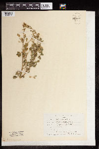
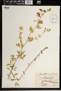
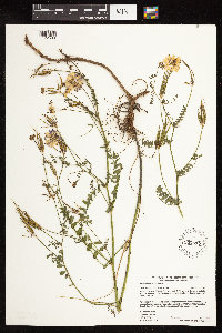
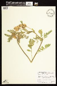
MIN:Plants | 955047[1295666]Stork, H. E. s.n.1925-00-00 United States, Minnesota, Itasca, Bowstring [Chippewa National Forest], 47.537188 -93.905046 |
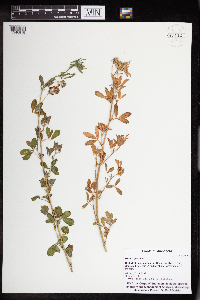
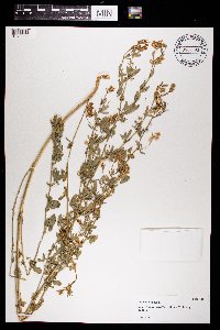
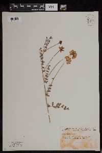
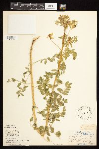
MIN:Plants | 955048[1295665]Flygare, Lenore s.n.1923-07-01 United States, Minnesota, Martin, Sherburne, 43.65 -94.7167 |
MIN:Plants | 955049[1295664]Stork, H. E. s.n.1925-06-07 United States, Minnesota, Itasca, Bowstring [Chippewa National Forest], 47.537188 -93.905046 |
MIN:Plants | 959571[1311842]Barbara Riebs 1948-06-24 United States, Wisconsin, Kenosha, Silver Lake |
MIN:Plants | 959572[1311843] 1892-07-00 United States, Nebraska |
MIN:Plants | 963112[1346819]Whitfeld, T.J.S. 22392019-06-22 United States, Minnesota, Cass, Us Army Corps of Engineers Winnibigoshish Recreation Area, triangle, 47.423309 -94.054475 |
MIN:Plants | 961007[1334087]Boyd, Crystal CLB2016192016-08-21 United States, Minnesota, Grant, Helsene WMA. 7 miles NE of Herman. 2.5 miles east on Co. Rd. 27. 3 miles north on Co. Rd. 9. 1 mile east on 170th St. T128N R43W Sec. 28, 45.87585 -96.08249 |
MIN:Plants | 966152[1356915]T. J. S. Whitfeld 26062020-06-22 United States, Minnesota, Washington, Lost Valley Prairie Scientific and Natural Area, 2 miles east north east of intersection of State Highway 95 and 110th Street, at dead-end of Nyberg Avenue South., 44.798895 -92.820892, 269m |
MIN:Plants | [] 1933-07-03 United States, New York, Route 20, Albany |
MIN:Plants | 967640[1368208]Drew, L.A. s.n.1971-07-27 United States, Minnesota, Clearwater, Iron Springs Bog; T144N R36W sec. 28 SW 1/4, 47.257241 -95.249493 |
MIN:Plants | 969593[1372083] s.n.1933-07-03 United States, New York, Route 20, Albany Roadside |
MIN:Plants | 971324[1394805]Janssens, J. 75/1821975-07-21 Belgium, Antwerpen, Kiel, 15m |
MIN:Plants | 972047[1395782]Janssens, J. 2201974-06-22 Belgium, Kiel |
MIN:Plants | []Sulkers, R. GW13452002-07-29 United States, Colorado, Delta, Private property, along Rotcap Creek, Pitkin Mesa, 38.870528 -107.638472, 1808m |
MIN:Plants | [1397753]Messerschmidt, W. s.n.1979-07-18 United States, North Dakota, Morton, 1.12 km east of county highway 85, near Rte.139 |
MIN:Plants | Psoralidium tenuiflorum (Pursh) Rydberg 142394[1078814]Butters, F.; et al. United States, Minnesota, Fillmore, Detailed locality information protected. This is typically done to protect rare or threatened species localities. |
MIN:Plants | Psoralidium tenuiflorum (Pursh) Rydberg 142395[1078815]MacMillan, C. United States, Minnesota, Renville, Detailed locality information protected. This is typically done to protect rare or threatened species localities. |
MIN:Plants | Psoralidium tenuiflorum (Pursh) Rydberg 429393[1078813]Lee, Michael United States, Minnesota, Fillmore, Detailed locality information protected. This is typically done to protect rare or threatened species localities. |
MIN:Plants | Psoralidium tenuiflorum (Pursh) Rydberg 459160[1078812]Lee, Michael United States, Minnesota, Fillmore, Detailed locality information protected. This is typically done to protect rare or threatened species localities. |
MIN:Plants | Psoralidium tenuiflorum (Pursh) Rydberg 971090[1394559]Smith, Welby R United States, Minnesota, Houston, Detailed locality information protected. This is typically done to protect rare or threatened species localities. |
MIN:Plants | Oxytropis viscida Nuttall 439012[1078570]Smith, Welby United States, Minnesota, Cook, Detailed locality information protected. This is typically done to protect rare or threatened species localities. |
MIN:Plants | Oxytropis viscida Nuttall 371233[1078572]Burns, G.; Hendrickson, M. United States, Minnesota, Cook, Detailed locality information protected. This is typically done to protect rare or threatened species localities. |
MIN:Plants | Oxytropis viscida Nuttall 770065[1078571]Smith, Welby United States, Minnesota, Cook, Detailed locality information protected. This is typically done to protect rare or threatened species localities. |
MIN:Plants | Oxytropis viscida Nuttall 538814[]Butters, F.; et al. United States, Minnesota, Cook, Detailed locality information protected. This is typically done to protect rare or threatened species localities. |
MIN:Plants | Oxytropis viscida Nuttall []Weiblen, G. D. United States, Colorado, Gunnison, Detailed locality information protected. This is typically done to protect rare or threatened species localities. |
MIN:Plants | 454925[1075733]Smith, Welby 205611992-06-25 United States, Minnesota, Redwood, Cedar Rock Wildlife Management Area. Redwood County ... Cedar Rock State Wildlife Management Area, about 4 miles north-northwest of Redwood Falls ... T113N R36W NW1/4 of NW1/4 of Sec 11. 113N 36W 11, 44.6122222 -95.1563889 |
MIN:Plants | 919338[1075740]Cholewa, A. 27532010-06-24 United States, Minnesota, Pine, Marshland Visitor Center on the St. Croix River at state highway 70, about 200 yards upstream of highway bridge.;Chengwatana State Forest;038N;20W;13, 45.7736111 -92.7819444 |
MIN:Plants | 124758[1075743]Smith, Welby 229411993-07-15 United States, Minnesota, Fillmore, Fillmore County...Along the Root River Trail, about 2 miles west of Lanesboro...T 103N R 10W SE1/4 of SW1/4 of Sec 15;;103N;10W;15, 43.7202778 -92.0197222 |
MIN:Plants | 432701[1075737]Shackleford, Ian 5282001-07-12 United States, Minnesota, Cass, Cass County...Minnesota Highway 200, about 1 mile west of the Boy River.;Chippewa National Forest / Leech Lake Indian Reservation;141N;27W;08, 47.0441655 -94.1267682 |
MIN:Plants | 919358[1075741]Cholewa, A. 27732010-07-22 United States, Minnesota, Anoka, City of Coon Rapids, Al Flynn Park, Avocet and Coon Rapids Blvd, foot/bike path along Coon Creek between footbridge and railroad tressel.;;031N;24W;24, 45.1530556 -93.2969444 |
MIN:Plants | 911771[1075744]Chayka, K. KC-09062009-08-14 United States, Minnesota, Ramsey, Battle Creek County Park. Ramsey County...Battle Creek West Regional Park, St. Paul; along the paved trail through Battle Creek West north of Lower Afton Rd. 028N 22W 3, 44.938 -93.0236667 |
MIN:Plants | 428573[1075731]Bolling, G. 71997-06-22 United States, Minnesota, Hennepin, Hennipin [sic] Co.; found on southeast corner of Excelsior Blvd. and highway 101 near pond.;;117N;22W;, 44.909623 -93.500771 |
MIN:Plants | 440177[1075738]Myhre, K. 40611993-07-07 United States, Minnesota, Pine, Pine Co. Located 2.5 mi E of the town of Duxbury. Plants occur in a gravel pit; T42N R17W NE1/4 of NE1/4 of Sec 14;Saint Croix State Forest;042N;17W;14, 46.1204454 -92.4566271 |
MIN:Plants | 458541[1075730]Swanson, Gary s.n.1997-06-26 United States, Minnesota, Sherburne, Sherburne National Wildlife Refuge; NESE 28-35-27 [twp & rg];Sherburne National Wildlife Refuge;035N;27W;28, 45.4942102 -93.7056139 |
MIN:Plants | 519146[1075746]Schimpf, D. 951982-07-28 United States, Minnesota, Saint Louis, St. Louis Co. T50N, R14W, SE1/4 S15; near the Skyline Parkway N of Chester Creek;;050N;14W;15, 46.8148306 -92.1003332 |
MIN:Plants | 671257[1075745]Morley, T. 12971976-07-08 United States, Minnesota, Norman, Flom Twp, T143N, R43W, roadside ditch at crest of hill, right side og co rd 36 facing N; W edge of S17;;143N;43W;17, 47.2020645 -96.1625443 |
MIN:Plants | 685070[1075750]Stassen, Carol 1301977-06-20 United States, Minnesota, Lyon, Camden State Park; T110N, 42W, S5, along park entrance roadside;Camden State Park;110N;42W;5, 44.3631806 -95.9274434 |
MIN:Plants | 687375[1075749]Wheeler, Gerald; Glaser, Paul 18121977-06-28 United States, Minnesota, Itasca, Coll. site no. 73. NE1/4 SW1/4 S22, T54N, R25W; ca 6 mi SSE of Grand Rapids;;054N;25W;22, 47.1452633 -93.5021806 |
MIN:Plants | 807631[1075748]Dorio, J. 2811977-06-20 United States, Minnesota, Morrison, Lake Alexander;;N;;, 46.206485 -94.543705 |
MIN:Plants | 833078[1075735]Myhre, K. 24431992-06-29 United States, Minnesota, Cass, Cass Co. Located 1/2 mi NW of Schafer Point in Gull Lake; T135N R29W NW1/4 of SW1/4 of Sec.17;;135N;29W;17, 46.5071193 -94.3617497 |
MIN:Plants | 833090[1075736]Myhre, K. 29651992-08-06 United States, Minnesota, Cass, Cass Co. Located at the boat landing at Birches Campground on Lake Winnibigoshish; T146N R27W SW1/4 of SW1/4 of Sec.29;Chippewa National Forest / Leech Lake Indian Reservation;146N;27W;29, 47.4344648 -94.1310452 |
MIN:Plants | 833888[1075747]Smith, Welby 142261988-06-10 United States, Minnesota, Washington, Washington Co. About 4 mi NE of Scandia, in the St. Croix River Valley;;032N;19W;6, 45.2899444 -92.7661109 |
MIN:Plants | 838304[1075734]Smith, Welby 177101990-08-03 United States, Minnesota, Waseca, Waseca Co. On the right-of-way of the Chicago & Northwestern Railroad, about 2 mi W of Waseca; T107N R23W SW1/4 of NE1/4 Waseca Co. On the right-of-way of the Chicago & Northwestern Railroad, about 2 mi W of Waseca; T107N R23W SW1/4 of NE1/4 of Sec 11. 107N 23W 11, 44.0875435 -93.5570583 |
MIN:Plants | 585750[1075752]Moore, John; Johnson, Albert 261581962-09-21 United States, Minnesota, Winona, 1 mi W of Winona;;;;, 44.047247 -91.741864 |
MIN:Plants | 697801[1075739]Ownbey, Gerald 54241976-08-29 United States, Minnesota, Washington, Near boat dock, St. Croix River. NW1/4 of section;Afton State Park;027N;20W;02, 44.8547629 -92.7750459 |
MIN:Plants | 781190[1075751]Smith, Welby 99821984-10-02 United States, Minnesota, Ramsey, In Shoreview; S of Gramsie Road, W of TH 49 and N of I 694. SE1/4 SE1/4 of section;Snail Lake Vadnais Lake County Park;030N;23W;25, 45.0575023 -93.1164411 |
MIN:Plants | 912377[1075742]Smith, Welby 229161993-07-14 United States, Minnesota, Sibley, Sibley County ... Between TH 19 and the adjacent railroad tracks, about 4 miles west of Gaylord ... T112N R29W NE1/4 of NE1/4 of Sec 4. 112N 29W 4, 44.5427778 -94.3116667 |
MIN:Plants | 509739[1075732]Wheeler, Gerald 175961997-09-02 United States, Minnesota, Redwood, Redwood County ... Ca. 3 mi. NE of Delhi, Cedar Rock State WMA ... NW1/4 NW1/4 NW1/4 Sec. 11 T113N R36W (Delhi 11);Cedar Rock Wildlife Management Area;113N;36W;11, 44.6053218 -95.1498365 |
MIN:Plants | 937677[1122638]Gerdes, Lynden B. 66372012-07-24 United States, Minnesota, Lake, Approximately 5.70 miles northwest of Isabella, MN. Old location of the Environmental Learning Center in vicinity of staff trailer locations.;Superior National Forest;060N;09W;27, 47.656111 -91.460278 |
MIN:Plants | 954209[1295825]Friesner, Ray C. 9708 United States, Indiana, Marion |
MIN:Plants | 960992[1334072]Boyd, Crystal CLB2016052016-06-08 United States, Minnesota, Renville, Morton Outcrops SNA. In city limits of Morton, MN. Northeast of intersection of U.S. Highway 75 and State Highway 19. East of BP gas station. Crystalline bedrock outcrop prairie, Minnesota River subtype. T113N R34W SW1/4 of SW1/4 of Sec. 31, 44.5505 -94.99022 |
MIN:Plants | 961018[1334098]Boyd, Crystal CLB2016112016-07-19 United States, Minnesota, Meeker, Private Property. 1.5 miles west of Cosmos. 16 miles of Hutchinson. 2 miles south of Cosmos County Park. Along west side of Township Road 280. T117N R32W SE1/4 of SE1/4 of Sec. 29, 44.91126 -94.71843 |
MIN:Plants | 966147[1356910]T. J. S. Whitfeld 26202020-06-22 United States, Minnesota, Washington, Lost Valley Prairie Scientific and Natural Area, 2 miles east north east of intersection of State Highway 95 and 110th Street, at dead-end of Nyberg Avenue South., 44.800545 -92.822574, 275m |
MIN:Plants | 963565[1352180]Graham, Dustin R. DRJG1412018-06-21 United States, Minnesota, Otter Tail, 3.5 miles south by southwest of Lyman, MN., 46.3 -95.28, 1425m |
MIN:Plants | 973693[1397248]Bezanson, Char A. 1901991-07-17 United States, Minnesota, Rice, Railroad right-of-way on the southwestern edge of Faribault., 44.276402 -93.295392 |
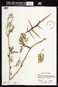
MIN:Plants | Prosopis glandulosa Torrey 510098[]US Nat. Arboretum staff 83-791983-00-00 United States, Texas, Bexar, Bexar Co. |
MIN:Plants | Astragalus congdonii S. Watson 235880[1075055]Congdon, J. s.n.1888-05-21 United States, California, Mariposa, Hite's Cove Trail, Mariposa County...Type locality;Yosemite National Park |
MIN:Plants | Astragalus congdonii S. Watson 236301[1075054]Congdon, J. s.n.1892-05-08 United States, California, Mariposa, Hite's Cove, Mariposa County...Type locality;Yosemite National Park |
MIN:Plants | Astragalus congdonii S. Watson 236197[1075056]Congdon, J. s.n.1883-03-00 United States, California, Mariposa, Hite's Cove, Mariposa County...Type locality;Yosemite National Park |
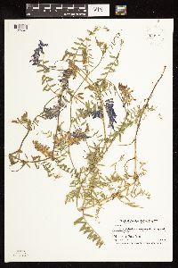
MIN:Plants | Vicia villosa Roth 293454[1079902]Nielsen, E. 28561934-08-30 United States, Minnesota, Ramsey, Snail Lake;Snail Lake Vadnais Lake County Park;030N;23W;, 45.073448 -93.125467 |
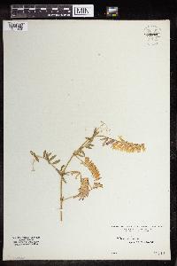
MIN:Plants | Vicia villosa Roth 929733[1122841]Smith, Welby 161431989-08-23 United States, Minnesota, Nobles, About 4 miles northwest of Worthington. NW1/4 of NW1/4 of section;Herlein-Boote Wildlife Management Area;102N;40W;07, 43.6588889 -95.6919444 |
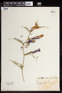
MIN:Plants | Vicia villosa Roth 930084[1122842]Smith, Welby 160551989-08-03 United States, Minnesota, Mille Lacs, About 4.5 miles west of Princeton. SW1/4 of SE1/4 of section;Kunkel Wildlife Management Area;036N;27W;26, 45.5763889 -93.6655556 |
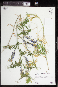
MIN:Plants | Vicia villosa Roth 930213[1122840]Scott, P. 33022010-07-12 United States, Minnesota, Cook, Hungry Jack Lake. NENW of section;Superior National Forest;064N;01W;03, 48.055437 -90.3068467 |
MIN:Plants | Vicia villosa Roth 933521[1122843]Smith, Welby R. 205081992-06-20 United States, Minnesota, Wadena, About 4 miles east of Nimrod SE of SE of section;;137N;33W;36, 46.6313889 -94.7847222 |
MIN:Plants | Vicia villosa Roth 959670[1311969] 1919-06-00 United States, Iowa, Grinnell; 1310 Elm St., 41.743049 -92.722412 |
MIN:Plants | Vicia villosa Roth 959672[1311971]Ray C. Friesner 96491936-06-07 United States, Indiana, Kessler Blvd. and Rd. 29 |
MIN:Plants | Vicia villosa Roth 963595[1352210]Graham, Dustin R. DRJG762017-06-06 United States, Minnesota, Yellow Medicine, Plants located on bluffs along the Yellow Medicine River, 1.4 km S of the Minnesota River., 44.73 -95.44, 906m |
MIN:Plants | 897071[1076713]Smith, Welby 292992002-06-11 United States, Minnesota, Ramsey, Ramsey County...Mounds Park in St. Paul...T 28N R 22W SW1/4 of NE1/4 of Sec 4;Indian Mounds County Park;028N;22W;04, 44.9455556 -93.0547222 |
MIN:Plants | 510691[]US Nat. Arboretum staff 461978-00-00 United States, Maryland, Frederick, [no further data] |
MIN:Plants | 137728[1076710]Lyon, H.; Wheeler, William 413W1899-07-25 United States, Minnesota, Houston, Jefferson. [from notes in field book: On island across Bluff Slough from Reinhart's];Dorer Memorial Hardwood State Forest;101N;04W;, 43.56242 -91.278997 |
MIN:Plants | 432843[1076705]Harris, Fred 941281994-07-13 United States, Minnesota, Olmsted, Olmsted Co.; on N side of Root river valley; NW1/4 of NE1/4 of NE1/4 Sect. 18 T105N R12W;Dorer Memorial Hardwood State Forest;105N;12W;18, 43.8985479 -92.3084474 |
MIN:Plants | 475838[1076711]Wheeler, Gerald 155991997-05-21 United States, Minnesota, Redwood, Redwood Co.; Ca. 2 mi. NW of North Redwood; SE1/4 NW1/4 SW1/4 Sec. 13 T113N R36W (Delhi 13);;113N;36W;13, 44.5909838 -95.1274523 |
MIN:Plants | 508536[1076706]Lee, Michael MDL8831995-05-31 United States, Minnesota, Wabasha, Wabasha Co.; E-facing slope along West Indian creek 5 mi NNE of Plainview; T109N R11W NWSENW 21;Dorer Memorial Hardwood State Forest;109N;11W;21, 44.2293933 -92.1396898 |
MIN:Plants | 766711[1076712]Haig, Vincent s.n.2000-09-01 United States, Minnesota, Blue Earth, Mankato;;N;;, 44.17072 -93.992534 |
MIN:Plants | 829779[1076707]Kern, Carole 20491993-06-21 United States, Minnesota, Houston, Houston Co. MCBS #9. T-104-N R-07-W Sec.2 SW4 NE4 SE4.;Dorer Memorial Hardwood State Forest;104N;07W;2, 43.8394797 -91.640712 |
MIN:Plants | 906119[1076714]Bolton, N. 42008-09-02 United States, Minnesota, Ramsey, Saint Anthony Park [neighborhood], Saint Paul...College Park, approx. 0.25 miles west of U of MN, Saint Paul campus.;;029N;23W;20, 44.9844905 -93.1974935 |
MIN:Plants | 897003[1076708]Smith, Welby 292982002-06-11 United States, Minnesota, Ramsey, Ramsey County...Mounds Park in St. Paul...T 28N R 22W SW1/4 of NE1/4 of Sec 4;Indian Mounds County Park;028N;22W;04, 44.9455556 -93.0547222 |
MIN:Plants | 574829[1076709]Moore, John 23614A1959-06-16 United States, Minnesota, Pipestone, 1 1/2 mi N of Pipestone;<No data>;;;, 44.022993 -96.311183 |
MIN:Plants | 959519[1311863] 1859-00-00 |
MIN:Plants | 959520[1311864] 1890-00-00 |
MIN:Plants | 959521[1311865]Wible, Paul G. 1928-08-13 United States, Indiana |
MIN:Plants | Astragalus tenellus Pursh 138065[1075541]Sheldon, Edmund S34291892-08-00 United States, Minnesota, Otter Tail, Eagle Lake, O.T. Co.;;131N;40W;10, 46.1728347 -95.6976807 |
MIN:Plants | Astragalus tenellus Pursh 138066[1075543]Sheldon, Edmund S35351892-08-00 United States, Minnesota, Otter Tail, Lake Belmont;;;;, 46.198513 -95.641335 |
MIN:Plants | Astragalus tenellus Pursh 138067[1075542]Sheldon, Edmund s.n.1892-08-00 United States, Minnesota, Otter Tail, Lake Belmont;;N;;, 46.198513 -95.641335 |
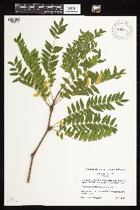
MIN:Plants | Parkinsonia florida S. Watson 510094[]Univ. of Calif. Bot. Gard. list 18 - 961976-00-00 United States, California, Riverside, Riverside Co. |
MIN:Plants | Astragalus neglectus (Torrey & A. Gray) E. Sheldon 910711[1075494]Rowe, Erika ERR2362007-08-08 United States, Minnesota, Hubbard, Hubbard County...Crow Wing River; 8 miles ESE of Park Rapids...T140N R33W NWNW S32;;140N;33W;32, 46.9027778 -94.8894444 |
MIN:Plants | Astragalus neglectus (Torrey & A. Gray) E. Sheldon 438343[1075492]Rowe, Erika ERR1482005-08-12 United States, Minnesota, Mahnomen, White Earth Indian Reservation / White Earth State Forest. Mahnomen County...1.2 miles west of Cty Hwy 4; 3.8 miles north of Becker/Mahnomen border...along north side of Spider Lake...1/4NE 1/4NE S18 T143N R39W. 143N 39W 18, 47.2013699 -95.6682158 |
MIN:Plants | Astragalus neglectus (Torrey & A. Gray) E. Sheldon 507988[1075491]Anderson, Craig 10042000-07-12 United States, Minnesota, Becker, White Earth Indian Reservation. Becker County ... county gravel road where some work had been done a couple of years previously ... T141N R41W: 1/4 of NE1/4 of NE1/4 of Sect. 5. 141N 41W 5, 47.0570195 -95.9014099 |
MIN:Plants | Astragalus neglectus (Torrey & A. Gray) E. Sheldon 134487[1075465]Aiton, G. s.n.1891-07-00 United States, Minnesota, Becker, Lake De Soto, Lake Itasca;Itasca State Park;142N;36W;, 47.145259 -95.2227848 |
MIN:Plants | Astragalus neglectus (Torrey & A. Gray) E. Sheldon 135414[1075466]Rosendahl, C. 43221922-07-00 United States, Minnesota, Clearwater, Itasca State Park;Itasca State Park;143N;36W;, 47.186726 -95.22325 |
MIN:Plants | Astragalus neglectus (Torrey & A. Gray) E. Sheldon 141907[1075456]MacMillan, C.; et al. 1531900-08-00 United States, Minnesota, Polk, Crookston;;150N;46W;30, 47.782 -96.60007 |
MIN:Plants | Astragalus neglectus (Torrey & A. Gray) E. Sheldon 141908[1075457]Sheldon, Edmund S39261892-08-00 United States, Minnesota, Otter Tail, Dalton;;N;;, 46.173849 -95.915609 |
MIN:Plants | Astragalus neglectus (Torrey & A. Gray) E. Sheldon 141909[1075462]Sheldon, Edmund S34141892-08-00 United States, Minnesota, Otter Tail, Eagle Lake;;N;;, 46.1728347 -95.6976807 |
MIN:Plants | Astragalus neglectus (Torrey & A. Gray) E. Sheldon 141910[1075459]Sheldon, Edmund S36751892-08-00 United States, Minnesota, Otter Tail, Dalton;;N;;, 46.173849 -95.915609 |
MIN:Plants | Astragalus neglectus (Torrey & A. Gray) E. Sheldon 905653[1075475]Lee, Michael MDL40492005-07-27 United States, Minnesota, Becker, White Earth Indian Reservation / White Earth State Forest. Becker County...9.5 miles north-northwest of Ponsford...south-facing slope that forms shore of Back of the Moon Lake...T142N R38W SW1/4 of SW1/4 of SE1/4 Sec. 22; NE1/4 of NE1/4 Sec. 27...UTM's: 5218530N 312067E, 5318322N 312643E. 142N 38W 0, 47.0861101 -95.4769517 |
MIN:Plants | Astragalus neglectus (Torrey & A. Gray) E. Sheldon 915854[1075538]Rowe, Erika ERR1272005-08-12 United States, Minnesota, Becker, White Earth Indian Reservation. Becker County...2.3 miles NE of White Earth on Township Road 332nd near the intersection with Township Road 346th... 1/4SE 1/4NE S13 T142N R41W. 142N 41W 13, 47.0279882 -95.8173809 |
MIN:Plants | Astragalus neglectus (Torrey & A. Gray) E. Sheldon 915029[1075517]Lee, Michael MDL43342006-09-06 United States, Minnesota, Becker, Greenwater Lake Scientific Natural Area / White Earth Indian Reservation. Becker County ... Greenwater Lake State Scientific & Natural Area, six miles west-northwest of Ponsford .. Northwest side of Greenwater Lake ... T141N R38W SE1/4 of NE1/4 of NW1/4 Sec.33 ... UTM: 5206924N 309935E. 141N 38W 33, 46.9838935 -95.4976994 |
MIN:Plants | Astragalus neglectus (Torrey & A. Gray) E. Sheldon 141911[1075455]MacMillan, C.; et al. 1491900-08-00 United States, Minnesota, Polk, Crookston;;150N;46W;30, 47.782 -96.60007 |
Google Map
Google Maps is a web mapping service provided by Google that features a map that users can pan (by dragging the mouse) and zoom (by using the mouse wheel). Collection points are displayed as colored markers that when clicked on, displays the full information for that collection. When multiple species are queried (separated by semi-colons), different colored markers denote each individual species.
