University of Minnesota
http://www.umn.edu/
612-625-5000
http://www.umn.edu/
612-625-5000
Minnesota Biodiversity Atlas
Bell Museum
Dataset: MIN-Plants
Taxa: Schoenoplectus
Search Criteria: excluding cultivated/captive occurrences
Bell Museum plants | |
 MIN:Plants |  Schoenoplectus tabernaemontani (C.C. Gmelin) Palla 83965[1105709]Anderson, A. A6701893-08-00 United States, Minnesota, Cass, Gull Lake.;;N;;, 46.446379 -94.35099 |
MIN:Plants |  Schoenoplectus tabernaemontani (C.C. Gmelin) Palla 83968[1105625]Sandberg, John s.n.1886-07-00 United States, Minnesota, Goodhue, [no further data];;;;, 44.40985 -92.707485 |
MIN:Plants |  Schoenoplectus tabernaemontani (C.C. Gmelin) Palla 83969[1105814]MacMillan, C.; et al. 104SK1900-08-00 United States, Minnesota, Polk, Maple Lake, Polk Co.;;148N;43W;00, 47.65528 -96.16806 |
MIN:Plants |  Schoenoplectus tabernaemontani (C.C. Gmelin) Palla 83970[1105727]Kassube, J. s.n.1878-06-00 United States, Minnesota, Martin, Tuttles Creek.;;101N;31W;, 43.54387 -94.55343 |
MIN:Plants |  Schoenoplectus tabernaemontani (C.C. Gmelin) Palla 83971[1105669]Ballard, C. B311900-06-09 United States, Minnesota, Carver, Chaska;;116N;23W;34, 44.78944 -93.60194 |
MIN:Plants |  Schoenoplectus tabernaemontani (C.C. Gmelin) Palla 83972[1105680]Sheldon, Edmund S24591892-06-00 United States, Minnesota, Aitkin, Nichols;;044N;27W;04, 46.32387 -93.75721 |
MIN:Plants |  Schoenoplectus tabernaemontani (C.C. Gmelin) Palla 83973[1105668]Taylor, B. T2131891-06-00 United States, Minnesota, Waseca, Janesville.;;N;;, 44.116078 -93.708004 |
MIN:Plants |  Schoenoplectus tabernaemontani (C.C. Gmelin) Palla 83963[1021774]Sheldon, Edmund S.33861892-08-00 United States, Minnesota, Otter Tail, Silver Lake;;;;, 46.698868 -95.659449 |
MIN:Plants |  Schoenoplectus tabernaemontani (C.C. Gmelin) Palla 840517[1105649]Smith, Welby 136041987-07-27 United States, Minnesota, Washington, Rice Lake Wildlife Management Area. Washington Co. Rice Lake State Wildlife Management Area, about 1 mi E of Hugo. SE1/4 NE1/4 sec.21, T31N R21W Rice Lake. 031N 21W 21, 45.1611111 -92.9625 |
MIN:Plants |  Schoenoplectus tabernaemontani (C.C. Gmelin) Palla 841068[1105775]Smith, Welby 127161987-05-20 United States, Minnesota, Pipestone, Altona Wildlife Management Area. Pipestone County...Altona State Wildlife Management Area, about 1.5 mi SE of Verdi...floodplain of Flandreau Creek...NW1/4 NW1/4 sec.1, T108N R46W. 108N 46W 1, 44.1966667 -96.325 |
MIN:Plants |  Schoenoplectus tabernaemontani (C.C. Gmelin) Palla 841741[1105774]Smith, Welby 145491988-07-20 United States, Minnesota, Washington, Washington Co. At the SW end of Lake Elmo, about 1 mi S of the town of Lake Elmo; NW1/4 NE1/4 sec.26, T29N R21W;Lake Elmo County Park;029N;21W;26, 44.9833336 -92.8874969 |
MIN:Plants |  Schoenoplectus tabernaemontani (C.C. Gmelin) Palla 911042[1105810]Smith, Welby 244801994-06-23 United States, Minnesota, Winona, Whitewater Wildlife Management Area. Winona County ... Beaver Creek Valley, in Whitewater State Wildlife Management Area, about 5 miles east of Plainview ... T108N R10W NE1/4 of SW1/4 of Sec 19. 108N 10W 19, 44.1430556 -92.0733333 |
MIN:Plants | 568495[]Beardslee, H. C. s.n.1891-08-10 United States, North Carolina, Swain, Great Smoky Mountains;Great Smoky Mountains National Park, 518m |
MIN:Plants |  Schoenoplectus pungens (Vahl) Palla 250622[1105556]Mearns, E. 33811902-08-17 United States, Wyoming, Park, Yellowstone National Park ... Mammoth Hot Springs;Yellowstone National Park |
MIN:Plants |  Schoenoplectus tabernaemontani (C.C. Gmelin) Palla 907247[1105719]Smith, Welby 311032008-08-13 United States, Minnesota, Le Sueur, Murphy Wildlife Management Area [Le Sueur County]. Le Sueur County...Murphy State Wildlife Management Area, about 4 miles northwest of Waterville...T 109N R 23W SE1/4 of SW1/4 of Sec 5. 109N 23W 5, 44.2713889 -93.6197222 |
MIN:Plants |  Schoenoplectus tabernaemontani (C.C. Gmelin) Palla 681434[1105834_1;1105834_2]Swanson, Steven 4251975-06-12 United States, Wisconsin, La Crosse, Mississippi River (Navigation Pool #8) ... La Crosse Co, Site 7, area on S edge of I-90 levee.;Upper Mississippi National Wildlife Refuge |
MIN:Plants |  Schoenoplectus pungens (Vahl) Palla 907047[1105533]Smith, Welby 286222000-06-22 United States, Minnesota, Lyon, Lyon County ... On Sam Tutt's farm, about 2 miles E-SE of Florence ... T109N R43W SW1/4 of SE1/4 of Sec 22;;109N;43W;22, 44.2283333 -96.0055556 |
MIN:Plants |  Schoenoplectus smithii var. setosus (Fernald) S.G. Smith 909705[1285265]Lee, Michael D. MDL45572007-09-07 United States, Minnesota, Wadena, One mile northwest of the Knob Hill-Crow Wing River campground, 3.5 miles south-southwest of Oylen. UTM: 5155324N 358845E SW1/4 of NW1/4;Lyons State Forest;135N;33W;03, 46.5366589 -94.8408417 |
MIN:Plants |  Schoenoplectus pungens (Vahl) Palla 912705[1105489]Smith, Welby 231481993-07-28 United States, Minnesota, Grant, Berskow Wildlife Management Area. Grant County...Berskow State Wildlife Management Area. On the northeast sde of Thorstad Lake, about 5 miles east of Elbow Lake (town)...T 129N R 41W NW1/4 of NW1/4 of Sec 17. 129N 41W 17, 45.9905556 -95.8716667 |
MIN:Plants |  Schoenoplectus heterochaetus (Chase) Soj 477418[1105439]Myhre, K. 71281997-08-08 United States, Minnesota, Kanabec, Kanabec County ... Pomroy Lake. Located 10 miles northeast of the town of Mora. Plants occur along the southeast bay of the lake ... T 41N R 22W NW1/4 of NW1/4 of Sec 30. 041N 22W 30, 46.003482 -93.170462 |
MIN:Plants |  Schoenoplectus pungens (Vahl) Palla 907265[1105532]Smith, Welby 286472000-06-23 United States, Minnesota, Pipestone, Pipestone County ... Altona State Wildlife Area, about 2 miles southeast of Verdi ... T108N R46W NE1/4 of NW1/4 of Sec 1;Altona Wildlife Management Area;108N;46W;01, 44.1966667 -96.3219444 |
MIN:Plants |  Schoenoplectus acutus var. acutus (Muhlenberg ex Bigelow) ́. L̦ve & D. L̦ve 453828[1105393]Smith, Welby 157951989-07-18 United States, Minnesota, Freeborn, Freeborn County...At the south end of Geneva Lake, about 3 miles northeast of Clarks Grove; NE1/4 NE1/4 Sec. 30 T 104N R 20W. 104N 20W 30, 43.7852778 -93.2697222 |
MIN:Plants |  Schoenoplectus torreyi (Olney) Palla 477600[1105837]Gerdes, Lynden 79021998-08-05 United States, Minnesota, Crow Wing, Pine County [correction: Crow Wing Co.] ... (Little) Long Lake. Located 3.5 miles south of the town of Deerwood ... southeast shore of the lake ... T 46N R 28W SW1/4 of SE1/4 of sec 32. 46 10W 32, 46.424345 -93.904938 |
MIN:Plants |  Schoenoplectus tabernaemontani (C.C. Gmelin) Palla 911220[1105752]Smith, Welby 218501992-09-03 United States, Minnesota, Watonwan, Watonwan County...At the public access on the north side of Fedji Lake, about 2 miles northeast of Madelia...T 107N R 30W SW1/4 of SW1/4 of Sec 12. 107N 30W 12, 44.0816667 -94.3880556 |
MIN:Plants |  Schoenoplectus acutus (Muhlenberg ex Bigelow) ́. L̦ve & D. L̦ve 444334[1105860]Bright, R. 73-2531973-00-00 United States, Idaho, Franklin, [no further data] |
MIN:Plants |  Schoenoplectus acutus var. acutus (Muhlenberg ex Bigelow) ́. L̦ve & D. L̦ve 476044[1105404]Mensing, D. 95-24001995-08-10 United States, Minnesota, Carlton, Carlton Co, T48N R18W SE1/4 of the SW1/4 of S20; Park Lake;Fond du Lac Indian Reservation;048N;18W;20, 46.628015 -92.649915 |
MIN:Plants |  Schoenoplectus tabernaemontani (C.C. Gmelin) Palla 511346[1105794]Wheeler, Gerald 162961997-06-27 United States, Minnesota, Redwood, Redwood County ... Ca. 3.9 mi. N of Belview on Rte. 7, E of road ... N1/2 NW1/4 Sec. 20 T114N R37W (Swedes Forest 20);;114N;37W;20, 44.664942 -95.329922 |
MIN:Plants |  Schoenoplectus tabernaemontani (C.C. Gmelin) Palla 681289[1105835_1;1105835_2]Swanson, Steven 7201975-06-20 United States, Wisconsin, La Crosse, Mississippi River (Navigation Pool #8) ... La Crosse Co, Site 15, spit on the inside bend of a side channel;Upper Mississippi National Wildlife Refuge |
MIN:Plants | 83452[]Umbach, L.M. s.n.1899-09-12 United States, Indiana, Porter, Dune Park;Indiana Dunes National Lakeshore;;;, 41.663093 -87.032128 |
MIN:Plants |  Schoenoplectus subterminalis (Torrey) Soj 476755[1105609]Gerdes, Lynden 29611998-07-17 United States, Minnesota, Cook, T64N R03E S02SWSW. Cook County ... Superior National Forest, BWCAW. Shallows of the Royal River west of Royal Lake.;Boundary Waters Canoe Area Wilderness / Superior National Forest;064N;03E;2, 48.057888 -90.02419 |
MIN:Plants |  Schoenoplectus acutus var. acutus (Muhlenberg ex Bigelow) ́. L̦ve & D. L̦ve 912687[1105290]Smith, Welby 229061993-07-14 United States, Minnesota, Sibley, Sibley County...On the north side of Indian lake, about 4 miles west of Gaylord...T 113N R 29W NW1/4 of SW1/4 of Sec 21;;113N;29W;21, 44.5791667 -94.3341667 |
MIN:Plants |  Schoenoplectus pungens (Vahl) Palla 910385[1021744]Perleberg, D. 17042004-08-05 United States, Minnesota, Cass, Leech Lake, Lake ID: 11020300; Portage Bay, DNR Site # 574 [collector's latitude/longitude invalid];Chippewa National Forest / Leech Lake Indian Reservation;144N;28W;32, 47.247709 -94.25458 |
MIN:Plants |  Schoenoplectus subterminalis (Torrey) Soj 485525[1105622]Rand, Edward s.n.1889-08-28 United States, Maine, Hancock, Mount Desert Island ... Seal Cove Pond;Acadia National Park |
MIN:Plants |  Schoenoplectus pungens (Vahl) Palla 477820[1105479]Wheeler, Gerald 163091997-06-27 United States, Minnesota, Redwood, Redwood County ... Ca. 3.9 mi. N of Belview on Rte. 7, E of road ... N12 NW1/4 Sec. 20 T114N R37W (Swedes Forest 20);;114N;37W;20, 44.664942 -95.329922 |
MIN:Plants |  Schoenoplectus tabernaemontani (C.C. Gmelin) Palla 510451[1105826]Wheeler, Gerald 161661997-06-14 United States, Minnesota, Nicollet, Nicollet County ... Ca. 2.3 mi. W of Nicollet on Rte. 14, N of road; Swan Lake WMA ... N1/2 Sec. 6 T109N R28W;Swan Lake Wildlife Management Area;109N;28W;06, 44.275753 -94.240942 |
MIN:Plants |  Schoenoplectus pungens (Vahl) Palla 438484[1105548]Smith, Welby 258591995-08-17 United States, Minnesota, Hennepin, Hennepin County...About 1/4 mile downstream (south) of the Lake Street Bridge in Minneapolis. On the banks of the Mississippi River...T 28N R 23W SE1/4 of NW1/4 of Sec 5. 028N 23W 5, 44.9438889 -93.2022222 |
MIN:Plants |  Schoenoplectus torreyi (Olney) Palla 301463[1105842]Weatherby, C.; et al. 5261932-08-22 United States, Massachusetts, Middlesex, Concord;Minute Man National Historic Park |
MIN:Plants |  Schoenoplectus subterminalis (Torrey) Soj 435524[1105579]Myhre, K. 65901996-08-15 United States, Minnesota, Crow Wing, Crow Wing Co.; Located 1 mile northwest of the town of Nisswa. Plants occur in the north bays of Lake Edna; T 135N R 29W SE1/4 of NE1/4 of Sec 3. 135N 29W 3, 46.536501 -94.319016 |
MIN:Plants |  Schoenoplectus pungens (Vahl) Palla 477530[1021742]Smith, Welby 172371990-07-13 United States, Minnesota, Ramsey, Southeast end of Snail Lake, in Shoreview. SW1/4 of SW1/4 of section;Snail Lake Vadnais Lake County Park;030N;23W;24, 45.0683333 -93.1227778 |
MIN:Plants |  Schoenoplectus pungens (Vahl) Palla 910986[1105531]Smith, Welby 285962000-06-22 United States, Minnesota, Chippewa, Along Watson Sag, about 4 miles NW of Watson. SE1/4 of SW1/4 of section. [collector's latitude/longitude incorrect];Lac Qui Parle Wildlife Management Area;118N;41W;06, 45.058002 -95.847954 |
MIN:Plants |  Schoenoplectus subterminalis (Torrey) Soj 431478[1105602]Gerdes, Lynden; et al. 44082001-07-21 United States, Minnesota, Lake, Boundary Waters Canoe Area Wilderness / Superior National Forest. T62N R08W S33SWSE. Lake County...Superior National Forest. Boundary Water Canoe Area Wilderness. Confluence of the Isabella and Island Rivers.. 062N 08W 33, 47.769825 -91.290404 |
MIN:Plants |  Schoenoplectus tabernaemontani (C.C. Gmelin) Palla 443445[1105864]Bright, R. 72-941972-00-00 United States, Minnesota, Anoka, [no further data];;;;, 45.275799 -93.238627 |
MIN:Plants |  Schoenoplectus acutus var. acutus (Muhlenberg ex Bigelow) ́. L̦ve & D. L̦ve 474265[1105337]Haasch, S. s.n.1980-07-19 United States, Minnesota, Sherburne, Bergerson Slough;;;;, 45.445781 -93.797466 |
MIN:Plants |  Schoenoplectus tabernaemontani (C.C. Gmelin) Palla 524421[1105833]Benner, J. s.n.1948-07-15 United States, Wisconsin, Polk, Island five miles north of St. Croix Falls;Saint Croix National Riverway;;;, 45.488738 -92.698239 |
MIN:Plants |  Schoenoplectus acutus var. acutus (Muhlenberg ex Bigelow) ́. L̦ve & D. L̦ve 912120[1105289]Smith, Welby 230731993-07-21 United States, Minnesota, McLeod, McLeod County... On the east side of Hook Lake, about 3 miles north of Hutchinson... T117N R29W SW1/4 of SW1/4 of Sec 9;;117N;29W;09, 44.9519444 -94.335 |
MIN:Plants |  Schoenoplectus pungens (Vahl) Palla 83153[1105555]Nelson, Aven; et al. 67361899-08-28 United States, Wyoming, Park, Yellowstone National Park ... Gibbon Meadow;Yellowstone National Park |
MIN:Plants | 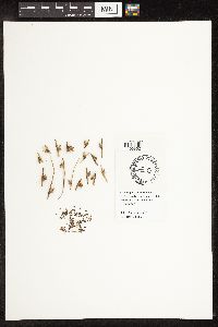 Schoenoplectus americanus (Persoon) Volkart ex Schinz & R. Keller 444337[1105862]Bright, R. 73-2851973-00-00 United States, Idaho, Bannock, [no further data] |
MIN:Plants | 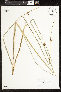 Schoenoplectus torreyi (Olney) Palla 573761[1105851]Homoya, M.; et al. 15872003-08-19 United States, Minnesota, Saint Louis, ST. LOUIS CO ... Lac La Croix, BWCAW. T68N R15W sec.34 NESENE.;Boundary Waters Canoe Area Wilderness / Superior National Forest;068N;15W;34, 48.332183 -92.247295 |
MIN:Plants | 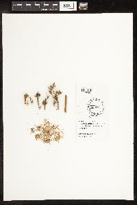 Schoenoplectus acutus (Muhlenberg ex Bigelow) ́. L̦ve & D. L̦ve 444335[1105861]Bright, R. 71-331971-00-00 United States, Idaho, Bannock, [no further data] |
MIN:Plants | 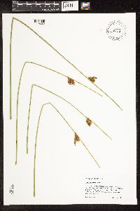 Schoenoplectus torreyi (Olney) Palla 459845[1105852]Scott, P. 19412005-08-26 United States, Minnesota, Lake, LAKE CO ... Island in Kawishiwi River, BWCAW. T63N R7W sec. 12 SENENW.;Boundary Waters Canoe Area Wilderness / Superior National Forest;063N;07W;12, 47.954695 -91.159478 |
MIN:Plants |  Schoenoplectus smithii var. setosus (Fernald) S.G. Smith 435127[1285264]Myhre, Karen 73571997-09-10 United States, Minnesota, Chisago, Colby Lake. Located 1.5 mi northwest of the town of Taylors Falls; northeast shore of the lake. SE1/4 of NE1/4;;034N;19W;23, 45.419259 -92.682626 |
MIN:Plants |  Schoenoplectus acutus var. acutus (Muhlenberg ex Bigelow) 915764[1105288]Smith, Welby 250861994-08-15 United States, Minnesota, Carlton, Carlton County...On the north side of Echo Lake in Moose Lake State Park...T46N R19W SE1/4 of SW1/4 of Sec 27;Moose Lake State Park;046N;19W;27, 46.4344444 -92.7325 |
MIN:Plants |  Schoenoplectus torreyi (Olney) Palla 476756[1105841]Gerdes, Lynden; et al. 31521998-08-12 United States, Minnesota, Cook, T65N R02W S21. Cook County ... Superior National Forest, Frances Bay of North Lake, BWCAW. Northeastern end Frances Bay;Boundary Waters Canoe Area Wilderness / Superior National Forest;065N;02W;21, 48.100572 -90.586083 |
MIN:Plants |  Schoenoplectus tabernaemontani (C.C. Gmelin) Palla 438455[1105642]Smith, Welby 258601995-08-17 United States, Minnesota, Hennepin, Hennepin County...About 1/4 mile downstream (south) of the Lake Street Bridge in Minneapolis. On the banks of the Mississippi River...T 28N R 23W SE1/4 of NW1/4 of Sec 5. 028N 23W 5, 44.9438889 -93.2022222 |
MIN:Plants |  Schoenoplectus pungens (Vahl) Palla 905518[1105535]Vanderbosch, Dana s.n.2005-06-29 United States, Minnesota, Scott, Rogers Lake; SE1/2 Sec 25 T 115N R 22W Scott County ... Northern side of Lower Prior Lake.;;115N;22W;25, 44.739525 -93.409127 |
MIN:Plants |  Schoenoplectus tabernaemontani (C.C. Gmelin) Palla 907049[1105718]Smith, Welby 286202000-06-22 United States, Minnesota, Lyon, Lyon County ... On Sam Tutt's farm, about 2 miles E-SE of Florence ... T109N R43W SW1/4 of SE1/4 of Sec 22;;109N;43W;22, 44.2283333 -96.0055556 |
MIN:Plants |  Schoenoplectus tabernaemontani (C.C. Gmelin) Palla 476765[1105742]Gerdes, Lynden; et al. 26401998-06-08 United States, Minnesota, Cook, T65N R02W S29SWNW. Cook County ... Superior National Forest, BWCAW. At the NE end of Crab Lake.;Boundary Waters Canoe Area Wilderness / Superior National Forest;065N;02W;29, 48.084718 -90.609098 |
MIN:Plants |  Schoenoplectus subterminalis (Torrey) Soj 910419[1105571]Loso, Stephanie; Bulman, Rachel 11202007-06-21 United States, Minnesota, Cass, Long Lake, Lake ID: 11014200; In bay south of main basin, DNR Site # 2399 [collector's latitude/longitude invalid];Chippewa National Forest / Leech Lake Indian Reservation;141N;27W;18, 47.030738 -94.149147 |
MIN:Plants |  Schoenoplectus tabernaemontani (C.C. Gmelin) Palla 907615[1105751]Smith, Welby 290812000-09-06 United States, Minnesota, Itasca, Itasca County...On the west side of Twin Lake, about 6 mi S of Pengilly on Hwy 65...T55N R22W SE1/4 of SE1/4 of Sec 18;;055N;22W;18, 47.2458333 -93.1775 |
MIN:Plants |  Schoenoplectus acutus (Muhlenberg ex Bigelow) ́. L̦ve & D. L̦ve 234255[1105433]Congdon, J. s.n.1890-08-18 United States, California, Tuolumne, Soda Springs, Tuolumne County;Yosemite National Park |
MIN:Plants |  Schoenoplectus acutus var. acutus (Muhlenberg ex Bigelow) ́. L̦ve & D. L̦ve 480790[1105380]Gerdes, Lynden; et al. 28991998-07-09 United States, Minnesota, Cook, T64N R03E S03SWNW. Cook County ... Superior National Forest, Little John Lake.;Superior National Forest;064N;03E;3, 48.057476 -90.04601 |
MIN:Plants |  Schoenoplectus tabernaemontani (C.C. Gmelin) Palla 454613[1105822]Myhre, K. 68561997-07-08 United States, Minnesota, Carlton, Carlton County ... Cole Lake. Located 2 miles southwest of the town of Wright. Plants occur along the northwest bays of lake. T48N R21W SE1/4 of NE1/4 of Sec 7. 048N 21W 7, 46.658395 -93.053682 |
MIN:Plants |  Schoenoplectus pungens (Vahl) Palla 907251[1105534]Smith, Welby; Dahle, R. 308742008-06-09 United States, Minnesota, Itasca, Itasca County...About 5 miles northeast of Grand Rapids...abandoned tailings basin. T 56N R 25W SE1/4 of SE1/4 of Sec 33;;056N;25W;33, 47.285 -93.5161111 |
MIN:Plants |  Schoenoplectus heterochaetus (Chase) Soj 914547[1105287]Lee, Michael D. MDL40072005-06-30 United States, Minnesota, Todd, Grey Eagle Wildlife Management Area. Alont the northern and eastern shorelines of Bunker Lake, four miles west-southwest of the town of Grey Eagle. T127N R33W NW1/4 of NE1/4 Sec.16., 45.810621 -94.839552 |
MIN:Plants |  Schoenoplectus acutus var. acutus (Muhlenberg ex Bigelow) ́. L̦ve & D. L̦ve 453995[1105278]Lee, Michael MDL20721998-05-28 United States, Minnesota, Stearns, Stearns Co.; St. Wendel Swamp 2-1/2 miles south of St. Wendel; T125N R29W SW1/4 of SW1/4 of SE1/4 Sec. 17;;125N;29W;17, 45.637338 -94.356597 |
MIN:Plants |  Schoenoplectus tabernaemontani (C.C. Gmelin) Palla 484994[1105743]Gerdes, Lynden 30671998-07-31 United States, Minnesota, Cook, T65N R02W S30SWSE. Cook County ... Superior National Forest. West end of Little Mayhew Lake.;Superior National Forest;065N;02W;30, 48.084458 -90.630526 |
MIN:Plants |  Schoenoplectus torreyi (Olney) Palla 477182[1105838]Anderson, Chel; et al. 99962001-07-26 United States, Minnesota, Cook, Superior National Forest. Cook County ... bay on west side of Christine Lake, where creek flows in from White Pine Lake ... T61N R3W NE1/4 of SE1/4 of Sec. 29. 061n 03W 29, 47.738523 -90.735243 |
MIN:Plants |  Schoenoplectus acutus var. acutus (Muhlenberg ex Bigelow) ́. L̦ve & D. L̦ve 511483[1105303]Wheeler, Gerald 170131997-08-08 United States, Minnesota, Swift, Swift County ... Ca. 5 mi. NNE of Benson; on NW margin of Frovold Lake ... NW1/4 SE1/4 NE1/4 Sec. 16 T122N R39W;;122N;39W;16, 45.376026 -95.571928 |
MIN:Plants |  Schoenoplectus tabernaemontani (C.C. Gmelin) Palla 499042[1105698]Juhnke, C. 450 CMJ FRO1999-07-14 United States, Minnesota, Goodhue, Frontenac State Park. Frontenac State Park Goodhue County ... Along Pleasant Valley Creek just before its confluence with Well's Creek ... T112N R13W SE NE NW 14. 112N 13W 14, 44.505485 -92.339405 |
MIN:Plants |  Schoenoplectus acutus var. acutus (Muhlenberg ex Bigelow) ́. L̦ve & D. L̦ve 124669[1105332]Smith, Welby 230361993-07-21 United States, Minnesota, Meeker, Meeker County...At the south end of Long Lake, about 1 mile north of Dassel...T 119N R 29W SW1/4 of SE1/4 of Sec 22;;119N;29W;22, 45.0977778 -94.3030556 |
MIN:Plants |  Schoenoplectus smithii var. setosus (Fernald) S.G. Smith 459842[1285262]Gerdes, Lynden B. 53292006-09-12 United States, Minnesota, Itasca, Bowstring State Forest. SE shores of Hale Lake. Approx. 7.05 miles SSW of Squaw Lake. NWSE;Chippewa National Forest / Leech Lake Indian Reservation;147N;28W;24, 47.531191 -94.171262 |
MIN:Plants |  Schoenoplectus tabernaemontani (C.C. Gmelin) Palla 905519[1105796]Vanderbosch, Dana s.n.2005-06-29 United States, Minnesota, Scott, Rogers Lake; SE1/2 Sec 25 T 115N R 22W Scott County ... northern side of Lower Prior Lake.;;115N;22W;25, 44.739586 -93.409127 |
MIN:Plants |  Schoenoplectus acutus var. acutus (Muhlenberg ex Bigelow) ́. L̦ve & D. L̦ve 426799[1105405]Wheeler, Gerald 163391997-06-28 United States, Minnesota, Swift, Monson Lake State Park. Swift County ... Ca. 10 mi NNE of Kerkhoven; Monson Lake State Memorial Park ... along shore of Monson Lake ... W1/2 NE1/4 NW1/4 Sec. 1 T121N R37W (Hayes 1). 121N 37W 1, 45.318174 -95.265442 |
MIN:Plants |  Schoenoplectus tabernaemontani (C.C. Gmelin) Palla 912364[1105778]Smith, Welby 229861993-07-20 United States, Minnesota, Sibley, Sibley County ... At the southeast end of Silver Lake, about 5 miles east of Arlington ...T113N R26W NW1/4 of NW1/4 of Sec 9. 113N 26W 9, 44.6130556 -93.9686111 |
MIN:Plants |  Schoenoplectus torreyi (Olney) Palla 477411[1105840]Myhre, K. 71131997-08-04 United States, Minnesota, Saint Louis, Big Rice Lake. Located 11 miles north of the town of Virginia. Northeast shore of the lake. NW1/4 of NW1/4 of section.;Superior National Forest;060N;17W;10, 47.697853 -92.487553 |
MIN:Plants |  Schoenoplectus acutus var. acutus (Muhlenberg ex Bigelow) 453662[1105323]Whitfeld, T.J.S.; Harris, Fred 2322001-06-12 United States, Minnesota, Kandiyohi, Kandiyohi County...1/2 mile east of County Hwy. 5, 1 1/2 miles north of State Hwy. 9...east of Timber Lake...T122N R35W SE1/4 of SE1/4 of NW1/4 of Section 21.. 122N 35W 21, 45.3618168 -95.0810136 |
MIN:Plants |  Schoenoplectus subterminalis (Torrey) Soj 910481[1105572]Loso, Stephanie; Perleberg, D. 15542006-08-03 United States, Minnesota, Cass, Ten Mile Lake, ID: 11041300. Southeast shore of Long Bay. DNR Site # 4 - 13 [collector's latitude/longitude invalid];Foothills State Forest;140N;30W;06, 46.972471 -94.522077 |
MIN:Plants |  Schoenoplectus pungens (Vahl) Palla 432073[1105473]Lee, Michael MDL21881998-06-27 United States, Minnesota, Stearns, Stearns Co.; west side of State Hwy 4 along stony Creek 1-3/4 miles north of Spring Hill; T124N R33W SW1/4 of NE1/4 Sec. 16. 124N 33W 16, 45.549903 -94.834059 |
MIN:Plants |  Schoenoplectus subterminalis (Torrey) Soj 907683[1105577]Gerdes, Lynden; et al. 56262008-08-06 United States, Minnesota, Saint Louis, Boundary Waters Canoe Area Wilderness / Superior National Forest. T63N R14W S23SWSENW. St. Louis County, MN. Superior National Forest. Boundary Waters Canoe Area Wilderness. Clark Lake...western portion of lake along northern, western and southern shores.. 063N 14W 23, 47.9247222 -92.0883333 |
MIN:Plants |  Schoenoplectus tabernaemontani (C.C. Gmelin) Palla 438479[1105641]Smith, Welby 259001995-08-23 United States, Minnesota, Yellow Medicine, Upper Sioux Agency State Park. Yellow Medicine County...In Upper Sioux Agency State Park. On the floodplain of the Minnseota River about 5 miles east-southeast of Granite Falls...T 115N R 38W SE1/4 of NW1/4 of Sec 29. 115N 38W 29, 44.7405556 -95.4505556 |
MIN:Plants |  Schoenoplectus acutus var. acutus (Muhlenberg ex Bigelow) ́. L̦ve & D. L̦ve 461790[1105291]Lehtinen, R. 95-9071995-08-15 United States, Minnesota, Pope, Pope Co, T124N R38W NE1/4 of the NW1/4 of S28; Nelson Lake.;;124N;38W;28, 45.520673 -95.449408 |
MIN:Plants |  Schoenoplectus acutus var. acutus (Muhlenberg ex Bigelow) ́. L̦ve & D. L̦ve 510906[1105403]Gerdes, Lynden; et al. 28991998-07-09 United States, Minnesota, Cook, T64N R03E S03SWNW. Cook County ... Superior National Forest, Little John Lake.;Superior National Forest;064N;03E;3, 48.057476 -90.04601 |
MIN:Plants |  Schoenoplectus tabernaemontani (C.C. Gmelin) Palla 309358[1105723]Roitsch, C. 5501999-09-18 United States, Minnesota, Morrison, Crane Meadows National Wildlife Refuge;Crane Meadows National Wildlife Refuge;;;, 45.9414 -94.21 |
MIN:Plants |  Schoenoplectus tabernaemontani (C.C. Gmelin) Palla 924519[1105777]Smith, Welby 214101992-08-12 United States, Minnesota, Marshall, About 11 miles east of Argyle. Along Middle River. NW1/4 of SE1/4 of section;Old Mill State Park;156N;46W;04, 48.3602778 -96.5702778 |
MIN:Plants |  Schoenoplectus tabernaemontani (C.C. Gmelin) Palla 924529[1105823]Smith, Welby 200961991-08-30 United States, Minnesota, Cook, About 9 miles north of Hovland. Swamp River. SW1/4 of SW1/4 of section;Grand Portage State Forest;064N;04E;33, 47.9752778 -89.9527778 |
MIN:Plants |  Schoenoplectus tabernaemontani (C.C. Gmelin) Palla 816680[1105623]Welling, C. CW90-117A1990-08-30 United States, Minnesota, Ramsey, E of Victoria St and 0.6 km S of County Rd. B; City of Roseville.;;029N;23W;14, 44.999104 -93.136254 |
MIN:Plants |  Schoenoplectus tabernaemontani (C.C. Gmelin) Palla 816682[1105675]Welling, C. CW90-0761990-08-15 United States, Minnesota, Ramsey, E of Victoria St and 0.6 km S of County Rd. B; City of Roseville.;;029N;23W;14, 44.999104 -93.136254 |
MIN:Plants |  Schoenoplectus acutus var. acutus (Muhlenberg ex Bigelow) ́. L̦ve & D. L̦ve 924507[1021715]Smith, Welby 214941992-08-12 United States, Minnesota, Pennington, About 16 miles SW of Thief River Falls. NW1/4 of SE1/4 of section.;Pembina Wildlife Management Area;152N;45W;18, 47.9838889 -96.4658333 |
MIN:Plants |  Schoenoplectus tabernaemontani (C.C. Gmelin) Palla 928238[1105674]Anderson, Chel 22312011-08-09 United States, Minnesota, Lake, Annie Lake, north shore. UTM: 5327329.05531902 / 641478.88528966. SE1/4 of NE1/4 of section;Boundary Waters Canoe Area Wilderness / Superior National Forest;065N;06W;28, 48.0835108 -91.1002925 |
MIN:Plants |  Schoenoplectus subterminalis (Torrey) Soj 928669[1105573]Anderson, Chel 22252011-08-30 United States, Minnesota, Lake, UTM: 5329887 / 635035. SE1/4 of SE1/4 of section.;;065N;07W;14, 48.1079131 -91.1859511 |
MIN:Plants |  Schoenoplectus acutus var. acutus (Muhlenberg ex Bigelow) 922312[1105358]Smith, Welby 232441993-07-29 United States, Minnesota, Douglas, At the south end of Lake Rachel, about 2.5 mi S of Holmes City...T 127N R 39W SW1/4 of NW1/4 of Sec 23;;127N;39W;23, 45.7958333 -95.5502778 |
MIN:Plants |  Schoenoplectus tabernaemontani (C.C. Gmelin) Palla 922631[1105626]Smith, Welby 233241993-08-03 United States, Minnesota, Renville, About 4 miles east of Sacred Heart. SE1/4 of SE1/4 of Sec.;;115N;37W;02, 44.7913889 -95.2602778 |
MIN:Plants |  Schoenoplectus heterochaetus (Chase) Soj 930004[1106803]Smith, Welby 159141989-07-26 United States, Minnesota, Nobles, About 6 miles W-NW of Kinbrae. SE of NW of section;Fulda Wildlife Management Area;104N;40W;02, 43.841093 -95.60274 |
MIN:Plants |  Schoenoplectus tabernaemontani (C.C. Gmelin) Palla 930010[1105716]Smith, Welby 159591989-07-31 United States, Minnesota, Kanabec, N side of Ann Lake, about 5 mi NW of Mora. SW1/4 of NE1/4 of section;Ann Lake Wildlife Management Area;040N;24W;30, 45.925 -93.3772222 |
MIN:Plants |  Schoenoplectus subterminalis (Torrey) Soj 930110[1105574]Smith, Welby 160881989-08-11 United States, Minnesota, Cook, West end of Homer Lake. SW1/4 of NE1/4 of section;Boundary Waters Canoe Area Wilderness / Superior National Forest;063N;03W;33, 47.896805 -90.713034 |
MIN:Plants |  Schoenoplectus purshianus var. purshianus (Fernald) M.T. Strong 929851[1105561]Milburn, Scott SAM10-0552010-09-30 United States, Minnesota, Washington, Pond east of Turtle Lake and six miles southwest of Scandia. UTM: 510940E 5002524N. SWNE of section;;031N;20W;17, 45.1761111 -92.8607639 |
MIN:Plants |  Schoenoplectus acutus var. acutus (Muhlenberg ex Bigelow) ́. L̦ve & D. L̦ve 930974[1105411]Smith, Welby R. 159261989-07-26 United States, Minnesota, Nobles, About 4.5 miles north of Wilmont. SW1/4 of NW1/4 of section;County Line Wildlife Management Area;104N;41W;06, 43.8438889 -95.8094444 |
MIN:Plants |  Schoenoplectus tabernaemontani (C.C. Gmelin) Palla 930625[1105673]Gerdes, Lynden B.; Doerr, Andrea L. 61262010-07-19 United States, Minnesota, Cook, Portage between Paulson Lake and Sea Gull Lake; approximately 0.60 miles northwest of the Paulson Lake landing. NWSESESE of section;Superior National Forest;065N;05W;14, 48.1075 -90.9236111 |
MIN:Plants |  Schoenoplectus purshianus var. purshianus (Fernald) M.T. Strong 930299[1105560]Lee, Michael MDL48562008-09-17 United States, Minnesota, Cass, Wegwos Lake. Along County Road 41 in rolling forested moraine 7.5 miles southeast of Akeley, 8 miles northwest of Backus. On north end of the lake. S1/2 of SE1/4 of SE1/4 of section;;140N;31W;30, 46.906869 -94.6416635 |
MIN:Plants |  Schoenoplectus tabernaemontani (C.C. Gmelin) Palla 932173[1105749]Lee, Michael MDL47412008-07-30 United States, Minnesota, Hubbard, Along the lower reaches of the Schoolcraft River south of Lake Plantagenet, seven miles south-southwest of Bemidji. At the County Highway 9 bridge. SE1/4 of SE1/4 of NE1/4 of section;;145N;34W;24, 47.3607919 -94.9274112 |
Google Map
Google Maps is a web mapping service provided by Google that features a map that users can pan (by dragging the mouse) and zoom (by using the mouse wheel). Collection points are displayed as colored markers that when clicked on, displays the full information for that collection. When multiple species are queried (separated by semi-colons), different colored markers denote each individual species.