University of Minnesota
http://www.umn.edu/
612-625-5000
http://www.umn.edu/
612-625-5000
Minnesota Biodiversity Atlas
Bell Museum
Dataset: MIN-Plants
Taxa: Selaginellaceae
Search Criteria: excluding cultivated/captive occurrences
Bell Museum plants | |
 MIN:Plants |  Selaginella rupestris (L.) Spring 55548[1383878]Ballard, C. s.n.1892-08-00 United States, Minnesota, Goodhue, Zumbrota, Goodhue Co.;;N;;, 44.294132 -92.669081 |
MIN:Plants |  Selaginella rupestris (L.) Spring 55550[1383892]Holzinger, John s.n.1888-06-30 United States, Minnesota, Winona, Winona;;107N;06W;00, 44.0333 -91.6333 |
MIN:Plants |  Selaginella rupestris (L.) Spring 55551[1383773]Lange, D. s.n.1891-07-00 United States, Minnesota, Ramsey, St. Paul;;;;, 44.960694 -93.076799 |
MIN:Plants |  Selaginella rupestris (L.) Spring 55552[1383957]Arthur, J.; et al. A1711886-07-26 United States, Minnesota, Saint Louis, Duluth;;;;, 46.7833 -92.1 |
MIN:Plants |  Selaginella rupestris (L.) Spring 55554[1383788]Lyon, H. 781899-06-10 United States, Minnesota, Houston, Winnebago Valley, Houston Co.;Dorer Memorial Hardwood State Forest;N;;, 43.537379 -91.40119 |
MIN:Plants |  Selaginella rupestris (L.) Spring 55555[1383779]Butters, F.; et al. 33521916-08-08 United States, Minnesota, Stearns, 3 mi W of St. Cloud;;;;, 45.549983 -94.212031 |
MIN:Plants |  Selaginella rupestris (L.) Spring 55556[1383784]Rosendahl, C. 36971918-08-17 United States, Minnesota, Hubbard, E of La Salle Springs, Itasca State Park;Itasca State Park;143N;35W;, 47.195358 -95.10652 |
MIN:Plants |  Selaginella rupestris (L.) Spring 55557[1383765]Butters, F.; et al. 35951916-07-08 United States, Minnesota, Crow Wing, W side of Lake Hubert, Crow Wing Co.;;135N;28W;, 46.486586 -94.266911 |
MIN:Plants |  Selaginella rupestris (L.) Spring 55558[1383757]Morris, E.; et al. 991904-08-30 United States, Minnesota, Chippewa, Near Stewarts. Montevideo;;117N;40W;, 44.941389 -95.722222 |
MIN:Plants |  Selaginella rupestris (L.) Spring 564906[1383778]Cotter, Shirley 3481948-08-15 United States, Minnesota, Becker, DeSoto Lake, Itasca Park;Itasca State Park;142N;36W;, 47.145259 -95.222784 |
MIN:Plants |  Selaginella rupestris (L.) Spring 566615[1383825]Moore, John 243571958-10-07 United States, Minnesota, Blue Earth, Blue Earth Co. 2 mi W of Mankato;;N;;, 44.162588 -94.039641 |
MIN:Plants |  Selaginella rupestris (L.) Spring 572710[1383973]Moore, John 258591961-09-29 United States, Minnesota, Pipestone, Pipestone Co.; along the Rock Island Rail Road tracks, Pipestone;;106N;46W;, 44.000526 -96.317534 |
MIN:Plants |  Selaginella rupestris (L.) Spring 574462[1383872]Moore, John; et al. 248541959-09-19 United States, Minnesota, Kittson, Kittson County...1 mi N of Halma;;;;, 48.661089 -96.60032 |
MIN:Plants |  Selaginella rupestris (L.) Spring 574557[1383832]Moore, John 245991959-06-05 United States, Minnesota, Blue Earth, Blue Earth Co. 2 mi W of Mankato;;N;;, 44.162588 -94.039641 |
MIN:Plants |  Selaginella rupestris (L.) Spring 578832[1383830]Ownbey, Gerald; Bloom, W. 33681962-08-20 United States, Minnesota, Clearwater, Clearwater Co. 5 mi N of Shevlin. T148N, R36W, NE1/4 Sec.32.;;148N;36W;32, 47.597406 -95.276191 |
MIN:Plants |  Selaginella rupestris (L.) Spring 585269[1383811]Moore, John 259841962-05-31 United States, Minnesota, Pipestone, Pipestone Co.; at Pipestone;;106N;46W;, 44.000526 -96.317534 |
MIN:Plants |  Selaginella rupestris (L.) Spring 585478[1383791]Moore, John; et al. 260451962-06-07 United States, Minnesota, Houston, Houston County...3 mi SW of Caledonia;;;;, 43.631619 -91.501053 |
MIN:Plants |  Selaginella rupestris (L.) Spring 602818[1383916]Ownbey, Gerald 40331967-06-04 United States, Minnesota, Stearns, Stearns Co. Wakefield Twp, T123N, R30W, SW1/4 Sec.20, near S line of section, about 1.5 mi SE of Richmond.;;123N;30W;20, 45.449224 -94.47601 |
MIN:Plants |  Selaginella rupestris (L.) Spring 603887[1383845]Moore, John; Moore, Marjorie 271141967-06-09 United States, Minnesota, Pipestone, Pipestone Co.; northeast corner of Pipestone National Monument;Pipestone National Monument;106N;46W;, 44.013519 -96.324755 |
MIN:Plants |  Selaginella rupestris (L.) Spring 607532[1383853]Westkaemper, Remberta s.n.1966-10-01 United States, Minnesota, Stearns, Stearns Co. Granite quarry. Cold Spring.;;123N;30W;, 45.453611 -94.427778 |
MIN:Plants |  Selaginella rupestris (L.) Spring 630430[1383809]Ownbey, Gerald 47041973-07-08 United States, Minnesota, Washington, Washington Co. Jnc. of Co.Rd.21 (Stagecoach Trail) and Valley Creek Trail, ca. 2 mi NW of Afton; T28N, R20W, NE1/4 Sec.1 Washington Co. Jnc. of Co.Rd.21 (Stagecoach Trail) and Valley Creek Trail, ca. 2 mi NW of Afton; T28N, R20W, NE1/4 Sec.16.. 028N 20W 16, 44.916202 -92.80758 |
MIN:Plants |  Selaginella rupestris (L.) Spring 631560[1383836]Richards, Donald; et al. 21931972-07-11 United States, Minnesota, Koochiching, Koochiching County...banks of Big Fork River on Hwy.71 near Big Falls.;Pine Island State Forest;155N;25W;, 48.1833 -94.1667 |
MIN:Plants |  Selaginella rupestris (L.) Spring 633860[1383810]Ownbey, Gerald 47041973-07-08 United States, Minnesota, Washington, Washington Co. Jnc. of Co.Rd.21 (Stagecoach Trail) and Valley creek Trail, about 2 mi NW of Afton village. T28N, R20W, N Washington Co. Jnc. of Co.Rd.21 (Stagecoach Trail) and Valley creek Trail, about 2 mi NW of Afton village. T28N, R20W, NE1/4 Sec.16.. 028N 20W 16, 44.916202 -92.80758 |
MIN:Plants |  Selaginella rupestris (L.) Spring 670830[1383792]Rosendahl, C. 57271928-08-11 United States, Minnesota, Houston, Sec.22, Spring Grove Twp, Houston Co.;;101N;07W;22, 43.536819 -91.660784 |
MIN:Plants |  Selaginella rupestris (L.) Spring 681909[1383974]Clemants, Steven 8301977-08-08 United States, Minnesota, Cook, Cook Co. Along the Gunflint Trail, 4.0 mi S of Trails End Campground. T65N, R4W, Sec.15 NW1/4.;Superior National Forest;065N;04W;15, 48.113086 -90.82588 |
MIN:Plants |  Selaginella rupestris (L.) Spring 687450[1383833]Wheeler, Gerald; Glaser, Paul 18911977-07-07 United States, Minnesota, Itasca, Itasca Co. Coll. Site #86. SE1/4 SE1/4 Sec.27 T62N R22W, approx. 44 mi NE of Grand Rapids;Chippewa National Forest;062N;22W;27, 47.822578 -93.128334 |
MIN:Plants |  Selaginella rupestris (L.) Spring 687955[1383961]Wheeler, Gerald; Glaser, Paul 24081977-08-04 United States, Minnesota, Itasca, Itasca co. Coll. Site #173 - near releve 51. SE1/4 SE1/4 sec.27 T56N R25W, approx. 4 mi NNE of Grand Rapids; just N of H Itasca co. Coll. Site #173 - near releve 51. SE1/4 SE1/4 sec.27 T56N R25W, approx. 4 mi NNE of Grand Rapids; just N of Hwy.332.. 056N 25W 27, 47.298159 -93.494211 |
MIN:Plants |  Selaginella rupestris (L.) Spring 689965[1383798]Ownbey, Gerald 56671977-07-19 United States, Minnesota, Hubbard, Hubbard Co. E side of U.S. Rt.71, 2.5 mi S of its jnc. with Minn. Rt.34 in Park Rapids.;;N;;, 46.88599 -95.058632 |
MIN:Plants |  Selaginella rupestris (L.) Spring 691347[1383855]Clemants, Steven 15511978-08-21 United States, Minnesota, Renville, Renville Co. 0.5 mi W of Morton, at the intersection of co.rd.19 and US 71; T113N, R34W, SW1/4 Sec.31.;;113N;34W;31, 44.549251 -94.983808 |
MIN:Plants |  Selaginella rupestris (L.) Spring 691350[1383818]Clemants, Steven 7271977-06-20 United States, Minnesota, Hubbard, Hubbard Co. 2.25 mi E of Guthrie; T144N, R32W, S Sec.9 and N Sec.16.;;144N;32W;, 47.295253 -94.739054 |
MIN:Plants |  Selaginella rupestris (L.) Spring 691410[1383889]Ownbey, Gerald 60671978-07-26 United States, Minnesota, Dakota, Dakota Co. T114N, R17W, Sec.11, NE1/4. NE side of Tr.316, 2 mi SE of its jnc. with U.S. Rt.61 in Hastings.;;114N;17W;11, 44.698529 -92.818029 |
MIN:Plants |  Selaginella rupestris (L.) Spring 691414[1383854]Clemants, Steven 14931978-06-14 United States, Minnesota, Rock, Rock Co. Blue Mound State Park. 3.4 mi N of Luverne; T103N, R45W, Sec.23.;Blue Mounds State Park;103N;45W;23, 43.710597 -96.202615 |
MIN:Plants | 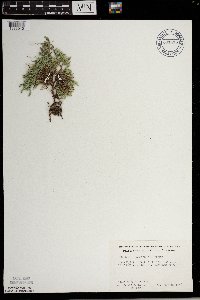 Selaginella rupestris (L.) Spring 691415[1383940]Smith, Welby; et al. 60941978-07-26 United States, Minnesota, Wabasha, Wabasha County...T109N, R9W, Sec.6, NE1/4. 4.6 mi SE of Kellogg on Rt. 84.;;109N;09W;06, 44.272608 -91.938982 |
MIN:Plants | 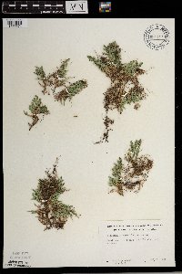 Selaginella rupestris (L.) Spring 691417[1383874]Ownbey, Gerald 60341978-07-08 United States, Minnesota, Polk, Polk Co. 1 mi SW of Fertile.;;N;;, 47.52584 -96.295493 |
MIN:Plants |  Selaginella rupestris (L.) Spring 694778[1383882]Peck, J.; et al. 75430P1975-08-03 United States, Minnesota, Lake of the Woods, Lake of the Woods Co.: on LOTW Co.51, 2 mi E of jnc. with LOTW Co.10;;;;, 49.059039 -94.920086 |
MIN:Plants |  Selaginella rupestris (L.) Spring 694779[1383883]Peck, J.; et al. 75429P1975-08-03 United States, Minnesota, Lake of the Woods, Lake of the Woods Co.: 5 mi S of Stoney Pt. on LOTW Co.17;Northwest Angle;;;, 49.353711 -95.002845 |
MIN:Plants |  Selaginella rupestris (L.) Spring 694780[1383884]Wagner, W.; et al. s.n.1973-08-13 United States, Minnesota, Becker, Becker Co. Green Valley Twp, T139N, R36W, sec.1, E end, 0.5 mi off 117 opn gravel rd. to .4 mi on two track to forest; on N side. 139N 36W 1, 46.883993 -95.172978 |
MIN:Plants |  Selaginella rupestris (L.) Spring 694781[1383885]Wagner, W.; et al. 756361975-08-20 United States, Minnesota, Cass, Cass Co.; by Hwy.371, S of Cass Lake, 1.4 mi N of entrance to Pike Bay Area Campground of Chippewa Nat. For.;Chippewa National Forest / Leech Lake Indian Reservation;145N;31W;, 47.421021 -94.537277 |
MIN:Plants |  Selaginella rupestris (L.) Spring 694782[1383886]Wagner, W. 732121973-08-11 United States, Minnesota, Becker, Becker Co.: Rt.46, just W of Indian Creek; R36W, T141N, betw. sec.4 & 9;Two Inlets State Forest;141N;36W;, 47.050732 -95.243401 |
MIN:Plants |  Selaginella rupestris (L.) Spring 694783[1383887]Wagner, W. 732571973-08-15 United States, Minnesota, Saint Louis, St. Louis Co.: Rt.765, ca.4.9 mi W of Ash River, Lookout Tower; T68N, r20W, Sec.9.;Kabetogama State Forest;068N;20W;9, 48.41713 -92.789044 |
MIN:Plants |  Selaginella rupestris (L.) Spring 694784[1383881]Peck, J.; et al. 75431P1975-08-03 United States, Minnesota, Lake of the Woods, Lake of the Woods Co.: Clementson, on Minn.11; at Rapid River bridge;;;;, 48.6833 -94.4333 |
MIN:Plants |  Selaginella rupestris (L.) Spring 694872[1383888]Wagner, W. 732231973-08-14 United States, Minnesota, Koochiching, Koochiching Co.: Margie;Pine Island State Forest;153N;26W;, 48.025406 -93.9333 |
MIN:Plants |  Selaginella rupestris (L.) Spring 703025[1383794]Peck, J. 79-7071979-08-26 United States, Minnesota, Wabasha, Wabasha co, Watopa Twp.; East Indian Creek, T109N R10W S31;;109N;10W;31, 44.200202 -92.05946 |
MIN:Plants |  Selaginella rupestris (L.) Spring 703063[1383946]Ownbey, Gerald 65121979-09-16 United States, Minnesota, Rice, Sec. SW1/4. Co.Rt.20, ca. 2.5 mi S of Dundas. Along Cannon River, E side.;Cannon River Wilderness Park;111N;20W;26, 44.389825 -93.200024 |
MIN:Plants |  Selaginella rupestris (L.) Spring 708010[1383921]Smith, Welby 13291979-08-02 United States, Minnesota, Redwood, Redwood co. T114N R37W, SE1/4 sec.7. 5 mi due N of jnc. of co.hwys.7 and 54 in Belview. 1/4 mi W of co.rd.7.;;114N;37W;7, 44.691689 -95.350531 |
MIN:Plants |  Selaginella rupestris (L.) Spring 708020[1383831]Smith, Welby 13391979-08-02 United States, Minnesota, Redwood, Redwood Co. T112N R34W, NW1/4 SE1/4 sec.14. 6.5 mi N-NE of Morgan, S of Wabasha Creek and N of co.Hwy.10.;;112N;34W;14, 44.513365 -94.889882 |
MIN:Plants |  Selaginella rupestris (L.) Spring 709105[1383943]Wheeler, Gerald 40951979-06-27 United States, Minnesota, Renville, Renville Co. Approx. 0.25 mi W of Morton. The jnc. of Rt. 71 and 19. T113N R34W Sec.31.;;113N;34W;31, 44.549251 -94.983808 |
MIN:Plants |  Selaginella rupestris (L.) Spring 709370[1383933]Wheeler, Gerald 43621979-07-10 United States, Minnesota, Big Stone, Big Stone Co. Approx. 0.25 mi SE of Ortonville on Rt.7; T121N R46W Sec.15;;121N;46W;15, 45.290922 -96.420296 |
MIN:Plants |  Selaginella rupestris (L.) Spring 709534[1383911]Wheeler, Gerald 45351979-07-22 United States, Minnesota, Carlton, Carlton Co. Jay Cooke State Park; T48N R16W Sec.9;Jay Cooke State Park;048N;16W;9, 46.656048 -92.375008 |
MIN:Plants |  Selaginella rupestris (L.) Spring 709612[1383934]Wheeler, Gerald 46131979-08-02 United States, Minnesota, Redwood, Redwood Co. Approx. 6.5 mi N-NE of Morgan. About 1/16 to 1/8 mi W of Rt.11; T112N R34W Sec.14;;112N;34W;14, 44.513365 -94.889882 |
MIN:Plants |  Selaginella rupestris (L.) Spring 709662[1383799]Wheeler, Gerald 46661979-08-02 United States, Minnesota, Redwood, Redwood Co. Approx. 6.5 mi N of Morgan; (Cedar Maountain); T112N R34W Sec.15;;112N;34W;15, 44.513365 -94.889882 |
MIN:Plants |  Selaginella rupestris (L.) Spring 709680[1383800]Wheeler, Gerald 46871979-08-02 United States, Minnesota, Redwood, Redwood Co. Approx. 5.5 mi N of Belview on Rt.7; T114N R37W Sec.7;;114N;37W;7, 44.691689 -95.350531 |
MIN:Plants |  Selaginella rupestris (L.) Spring 709994[1383941]Wheeler, Gerald 50241979-10-06 United States, Minnesota, Le Sueur, Le Sueur Co. Approx. 1 mi SW of Kasota; bluff overlooking the Minnesota River. High Lime Prairie; T109N R26W Sec.6.;East Minnesota River Wildlife Management Area;109N;26W;6, 44.274575 -93.998475 |
MIN:Plants |  Selaginella rupestris (L.) Spring 711422[1383844]Smith, Welby 9981979-06-26 United States, Minnesota, Nicollet, Nicollet Co. T110N R30W, NE1/4 SE1/4 sec.35. 3.2 mi W of Courtland; S side of State Hwy.14;;110N;30W;35, 44.290079 -94.401883 |
MIN:Plants |  Selaginella rupestris (L.) Spring 711441[1383920]Smith, Welby 10261979-06-27 United States, Minnesota, Pipestone, Pipestone Co. T106N R46W, SE1/4 SW1/4 sec.1. Pipestone National Monument. Just E of the quarry ridge.;Pipestone National Monument;106N;46W;1, 44.013519 -96.324755 |
MIN:Plants |  Selaginella rupestris (L.) Spring 711986[1383919]Smith, Welby 9321979-06-02 United States, Minnesota, Wright, Wright Co. T122N R25W, SE1/4 NW1/4 sec.30. 0.2 mi N of Co.Hwy.75, 5.5 mi NW of its jnc. with State Hwy.25 in Monticello.;;122N;25W;30, 45.345989 -93.884026 |
MIN:Plants |  Selaginella rupestris (L.) Spring 724409[1383894]Smith, Welby 35341980-08-24 United States, Minnesota, Wright, Wright Co. T123N R27W, SW1/4 NW1/4 sec.35. Rest area on W side of Co.Rd.75 in Clearwater.;;123N;27W;35, 45.41947 -94.054708 |
MIN:Plants |  Selaginella rupestris (L.) Spring 724783[1383900]Smith, Welby 26701980-06-26 United States, Minnesota, Winona, Whitewater Wildlife Management Area. Winona co. T108N R10W, NW1/4 SE1/4 NW1/4 sec.14. On the E side of the Whitewater River, about 1/2 mi NE of the jnc. of C Winona co. T108N R10W, NW1/4 SE1/4 NW1/4 sec.14. On the E side of the Whitewater River, about 1/2 mi NE of the jnc. of Co.Hwys.30 and 74.. 108N 10W 14, 44.161283 -91.9983 |
MIN:Plants |  Selaginella rupestris (L.) Spring 733477[1383907]Quinn, Robert 6971980-06-30 United States, Minnesota, Clearwater, Clearwater Co. Ca. 1 mi on Co.2, pass Minn.200;Itasca State Park;143N;36W;, 47.197458 -95.201964 |
MIN:Plants |  Selaginella rupestris (L.) Spring 733478[1383870]Quinn, Robert 3981979-08-03 United States, Minnesota, Polk, Polk Co.;;N;;, 47.773855 -96.401806 |
MIN:Plants |  Selaginella rupestris (L.) Spring 746718[1383904]Smith, Welby 47321981-07-10 United States, Minnesota, Sherburne, Sherburne Co. On the W side of Co.Hwy.1, about 3 1/2 mi N-NW of its jnc. with U.S.Hwy.10 in Elk River; SW1/4 SW1/4 sec.1 Sherburne Co. On the W side of Co.Hwy.1, about 3 1/2 mi N-NW of its jnc. with U.S.Hwy.10 in Elk River; SW1/4 SW1/4 sec.17, T33N R26W. 033N 26W 17, 45.315986 -93.623044 |
MIN:Plants |  Selaginella rupestris (L.) Spring 749103[1383903]Wheeler, Gerald 54511981-05-18 United States, Minnesota, Stearns, Stearns Co. About 3.5 mi SW of St. Cloud; (just E of Tr.15). T123N R28W Sec.5;;123N;28W;5, 45.493436 -94.230376 |
MIN:Plants |  Selaginella rupestris (L.) Spring 749141[1383902]Wheeler, Gerald 54801981-05-18 United States, Minnesota, Stearns, Stearns Co. About 1 mi W of Rockville on unmarked co.rd.; T123N R29W Sec.8;;123N;29W;8, 45.479391 -94.35342 |
MIN:Plants |  Selaginella rupestris (L.) Spring 749321[1383901]Wheeler, Gerald 55971981-07-17 United States, Minnesota, Carlton, Carlton Co. Jay Cooke State Park, about .25 mi W of the Headquarters; T48N R16W Sec.(s) 9-10;Jay Cooke State Park;048N;16W;, 46.649665 -92.330748 |
MIN:Plants |  Selaginella rupestris (L.) Spring 751014[1383906]Galatowitsch, S. 8531983-05-22 United States, Minnesota, Wabasha, Wabasha County...NE1/4 NW1/4 Sec. 8 T109N R9W;Kellogg-Weaver Dunes Scientific Natural Area / Kellogg-Weaver Dunes, The Nature Conservancy;109N;09W;08, 44.25801 -91.91867 |
MIN:Plants |  Selaginella rupestris (L.) Spring 753195[1383871]Boe, J. 18601983-05-27 United States, Minnesota, Kittson, Kittson Co. Norway Dunes: SW1/4 SE1/4 Sec.10. T160N R46W;Norway Dunes, The Nature Conservancy;160N;46W;10, 48.695736 -96.572771 |
MIN:Plants |  Selaginella rupestris (L.) Spring 758305[1383899]Delaney, B. s.n.1983-06-25 United States, Minnesota, Anoka, Cedar Creek National History Area. Anoka Co. Cedar Creek Natural History Area. In N-S 'limb' extending from the centaral portion of old field in SE1/4 of S Anoka Co. Cedar Creek Natural History Area. In N-S 'limb' extending from the centaral portion of old field in SE1/4 of SE1/4 sec.33 Bethel Twp.. 034N 23W 33, 45.299567 -93.328827 |
MIN:Plants |  Selaginella rupestris (L.) Spring 773290[1383861]Boe, J. 7701979-07-14 United States, Minnesota, Lake of the Woods, Lake of the Woods Co. Long Point; near lake; SW1/4 Sec.31 R33W T164N;;164N;33W;31, 48.977214 -94.959949 |
MIN:Plants |  Selaginella rupestris (L.) Spring 774075[1383795]Boe, J. 7851979-07-15 United States, Minnesota, Lake of the Woods, Lake of the Woods Co. Near gravel pit, Angle Inlet; N1/2 Sec.31 R34W T168N;Northwest Angle;168N;34W;31, 49.330606 -95.080858 |
MIN:Plants |  Selaginella rupestris (L.) Spring 774406[1383908]Monson, Paul 52631982-08-11 United States, Minnesota, Saint Louis, Voyageurs National Park. Voyageur's National Park. St. Louis Co. R-19W, T-69N, NE1/4, S-18. Agnes Lake, Kabetogama peninsula. N shore near campsi Voyageur's National Park. St. Louis Co. R-19W, T-69N, NE1/4, S-18. Agnes Lake, Kabetogama peninsula. N shore near campsite.. 069N 19W 18, 48.470908 -93.008801 |
MIN:Plants |  Selaginella rupestris (L.) Spring 776352[1383756]Morley, T. 15941985-05-18 United States, Minnesota, Scott, Scott Co. NNW of Jordan near the Minnesota River. T114N, R24W, SE corner of sec.12, N of N loop of E. Sioux Vista Driver Scott Co. NNW of Jordan near the Minnesota River. T114N, R24W, SE corner of sec.12, N of N loop of E. Sioux Vista Driver.. 114N 24W 12, 44.690304 -93.64729 |
MIN:Plants |  Selaginella rupestris (L.) Spring 780490[1383905]Ownbey, Gerald 69011983-06-22 United States, Minnesota, Dakota, Dakota Co. T113N, R19W, Sec.32, just E of center of section. At Castle Rock;;113N;19W;32, 44.550813 -93.124293 |
MIN:Plants |  Selaginella rupestris (L.) Spring 787206[1383838]Smith, Welby 110381985-08-10 United States, Minnesota, Dakota, Dakota County...About 2 mi S-SE of Coates; 0.2 mi SW of the jnc. of 180th street and U.S. Hwy. 52...NW1/4 NE1/4 sec. 18, T114N R18W. 114N 18W 18, 44.6858333 -93.0222222 |
MIN:Plants |  Selaginella rupestris (L.) Spring 793118[1383840]Ownbey, Gerald 72231987-09-03 United States, Minnesota, Lake of the Woods, Lake of the Woods Co. T163N, R34W, Sec.30, SE1/4. N side of Co.Rt.17, 4 mi S of Arnesen.;;163N;34W;30, 48.908654 -95.08037 |
MIN:Plants |  Selaginella rupestris (L.) Spring 802752[1383842]Smith, Welby 114371986-05-16 United States, Minnesota, Sherburne, Sherburne Co. Sherburne National Wildlife Refuge, about 2 1/2 mi SE of Orrock. SW1/4 SE1/4 sec.10, T34N R27W;Sherburne National Wildlife Refuge;034N;27W;10, 45.4444427 -93.6819458 |
MIN:Plants |  Selaginella rupestris (L.) Spring 802816[1383841]Smith, Welby 115841986-05-31 United States, Minnesota, Sherburne, Sherburne Co. Sherburne National Wildlife Refuge, about 2 1/2 mi SE of Santiago; NE1/4 SW1/4 sec.23, T35N R28W;Sherburne National Wildlife Refuge;035N;28W;23, 45.5074997 -93.7938919 |
MIN:Plants |  Selaginella rupestris (L.) Spring 804425[1383938]Johnson, Gary s.n.1989-08-05 United States, Minnesota, Kanabec, SW1/4 S.20 T40N R24W, Kanabec Co.;;T040N R24W S20, 45.940063 -93.360144 |
MIN:Plants |  Selaginella rupestris (L.) Spring 812683[1383939]Wheeler, Gerald 106061988-06-02 United States, Minnesota, Polk, Polk Co. Ca. 2.5 mi SSW of Fertile, Agassiz Dune area; NW1/4 SE1/4 Sec.31 T147N R44W (Garfield Twp.);Agassiz Dunes Scientific Natural Area;147N;44W;31, 47.507122 -96.312638 |
MIN:Plants |  Selaginella rupestris (L.) Spring 812698[1383755]Wheeler, Gerald 115001988-07-27 United States, Minnesota, Lac Qui Parle, Lac Qui Parle Co. Ca. 6 mi NNE of Bellingham, Lac Qui Parle WMA; N1/2 Sec.12 T120N R45W (Agassiz Twp.);Lac Qui Parle Wildlife Management Area;120N;45W;12, 45.214683 -96.23671 |
MIN:Plants |  Selaginella rupestris (L.) Spring 815140[1383873]Wheeler, Gerald 106261988-06-03 United States, Minnesota, Norman, Norman County...Ca. 6.5 mi NNW of Gary, Agsco Dunes Area; NE1/4 SE1/4 Sec.18 T146N R44W (Sundal Twp.);Prairie Smoke Dunes Scientific Natural Area;146N;44W;18, 47.46366 -96.313166 |
MIN:Plants |  Selaginella rupestris (L.) Spring 830161[1311468]Boe, J. 920813011992-08-13 United States, Minnesota, Roseau, Roseau Co.; in NW Roseau county; SW1/4 SW1/4 Sec.29 T164N R44W.;;164N;44W;29, 48.941532 -96.359046 |
MIN:Plants |  Selaginella rupestris (L.) Spring 833876[1383834]Smith, Welby 141671988-06-01 United States, Minnesota, Lac Qui Parle, Lac Qui Parle Co. In the Minnesota Valley, about 6 mi NW of Bellingham; SW1/4 SW1/4 sec 7, T120N R45W.;;120N;45W;7, 45.218565 -96.341865 |
MIN:Plants |  Selaginella rupestris (L.) Spring 836119[1383895]Schimpf, D.; et al. 1671983-08-23 United States, Minnesota, Cook, Grand Portage National Monument; Cook Co, R-6E, T-63N, S-4, Mt. Rose;Grand Portage National Monument / North Shore;063N;06E;04, 47.999682 -89.760688 |
MIN:Plants |  Selaginella rupestris (L.) Spring 841049[1383858]Smith, Welby 127331987-05-20 United States, Minnesota, Nicollet, Nicollet Co. In the Minnesota Valley, about 9 mi N-NE of Sleepy Eye; SE1/4 SW1/4 sec.15, T111N R32W;;111N;32W;15, 44.420061 -94.674298 |
MIN:Plants |  Selaginella rupestris (L.) Spring 492512[1383772]Wheeler, Gerald 168121997-07-24 United States, Minnesota, Benton, Benton County ... Ca. 0.5 mi. SW of Watab ... N1/2 SE1/4 NW1/4 Sec. 27 T37N R31W;;037N;31W;27, 45.667396 -94.194717 |
MIN:Plants |  Selaginella rupestris (L.) Spring 461419[1311471]Gerdes, Lynden; et al. 32201998-08-26 United States, Minnesota, Cook, Boundary Waters Canoe Area Wilderness / Superior National Forest. T64N R02E S07NENW. Cook County; Superior National Forest, BWCAW. North shore, bedrock outcrop along the eastern third of Pierz Lake.. T064N R02E S7, 48.04129 -90.241743 |
MIN:Plants |  Selaginella rupestris (L.) Spring 478128[1383860]Wheeler, Gerald 192761998-06-17 United States, Minnesota, Scott, Scott County ... Ca. 1 mi. NW of Jordan ... W1/2 SE1/4 Sec. 12 T114N R24W (St. Lawrence 12);;114N;24W;12, 44.689449 -93.647205 |
MIN:Plants |  Selaginella rupestris (L.) Spring 472835[1383843]Lee, Michael MDL16181997-05-06 United States, Minnesota, Wabasha, Dorer Memorial Hardwood State Forest. Wabasha Co.; Zumbro Bottoms DNR Forestry Unit. Along the Zumbro River one mile south of Dumfries; west-facing slope of 100ft. high river terrace; T110N R11W NE1/4 of SW1/4 sec. 15. 110N 11W 15, 44.249964 -91.954363 |
MIN:Plants |  Selaginella rupestris (L.) Spring 427276[1383806]Scott, P. 11691999-08-19 United States, Minnesota, Cook, Cook Co.; at campsite on unnamed island just west of Horseshoe Island, Saganaga Lake, BWCAW. T66N R4W sec. 6 SENENW.;Boundary Waters Canoe Area Wilderness / Superior National Forest;066N;04W;6, 48.230425 -90.890557 |
MIN:Plants |  Selaginella rupestris (L.) Spring 489269[1311469]Lee, Michael MDL27322000-06-21 United States, Minnesota, Lake, Superior National Forest. Lake County...in the Superior National Forest two miles north-northeast of Cramer...south-facing slope above Paccini Lake...T59N R6W NW1/4 of NE1/4 Sec. 34. 059N 06W 34, 47.551557 -91.075831 |
MIN:Plants |  Selaginella rupestris (L.) Spring 480011[1383863]Cholewa, A. 25862001-06-21 United States, Minnesota, Sherburne, Sherburne Co. Sand Dunes State Forest, Uncas Dunes Scientific and Natural Area (near Lake Ann). T34N R27W Sec. 22.;Sand Dunes State Forest / Uncas Dunes Scientific Natural Area;034N;27W;22, 45.422143 -93.684004 |
MIN:Plants | Selaginella rupestris (L.) Spring 55577[]Wheeler, William 6721900-08-00 United States, Michigan, Keweenaw, Tobin's Harbor, Isle Royale;Isle Royale National Park |
MIN:Plants |  Selaginella rupestris (L.) Spring 782231[1383975]Gerdes, Lynden 51122006-05-23 United States, Minnesota, Itasca, George Washington State Forest. T62N R24W S17NWNENW Itasca County ... George Washington State Forest. Approximately 9.23 miles ENE of Effie, MN and 0.26 mile E of Cty. Rd. 525.. 062N 24W 17, 47.863849 -93.436859 |
MIN:Plants |  Selaginella rupestris (L.) Spring 920211[1383862]Smith, Welby 182611990-08-31 United States, Minnesota, Morrison, Camp Ripley Military Reservation. Camp Ripley Military Reservation. Morrison County...About 0.5 km west of Gilgal Church (abandoned) and 8 km south of Pillager...UTM: 384400E 5122900N. T 132N R 30W NE1/4 of NE1/4 of Sec 18. 132N 30W 18, 46.2516667 -94.4997222 |
MIN:Plants |  Selaginella rupestris (L.) Spring 435527[1311473]Wheeler, Gerald 156851997-05-23 United States, Minnesota, Renville, Renville Co.; Ca. 15 mi. S of Danube on Rte. 1, W of road; NW1/4 NE1/4 SW1/4 Sec. 20 T113N R35W (Beaver Falls 20);;113N;35W;20, 44.578346 -95.085406 |
MIN:Plants |  Selaginella rupestris (L.) Spring 492649[1383896]Wheeler, Gerald 174641997-08-30 United States, Minnesota, Nicollet, Nicollet County ... Ca. 2.5 mi. NW of Courtland on Rte. 14; Red Rock area ... E1/2 SE1/4 SW1/4 Sec. 34 T110N R30W (Courtland 34). 110N 30W 34, 44.292954 -94.420107 |
MIN:Plants |  Selaginella rupestris (L.) Spring 909152[1383937]Smith, Welby; et al. 310262008-07-22 United States, Minnesota, Lake, Boundary Waters Canoe Area Wilderness / Superior National Forest. Lake County ... Near the southeast end of Fourtown Lake in the Boundary Waters Canoe Area Wilderness, Superior National Forest ... T65N R11W SE1/4 of SE1/4 of Sec 31. 065N 11W 31, 48.0669444 -91.7822222 |
MIN:Plants |  Selaginella rupestris (L.) Spring 905124[1383876]Smith, Welby 282851999-09-01 United States, Minnesota, Koochiching, Koochiching County ... About 6 miles north of Loman ... T159N R25W SE1/4 of SE1/4 of Sec 10;;159N;25W;10, 48.6019444 -93.8241667 |
MIN:Plants |  Selaginella rupestris (L.) Spring 629017[1372289]Neese, E. 3891972-10-08 United States, Wyoming, Crook, Crook Co: Devils Tower Nat. Monument, summit of Devils Tower.;Devils Tower National Monument |
MIN:Plants |  Selaginella rupestris (L.) Spring 915929[1383960]Smith, Welby; et al. 314832009-09-12 United States, Minnesota, Cook, Boundary Waters Canoe Area Wilderness / Superior National Forest. Cook County...Boundary Waters Canoe Area Wilderness, Superior National Forest. At the south end of John Lake T 65N R 3E SW1/4 of SW1/4 of Sec 34. 065N 03E 34, 48.0672222 -90.0536111 |
Google Map
Google Maps is a web mapping service provided by Google that features a map that users can pan (by dragging the mouse) and zoom (by using the mouse wheel). Collection points are displayed as colored markers that when clicked on, displays the full information for that collection. When multiple species are queried (separated by semi-colons), different colored markers denote each individual species.