University of Minnesota
http://www.umn.edu/
612-625-5000
http://www.umn.edu/
612-625-5000
Minnesota Biodiversity Atlas
Bell Museum
Dataset: MIN-Plants
Taxa: Schoenoplectus
Search Criteria: excluding cultivated/captive occurrences
Bell Museum plants | |
 MIN:Plants | 251151[]Umbach, L.M. s.n.1899-09-12 United States, Indiana, Porter, Dune Park;Indiana Dunes National Lakeshore;;;, 41.663093 -87.032128 |
MIN:Plants |  Schoenoplectus acutus var. acutus (Muhlenberg ex Bigelow) 462417[1021714]Crowell, Wendy s.n.2001-06-20 United States, Minnesota, Hennepin, Hennepin County, Bryant Lake;;116N;22W;02, 44.884269 -93.429593 |
MIN:Plants |  Schoenoplectus pungens (Vahl) Palla 482169[1021740]Wheeler, Gerald 170111997-08-08 United States, Minnesota, Swift, Swift Co.; Ca. 5 mi. NNE of Benson, on NW margin of Frovold Lake; NW1/4 SE1/4 Sec. 16 T122N R39W (Benson 16);;122N;39W;16, 45.376026 -95.571928 |
MIN:Plants |  Schoenoplectus tabernaemontani (C.C. Gmelin) Palla 699675[1021788]Ziegler, S.; et al. 17661975-07-15 United States, Wisconsin, Vernon, Upper Mississippi National Wildlife Refuge. Mississippi River (Navigation Pool #8) ... Vernon Co.; Island 9; Mississippi River-mile #688.8; T14N R7W Sec 18 ... Island on E side of main channel. 014N 07W 18, 193m |
MIN:Plants |  Schoenoplectus subterminalis (Torrey) Soj 221306[1021766]Cooper, William 2141910-08-18 United States, Michigan, Keweenaw, Duncan Bay. Isle Royale.;Isle Royale National Park |
MIN:Plants | 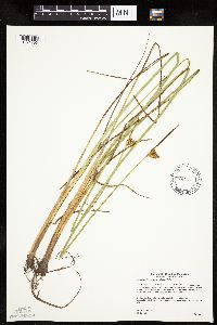 Schoenoplectus torreyi (Olney) Palla 439032[1021796]Gerdes, Lynden 49212004-08-16 United States, Minnesota, Lake, Superior National Forest. T61N R09W S25NWNEN. Lake County...Superior National Forest. Approximately 9.23 miles NW of Isabella, MN and 1.5 miles SW down the Tomahawk Road (FR 377) from its junction with the Northwest Road (FR 373). Pond on N side of FR 377.. 061N 09W 25, 47.737043 -91.415884 |
MIN:Plants |  Schoenoplectus americanus (Persoon) Volkart ex Schinz & R. Keller 794928[1021725]Schaaf, J. 1281982-07-28 United States, Nevada, Pershing, Pershing Co. ... Humboldt River edge, near Lovelock. 26PE350 ... Elev.: 3980 ft. |
MIN:Plants |  Schoenoplectus torreyi (Olney) Palla 83943[1021800]Chase, Agnes 6081897-09-06 United States, Indiana, Porter, Dune Park;Indiana Dunes National Lakeshore;;;, 41.663093 -87.032128 |
MIN:Plants |  Schoenoplectus smithii var. setosus (Fernald) S.G. Smith 488364[1021753]Zager, S. 160c1999-09-09 United States, Minnesota, Kanabec, MCBS Site KA011. NE1/4 of SW1/4 of NW1/4 of section;;042N;22W;24, 46.1104389 -93.0705333 |
MIN:Plants | 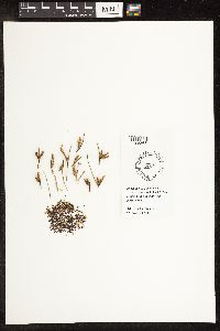 Schoenoplectus americanus (Persoon) Volkart ex Schinz & R. Keller 444338[1105863]Bright, R. 73-2481973-00-00 United States, Idaho, Franklin, [no further data] |
MIN:Plants |  Schoenoplectus tabernaemontani (C.C. Gmelin) Palla 907260[1021776]Smith, Welby 286132000-06-22 United States, Minnesota, Chippewa, Chippewa County...along Watson Sag, about 5 miles NW of Watson...T 119N R 42W SE1/4 of SE1/4 of Sec 36;Lac Qui Parle Wildlife Management Area;119N;42W;36, 45.0686111 -95.8627778 |
MIN:Plants |  Schoenoplectus torreyi (Olney) Palla 491507[1021799]Myhre, K. 78421998-07-28 United States, Minnesota, Pine, Pine County ... Olive Lake. Located 15 miles east of the town of Hinkley ...T41N R18W SE1/4 of SE1/4 of Sec 21;;041N;18W;21, 46.019105 -92.626408 |
MIN:Plants |  Schoenoplectus americanus (Persoon) Volkart ex Schinz & R. Keller 83736[1105436]Coville, Frederick; Funston, Frederick 5691891-04-08 United States, California, Inyo, Furnace Creek Canyon, Funeral Mountains;Death Valley National Park, 100m |
MIN:Plants | 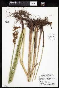 902903[1021722]Smith, Welby 296592006-07-10 United States, Minnesota, Waseca, Teal Marsh Wildlife Management Area. Waseca County...At Reese Lake in Teal State Wildlife Management Area, about 6 miles west-northwest of Ellendale... T 105N R 22W NE1/4 of NW1/4 of Sec 24. 105N 22W 24, 43.8888889 -93.4205556 |
MIN:Plants | 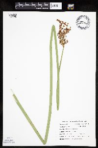 Schoenoplectus tabernaemontani (C.C. Gmelin) Palla 479492[1021778]DeMink, L. 3942000-09-17 United States, Minnesota, Morrison, Crane Meadows National Wildlife Refuge; NENE 30-T40N-R31W; Near edge of Rice Lake.;Crane Meadows National Wildlife Refuge;040N;31W;30, 45.933896 -94.251564 |
MIN:Plants | 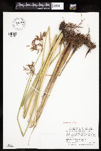 902900[1021734]Smith, Welby R. 297652006-08-04 United States, Minnesota, Lac Qui Parle, Perry State Wildlife Management Area, about 9 miles northwest of Madison. T119N R45W SW1/4 of NW1/4 of Sec 21, 45.105 -96.3041667 |
MIN:Plants | 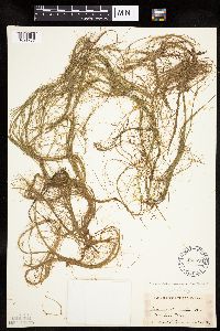 Schoenoplectus subterminalis (Torrey) Soj 485526[1021767]Rand, Edward s.n.1889-08-28 United States, Maine, Hancock, Mount Desert Island ... Seal Cove Pond;Acadia National Park |
MIN:Plants |  Schoenoplectus acutus (Muhlenberg ex Bigelow) ́. L̦ve & D. L̦ve 623399[1021720]Niles, W.; et al. 7491966-05-01 United States, Arizona, Cochise, Canyon to the right and northeast of the State of Texas Mine, Huachuca Mountains, Coronado National Memorial;Coronado National Monument, 1768m |
MIN:Plants |  Schoenoplectus heterochaetus (Chase) Soj 459830[1021729]Homoya, M.; et al. 15862003-08-19 United States, Minnesota, Saint Louis, ST. LOUIS CO ... Lac La Croix, BWCAW. T68N R15W sec. 25.;Boundary Waters Canoe Area Wilderness / Superior National Forest;068N;15W;25, 48.344655 -92.2026 |
MIN:Plants |  902916[1021723]Smith, Welby 297692006-08-04 United States, Minnesota, Big Stone, Victory Wildlife Management Area. Big Stone County...Victory State Wildlife Management Area, about 5 miles northeast of Ortonville...small prairie lake...T 122N R 45W NE1/4 of SE1/4 of Sec 31. 122N 45W 31, 45.3305556 -96.3483333 |
MIN:Plants |  Schoenoplectus torreyi (Olney) Palla 462439[1021794]Smith, Welby 263551996-08-23 United States, Minnesota, Saint Louis, Boundary Waters Canoe Area Wilderness / Superior National Forest. St. Louis County ... Superior National Forest, Boundary Waters Canoe Area Wilderness ... Nina Moose River ... T66N R14W SW1/4 of SW1/4 of Sec 13. 066N 14W 13, 48.1977778 -92.0797222 |
MIN:Plants |  Schoenoplectus acutus (Muhlenberg ex Bigelow) ́. L̦ve & D. L̦ve 567157[1021721]Hunnewell, F. s.n.1914-08-21 United States, Wyoming, Park, Yellowstone National Park ... Mammoth Hot Springs;Yellowstone National Park, 2286m |
MIN:Plants | Schoenoplectus smithii var. setosus (Fernald) S.G. Smith 435083[]Lee, Michael MDL24451998-09-10 United States, Minnesota, Mille Lacs, 3-1/2 miles northwest of Onamia. SE1/4 of SE1/4 of section;Mille Lacs Kathio State Park;042N;27W;14, 46.119975 -93.714659 |
MIN:Plants |  Schoenoplectus tabernaemontani (C.C. Gmelin) Palla 499071[1021781]Capistrant, A. AMC13391998-06-22 United States, Minnesota, Ramsey, Ramsey Co, T29N R22W S21 [Lake Phalen];;029N;22W;21, 44.984772 -93.055944 |
MIN:Plants |  Schoenoplectus tabernaemontani (C.C. Gmelin) Palla 509397[1021777]Roitsch, C. 5461999-09-18 United States, Minnesota, Morrison, Crane Meadows National Wildlife Refuge;Crane Meadows National Wildlife Refuge;;;, 45.9414 -94.21 |
MIN:Plants |  Schoenoplectus americanus (Persoon) Volkart ex Schinz & R. Keller 83735[1021726]Mulford, A. Isabel s.n.1892-08-28 United States, Wyoming, Park, Yellowstone National Park ... Upper Geyser Basin;Yellowstone National Park |
MIN:Plants |  Schoenoplectus heterochaetus (Chase) Soj 479105[1021730]Lehtinen, R. 95-22001995-08-22 United States, Minnesota, Lyon, Lyon Co, T110N R43W NW1/4 of the SW1/4 of S1; Prairie Marshes Wildlife Management Area.;Prairie Marshes Wildlife Management Area;110N;43W;1, 44.363431 -95.968101 |
MIN:Plants |  Schoenoplectus torreyi (Olney) Palla 489161[1021791]Gerdes, Lynden 48952004-08-05 United States, Minnesota, Lake, Superior National Forest. T60N R08W S04SESWN. Lake County...Superior National Forest. Approximately 6.54 miles N of Isabella, MN. 1.1.62 miles SW of Helen Lake and 0.24 mile E of the Northwest Road (FR 373).. 060N 08W 4, 47.709118 -91.352422 |
MIN:Plants |  Schoenoplectus torreyi (Olney) Palla 531743[1021801]Umbach, L. 45151909-08-09 United States, Indiana, Porter, Northern Porter County ... Dune Park on Lake Michigan (7 mi. E. of Gary, SE of Chicago);Indiana Dunes National Lakeshore;;;, 41.663093 -87.032128 |
MIN:Plants |  902910[1021733]Smith, Welby R. 297262006-07-27 United States, Minnesota, Pipestone, Woodstock State Wildlife Management Area, about 14 mi northeast of Pipestone (town). T107N R44W SE1/4 of SW1/4 of sec 1, 44.0977778 -96.0777778 |
MIN:Plants |  Schoenoplectus subterminalis (Torrey) Soj 461941[1021761]Lee, Michael MDL26841999-08-10 United States, Minnesota, Lake, North Shore. Lake County ... Along County Road 7 six miles northeast of Finland ... East Branch Baptism River ... T58N R6W NE1/4 of SW1/4 of SW1/4 Sec. 31. 058N 06W 31, 47.465115 -91.139684 |
MIN:Plants |  Schoenoplectus acutus var. acutus (Muhlenberg ex Bigelow) ́. L̦ve & D. L̦ve 916981[1021708]Gerdes, Lynden 59512009-09-16 United States, Minnesota, Cook, T64N R03E S03SWNW. Cook County, MN. Superior National Forest. Little John Lake...NAD 83 / 719647 / 5327111;Superior National Forest;064N;03E;03, 48.0594444 -90.0519444 |
MIN:Plants |  Schoenoplectus acutus var. acutus (Muhlenberg ex Bigelow) ́. L̦ve & D. L̦ve 898570[1021712]Lawrenz, Ron s.n.2007-06-09 United States, Minnesota, Washington, Washington County, Warner Nature Center,Tarapin Lake, T31N R20W Sec.15.;Warner Nature Center;031N;20W;15, 45.174187 -92.825005 |
MIN:Plants |  Schoenoplectus tabernaemontani (C.C. Gmelin) Palla 244993[1021786]Harris, J. Arthur C161061916-02-10 United States, Florida, Dade, Everglades, near Long Key, Dade County;Everglades National Park |
MIN:Plants |  Schoenoplectus pungens (Vahl) Palla 907526[1021739]Smith, Welby 290822000-09-06 United States, Minnesota, Itasca, Itasca County...On the west side of Twin Lake, about 6 mi S of Pengilly on Hwy 65...T55N R22W SE1/4 of SE1/4 of Sec 18;;055N;22W;18, 47.2458333 -93.1775 |
MIN:Plants | 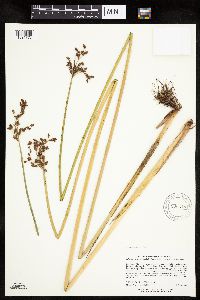 Schoenoplectus tabernaemontani (C.C. Gmelin) Palla 906318[1021773]Lee, Michael MDL37652004-08-03 United States, Minnesota, Todd, Todd County...Lake Beauty Bible Camp, seven miles northeast of Long Prairie...Spring Branch Creek, west of Lake Beauty...T129N R32W NW1/4 of SE1/4 Sec. 04. 129N 32W 4, 46.012899 -94.721123 |
MIN:Plants | 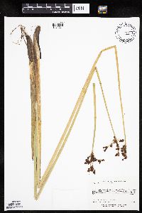 Schoenoplectus tabernaemontani (C.C. Gmelin) Palla 493455[1021784]Lee, Michael MDL29782001-06-22 United States, Minnesota, Lake, Finland State Forest. Lake County...Along Ninemile Creek at junction of County Road 7 and the (Erie) Mining Railroad, 3/4 mile NNE of Cramer...gravel pit just east of railroad tunnel...T58N R6W SW1/4 of SE1/4 of NW1/4 Sec. 3. 058N 06W 3, 47.538429 -91.082123 |
MIN:Plants | 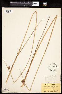 Schoenoplectus pungens (Vahl) Palla 567160[1021747]Hunnewell, F. 30301914-08-21 United States, Wyoming, Park, Yellowstone National Park ... Mammoth Hot Springs;Yellowstone National Park |
MIN:Plants | 289196[]Beardslee, H. C. s.n.1891-00-00 United States, North Carolina, Swain, Great Smoky Mountains;Great Smoky Mountains National Park, 518m |
MIN:Plants | 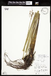 Schoenoplectus heterochaetus (Chase) Soj 461789[1021728]Husveth, J. 95-7011995-08-20 United States, Minnesota, Stearns, NE1/4 of the NE1/4 of section;Kenna Wildlife Management Area;125N;34W;16, 45.63621 -94.963799 |
MIN:Plants |  Schoenoplectus torreyi (Olney) Palla 304551[1021802]Weatherby, C.; et al. 5261932-08-22 United States, Massachusetts, Middlesex, Concord;Minute Man National Historic Park |
MIN:Plants |  Schoenoplectus americanus (Persoon) Volkart ex Schinz & R. Keller 250621[1021727]Mearns, E. 30791902-08-10 United States, Wyoming, Park, Yellowstone National Park ... Gibbon River (at crossing n. of Wylie Camp);Yellowstone National Park |
MIN:Plants |  Schoenoplectus subterminalis (Torrey) Soj 515077[1021759]Lee, Michael MDL38082004-08-19 United States, Minnesota, Todd, TODD COUNTY ... Two miles southwest of Lincoln ... Little Cranberry Lake ... T131N R32W NE1/4 of NW1/4 Sec.2;;131N;32W;02, 46.187553 -94.678894 |
MIN:Plants |  Schoenoplectus acutus var. acutus (Muhlenberg ex Bigelow) ́. L̦ve & D. L̦ve 428439[1021713]Myhre, K. 64711996-08-05 United States, Minnesota, Crow Wing, Crow Wing Co.; Located 18 miles northeast of the town of Brainerd. Plants occur along the southwest bay of Little Hamlet Lake; T 46N R 28W SE1/4 of NE1/4 of Sec 27. 046N 28W 27, 46.438931 -93.862828 |
MIN:Plants |  Schoenoplectus torreyi (Olney) Palla 515057[1021795]Homoya, M.; et al. 15482003-08-17 United States, Minnesota, Saint Louis, ST. LOUIS CO ... Cove of Lac La Croix, BWCAW. T67N R14W sec.11 SENWSW;Boundary Waters Canoe Area Wilderness / Superior National Forest;067N;14W;11, 48.303959 -92.094074 |
MIN:Plants |  Schoenoplectus subterminalis (Torrey) Soj 509305[1021758]Myhre, K. 64731996-08-05 United States, Minnesota, Crow Wing, Crow Wing County ... Located 18 miles northeast of the town of Brainerd ... southwest bay of Little Hamlet Lake ... T 46N R 28W SE1/4 of NE1/4 of Sec 27. 046N 28W 27, 46.438931 -93.862828 |
MIN:Plants |  Schoenoplectus torreyi (Olney) Palla 485032[1021792]Myhre, K. 72921997-08-27 United States, Minnesota, Carlton, Carlton County ... Graham Lake. Located 3 mi southwest of the town of Holyoak [sic] ... T46N R17W NE1/4 of NW1/4 Sec 26;;046N;17W;26, 46.439481 -92.456458 |
MIN:Plants |  Schoenoplectus pungens (Vahl) Palla 510314[1021741]Wheeler, Gerald 189521998-06-06 United States, Minnesota, Redwood, Ca. 4.5 mi. NE of Belview; 0.3 mi. E of jct. of Rte(s). 19 and 58...N1/2 NE1/4 NW1/4 of section;;114N;37W;27, 44.650505 -95.289332 |
MIN:Plants |  902906[1021724]Smith, Welby 297842006-08-09 United States, Minnesota, Martin, Martin County...south end of South Silver Lake, about 10 miles south of Fairmont...T101N R30W NW1/4 of NW1/4 of Sec 32;;101N;30W;32, 43.5122222 -94.4633333 |
MIN:Plants |  Schoenoplectus torreyi (Olney) Palla 904505[1021797]Smith, Welby 268171997-08-24 United States, Minnesota, Saint Louis, Boundary Waters Canoe Area Wilderness / Superior National Forest. St. Louis County ... Superior National Forest; Boundary Waters Canoe Area Wilderness, along the Moose River ... T65N R14W SE1/4 of NW1/4 of Sec 11. 065N 14W 11, 48.13 -92.0986111 |
MIN:Plants |  Schoenoplectus tabernaemontani (C.C. Gmelin) Palla 681634[1021789]Swanson, Steven 11021975-07-01 United States, Wisconsin, Vernon, Mississippi River (Navigation Pool #8) ... Vernon Co, Site 60;Upper Mississippi National Wildlife Refuge |
MIN:Plants |  Schoenoplectus tabernaemontani (C.C. Gmelin) Palla 454298[1021771]Biederman, L. 304A1999-07-25 United States, Minnesota, Pipestone, Pipestone County ... (Altona Wildlife Management Area) ... T108N R46W NWNW01;Altona Wildlife Management Area;108N;46W;01, 44.190127 -96.318183 |
MIN:Plants |  Schoenoplectus smithii var. setosus (Fernald) S.G. Smith 435485[1285197]Lee, Michael D. MDL24451998-09-10 United States, Minnesota, Mille Lacs, 3-1/2 miles northwest of Onamia. SE1/4 of SE1/4;Mille Lacs Kathio State Park;042N;27W;14, 46.119975 -93.714659 |
MIN:Plants |  Schoenoplectus acutus (Muhlenberg ex Bigelow) ́. L̦ve & D. L̦ve 444333[1105859]Bright, R. 72-201972-00-00 United States, Idaho, Franklin, [no further data] |
MIN:Plants |  Schoenoplectus torreyi (Olney) Palla 920047[1021793]Smith, Welby 258361995-08-12 United States, Minnesota, Cook, Boundary Waters Canoe Area Wilderness / Superior National Forest. Cook County...In the Boundary Waters Canoe Area Wilderness, Superior National Forest...south end of Hub Lake...T 64N R 5W SE1/4 of SE1/4 of Sec 34. 064N 05W 34, 47.9786111 -90.9447222 |
MIN:Plants |  Schoenoplectus tabernaemontani (C.C. Gmelin) Palla 280866[1021785]Harris, J. Arthur C293231929-07-31 United States, Utah, Washington, near base of Great White Throne. Zion National [Park];Zion National Park |
MIN:Plants | 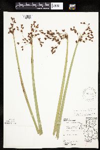 Schoenoplectus tabernaemontani (C.C. Gmelin) Palla 571528[1021787]Hartley, Thomas 18621956-08-01 United States, Wisconsin, Trempealeau, Driftless Area...Trempealeau County ... Trempealeau Bay. Perrot State Park. |
MIN:Plants | 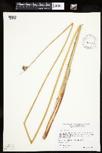 Schoenoplectus acutus var. acutus (Muhlenberg ex Bigelow) ́. L̦ve & D. L̦ve 484703[1021711]Wheeler, Gerald 189511998-06-06 United States, Minnesota, Redwood, Redwood Co.; Ca. 4.5 mi. NE of Belview, 0.3 mi. E of jct. of Rte(s). 19 and 58; N1/2 NE1/4 NW1/4 Sec. 27 T114N R37W (Swedes Forest 27). 114N 37W 27, 44.650505 -95.289332 |
MIN:Plants | 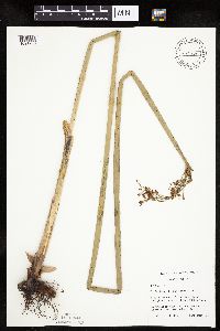 Schoenoplectus tabernaemontani (C.C. Gmelin) Palla 479156[1021783]Lehtinen, R. 95-20061995-09-08 United States, Minnesota, Lyon, Lyon Co, T113N R40W SE1/4 of the NE1/4 of S22;;113N;40W;22, 44.579613 -95.654909 |
MIN:Plants | 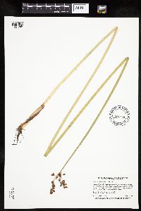 Schoenoplectus tabernaemontani (C.C. Gmelin) Palla 921163[1021780]Smith, Welby 231121993-07-28 United States, Minnesota, Grant, National Waterfowl Production Area. At the northwest end of Lee Lake, about six miles east of Elbow Lake (town).;Redhead Slough Wildlife Management Area;129N;41W;08, 45.9938889 -95.8583333 |
MIN:Plants |  Schoenoplectus tabernaemontani (C.C. Gmelin) Palla 476100[1021772]Smith, Welby 157101989-07-12 United States, Minnesota, Mille Lacs, Mille Lacs County...On the south side of Silver Lake, about one mile east of Princeton...SE1/4 NE1/4 sec. 34, T 36N R 26W. 036N 26W 34, 45.5680542 -93.5527802 |
MIN:Plants |  Schoenoplectus acutus var. acutus (Muhlenberg ex Bigelow) ́. L̦ve & D. L̦ve 461788[1021707]Lehtinen, R. 95-3131995-08-12 United States, Minnesota, Clearwater, Clearwater Co, T143N R36W NE1/4 of the SE1/4 of S22; Elk Lake.;Itasca State Park;143N;36W;22, 47.188292 -95.222791 |
MIN:Plants |  Schoenoplectus acutus var. acutus (Muhlenberg ex Bigelow) 912701[1021709]Smith, Welby 231131993-07-28 United States, Minnesota, Grant, Redhead Slough Wildlife Management Area. Grant County...National Waterfowl Production Area. At the northwest end of Lee Lake, about six miles east of Elbow Lake (town)...T 129N R 41W SW1/4 of SE1/4 of Sec 8. 129N 41W 8, 45.9938889 -95.8583333 |
MIN:Plants |  Schoenoplectus acutus var. acutus (Muhlenberg ex Bigelow) ́. L̦ve & D. L̦ve 477643[1021710]Whitfeld, T.J.S. 249b2001-06-26 United States, Minnesota, Kandiyohi, Kandiyohi County ... 3/4 mile west of US Hwy. 71; 1 1/3 miles south of Pope/Kandiyohi county line; in pasture north of 285 Ave. NW ... T122N R35W NW1/4 of SE1/4 of NE1/4 of Section 9. 122N 35W 9, 45.390694 -95.080756 |
MIN:Plants |  Schoenoplectus torreyi (Olney) Palla 491024[1021798]Myhre, K. 79431998-08-10 United States, Minnesota, Crow Wing, Crow Wing County ...Twin Lakes (west). Located 10 miles southeast of the town of Emily. Area Surveyed: east end of the lake ... T137N R25W SE1/4 of NE1/4 of Sec 27. 137 25W 27, 46.651071 -93.831043 |
MIN:Plants |  Schoenoplectus tabernaemontani (C.C. Gmelin) Palla 896968[1021768]Smith, Welby 156991989-07-13 United States, Minnesota, Kanabec, Kanabek [sic] County...On the north side of Fish Lake, about 2 miles south of Mora...SE1/4 SE1/4 section 23, T 39N R 24W;;039N;24W;23, 45.853598 -93.296832 |
MIN:Plants |  Schoenoplectus tabernaemontani (C.C. Gmelin) Palla 493806[1021770]Gerdes, Lynden 49202004-08-16 United States, Minnesota, Lake, Superior National Forest. T61N R09W S25NWNEN. Lake County...Superior National Forest. Approximately 9.23 miles NW of Isabella, MN and 1.5 miles SW down the Tomahawk Road (FR 377) from its junction with the Northwest Road (FR 373). Pond on N side of FR 377.. 061N 09W 25, 47.737043 -91.415884 |
MIN:Plants |  Schoenoplectus tabernaemontani (C.C. Gmelin) Palla 906335[1021769]Gerdes, Lynden; et al. 54542007-07-03 United States, Minnesota, Lake, Fish Fry Lake approx. 4.68 miles NW of Isabella, MN. NE of boat landing.;Superior National Forest;060N;09W;26, 47.653542 -91.438022 |
MIN:Plants | 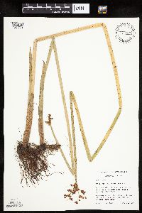 Schoenoplectus tabernaemontani (C.C. Gmelin) Palla 461740[1021779]Schik, K. 95-3351995-08-16 United States, Minnesota, Polk, Polk Co, T151n R46W NW1/4 of the SE1/4 of S13; on CRP land.;;151N;46W;13, 47.898302 -96.493071 |
MIN:Plants | 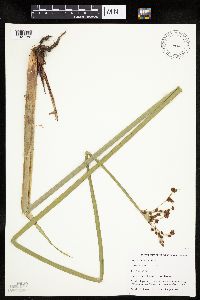 Schoenoplectus tabernaemontani (C.C. Gmelin) Palla 499070[1021782]Capistrant, A. AMC14891998-08-05 United States, Minnesota, Carver, [no further data];;116N;23W;16, 44.855973 -93.592079 |
MIN:Plants | 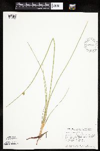 Schoenoplectus torreyi (Olney) Palla 439330[1021790]Smith, Welby 143201988-06-24 United States, Minnesota, Kanabec, NW end of Pomroy Lake, about 6 mi N of Quamba. NE1/4 SW1/4 of section;;041N;23W;24, 46.0155556 -93.1944444 |
MIN:Plants | 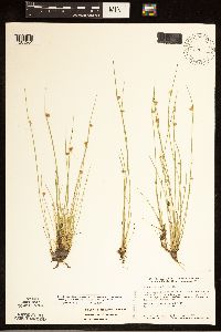 439341[1285204]Smith, Welby R. 143211988-06-24 United States, Minnesota, Kanabec, At the NW end of Pomroy Lake, about 6 mi N of Quamba. NE1/4 SW1/4;;041N;23W;24, 46.0155556 -93.1944444 |
MIN:Plants | 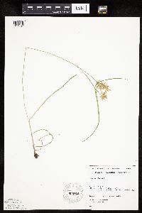 Schoenoplectus smithii var. setosus (Fernald) S.G. Smith 805803[1019594]Almendinger, J. s.n.1987-07-07 United States, Minnesota, Washington, Scandia; T32N R19W SE1/4 SE1/4 of sec.7; island in the St. Croix River, about 2 mi NE of Scandia;;032N;19W;7, 45.273759 -92.765475 |
MIN:Plants | 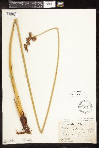 Schoenoplectus acutus var. acutus (Muhlenberg ex Bigelow) ́. L̦ve & D. L̦ve 222019[1105354]Butters, F.; et al. 53541927-07-30 United States, Minnesota, Anoka, E end of Coon Lake. Anoka Co.;;033N;22N;, 45.340658 -93.081463 |
MIN:Plants | 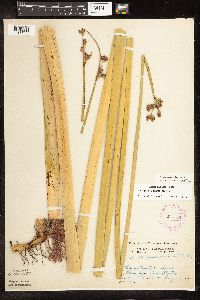 Schoenoplectus acutus var. acutus (Muhlenberg ex Bigelow) ́. L̦ve & D. L̦ve 275974[1105377]Grant, Martin 28161929-07-17 United States, Minnesota, Clearwater, Itasca State Park. Lake Itasca.;Itasca State Park;143N;36W;2, 47.231973 -95.201528 |
MIN:Plants | 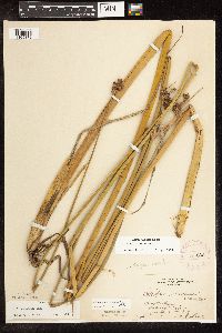 Schoenoplectus acutus var. acutus (Muhlenberg ex Bigelow) ́. L̦ve & D. L̦ve 276805[1105372]Huff, N. 2061914-07-31 United States, Minnesota, Lake, Isabella River.;Boundary Waters Canoe Area Wilderness / Superior National Forest;N;;, 47.797478 -91.34342 |
MIN:Plants |  Schoenoplectus acutus var. acutus (Muhlenberg ex Bigelow) ́. L̦ve & D. L̦ve 291960[1105426]Hotchkiss, N.; et al. 39451930-07-15 United States, Minnesota, Brown, Linden Lake. Brown Co.;;108N;30W;, 44.152331 -94.429033 |
MIN:Plants |  Schoenoplectus acutus var. acutus (Muhlenberg ex Bigelow) ́. L̦ve & D. L̦ve 291978[1105425]Hotchkiss, N.; et al. 39471930-07-16 United States, Minnesota, Brown, Lake Hanska. Brown Co.;;;;, 44.145015 -94.61931 |
MIN:Plants |  Schoenoplectus acutus var. acutus (Muhlenberg ex Bigelow) ́. L̦ve & D. L̦ve 306670[1105293]Oosting, H. 30371930-08-12 United States, Minnesota, Anoka, Ham Lake.;;032N;23W;, 45.254503 -93.203833 |
MIN:Plants |  Schoenoplectus acutus var. acutus (Muhlenberg ex Bigelow) ́. L̦ve & D. L̦ve 306815[1105307]Moyle, J. 24571935-09-18 United States, Minnesota, Saint Louis, Pelican Lake.;Kabetogama State Forest;N;;, 48.061946 -92.905816 |
MIN:Plants | 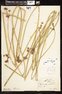 Schoenoplectus acutus var. acutus (Muhlenberg ex Bigelow) ́. L̦ve & D. L̦ve 307248[1105371]Oosting, H. 30251930-07-05 United States, Minnesota, Otter Tail, East Battle Lake.;;133N;39W;00, 46.325632 -95.594255 |
MIN:Plants | 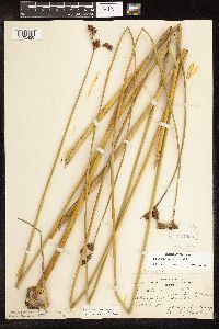 Schoenoplectus acutus var. acutus (Muhlenberg ex Bigelow) ́. L̦ve & D. L̦ve 331900[1105428]Breckenridge, Walter; et al. 30861930-09-07 United States, Minnesota, Lake, Silver Island Lake;;;;, 47.733268 -91.135248 |
MIN:Plants | 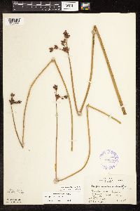 Schoenoplectus acutus var. acutus (Muhlenberg ex Bigelow) ́. L̦ve & D. L̦ve 331955[1105427]U.S. Fish & Wildlife personnel s.n.1935-08-28 United States, Minnesota, Cook, Cook Co.; Bear Skin Lake, Superior National Forest.;Superior National Forest;065N;01W;, 48.082333 -90.44794 |
MIN:Plants | 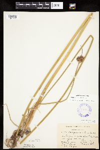 Schoenoplectus acutus var. acutus (Muhlenberg ex Bigelow) ́. L̦ve & D. L̦ve 336515[1021717]Smith, L.; Moyle, J. 2391936-08-11 United States, Minnesota, Itasca, North Star Lake;Chippewa National Forest;059N;26W;, 47.587871 -93.641146 |
MIN:Plants |  Schoenoplectus acutus var. acutus (Muhlenberg ex Bigelow) ́. L̦ve & D. L̦ve 336525[1105424]Smith, L.; Moyle, J. 4071936-08-27 United States, Minnesota, Itasca, Clear Lake;Chippewa National Forest;149N;26W;, 47.716439 -93.968826 |
MIN:Plants |  Schoenoplectus acutus var. acutus (Muhlenberg ex Bigelow) ́. L̦ve & D. L̦ve 336548[1105397]Morse, Marius; Moyle, J. 21936-00-00 United States, Minnesota, Saint Louis, Pequaywam Lake.;Cloquet Valley State Forest;N;;, 47.155272 -91.855943 |
MIN:Plants |  Schoenoplectus acutus var. acutus (Muhlenberg ex Bigelow) ́. L̦ve & D. L̦ve 336589[1105385]Smith, L.; Moyle, J. 391936-07-29 United States, Minnesota, Itasca, Bowstring Lake;Chippewa National Forest / Leech Lake Indian Reservation;147N;26W;, 47.542434 -93.968693 |
MIN:Plants |  Schoenoplectus acutus var. acutus (Muhlenberg ex Bigelow) ́. L̦ve & D. L̦ve 336595[1105314]Smith, L.; Moyle, J. 11936-07-27 United States, Minnesota, Itasca, Cut Foot Sioux Lake;Chippewa National Forest / Leech Lake Indian Reservation;147N;27W;, 47.542194 -94.09753 |
MIN:Plants | 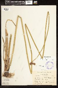 Schoenoplectus acutus var. acutus (Muhlenberg ex Bigelow) ́. L̦ve & D. L̦ve 336608[1105333]Smith, L.; Moyle, J. 771936-07-31 United States, Minnesota, Itasca, Middle Pigeon Lake;Chippewa National Forest / Leech Lake Indian Reservation;147N;28W;, 47.542713 -94.223225 |
MIN:Plants | 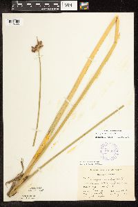 Schoenoplectus acutus var. acutus (Muhlenberg ex Bigelow) ́. L̦ve & D. L̦ve 338066[1105386]Smith, L.; Moyle, J. 2411936-08-11 United States, Minnesota, Itasca, North Star Lake;Chippewa National Forest;N;;, 47.587871 -93.641146 |
MIN:Plants | 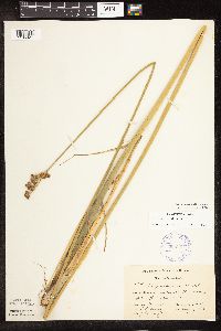 Schoenoplectus acutus var. acutus (Muhlenberg ex Bigelow) ́. L̦ve & D. L̦ve 338067[1105327]Smith, L.; Moyle, J. 2401936-08-11 United States, Minnesota, Itasca, North Star Lake;;N;;, 47.587871 -93.641146 |
MIN:Plants | 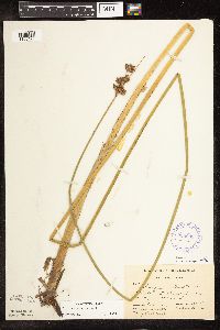 Schoenoplectus acutus var. acutus (Muhlenberg ex Bigelow) ́. L̦ve & D. L̦ve 338069[1105423]Smith, L.; Moyle, J. 3521936-08-22 United States, Minnesota, Beltrami, Beltrami Co.; Gilstead Lake.;Chippewa National Forest;148N;30W;, 47.628556 -94.481401 |
MIN:Plants |  Schoenoplectus acutus var. acutus (Muhlenberg ex Bigelow) ́. L̦ve & D. L̦ve 338070[1105421]Smith, L.; Moyle, J. 3531936-08-22 United States, Minnesota, Beltrami, Gilstead Lake.;;N;;, 47.67024 -94.53057 |
MIN:Plants |  Schoenoplectus acutus var. acutus (Muhlenberg ex Bigelow) ́. L̦ve & D. L̦ve 338072[1105355]Smith, L. 354a1936-07-22 United States, Minnesota, Beltrami, Beltrami Co.; Gilstead Lake.;Chippewa National Forest;148N;30W;, 47.628556 -94.481401 |
MIN:Plants |  Schoenoplectus acutus var. acutus (Muhlenberg ex Bigelow) ́. L̦ve & D. L̦ve 338086[1105347]Smith, L.; Moyle, J. 31936-07-27 United States, Minnesota, Itasca, Cut Foot Sioux Lake;Chippewa National Forest / Leech Lake Indian Reservation;N;;, 47.542194 -94.09753 |
MIN:Plants |  Schoenoplectus acutus var. acutus (Muhlenberg ex Bigelow) ́. L̦ve & D. L̦ve 338087[1105345]Smith, L.; Moyle, J. 21936-07-27 United States, Minnesota, Itasca, Cut Foot Sioux Lake;Chippewa National Forest / Leech Lake Indian Reservation;N;;, 47.542194 -94.09753 |
MIN:Plants |  Schoenoplectus acutus var. acutus (Muhlenberg ex Bigelow) ́. L̦ve & D. L̦ve 338091[1105419]Smith, L.; Moyle, J. 761936-07-31 United States, Minnesota, Itasca, Middle Pigeon Lake;Chippewa National Forest / Leech Lake Indian Reservation;148N;28W;, 47.542713 -94.223225 |
MIN:Plants |  Schoenoplectus acutus var. acutus (Muhlenberg ex Bigelow) ́. L̦ve & D. L̦ve 338093[1105344]Smith, L.; Moyle, J. 401936-07-29 United States, Minnesota, Itasca, Bowstring Lake;Chippewa National Forest / Leech Lake Indian Reservation;N;;, 47.542434 -93.968693 |
MIN:Plants |  Schoenoplectus acutus var. acutus (Muhlenberg ex Bigelow) ́. L̦ve & D. L̦ve 338094[1105343]Smith, L. 381936-07-29 United States, Minnesota, Itasca, Bowstring Lake;Chippewa National Forest / Leech Lake Indian Reservation;N;;, 47.542434 -93.968693 |
MIN:Plants |  Schoenoplectus acutus var. acutus (Muhlenberg ex Bigelow) ́. L̦ve & D. L̦ve 338137[1105341]Moyle, J. 23361936-08-15 United States, Minnesota, Otter Tail, Otter Tail Lake.;;N;;, 46.399132 -95.661637 |
Google Map
Google Maps is a web mapping service provided by Google that features a map that users can pan (by dragging the mouse) and zoom (by using the mouse wheel). Collection points are displayed as colored markers that when clicked on, displays the full information for that collection. When multiple species are queried (separated by semi-colons), different colored markers denote each individual species.