University of Minnesota
http://www.umn.edu/
612-625-5000
http://www.umn.edu/
612-625-5000
Minnesota Biodiversity Atlas
Bell Museum
Dataset: MIN-Plants
Taxa: Astragalus
Search Criteria: excluding cultivated/captive occurrences
Bell Museum plants | |
 MIN:Plants | 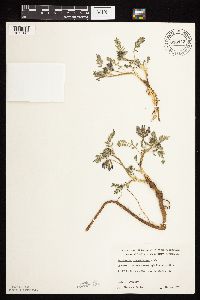 693943[1075142]Roefer, Florence s.n.1978-05-10 United States, Minnesota, Cottonwood, Jeffers Petroglyph Historic Site. T107N, R35W, NW1/4 Sec. 9, Delton Twp.;Jeffers Petroglyphs Historical Site;107N;35W;9, 44.0864517 -95.0499662 |
MIN:Plants | 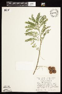 707982[1075171]Smith, Welby 13011979-08-03 United States, Minnesota, Pope, Strandness Prairie, 6 mi W and 1 mi N of jnc of co. hwy 29 and 104 in Glenwood; T125N R38W NW1/4 NW1/4 Sec. 6;Strandness Prairie, The Nature Conservancy;125N;38W;6, 45.6651515 -95.5001117 |
MIN:Plants | 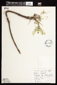 710054[1075163]Wheeler, Gerald 50841979-10-06 United States, Minnesota, Le Sueur, Le Sueur Co. Approx. 1 mi SW of Kasota, bluff overlooking the Minnesota River, High Lime Prairie; T109N R26W Sec. 6;East Minnesota River Wildlife Management Area;109N;26W;6, 44.3626183 -93.939379 |
MIN:Plants | 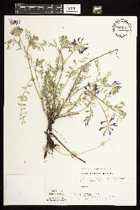 715507[1075162]Ottoson, S. 161979-06-07 United States, Minnesota, Clay, Blazing Star Prairie, 4 mi SE of Felton; NE1/4 Sec. 5 T141N R45W;Felton Prairie-Blazing Star Prairie Scientific Natural Area;141N;45W;5, 47.0567136 -96.4173556 |
MIN:Plants | 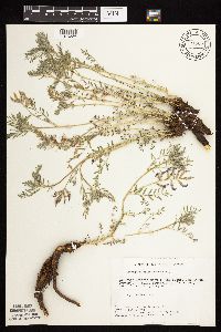 721505[1075223]Keller, C.; et al. 101979-06-11 United States, Minnesota, Polk, Polk County...Pankratz Prairie North...7 mi SE of Crookston; S1/2 Sec. 8 T149N R45W;Pankratz Memorial Prairie, The Nature Conservancy;149N;45W;08, 47.7385174 -96.4487891 |
MIN:Plants | 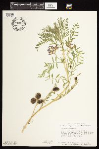 724721[1075147]Smith, Welby 24241980-06-10 United States, Minnesota, Douglas, T129N, R40W, NW1/4 NE1/4 NW1/4 Sec. 13. Between Hwy. 52 and the Great Northern R.R. tracks.;;129N;40W;13, 45.9840819 -95.6553448 |
MIN:Plants | 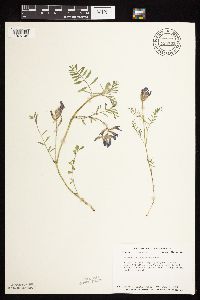 724731[1075146]Smith, Welby 23911980-06-05 United States, Minnesota, Stevens, Stevens Co.; T125N, R43W, NW1/4 SE1/4 SW1/4 Sec. 15. About 3/4 mi. west of Co. Rd. 9, and 1/8 mi. north of gravel road.;Pepperton Wildlife Management Area;125N;43W;15, 45.6362769 -96.0571399 |
MIN:Plants | 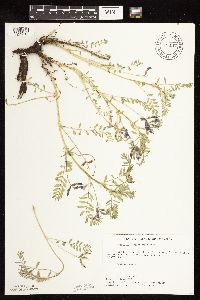 727147[1122610]Ottoson, S. 161979-06-06 United States, Minnesota, Norman, Twin Valley Prairie: (TNC) 5 mi. W of Syre, NW1/4 and E1/2 of SW1/4 of Sec. 23, T143N, R45W.;Twin Valley Prairie Scientific Natural Area;143N;45W;23, 47.2744614 -96.3536656 |
MIN:Plants |  727364[1075148]Ottoson, S. 71979-06-07 United States, Minnesota, Clay, Clay County Bicentennial Prairie: 4 mi. SE of Felton, SW1/4 Sec. 5, T141N, R45W.;Felton Prairie-Bicentennial Prairie Scientific Natural Area;141N;45W;5, 47.0567136 -96.4173556 |
MIN:Plants |  728712[1075191]Schmidt, D.; et al. 191979-06-05 United States, Minnesota, Mahnomen, Mahnomen County...Santee Prairie: 3 mi SE of Bejou, Sec. 6, 7, T145N, R41W.;Santee Prairie Scientific Natural Area / White Earth Indian Reservation;145N;41W;00, 47.4051432 -95.9225134 |
MIN:Plants |  732608[1075190]Severson, M. 1871980-05-21 United States, Minnesota, Becker, Zimmerman Prairie: 10 mi. W of Ogema. E1/2 SW1/4 Sec. 16, T142N, R43W.;Zimmerman Prairie [TNC];142N;43W;16, 47.1150258 -96.1414196 |
MIN:Plants |  732678[1075189]Severson, M. 4301980-07-01 United States, Minnesota, Becker, Zimmerman Prairie: 10 mi. W of Ogema. SE1/4 SW1/4 Sec. 16, T142N, R43W.;Zimmerman Prairie [TNC];142N;43W;16, 47.1150258 -96.1414196 |
MIN:Plants | 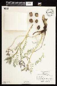 739555[1075194]Converse, C. 8831982-05-28 United States, Minnesota, Otter Tail, Otter Tail Preserve: T131N, R44W, SW1/4 SE1/4 Sec. 17.;Ottertail Prairie Scientific Natural Area;131N;44W;17, 46.1592444 -96.2353633 |
MIN:Plants | 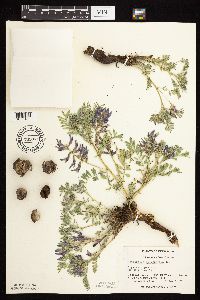 739971[1075187]Converse, C. 8031982-05-21 United States, Minnesota, Chippewa, Chippewa and Swift Cos. Chippewa Prairie: T119N, R43W, SW1/4 NE1/4 Sec. 12.;Chippewa Prairie, The Nature Conservancy;119N;43W;12, 45.1302134 -95.9905655 |
MIN:Plants | 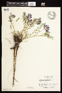 740055[1075193]Converse, C. 7871982-05-19 United States, Minnesota, Douglas, Staffanson Prairie: T127N, R40W, NW1/4 NE1/4 and NE1/4 NW1/4 of Sec. 18.;Staffanson Prairie, The Nature Conservancy;127N;40W;18, 45.810665 -95.7480052 |
MIN:Plants | 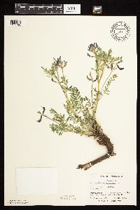 740114[1075188]Converse, C. 7651982-05-15 United States, Minnesota, Pope, Ordway Prairie: T123N, R36W, NW1/4 Sec. 30.;Ordway Prairie, The Nature Conservancy;123N;36W;30, 45.4342616 -95.2450181 |
MIN:Plants | 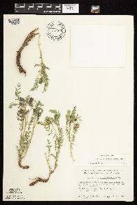 743660[1075078]Nietering, E.; et al. 2131982-05-08 United States, Minnesota, Redwood, Redwood County...1/4 mi SW of Minnesota River, NW of Dephi...SW1/4 NW1/4 Sec. 30 T114N R36W;;114N;36W;30, 44.6488401 -95.2302787 |
MIN:Plants | 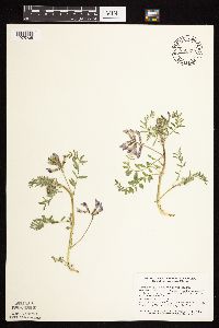 746522[1075205]Smith, Welby 37271981-04-28 United States, Minnesota, Goodhue, Goodhue County ... McKnight Prairie, about 1-3/4 mi SSE of Randolph ... SE1/5 SW1/4 Sec. 18 T112N R18W;McKnight Prairie;112N;18W;18, 44.507973 -93.0292969 |
MIN:Plants | 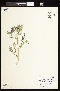 746532[1075206]Smith, Welby 39431981-05-27 United States, Minnesota, Martin, On the N side of co. hwy 50, ca. 2 1/4 mi W of its jnc with st. hwy 15 in Truman; SW1/4 SE1/4 Sec. 7 T104N R30W;;104N;30W;7, 43.8254659 -94.4801099 |
MIN:Plants | 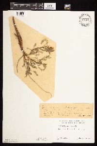 746961[1075166]Jordan, s.n.1910-05-00 United States, Minnesota, Stearns, Stearns Co.; St. Cloud;;N;;, 45.5582 -94.181183 |
MIN:Plants | 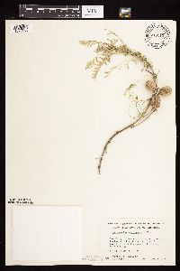 748212[1075138]Wheeler, Gerald 55331981-06-06 United States, Minnesota, Goodhue, Red Wing. On a W-facing bluff adjacent to Rte. 61 (E of road). T113N, R14W, Sec. 28.;;113N;14W;28, 44.5630449 -92.5030379 |
MIN:Plants | 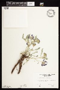 749535[1075152]Ehritt, K. s.n.1977-04-20 United States, Minnesota, Le Sueur, Le Sueur County ... Ottawa Bluffs: NE1/4 Sec. 3; T110N, R26W;Ottawa Bluffs, The Nature Conservancy;110N;26W;03, 44.3626183 -93.939379 |
MIN:Plants | 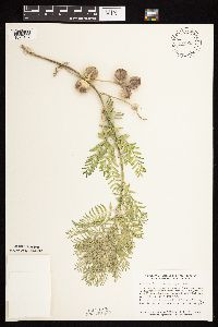 757953[1075107]Smith, Welby 66021982-07-03 United States, Minnesota, Kandiyohi, Kandiyohi Co.; About 3 1/2 mi. NE of Raymond. Strip between the Burlington Northern R.R. tracks and Hwy. 23, about 40 ft. NE of its junction with Hwy. 1. SW1/4 NW1/4 Sec. 10, T118N, R36W.. 118N 36W 10, 45.0440944 -95.1760679 |
MIN:Plants | 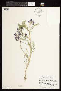 757977[1075108]Smith, Welby 60221982-05-22 United States, Minnesota, Jackson, Sangl Wildlife Management Area. Sangle State Wildlife Management Area. On the N side of Hwy. 4, ca. 1/2 mi. E of it's jct. with Hwy. 86. NE1/4 SW1/4 S Sangle State Wildlife Management Area. On the N side of Hwy. 4, ca. 1/2 mi. E of it's jct. with Hwy. 86. NE1/4 SW1/4 Sec. 21, T101N, R36W.. 101N 36W 21, 43.5373326 -95.1644274 |
MIN:Plants | 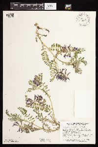 758017[1075106]Smith, Welby 59141982-05-14 United States, Minnesota, Big Stone, Big Stone Lake State Park. Big Stone Lake State Park (Bonanza Unit). Ca. 11 mi. SSE of Browns Valley. On a SW-facing bluff overlooking Big Stone Big Stone Lake State Park (Bonanza Unit). Ca. 11 mi. SSE of Browns Valley. On a SW-facing bluff overlooking Big Stone Lake. NW1/4 NW1/4 Sec. 20, T123N, R48W.. 123N 48W 20, 45.4508921 -96.708936 |
MIN:Plants | 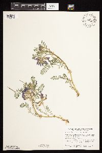 758110[1075109]Smith, Welby 58931982-05-14 United States, Minnesota, Pope, Glacial Lakes State Park. Glacial Lakes State Park. On the E side of Hwy. 41, ca. 5 1/4 mi. S of it's jct. with Hwy. 28 in Starbuck. W1/2 NE1/4 Glacial Lakes State Park. On the E side of Hwy. 41, ca. 5 1/4 mi. S of it's jct. with Hwy. 28 in Starbuck. W1/2 NE1/4 Sec. 23, T124N, R39W.. 124N 39W 23, 45.5348415 -95.5313658 |
MIN:Plants | 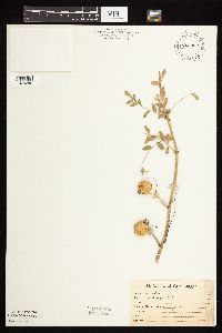 763382[1075202]Lugger, O. 6362 United States, Minnesota, Nobles, Worthington;;N;;, 43.628414 -95.598458 |
MIN:Plants | 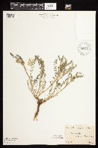 764431[1075210]Hart, H. s.n.1922-05-28 United States, Minnesota, Hennepin, N of Minneapolis;;N;;, 45.106108 -93.306408 |
MIN:Plants | 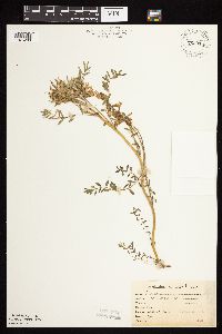 765018[1075203]Lugger, O. 1900-06-00 United States, Minnesota, Meeker, Litchfield;;119N;31W;12, 45.13098 -94.51267 |
MIN:Plants | 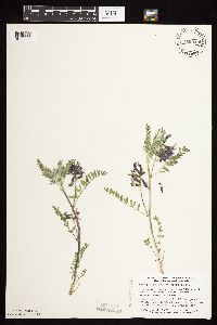 769940[1075065]Smith, Welby 77231983-05-28 United States, Minnesota, Jackson, right-of-way of the Chicago & Northern RR, ca 3 mi ENE of Heron Lake (town), NE1/4 SW1/4 S16, T104N, R37W;;104N;37W;16, 43.811993 -95.2854139 |
MIN:Plants | 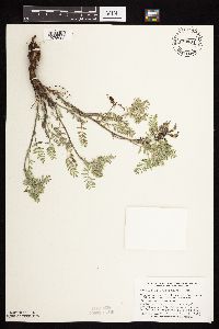 770484[1075096]Smith, Welby 77491983-06-01 United States, Minnesota, Swift, Swift Co.; between State Hwy 9 and the Burlington Northern RR tracks, ca 2.5 mi NW of Clontarf, NW1/4 SW1/4 S4, T122N, R Swift Co.; between State Hwy 9 and the Burlington Northern RR tracks, ca 2.5 mi NW of Clontarf, NW1/4 SW1/4 S4, T122N, R40W. 122N 40W 4, 45.4052 -95.6959837 |
MIN:Plants | 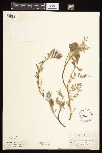 774511[1075186]Aiton, G. s.n.1891-05-00 United States, Minnesota, Hennepin, Minneapolis;;N;;, 44.970736 -93.268643 |
MIN:Plants | 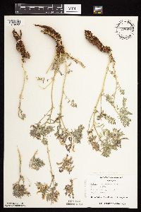 778090[1075063]Duxbury, Alexis 11001983-05-30 United States, Minnesota, Lyon, Glynn Prairie; S1/2 NE1/4 Sec. 7 T109N R40W;Glynn Prairie Scientific Natural Area;109N;40W;7, 44.2610945 -95.7045759 |
MIN:Plants | 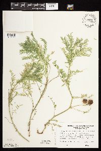 780420[1075059]Ownbey, Gerald 69931985-06-02 United States, Minnesota, Washington, T27N, R20W S2, SW1/4 NW1/4 Afton State Park, SW facing bluff across from Afton Alps Ski area;Afton State Park;027N;20W;2, 44.8547629 -92.7750459 |
MIN:Plants | 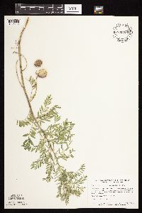 781400[1075165]Smith, Welby 94901984-06-28 United States, Minnesota, Lyon, Prairie Marshes State Wildlife Management Area, ca. 4 mi NNW of Russell; SE1/4 SW1/4 Sec. 36 T111N R43W;Prairie Marshes Wildlife Management Area;111N;43W;36, 44.3781193 -95.9681021 |
MIN:Plants | 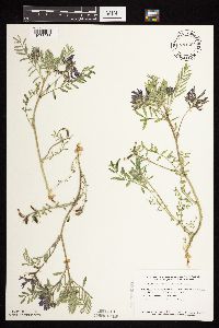 781564[1075066]Smith, Welby 89271984-05-30 United States, Minnesota, Lac Qui Parle, Hegland Wildlife Management Area. Lac Qui Parle Co.; In the Minnesota Valley, ca. 5 mi E of Louisburg, in a National Waterfowl Production Area; NE1/4 SW1/4 Sec. 4 T119N R43W. 119N 43W 4, 45.145671 -96.0523319 |
MIN:Plants |  781574[1075173]Smith, Welby 89021984-05-29 United States, Minnesota, Jackson, Kilen Woods State Park, ca. 6.5 mi NE of Lakefield; SE1/4 NW1/4 Sec. 17 T103N R35W;Kilen Woods State Park;103N;35W;17, 43.7248138 -95.0646485 |
MIN:Plants |  781725[1075164]Smith, Welby 89121984-05-30 United States, Minnesota, Jackson, Sioux Valley State Wildlife Management Area, ca. 1 mi SSE of Sioux Valley (town); NE1/4 NE1/4 Sec. 29 T101N R37W;Sioux Valley Wildlife Management Area;101N;37W;29, 43.522292 -95.3046432 |
MIN:Plants |  788911[1075209]Smith, Welby 102761985-05-30 United States, Minnesota, Cottonwood, Expandere Wildlife Management Area. Cottonwood County ... Expandere State Wildlife Management Area, about 13 mi WNW of Windom ... SE1/4 SW1/4 Sec 1 T105N, R38W. 105N 38W 1, 43.9225006 -95.351944 |
MIN:Plants |  789751[1075076]Smith, Welby 103621985-05-31 United States, Minnesota, Jackson, Ca. 1 mi SE of Petersburg, in the Des Moines River Valley; NW1/4 SE1/4 Sec. 27 T101N R34W;;101N;34W;27, 43.5228821 -94.9043901 |
MIN:Plants |  792198[1075170]Smith, Welby 102501985-05-29 United States, Minnesota, Yellow Medicine, Sioux Nation State Wildlife Management Area, ca. 8 mi. WSW of Canby. NW1/4 SW1/4 Sec. 17, T114N, R46W.;Sioux Nationalion Wildlife Management Area;114N;46W;17, 44.681835 -96.4295916 |
MIN:Plants |  793930[1075102]Clark, A. 221986-06-30 United States, Minnesota, Pope, White Bear Lake Twp, T125N, R39W, S1, near Strandness Lake;;125N;39W;1, 45.6651217 -95.5203263 |
MIN:Plants |  795561[1075058]Cholewa, A. 13151987-05-09 United States, Minnesota, McLeod, Schaefer Prairie Preserve, ca 8 mi SW of Glencoe; T115N, R29W, S34 SE1/4, W or N sides of hills in NE corner of preserve;Schaefer Prairie, The Nature Conservancy;115N;29W;34, 44.7250496 -94.3049103 |
MIN:Plants |  803002[1075064]Smith, Welby 117341986-06-12 United States, Minnesota, Lac Qui Parle, Lac Qui Parle County ... Antelope Hills, about 7.5 mi due west of Providence ... SW1/4 NE1/4 Sec. 27 T116N R45W;;116N;45W;27, 44.830555 -96.2616653 |
MIN:Plants |  804590[1075128]Smith, Welby 123701986-07-24 United States, Minnesota, Polk, Polk County...Belgium State Wildlife Management Area, about 4 mi ENE of Euclid; NW1/4 NE1/4 Sec. 16 T152N R46W;Belgium Wildlife Management Area;152N;46W;16, 47.9851447 -96.5582728 |
MIN:Plants |  804623[1075127]Smith, Welby 116941986-06-12 United States, Minnesota, Pipestone, Prairie Coteau Scientific Natural Area. Pipestone County ...Prairie Coteau State Scientific and Natural Area (Aetna Prairie), on the NW side of st. hwy 23, about 2.5 mi NE of Holland ... NW1/4 SE1/4 Sec. 32 T108N R44W. 108N 44W 32, 44.1152763 -96.1522217 |
MIN:Plants |  804772[1075105]Goecke, B. s.n.1976-05-16 United States, Minnesota, Pope, Strandness Prairie: 4 mi. N of Starbuck.;Strandness Prairie, The Nature Conservancy;N;;, 45.6651515 -95.5001117 |
MIN:Plants |  804773[1075104]Ordway, E. s.n.1981-05-09 United States, Minnesota, Pope, Strandness Prairie: 4 mi. N of Starbuck;Strandness Prairie, The Nature Conservancy;N;;, 45.6651515 -95.5001117 |
MIN:Plants | 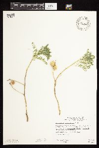 815954[1075137]Wheeler, Gerald 108301988-06-23 United States, Minnesota, Clay, Ca. 8 mi. E of Barnesville; ca. 0.3 mi. N of Rte. 34. NW1/4 SE1/4 Sec. 21, T137N, R44W (Tansem Twp.);;137N;44W;21, 46.6664854 -96.2466638 |
MIN:Plants | 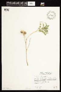 815957[1075139]Wheeler, Gerald 108231988-06-22 United States, Minnesota, Becker, Approx. 14.5 mi. SW of Detroit Lakes; waterfowl area W of road. NW1/4 of SE1/4 of section.;Lage-Larson Wildlife Management Area;138N;43W;32, 46.723471 -96.14063 |
MIN:Plants | 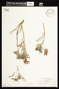 816469[1075136]Ordway, E. 31977-05-09 United States, Minnesota, Pope, Strandness Prairie, 4 mi. NE of Starbuck.;Strandness Prairie, The Nature Conservancy;125N;38W;6, 45.6651515 -95.5001117 |
MIN:Plants | 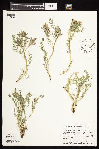 840681[1075184]Smith, Welby 126371987-05-07 United States, Minnesota, Scott, Minnesota Valley National Wildlife Refuge. Scott County...The Louisville Swamp area, in the Minnesota Valley National Wildlife Refuge, about 6 mi S of Shakopee...NW1/4 SW1/4 sec.28, T115N R23W. 115N 23W 28, 44.7355537 -93.5988922 |
MIN:Plants | 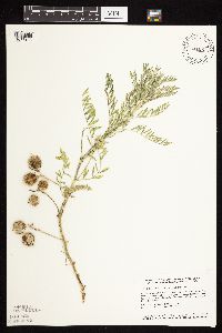 841061[1075183]Smith, Welby 127071987-05-16 United States, Minnesota, Goodhue, Goodhue County...Hay Creek Recreation Area, about 2 mi S of Red Wing...SW1/4 NW1/4 sec.7, T112N R14W;Dorer Memorial Hardwood State Forest;112N;14W;07, 44.523613 -92.5458298 |
MIN:Plants | Astragalus flexuosus var. flexuosus (Hooker) Douglas ex G. Don 445566[1075228]Biederman, L. United States, Minnesota, Big Stone, Detailed locality information protected. This is typically done to protect rare or threatened species localities. |
MIN:Plants | Astragalus flexuosus var. flexuosus (Hooker) Douglas ex G. Don 833829[1075258]Smith, Welby United States, Minnesota, Big Stone, Detailed locality information protected. This is typically done to protect rare or threatened species localities. |
MIN:Plants | Astragalus flexuosus var. flexuosus (Hooker) Douglas ex G. Don 134867[1075251]Moyer, Lycurgus United States, Minnesota, Big Stone, Detailed locality information protected. This is typically done to protect rare or threatened species localities. |
MIN:Plants | Astragalus flexuosus var. flexuosus (Hooker) Douglas ex G. Don 134868[1075252]Moyer, Lycurgus United States, Minnesota, Big Stone, Detailed locality information protected. This is typically done to protect rare or threatened species localities. |
MIN:Plants | Astragalus flexuosus var. flexuosus (Hooker) Douglas ex G. Don 134869[1075250]Johnson, A.; et al. United States, Minnesota, Big Stone, Detailed locality information protected. This is typically done to protect rare or threatened species localities. |
MIN:Plants | Astragalus flexuosus var. flexuosus (Hooker) Douglas ex G. Don 134870[1075246]Sheldon, Edmund United States, Minnesota, Traverse, Detailed locality information protected. This is typically done to protect rare or threatened species localities. |
MIN:Plants | Astragalus flexuosus var. flexuosus (Hooker) Douglas ex G. Don 134872[1075254]G. & L. United States, Minnesota, Chippewa, Detailed locality information protected. This is typically done to protect rare or threatened species localities. |
MIN:Plants | Astragalus flexuosus var. flexuosus (Hooker) Douglas ex G. Don 134873[1075253]G. & L. United States, Minnesota, Chippewa, Detailed locality information protected. This is typically done to protect rare or threatened species localities. |
MIN:Plants | Astragalus flexuosus var. flexuosus (Hooker) Douglas ex G. Don 134874[1075248]Sheldon, Edmund United States, Minnesota, Big Stone, Detailed locality information protected. This is typically done to protect rare or threatened species localities. |
MIN:Plants | Astragalus flexuosus var. flexuosus (Hooker) Douglas ex G. Don 134875[1075245]Sheldon, Edmund United States, Minnesota, Big Stone, Detailed locality information protected. This is typically done to protect rare or threatened species localities. |
MIN:Plants | Astragalus flexuosus var. flexuosus (Hooker) Douglas ex G. Don 226406[1075247]Anonymous United States, Minnesota, Big Stone, Detailed locality information protected. This is typically done to protect rare or threatened species localities. |
MIN:Plants | Astragalus flexuosus var. flexuosus (Hooker) Douglas ex G. Don 371217[1075249]Moore, John United States, Minnesota, Big Stone, Detailed locality information protected. This is typically done to protect rare or threatened species localities. |
MIN:Plants | Astragalus flexuosus var. flexuosus (Hooker) Douglas ex G. Don 735943[1075244]Dana, R. United States, Minnesota, Lincoln, Detailed locality information protected. This is typically done to protect rare or threatened species localities. |
MIN:Plants | Astragalus flexuosus var. flexuosus (Hooker) Douglas ex G. Don 744688[1075282]Converse, C. United States, Minnesota, Swift, Detailed locality information protected. This is typically done to protect rare or threatened species localities. |
MIN:Plants | Astragalus flexuosus var. flexuosus (Hooker) Douglas ex G. Don 746517[1075233]Smith, Welby United States, Minnesota, Big Stone, Detailed locality information protected. This is typically done to protect rare or threatened species localities. |
MIN:Plants | Astragalus flexuosus var. flexuosus (Hooker) Douglas ex G. Don 746525[1075237]Smith, Welby United States, Minnesota, Lac Qui Parle, Detailed locality information protected. This is typically done to protect rare or threatened species localities. |
MIN:Plants | Astragalus flexuosus var. flexuosus (Hooker) Douglas ex G. Don 746542[1075235]Smith, Welby United States, Minnesota, Yellow Medicine, Detailed locality information protected. This is typically done to protect rare or threatened species localities. |
MIN:Plants | Astragalus flexuosus var. flexuosus (Hooker) Douglas ex G. Don 756157[1075281]Converse, C.; et al. United States, Minnesota, Big Stone, Detailed locality information protected. This is typically done to protect rare or threatened species localities. |
MIN:Plants | Astragalus flexuosus var. flexuosus (Hooker) Douglas ex G. Don 777533[1075283]Coffin, Barbara; et al. United States, Minnesota, Big Stone, Detailed locality information protected. This is typically done to protect rare or threatened species localities. |
MIN:Plants | Astragalus flexuosus var. flexuosus (Hooker) Douglas ex G. Don 777534[1075284]Coffin, Barbara; et al. United States, Minnesota, Big Stone, Detailed locality information protected. This is typically done to protect rare or threatened species localities. |
MIN:Plants | Astragalus flexuosus var. flexuosus (Hooker) Douglas ex G. Don 778239[1075274]Converse, C. United States, Minnesota, Lac Qui Parle, Detailed locality information protected. This is typically done to protect rare or threatened species localities. |
MIN:Plants | Astragalus flexuosus var. flexuosus (Hooker) Douglas ex G. Don 778250[1075280]Converse, C. United States, Minnesota, Lac Qui Parle, Detailed locality information protected. This is typically done to protect rare or threatened species localities. |
MIN:Plants | Astragalus flexuosus var. flexuosus (Hooker) Douglas ex G. Don 778254[1075240]Converse, C. United States, Minnesota, Lac Qui Parle, Detailed locality information protected. This is typically done to protect rare or threatened species localities. |
MIN:Plants | Astragalus flexuosus var. flexuosus (Hooker) Douglas ex G. Don 778262[1075229]Converse, C. United States, Minnesota, Lac Qui Parle, Detailed locality information protected. This is typically done to protect rare or threatened species localities. |
MIN:Plants | Astragalus flexuosus var. flexuosus (Hooker) Douglas ex G. Don 778263[1075276]Converse, C. United States, Minnesota, Swift, Detailed locality information protected. This is typically done to protect rare or threatened species localities. |
MIN:Plants | Astragalus flexuosus var. flexuosus (Hooker) Douglas ex G. Don 778283[1075273]Converse, C. United States, Minnesota, Big Stone, Detailed locality information protected. This is typically done to protect rare or threatened species localities. |
MIN:Plants | Astragalus flexuosus var. flexuosus (Hooker) Douglas ex G. Don 778284[1075278]Converse, C. United States, Minnesota, Swift, Detailed locality information protected. This is typically done to protect rare or threatened species localities. |
MIN:Plants | Astragalus flexuosus var. flexuosus (Hooker) Douglas ex G. Don 778285[1075275]Converse, C. United States, Minnesota, Lac Qui Parle, Detailed locality information protected. This is typically done to protect rare or threatened species localities. |
MIN:Plants | Astragalus flexuosus var. flexuosus (Hooker) Douglas ex G. Don 778286[1075232]Converse, C. United States, Minnesota, Lac Qui Parle, Detailed locality information protected. This is typically done to protect rare or threatened species localities. |
MIN:Plants | Astragalus flexuosus var. flexuosus (Hooker) Douglas ex G. Don 778288[1075236]Converse, C. United States, Minnesota, Lac Qui Parle, Detailed locality information protected. This is typically done to protect rare or threatened species localities. |
MIN:Plants | Astragalus flexuosus var. flexuosus (Hooker) Douglas ex G. Don 778289[1075257]Converse, C. United States, Minnesota, Lac Qui Parle, Detailed locality information protected. This is typically done to protect rare or threatened species localities. |
MIN:Plants | Astragalus flexuosus var. flexuosus (Hooker) Douglas ex G. Don 778290[1075259]Converse, C. United States, Minnesota, Lac Qui Parle, Detailed locality information protected. This is typically done to protect rare or threatened species localities. |
MIN:Plants | Astragalus flexuosus var. flexuosus (Hooker) Douglas ex G. Don 778291[1075279]Converse, C. United States, Minnesota, Lac Qui Parle, Detailed locality information protected. This is typically done to protect rare or threatened species localities. |
MIN:Plants | Astragalus flexuosus var. flexuosus (Hooker) Douglas ex G. Don 778292[1075277]Converse, C. United States, Minnesota, Big Stone, Detailed locality information protected. This is typically done to protect rare or threatened species localities. |
MIN:Plants | Astragalus flexuosus var. flexuosus (Hooker) Douglas ex G. Don 781404[1075231]Smith, Welby United States, Minnesota, Lyon, Detailed locality information protected. This is typically done to protect rare or threatened species localities. |
MIN:Plants | Astragalus flexuosus var. flexuosus (Hooker) Douglas ex G. Don 781991[1075243]Converse, C. United States, Minnesota, Lac Qui Parle, Detailed locality information protected. This is typically done to protect rare or threatened species localities. |
MIN:Plants | Astragalus flexuosus var. flexuosus (Hooker) Douglas ex G. Don 792843[1075261]Converse, C. United States, Minnesota, Lac Qui Parle, Detailed locality information protected. This is typically done to protect rare or threatened species localities. |
MIN:Plants | Astragalus flexuosus var. flexuosus (Hooker) Douglas ex G. Don 792844[1075260]Converse, C. United States, Minnesota, Chippewa, Detailed locality information protected. This is typically done to protect rare or threatened species localities. |
MIN:Plants | Astragalus flexuosus var. flexuosus (Hooker) Douglas ex G. Don 792882[1075265]Converse, C. United States, Minnesota, Lac Qui Parle, Detailed locality information protected. This is typically done to protect rare or threatened species localities. |
MIN:Plants | Astragalus flexuosus var. flexuosus (Hooker) Douglas ex G. Don 792884[1075262]Converse, C. United States, Minnesota, Lac Qui Parle, Detailed locality information protected. This is typically done to protect rare or threatened species localities. |
MIN:Plants | Astragalus flexuosus var. flexuosus (Hooker) Douglas ex G. Don 792886[1075263]Converse, C. United States, Minnesota, Lac Qui Parle, Detailed locality information protected. This is typically done to protect rare or threatened species localities. |
MIN:Plants | Astragalus flexuosus var. flexuosus (Hooker) Douglas ex G. Don 792887[1075264]Converse, C. United States, Minnesota, Lac Qui Parle, Detailed locality information protected. This is typically done to protect rare or threatened species localities. |
MIN:Plants | Astragalus flexuosus var. flexuosus (Hooker) Douglas ex G. Don 792895[1075227]Converse, C. United States, Minnesota, Lac Qui Parle, Detailed locality information protected. This is typically done to protect rare or threatened species localities. |
MIN:Plants | Astragalus flexuosus var. flexuosus (Hooker) Douglas ex G. Don 795348[1075239]Dana, R. United States, Minnesota, Traverse, Detailed locality information protected. This is typically done to protect rare or threatened species localities. |
MIN:Plants | Astragalus flexuosus var. flexuosus (Hooker) Douglas ex G. Don 795351[1075242]Dana, R. United States, Minnesota, Traverse, Detailed locality information protected. This is typically done to protect rare or threatened species localities. |
MIN:Plants | Astragalus flexuosus var. flexuosus (Hooker) Douglas ex G. Don 795352[1075241]Dana, R. United States, Minnesota, Traverse, Detailed locality information protected. This is typically done to protect rare or threatened species localities. |
MIN:Plants | Astragalus flexuosus var. flexuosus (Hooker) Douglas ex G. Don 795387[1075234]Dana, R. United States, Minnesota, Traverse, Detailed locality information protected. This is typically done to protect rare or threatened species localities. |
Google Map
Google Maps is a web mapping service provided by Google that features a map that users can pan (by dragging the mouse) and zoom (by using the mouse wheel). Collection points are displayed as colored markers that when clicked on, displays the full information for that collection. When multiple species are queried (separated by semi-colons), different colored markers denote each individual species.