University of Minnesota
http://www.umn.edu/
612-625-5000
http://www.umn.edu/
612-625-5000
Minnesota Biodiversity Atlas
Bell Museum
Dataset: MIN-Plants
Taxa: Astragalus
Search Criteria: excluding cultivated/captive occurrences
Bell Museum plants | |
 MIN:Plants | Astragalus flexuosus var. flexuosus (Hooker) Douglas ex G. Don 795389[1075269]Dana, R. United States, Minnesota, Traverse, Detailed locality information protected. This is typically done to protect rare or threatened species localities. |
MIN:Plants | Astragalus flexuosus var. flexuosus (Hooker) Douglas ex G. Don 795391[1075268]Dana, R. United States, Minnesota, Traverse, Detailed locality information protected. This is typically done to protect rare or threatened species localities. |
MIN:Plants | Astragalus flexuosus var. flexuosus (Hooker) Douglas ex G. Don 795392[1075230]Dana, R. United States, Minnesota, Traverse, Detailed locality information protected. This is typically done to protect rare or threatened species localities. |
MIN:Plants | Astragalus flexuosus var. flexuosus (Hooker) Douglas ex G. Don 795393[1075267]Dana, R. United States, Minnesota, Traverse, Detailed locality information protected. This is typically done to protect rare or threatened species localities. |
MIN:Plants | Astragalus flexuosus var. flexuosus (Hooker) Douglas ex G. Don 795403[1075226]Dana, R. United States, Minnesota, Traverse, Detailed locality information protected. This is typically done to protect rare or threatened species localities. |
MIN:Plants | Astragalus flexuosus var. flexuosus (Hooker) Douglas ex G. Don 795415[1075266]Dana, R. United States, Minnesota, Traverse, Detailed locality information protected. This is typically done to protect rare or threatened species localities. |
MIN:Plants | Astragalus flexuosus var. flexuosus (Hooker) Douglas ex G. Don 805651[1075270]Dana, R. United States, Minnesota, Big Stone, Detailed locality information protected. This is typically done to protect rare or threatened species localities. |
MIN:Plants | Astragalus flexuosus var. flexuosus (Hooker) Douglas ex G. Don 805670[1075272]Dana, R. United States, Minnesota, Big Stone, Detailed locality information protected. This is typically done to protect rare or threatened species localities. |
MIN:Plants | Astragalus flexuosus var. flexuosus (Hooker) Douglas ex G. Don 805707[1075271]Dana, R. United States, Minnesota, Big Stone, Detailed locality information protected. This is typically done to protect rare or threatened species localities. |
MIN:Plants | Astragalus flexuosus var. flexuosus (Hooker) Douglas ex G. Don 805815[1075238]Converse, C. United States, Minnesota, Big Stone, Detailed locality information protected. This is typically done to protect rare or threatened species localities. |
MIN:Plants | Astragalus flexuosus var. flexuosus (Hooker) Douglas ex G. Don 816021[1075255]Wheeler, Gerald United States, Minnesota, Big Stone, Detailed locality information protected. This is typically done to protect rare or threatened species localities. |
MIN:Plants | Astragalus flexuosus var. flexuosus (Hooker) Douglas ex G. Don 816028[1075256]Wheeler, Gerald United States, Minnesota, Traverse, Detailed locality information protected. This is typically done to protect rare or threatened species localities. |
MIN:Plants | Astragalus flexuosus var. flexuosus (Hooker) Douglas ex G. Don 816268[1075285]Wheeler, Gerald United States, Minnesota, Big Stone, Detailed locality information protected. This is typically done to protect rare or threatened species localities. |
MIN:Plants | 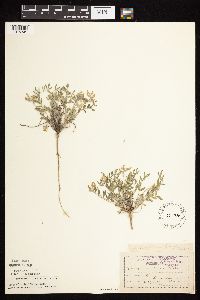 Astragalus lotiflorus Hooker 135226[1075345]Moyer, Lycurgus s.n.1893-06-04 United States, Minnesota, Chippewa, Montevideo;;117N;40W;, 44.953148 -95.715397 |
MIN:Plants | 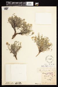 Astragalus lotiflorus Hooker 135228[1075355]Moyer, Lycurgus s.n.1887-06-10 United States, Minnesota, Chippewa, Montevideo;;117N;40W;, 44.953148 -95.715397 |
MIN:Plants | 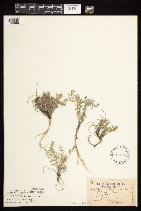 Astragalus lotiflorus Hooker 135236[1075353]Nelson, Nels s.n.1894-05-00 United States, Minnesota, Chippewa, Montevideo;;117N;40W;, 44.953148 -95.715397 |
MIN:Plants | 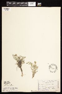 Astragalus lotiflorus Hooker 135237[1075352]Moyer, Lycurgus s.n.1894-05-00 United States, Minnesota, Chippewa, Montevideo;;117N;40W;, 44.953148 -95.715397 |
MIN:Plants |  Astragalus lotiflorus Hooker 135239[1075314]Moyer, Lycurgus s.n.1910-05-08 United States, Minnesota, Yellow Medicine, Minnesota bluffs;;N;;, 44.718101 -95.89093 |
MIN:Plants |  Astragalus lotiflorus Hooker 135240[1075316]Sheldon, Edmund S34231892-08-00 United States, Minnesota, Otter Tail, Eagle Lake;;N;;, 46.1728347 -95.6976807 |
MIN:Plants |  Astragalus lotiflorus Hooker 135241[1075337]Moyer, Lycurgus 21371894-06-00 United States, Minnesota, Chippewa, Montevideo;;117N;40W;, 44.953148 -95.715397 |
MIN:Plants |  Astragalus lotiflorus Hooker 135242[1075335]Moyer, Lycurgus 21371885-06-00 United States, Minnesota, Chippewa, Near Rock Cut, Montevideo;;117N;40W;, 44.951934 -95.715397 |
MIN:Plants | 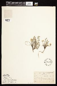 Astragalus lotiflorus Hooker 135243[1075354]Moyer, Lycurgus 21371893-05-30 United States, Minnesota, Chippewa, Montevideo;;117N;40W;, 44.953148 -95.715397 |
MIN:Plants | 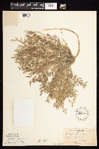 Astragalus lotiflorus Hooker 135244[1075313]Moyer, Lycurgus 21371899-06-13 United States, Minnesota, Big Stone, Bluffs of Big Stone Lake, Ortonville;;N;;, 45.414064 -96.63009 |
MIN:Plants | 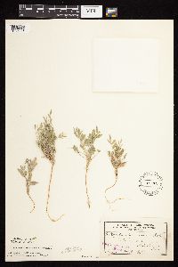 Astragalus lotiflorus Hooker 135245[1075318]Sheldon, Edmund s.n.1892-08-00 United States, Minnesota, Otter Tail, Silver Lake;;N;;, 46.6940683 -95.6580664 |
MIN:Plants | 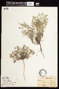 Astragalus lotiflorus Hooker 135246[1075346]Moyer, Lycurgus s.n.1908-05-31 United States, Minnesota, Chippewa, Bluffs of Minnesota Valley, Montevideo;;117N;40W;, 44.932918 -95.732649 |
MIN:Plants | 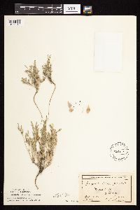 Astragalus lotiflorus Hooker 135247[1075315]Sheldon, Edmund S37281892-08-00 United States, Minnesota, Otter Tail, Fergus Falls;;N;;, 46.286099 -96.078588 |
MIN:Plants | 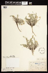 Astragalus lotiflorus Hooker 135248[1075347]Moyer, Lycurgus s.n.1893-06-04 United States, Minnesota, Chippewa, Montevideo;;117N;40W;, 44.953148 -95.715397 |
MIN:Plants | 135351[1122617]Moyer, Lycurgus United States, Minnesota, Yellow Medicine, Detailed locality information protected. This is typically done to protect rare or threatened species localities. |
MIN:Plants | 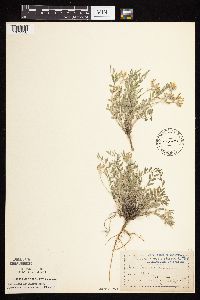 Astragalus lotiflorus Hooker 178443[1075336]Moyer, Lycurgus s.n.1893-06-04 United States, Minnesota, Chippewa, Montevideo;;117N;40W;, 44.953148 -95.715397 |
MIN:Plants | 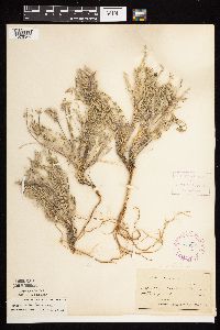 Astragalus lotiflorus Hooker 278131[1075344]Roberts, Thomas s.n.1879-06-09 United States, Minnesota, Grant, Herman;;N;;, 45.809888 -96.139444 |
MIN:Plants | 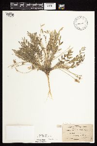 Astragalus lotiflorus Hooker 305752[1075349]Moyer, Lycurgus 501898-06-13 United States, Minnesota, Big Stone, Ortonville;;N;;, 45.306619 -96.446152 |
MIN:Plants | 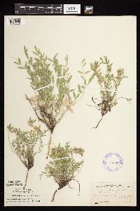 Astragalus lotiflorus Hooker 356697[1075333]Stevens, O. 3241938-05-30 United States, Minnesota, Becker, Beach, Lake Cormorant, Lake Park;;N;;, 46.764272 -96.053019 |
MIN:Plants | 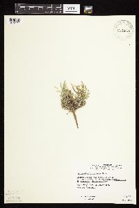 Astragalus lotiflorus Hooker 428628[1075360]Wheeler, Gerald 111631988-07-16 United States, Minnesota, Traverse, Traverse Co.; Browns Valley (NE side), W of Rte. 2; E1/2 SW1/4 Sec. 27 T125N R49W (Folsom Township);;125N;49W;27, 45.6078012 -96.8130731 |
MIN:Plants | 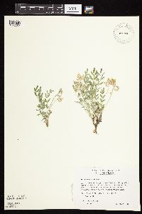 Astragalus lotiflorus Hooker 429379[1075289]Wheeler, Gerald 157671997-05-25 United States, Minnesota, Nicollet, Nicollet Co.; Ca. 10 mi. SE of Fort Ridgely State Park on Rte. 21; SW1/4 NE1/4 NW1/4 Sec. 33 T111N R31W (West Newton 33);;111N;31W;33, 44.3725651 -94.5640733 |
MIN:Plants | 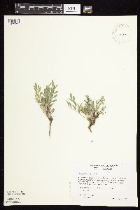 Astragalus lotiflorus Hooker 429380[1075292]Wheeler, Gerald 171491997-08-11 United States, Minnesota, Renville, Renville Co.; Ca. 6 mi. SW of Sacred Heart; SE1/4 NW1/4 NE1/4 Sec. 19 T115N R38W (Hawk Creek 19);;115N;38W;19, 44.7496446 -95.4748403 |
MIN:Plants | 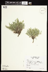 Astragalus lotiflorus Hooker 460455[1075290]Wheeler, Gerald 176711997-09-04 United States, Minnesota, Chippewa, Chippewa Co.; Ca. 3 mi. NW of Granite Falls on Palmer Creek Road; NW1/4 NE1/4 SE!/4 Sec. 20 T116N R39W (Granite Falls 20 Chippewa Co.; Ca. 3 mi. NW of Granite Falls on Palmer Creek Road; NW1/4 NE1/4 SE!/4 Sec. 20 T116N R39W (Granite Falls 20). 116N 39W 20, 44.836485 -95.5769896 |
MIN:Plants | 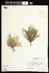 Astragalus lotiflorus Hooker 475288[1075332]Wheeler, Gerald 165361997-07-03 United States, Minnesota, Renville, Renville Co.; Ca. 3.5 mi. SE of Franklin on Rte. 5; SE1/4 SE1/4 NE1/4 Sec. 20 T112N R33W (Camp 20);;112N;33W;20, 44.4885888 -94.8423467 |
MIN:Plants | 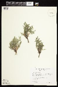 Astragalus lotiflorus Hooker 475291[1075368]Wheeler, Gerald 172541997-08-15 United States, Minnesota, Yellow Medicine, Yellow Medicine Co.; Ca. 7 mi. N of Echo on Rte. 67, 0.2 mi. E on Rte. A1; NE1/4 NW1/4 SW1/4 Sec. 34 T115N R38W (Sioux A Yellow Medicine Co.; Ca. 7 mi. N of Echo on Rte. 67, 0.2 mi. E on Rte. A1; NE1/4 NW1/4 SW1/4 Sec. 34 T115N R38W (Sioux Agency 34 'N'). 115N 38W 34, 44.7230652 -95.411758 |
MIN:Plants | 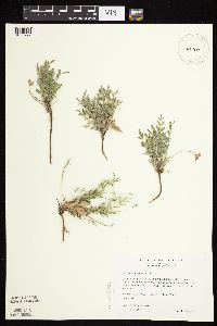 Astragalus lotiflorus Hooker 475333[1075297]Wheeler, Gerald 162851997-06-26 United States, Minnesota, Renville, Renville Co.; Ca. 10.5 mi. S of Renville; NW1/4 SW1/4 NE1/4 Sec. 33 T114N R36W (Flora 33);;114N;36W;33, 44.5354016 -94.9368815 |
MIN:Plants | 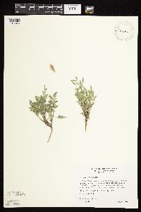 Astragalus lotiflorus Hooker 475841[1075366]Wheeler, Gerald 171101997-08-11 United States, Minnesota, Chippewa, Gneiss Outcrops Scientific Natural Area. Chippewa Co.; Ca. 2 mi. SE of Granite FAlls, E of Pete's Pt. Rd. SE; NE1/4 SW1/4 SW1/4 Sec. 12 T 115N R39W (Granite FAll Chippewa Co.; Ca. 2 mi. SE of Granite FAlls, E of Pete's Pt. Rd. SE; NE1/4 SW1/4 SW1/4 Sec. 12 T 115N R39W (Granite FAlls 12 'S'). 115N 39W 12, 44.7815206 -95.4926834 |
MIN:Plants | 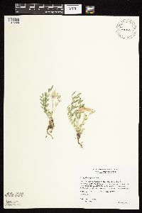 Astragalus lotiflorus Hooker 475842[1075369]Wheeler, Gerald 160971997-06-10 United States, Minnesota, Renville, Renville Co.; Ca. 3.5 mi. SE of Franklin on Rte. 5, NW of the jct. of Rte. 3 and Rte. 5; SE1/4 SE1/4 NE!/4 Sec. 20 T112N Renville Co.; Ca. 3.5 mi. SE of Franklin on Rte. 5, NW of the jct. of Rte. 3 and Rte. 5; SE1/4 SE1/4 NE!/4 Sec. 20 T112N R33W (Camp 20). 112N 33W 20, 44.4885888 -94.8423467 |
MIN:Plants | 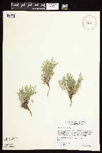 Astragalus lotiflorus Hooker 475894[1075325]Wheeler, Gerald 161881997-06-25 United States, Minnesota, Renville, Renville Co.; Ca. 3.5 mi. SE of Franklin on Rte. 5, NW of the jct. of Rte. 3 and Rte. 5; SE1/4 SE1/4 NE1/4 Sec. 20 T112N Renville Co.; Ca. 3.5 mi. SE of Franklin on Rte. 5, NW of the jct. of Rte. 3 and Rte. 5; SE1/4 SE1/4 NE1/4 Sec. 20 T112N R33W (Camp 20). 112N 33W 20, 44.4885888 -94.8423467 |
MIN:Plants |  Astragalus lotiflorus Hooker 476408[1075326]Wheeler, Gerald 161901997-06-25 United States, Minnesota, Renville, Renville Co.; Ca. 3 mi. SE of Franklin on Rte. 5, 0.4 mi. W of the jct. of Rte. 3 and Rte. 5; NW1/4 SW1/4 NE1/4 Sec. 20 Renville Co.; Ca. 3 mi. SE of Franklin on Rte. 5, 0.4 mi. W of the jct. of Rte. 3 and Rte. 5; NW1/4 SW1/4 NE1/4 Sec. 20 T112N R33W (Camp 20). 112N 33W 20, 44.4777794 -94.8557896 |
MIN:Plants |  Astragalus lotiflorus Hooker 484845[1075291]Wheeler, Gerald 161831997-06-25 United States, Minnesota, Renville, Renville Co.; Ca. 5.2 mi. SE of Franklin on Rte. 5; NW1/4 SW1/4 NW1/4 Sec. 27 T112N R33W (Camp 27);;112N;33W;27, 44.4778081 -94.7955466 |
MIN:Plants |  Astragalus lotiflorus Hooker 484859[1075367]Wheeler, Gerald 164431997-06-30 United States, Minnesota, Chippewa, Chippewa Co.; Ca. 4.5 mi. NW of Granite Falls on Palmer Creek Road; SE1/4 NE1/4 SW1/4 Sec. 18 T116N R39W (Granite Falls Chippewa Co.; Ca. 4.5 mi. NW of Granite Falls on Palmer Creek Road; SE1/4 NE1/4 SW1/4 Sec. 18 T116N R39W (Granite Falls 18). 116N 39W 18, 44.8492471 -95.6008331 |
MIN:Plants |  Astragalus lotiflorus Hooker 618958[1075311]Tanner, W. s.n.1968-05-00 United States, Minnesota, Le Sueur, Le Sueur Co. About 1/2 mi SE of Ottawa. T110N, R26W, NE1/4 Sec. 3.;Ottawa Bluffs, The Nature Conservancy;110N;26W;3, 44.3626183 -93.939379 |
MIN:Plants | 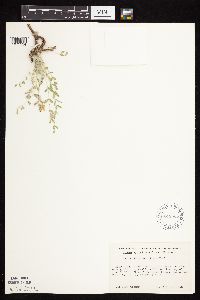 Astragalus lotiflorus Hooker 618965[1075334]Tanner, W. s.n.1970-05-25 United States, Minnesota, Le Sueur, Le Sueur Co. Near the edge of a gully near the top of the bluff, "Ottawa" Prairie; Kasota Twp. T110N R26W NE1/4 Sec. 3;Ottawa Bluffs, The Nature Conservancy;110N;26W;3, 44.3626183 -93.939379 |
MIN:Plants | 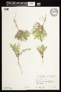 Astragalus lotiflorus Hooker 689911[1075356]Ownbey, Gerald 57111977-07-27 United States, Minnesota, Norman, T143N, R43W, Sec. 29, NE1/4 NE1/4. Rte. 113, 5 mi. E of Syre.;;143N;43W;29, 47.1730876 -96.1628007 |
MIN:Plants | 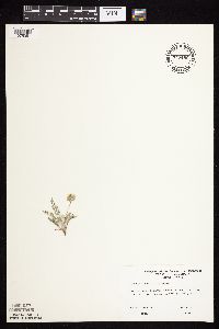 Astragalus lotiflorus Hooker 747486[1075351]Dana, R. s.n.1978-05-00 United States, Minnesota, Lincoln, Lincoln County...Hole-in-the-Mountain Preserve, ca. 1.5 mi S of Lake Benton;Hole-in-the-Mountain Prairie, The Nature Conservancy;109N;45W;, 44.239354 -96.287539 |
MIN:Plants | 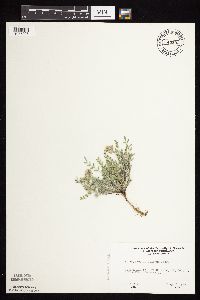 Astragalus lotiflorus Hooker 749533[1075295]Ehritt, K. s.n.1977-04-27 United States, Minnesota, Le Sueur, Le Sueur Co. Ottawa Bluffs; T110N R26W NE1/4 Sec. 3;Ottawa Bluffs, The Nature Conservancy;110N;26W;3, 44.3626183 -93.939379 |
MIN:Plants | 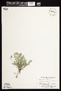 Astragalus lotiflorus Hooker 757939[1075294]Smith, Welby 58811982-05-08 United States, Minnesota, Lac Qui Parle, Antelope Hills, ca. 7.5 mi due W of Providence; SW1/4 NE1/4 Sec. 27 T116N R45W;;116N;45W;27, 44.8271788 -96.2659745 |
MIN:Plants | 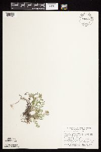 Astragalus lotiflorus Hooker 758121[1075348]Smith, Welby 59061982-05-14 United States, Minnesota, Pope, Glacial Lakes State Park. Glacial Lakes State Park, on the E side of co. hwy 41, ca. 5 1/4 mi S of its jnc with st. hwy 28 in Starbuck; W1/2 NE1/4 Glacial Lakes State Park, on the E side of co. hwy 41, ca. 5 1/4 mi S of its jnc with st. hwy 28 in Starbuck; W1/2 NE1/4 Sec. 23 T124N R39W. 124N 39W 23, 45.5348415 -95.5313658 |
MIN:Plants | 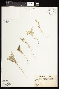 Astragalus lotiflorus Hooker 765024[1075350]Lugger, O. s.n.1900-08-00 United States, Minnesota, Otter Tail, Silver Lake;;;;, 46.6940683 -95.6580664 |
MIN:Plants | 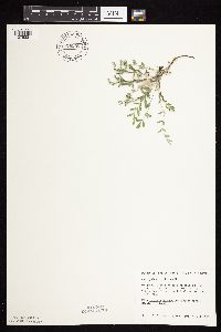 Astragalus lotiflorus Hooker 778243[1075321]Converse, C. 26451985-09-03 United States, Minnesota, Lac Qui Parle, E-facing slope that drains into the N fork of the Yellow Bank River. NW1/4 SE1/4 Sec. 26, T120N, R46W.;;120N;46W;26, 45.1751834 -96.3845649 |
MIN:Plants | 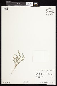 Astragalus lotiflorus Hooker 778245[1075320]Converse, C. 26201985-08-10 United States, Minnesota, Lac Qui Parle, NE1/4 NE1/4 Sec. 28, T120N, R44W.;;120N;44W;28, 45.1751088 -96.1762428 |
MIN:Plants | 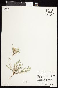 Astragalus lotiflorus Hooker 778246[1075317]Converse, C. 25281985-06-25 United States, Minnesota, Yellow Medicine, Yellow Medicine Co. ... SE1/4 NE1/4 Sec. 13, T114N, R46W. SE1/4 NE1/4 Sec. 13, T114N, R46W.. 114N 46W 13, 44.6815146 -96.3484656 |
MIN:Plants | 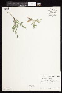 Astragalus lotiflorus Hooker 778247[1075319]Converse, C. 26591985-09-05 United States, Minnesota, Lac Qui Parle, SE1/4 SE1/4 Sec. 31, T120N, R43W.;;120N;43W;31, 45.1595178 -96.0934617 |
MIN:Plants | 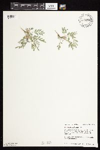 Astragalus lotiflorus Hooker 778256[1075322]Converse, C. 26391985-09-01 United States, Minnesota, Big Stone, NW1/4 NW1/4 Sec. 23, T124N, R49W.;;124N;49W;23, 45.5387705 -96.7712425 |
MIN:Plants | 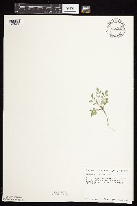 Astragalus lotiflorus Hooker 778280[1075323]Converse, C. 26581985-09-05 United States, Minnesota, Lac Qui Parle, NE1/4 SE1/4 Sec. 31, T120N, R43W.;;120N;43W;31, 45.1595178 -96.0934617 |
MIN:Plants | 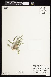 Astragalus lotiflorus Hooker 778281[1075324]Converse, C.; et al. 26341985-08-24 United States, Minnesota, Lac Qui Parle, Lac Qui Parle Co.; SW1/4 NE1/4 Sec. 14, T120N, R45W.;Plover Prairie, The Nature Conservancy;120N;45W;14, 45.2040878 -96.2582562 |
MIN:Plants | 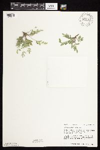 Astragalus lotiflorus Hooker 778282[1075357]Converse, C. 26491985-09-03 United States, Minnesota, Chippewa, Chippewa Co. W-facing slope along Watson Sag. SE1/4 SW1/4 Sec. 5, T118N, R41W.;;118N;41W;5, 45.0580663 -95.8276009 |
MIN:Plants | 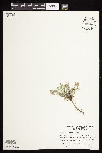 Astragalus lotiflorus Hooker 780497[1075358]Ownbey, Gerald 68841983-05-16 United States, Minnesota, Lac Qui Parle, Antelope Hills Prairie; T116N R45W Sec. 27 W1/2 NE1/4;;116N;45W;27, 44.8271788 -96.2659745 |
MIN:Plants |  Astragalus lotiflorus Hooker 782158[1075312]Dana, R. 851241985-08-29 United States, Minnesota, Clay, Bluestem Prairie. On former beach of ridge of Glacial Lake Agassiz. SW1/4 NE1/4 Sec. 23, T139N, R46W.;Bluestem Prairie Scientific Natural Area;139N;46W;23, 46.8401941 -96.452227 |
MIN:Plants |  Astragalus lotiflorus Hooker 792862[1075304]Converse, C. 26891986-07-26 United States, Minnesota, Chippewa, Lac Qui Parle Wildlife Management Area. Chippewa Co. SW1/4 NW1/4 Sec. 34, T119N, R42W. Lac Qui Parle Wildlife Management Area. Along abandoned glacial river c Chippewa Co. SW1/4 NW1/4 Sec. 34, T119N, R42W. Lac Qui Parle Wildlife Management Area. Along abandoned glacial river channel near it's confluence with Watson Sag.. 119N 42W 34, 45.072484 -95.9086248 |
MIN:Plants |  Astragalus lotiflorus Hooker 792872[1075305]Converse, C. 27281987-07-11 United States, Minnesota, Lac Qui Parle, Lac Qui Parle Wildlife Management Area. Lac Qui Parle County...slope of N side of Emily Creek near its confluence with Lac Qui Parle. SW1/4 SE1/4 Sec. 23 T119N, R43W. 119N 43W 23, 45.0963898 -96.0069427 |
MIN:Plants |  Astragalus lotiflorus Hooker 792873[1075306]Converse, C. 28291987-09-18 United States, Minnesota, Lac Qui Parle, Gravelly knoll E of the N fork of the Yellow Medicine River. SW1/4 NE1/4 Sec. 25 T120N, R46W;;120N;46W;25, 45.1786118 -96.3622208 |
MIN:Plants | 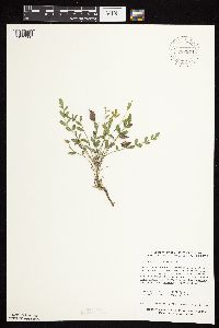 Astragalus lotiflorus Hooker 792874[1075300]Converse, C. 28281987-09-17 United States, Minnesota, Lac Qui Parle, Ca. 4.5 mi. NW of Montevideo W of Hwy. 79. Found along the NW-facing 20-40 degree upper prairie slopes of creek near it Ca. 4.5 mi. NW of Montevideo W of Hwy. 79. Found along the NW-facing 20-40 degree upper prairie slopes of creek near its confluence with the Minnesota River. SE1/4 NE1/4 Sec. 8, T117N, R41W.. 117N 41W 8, 44.9571938 -95.8297279 |
MIN:Plants | 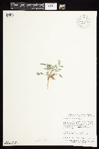 Astragalus lotiflorus Hooker 792876[1075301]Converse, C. 28261987-09-17 United States, Minnesota, Lac Qui Parle, Lac Qui Parle County...3 mi. W of Montevideo N fo Hwy. 212...creek near it's confluence with the Minnesota River. W1/2 SW1/4 Sec. 15, T117N, R41W. 117N 41W 15, 44.939724 -95.796669 |
MIN:Plants | 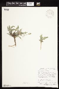 Astragalus lotiflorus Hooker 792877[1079955]Converse, C. 28231987-09-18 United States, Minnesota, Lac Qui Parle, Lac Qui Parle County...ravine draining into Emily Creek near it's confluence with the Minnesota River, and just W of Hwy. 40. NW1/4 SW1/4 Sec. 25, T119N, R43W. 119N 43W 25, 45.086113 -95.9833298 |
MIN:Plants | 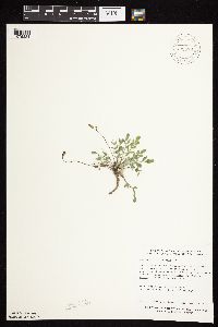 Astragalus lotiflorus Hooker 792878[1075331]Converse, C. 28241987-09-17 United States, Minnesota, Lac Qui Parle, Ca. 4.5 mi. NW of Montevideo E of Hwy. 79. NW1/4 SW1/4 Sec. 9, T117N, R41W;;117N;41W;9, 44.9561119 -95.8172226 |
MIN:Plants | 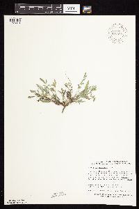 Astragalus lotiflorus Hooker 792879[1075310]Converse, C. 27901987-09-01 United States, Minnesota, Lac Qui Parle, Lac Qui Parle County..Along the E side of the W fork of the Lac Qui Parle River. NW1/4 SW1/4 Sec. 29, T116N, R46W;;116N;46W;29, 44.8286095 -96.4366684 |
MIN:Plants | 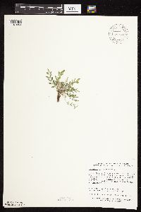 Astragalus lotiflorus Hooker 792880[1079953]Converse, C. 27961987-09-02 United States, Minnesota, Lac Qui Parle, Ca. .75 mi. N of Yellow Medicine Co. line on Hwy. 7. SE1/4 NW1/4 Sec. 33, T116N, R46W;;116N;46W;33, 44.8152771 -96.4133301 |
MIN:Plants | 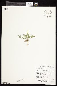 Astragalus lotiflorus Hooker 792881[1075329]Converse, C. 28051987-09-03 United States, Minnesota, Lac Qui Parle, Ca. 3.5 mi. W of Bellingham on Hwy. 30, on W banks of the Yellow Bank River. NE1/4 NW1/4 Sec. 12, T119N, R46W;;119N;46W;12, 45.148613 -96.3669434 |
MIN:Plants | 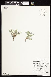 Astragalus lotiflorus Hooker 792883[1075328]Converse, C. 28081987-09-03 United States, Minnesota, Lac Qui Parle, Lac Qui Parle County..SE of the intersection of Hwys. 3 and 32, ca. 4 mi. W of Bellingham. Along the E bank of the Yellow Medicine River. SW1/4 NW1/4 Sec. 13, T116N, R46W. 116N 46W 13, 45.1186104 -96.3694458 |
MIN:Plants |  Astragalus lotiflorus Hooker 792885[1079957]Converse, C. 28201987-09-16 United States, Minnesota, Lac Qui Parle, Lac Qui Parle County...Just W of Hwy. 33 that borders the W shoreline of Lac Qui Parle...ravine draining into the lake. SW1/4 SW1/4 Sec. 4, T118N, R42W.. 118N 42W 4, 45.0525017 -95.9380569 |
MIN:Plants |  Astragalus lotiflorus Hooker 792888[1075299]Converse, C. 27891987-09-01 United States, Minnesota, Lac Qui Parle, Ca. 1/2 mi. E of South Dakota border and one mi. N of the Yellow Medicine county line along the S side of the W fork of Ca. 1/2 mi. E of South Dakota border and one mi. N of the Yellow Medicine county line along the S side of the W fork of the Lac Qui Parle River. SE1/4 NE1/4 Sec. 30, T116N, R46W.. 116N 46W 30, 44.8271206 -96.446197 |
MIN:Plants |  Astragalus lotiflorus Hooker 792889[1075327]Converse, C. 27791987-08-21 United States, Minnesota, Lac Qui Parle, Ca. 25 mi. NW of Crow Creek along the South Dakota. On a SE-facing slope. NW1/4 NW1/4 Sec. 6, T116N, R46W;;116N;46W;6, 44.8916664 -96.4488907 |
MIN:Plants |  Astragalus lotiflorus Hooker 792890[1079956]Converse, C. 27821987-08-21 United States, Minnesota, Lac Qui Parle, Near the W fork of the Lac Qui Parle River. SE1/4 NE1/4 Sec. 18, T116N, R46W;;116N;46W;18, 44.9852791 -96.4402771 |
MIN:Plants | 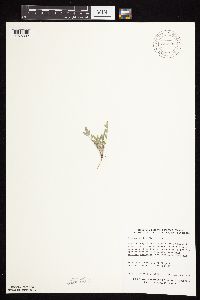 Astragalus lotiflorus Hooker 792898[1075302]Converse, C. 27461987-08-05 United States, Minnesota, Lac Qui Parle, Lac Qui Parle County ...N of Hwy. 18 ca. 5 mi. NW of Montevideo. Along upper slope of ravine. SE1/4 SW1/4 Sec. 05 T117N, R41N. 117N 41W 5, 44.9666672 -95.8269424 |
MIN:Plants | 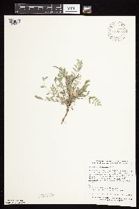 Astragalus lotiflorus Hooker 792899[1075309]Converse, C. 27481987-08-05 United States, Minnesota, Lac Qui Parle, Ca. 1 mi. SE of Lac Qui Parle town along the west bank of Ten Mile Creek. NW1/4 NE1/4 Sec. 23, T118N, R42W;;118N;42W;23, 45.015157 -95.888871 |
MIN:Plants | 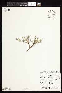 Astragalus lotiflorus Hooker 792900[1075298]Converse, C. 27421987-08-04 United States, Minnesota, Lac Qui Parle, Lac Qui Parle County...Ca. 100 m S of Hwy. 212 just W of the intersection of Hwy. 59. NW1/4 NE1/4 Sec. 21, T117N, R41W. 117N 41W 21, 44.9280955 -95.8085598 |
MIN:Plants | 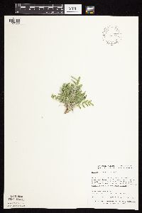 Astragalus lotiflorus Hooker 795349[1075339]Dana, R. 870451987-07-07 United States, Minnesota, Traverse, In bluffs above Lake Traverse, above a large gravel excavation in bluff; T125N R49W S1/2 SW1/4 NE1/4 Sec. 16;;125N;49W;16, 45.6369438 -96.8305588 |
MIN:Plants |  Astragalus lotiflorus Hooker 795353[1075340]Dana, R. 870571987-07-08 United States, Minnesota, Traverse, On bluffs above Lake Traverse, of slope of large coulee; T126N R47W E1/2 SE1/4 NE1/4 Sec. 6;;126N;47W;6, 45.7544441 -96.6155548 |
MIN:Plants |  Astragalus lotiflorus Hooker 795385[1075343]Dana, R. 870531987-07-08 United States, Minnesota, Traverse, On bluffs above Lake Traverse, along cattle trail on ridge crest; T127N R47W NW1/4 SE1/4 SW1/4 Sec. 32;;127N;47W;32, 45.7605553 -96.6066666 |
MIN:Plants |  Astragalus lotiflorus Hooker 795395[1075342]Dana, R. 870851987-07-23 United States, Minnesota, Traverse, On bluffs above Lake Traverse; T126N R48W SW1/4 NE1/4 SE1/4 Sec. 22;;126N;48W;22, 45.709302 -96.687697 |
MIN:Plants |  Astragalus lotiflorus Hooker 795404[1075338]Dana, R. 870701987-07-13 United States, Minnesota, Traverse, In bluffs above Lake Traverse; T126N R47W SE1/4 NE1/4 NW1/4 Sec. 7;;126N;47W;7, 45.7425003 -96.6258316 |
MIN:Plants | 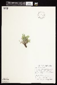 Astragalus lotiflorus Hooker 795406[1075341]Dana, R. 870361987-07-07 United States, Minnesota, Traverse, Along deep ravine; T125N R49W SE1/4 SW1/4 SW1/4 Sec. 27;;125N;49W;27, 45.601944 -96.8202744 |
MIN:Plants | 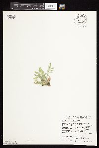 Astragalus lotiflorus Hooker 805656[1075307]Dana, R. 880171988-07-15 United States, Minnesota, Big Stone, In Big Stone Moraine at top of Minnesota River Valley Bluffs. SW1/4 SE1/4 NE1/4 Sec. 9, T122N, R47W;;122N;47W;9, 45.3933334 -96.558609 |
MIN:Plants | 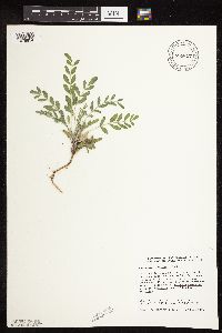 Astragalus lotiflorus Hooker 805817[1079954]Converse, C. 28821988-09-30 United States, Minnesota, Big Stone, Ca. 5 mi. E of Ortonville. SW1/4 NW1/4 Sec. 8, T121N, R45W;;121N;45W;8, 45.3069458 -96.3416672 |
MIN:Plants |  Astragalus lotiflorus Hooker 805818[1075330]Converse, C. 28811988-09-30 United States, Minnesota, Big Stone, Ca. 6 mi. NW of Ortonville. SE1/4 NE1/4 Sec/ 11, T122N. R47W;;122N;44W;11, 45.396946 -96.5122223 |
MIN:Plants | 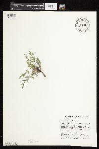 Astragalus lotiflorus Hooker 805819[1075303]Converse, C. 28851988-10-01 United States, Minnesota, Big Stone, Big Stone County...SW1/4 NW1/4 Sec. 20, T121N, R45W;Menzel Wildlife Management Area;121N;45W;20, 45.2786111 -96.3436111 |
MIN:Plants | 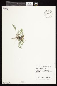 Astragalus lotiflorus Hooker 805821[1075361]Converse, C. 28841988-10-01 United States, Minnesota, Big Stone, NE1/4 SE1/4 Sec. 18. T121N, R45W;;121N;45W;18, 45.2897224 -96.3444443 |
MIN:Plants |  Astragalus lotiflorus Hooker 805824[1075308]Converse, C. 28801988-09-29 United States, Minnesota, Lac Qui Parle, Ca. 6 mi. SE of Marietta. S1/2 NE1/4 Sec. 30, T117N, R45W;;117N;45W;1, 44.9180565 -96.3444443 |
MIN:Plants | 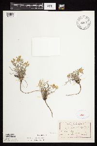 Astragalus lotiflorus Hooker 813648[1075359]Moyer, Lycurgus s.n.1892-06-04 United States, Minnesota, Chippewa, Montevideo;;117N;40W;, 44.953148 -95.715397 |
MIN:Plants | 445573[1075378]Biederman, L. United States, Minnesota, Yellow Medicine, Detailed locality information protected. This is typically done to protect rare or threatened species localities. |
MIN:Plants | 445574[1075379]Biederman, L. United States, Minnesota, Lac Qui Parle, Detailed locality information protected. This is typically done to protect rare or threatened species localities. |
MIN:Plants | 447089[1075417]Biederman, L. United States, Minnesota, Lac Qui Parle, Detailed locality information protected. This is typically done to protect rare or threatened species localities. |
MIN:Plants | 833856[1075421]Smith, Welby United States, Minnesota, Big Stone, Detailed locality information protected. This is typically done to protect rare or threatened species localities. |
MIN:Plants | 135316[1075419]Moyer, Lycurgus United States, Minnesota, Big Stone, Detailed locality information protected. This is typically done to protect rare or threatened species localities. |
MIN:Plants | 135347[1075399]Moyer, Lycurgus United States, Minnesota, Big Stone, Detailed locality information protected. This is typically done to protect rare or threatened species localities. |
Google Map
Google Maps is a web mapping service provided by Google that features a map that users can pan (by dragging the mouse) and zoom (by using the mouse wheel). Collection points are displayed as colored markers that when clicked on, displays the full information for that collection. When multiple species are queried (separated by semi-colons), different colored markers denote each individual species.