University of Minnesota
http://www.umn.edu/
612-625-5000
http://www.umn.edu/
612-625-5000
Minnesota Biodiversity Atlas
Bell Museum
Dataset: MIN-Plants
Taxa: Carex
Search Criteria: excluding cultivated/captive occurrences
Bell Museum plants | |
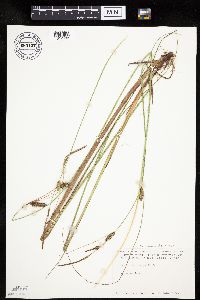
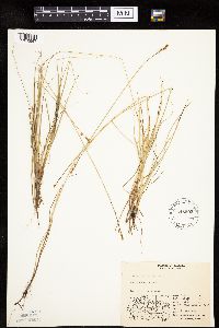
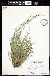
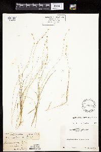
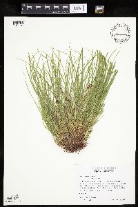
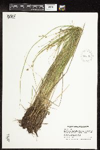
MIN:Plants | Carex lasiocarpa subsp. americana (Fernald) Hultén 680127[1012683]Coffin, Barbara 3221976-07-08 United States, Wisconsin, Ashland, Presque Isle Point, Stockton Island, Apostle Islands National Lakeshore;Apostle Islands National Lakeshore;;;, 46.916326 -90.548792 |
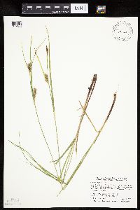
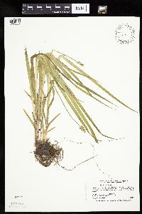
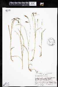
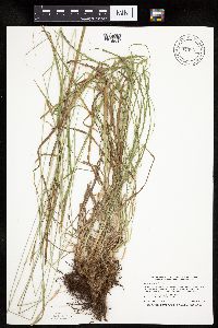
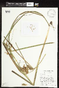
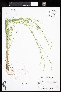
MIN:Plants | Carex pellita Willdenow 491222[1014539]Smith, Welby 293042002-06-10 United States, Minnesota, Olmsted, Olmsted County ... About 0.5 mile west of jct of U.S. hwy 52 and U.S. Hwy 63 just south of Rochester ... T 106N R 14W SW1/4 of NW1/4 of Sec 23. 106N 14W 23, 43.9736111 -92.4791667 |
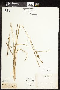
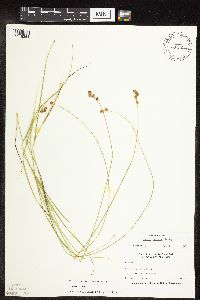
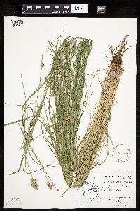
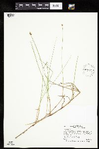
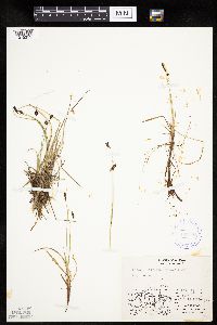
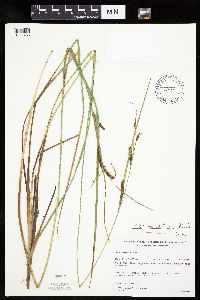
MIN:Plants | 234818[1118649]Congdon, J. s.n.1890-08-10 United States, California, Mariposa, Crescent Lake, Mariposa County;Yosemite National Park |
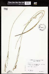
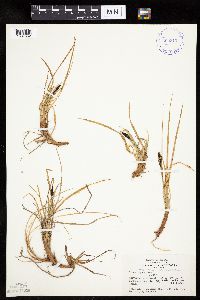
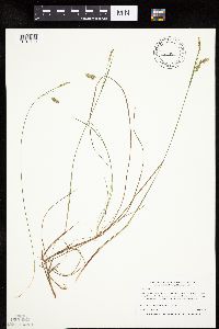
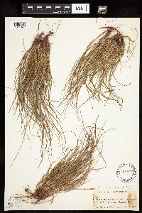
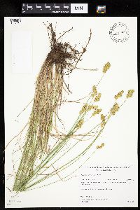
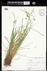
MIN:Plants | Carex praticola Rydberg 916499[1015043]Gerdes, D. Lawson; et al. United States, Minnesota, Cook, Detailed locality information protected. This is typically done to protect rare or threatened species localities. |
MIN:Plants | Carex emoryi Dewey 509851[1010383]Wheeler, Gerald 189121998-06-05 United States, Minnesota, Carver, Minnesota Valley National Wildlife Refuge. Carver County ... Ca. 2.5 mi. SE of East Union, E of Rte. 45 ... bordering the Minnesota River ... S1/2 SW1/4 Sec. 7 T114N R23W. 114N 23W 7, 44.694137 -93.630874 |
MIN:Plants | Carex utriculata Boott in W.J. Hooker 907168[1017957]Smith, Welby 285022000-06-05 United States, Minnesota, Goodhue, Goodhue County...In the Cannon River Valley, about 3 miles west of Red Wing...T113N R15W SW1/4 of SE1/4 of Sec 21;Dorer Memorial Hardwood State Forest;113N;15W;21, 44.5730556 -92.6188889 |
MIN:Plants | Carex emoryi Dewey 681039[1109831]Swanson, Steven 6681975-06-19 United States, Wisconsin, La Crosse, La Crosse Co, Site 16;Upper Mississippi National Wildlife Refuge |
MIN:Plants | Carex diandra Schrank 491090[1009760]Gerdes, Lynden; et al. 34911999-06-23 United States, Minnesota, Cook, Superior National Forest. T65N R02W S19SENE. Cook County ... Superior National Forest. NE corner of the most southeastern bay of Gunflint Lake. most bay of Gunflint Lake. Approx. .25 mile south of the Canadian border.. 065N 02W 19, 48.09871 -90.630415 |
MIN:Plants | Carex membranacea Hooker 400827[1013514]Spetzman, L. 10351948-08-02 United States, Alaska, Arctic North Slope...Sadlerochit River;Arctic National Wildlife Refuge;;;, 69.5 -145, 610m |
MIN:Plants | Carex viridula subsp. viridula Michaux 909953[1018262]Gerdes, Lynden; et al. 56752008-08-22 United States, Minnesota, Lake, Boundary Waters Canoe Area Wilderness / Superior National Forest. T66N R11W S26SWSW. Lake County, MN. Superior National Forest. Boundary Waters Canoe Area Wilderness. Crooked Lake; Approximately 0.12 miles south of Table Rock.. 066N 11W 26, 48.1694444 -91.7083333 |
MIN:Plants | Carex nigricans C.A. Meyer 698558[1110992]Wheeler, Gerald 27401978-07-31 United States, Montana, Flathead, Flathead County ... Glacier National Park. Hidden Lake Trail, near Logan Pass;Glacier National Park, 2134m |
MIN:Plants | Carex deflexa var. deflexa Hornemann 492184[1009271]Gerdes, Lynden 49742005-05-31 United States, Minnesota, Lake, Superior National Forest. T60N R09W S35NENENW Lake County ... Superior National Forest. Fish Fry Lakes area NW of Isabella ... Small seasonal pond along the south side of highway approximately 0.63 miles east of the Grouse lake Rd (FR 177) and Hwy.1 intersection.. 060N 09W 35, 47.639222 -91.437962 |
MIN:Plants | Carex scabrata Schweinitz 79281[1113959]Beardslee, H.; et al. s.n.1891-08-20 United States, North Carolina, Swain, Great Smoky Mountains ... Swain County;Great Smoky Mountains National Park, 549m |
MIN:Plants | Carex tuckermanii Dewey 904818[1017718]Whitfeld, T.J.S. 5442004-07-16 United States, Minnesota, Otter Tail, OTTER TAIL COUNTY ... 5 1/2 miles southwest of Dunvilla; 1/4 mile west of Otter lake ... T137N R41W NESW 31;;137N;41W;31, 46.636787 -95.908681 |
MIN:Plants | Carex buxbaumii Wahlenberg 426939[1008266]Schik, K. 96-1311996-06-26 United States, Minnesota, Norman, Norman County...T144N R43W SW1/4 of the NW1/4 of S26...at Faith Wildlife Management Area.;Faith Wildlife Management Area;144N;43W;26, 47.260347 -96.098789 |
MIN:Plants | Carex egglestoni Mackenzie 383143[1010358]Maguire, Bassett 211261941-08-04 United States, Nevada, White Pine, Lehman Creek, Lehman Creek basin, Snake Range ... White Pine County;Great Basin National Park, 2896m |
MIN:Plants | Carex magellanica Lamarck 435278[1110847]Lee, Michael MDL17911997-07-01 United States, Minnesota, Stearns, Stearns Co.; Six miles south of St. Augusta; T122N R28W SE1/4 of SE1/4 Sec. 12, NW1/4 of SE1/4 Sec. 12;;122N;28W;12, 45.391357 -94.148594 |
MIN:Plants | Carex grisea Wahlenberg 476716[1011187]Wheeler, Gerald 198311999-06-04 United States, Minnesota, Jackson, Jackson County ... Ca. 6.5 mi. NE of Lakefield; Kilen Woods State Park ... N1/2 SE1/4 Sec.17 T103N R35W (Belmont 17);Kilen Woods State Park;103N;35W;17, 43.724814 -95.064648 |
MIN:Plants | Carex chalciolepis T. Holm 521255[1009307]Cooper, William s.n.1904-08-12 United States, Colorado, Larimer, Mummy Mts, Estes Park;Rocky Mountain National Park |
MIN:Plants | Carex pensylvanica Lamarck 904553[1014803]Smith, Welby 260591996-05-29 United States, Minnesota, Fillmore, Dorer Memorial Hardwood State Forest. Fillmore County...Along a small tributary to Shattuck Creek, about 8 miles east-southeast of Lanesboro...T102N R8W SE1/4 of SE1/4 of Sec 6. 102N 08W 6, 43.6577778 -91.8238889 |
MIN:Plants | Carex heteroneura W. Boott 233444[1011432]Congdon, J. s.n.1898-08-01 United States, California, Mariposa, Chilnualna Trail, Mariposa County;Yosemite National Park |
MIN:Plants | Carex sterilis Willdenow 920645[1016692]Milburn, Scott; et al. United States, Minnesota, Polk, Detailed locality information protected. This is typically done to protect rare or threatened species localities. |
MIN:Plants | Carex diandra Schrank 909965[1009766]Smith, Welby 245301994-06-29 United States, Minnesota, Polk, Polk County...Rydell National Wildlife Refuge, about 3 miles southeast of Mentor...T 148N R 43W NW1/4 of SE1/4 of Sec 2;Rydell National Wildlife Refuge;148N;43W;02, 47.6625 -96.0977778 |
MIN:Plants | Carex mertensii J.D. Prescott ex Bongard 78134[1013566]Elmer, A.D.E. 27111900-08-00 United States, Washington, Clallam, Olympic Mts. [Olympic National Park] |
MIN:Plants | Carex glareosa Wahlenberg 548503[1010667]Spetzman, L. 39431951-07-31 United States, Alaska, Arctic North Slope ... John R. at Hunt Fork;Gates of the Arctic National Park;;;, 67.7833328 -152.3833313, 610m |
MIN:Plants | Carex cephaloidea (Dewey) Dewey 431670[1008557]Smith, Welby 166421990-05-21 United States, Minnesota, Steele, Steele County ... Kaplan Woods City Park, on the south side of Owatonna ... T107N R20W NE1/4 of NW1/4 of Sec 21;;107N;20W;21, 44.0644444 -93.235 |
MIN:Plants | Carex tenera var. tenera Dewey 473208[1118364]Nation, R. 94-4591994-06-21 United States, Minnesota, Mower, Tract #13N. NE1/4 of SE1/4 of Sec.;Lake Louise State Park;101N;14W;21, 43.536578 -92.519043 |
MIN:Plants | Carex jamesii Schweinitz 479240[1012276]Harris, Fred United States, Minnesota, Olmsted, Detailed locality information protected. This is typically done to protect rare or threatened species localities. |
MIN:Plants | Carex bigelowii Torrey ex Schweinitz 399312[1007552]Spetzman, L. 2601947-06-13 United States, Alaska, Shaviovik River, E. Fork ... west of ice field;Arctic National Wildlife Refuge;;;, 69.4666672 -146.5833282 |
MIN:Plants | Carex geyeri Boott 233181[1010661]Congdon, J. s.n.1888-05-21 United States, California, Mariposa, Yosemite Region, Mariposa County;Yosemite National Park |
MIN:Plants | Carex vulpinoidea Michaux 461181[1018344]Wheeler, Gerald 163381997-06-28 United States, Minnesota, Swift, Monson Lake State Park. Swift Co.; Ca. 10 mi. NNE of Kerkhoven, Monson Lake State Memorial Park; along shore of Monson Lake; W1/2 NE1/4 NW1/4 Sec. 1 T121N R37W (Hayes 1). 121N 37W 1, 45.318174 -95.265442 |
MIN:Plants | Carex exilis Dewey 438491[1109883]Gerdes, D. Lawson; Anderson, Chel United States, Minnesota, Lake, Detailed locality information protected. This is typically done to protect rare or threatened species localities. |
MIN:Plants | Carex backii W. Boott 493990[1007252]Gerdes, Lynden 43392001-05-29 United States, Minnesota, Lake, Superior National Forest. T57N R08W S29NWSE Lake County ... Finland State Forest. Approx. 6.0 miles SW of Finland MN. South off the Overlook Hiking Trail.. 057N 08W 29, 47.393227 -91.374507 |
MIN:Plants | 234447[1118677]Congdon, J. s.n.1899-08-28 United States, California, Tuolumne, Soda Springs of the Tuolumne;Yosemite National Park |
MIN:Plants | Carex straminiformis L.H. Bailey 233285[1016912]Congdon, J. s.n.1894-08-15 United States, California, Tuolumne, Soda Springs, Tuolumne County;Yosemite National Park |
MIN:Plants | Carex deweyana var. deweyana Schweinitz 288037[1009649]Wheeler, Gerald 199901999-06-11 United States, Minnesota, Carver, Carver Park Reserve County Park. Carver County ... Ca. 2 mi. NW of Victoria on Rte. 11; Carver Park Reserve ... trails to Stone and Zumbra lakes. SW1/4 Sec. 2 T116N R24W (Laketown 2). 116N 24W 2, 44.884273 -93.672712 |
MIN:Plants | Carex macrochaeta C.A. Meyer 663722[1013284]Noble, Mark; et al. 5461974-08-05 United States, Alaska, on the shoulder of Mt. Wright;Glacier Bay National Park;;;, 58.809784 -136.05167, 780m |
MIN:Plants | Carex tribuloides Wahlenberg 571468[1017499]Hartley, Thomas 73101959-07-10 United States, Iowa, Allamakee, Driftless Area...junction of the Upper Iowa and Mississippi Rivers. Allamakee County. T 100N R 4W Iowa Twp.;Upper Mississippi National Wildlife Refuge;100N;04W;00 |
MIN:Plants | Carex limosa L. 435187[1013100]Boe, J. 970617021997-06-17 United States, Minnesota, Aitkin, Aitkin Co.; North of Wolf Lake in Savanna Portage State Park. In releve 97-03; T 51N R 22W SW1/4 of SW1/4 of Sec 32;Savanna Portage State Park;050N;22W;32, 46.86039 -93.154338 |
MIN:Plants | 233478[1010254]Congdon, J. s.n.1890-08-10 United States, California, Mariposa, Chilnualna Falls, Mariposa County;Yosemite National Park |
MIN:Plants | Carex sprengelii Dewey ex Sprengel 915861[1016520]Smith, Welby 251811994-08-18 United States, Minnesota, Beltrami, Lake Bemidji State Park. Beltrami County...On the northeast side of Lake Bemidji, in Lake Bemidji State Park...T147 N R 33W SW1/4 of NE1/4 of Sec 23. 147N 33W 23, 47.5347222 -94.8311111 |
MIN:Plants | Carex chordorrhiza Ehrhart ex L. f. 909977[1009328]Smith, Welby 245331994-06-29 United States, Minnesota, Polk, Polk County...Rydell National Wildlife Refuge, about 3 miles southeast of Mentor...T 148N R 43W NW1/4 of SE1/4 of Sec 2;Rydell National Wildlife Refuge;148N;43W;02, 47.6625 -96.0977778 |
MIN:Plants | Carex umbellata Schkuhr ex Willdenow 485689[1017847]Rand, Edward s.n.1890-06-15 United States, Maine, Hancock, Mount Desert Island ... Oak Hill road, Somesville |
MIN:Plants | Carex oligosperma Michaux 436930[1013912]Smith, Welby 281051999-08-01 United States, Minnesota, Cook, Cook County...About 8 miles north of Grand Marais...T 62N R 1E NE1/4 of SW1/4 of Sec 8;Superior National Forest;062N;01E;08, 47.8663889 -90.3533333 |
MIN:Plants | Carex lasiocarpa subsp. americana (Fernald) Hultén 484278[1110629]Mensing, D. 95-10041995-08-04 United States, Minnesota, Clearwater, Clearwater Co, T144N R36W SW1/4 of the NE1/4 of S34...floodplain of the Mississippi River near the headwaters.;;144N;36W;34, 47.246264 -95.222996 |
MIN:Plants | Carex deflexa var. deflexa Hornemann 485954[1009302]Rand, Edward s.n.1891-06-23 United States, Maine, Hancock, Mount Desert Island ... Indian Point road, Somesville |
MIN:Plants | Carex emoryi Dewey 699597[1010454]Ziegler, S.; et al. 20651975-07-25 United States, Wisconsin, La Crosse, LaCrosse Co.; Island 20; Mississippi River-mile #695; T15N R7W Sec 17 ... Small island E side of main channel ... S end;Upper Mississippi National Wildlife Refuge;015N;07W;17, 194m |
MIN:Plants | 489496[1015182]Gerdes, Lynden 48692004-07-14 United States, Minnesota, Lake, Superior National Forest. T58N R09W S29NWNES. Lake County...Superior National Forest. Approximately 11.57 miles SW of Isabella, MN and ~0.48 mile south of the State FR.. 058N 09W 29, 47.480222 -91.502019 |
MIN:Plants | Carex blanda Dewey 484265[1109108]Husveth, J. 96-1941996-06-25 United States, Minnesota, Winona, Winona Co, T107N R10W SW1/4 of the SE1/4 of S6...North Fork Whitewater.;Whitewater Wildlife Management Area;107N;10W;06, 44.09954 -92.069429 |
MIN:Plants | Carex lasiocarpa subsp. americana (Fernald) Hultén 454071[1110676]Lee, Michael MDL20391998-05-19 United States, Minnesota, Stearns, Stearns Co.; Six miles south of St. Augusta; T122N R28W SE1/4 Sec. 12, N1/2 of NE1/4 Sec. 13, R27W W1/2 of SW1/4 Sec. 7;;122N;28W;, 45.369929 -94.199706 |
MIN:Plants | Carex sterilis Willdenow 437800[1016641]Smith, Welby United States, Minnesota, Carver, Detailed locality information protected. This is typically done to protect rare or threatened species localities. |
MIN:Plants | Carex laxiculmis var. copulata (L.H. Bailey) Fernald 477721[1012697]Lee, Michael United States, Minnesota, Winona, Detailed locality information protected. This is typically done to protect rare or threatened species localities. |
MIN:Plants | Carex emoryi Dewey 911307[1010427]Smith, Welby 244771994-06-23 United States, Minnesota, Winona, Whitewater Wildlife Management Area. Winona County...Beaver Creek Valley, in Whitewater State Wildlife Management Area, about 5 miles east of Plainview... along Beaver Creek...T 108N R 10W NE1/4 of SW1/4 of Sec 19. 108N 10W 19, 44.1430556 -92.0733333 |
MIN:Plants | Carex oligosperma Michaux 438403[1013910]Carlson, Bruce Wypt 6232005-06-23 United States, Minnesota, Saint Louis, Superior National Forest. St. Louis County...7.1km SSE of Hoyt Lakes, 3.8km SW of Hush Lake, 1.0km east of USFS Road 346/Moose Line Road... 700m NW of the St. Louis River...MN DNR Releve 3551...T57N R14W SENENE5. 057N 14W 5, 47.415805 -92.112001 |
MIN:Plants | 490588[1010225]Lee, Michael MDL29762001-06-22 United States, Minnesota, Lake, Finland State Forest. Lake County...Along Ninemile Creek at junction of County Road 7 and the (Erie) Mining Railroad, 3/4 mile NNE of Cramer...gravel pit just east of railroad tunnel...T58N R6W SW1/4 of SE1/4 of NW1/4 Sec. 3. 058N 06W 3, 47.538429 -91.082123 |
MIN:Plants | Carex stipata var. stipata Muhlenberg ex Willdenow 903395[1016780]Smith, Welby 295532006-06-04 United States, Minnesota, Anoka, Lamprey Pass Wildlife Management Area. Anoka County...Lamprey Pass State Wildlife Management Area, about 2 miles SW of Forest Lake (town)...T32N R22W SW1/4 of NE1/4 of Sec 13. 032N 22W 13, 45.29 -93.1225 |
MIN:Plants | Carex flava L. 909944[1010521]Milburn, Scott; et al. United States, Minnesota, Lake, Detailed locality information protected. This is typically done to protect rare or threatened species localities. |
MIN:Plants | Carex radiata (Wahlenberg) Small 920892[1015283]Lee, Michael MDL33572003-05-30 United States, Minnesota, Todd, Todd County...three miles west-northwest of Swanville...along small stream on southeast side of Mons Lake...T128N R32W SE1/4 of NE1/4 of SE1/4 Sec. 4. 128N 32W 4, 45.925934 -94.715568 |
MIN:Plants | Carex trisperma Dewey 904510[1017557]Smith, Welby 295622006-06-08 United States, Minnesota, Anoka, Boot Lake Scientific Natural Area. Anoka County ... Boot Lake State Scientific and Natural Area, about two miles northeast of Coon Lake Beach ... T33N R22W SW1/4 of SE1/4 of Sec 18. 033N 22W 18, 45.3436111 -93.1266667 |
MIN:Plants | Carex foenea Willdenow 454659[1010545]Gerdes, Lynden; et al. 28221998-07-03 United States, Minnesota, Cook, Boundary Waters Canoe Area Wilderness / Superior National Forest. T65N R02E S21SENE Cook County ... Superior National Forest, BWCAW. Tri-Mountain area. East-facing cliff complex approximately .75 mile north of West Pike Lake.. 065N 02E 21, 48.099994 -90.199525 |
MIN:Plants | Carex bromoides subsp. bromoides Schkuhr ex Willdenow 454353[1008050]Lee, Michael; et al. MDL12711996-06-10 United States, Minnesota, Benton, Benton County ... Six miles northwest of Milaca ... small ephemeral drainages feeding into Stony Brook ... T38N R28W NW1/4 NE1/4 Sec. 13. 038N 28W 13, 45.78593 -93.772872 |
MIN:Plants | Carex alopecoidea Tuckerman 907227[1006670]Lee, Michael; et al. MDL37612004-07-30 United States, Minnesota, Morrison, MORRISON COUNTY...Along the Mississippi river 2-1/2 miles west-northwest of Royalton...interior portions of MacDougall Island...T127N R29W NE1/4 of SE1/4 Sec. 5. 127N 29W 5, 45.839824 -94.358775 |
MIN:Plants | Carex bebbii (L.H. Bailey) Olney ex Fernald 455632[1007352]Gerdes, Lynden 50382005-07-26 United States, Minnesota, Lake, Superior National Forest. T58N R11W S24NENE Lake County ... Superior National Forest. Southwest of Isabella, MN. Aprroximately 0.75 miles west of Greenwood Lake in an old winter road 0.13 miles north of Greenwood Creek.. 058N 11W 24, 47.496106 -91.666347 |
MIN:Plants | Carex pellita Willdenow 488958[1014485]Gerdes, Lynden; et al. 34761999-06-23 United States, Minnesota, Cook, Northeast corner of the most southeastern bay of Gunflint Lake. SENE of section;Superior National Forest;065N;02W;19, 48.098709 -90.630416 |
MIN:Plants | Carex vulpinoidea Michaux 776643[1018491]Bryson, Charles 36931984-07-19 United States, Tennessee, Blount, Blount Co.: Great Smoky Mountain National Park. Ese of Turkey Pen Mt.;Great Smoky Mountains National Park, 488m |
MIN:Plants | Carex michauxiana Boeckeler 916495[1110904]Anderson, Chel United States, Minnesota, Cook, Detailed locality information protected. This is typically done to protect rare or threatened species localities. |
MIN:Plants | Carex sartwellii Dewey 913014[1015870]Smith, Welby 244361994-06-21 United States, Minnesota, Sherburne, Sand Prairie Wildlife Management Area. Sherburne County...Sand Prairie State Wildlife Management Area; about one mile east of the municipal boundaries of St. Cloud...T 35N R 30W NE1/4 of SW1/4 Section 4. 035N 30W 4, 45.55 -94.0811111 |
MIN:Plants | Carex umbellata Schkuhr ex Willdenow 510770[1017787]Wheeler, Gerald 160981997-06-10 United States, Minnesota, Renville, Renville County ... Ca. 3.5 mi. SE of Franklin on Rte. 5 ... SE1/4 SE1/4 NE1/4 Sec. 20 T112N R33W (Camp 20);;112N;33W;20, 44.488589 -94.842347 |
MIN:Plants | Carex retrorsa Schweinitz 426947[1113746]Mensing, D. 95-9621995-08-23 United States, Minnesota, Carlton, Carlton Co, T49N R21W SE1/4 of the SW1/4 of S8...floodplain of the Little Tamarack River.;;049N;21W;08, 46.745401 -93.031191 |
MIN:Plants | Carex rariflora (Wahlenberg) Smith 408263[1015311]Spetzman, L. 19231949-07-15 United States, Alaska, Arctic North Slope ... Anaktuvuk Pass;Gates of the Arctic National Park;;;, 68.2833333 -151.4166667, 610m |
MIN:Plants | 399418[1016062]Spetzman, L. United States, Alaska, Detailed locality information protected. This is typically done to protect rare or threatened species localities. |
MIN:Plants | Carex merritt-fernaldii Mackenzie 493242[1007861]Gerdes, Lynden; VanderMeulen, David 35381999-06-28 United States, Minnesota, Cook, Smaller cliff feature adjacent to the Rose Lake narrows. NENW of section;Boundary Waters Canoe Area Wilderness / Superior National Forest;065N;01W;21, 48.099916 -90.464435 |
MIN:Plants | Carex feta L.H. Bailey 233488[1010482]Congdon, J. s.n.1893-06-16 United States, California, Mariposa, Devil's Gulch, Mariposa County;Yosemite National Park |
MIN:Plants | Carex limosa L. 477439[1013077]Gerdes, Lynden 39902000-06-21 United States, Minnesota, Lake, Superior National Forest. T57N R08W S36SENE. Lake County ... Finland, MN. Circa small pond, approx. 1.2 miles NNW of Nicado Lake and 0.5 mile west of the Lax Lake Rd (Cty. 4). 057N 08W 36, 47.378818 -91.289457 |
MIN:Plants | Carex brunnescens subsp. sphaerostachya (Tuckerman) Kalela 917211[1008108]Lee, Michael MDL43572007-06-01 United States, Minnesota, Stearns, Stearns County...St. Johns University Arboretum Woods...southeast of Sagatagan Lake, two miles west of St. Joseph... T124N R29W SE1/4 of SE1/4 of NE1/4 sec. 7. 124N 29W 7, 45.565949 -94.373469 |
MIN:Plants | Carex chordorrhiza Ehrhart ex L. f. 515516[1009323]Lee, Michael MDL36101994-06-10 United States, Minnesota, Otter Tail, Folden Woods Marsh Wildlife Management Area. Ottertail [sic] County...Folden Woods State Wildlife Management Area, five miles southwest of Almora...east side of Snow Lakes...T132N R38W NW1/4 of SE1/4 Sec. 34. 132N 38W 34, 46.202041 -95.449888 |
MIN:Plants | Carex sterilis Willdenow 461182[1118159]Harris, Fred United States, Minnesota, Le Sueur, Detailed locality information protected. This is typically done to protect rare or threatened species localities. |
MIN:Plants | Carex cephalophora Muhlenberg ex Willdenow 520815[1008607]Wheeler, Gerald 189801998-06-09 United States, Minnesota, Carver, Carver County ... Ca. 2.6 mi. E of East Union on Rte. 50, N of road ... S1/2 SE1/4 Sec. 31 T115N R23W;;115N;23W;31, 44.725118 -93.635874 |
MIN:Plants | Carex prairea Dewey 473040[1014933]Lee, Michael MDL17101997-06-11 United States, Minnesota, Stearns, Stearns Co.; On the southwest side of St. Cloud; T124N R28W SE1/4 of NW1/4 Sec. 28;;124N;28W;28, 45.52255 -94.20895 |
MIN:Plants | 897078[]Bright, R. 73-2901973-00-00 United States, Idaho, Franklin, Franklin Co. |
MIN:Plants | Carex vernacula L.H. Bailey 233427[1018093]Congdon, J. s.n.1899-08-20 United States, California, Madera, Shadow Lake Trail, East of Minarets;Yosemite National Park |
MIN:Plants | Carex gracillima Schweinitz 435875[1110013]Smith, Michael 1761996-08-20 United States, Minnesota, Saint Louis, Voyagerus National Park. St. Louis Co.; Plot name: Voya 19 DNR # 5777; Cranberry Bay/ 48 34"31" 93 05'16";Voyageurs National Park;070N;21W;, 48.5752792 -93.0877762 |
MIN:Plants | Carex alopecoidea Tuckerman 499167[1106878]Mason, Harriet; et al. NSP98-601998-06-06 United States, Minnesota, Rice, Nerstrand Woods State Park. SW corner of sec. 16 in Nerstrand Big Woods State Park. Central in the open area, north of west electric transformer almost up to the sight of house (lath stake).. 110N 19W 16, 44.34528 -93.10722 |
MIN:Plants | Carex interior L.H. Bailey 916522[1110385]Smith, Welby 224161993-06-15 United States, Minnesota, Brown, Tauer Prairie Scientific Natural Area. Brown County ... Tauer Prairie State Scientific and Natural Area, about seven miles S-SW of New Ulm ... T109N R31W SW1/4 of SW1/4 of Sec 35. 109N 31W 35, 44.1991667 -94.5291667 |
MIN:Plants | Carex annectens (E.P. Bicknell) E.P. Bicknell 912353[1006714]Smith, Welby United States, Minnesota, Sibley, Detailed locality information protected. This is typically done to protect rare or threatened species localities. |
MIN:Plants | 493074[1008351]Rowe, Erika ERR152004-06-24 United States, Minnesota, Becker, Becker County ... 2.5 miles east of US Hwy 10; 1 mile west of Co. Hwy. 29; 1/2 mile south of Co. Hwy 54 ... T138N R40W NWSW 15. 138N 40W 15, 46.766685 -95.721577 |
MIN:Plants | Carex aquatilis Wahlenberg 493123[1006735]Gerdes, Lynden; et al. 38621999-08-05 United States, Minnesota, Cook, T65N R01W S36SESW Cook County ... Superior National Forest, Bogenho Lake ... Just east of Bearskin Lake.;Superior National Forest;065N;01W;36, 48.06963 -90.393739 |
MIN:Plants | Carex magellanica subsp. irrigua (Wahlenburg) Hiitonen 492071[1013425]Gerdes, Lynden; et al. 34451999-06-14 United States, Minnesota, Cook, T65N R03E S13NWSE. Cook County ... Superior National Forest, BWCAW. Southern shores/wetland adjacent to Vasceux Lake.;Boundary Waters Canoe Area Wilderness / Superior National Forest;065N;03E;13, 48.081607 -90.076407 |
MIN:Plants | Carex lacustris Willdenow 477426[1012390]Myhre, K. 54671995-06-04 United States, Minnesota, Aitkin, Aitkin County ... Located 8 miles northeast of the town of Aitkin ... T 48N R 26W NE1/4 of SE1/4 of sec 22;;048N;26W;22, 46.630913 -93.622797 |
MIN:Plants | Carex stricta Lamarck 680077[1017052]Gerdes, Lynden 48552004-06-28 United States, Minnesota, Lake, Superior National Forest. T60N R07W S01NWSE. Lake County...Superior National Forest. Approximately 11.11 miles NE of Isabella, MN and 0.70 miles ENE of Green Wing Lake.. 060N 07W 1, 47.710088 -91.160347 |
MIN:Plants | Carex gracillima Schweinitz 910705[1010782]Rowe, Erika ERR2432007-06-13 United States, Minnesota, Hubbard, Hubbard County...3.5 miles SE of Laport; 0.4 miles north of Co. Hwy 30...T143N R32W NESE S14;;143N;32W;14, 47.1983333 -94.6905556 |
MIN:Plants | Carex gynocrates Wormskj̦ld ex Drejer 526531[1011291]Lee, Michael MDL20671998-05-28 United States, Minnesota, Stearns, Stearns Co.; St. Wendel Swamp 2-1/2 miles south of St. Wendel; T125N R29W SW1/4 of SE1/4 Sec. 17;;125N;29W;17, 45.637338 -94.356597 |
MIN:Plants | Carex tenuiflora Wahlenberg 459518[1017308]Carlson, Bruce Wypt 7102005-08-02 United States, Minnesota, Saint Louis, St. Louis County ... 15.3km NE of Hoyt Lakes, 11.5km SW of Babbit, 0.85km south of Mud Lake ... T59N R13W NESESW 4 .. DNR Releve 3566.. 059N 13W 4, 47.622548 -91.999031 |
MIN:Plants | Carex cephaloidea (Dewey) Dewey 511199[1008558]Wheeler, Gerald 188271998-06-04 United States, Minnesota, Sibley, Ca. 1 mi. WSW of jct. of Rte. 25 and Rte. 6. NW1/4 NW1/4 of section;;114N;25W;36, 44.632945 -93.776858 |
MIN:Plants | Carex rupestris Allioni 408348[1015836]Spetzman, L. 19751949-07-17 United States, Alaska, Arctic North Slope ... Kanayut Lake;Gates of the Arctic National Park;;;, 68.3333359 -151, 914m |
MIN:Plants | Carex podocarpa R. Brown ex Richardson 564880[1014861]Cotter, Shirley 13381950-08-01 United States, Montana, Logan Pass ... Glacier Park;Glacier National Park, 2012m |
MIN:Plants | Carex aquatilis Wahlenberg 477676[1006750]Gerdes, Lynden 42962000-08-30 United States, Minnesota, Cook, T61N R01E S18NENE. Cook County ... Grand Marais. Grand Marais Fen.;North Shore;061N;01E;18, 47.766516 -90.371716 |
MIN:Plants | Carex lasiocarpa subsp. americana (Fernald) Hultén 454859[1012560]Smith, Welby 206931992-07-08 United States, Minnesota, Goodhue, Dorer Memorial Hardwood State Forest. Goodhue County ... About 3 miles west of Red Wing ... bluff in the Cannon River Valley ... T 113N R 15W SW1/4 of SE1/4 of Sec 21. 113N 15W 21, 44.5738889 -92.6194444 |
MIN:Plants | Carex gynandra Schweinitz 904632[1011249]Gerdes, Lynden 41572000-07-26 United States, Minnesota, Lake, North Shore / Wolf Ridge Environmental Center. T57N R07W S34NESE. Lake County...Wolf Ridge Environmental Learning Center, Finland, MN. West of Wolf Lake; just south of sewer plant trail and Wolf Lake hiking trail junction (on west side of board walk portion of trail).. 057N 07W 34, 47.378962 -91.203696 |
MIN:Plants | Carex hoodii Boott 77287[1011537]Nelson, Aven; et al. 63571899-08-08 United States, Wyoming, Park, Yellowstone National Park ... Lewis River;Yellowstone National Park |
Google Map
Google Maps is a web mapping service provided by Google that features a map that users can pan (by dragging the mouse) and zoom (by using the mouse wheel). Collection points are displayed as colored markers that when clicked on, displays the full information for that collection. When multiple species are queried (separated by semi-colons), different colored markers denote each individual species.
