University of Minnesota
http://www.umn.edu/
612-625-5000
http://www.umn.edu/
612-625-5000
Minnesota Biodiversity Atlas
Bell Museum
Dataset: MIN-Plants
Taxa: Myrsinaceae
Search Criteria: excluding cultivated/captive occurrences
Bell Museum plants | |
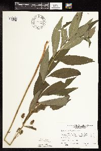
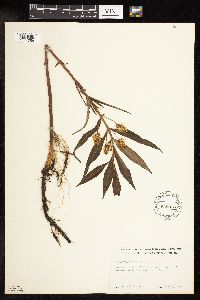
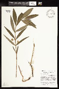
MIN:Plants | 794045[1144789]Wheeler, Gerald 63581982-08-11 United States, Minnesota, Mahnomen, Mahnomen Co. Approx. 1.5 mi N of the jct. of Rt. 113 and Rt. 4 (W side of the road)T143N, R39W, Sec. 19.;White Earth Indian Reservation / White Earth State Forest;143N;39W;19, 47.1869818 -95.6681393 |
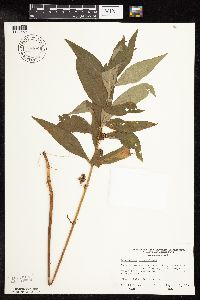
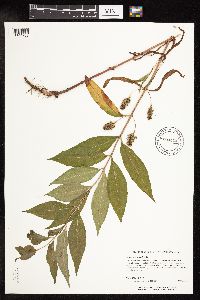
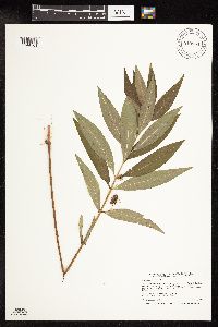
MIN:Plants | 794061[1144652]Wheeler, Gerald 62961982-08-10 United States, Minnesota, Mahnomen, Mahnomen Co. At the jct. of Rt. 15 and Rt. 24. T146N, R39W, Sec. 3 & 4.;White Earth Indian Reservation;146N;39W;, 47.455251 -95.6144374 |
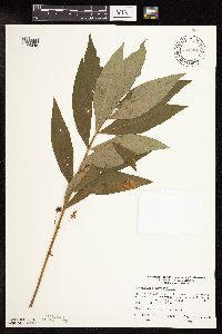
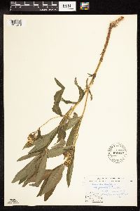
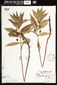
MIN:Plants | 794081[1144846]Wheeler, Gerald 63311982-08-10 United States, Minnesota, Mahnomen, Mahnomen Co. Approx. 11.7 mi E of Mahnomen on Rt. 200. T145N, R40W, Sec. 34 & 35.;White Earth Indian Reservation;145N;40W;, 47.3677439 -95.7415736 |
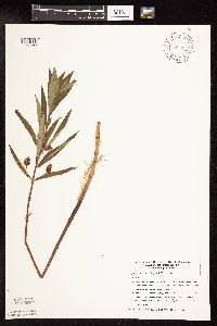
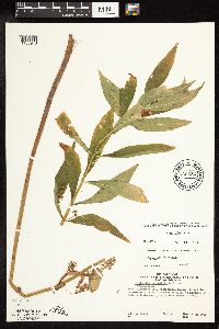
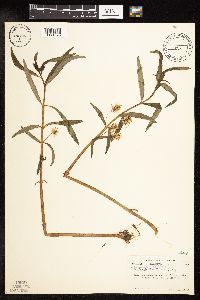
MIN:Plants | 794453[1144787]Glaser, Paul 12041980-07-17 United States, Minnesota, Koochiching, Koochiching Co.; Releve 29. NE1/4 SW1/4 Sec. 7, T158N, R26W, North Black River Peatland. 10 mi W of Loman and 32 mi. W of International Falls.. 158N 26W 7, 48.519127 -94.0252159 |
MIN:Plants | 794531[1144847]Glaser, Paul 13291980-07-22 United States, Minnesota, Roseau, NE1/4 SW1/4 Sec. 32, T164N, R37W, Marvin Lake Fen. 1 mi. SW of Marvin Lake and 8 mi. NW of Warroad.;;164N;37W;32, 48.9806602 -95.4527821 |
MIN:Plants | 795449[1144644]Cholewa, A.; Engels, A. 13951987-06-20 United States, Minnesota, Beltrami, Pennington Bog Preserve, ca. 1 mi N of Pennington on hwy 10; T146N, R30W S3 NW1/4.;Leech Lake Indian Reservation / Pennington Bog Scientific Natural Area;146N;30W;3, 47.491615 -94.4690408 |
MIN:Plants | 795569[1144728]Cholewa, A.; et al. 13661987-06-18 United States, Minnesota, Aitkin, Ca 10 airmiles ESE of Aitkin, ca 1 mi E of Dam Lake.;;047N;25W;36, 46.5169444 -93.4388889 |
MIN:Plants | 804878[1144786]Ordway, E. 71978-06-13 United States, Minnesota, Pope, Strandness Prairie. 4 mi. E of Starbuck.;Strandness Prairie, The Nature Conservancy;125N;38W;6, 45.6651515 -95.5001117 |
MIN:Plants | 812304[1144731]Wheeler, Gerald 105471988-05-31 United States, Minnesota, Norman, Ca. 6.5 mi. E-NE of Twin Valley; S of the Wild Rice River. E1/2 NE1/4 NW1/4 Sec. 22, T144N, R43W, Fossum Twp.;;144N;43W;22, 47.2748956 -96.1201198 |
MIN:Plants | 816162[1144733]Bender, J. s.n.1986-06-05 United States, Minnesota, Washington, Belwin Outdoor Education Laboratory. T28N, R20W.;Belwin Outdoor Education Laboratory;028N;20W;, 44.9071726 -92.8120203 |
MIN:Plants | 817602[1144649]Cholewa, A. 20071991-06-08 United States, Minnesota, Aitkin, Solana State Forest. Aitkin Co. Solano State Forest. SW end of Porcupine Lake, ca. 4 mi. W of Hwy. 65 on West White Pine Road; T45N, R24W, Aitkin Co. Solano State Forest. SW end of Porcupine Lake, ca. 4 mi. W of Hwy. 65 on West White Pine Road; T45N, R24W, S13.. 045N 24W 13, 46.3833524 -93.3162639 |
MIN:Plants | 818179[1144642]Engels, A.; et al. s.n.1991-06-12 United States, Minnesota, Aitkin, Aitkin Co. N side of Blind Lake, lakeshore; T48N R27W Sec. 10 SW1/4 SE1/4;;048N;27W;10, 46.6605537 -93.7507047 |
MIN:Plants | 831338[1144858]Dahle, R.; et al. 920101992-05-27 United States, Minnesota, Martin, Martin Co. 1.4 mi NE of Granada along Soo Line track within RR right of way; T103N R29W SE1/4 of SW1/4 of Sec.21;;103N;29W;21, 43.7095611 -94.3178904 |
MIN:Plants | 832098[1144788]Oppedahl, R. s.n.1981-06-26 United States, Minnesota, Lake, Lake Co. ... R-10W R-64N Sec.27;Boundary Waters Canoe Area Wilderness / Superior National Forest;064N;10W;27, 47.988879 -91.5959287, 427m |
MIN:Plants | 833839[1144727]Smith, Welby 141651988-05-31 United States, Minnesota, Lac Qui Parle, Quilitz Wildlife Management Area. Lac Qui Parle Co. Quilitz State Wildlife Management Area, about 5 mi E of Nassau, on the S side of State Hwy 24. NE1/4 N Lac Qui Parle Co. Quilitz State Wildlife Management Area, about 5 mi E of Nassau, on the S side of State Hwy 24. NE1/4 NW1/4 sec 6, T118N R45W. 118N 45W 6, 45.0592649 -96.3411014 |
MIN:Plants | 835624[1144641]Cholewa, A.; et al. 22261995-06-22 United States, Minnesota, Aitkin, about 17 mi NE of McGregor, SW end of Wolf Lake. NE1/4 of section;Savanna Portage State Park;050N;22W;06, 46.845996 -93.1774497 |
MIN:Plants | 836043[1144859]Smith, Welby 173121990-07-17 United States, Minnesota, Morrison, On the S side of Argonne Road, about 0.5 km S of Ferrell Lake; UTM: 390700E 5106500N. NE1/4 of NE1/4 of Section;Camp Ripley Military Reservation;130N;30W;02, 46.1002284 -94.4216996 |
MIN:Plants | 841067[1144729]Smith, Welby 127181987-05-20 United States, Minnesota, Pipestone, Altona Wildlife Management Area. Pipestone County...Altona State Wildlife Management Area, about 1.5 mi SE of Verdi...floodplain of Flandreau Creek NW1/4 NW1/4 sec.1, T108N R46W. 108N 46W 1, 44.1966667 -96.325 |
MIN:Plants | 353910[1188944]Lakela, Olga 25201938-07-03 United States, Wisconsin, Douglas, Allouez Bay front. Superior. |
MIN:Plants | 916013[1144864]Smith, Welby; et al. 314942009-09-14 United States, Minnesota, Cook, Boundary Waters Canoe Area Wilderness / Superior National Forest. Cook County...Boundary Waters Canoe Area Wilderness, Superior National Forest. On the south side of the Royal River T 64N R 3E NW1/4 of NE1/4 of Sec 3. 064N 03E 3, 48.0619444 -90.0413889 |
MIN:Plants | 539913[1144758]Tester, John s.n.1957-06-17 United States, Minnesota, Mahnomen, 3-4 miles W and 1 mile S of Waubun;Waubun Prairie Wildlife Management Area / White Earth Indian Reservation;143N;42W;33, 47.1589 -96.00743 |
MIN:Plants | 904412[1144702]Anderson, Rebecca 20070072007-07-11 United States, Minnesota, Saint Louis, ST. LOUIS COUNTY ... McCarthy Beach State Park, 2.5 miles N of Side Lake. NAD 83 ... T60N R21W NENE8;McCarthy Beach State Park;060N;21W;08, 47.7021 -93.02151 |
MIN:Plants | 552119[1188946]Stevens, O.; et al. 17361958-06-13 United States, North Dakota, Pembina, Svold |
MIN:Plants | 739532[1188943]Banks, J. 3011976-09-06 United States, Iowa, Allamakee, Allamakee Co, Mississippi River...backwaters E of main channel parallel to nautical mile 661. |
MIN:Plants | 471951[1144792]Mensing, D. 96-1151996-06-30 United States, Minnesota, Clearwater, Clearwater Co, T144N R36W SW1/4 of the NE1/4 of S34; Mississippi River near the headwaters;Itasca State Park;144N;36W;34, 47.1595409 -95.2226562 |
MIN:Plants | 910964[1144761]Smith, Welby 246261994-07-11 United States, Minnesota, Koochiching, Koochiching County...About 3 miles E of Northome. Along margin of Tuefer Lake...T 151N R 28W SW1/4 of NE1/4 of Sec 27;;151N;28W;27, 47.8694444 -94.2183333 |
MIN:Plants | 575398[1188945]Garton, C. 92571961-08-08 Canada, Ontario, Rainy River District ... 5 mi. NE. of Gameland, Sutherland Twp. |
MIN:Plants | 448031[1144676]Abbott, Robinson s.n.1963-07-19 United States, Minnesota, Cook, Cook Co.; shores of Trout Lake, off Gunflint Trail, N. of Grand Marais;Superior National Forest;062N;02E;, 47.8453519 -90.1894692 |
MIN:Plants | 461316[1144853]Gerdes, Lynden 27651998-06-21 United States, Minnesota, Cook, T64N R01E S09NENE. Cook County; Superior National Forest, BWCAW. Narrows between Little Alder and Alder Lake.;Boundary Waters Canoe Area Wilderness / Superior National Forest;064N;01E;9, 48.0414124 -90.3281745 |
MIN:Plants | 490524[1144863]Lee, Michael; et al. MDL29052000-08-13 United States, Minnesota, Todd, Todd County...wetland complex between low, north-south trending drumlins five miles north-northeast of Clarissa... T131N R34W SW1/4 of NE1/4 Sec. 1.. 131N 34W 1, 46.1868165 -94.9059477 |
MIN:Plants | 923447[1144866]Smith, Welby 203561992-06-08 United States, Minnesota, Pennington, About 10 miles E of Goodridge. SW1/4 of NE1/4 of section.;Reiner Wildlife Management Area;154N;39W;13, 48.1588889 -95.6022222 |
MIN:Plants | 923427[1144865]Smith, Welby 204101992-06-16 United States, Minnesota, Cass, On Ottertail Peninsula in Leech Lake; Chippewa National Forest...T 143N R 30W SE1/4 of SW1/4 of Sec 1;Chippewa National Forest / Leech Lake Indian Reservation;143N;30W;01, 47.2244444 -94.4113889 |
MIN:Plants | 930683[1144867]Gerdes, Lynden B.; Smith, Welby R. 60362010-06-25 United States, Minnesota, Cook, Banadad Lake area. Unnamed bog lake approximately 0.08 miles north of the western end of Banadad Lake. NWSESWNE of section;Superior National Forest;064N;03W;10, 48.0405556 -90.68 |
MIN:Plants | 936446[1144703]Anderson, Derek; Sykora, Rod 20882012-05-25 United States, Minnesota, Lac Qui Parle, About 8.5 km southeast of Odessa. SW1/4 of NW1/4 of section;Plover Prairie, The Nature Conservancy;120N;45W;14, 45.20625 -96.2644192 |
MIN:Plants | 936380[1144704]Anderson, Derek 9262008-06-12 United States, Minnesota, Waseca, 7 km south of Waseca on County Road 13.;Sedan Brook Prairie Scientific Natural Area;106N;22W;08, 44.0028131 -93.5000211 |
MIN:Plants | 806521[1188743]Morency, M. 231 Canada, Quebec |
MIN:Plants | 800733[1188744]Larson, G. E. 9579 United States, South Dakota, Spink |
MIN:Plants | 932276[1144762]Lee, Michael MDL46482008-07-01 United States, Minnesota, Wadena, Along the Cat River, four miles northeast of Sebeka. UTM: 5171642N 343790E. NW1/4 of NE1/4 of SE1/4 of section;;137N;35W;13, 46.6801006 -95.042569 |
MIN:Plants | 270643[1188745]Sharp, A. J. s.n. United States, Michigan, Arenac |
MIN:Plants | 257383[1189871]Fernald, M. L. s.n. United States, Maine, Aroostook |
MIN:Plants | 170395[1188747]Fernald, M. L. 14365 United States, Maine, Penobscot |
MIN:Plants | 598191[1188748]Gates, F. C. 11716 United States, Michigan, Cheboygan |
MIN:Plants | 364364[1188750]Jacobs, D. L. 33 Canada, Ontario, Thunder Bay |
MIN:Plants | 557378[1188751]Moir, D. R. 484 Canada, Ontario, Kenora |
MIN:Plants | 556353[1188752]Moir, D. R. 410 Canada, Ontario, Kenora |
MIN:Plants | 264322[1188753]Holzinger, J. M. s.n. United States, Wisconsin, Buffalo |
MIN:Plants | 405933[1188754]Gleason, H. A. s.n. United States, Michigan, Cheboygan |
MIN:Plants | 170378[1188756]Zeller, S. M. 1108 United States, Washington, San Juan |
MIN:Plants | 170381[1188757]Sandberg, J. H. s.n. United States, Idaho, Kootenai |
MIN:Plants | 170393[1188758]Fitch, A. s.n. United States, New Jersey, Gloucester |
MIN:Plants | 170394[1188759]anonymous s.n. United States |
MIN:Plants | 170398[1188760]Fallass, C. W. s.n. United States, Michigan, Kent |
MIN:Plants | 170397[1188761]Henderson, L. F. 2425 United States, Washington, Yakima |
MIN:Plants | 170396[1188762]Rosendahl, C. O. 1513 Canada, British Columbia |
MIN:Plants | 486070[1188763]Rand, E. L. s.n. United States, Maine |
MIN:Plants | 599005[1188764]Tryon, R. M. 3051 United States, Indiana, Lake |
MIN:Plants | 557377[1188765]Moir, D. R. 4180 Canada, Ontario, Kenora |
MIN:Plants | 804956[1188766]Garton, C. E. 21181 Canada, Ontario, Thunder Bay |
MIN:Plants | 278815[1188767]Carpenter, D. S. s.n. United States, Vermont, Rutland |
MIN:Plants | 291240[1188768]Muenscher, W. C. 2473 United States, New York, Jefferson |
MIN:Plants | 170383[1188769]Sandberg, J. H. s.n. United States, Washington, Grant |
MIN:Plants | 170380[1188770]Howell, T. 1513 United States, Oregon, Marion |
MIN:Plants | 404051[1188771]Eggleston, W. W. s.n. United States, Vermont, Rutland |
MIN:Plants | 170392[1188772]Shear, C. L. s.n. United States, Massachusetts, Berkshire |
MIN:Plants | 257354[1188773]Lunell, J. 805 United States, North Dakota, Benson |
MIN:Plants | 267338[1188774]Denslow, H. M. s.n. United States, Vermont, Orange |
MIN:Plants | 383807[1188775]Briggs, J. De Q. s.n. United States, Massachusetts, Middlesex |
MIN:Plants | 295614[1188776]Marie-Victorin, J. L. 9725 Canada, Quebec |
MIN:Plants | 489950[1188777]Stevens, O. A. s.n. United States, North Dakota, Kidder |
MIN:Plants | 487525[1188778]Deane, W. s.n. United States, Massachusetts, Middlesex |
MIN:Plants | 503678[1188779]Russell, N. H. 6175425 United States, New York, Albany |
MIN:Plants | 530779[1188780]Campbell, R. J. s.n. United States, Ohio, Portage |
MIN:Plants | 170377[1188781]s.n. United States, Colorado, Larimer |
MIN:Plants | 292550[1188782]Churchill, J. R. s.n. United States, Massachusetts, Berkshire |
MIN:Plants | 257382[1188783]Deam, C. C. 979 United States, Indiana, Wells |
MIN:Plants | 831910[1188784]Watson, S. H. s.n. United States, Wisconsin, Dane |
MIN:Plants | 553203[1188785]Gillett, J. M. 6186 Canada, Ontario, Hastings |
MIN:Plants | 549287[1188786]Umbach, L.M. s.n. United States, Indiana, Clark |
MIN:Plants | 657534[1188787]Dickinson, W. S. 254 Canada, Ontario, Norfolk |
MIN:Plants | 361257[1188788]Hayden, A. 10155 United States, Iowa, Clay |
MIN:Plants | 800617[1188789]Van Sickle, S. 806 United States, South Dakota, Day |
MIN:Plants | 170384[1188790]Cole, E. J. s.n. United States, Michigan, Kent |
MIN:Plants | 170376[1188791]Durand, E. J. s.n. United States, New York, Ontario |
MIN:Plants | 170389[1188792]Ashcroft, G. B. s.n. United States, Ohio, Geauga |
MIN:Plants | 275151[1188793]Lakela, O. 198 United States, North Dakota, Ward |
MIN:Plants | 170382[1188794]Clements, F. 2842 United States, Nebraska |
MIN:Plants | 403251[1188795]Wadmond, S. C. 2821 United States, Wisconsin, Oneida |
MIN:Plants | 403252[1188796]Wadmond, S. C. 2821 United States, Wisconsin, Racine |
MIN:Plants | 403183[1188797]Wadmond, S. C. 3526 United States, Wisconsin, Walworth |
MIN:Plants | 372162[1188798]Marr, J. 217 United States, Wisconsin, Vilas |
MIN:Plants | 208541[1188799]Bergman, H. F. 1941 United States, North Dakota, Benson |
MIN:Plants | 257324[1188800]Lunell, J. 468 United States, North Dakota, Benson |
MIN:Plants | 170379[1188801]Morton, J. A. 6767 Canada, Ontario, Huron |
MIN:Plants | 403254[1188802]Wadmond, S. C. 1710 United States, Wisconsin, Vilas |
MIN:Plants | 403253[1188803]Wadmond, S. C. [3526] United States, Wisconsin, Walworth |
MIN:Plants | 559794[1188804]Soper, J. H. 6312 Canada, Ontario, Norfolk |
MIN:Plants | 298937[1188805]Knight, O. W. s.n. United States, Maine, Penobscot |
MIN:Plants | 170387[1188806]Nelson, N. L. T. s.n. United States, Illinois, Cook |
MIN:Plants | 170391[1188807]Moffatt, W. S. 1660 United States, Indiana, Lake |
MIN:Plants | 170390[1188808]Moffatt, W. S. 189 United States, Indiana, Lake |
Google Map
Google Maps is a web mapping service provided by Google that features a map that users can pan (by dragging the mouse) and zoom (by using the mouse wheel). Collection points are displayed as colored markers that when clicked on, displays the full information for that collection. When multiple species are queried (separated by semi-colons), different colored markers denote each individual species.
